
Day 3 - October 14

Though my third day now in Ontario this was my first on the road for photography. It seems we arrived in the midst of an early snow storm which caused major havoc all around us. Fortunately the Grimsby area was spared the worst and though we had high winds and rain there was little snow. So I was laid up indoors dreaming of what adventures may yet come.

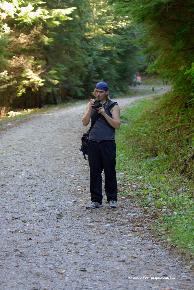
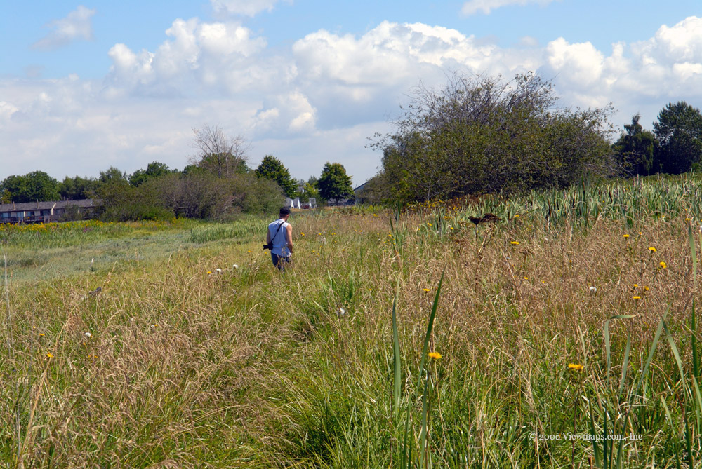
So on day three when the weather finally cleared enough to get out, I met up with my wife’s cousin Michael – a local Pastor – and his son Lucas. We set out to find some interesting sights to capture. It was a fun time being out in the sun though still quite cool. I discovered that Luke has a budding interest in photography, so this was a great chance for him to try out his new digital camera.

Michael suggested the local conservation area which is only a mile or so from his home as a place to start. It sounded good to me and since I had only see it from the top side, approaching the ravine from the bottom would be a new experience. We quickly drove the short distance, but just as we arrived it was my scheduled time to call my Ham radio buddy back in Vancouver. So I called Ralph with my hand-held radio and had a quick chat, afterwards Michael and I had a fun discussion about amateur radio during our hike.

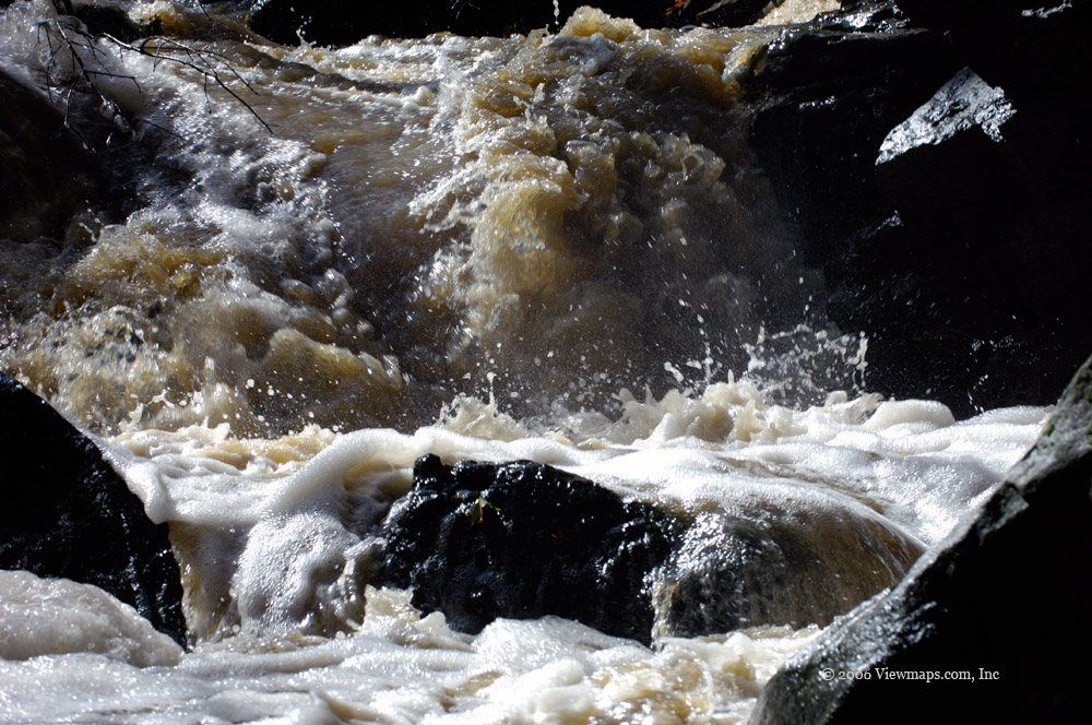
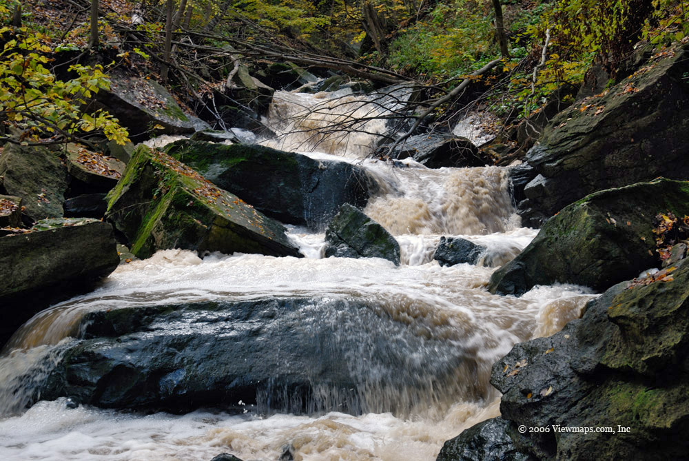
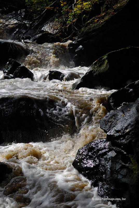
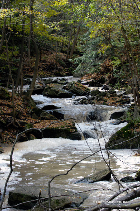
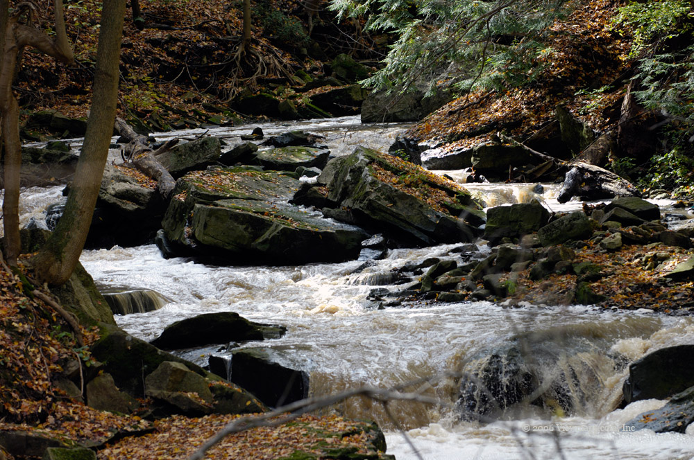
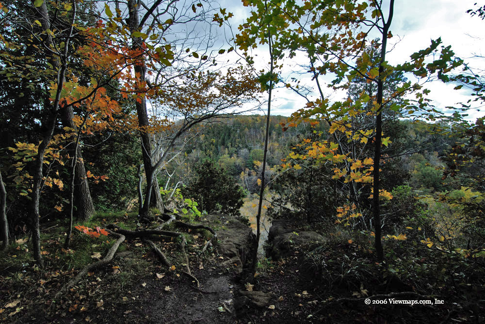
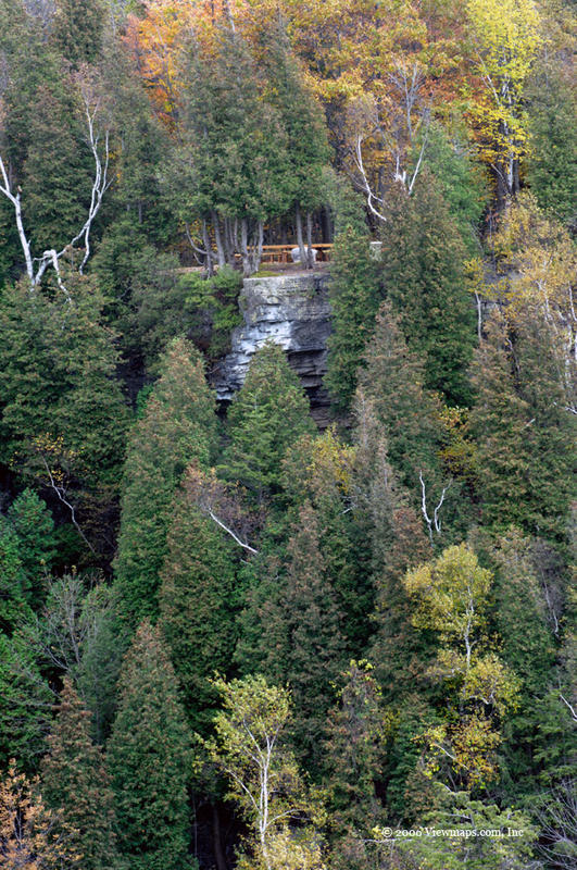
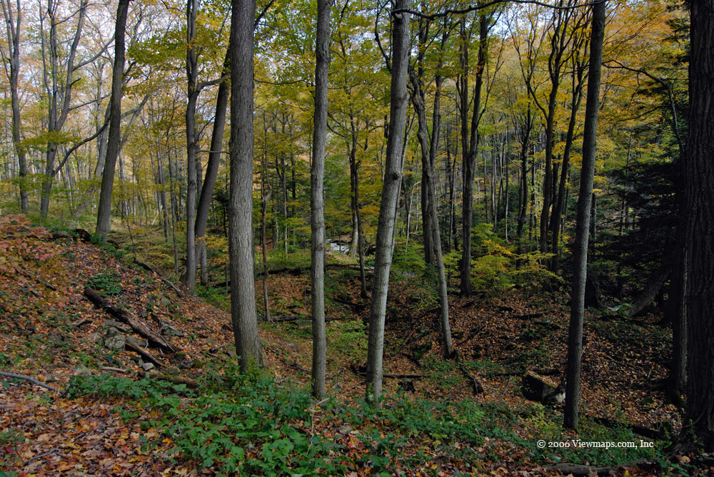
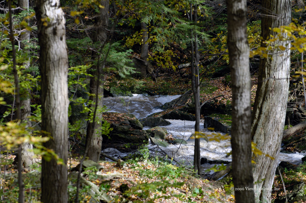
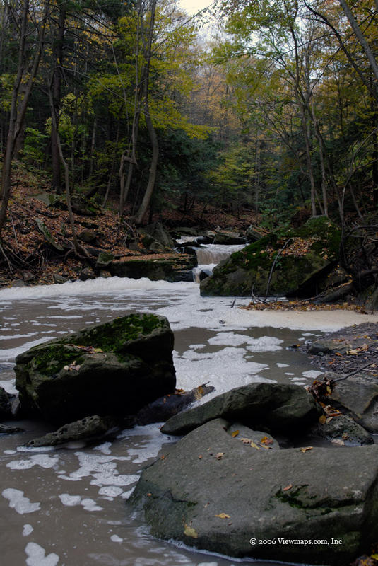
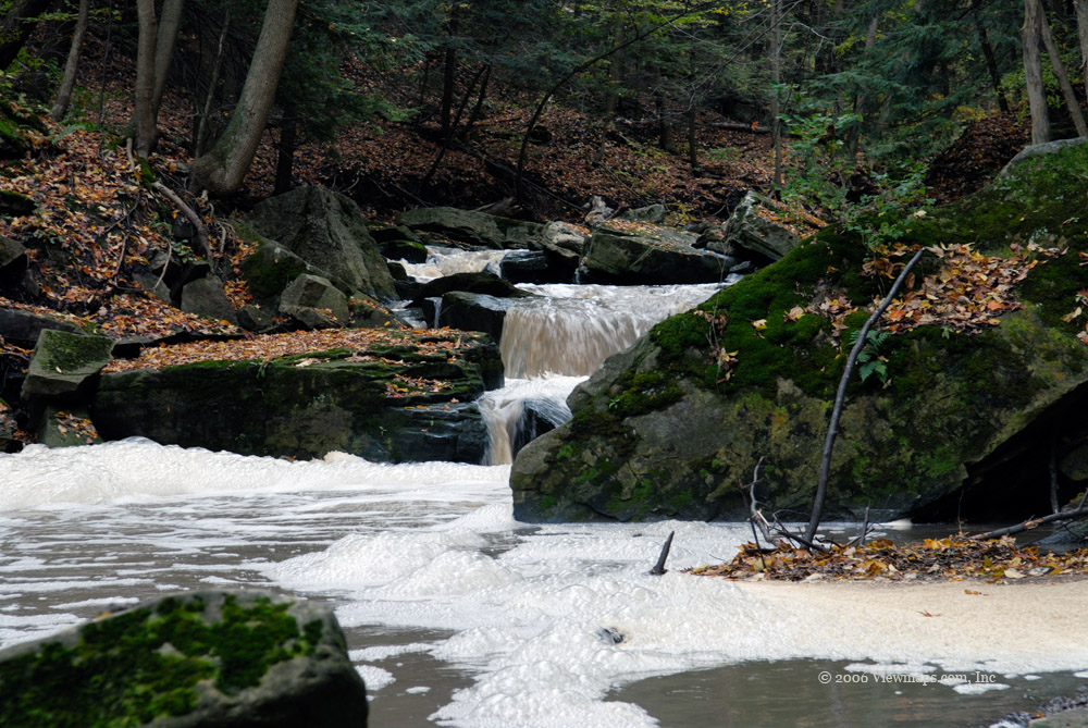
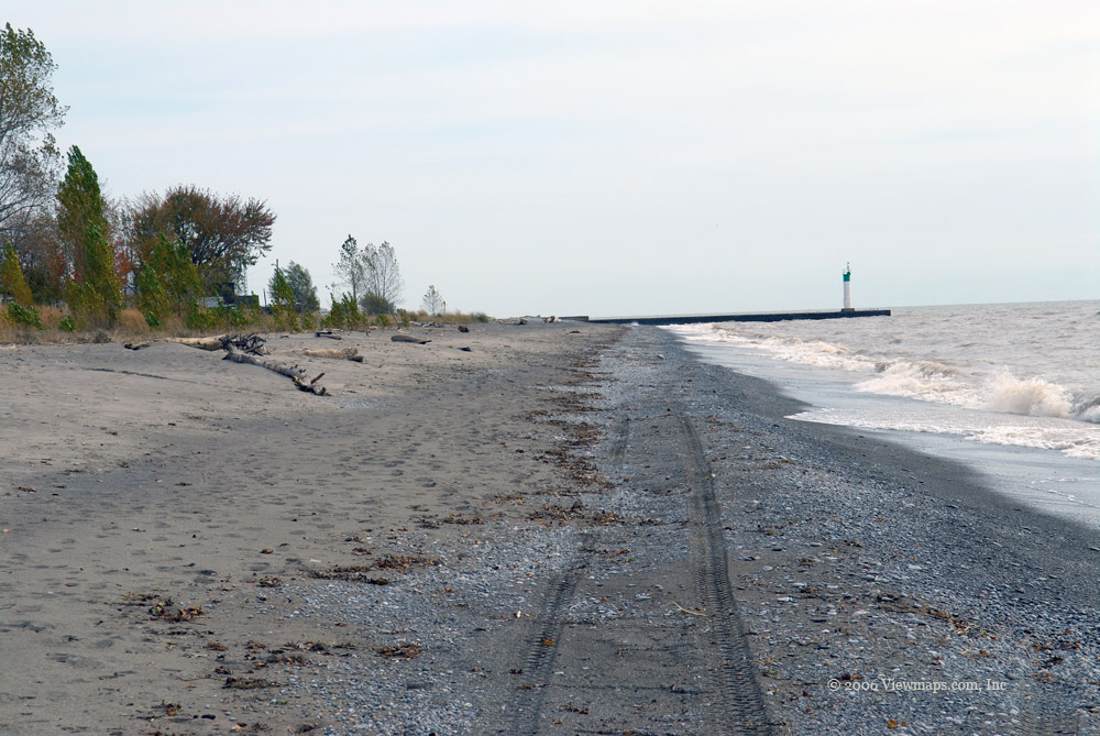
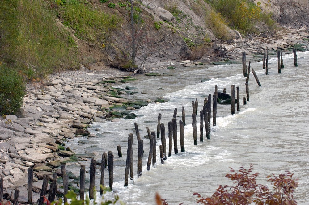
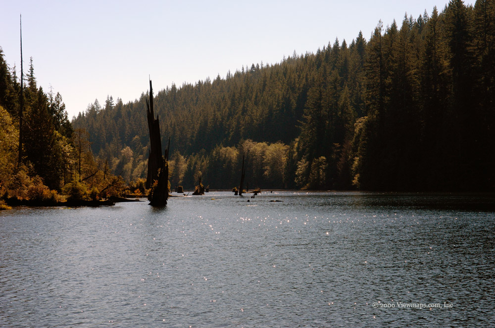
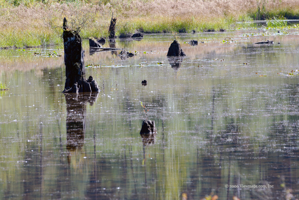
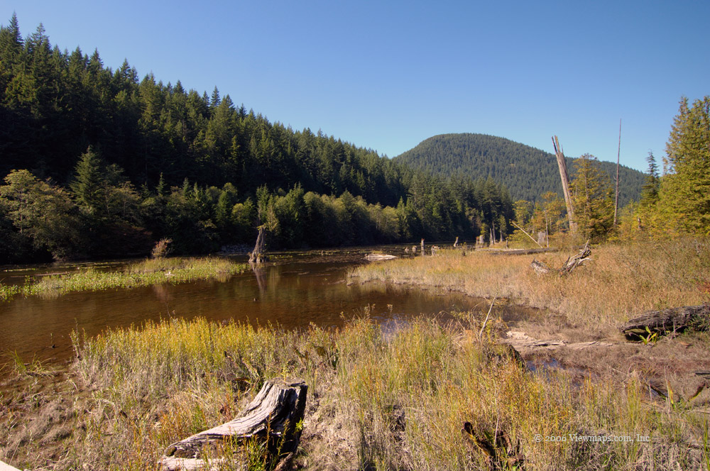
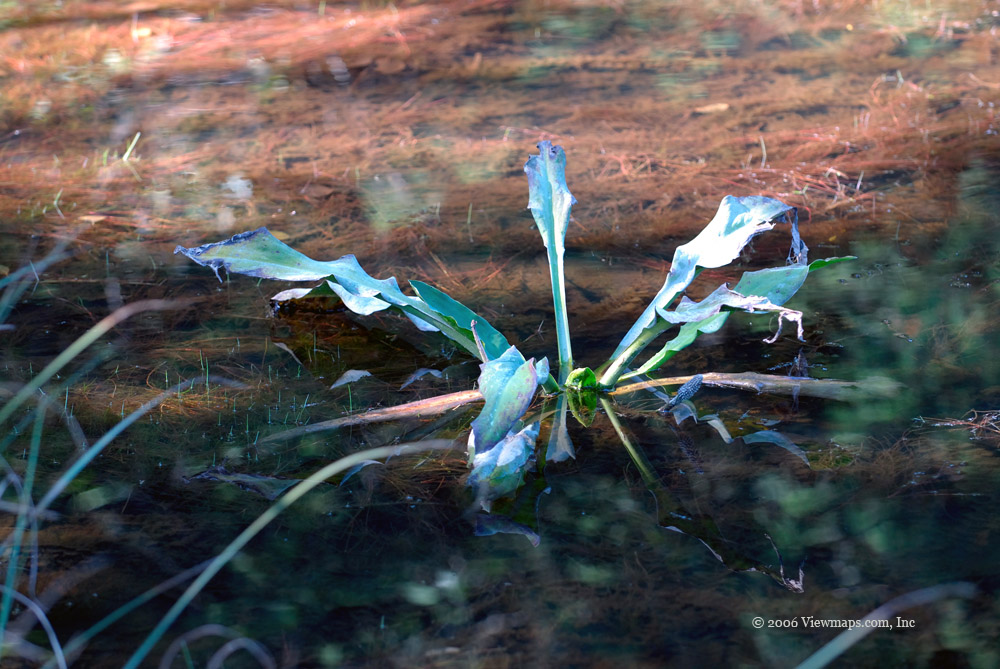
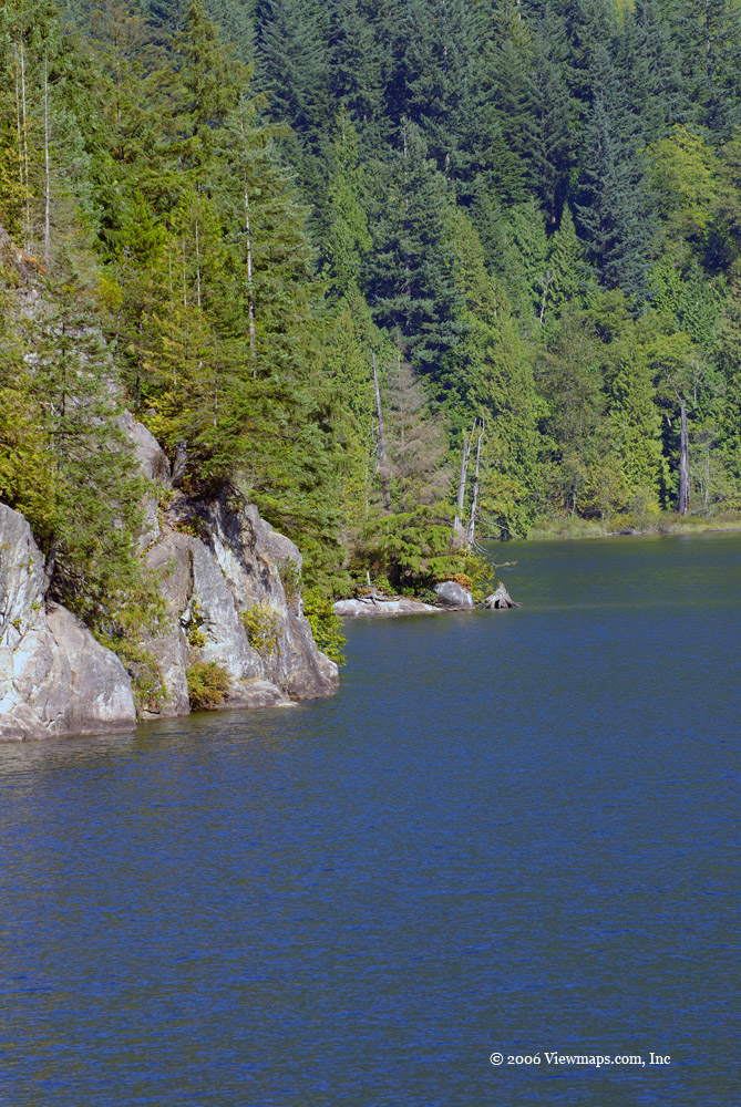
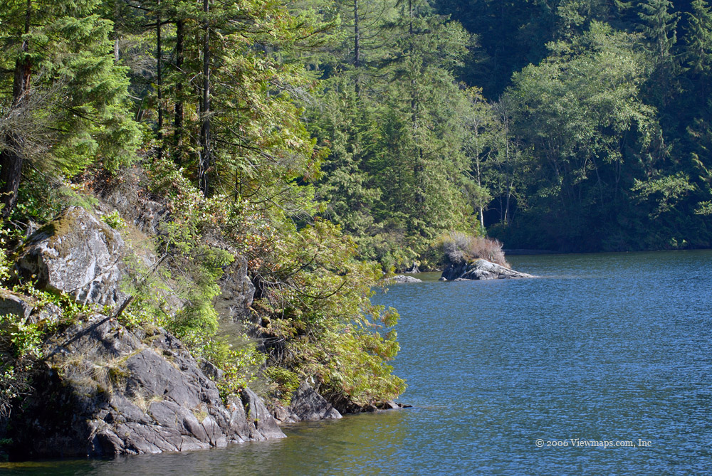
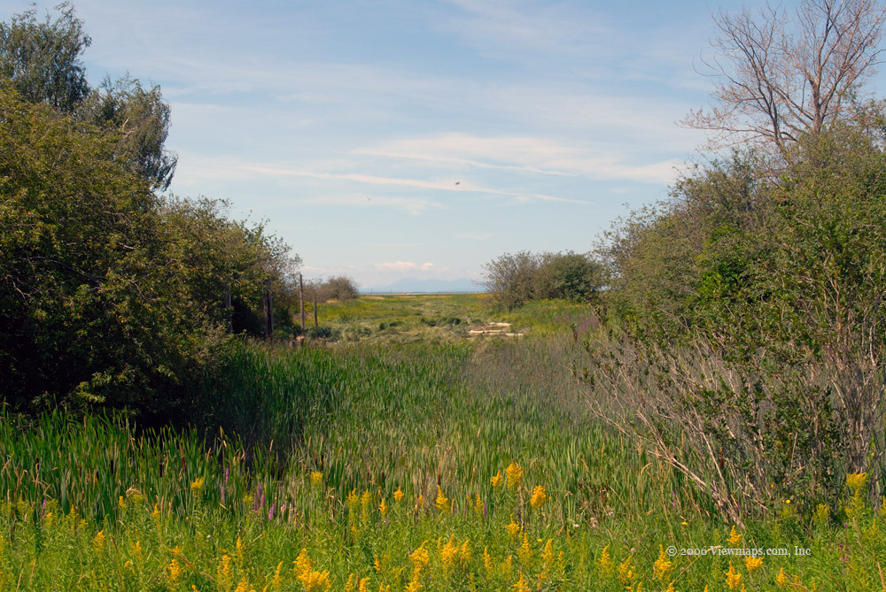
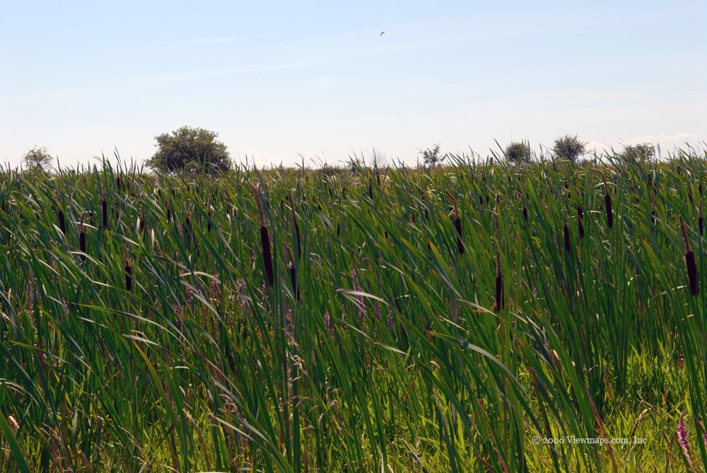
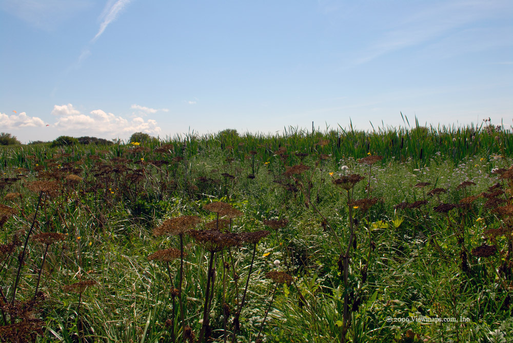
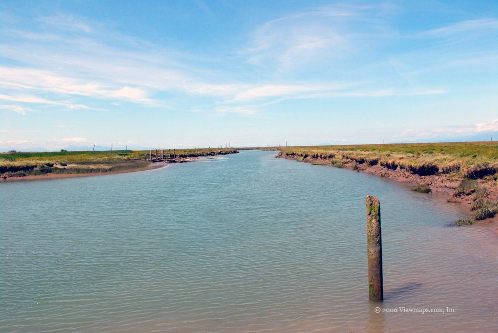
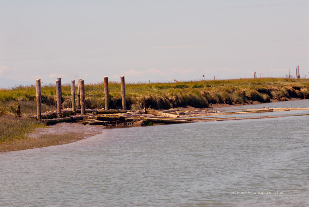
The ravine access was very easy as we were able to get on to the Bruce trail almost from the parking spot. It allowed us to wander alongside the creek for some distance before scaling the ravine wall and leading us to a few lookout points. The creek was definitely running fast and angry thanks to the recent rain storms. The one feature I was somewhat apprehensive about were the large quantities of suds found around the falls. They seemed a little unnatural to me, likely thanks to all the pollutants the creek runs through.

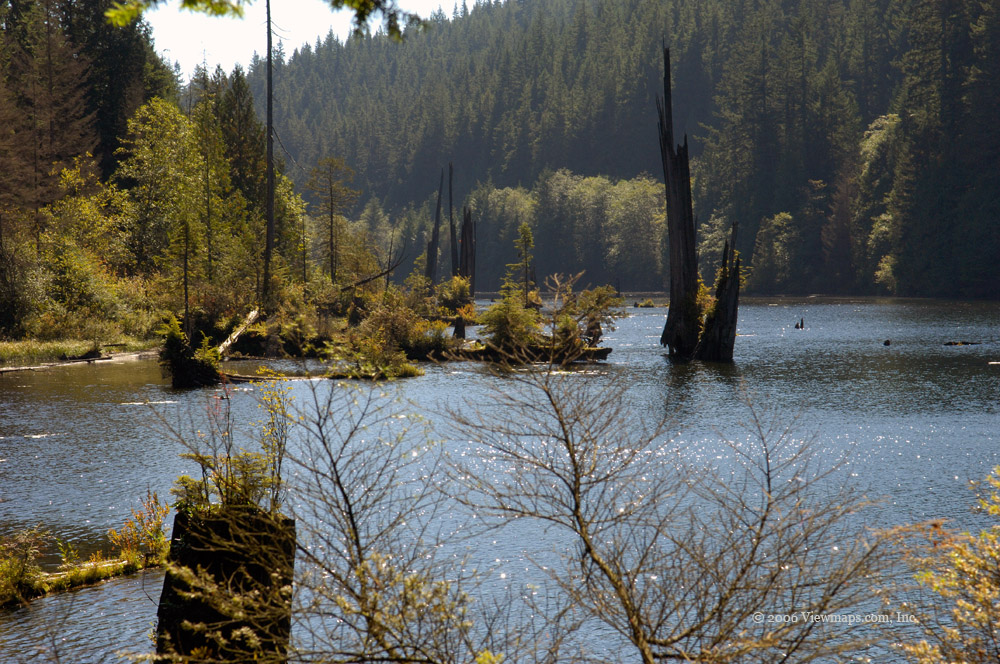
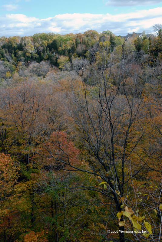
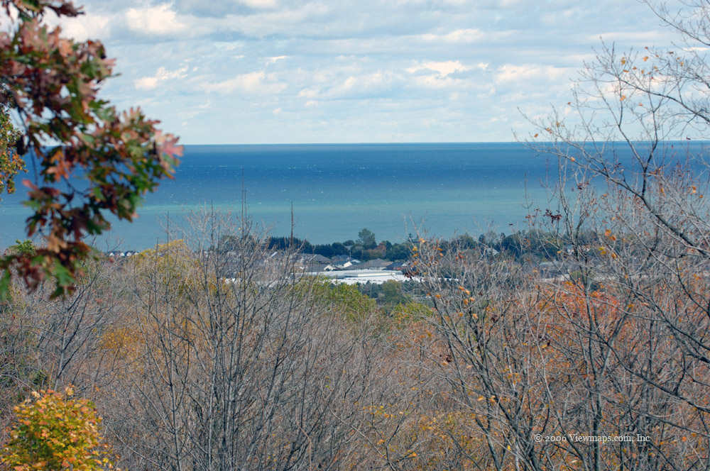
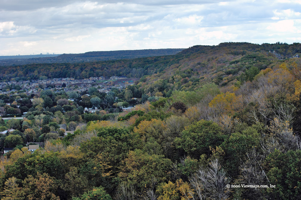
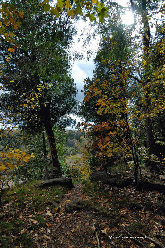
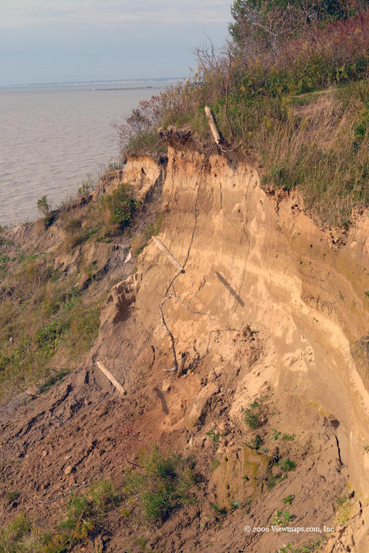
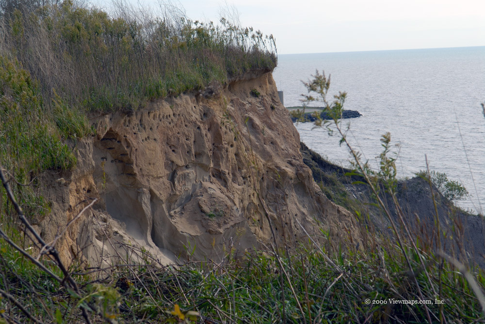
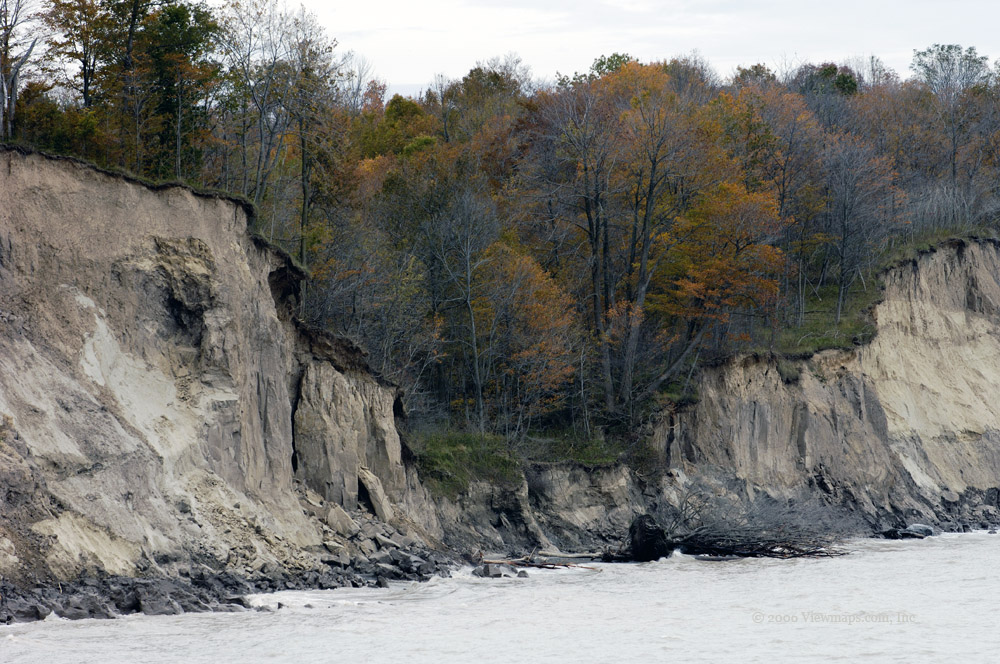
Views from the lookout points were well enjoyed by all. I particularly enjoyed the fall colours one could discover from up there. On other days I could have stayed for quite some time, but the cold wind was not about to let us get comfortable and settle in for a long visit. The edge of the ravine had some very pretty fissures which added to the beauty of the setting.

On our way down we once again stopped by the creek for a few more photos of the rapids and foam. Once out of the woods we decided we were too cold to find another area so we found a local restaurant and settled in for a pleasant meal with hot drinks for all. Although we didn’t actually make it to the main portion of Beamer Falls, we all enjoyed our excursion and opportunity to spend a few hours with nature. Perhaps next year I can explore a few more parts of the conservation area.

Day 4 - October 15

October 15 was a beautiful day to be out taking photos. It ended up being the best day of the whole trip – too bad I didn’t know this in advance! This was the day we were leaving Grimsby for Port Stanley; so much of our time was used up driving.

We wanted to take in scenery, so our choice of roads kept us off the main highways in favour of the smaller roads and the shoreline road along Lake Erie. This of course slowed us down and took most of the day for the drive. I enjoy driving through the farm lands of south-Western Ontario; the landscape is so different from that in BC. I find the vastness of the open spaces to be quite over-whelming; farms just keep appearing mile after mile after mile. There are so many farms; it makes the puniness of the BC lower mainland look like a joke in comparison. Some how this open vastness stirs a sense of adventure in me which is very attractive and draws me back again time-after-time.

The tiny little towns every few miles are also quite novel, they seem to often be just a few buildings at a road crossing. Both my wife and I find the notion that these cross-road towns have been given a name to be somewhat comical. Why does a run-down building at the corner of two roads deserve its own name on a map? I suppose it just adds to the adventure of being in a different environment.

Our drive out of Grimsby began in the late morning, drove south straight to the Lake Erie shore. The drive had a few moments of confusion as we tried to find ourselves on the map, but we got to the lake without much delay. The countryside was charming but not as colourful as I was hoping for.

As we drove along the shoreline I was dreaming of living in one of the homes which dot the water. The area is so beautiful and seems so remote, that with the cold wind that was energetically blowing and the starkness of autumn, I was instilled with a sense of remoteness that teased me with a way to get away from the toils of life. Oh to be back there curled up with a book staring at the sun setting over the lake while sipping on a cup of hot … you get the idea.

I found the moods of the shoreline beach to be quite varied; the places of most interest to me were those with the rugged flat-topped rocks that speckled the lake’s shore. The high winds were whipping up the waves creating some huge splashes as they were slowing beating the granite down to sand. I took some photos at the same place outside the town of Selkirk as I did last year; unfortunately the colours were not as spectacular this year. We then moved in-land a bit to enjoy lunch at the Sunflower Café in Selkirk.
As we drove further west we came through Port Burwell where we encountered one of Canada’s largest wind farms. In operation only since April of this year, it has 66 turbines each with an 80m tower! They feel incredibly massive when one gets close to their base, very intimidating to such a tiny creature like me. The area around the turbines was energized with a deep bone-chilling and almost sub audible throbbing that your whole body could feel – not a place I would want to stay in for long. 

The rest of the drive to Port Stanley went quicker and had little of interest to me – it seems the long drive had taken its toll and I just wanted to be done and to put my feet up for a while.

Day 5 - October 16

The next day – October 16th offered a dull setting but it was good enough to get out and into the car and drive around to see what the area offered a scenic landscape photographer. I got on the highway and headed east along the route we used when we arrived in Port Stanley. Very quickly I came upon a sign that mentioned hawk bluff with a road that led towards the lake. So I turned onto it and drove the couple kilometers to its end at a bluff overlooking the lake. 

As I drove down the gravel road I passed another photographer who was packing up his long lenses and heading home. I guess I missed the hawk watching period of the morning, next time I will plan to come earlier to see them. I left the car and got out to walk the short distance to the cliff edge. The lake looked quite vast from up here; the winds were moderate but not overly cold. They were a nuisance for stability but I was able to get off a few shots. 

The main impression I got from up there was of the constant progression of erosion. One could see the power of nature as the bank was slowly being eaten away. The collapsed fence was a powerful reminder that sometimes erosion works at a faster pace and really takes little notice of the designs and efforts of man. The bluff face contained hundreds of holes where I assume birds made their nests. I didn’t see any but there were sure enough of the nest holes.

Just back from the edge the winds were a bit slower and I noticed a number of cabbage white butterflies busily eating off of the last blooms of the season. They were a bit of a challenge to capture and get a decent shot of as it seemed that they would move on as soon as I got setup enough to capture an image.

After the bluff I continued heading east along the shore and eventually came to Port Bruce where I got out and walked along the beach. I noticed some tire marks in the sand which seemed a bit out of place but they added to the mood of the deserted beach. I’m sure that in summer the beach would have been crowded.

I then headed in-land and drove through St. Thomas. Nothing inspired me there today perhaps tomorrow. I drove back to Port Stanley and went into a residential area on the east side. There I discovered some old pilings along the lake edge which caught my eye. A view of the port’s lighthouse and breakers was also available for this location.
I went back to my suite and rested for the remainder of the day. During the evening I had the urge to gather a few more shots and was attracted to the night views from my balcony. 

The rain over the rest of the trip basically shutdown the photo gathering but it did convince to come back perhaps next year to uncover a few more secrets of the area.

Day 7 - October 18

Time was marching on and I only had a couple days left in Ontario, being trapped inside thanks to the rain was taking its toll and making me a bit anxious to get out and explore the area. In the end, the weather was quite disappointing this year and prevented me from getting out exploring the countryside for photo opportunities most days. So the images from today were the result of a bit of desperation on my part – I just had to get the camera in my hands and shoot something! Perhaps if I return next year things will be better.

All I was able to photograph today were a few shots of the harbour from our balcony. The setting was very nice, one could watch the boats moving throughout the day and when the fishing boats returned – usually one at a time – we could watch them unload their catch. The boat closest to our suite were a fun group to watch – they often were on their way out of the harbour by 4:15AM each morning and often the last back around 3 to 4PM. Though their departure at so early an hour woke me each morning, I felt a connection with them and was always glad to see them return with a good size catch. The last day we were there they returned with a huge catch and filled 6 of those green containers full of fish.

The setting of the Inn right on the water was very pleasant and offered hours of entertainment as we watched the activity in the harbour. The high winds and waves added to the interest – one day they were splashing far above the breakwater at the harbour entrance. I look forward to returning and exploring more of the area under better weather conditions.

Snow Shoeing in Eastern Stave

As this was my first time on snow shoes I wasn’t sure what to expect. Was it going to be difficult to walk? Was it going to be overly strenuous and tiring? How many times was I going to fall over? All good questions and for a person like me who likes to be in control and organized it left me a bit out of my comfort zone. But this was a good low key opportunity to try a new adventure. So I left with two of my boys Geoff, and Ethan and out we went.

On arriving in the Stave region I was wondering where the snow had gone. A month earlier the snow was much lower and we were in it at the start of the forest road, but today it was no where to be found. We traveled in and upward and fairly soon we came upon the snow and had to put on the chains to get some distance. Soon that too was not enough so we stopped there and got out to try the new snow shoes. Getting them on was quite easy and quick, these modern shoes are well made and easy to work. Off we went up the road, at first there were some ruts from a quad but soon we were past those and into virgin snow. We continued for a while climbing in elevation and having fun trying out different things one could do. As usual I was holding back the boys with their high energy output, but we all got as far as we wanted this first time out. The way back was just as adventuresome as we had to learn the downhill aspect of walking in the shoes.

Though the walk wasn’t that long we did have fun out there, but this left us with some time to explore a newly opened lower region. So we drove through an area that offered a few views of Stave Lake and the main 4x4 mud pit area on the far side. We did turn back a bit early on one road as it looked like a mud bath and as we didn’t have a winch we thought it prudent to avoid pushing our luck too far.

On the way back up to the main road we stopped at a viewpoint where I got a number of mountain shots, the boys found a number of skeet’s – there were many in good shape that the shooters had missed! Then it was off to home. I felt it was a good trip not only with learning some new skills but also an opportunity to explore a new area and capture some interesting scenes.

To Cypress Point or bust

I decided to take up my youngest son Ethan on this trip and give him some road experience in the snow. He hadn’t driven in snow, never mind on the logging roads in deep snow. So I thought it would be a good opportunity to give him some experience and a chance for me to capture some winter photos from a favorite spot along Stave Lake.
The drive to the Forest Service Road went without incident; traffic was light and the roads clear - our stop at Starbucks a key part of this portion of the trip. We drove through Miracle Valley and on to the logging road; very quickly we were driving in the snow. It was a fun experience for Ethan as we made our way along the slowly deepening snow cover. Soon we came by one group of target shooters who had pulled over to the side. They couldn’t drive up the next hill and were going to walk it rather than give up on their shooting. It was an ominous sign and raised the anxiety level for Ethan as he quickly came to the hill. 

We were up and over it in no time and with no problems! Having a decent back-road equipped vehicle certainly makes a difference. So it was on up the road to Salisbury Lake and then the point. We turned off the major road into an area with no tracks. It was fun and easy going for a half kilometer but soon we were snow plowing and losing traction. I could see the high point of the drive just a 100 meters ahead and then it would be down-hill virtually to the lake. So, should we put on the chains and go for it? But I remembered how difficult that section was on the return when I was here a year ago and while we may get over the peak and all the way down coming back may be much harder. Regretfully I decided to cut our losses and not push it. Perhaps if I had had an electric winch I would have tried it, but such was not the case. So I taught Ethan how to put on the chains and we backed down the ruts we created. He was having quite a challenge staying in them and away from the drop at the road edge. On a couple of occasions we were quite a bit closer than I would have preferred!

When we made it back to the traveled road we decided to go further up and made perhaps a kilometer before encountering the same challenge. A couple quads came up and zipped past us, but as it was Ethan first time we decided it was enough for today and we practiced a u-turn in the tight space available.

On our way back we stopped for some photo taking and I walked along the road at a few points to get some photos. We finally came past the target shooters who had completed their goal and were now loading back into their car. We stopped at the Lost Creek bridge for some more photos and watched as the target shooters struggled up the incline, they were weaving all over the road! They had to make several runs to get over it, I was starting to think we would have to tow them up it.

It was a fun trip, and good experience for Ethan even though we didn’t make it to Stave Lake. I guess we’ll have to try again when the snow has melted down somewhat. In this collection, I have selected a few photos I took on the return. The snow was so bright the photos came out looking black and white!

Angry Harrison Lake

It had been awhile since we were last out in the back country so we were not quite as picky about the weather. Today, Sept 30, 2006, wasn’t a wet day but the winds sure came up and made it a difficult job taking the few photos I managed to get. We were getting away a bit later and so needed to find a reasonably close area to explore. We settled on the Chehalis lake area and then ventured on over to Harrison. 

As we arrived at Chehalis the wind was getting stronger and a few drops of rain were felt, we drove to my favorite overlook of the lake and snapped a few shots of the bleak lake below. I do like the mistiness of the scene with the low hung clouds as they moved up the lake. We only stayed a short while and planned to capture a few shots from the northern end of the lake. When we reached the north end, a heard of quads were racing around the area, so we decided to head over to Harrison without stopping.

We arrived at Harrison near 20 mile bay so that is where we headed first. It was a glorious sight. The water level was low so we were able to drive out a ways onto the beach. The wind was strong and it was whipping the waves up higher than I had seen in the past. The play of the sun on the breaking waves with the mists in the background created a wonderful scene full of many textures and subtle hues which invoked by imagination. The line of pilings seemed particularly interesting in this weather. I thought the small Canadian flag placed on the furthest post was holding up extremely well in the high winds. After exploring the beach for awhile we drove further up the lake past the new bridge which was recently replaced due to a wash out two years prior. 

We stopped shortly past the new bridge at a small beach area which was a recent camp site and caught a few further pictures, the wind had quieted down signifiacantly by this point. As it was getting late, we turned back but first stopped by 20 mile bay camp grounds for a few more photos. Then it was on down the lake for one more brief stop before we headed home. So for a day that seemed very uncertain, we ended up with some very interesting photo opportunities.

Buntzen Lake

It had been awhile since I was last out to Buntzen Lake and I had never hiked the path around the lake, so today was the day. Ethan and I set out to explore the further sides of the small lake that parallels Indian Arm. I am not sure how much of the lake is natural as a dam keeps the level up and feeds a small power plant.

It was a warm day and quite bright, so it looked like a good day for a few photos. We decided to travel clockwise around the lake and so headed off to the south from the main beach and parking area, traveling first through the energy trail. This early part of the trail has one viewpoint I consider perhaps the nicest of the lake. It looks south and captures some interesting tree trunks which in early morning can have a special glow as the mists rise above the lake. This trip we unfortunately didn’t have any mists to view.

Heading across the foot bridge we saw we met a number of people admiring the views of the marshy part of the lake. This area is particularly beautiful when the mists are out as we were told by one couple who had been here earlier this morning. Heading north along the west side of the lake takes us along a road and offered us few views of the lake or anything else that caught my eye. When the road ended we followed a well used trail, I scampered off it to catch a few glimpses of the rougher parts of the lake. We continued along the trail for what seemed an eternity. The heat and the weight of the camera gear finally did me in and I had to pass the bag to Ethan – he had no problems fortunately. I guess I am in far worse shape then I thought. The trail wasn’t that bad, it did have a number of ups and downs but nothing severe.

We finally came to the northern end of the lake where a suspension bridge provided access across a narrow point to the other side. We crossed over and rested at the beach area where a few others were enjoying the sun. Our walk back to the car park went without incident and was much easier than the other side of the lake, but by this point I was too tired to enjoy the views and be inspired by the beauty. So the pictures from this side are missing. I will need another hike along here but perhaps only along the eastern shoreline to capture the views I zipped past.

The lake definitely has some views worth returning for and I will need to do that. Perhaps when I get in better shape I can do the peeks trail and view Indian Arm for some spectacular shots from up high as well.

Lighthouse Park in October

It had been quite a while since I last got out to take some sunset photos and I was hoping for something other than Crescent Beach. As the weather was iffy, I had to decide if it would be worth the drive to Lighthouse Park in the hope the sun and clouds would co-operate? For most of the day it had been overcast and dull but by mid-afternoon a major clearing to the west opened up and I had to determine if it would hold? Well, I decided to take the chance and drive out. About half way there I realized the clearing was closing up but since I was on the way I thought I would finish the drive and enjoy a bit of nature.

After I parked I made my way to the east beach. There were a number of families out enjoying the now overcast afternoon with a number of children playing on the rocks and enjoying the water while the parents sat on the higher rocks chatting about life’s issues. I enjoyed watching the kids play and from time-to-time I spotted something of interest and stopped to capture an image. The one recurring sight I love from this spot is the view of Vancouver with Mount Baker looming over it.

After a while the families left and it had gotten quieter, so I decided it was time to head to the west beach just in case the sun peeked through. I hiked back up the rocks and over to the west beach and set up my equipment and watched for the fleeting moment the sun would appear. 

While waiting one other intrepid soul made his way to the beach but realized it wasn’t likely to be a good sunset and so he left after a brief chat. I did find a few shots of interest – the lighthouse itself is always a fun picture. I also enjoyed the small cove between me and the point - it has a lovely colour to it. Well the time came for the sun to set and still no sight of it, in fact the clouds were even thicker and it was getting quite dull and cold. So I packed up and started for the car. The place seemed deserted; I came across no one on the long walk back to the car. There were a few people still in the parking lot but it sure seemed empty while I was walking back, the dullness and encroaching evening added to the sense of isolation. The drive home went without incident, I was listening to the UBC repeater when a chap from Prince Rupert called but he didn’t find who he wanted. He was having trouble dropping the link so I offered him a hand and dropped it for him.

In the end I did end up with a few images that I published, so the excursion was worth while despite the lack of sun.

Gary Point

It was a pleasant day to be out exploring the back country and finding new sights but the morning got away from us and we soon realized that it was too late to be starting for the hills. So I checked over the map and noticed a nice point at the south-western tip of Richmond where the south arm of the Fraser emptied into the strait. I had never been to Gary point so we thought we would give it a try.

We arrived amidst the encroaching heat of the day and we could see that the park was a popular place which was starting to fill up with others. So we headed for the shore line and looked around. The first two pictures capture the Fraser River looking east toward Steveston then west towards the mud banks along Georgia Strait. It was an interesting view of the river, and as the tide was out, much of the mud flats were visible. We came across a sheltered and dredged out mooring area where this building on stilts was found. I liked to view of this building being suspended over the water.

We then headed out into the salt flats directly hoping to get a ways out. We found a small trail through the marsh grasses which helped us get some distance out. The ground was very soggy and was traversed with numerous small flowing ditch sized streams. Even though it was August and hot the area was quite wet. The variety of the grasses was surprising as was the density of it. The path was certainly appreciated, without it the going would have been much slower and the likelihood of getting soaked feet almost a certainty.

We weren’t able to get much further west than the trail in Gary Point Park proper due to a small channel. We could have crossed over to the other side by back-tracking but the ground was just too soggy to travel with the hiking boots we had on. So we enjoyed the view of the channel through the marsh for a while and turned back.

We went back to Gary Point and saw the coast guard hovercraft come ashore so the guys could get some refreshments and the local concession stand. My final shots were taken in a small Japanese garden where I found some manicured trees to be of particular interest.

Subscribe to 2006