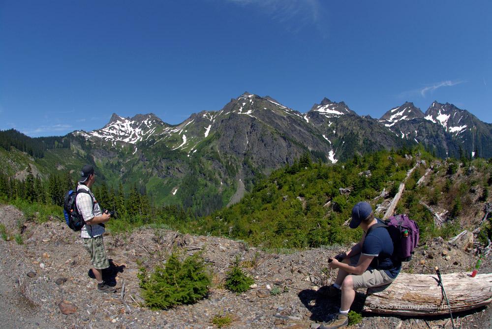
Airplane Creek Re-visited
With the Pathfinder repaired I was finally able to do the hike I had planned to do June 21st – explore the ridge line leading to Lady Peak.
Category
Serendipitous Discoveries
2008
Click on image to view gallery
Today was my second attempt to reach the ridge-line that connects Mt. Laughington with Lady Peak. It is an off trail hike but by the maps should be less than a kilometer in distance though a bit of a climb. I was hoping to reach the ridge so I could view the Chipmunk creek FSR on the other side. In my travels to Cheam along the Chipmunk FSR I had been intrigued with the possibility of reaching that ridge. The planned access looked fairly easy should things go as planned.
Unfortunately things did not go as planned. My two sons and I were making good distance along the Airplane FSR but came to a series of washouts that were increasing in difficulty. We finally reached one that seemed a bit too much for us. Perhaps if we had a winch we could of tried it or if we were on quads. But we had neither and so the best approach was to park and walk the remainder of the road then head up to the ridge. So we set off at a good clip. Soon the heat of the day was taking its toll and by the time we reached the end of the road – the start of the hike – we were already getting tired, having hiked 2.75km. But as we were here and the ridge looked so close, I decided to break for lunch and after a rest we set off up the slope to the ridge.
On the way up we crossed over a steep gravelly slope and made our way across a small stream. The area became quite soft and marshy until we crossed to the north side of the stream and climbed up out of its small valley. Soon we encountered large patches of snow which made hiking difficult on the steep slope. But walking on the snow was preferable to the soft marshy soil the ice melt fed below each snow patch. The hike was difficult and I needed to hang on to a lot of ground cover to keep from falling over and rolling down the slope which I am sure would have been for some distance.
I had my GPS unit but the cable connecting it to the computer was broken and as such I wasn’t able to determine just how much further a climb there was to the ridge line. Since we were getting quite worn out and the day was getting past prime, I decided to cut our losses and take a rest before heading back down. In reviewing the hike on the map later I learned that the ridge was only 200 meters further up, we had covered around two thirds of the distance from the road.
The hike back down to the road went very quickly as we were able to slide down the snow patches and make very good time. When I got back to the marshy ground by the small stream I took time to photograph a number of the wild flowers growing along the stream. Then it was back up the other side and down to the road. In the end our off road portion of the hike took and hour and a half, not too long but it would be another hour before we got to the pathfinder!
So even though I didn’t reach the ridge, we did have a good hike and it was fun spending time with two of my boys – Ed and Ethan. It does look quite achievable but I will try it again after I get a quad and can drive to the end of the FSR before I start the climb. Getting the GPS communication cable fixed so I can plot the route in advance would also be a useful task.
Story Lines
Recent Posts
- Serendipitous Discoveries, Parks on the Air / Jan 19, 26 /
- Parks on the Air / Jan 17, 26 /
- Serendipitous Discoveries / Oct 30, 25 /
- Serendipitous Discoveries / Oct 21, 25 /
- Serendipitous Discoveries, Parks on the Air, Coastal Views / Oct 20, 25 /
- Parks on the Air / Oct 07, 25 /
- Parks on the Air / Oct 03, 25 /
- General Collections / Sep 22, 25 /
- Parks on the Air / Sep 18, 25 /

