Harrison West
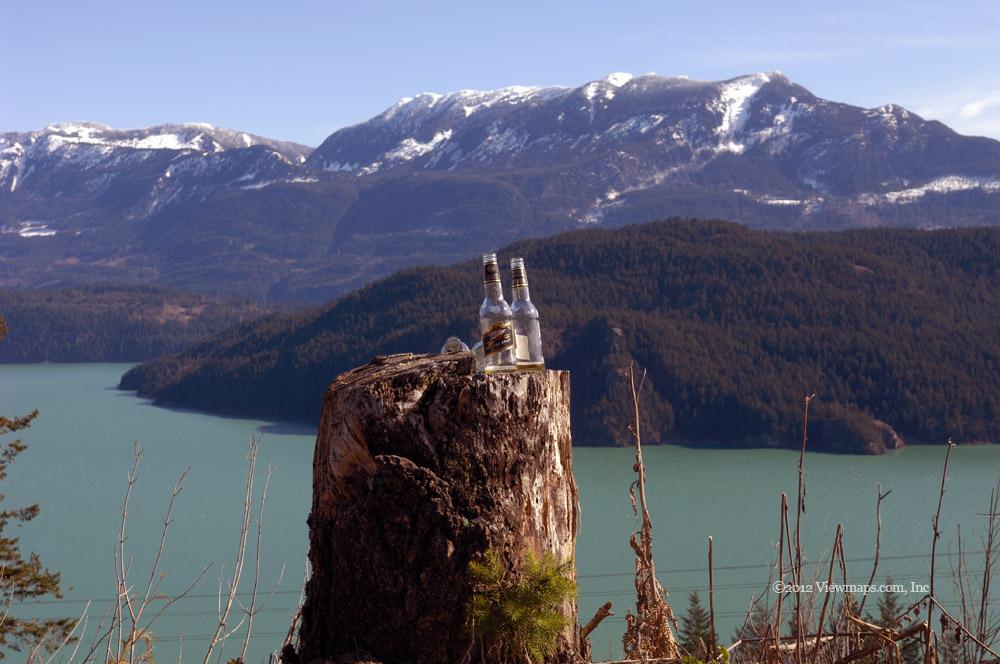
It was a lovely sunny day to enjoy the outdoors but as it was still early in the season we opted for an easy drive along the western shore of Lake Harrison.
Category
Serendipitous Discoveries
2012
Click on image to view gallery
It was such a lovely day to enjoy the back country and so I was expecting to find some good opportunities for photos. I also organized a radio test with the guys at home so set up and operating had to be slotted into our driving schedule. Our first stop on the way in was at the first side road off on the lake side of the road. This branch follows the transmission line all the way back to the Harrison River. That is a lovely drive with a great view at the end but for today we stayed at the start of it and gathered a few images of Echo Island. The water colour was exquisite and with the warm sun I was just thoroughly enjoying being here.
After admiring the view and studying an abandoned truck down slope from the road we continued heading up the mainline. At one point I spotted a nice small swampy pond below the road with an access road just back from where we were. I had Ethan turn back and we drove down the access road and I got out to walk to the pond where I gathered a number of photos of the stumps in the water. Their reflections were quite impressive in the still water. After enjoying the pond, I pushed my way back through the bare brush and returned to the truck. The access road curved around the lake and eventually joined the mainline.
We started back up the West Harrison and came up to a truck we had passed earlier. They pulled over to let us pass them once again. This happened twice more before we finally lost them. They were likely getting a bit curious about our disappearances and return. The road was completely clear of snow but it was filled with several groups of quads which were swarming past us throughout the day. They often looked surprised to see us there. Before we arrived at the Mystery Creek fork, I was concerned that our clear road would be blocked by snow as it was at this point we encountered the first snow on the road a few months back. Back then the road had been plowed up to this point and then continued on up the Mystery fork. Today it was reversed and our fork was clear and the Mystery side completely snowed in!
We continued north up the mainline taking a few forks that seemed like they would offer some lake views but they all were blocked by trees and so we just continued up the road. Soon we were weaving through blow-down where numerous trees were hanging across the road. The largest of the trees had been cut to allow passing, but one still had to carefully weave between them to get past. Along this section we were encountering a bit of snow on the road but nothing deep enough to even be slippery.
I wanted to get back to the small peninsula at the delta of Bremner Creek. It was the spot Geoff and I ate lunch last time up this way and it had some gorgeous lake views looking north and south towards Doctor Point. As we got closer to Bremner Creek we stopped at a small waterfall for photos. Each of these little falls offers unique angles to enjoy and with some slow shutter speed photos, they can really look spectacular. Eventually we arrived at the campsite at Bremner and there I gathered a number of lake photos. As it was now getting on in time and the sun would soon be blocked by the western hills, we decided to start for home.
The return trip went quite quickly. We did stop at one other waterfall but otherwise Ethan was determined to see how fast he could get back. The area around Doctor’s Bay has a number of side roads which I would like to explore and also some historical Petroglyphs that I have wanted to see for some time. Today we had run out of time but perhaps next trip I will make it our goal to explore the bay and photograph the glyphs if we can find them. The drive even with the one longer stop took just over an hour to get back to the start of the FSR. So we made really good time and still managed to see some lovely sights to note for next trip.
Story Lines
Recent Posts
- Parks on the Air / Jan 17, 26 /
- Serendipitous Discoveries / Oct 30, 25 /
- Serendipitous Discoveries / Oct 21, 25 /
- Serendipitous Discoveries, Parks on the Air, Coastal Views / Oct 20, 25 /
- Parks on the Air / Oct 07, 25 /
- Parks on the Air / Oct 03, 25 /
- General Collections / Sep 22, 25 /
- Parks on the Air / Sep 18, 25 /
- Parks on the Air, Coastal Views / Sep 11, 25 /

