Mount Newton and John Dean
An easy walk to the summit for an activation – almost
Category
Summits on the Air
Parks on the Air
2023
Click on image to view gallery
For my second trip to the hills on my Victoria vacation I decided to revisit Mount Newton. This summit is within the John Dean Park so it is a dual summits-on-the-air and parks-on-the-air location. I had never activated the park yet so this would be a chance to get both done in a single trip and give me a new park. The summit area is only around 400m away from the parking lot, so it makes for a quick activation. The challenge for some is the communication towers that litter the summit area. There is a conventional cell tower but also a radar tower for the airport and a large dome structure with additional radio equipment. So, the area can be quite bad for radio interference.
I left the hotel around 10:30am and began my drive to the summit, the route follows the ferry route most of the way. Once off the highway, there is a short drive through Saanichton to the park gate. The drive through the park is fairly short as the road makes its way to the summit parking lot. The lot only holds a few cars but there were only two there when I arrived. I parked and wandered a bit to gather a few photos. Done with the area near the car, I donned my pack and started up the short trail to the summit. Previously I just walked up the service road but this time I decided to use the well-maintained trail that climbs half the way along the road. It is a bit more interesting and being a bit longer the grade is a bit lower.
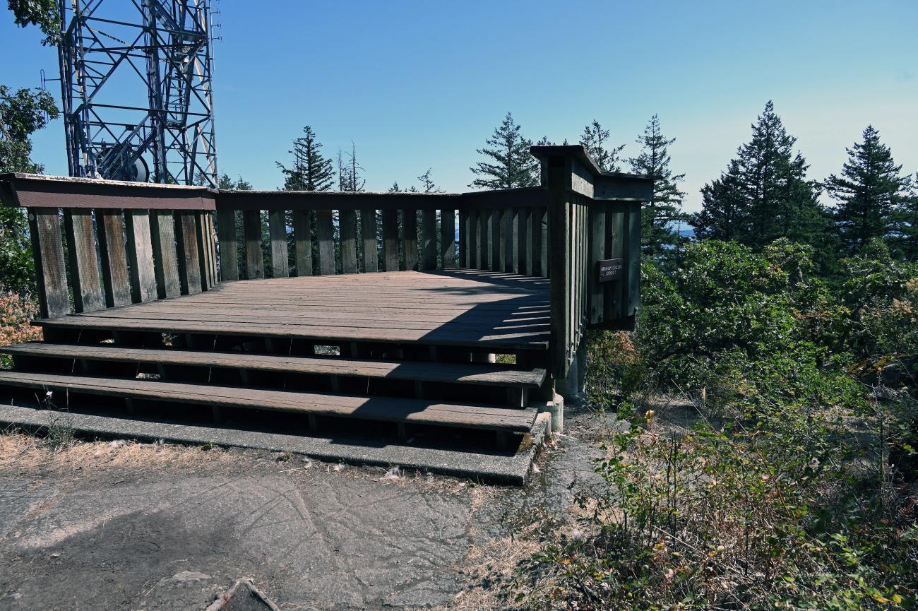
Back to the road, I followed it the rest of the way to the viewpoint. The platform itself was in full sun so it was not where I wanted to operate, it has very little view left so it wasn’t much of a loss. Just south of the platform is a grassy space with some spots shaded by the trees. I chose a location and set up my antenna and radio. I was then going to check the conditions and realized that I had left my cell phone in the car. Well, it wasn’t strictly needed so I just settled in and started to put out my first call. I grabbed my notebook for logging and didn’t see a pencil or pen! I dumped out the pack and looked – no pencil. I needed either my phone or my pad to log. I was not happy.
There being no one around I decided to leave my station set up and make a quick walk back to the car. Without the pack it went quickly down the road. I grabbed my phone and dug through my HF radio case for a pencil. Finding it I set off again for the summit. I was soon back and ready to operate. I had my first contact very soon after arriving back, it was my friend Stuart from back home who had just turned on his radio. I quickly got a few more contacts over the next minutes. I had the needed 4 for SOTA in only eight minutes but POTA required 10. I continued calling and after 20 minutes I had 7 in the log. It was getting close but still not enough. Another 5 minutes and I had two more logged. The tenth station took a bit more work with me repointing the yagi from Vancouver to Seattle and back. Eventually I got my 10th contact a chap in Vancouver. I had been trying for almost 30 minutes but being in no rush I decided to try for a few more. Over the next 8 minutes I logged three more. By now the sun had moved and my location was no longer shaded.
Rather than move to a shaded spot I decided I had enough and it was time to pack up. I disconnected the radio and packed it away. I then opened the upper chamber of my pack to store my pencils and discovered the two that were there! I had forgotten that with the back pack I kept the pencils in the small upper chamber and not in the bag like I do for HF park activations. In other words, I had the missing pencils with me all along! I guess I just need to keep things more consistent between the two types of activations. Done packing up, I gathered a few more photos and made my way back to the car. It was a nice adventure and almost completely empty of people. It can be a busy spot but today was very light. The drive home was easy and traffic not overly heavy.
Story Lines
Recent Posts
- Serendipitous Discoveries, Parks on the Air / Jan 19, 26 /
- Parks on the Air / Jan 17, 26 /
- Serendipitous Discoveries / Oct 30, 25 /
- Serendipitous Discoveries / Oct 21, 25 /
- Serendipitous Discoveries, Parks on the Air, Coastal Views / Oct 20, 25 /
- Parks on the Air / Oct 07, 25 /
- Parks on the Air / Oct 03, 25 /
- General Collections / Sep 22, 25 /
- Parks on the Air / Sep 18, 25 /

