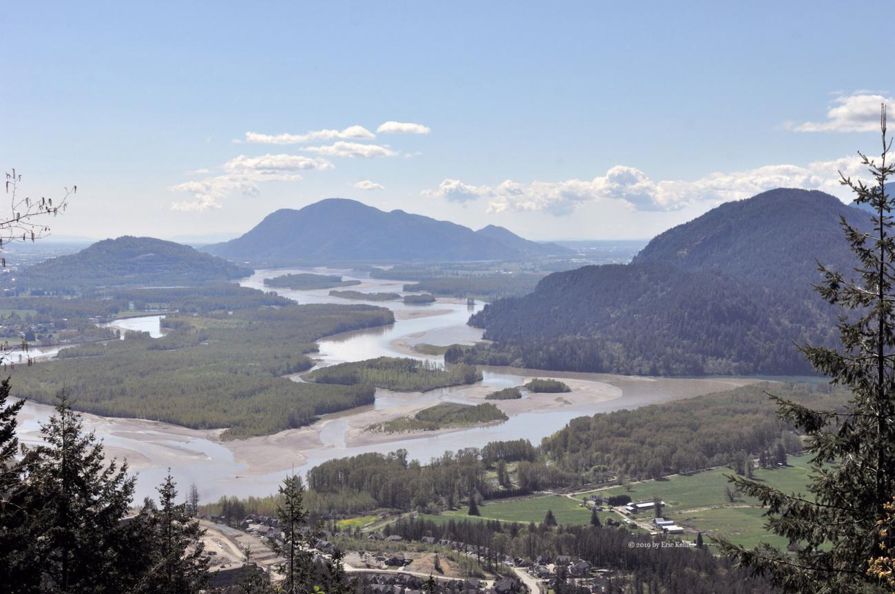
Mount Woodside and the True Summit
A lovely day to drive to a summit and enjoy the fresh air while making radio contacts
Category
Serendipitous Discoveries
Summits on the Air
2019
Click on image to view gallery
Tount Woodside is one of the few summits where one can drive to the top and be in the operating zone for Summits on the Air.I have driven to the top several times and was looking forward to a return visit. The official SOTA peak location is vastly different from where Google Earth shows as the summit, so it was a goal for today’s trip to explore the summit and confirm the true location. I had hoped to head out a week earlier but the weather got in the way and I stayed home and did some yard work. Today the weather was sunny and pleasant, so off we went.
Ralph arrived at the house by 9:30 and we quickly loaded the truck and set off for a coffee, fuel and the start of the logging road. The truck needed a good run as it has been idle most of the year so far, it was up to the task and we made good time to Woodside. At the start of the logging road I switched the truck into 4x4 mode and we started up the rough road. I was concerned that we could be stopped short of the summit due to snow which may block our way up. The ski hill webcams were still showing snow at the 950m level which is where we would be. So as we drove up the road gaining elevation I was ever the more anxious as to what would be around the next turn, seeing numerous flows of water didn’t ease my anxiety any.
When we came to the final fork we still had seen no snow and I was now feeling much better, shortly into the last road segment we met a hiker coming down from the summit, that in itself was odd but we just continued up. The one advantage of doing the drive in April is the lack of leaves on the alder. The road was getting encased with the alder trees and being bare at this time made it a bit more open and easier to pick ones way along the road. Even so, we still managed to hit one tree hard enough it bent one of my antennas.
As we continued along the final road we did finally find some snow. There was a small patch of packed snow on the road but it only covered about a quarter of the road width and was easy to pass by. A second smaller patch was soon encountered and then we popped out from the alder tree tunnel and we were at the old abandoned radio site. We parked the truck and decided we would search for the true summit before operating, so we set off to the south with our gps’s in hand to locate the Google Earth summit location. We had around 250m to where the indicated spot was and that was through a forested area. Fortunately, only a short initial section had close packed trees, for most of the way it was open forest which made travel fairly easy.
I followed along the ridge keeping the higher point in view as I made my way south. The GPS location for the summit was still south but somewhat to the west. As I closed in on the highest point I could see that the Google Earth location was about 80m to the North-west of the highest point and that location was actually in a dip quite a bit below the true summit. So I marked the high point on the GPS and went to confirm that the other site was indeed wrong, then we started back to the truck for some radio fun. The location indicated by SOTA was quite far from the summit, at least the Google spot was reasonably close, so the SOTA database will need to be updated.
Ralph went about setting up his buddipole antenna for HF contacts and I got out my 2m radio and antenna and was on the air fairly quickly. We then started calling for stations. I was having a hard time raising contacts due to the surrounding mountains which blocked large swaths of possible sites. I did manage to make 5 contacts. Meanwhile Ralph was busy with his Morse contacts and soon had 11 in the log. Later I used his antenna with my KX2 and made a further voice contact with a station in Minnesota (around 2000km distant).
We had completed our two goals and it was time to pack up and return home. If there was a view from the site I could spend much longer just enjoying it but the old radio site is surrounded by trees and so we had no views from there, perhaps climbing the tower would open up a view but that was not going to happen. The drive down went easily and after a few stops to gather some photos we were soon back on pavement making our way home. A good trip and we were fortunate to have avoided any snow.
Story Lines
Recent Posts
- Serendipitous Discoveries, Parks on the Air / Jan 19, 26 /
- Parks on the Air / Jan 17, 26 /
- Serendipitous Discoveries / Oct 30, 25 /
- Serendipitous Discoveries / Oct 21, 25 /
- Serendipitous Discoveries, Parks on the Air, Coastal Views / Oct 20, 25 /
- Parks on the Air / Oct 07, 25 /
- Parks on the Air / Oct 03, 25 /
- General Collections / Sep 22, 25 /
- Parks on the Air / Sep 18, 25 /

