
Yak Peak Hike

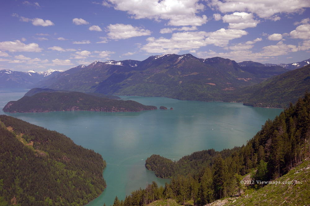
Our day began at 6am with the alarm clock reminding me of the grueling event soon to be started. After a quick routine we were on the road by 6:30 and heading for the first all crucial stop – Starbucks. Once we had loaded up on the essential drugs for the morning we were off for the trailhead near the summit of the Coquihalla highway. Being early the traffic was light and we were soon zipping through Abbotsford, Chilliwack, and Bridal Falls – well another quick stop at the small grocery there to gather some additional food items for munching along the trail. Then we passed through Hope and soon were approaching the Zopkios range and the rest stop named after the mountains looming over the highway.

Of course when we arrived we were socked in with cloud and couldn’t even see the mountain we were soon to subdue. Having parked the truck we got out to get our gear in order for the hike and immediately started to get chilled. It was quite cold out and with the blowing clouds it was also very damp. We felt that at least the hike would be cool and we wouldn’t over heat on the way up, but we were apprehensive of getting to the top and not being able to see anything. Finally we had ourselves in order and we started out along the side of the highway to the start of the trail. Though uphill the excitement of the hike made it easy going and fast.

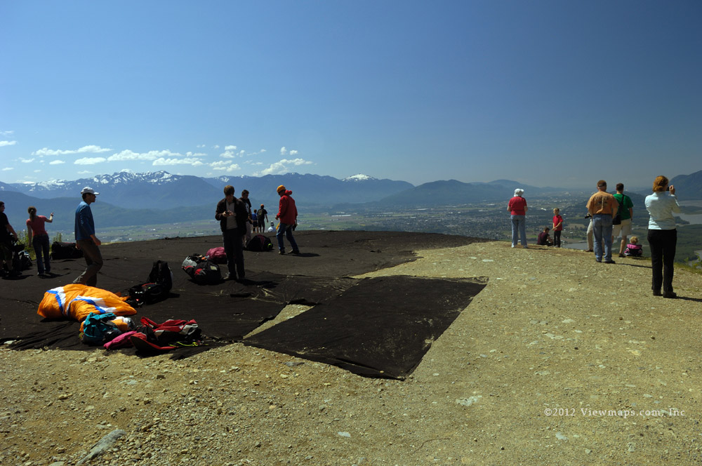
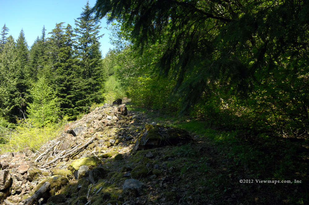
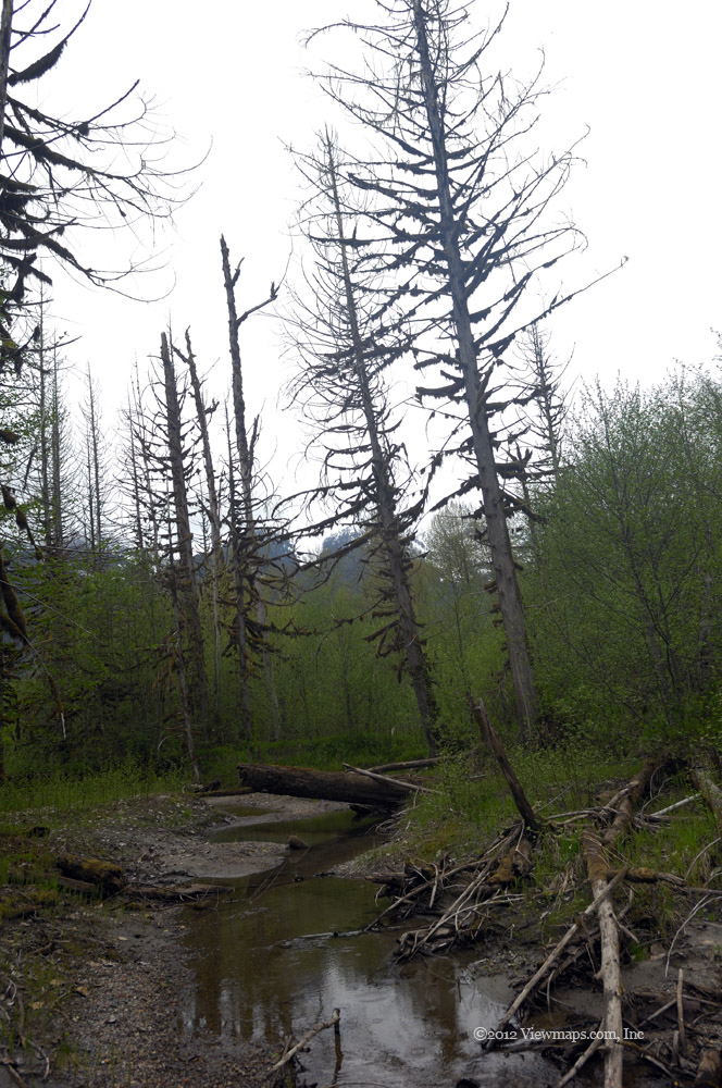
As we reached the cairn marking the start of the trail we met up with a group of three guys who were also doing the hike – chatting with them later near the top we learned that this was the third time that one of them had hiked Yak Peak. They gave us encouragement along the way as we crossed over some steep sections – mind you most of the trail was steep sections! Passing the cairn it took a few tries to locate the path through the overgrown brush but we soon were on the trail and crossing over a swampy patch on some narrow water soaked logs. Then it was into the forest and almost immediately up the steep slope that would continue for most of the hike.

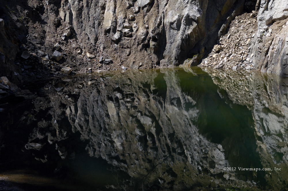
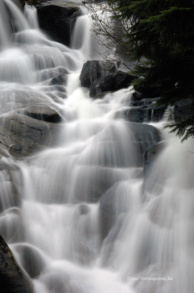
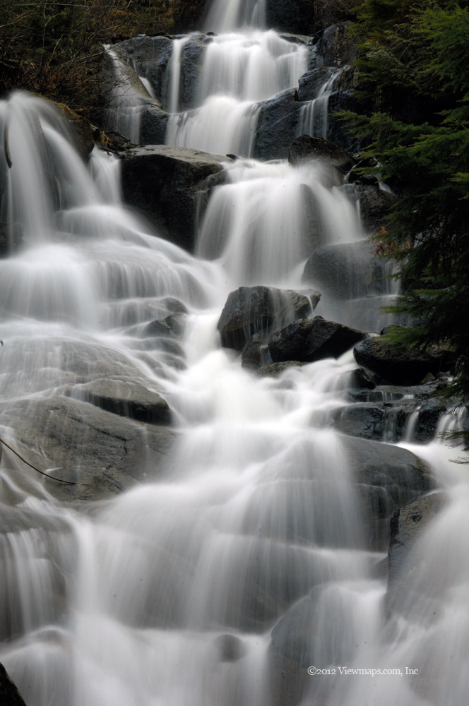
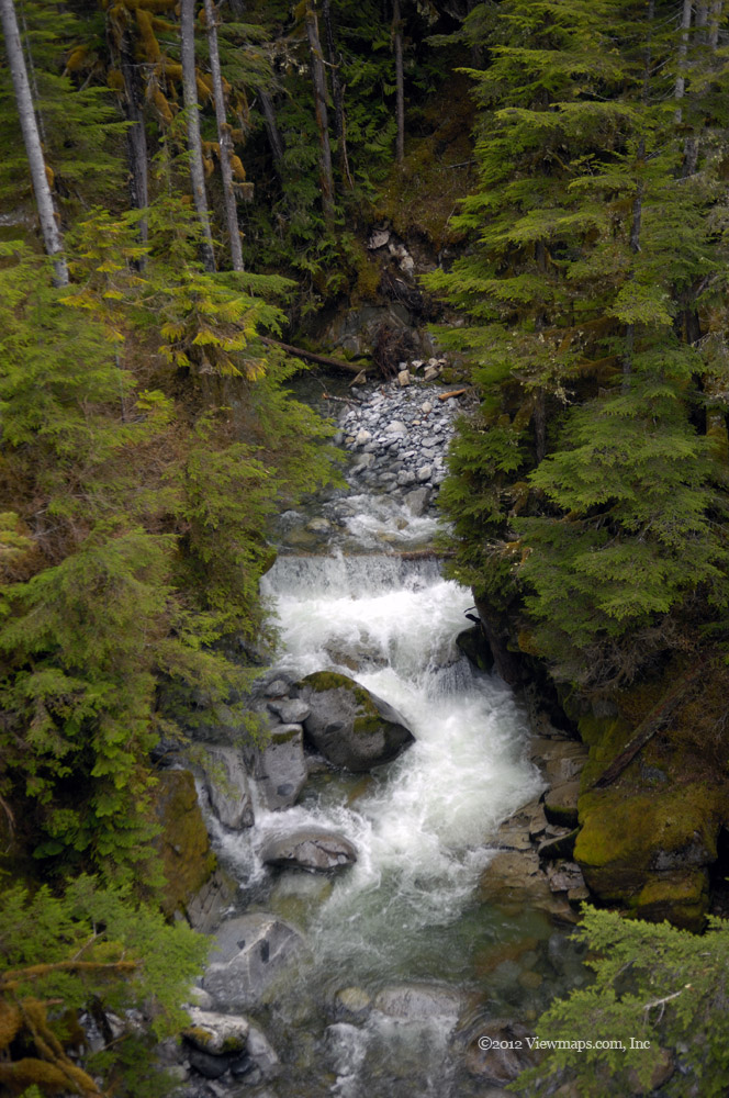
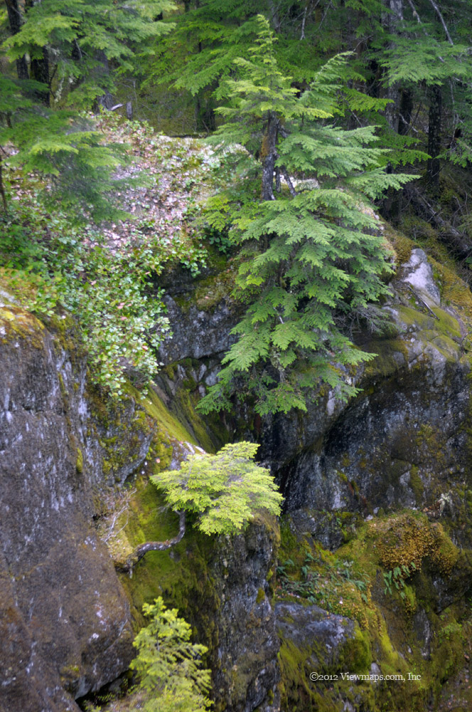
The initial trail through the trees was pleasant as the switchbacks helped reduce the steepness and the cool air made for pleasant hiking conditions. After some time and several rest stops we came up the start of the talus field where we had to scramble over huge rocks to reach the base of the steep smooth cliff face that the climbers come to enjoy. There were in fact two groups climbing the mountain today and one of the groups was already on the slope a ways above us. The next section of our hike had us travel along the base of the cliff wall to the east side where we started once again to gain elevation. The next segment of the hike climbed along the edge of the cliff face where we were able to get reasonable footholds amongst the trees and boulders. It was hard going but quite scenic, the far edge of the cliff face sports a stream cascading down from the heights it was noisy but quite pretty to behold.

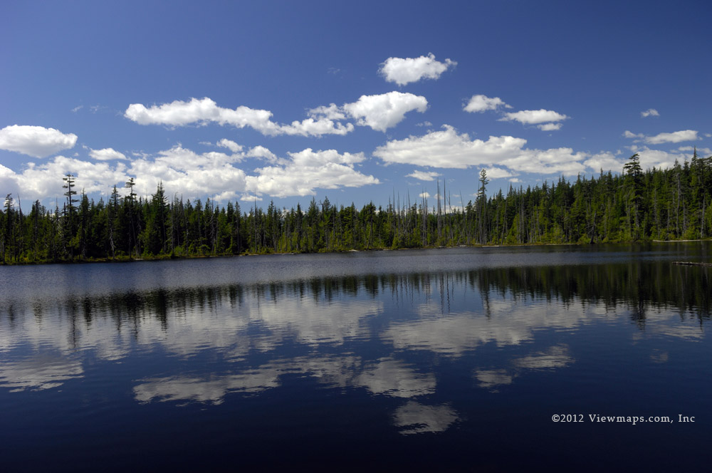
After some distance, the trail leads over a steep rock where a rope has been secured to help hikers get on top of it. It was nice having the rope as it made this section go quite quickly. After the rope the trail heads away from the side of the cliff and moves into a broader ravine which continues up to the ridge connecting Yak and Nak Peaks. This section was mostly grasses and exposed rock and made a nice spot for scenery but heading up we missed it all due to the clouds we were continually cloaked in. The return trip gave us grand vistas to enjoy as we made our way down this section, but for now it was grey cool and damp. Before much further we reached a protected dip just below the ridge line where the other group had stopped to eat lunch and wait out the clouds hoping they would clear. We hiked past them and up another 40m elevation to the base of a snow field where we stopped to eat lunch.

The snow field looked quite intimidating in the fog and we didn’t feel comfortable crossing it without clearer conditions so we had to hope the clouds would clear in time for us to continue. By the time we had finished lunch the clouds had started to clear and we had good patches of visibility and we felt it would continue to improve. Two from the other group also decided to make a go of it and they set off up the snow field. This was our first chance to use our new crampons and so we put them one and started up the snow. They helped quite a bit but it was soft and slippery enough that they still weren’t 100% effective. The snow was only a couple hundred meters across and so we were soon at its top which was at the ridge connecting Yak Peak to its sub peak. We decided to climb the main peak and do the sub-peak later if we felt up to it.

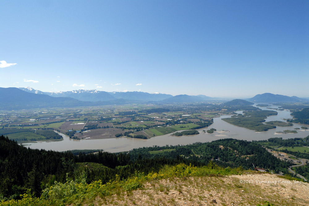
This final scramble over rocks was fairly short and we were soon resting on the summit of Yak Peak. It was a glorious spot and the clouds were rapidly dissipating and we were getting fuller and better views of the mountains around us every few minutes. By the time we left the clouds were gone and the views were spectacular. Looking down along the ridge to the sub peak made us realize that the sub-peak would be an easy hike and so we decided to hike it as well. The hike off the summit to the ridge and sub-peak went easily but the steepness made it go much slower than I was expecting. This was to be our situation for our entire descent. The views from the sub-peak were mainly of the highway below us but it was well worth the time to do it. 

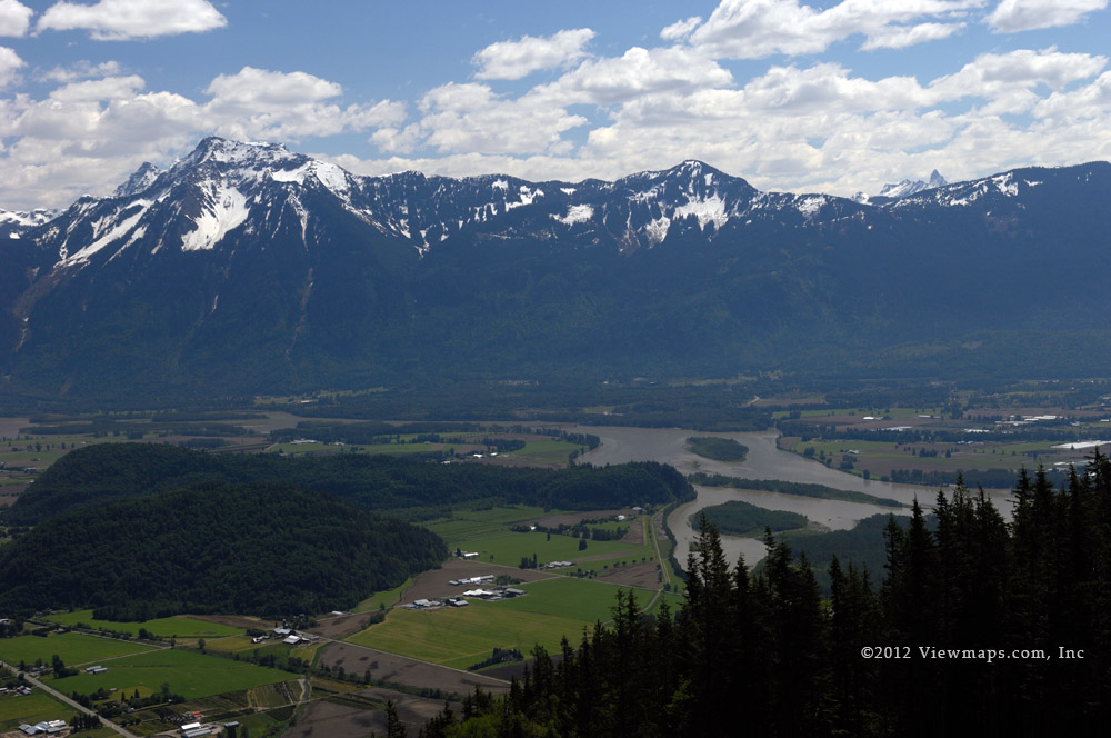
We now were done with the peaks and looking over at Nak Peak we decided it would not be our goal for today so we started down the trail for the truck. On crossing back over the snow field I lost my footing about 25 meters from the bottom and went for a slide to the rocks at its base. I did get a few scratches on the rocks but mostly just a bit refreshed in the cool snow. Once wiped down and the snow brushed off my camera gear we took a few photos and then started down the wide ravine which we had ascended earlier. It looked vastly different now with the cloud cover gone. I could see the smooth wall of the peak during most of this section and if I had seen it on the way up it may have been a bit discouraging as it looked so ominous from this location.

The slope was steep and fairly slippery which made it slow going and with the sun out in full it was now getting much hotter. I was glad we were heading down but I was still getting quite tired as we reached the base of the cliff face. There we stopped to locate the climbers – they were still way up the face – I don’t know how long they were on the mountain today but we got back to the truck having spent 8 hours on the trail. The final two sections of the trail – Talus field and forest were very tiring to me and it was feeling a bit tedious, but one couldn’t just stop here we had to continue on down to the truck. Geoff was feeling the exhaustion as well as he slipped a couple time on the trail but nothing like my slide in the snow.

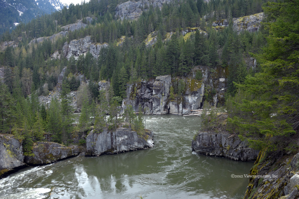
It sure felt good to be off the trail and making our way along the highway to the truck. Next time should we return we will park along the side of the highway just a bit up from the trailhead like the other group. It would save about 700 meters each way! But we didn’t know about it this time and so we still had 700 meters to go. Arriving at the truck was sure a relief and after a brief rest we packed away our gear, turned on the A/C and made for home! It was grueling and we were exhausted but we felt great as we made the summit and it was our most challenging hike to date. Our third peak of the season will be longer but not nearly as steep.

Brohm Ridge and Lake

The weather was a bit questionable and I was concerned we may get caught by rain. Though we were mostly driving, rain would cut down on our viewing opportunities and as we were heading for a high elevation ridge I really wanted get some views. As we made our way north to Squamish the clouds kept their heaviness and I was not very hopeful. Once in Squamish we faced a second challenge, the local ham operators were active on the repeater helping with a bike race. This kept us off the air except for emergencies – at-least they provided some interesting background conversation.

We topped up the truck in Squamish and made for the start of the FSR. The initial road was quite nice as it was well used along the lower section as an access to Cat Lake, a popular destination. This did give us a new problem – there was a very slow moving truck in front of us. They seemed afraid of even the smallest holes. After a few minutes they finally pulled over to let us pass. We did and soon were out of sight. We reached a fork the main branch on the right stayed low but the left started up steeply and was in poorer condition. So up we went.

This road was rough but not overly so. We gained some elevation and came by a pull-out where we stopped to gather a few photos. Alas the clouds were still thick and I could see very little beyond our immediate location. At least the greens were vibrant. We continued up the road and soon reached a few more forks – taking the left each time we soon were crossing bridges and gaining elevation. This branch followed the Brohm River and offered some nice views down the valley to Squamish unfortunately the clouds were blocking the sights. We tried each short spur in turn as we drove along gathering photos of wet leaves and trees. At one point we were at the base of some serious rock cliffs which had a neat look to them. Taking photos proved hazardous as we couldn’t stay out of the car for long enough to enjoy the place thanks to the bugs which were biting voraciously and we had forgotten to pack bug spray. They really put a crimp on my photography.

While driving, we spotted some observation huts just off the main road, I hiked out to the first one we saw and climbed up into it. It did have a nice view of the valley and I spotted a second one further up. I wasn’t sure of their purpose but perhaps they had some nice views when the clouds were less. We back tracked along the road and took the next major fork which crossed over to the next creek valley and connected to another road which continued further up the ridge. This time we found the main road to the higher Brohm Ridge. This road seemed much rougher and the map showed it as a snowmobile route. 

We continued up the road through a few switchbacks startling one very fat Grouse at one point. Soon however, we started to encounter snow. Shortly after we spotted a truck parked and looking further along the road we discovered a patch of snow on the road. We took a few minutes to gather some photos here as there was a bit of peak which offered some nice sights despite them being rather limited by the cloud cover. We decided we could get through the snow patch and so we continued over it at which point we came to a gate which was fortunately open. We rounded a bend and after only a few hundred meters came by serious snow cover and we realized that out forward journey was now at an end. Quite disappointed we turned around and crossed back over the snow patch, back around the bend with the grouse and then we pulled off at a wide spot to enjoy some lunch. Being out of the truck exposed us to the blood suckers but the wind had picked up a bit and we were in moving cloud so the moisture helped reduce the bug count. While eating a few others came by up the road on motor bikes and trucks, it seems to be a busy spot despite the rough road.

Done we lunch we started down the road, we chose to continue down the other branch so as as to see how this road played out. It dropped fairly quickly and looked like it had some decent viewpoints for another day. At one spot we came across a small ramp that had been built off the side of the road. It seemed to be a jump but I thought it was too high for bikes – the landing zone was over-grown so we never did determine what its purpose was. As we reached the bottom we came by an open area with roads crisscrossing – a popular bike area. Then we spotted a sign pointing out the way to Cat Lake, I thought of heading there but the parking area was full and so I opted out, driving past we were soon back at the start of the road.

It being early we decided to cross the highway and stop at Brohm Lake for a few quick photos around the rock cliffs just off the parking lot. The day had by now nicely brightened up and I had some nice contrasty and colourful views of the lake, there were even numerous people sunning themselves on the rocks. Ethan stayed in the truck reading while I spent a few minutes on the rocks and after I had my fill of photos, we started off for home. As we came by Porteau Cove I couldn’t resist pulling in there to gather some pictures of Howe Sound and the islands. It was a great view as usual. I stopped to talk with some scuba divers who told me there were a number of sunken wrecks placed around here for divers. Done with the spot we continued on home. Just passed the cove I noticed a very scenic spot below with easy road access – it is the actual Porteau Cove rather than just the ferry area. I will need to come back to this spot. 

We stopped at the view point along the highway where I was able to gather a few more photos. As we drove through West Vancouver, I felt a bit nostalgic and we took a brief detour to view the old house I lived in up to age 7. It was well hidden in shrubbery and I didn’t really see the house. But I did get a few photos of the view from the road above the house. I will need to drop in on the place and introduce myself one day to the current owners. Perhaps they will let me take a photo from the deck. Well finally we had used up our day and we set off for home without any further stops. Though the ridge proved a bit of a let-down in the clouds we did get some great photos at the other spots as the day cleared and the sun came. But I need to get back there and try the ridge once more not only to take in the views but to also get on the actual ridge and see Mt Garibaldi from up close.

Wells Peak Hike

It was just short of two years ago that we climbed Hope Mountain. At that time we saw the trail for Wells Peak and decided we would need to come back and try that hike. So here we were two years later starting off extra early for Wells Peak. We wanted to beat the afternoon heat so we left the house at 6:30AM and made only one coffee stop on our drive to the trailhead. Being so early the roads were clear of cars and we made good time all the way to the start of the logging road.

Starting up the FSR went well but soon we came by a large bolder that had fallen onto the road. There was a well-travelled path around it and though tight we were able to get by with little delay. We stopped to take a few photos of the waterfall just up from the level water crossing that at one point had been the place of a bridge. Driving this section of road reminded me of a few past trips where we encountered vehicle troubles – it was here that we first discovered the hole in the floor board of our previous vehicle, a Nissan Pathfinder, which was right above the exhaust pipe and was the cause of the rug smoldering! Today our drive went quickly and we were soon parking at the road end and the start of the trail.

The Hope Mountain trail starts off going down into the creek bed before climbing the far side of the valley, Wells Peak trail just starts straight up the old road. So after getting our gear in order, it seemed to take far too long, we started up the over-grown road. This first section goes quite quickly as it is fairly smooth travel and in a straight line up the side of the valley. The only interesting item we came across were several piles of bear scat. The bear obviously found the old road a convenience as well. Eventually we came to the bend and made our way south gaining elevation a bit slower for the next few hundred meters. 

Our first challenge of the day was getting over a large log that was across the trail. Now normally that would be easy but this one was covered in large red ants and they seemed quite aggressive. After planning his move Geoff got over without a problem. Then he helped me over. Once on the far side I took a few steps and stopped short as I felt a painful bite in my calf. I looked down to find a large red ant gnawing on my leg! A quick brush and it was off with no ill effects – those little things certainly can bite. We continued along the old road bed but soon we reached a washed out section which left us scrambling over slippery slope to get to the next segment of trail. Then we reached the forested portion where there is an old sign reminding people of no fires.

The next section was very steep with many small switchbacks as the trail made its way up to the ridge that leads to the northern flank of the peak. The trail is well marked and worn here so it is very easy to follow and though steep the tree-cover makes it cooler and a pleasant section to hike. We came by an old tree ladder which helped us climb up a steep section and then a very long tree bridge which crossed a soggy slope. Continuing up we were getting closer to the ridge when we suddenly realized that we were reaching the snow line. It seems that the late season had left a fair amount of snow still on the ground for us to deal with. It was hot enough that the snow was melting and every so often we watched as a buried tree sprung free from the snow! Though in some ways walking on the packed snow made travel easier, it also hid trail markers and so we were taking longer to determine our path. When we reached the ridge we lost the markers all together and so we hiked out on the open slope and there we beheld the snow packed bowl before us. 

Our initial hiking on the snow went fairly easy as it wasn’t too steep and the ground seemed reasonably solid so though tiring due to the steepness, we were able to plot a path upward. As we got closer to the base of the cliffs that drop from the peak we realized that the slope was getting steeper and was also less dense and so we were starting to slip more. Looking forward we saw that the edge of the bowl was even steeper than here and we felt that we wouldn’t be able to hike up it without spiked shoes. So we were faced with the sad decision of turning back short of the peak. Looking even higher we could see that snow continued all the way to the summit and with there being a steep drop on both sides we felt it would be unsafe to cross it with our current equipment. So we grudgingly turned back.

On our way down we decided to head for the ridge rather than retrace our steps and there we found some trail markers and found the general path we should have ascended along. It being passed noon we decided to find a dry level patch to setup for cooking our food and so we continued down the ridge until we reached the place where we first reached the ridge and crossed over onto the open slope. Here there was a nice level rocky area where we could relax and enjoy some sun and food before starting back down the slope. It worked out well and we had a good rest while cooking, I also had some chats with Ralph on my Ham radio. Today’s link went from my hand-held to the Hope repeater onto the Sumas Mountain repeater and over to Ralph’s hand-held in Surrey, it worked well. In packing up, Geoff managed to cut his thumb on his machete which was painful. Fortunately we had enough supplies in our small kits to deal with it.

Done with lunch we cleaned up and started back down the trail. Crossing over the snow seemed to take much longer than what it seemed on our way up but eventually we reached the end of the snow and solid dry ground. Heading back down the slope seemed much harder and steeper than it did on our way up but we made good time and soon were leaving the woods and heading for the ant covered log. This time we both got over without trouble. The final stretch down the logging road seemed to take extra-long as the sun was now out in full force and we were getting heated. I sure was glad for the tree cover earlier.

Finally back to the truck we got it started so we could enjoy some cool air. The drive back down the road went smoothly, we stopped for photos at a couple of spots but we were too tired to do any serious exploration. So we descended quickly and soon were on the pavement heading for home. It was a lovely hike and well worth a second attempt to reach the summit.

Tulameen Valley

The weather was not looking good all week as we monitored the changing forecast and by Saturday morning it was in heavy rain that we departed the house an hour earlier than normal for our drive to the start of the Tulameen FSR. Just a few blocks from home we ran in to an unexpected obstacle – a bike race had closed off the intersection of 24th & 184th. When this annoying event happened last year we were stopped for 15 minutes before being able to cross the road. I really think they need to allow cars through every few minutes and not make things so annoying. We turned around and drove north to #10 highway and then out for the east. We lost some time but were still ahead of our normal departure.

Rather than a quick coffee near home we stopped at the old spot in Abbotsford before continuing on to Hope and the Coquihalla. The rain had lessened as we made our way up the valley and by the time we left the highway it was only a mild drizzle. That we could live with but it also hid the peaks of the mountains from us so we did have fewer grand vista opportunities to photograph. But we were now here enjoying the backcountry with the irritation of the cyclists rapidly fading from memory! Not far along the road we startled a huge snow hare who then quickly hoped across the road in front of us. He was partway into changing colours from white to grey, his feet were still snow white.

We continued south along the Tulameen mainline as we hoped to make it past where we were stopped by snow last year. The drive went quite quickly as the road was in good shape and the dull rainy weather made it uninviting to get out and take photos, I did hope it would clear a bit as the day progressed. Soon we were all the way down to Sutter Creek and the Rec. site where we had some great views of the small gorge the creek flows through. I got a couple of photos today but the rain really cramped my style and we didn’t bother to climb down the slope to the water this time. After Geoff shot off a few rounds of his guns we continued south and soon passed the point we were stopped at last year. As we drove the new section we surprised a few deer and by the end of the day we had seen six deer and two bears. The second group of deer were running down the road away from us and soon switched into hoping mode, it is a funny sight to see but they do make good speed! Alas we were stopped by snow once again less than 6km past our previous point. I guess we will just have to try one more time.

We reluctantly turned back and started to explore the side roads as we came to them. The first led to a more recently logged area along Vuich Creek. We had to clear one tree that had fallen across the road and soon we came by a small bridge where two logs had been pulled across to block entry. Now we could have moved them but we decided to honour the desires of the loggers who placed them there as we had so much to see. Turning back to the mainline we stopped at Sutter Creek again and this explored the area across from the gorge where some side roads led to a few campsites. We drove a short distance along a grassy road and found a few interesting sights but then it was back to the mainline for the next side road.

We soon spotted an old road called the Railroad Creek FSR. It went directly west and followed along the creek eventually opening up into a wide alpine valley it was quite scenic with the low clouds and mists filling in the area. A second branch made it even further west but here we had to saw down a fallen tree which was blocking the road. Continuing along we got to the end where there was some deep snow blocking the final 100m of road. Well that was just too much for Geoff and with an exposed patch of road just 100 feet across the snow he decided to drive it. Well of course we got stuck 30 feet short of the end. I was not impressed and we spent the next 45 minutes winching ourselves across and then back again! It was a nice area and the small creek quite interesting but winching in a drizzle was less than ideal. Once we were clear of snow and moving again we decided to head for the campsite where we ate lunch last trip.

It is a nice campsite but being next to the road would be a bit dusty in the summer. Today we pulled in close to the threes and even though there was a fine drizzle falling we were generally dry when next to the skimpy pine trees. Geoff managed to start a small campfire while our burners heated lunch. As we finished lunch we heard a vehicle on the mainline calling out mileage markers as they came down towards us. This got Geoff interested in doing the same once we got moving. The next major side road was the Champion FSR which we decided to explore. This road initially parallels the Tulameen River but on the east side before curving around south as it follows Champion Creek far below in a narrow valley.

We travelled the main road ignoring a myriad of further side roads that all seemed to offer exciting views. There was one marked branch that indicated a connection to the next group of roads which had another exit point. We decided to stay on what we thought was the Champion mainline and worked our way north again around Olivine Mountain. Eventually we took a left branch that hugged the flank of Olivine passing up the one that followed down Olivine Creek. This one seemed to indicate it followed Hines Creek back down to the Tulameen River. Alas after clearing another tree, we dead-ended in a large turn around. We could see the faint remains of the old road that continued downslope but it was not passible. We also spooked a large bear as we entered the turn-around – boy can he move fast when running away!

As it was now getting late in the day and our fuel level was starting to drop more than I like we decided to just retrace our path and head home. Later I learned that the other branch leading down Olivine Creek continues along the Tulameen River and eventually exits the backcountry at Coalmont. It would have been shorter and offered new scenery but the return drive still offered so much to see. And so we made our way back along the Champion and stopped at the bridge over the Tulameen just at its start. Here I took some photos of the river rapids below while Geoff decided to shoot off rounds from all four of the rifles he had brought along, he couldn’t make up his mind which ones he wanted to bring this morning so he just took all four. Done with the photos and target practice we drove back along the Tulameen FSR and soon found ourselves back on the Coquihalla Highway. As we neared Hope the rain got really heavy and continued for most of the trip home. It seems that we actually had very little rain all day while the valley was in heavy down pour.

So there we are, another trip to this fascinating area. There are so many roads to explore. One really needs to camp out here and have a few tanks of gas to reload so one can concentrate on the vastness of the area.

Brohm Lake Hike

July is only a few weeks away and with it comes my mountain peak hikes. So I felt I needed to get a bit conditioned for hiking by starting out with an easier hike. Although I have hiked Brohm Lake a couple times in the past, I never hiked the western ridge to a viewpoint. So it seemed like a good goal for the day, weather permitting. Fortunately the weather looked ideal for a hike and so Ethan and set off for the lake and the start of our day of hiking.

Along the drive in, Ethan was trying to remember which lake this was, hoping it was not the one he really hated. Later at about the two –thirds point we determined this was his hated hike! But today it was going very well and not at all like his memory. We felt that the reason for the prior difficulty was due to the camera bag we were lugging around. I now have a smaller hiking setup which is much lighter and easier to take along. So in the end Ethan’s view of the hike was redeemed.

We arrived at the lake parking lot before 11, not really early enough for a major hike but for this one it would be just fine. I really quite like the hike around the lake as there are quite a few interesting sights as one makes their way around the trail. Around the parking area the shore is very rugged with tall boulders dropping down to the lake edge which give a dramatic look to the photos. As one hikes south the terrain changes to a flat marshy mode with lots of tall grass choking the surface of the lake. Here there is a long wooden foot-bridge which crosses over the marshy portion of the lake. The bridge offers a great number of textures by itself but it also opens up many angles on the lake to enjoy.

On the far side of the bridge the trail forks, the right branch follows the lake edge north and has been the way we have gone in the past. The left branch initially leads south and then curves around to the north on the far side of a ridge. One can from there take a short side trail up to a minor peak where there is an old observation platform. Along this portion of the trail I spotted some lovely sheer rock walls with ample mosses and greenery hanging down from it. The fresh greens of spring made for a very rich look and I was stopping often to gather a few photos. I really need to come with a couple of flash units to provide some fill light but those were not with me today. Closer to the top we came by some amazing patches of skunk cabbage – the flowers were not out yet but the leaves were huge and rich in bright greens. I gathered a number of photos of the plants.

At the top of the ridge we met up with a hiking group of seniors who were enjoying the view to the west. Before I got out to enjoy the scene, we pulled out our camp stoves and started cooking our lunch. We found a wide platform which formed the top step of a short set of stairs which offered a nice level spot for our burners and there we cooked our soup. Once done cooking and eating, I wandered around the area looking for views and taking some photos. I chatted with the group of seniors who were trying to determine the name of the peak directly to our west. I figured it was Alpha Peak as it was quite striking and looked like what I remembered it to be – checking later confirmed my guess. Once I had gathered the photos that caught my eye, Ethan and started down the trail and the connection back to the main loop trail around the lake. After descending for 15 minutes we joined up with the main trail and continued north around the lake. We didn’t want to follow some of the side trails that lead to the shore of the lake so we didn’t actually have much lake view as we made our way to the north end of the lake. Coming back south on the east side soon brought us back to the edge of the lake with some nice views of people fishing in its middle. The trail starts at lake level but soon it reaches a rock wall with a long set of stairs providing access to the top. This is convenient but tiring. Once we reached the top of the wall. We noticed that there were a number of nice new stairs and bridges that had been recently added to the trail to make it easier. This is nice but does detract a bit from the feel.

Heading back to the truck along this section of the hike went fairly quickly as it was getting hot out and I wasn’t stopping to take photos as much as I was on the way out earlier in the day. But I was satisfied with my catch so far and we achieved the primary goal of reaching the peak and getting some hike conditioning. Once back to the truck we got the AC turned on and quickly cooled down so we could better enjoy the afternoon and the drive home. It was a pleasant hike and a good start for the season. The view from the viewpoint was good to the west, reasonable to the south but the eastern view was now over-grown and one wasn’t able to see the lake. But I had a good time and would enjoy doing the hike again.

Silver Creek Bear Farm

Two and a half years ago Ethan and I drove a loop starting in Garnet Creek jumping across to Talc Creek and ending on the East Harrison. It was a lovely drive with some amazing valleys to explore. So today, Geoff and I hoped to do the drive in reverse, starting on the Harrison and then exploring Talc Creek. Unfortunately, the start of Talc Creek presented a locked gate! Not at all what we were expecting. It seems that with the increase in back-country campers in the area, most of the roads are getting gated. So with no way to enter the Talc valley we decided to continue north up the Harrison and cross Cogburn Creek to run up that road but it too was gated! Now we were getting frustrated.

I felt we should just keep heading up the road and so we drove up to the Silver Creek log sorting yard and then continued on. We soon came by a side road to the east which had some large logs partially blocking access which we had never explored so in we went. We ended up spending the whole day in this relatively small area. The area had multiple side branches for us to explore and some lovely sights of the mountains and greens of the mossy understory. On our first side branch we stopped at the end of the road and climbed up some tree fall to get a view to the north. It was an OK sight but not great. We then drove to the end of another branch where we were had to stop as the road continuing on was not drivable, so we decided to hike out on it to a lovely moss and fern covered area. While there we heard some logs dropping or branches breaking and at the second time Geoff got concerned then when I mentioned that I had also heard them both we figured there might be an animal lurking not far away. He fired off a couple rounds of his .22 and we then went back to the car so he could get his bigger rifle. We returned for a few more photos and then left the area.

We drove to the end of another side road and there we got out and clambered up a small ridge to gather some photos of the area. I spotted some interesting trees to photograph. As we retraced our drive I looked up another side road and spotted a bear on the road right near a turn. We hocked the horn and it quickly scurried off around the bend and up the road. We drove on up this side road but never saw the bear again. We quickly drove this branch and then returned to the mainline where we drove back to the next fork. This one opened up a whole new area for us to explore and so we ended up driving a fair ways south as we slowly gained elevation.

On the first road in this new area we had a sharp switch back as the road climbed the slope of the mountain and as we continued up Geoff looked down slope at the road we had just driven up and saw a large black bear about 30 meters from the side of the road! We decided to stay where we were and watch the bear for a while. He was busy eating berries and really wasn’t interested in us. The Salmon berries were ripening well and he was enjoying a good meal. We drove the short distance to the end of this branch and then had to come back down passing by where the bear was. We did so and stopped along the road closest to the foraging bear. He merely looked up at as and continued eating, then as we weren’t moving he lay down on a log much as a dog would do and watched us. Geoff fired off some rounds of his SKS to which the bear looked up but couldn’t be bothered to move. Geoff fired off another sequence, this time the bear casually got up and walked away. He really didn’t seem to care about us much at all, considering it was still open bear season, he should have been a bit more wary.

Done with that bear we drove on a couple hundred meters into an open area and there we set up for lunch. Here we were down-wind but we kept a close eye on the ridge line separating us and the bear. After enjoying a nice heated meal we packed up and started to drive off. Only a few meters down the road I looked up slope and there was a third bear eating away. He was a smaller brown bear and though he was somewhat up slope of us he kept his good eye on us as he munched his berries. We continued along downslope exploring a few more side roads as we made our way along. Soon we found ourselves at the back side of the log sorting yard.

There was another side branch to follow so we opted to continue exploring in this area. Here we had to clear some trees which had fallen across the road, clearing them allowed us to follow the road up a small ridge where we stopped at the end of one short spur. Geoff was thinking that we were likely right above the mine shaft we had explored from the main East Harrison road previously. As he was out exploring the area just past the road end he almost fell into a tree-branch covered open pit! This really intrigued him and so he started pulling off the dead branches to better expose the opening. It was fairly large but full of water about 12 feet down from the opening so we couldn’t tell how deep it went. We marked the spot on the map so we could see where it was in relation to the mine opening. Later on our way out we stopped to check and saw that this pit was directly in line with the mine shaft!

We continued to explore the remaining roads in the area and once they were all travelled and we took some time to fire off a few target shots before we returned to the East Harrison and crossed it to explore a few spurs leading off to Silver Creek. Here we came across a number of really excellent camping spots next to the river. They would likely get grabbed up quite quickly on a long week-end. As we explored the spurs along the river we soon came to the log yard again. Here I noticed a lovely cloud formation over the lake and so we made our way through the yard to the shore of Harrison Lake where I took a number of photos.

Done with the lake photos we started back south towards home. We made a couple more stops along the way enjoying the amazing greens of the damp mossy forest. Just past the Bear Creek camp at the mouth of Cogburn Creek we stopped to chat with a guy who was camping along the beach. He had hauled in a full hot tub on a low bed trailer and was busy getting a home-built furnace started which was used to heat water for the hot tub! It was quite a setup! I didn’t have the heart to tell him that the tubs at the Clear River hot springs were full, warm and ready to go and only a dozen or so miles up the road!

We continued on out having had a remarkable day in the sun even though we didn’t get done a thing we had started out to do. But we enjoyed nature, saw many new things, enjoyed the company of bears which weren’t just running away. We got to clear some road, push our way through brush, explore some mines and rock formations, look-over campsites by the river, do several rounds of target practice, chat with a guy who hauled a hot tub into the back-country and just generally relax in nature. So I guess we had a full day.

Mt Woodside and Mt Agassiz

Today Ethan joined me for a drive through the hills. Our goal was to explore the roads on Mt. Agassiz. To get there one had to enter via Mt. Woodside and so we set out for the FSR entrance off the highway on the lower slopes of the mountain.  The initial climb to the ridge goes quite quickly as the road is in good shape and we really don’t have to go that far.  About half way up there is a good view showing the beauty of the Fraser River and the valley heading west. It is an amazing view and would only get better as we gained further elevation.

As we came by the side branch leading to the launch point of the paragliders, Ethan suggested we go there first and so we did. I was easy to convince as I felt we would get better views with the sun behind us rather than in front. When we arrived we found four pilots on the site preparing to take off. We chatted with them as they each in turn launched into the scenery. I got some good shots of the pilots taking off. One of them was embarking on an 8 hour cross-country flight – across to Stave River up the lake, over to Harrison and back down!

After an hour plus on the site we set off for the rest of our day’s journey. Climbing higher we came by the fork leading to the radio repeater on the peak of Woodside and as its gate was open we started up it next. The road was a bit over-grown and the brush still leaning inward from the season’s snowfall. We got to within a half kilometer of the end before snow stopped us. So close but it is still out there causing trouble. We returned to the mainline and continued north-east. We came by the fork leading to Stacey Lake where we walked around its frozen surface back in December 2010. Today we found a string of 4x4 parked on the road with the drivers all busy fishing on the lake. We chatted with one chap who had come in from the lake as he had gotten very cold.

We backed back to the mainline and continued on our way to Mt. Agassiz. The next gate was also open and we continued along soon passing the peak of Agassiz and coming to an amazing viewpoint of Harrison Lake. Here we stopped to enjoy our lunch and the great scenery.  It was lovely in the bright sunlight but soon we were getting overheated and so we continued up the road but it only went a short distance further. So we returned to the first fork and there we drove along a soggy bit of road and soon found ourselves within a few feet of the edge of Campbell Lake.  We stopped at a makeshift campsite so I could gather a few photos of the lake and its reflections of the clouds above. The road continued on past the lake and so we decided to follow it. The first few hundred meters were very wet and soft but it hardened up enough for us to keep going. We continued for a few hundred meters more crossing some more swamp zones and very narrow gaps before we realized the road had narrowed to a trail and we would need to back out. This proved a bit troublesome, tight space between trees and a drop on the one side. After careful maneuvering Ethan was able to back us out and we were soon back to the lake where we could turn around.

While extricating ourselves from the tightest part, a pair of hikers came by having climbed the slope from Harrison Hot Springs. They came to see the lake and would be heading back not much after we had returned to the mainline. I can only image what they thought of our situation as they made their way past us.

The map shows that the road crosses back over the ridge of Agassiz and down the slope down to the roads below. I thought we could drive it to see where it came out. This area was also more freshly logged and the road was in good shape. So we decided to follow it out. We had some lovely views to the south as we slowly descended the slope. But the original road was not followed for long and soon we found ourselves further to the east in newly logged areas. We back tracked but were unable to find any road branch that continued on down the slope. So we had to return the way we came.

The map also showed an old road leading down to the Harrison River. The early section of the road looked fairly good so we decided to give it a drive. We made it about a third of the way before the road narrowed and looked less inviting. If it had been earlier we likely would have continued down but by this time we were tired and didn’t really want to fight a narrow road for the second time today. So I guess I will need to try it another day.

Once we returned to the main line we noticed that our tonneau cover was slipping at the top end and so we had to get out and straighten it. This needed to be repeated often as we descended over the rough spots on the way out. (After we got home I inspected it and discovered that one of the clamps had broken loose and needed repair.) We soon rounded a bend and were greeted by two kids riding an ATV. They seemed a bit uncertain as to which path of a fork to take. But they got out of our way and we continued on.  About three quarters of a kilometer further back we were stopped but a chap in a truck asking if we had seen them! It seems that he was having trouble keeping reigns on them. But we told him where they were and he set off to find the escapees.

By this point the jarring had taken it toll on both Ethan and I and so we decided to head out and call it a day. We had seen some great scenery and pushed our abilities on the narrow roads. So even though we didn’t need the winch, it was a good day and a lot of fun. Now I have finally seen the majority of the area on these two mountains and can move on to more new stuff.

A day in the Silver-Skagit Valley

It was eleven years ago that Geoff, Ethan and I were driving through the valley and exploring some of the easier side–roads. At the end of one of these was an old cabin that was hidden in the trees along the side of a creek bed. Though we had tried a few times to find it since that trip, we hadn’t found it. Today we planned to put more effort into locating it. In looking over my old photo of the cabin I noticed a couple of mountain scenes taken at the same time. So I figured they were taken close to the cabin and if I could position Google Earth just right I would discover the spot they were taken. So a few days before the trip I spent some time on my computer and eventually pin-pointed the spot where the mountains on Google Earth looked similar to those on the old photos. Armed with a starting point we set off for the valley.

Upon arrival we soon learned two things – the first was that the road was recently graded and was very smooth and easy driving – all the way to Ross Lake. The second was that the easy road brought out a lot of campers and with the dry road the dust kicked up by driving was massive! Our first stop upon entering the valley was just before Silver Lake where we had a nice view into the lake and the river just below it. I have taken numerous photos form here but the spot always draws me back. We were able to clamber onto a huge rock in the middle of the river where we took some amazing water photos. Unfortunately, we had to wait for long gaps between vehicles on the road as the dust they kicked up blew across the river and lake obscuring the scene!

As we continued our way south along the valley, everywhere we found a wide spot or side road there were groups of campers milling about. They seemed to be eking out a camping experience in every nook-and-cranny that could be found! Quite funny in a way as those alongside the road were getting covered in a thick layer of dust with each passing car! With the road in such good shape we were very quickly approaching the location where our side road to the cabin should be and we needed to keep an eye out for it. Soon we found an old over-grown road leading off to the SE from the mainline. The trees were crowding the road and a deep cross-ditch made the entrance to the road a bit questionable. As it was only a half kilometer to the end of it we opted to just park and hike in to the end of the spur and look for the cabin. We easily reached the end of the road now much over-grown and covered in the intervening 11 years. We started up the creek bed and crossed over to the far side. After climbing through the bush along the side of the creek Geoff yells out that he found the spot! Unfortunately, the old cabin had been destroyed. All we found were some of the ‘appliances’ – bathtub, stove, wood-burning heater. It was a real shame but at-least we can now claim to have finally found it.

Done with the remains of the cabin we returned to the truck and made for Ross Lake at the end of the valley. It being the May long-week-end I figured that the park would now be open and we would be able to get all the way to the lake. Well I was partially correct. The gate was open and we did get all the way to where the lake should be. But the level was way down and there was no lake to find. It seems that the start of it was far to the south of where the border is and we decided to just wander around the lake bed for a bit and gather a few photos along the border. The number of groups crowding the open spaces was no longer surprising but the numbers were significant. On our way out – we decided to eat lunch outside of the park – we spotted a small car parked with a group, we had passed it on our way in while it was getting outfitted with a spare tire! They have a long drive back on a small tire! 

Once we got out of the park we started looking for a spot to set up the radio and eat lunch, we had thought about the granite quarry but people were camping in the middle of roads making it impossible to get past them! That was perhaps the most annoying part of the crowds. We didn’t find the quarry but did finally find a side road with no current occupant. I had hoped for a more open elevated spot but those were all occupied. So we made do with this tree enclosed location. The tall trees lining the road side actually proved useful as we were able to toss a rope over a lower branch and haul up the antenna and get on the air in record time. The spot worked out really well and I was able to have a good chat with the team back in White Rock. I also chatted with a station in Colorado. After we finished lunch and Geoff had shot at numerous targets, a pair of guys in a ATV came up the road looking for areas to explore. The driver turned out to be a guy Geoff went to school with!

Done with lunch and radio, we packed up and started to explore some more side roads as we made our way north. Some of them were blocked by campers but we did get to drive up the first side branch of the Cantelon FSR. We gained some good elevation and had some lovely view s before we were stopped by snow. Then it was back down to the main Silver-Skagit road and we drove north.A bit north of Silver Lake we took the fork that leads to the campsite on the west side of the lake and the Sowerby FSR. Choosing the Sowerby over the lake we made our way up that valley. We soon came to an extremely rough patch of road which should keep all but the most determined out of the valley. Shortly passed the rough section we stopped to observe a huge rock which had slid down from its original spot by about 2 meters. This rock was likely 20 meters tall and had moved a good 6 feet! At some point it will slide across the road or tip over and totally block it. I sure hope it isn’t today with us on the wrong side.

After looking over the big rock and getting up on top of it, we continued up the road and enjoyed some amazing views of the valley. We didn’t get all that far in as a pair of guys were busy sawing trees and clearing the road. They said the snow was deep just a few hundred meters beyond them, so we opted to call it a day and turned back and set off for home. It was a great day of driving even with the clouds of dust and the annoying city campers blocking some of the roads.

Northern Squamish River Valley

The Squamish valley has a large number of side branches to explore and I have traveled very few of them. I have seen the first and half the second plus a couple at the far end of the Elaho but as to the rest, well a few were partially seen many years back but nothing in recent memory. So we felt we should return to the valley and try for the far northern end of the Squamish mainline. The initial drive went quickly as we left home a half hour earlier than normal and we were able to beat the week-end traffic. In Squamish I was able to contact a local ham and we set up to do some simplex calling while we were far up the valley. On our way home we dropped into visit with John for a few minutes before heading home.

We zipped up the early section of the road passing the many lovely sites we stopped at last week. It was quite surprising to see how much greener the place is after just one week! We didn’t really stop to look around until we reached the bridge across the Squamish River leading to the Elaho. From the bridge we gave a call back to John and were able to get a clear signal all the way down the twisty valley. So now we started up the less traveled section of the road. The early part of the road was clear and easy to drive. Soon we came by a huge tree that had fallen across the road. It was huge but fortunately left a big enough gap under it that the truck was able to drive through it.

Soon after the tree we found a short side branch the lead up through a shale field. Here we parked and got out to look for some decent photo ops. Geoff noticed a huge stump not far up the slope so we made for it. I slipped on the moss at one point and was fortunately caught by Geoff. The mossy covering on the rocks was not as solid as it looked. When we areached the stump we discovered that it was hollow and not a safe spot to stand on which I had hoped to do. I gathered a few pictures of it to try and portray its size. We explored a bit more before we returned to the truck and continued up the mainline.

Not much further we came by a stream that had clogged it drainage pipe under the road and it was now flowing over the road cutting a deep crevasse into the road. We added some flagging tape to a small marker that a prior visitor had left to better mark the danger. There was still enough space to drive past the gap but in crossing we discovered that the water had made the ground very soft and we sank in the mud. So we had to haul out the winch and pull ourselves free of the soft sand. At the rate it seemed to be eating the road, I don’t think the spot will be crossable for much longer. We continued north, past the S200 branch and soon encountered deep snow. Well that was the end of our drive up the mainline for today, so we drove back to the S200 branch and started up it. Not far in we came by a lovely waterfall where we gathered a number of photos. Geoff was a bit worried about getting back across the gap on the mainline so we kept our stay short on this side road and soon we were driving back to the crevasse.

The return crossing saw us stuck in the soft sand as well and so we pulled ourselves along once again to get past the damaged road. Safely across the gap we made for the B1000 side road and zipped up it to the very end. It isn’t a large section and we were at the end in a few minutes. There we stopped to eat lunch. We had a grand view of the Squamish valley to the south and watched a group camping along the river below us. Here we put out another call to John and had a short chat with him explaining the damaged road and snow conditions. Done with lunch, we started back down the branch and decided to push through an older section of the branch that formed a loop. Here we were pushing over small alder as we drove the old road but soon we came by a small creek with some trees in the wrong spots. So we opted to back out but now we got wedged between some of the trees we squeezed between getting in and in the end we were forced to pull out the chainsaw and clear a few of the trees so we could maneuver better. Once back to clear road we set out for the mainline and the bridge over the river. We planned to start back up the valley on the west side via the E100 branch.

The E100 branch paralleled the wide valley for some distance providing numerous access points to the sandy river bed where we saw many camping locations. Several groups were camped out for the week-end. We continued up the branch and soon were gaining in elevation as we moved away from the valley. We found a couple of spots with some views of the river where it formed a bit of a gorge.

The road opened up on a gravel pit where we had some interesting shots of the rocks. They were organized in patterns that raised many questions in our minds. Here we also discovered the largest pine tree I have ever seen. The base of the truck was several feet in diameter! Geoff made his way down to it so we could demonstrate it size. It looked healthy even with its gnarly branches. Done with the gravel and the pine tree we continued up the branch until there too we were stopped by snow. An ATV had been stopped by the snow at the same point. Geoff of course had to push his way just a few inches past their furthest point. This spot was near a cliff wall and so I got out to explore and gather a few shots from the top of the cliff overlooking Dipper Creek.

We then started back down the road and took an overgrown side road where we crossed a small creek and soon found ourselves on a flat rock ledge that slowly descended to the Squamish river. It was somewhat over-grown and it being late we decided to not continue down it today. We backed out to a bend where there was a campsite and where we could turn around. Geoff discovered fresh bear claw marks on a tree in the middle of the camp site. We then drove back to the main branch and drove along to the gorge we saw earlier. Here we stopped where we had a view of a waterfall falling into the Squamish River. We climbed down to the river edge and spent some time photographing it. This mini-gorge along the Squamish River had a powerful majesty to it. Though the waterfall was not big it had a compelling feel to its simplicity.

As it was now almost 5pm and the sun was dipping below the peaks, we decided to head on out for the day. Though we didn’t get all that far up the valley, we did find some great sites and had a very enjoyable time exploring the area. We will need to be back here a few more times this summer once the snows are clear and we can push to the end of the roads. Once on the pavement we touched base with John once more and dropped into his place for a visit. It was good to chat with him and wind down a bit from the drive.

Elaho and Squamish Valleys

I really enjoy driving up the Elaho and seeing the beauty of this area surrounded by high mountain ranges and glacier capped peaks. I have seen very little of the area due to the time it takes to arrive on scene, but when I do get here I am never disappointed. This winter we drove the Squamish mainline twice in the deep snow hoping to reach the start of the Elaho but both times fell short of our goal. Today the snows are gone on the lower levels and the road was busy with recreational users so we were able to finally get to the Elaho River and enjoy the breath-taking gorge and amazing ice-capped peaks.

After fighting with some construction delays on the highway we finally arrived at the start of the mainline and our planned adventure. We soon noticed that the early section of road was recently graded and the horrible pot-holes cleared up – that sure made for a more pleasant start to the drive, the last time this area was not at all a fun bit of road. Driving on the road did get rougher as we journeyed deeper. 

We eventually came to a heavily wooded area with a small pond off to the east side of the road. We stopped to gather a few reflection shots of the new growth with its fascinating greens that spring brings out in the rush to return life back to the forest. I was still playing with my polarizer and experimented with the look of the shot through it. I am still not certain I like the results of using it but I am forcing myself to use it the next few trips to see if I can get more out of the scenery with it. Some shots are vastly improved others not at all, but the overall feel of the photos is different and I still have to decide if I like it.

Shortly after the pond we came by a stand of moss covered trees that called out in a loud way to Geoff, so we parked and got down into a small stream bed to gather a few photos of the trees with their moss chocked branches. We were now fighting the odd drop of rain, so I didn’t want to spend much time out here away from the safety of the truck – such a wuss. Done with the trees we made for the truck and continued on up the road. Soon we reached the turn-back spot of our previous trips and kept on going – no snow to hinder our ambitions today. We came by a few other vehicles where the occupants were out fishing or hunting in the surrounding bush. We also came by one side branch along the river that we drove that gave access to a number of great camping spots, but we were not staying the night so on we drove.

Finally we reached the bridge over the Squamish that provides the access to the Elaho valley. Over it we zipped and saw a few more groups camping along the river. We made our way directly to the viewpoint of the Elaho gorge where we stopped so I could gather a few more photos of the gorge. I never get enough of this view, today I found a trail leading to a small ledge where one had an even better view of the river far below. Reluctantly we left the gorge view and set off up the Elaho for the first bridge and our intended section for driving. The road seemed quite clear of debris and we thought it must have some activity of some sort occurring on it.

Not much beyond the bridge the road forks, we chose the right branch first and continued west along the south side of the Elaho. This road slowly gained elevation as it hugged the north slope of ice-cap peak. We came by one small waterfall, Geoff stopped just past it and in backing up got perilously close to the edge of the road, I yelled out to stop so he could get out and check his position to see how he should drive to get safely back onto the road. It wasn’t too serious a challenge yet but it could have been with a moment more of backing-up! We decided it wasn’t a good spot to photograph due to obscuring brush so we continued up the road.

Only a few dozen meters further we came by the main stream of the small creek and here we had an amazing waterfall. There was a fair amount of brush blocking a good view of the falls here as well, but we felt it would be worth the effort to clear some of it. So while I hacked at some of the closer branches, Geoff got out the chainsaw and made for the larger clumps along the edges of the drop. After 45 minutes we had most of the weed-trees removed and I was able to gather a good number of photos. Geoff found one more clump half way up the drop that he wanted to clear so he set off to deal with those trees while I waited for him to be done. That last bit of effort cleaned up the scene even more. Done with the site we packed up and started to leave when Geoff noticed that his clip of 22mm bullets had gone missing! After searching the area around the foot of the falls we gave up and continued up the road.

We soon switched back on the slope and were about to re-cross the same creek but here we ran into the first snow of the day and it stopped us dead after only a few meters and with it being lunch time we decided to eat. So out came our cooking equipment and Geoff made a small campfire. Once done with eating Geoff set-up a couple of our juice bottles as targets and we took a few shots for target practice. I actually hit the bottle far more often than I had expected! As we returned to the waterfall Geoff had to try and find that clip once more. This time he climbed up to the spot half way up where he was clearing and there he found the clip fallen down in a small pool of water! He was quite happy and we left the area in good spirits.

We were now back to the first fork and we started down the left side. This fork traveled along the valley in the eastern direction and soon was showing signs of less use. We had rocks to squirm between and trees to cut and drag out of the way it was slow going in spots but we did come by a bridge over a deep narrow gorge with an amazing view of the small creek below. There were a couple of trees growing out of the rock face that caught my eye which in their spring colours offered a lovely photograph. Continuing along we soon came by a particularly difficult area with both downed trees and scattered boulders. We almost called it quits at this point but the road bewond looked good and so we decided to see if we could clear a path through the mess. We did and soon had open road for some distance. 

We came by another fork, this led over an old bridge which had its surface layer rotting away. I didn’t like the look of it so we skipped it and continued up the road. This lead to the higher slopes and soon we were climbing up steep road looking out at some amazingly large cedars and original growth trees. They were quite a sight to see and the forest around them quite different from the normal regrowth areas we see. The road soon split into a number of short sections which we drove. The main road was blocked by a mud-slide not much below the snow line so that kept us from reaching the end of the road. We returned back down past the big trees and there we stopped to climb up a ridge along the side of the road. This exposed a deep cut into the side of the mountain where a huge avalanche had cleared the forest a few years ago. The devastation was still easy to see and the gouge in the flank of the mountain quite amazing. The top of the crevasse was hidden in the clouds far above and on looking at the map, it touched on the glacier near the peak of Ice-cap Peak.

Done marveling at the immensity of nature, we returned to the truck and soon found ourselves back at that rotting bridge. Well it was just too much fro Geoff to ignore and after walking it and looking it over in more detail, he felt the basic structure was sound and so we drove over it into a heavily reforested section. We came by a sign describing the zone as a research area and to leave the trees alone! They we planted in two modes – one randomly and the other in straight lines, the latter seemed quite funny to look at. We were able to drive in to near where that base of the avalanche had dumped its debris before being stopped by trees across the road. So it was now getting quite late in the day and we decided it was time to head out and home before we were even more exhausted.

Driving back past the Elaho gorge we saw a large group of people out admiring the view – it does seem to be a popular place to view the wonders of nature. Near the confluence of the Elaho and Squamish the ground is quite level and filled with swamps and ponds. Here we stopped by one next to the road to gather a few more reflection photos before heading out. Unfortunately, shortly after taking the first couple of photos the rain came and gone were our reflections on the pond! So, back to the truck and we soon were out of the backcountry! All too quickly I my opinion.

Subscribe to 2012