
Harrison East and Silver Creek

The Harrison area never fails to impress me, there are so many side roads, valleys and streams to explore and the loggers keep opening new places to see. The last two weeks we were on the west side of the lake so today we tried the east. On our last trip we stayed close to the start of the FSR due to a missing cover for our truck which limited our equipment. Today we were in good shape and ready to finish the side roads we ran out of time on previously.

Making our way down the mainline we soon found some cleared patches between us and the lake. There were a few shorter roads cut into the clearings which we drove hoping to find some nice views of the lake. These clearings didn’t seem to follow the standard pattern of logging and they left me with a negative feeling. The views were not great either and we didn’t find a view of the lake. There are some power projects planned for further up the mainline and perhaps this was part of the power line work. I just wish we could have found some nice sights through there.

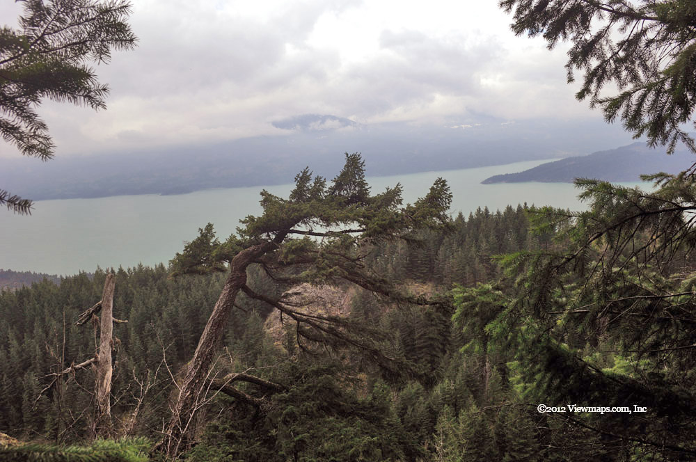
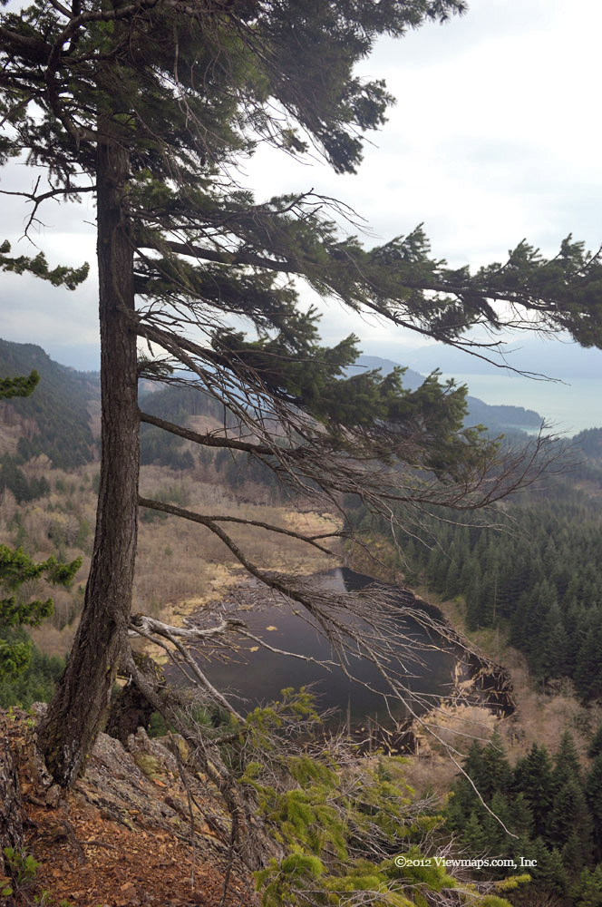
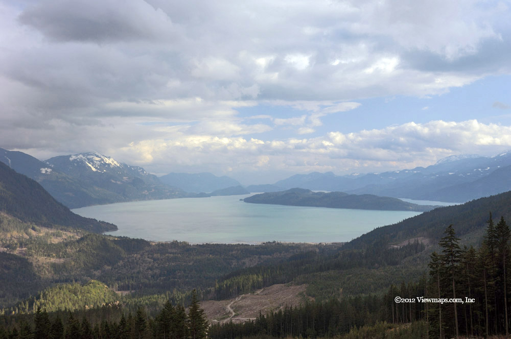
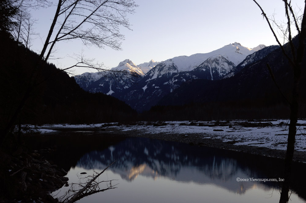
Eventually we came by the exit to the Cascade peninsula camping area and just past it was the side road I had hoped to resume our exploration on. We turned off the mainline and made our way past a swampy section and then past the spot we previously ate a late lunch at. Now we were into new ground and quickly gained elevation as we followed the road. We came by a ridge where Geoff suggested we hike out along and see if a good view was available. It was a good call as we were soon enjoying some amazing views of Harrison Lake and the small lake and marshy patch we crossed on our way in. I was trying out my polarizing filter today and so I tried a number of shots while standing at the edge of a long drop. The view was quite lovely and I plan to return, it would be a great spot for a winter sunset.

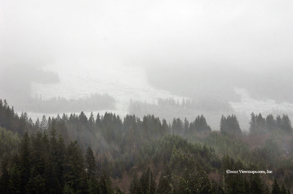
Done with the cliff face we continued up the road and gained more elevation and came by a few more spots with great views looking north along the lake. The day was still a bit dull and misty so the colours were quite muted. It still amazes me at how the same spot can look so different with the time of day, season and weather. We drove a number of further side branches and eventually ran out of road – the highest branch stopped us with snow – so there is still more to see one day. We returned back to the lowest branch and turned up it hoping it would connect back to the mainline further north, it went for some distance but eventually it too ended leaving us with the need to back-track and rejoin the mainline where we originally left it.

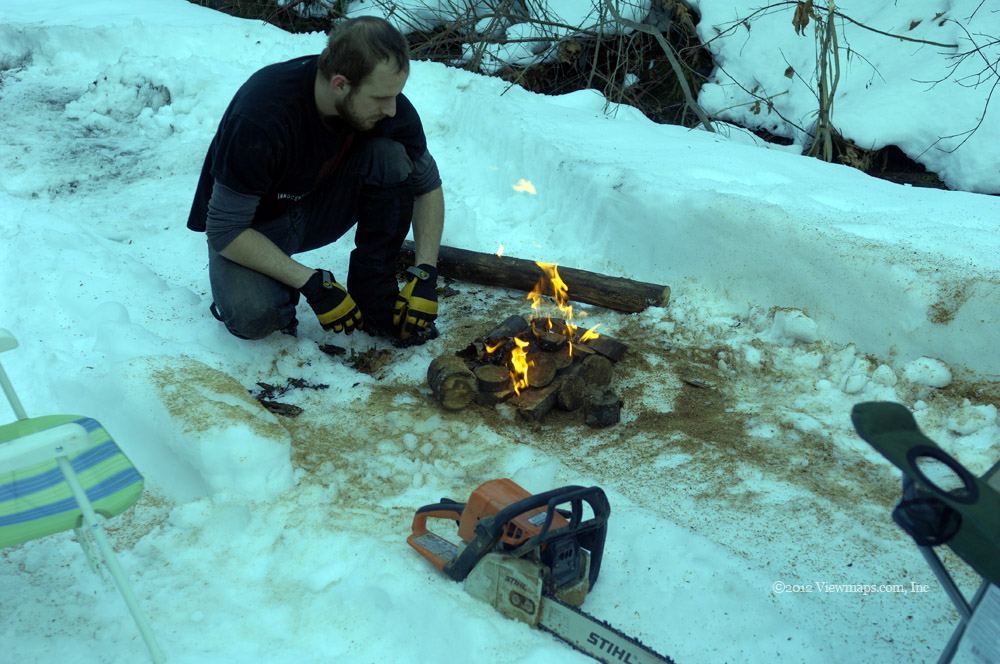
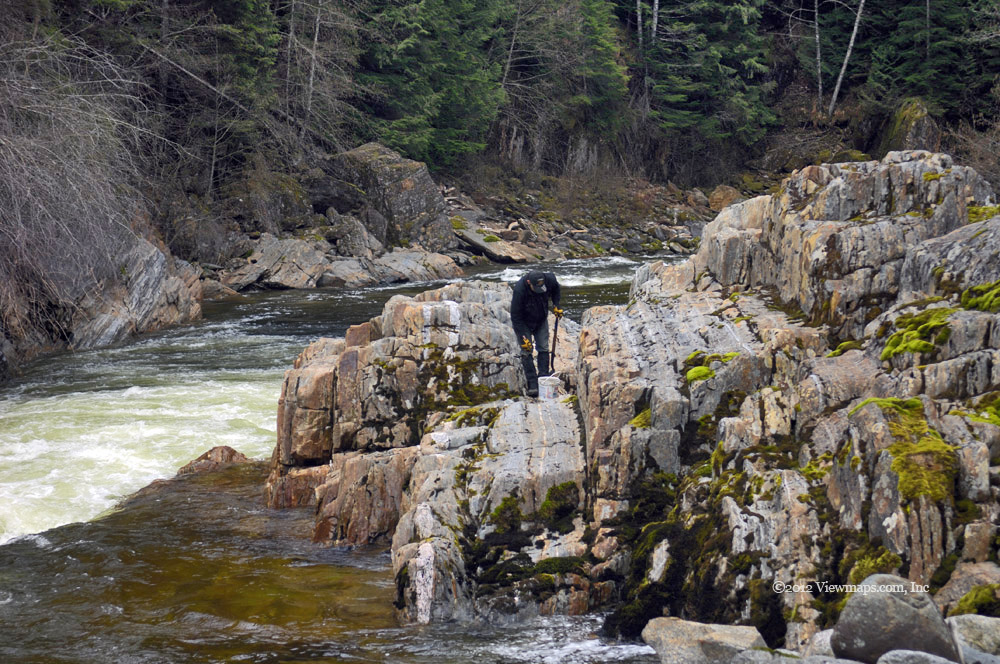
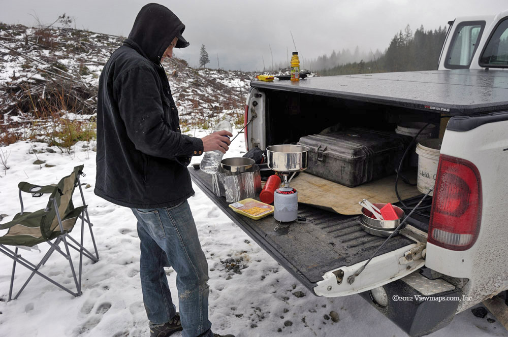
As it was now getting closer to lunch time we decided to head on up the road to the spot on Silver Creek where we planned to do some shooting and where Geoff planned to collect some river sand. The last time here he had found some yellow flakes in the sand and wanted to collect a larger amount and bring it home where a friend of his would teach him how to pan it. So we drove pretty much non-stop up the mainline, glancing at the sights but not taking time to enjoy them until we got to the planned stop on Silver Creek. We did see that the gate on Hornet Creek FSR was open so we detoured up it for a few kilometers. There was active logging taking place so we decided to not continue on into the active area and so we returned to Silver Creek. Once we arrived at our destination we pulled out our kitchen and cooked lunch. Geoff did a bit of target practice and even I tried a few shots with his 22. I even managed to occasionally hit a can!

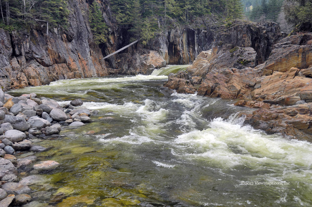
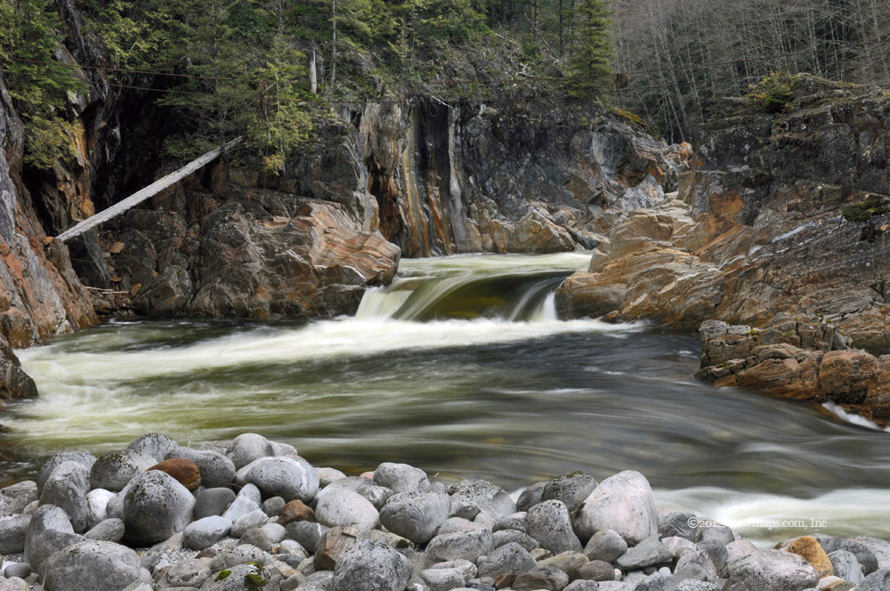
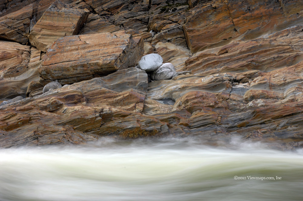
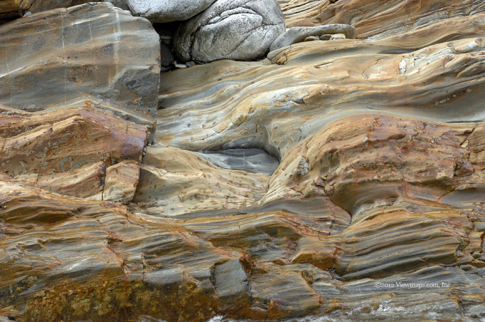
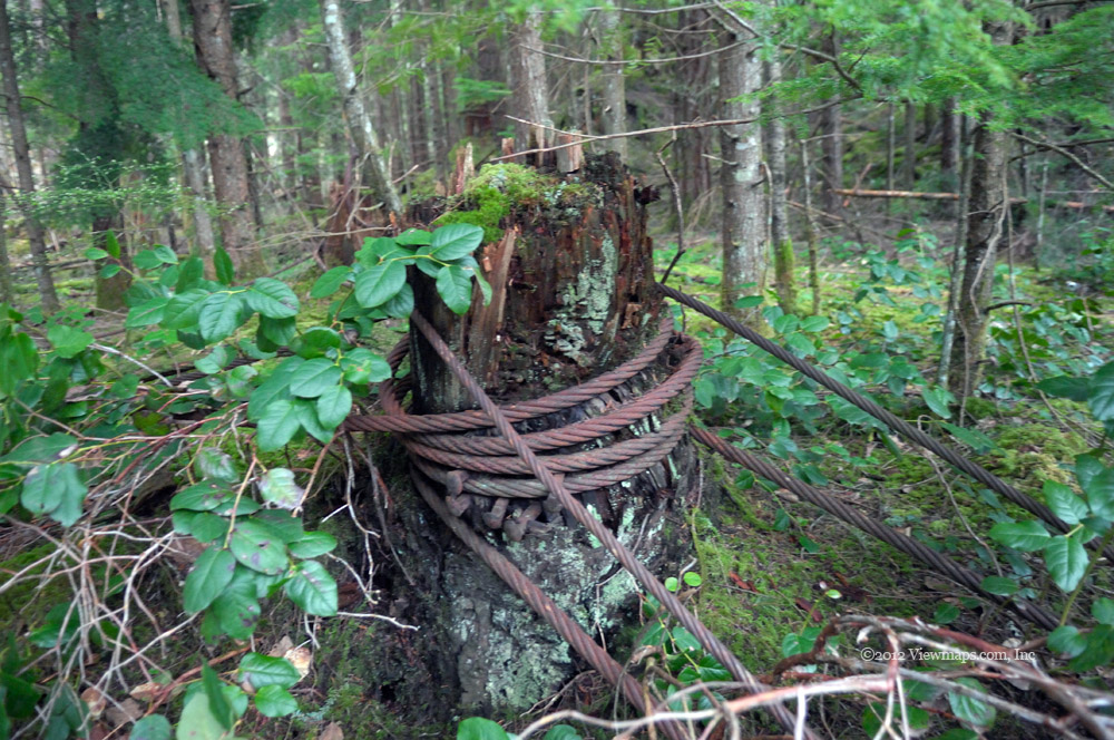
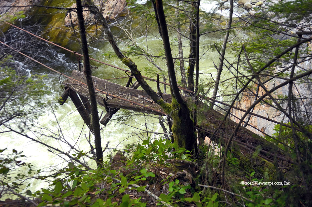
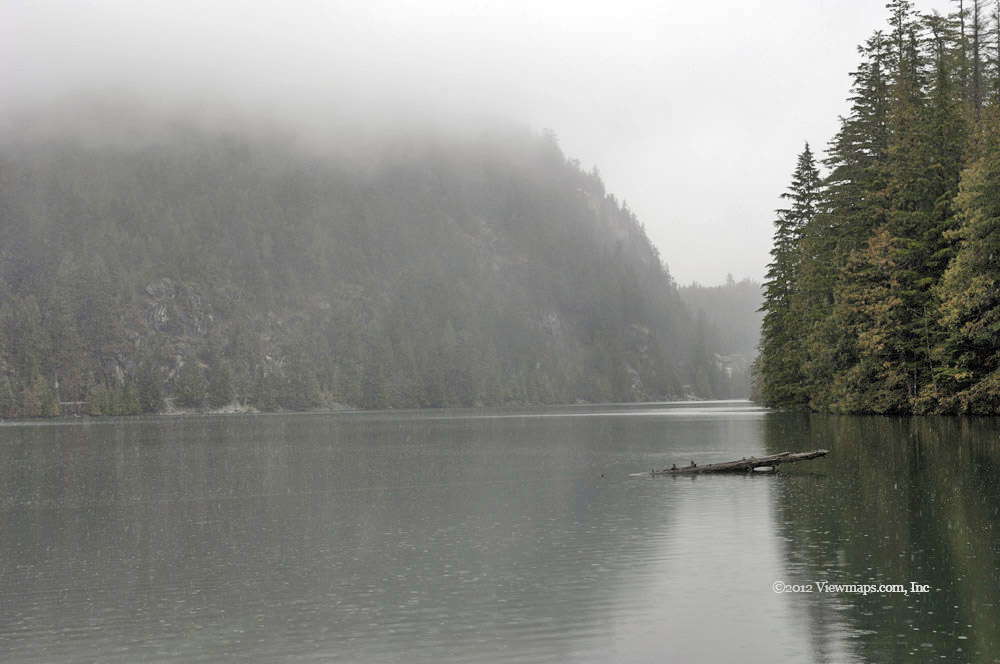
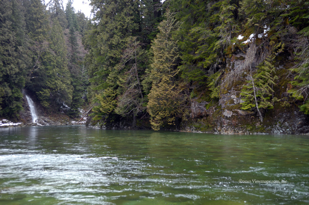
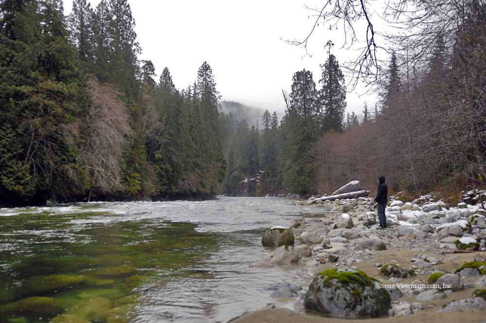
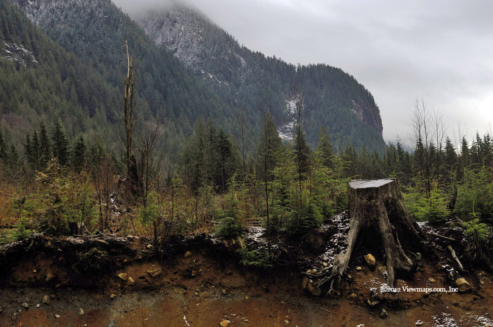
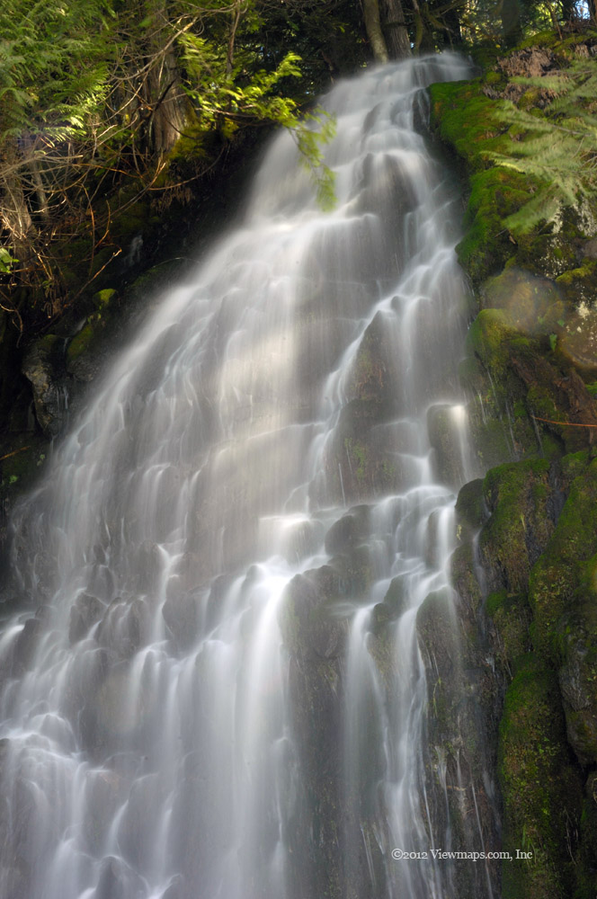
Done with lunch we hauled our camera and digging equipment out to the river. While Geoff shoveled sand into a large bucket I collected a number of photos of the river. It is a lovely spot with a small waterfall and rapids separated by a lovely icy cold pool. Even though the flow was still low, the river was quite powerful through this section. I can see why they want to harvest some of the energy. Across the pool and river there are the remains of an old footbridge. Two steel cables still hang in the air across the river. Once we were done with this spot we planned to climb up to the end of the bridge where some old timbers were still hanging in the air.

We clambered through the undergrowth as we made our way to the start of the old foot bridge. We found a few lengths of board still in place even though they were soft with thick moss growth. We also discovered that the bridge was anchored to a large stump! Perhaps it was a living tree when it was initially built but it sure looks questionable today. The cables were strung to a second stump as a safety backup! The old walkway was certainly a mess but we could see the steel cables used to hold the wood supports hanging out over the river still suspended by the main support cables. It would be possible to rebuild the bridge should any want a summer project. I just hope the anchor on the far side of the river is at least as solid as the stump on our side. I tried to find out some history about the old bridge but so far haven’t been able to locate any info on it.

Once we were done with the bridge we returned to the truck and drove back towards home. We stopped for a look at the main vehicle bridge across the Silver Creek we had used on the way up. It seemed to us that the current bridge is at least the fourth one constructed in that spot. The area seems to have been in use a long time and still a needed access route. 

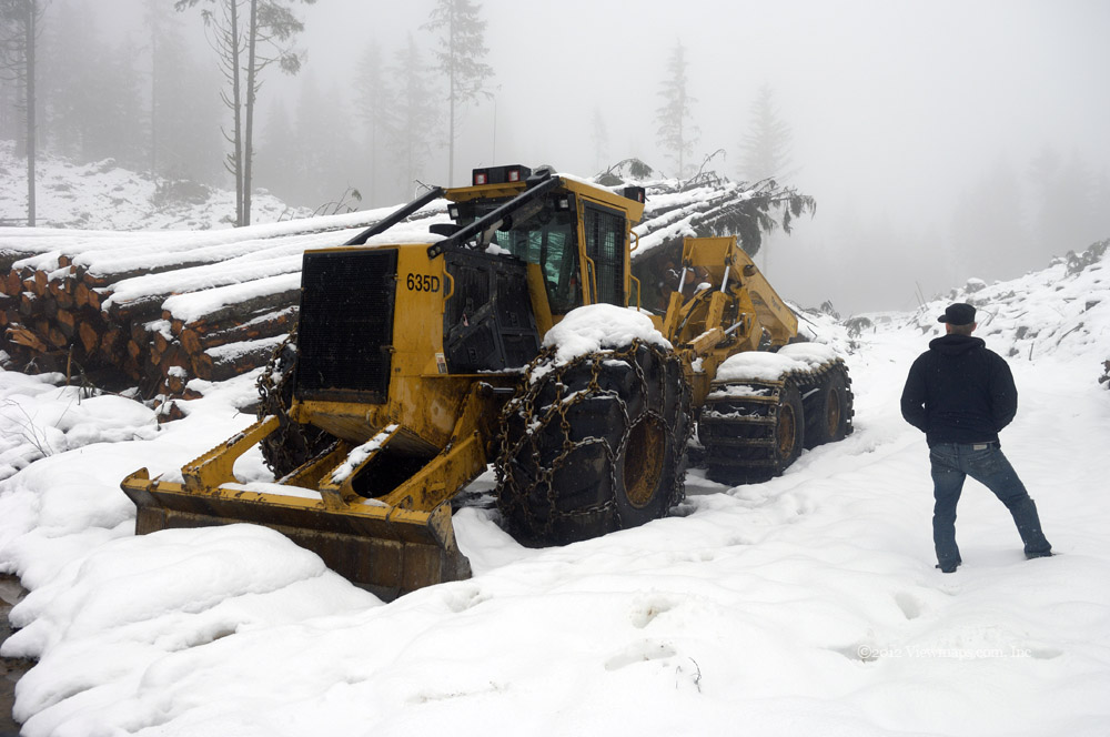
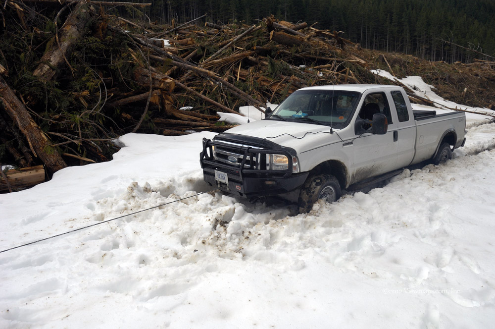
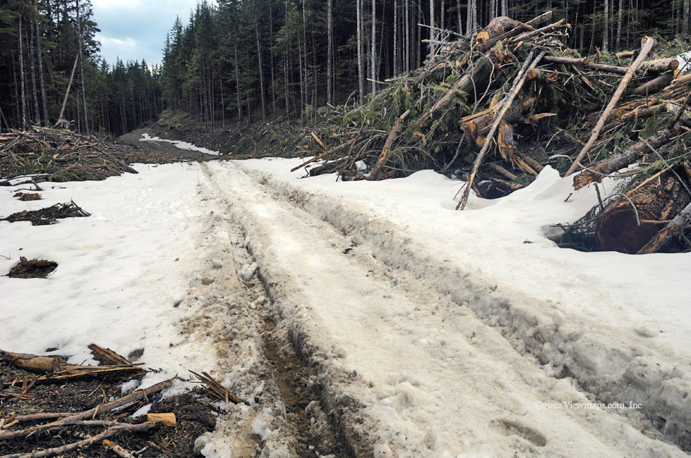
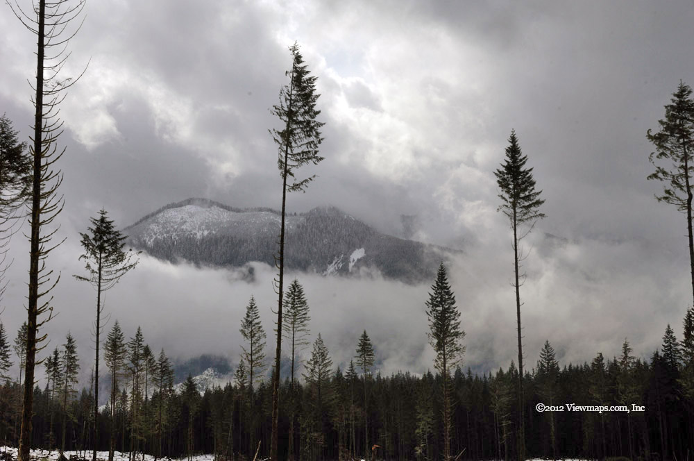
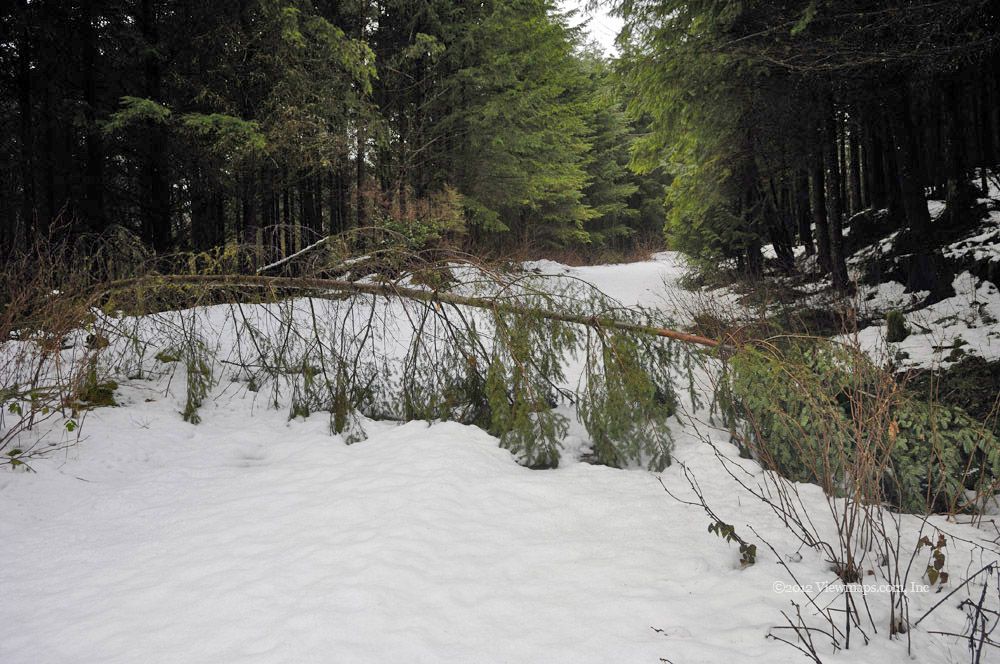
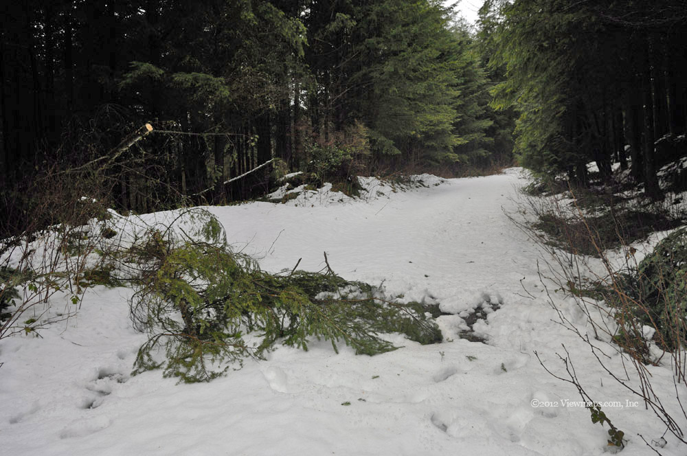
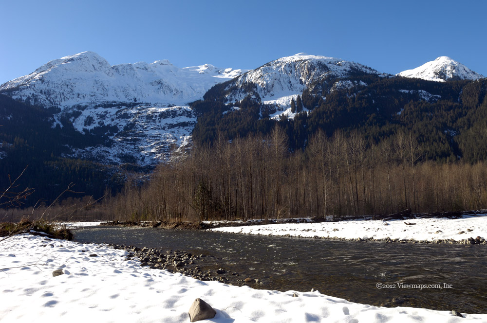
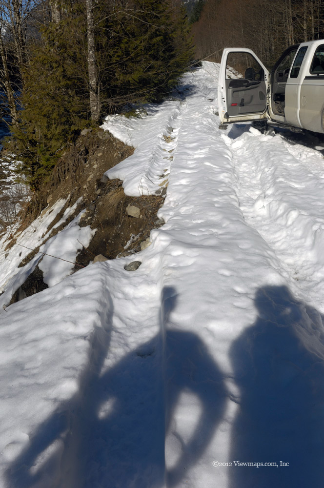
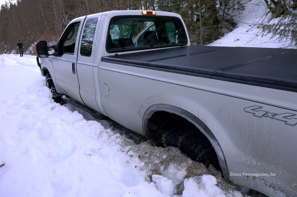
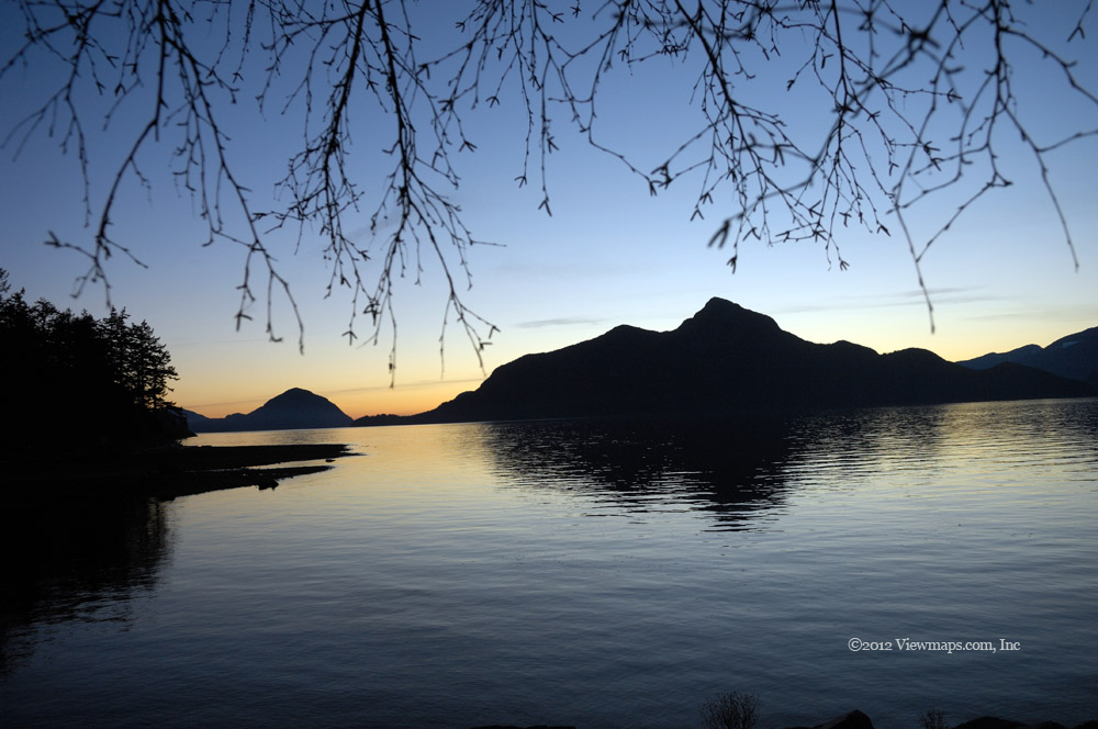
We next drove down the Silver Creek area to another side road – the Pine branch. We drove a small section of this on our last trip and today I wanted to finish it off. We drove each side branch as we came to it and from the end of the lowest and first branch we stopped to watch the heli-logging taking place across the valley. The helicopter had been parked when we drove by it earlier. Finally bored with the logging, we made our way higher up the group of side roads gaining some lovely views of Harrison Lake. We also were able to reach the repeater on Sumas Mountain and I chatted with Carolyn to let her know what we were up to. The highest branch started to be covered in patches of snow and soon we came to one about 100 feet long. We drove into it and got about a third of the way before being stopped. Unfortunately the ground was also soft so we could not reverse out either. Our only solution was to winch ourselves forward until we cleared the snow.

The winching process didn’t take all that long but we had an interesting time doing it. As the stump we had selected to tie to was a fair ways from the truck we decided to extend the line with a pair of recovery straps. When the winch line grew taught the truck still refused to move – instead the straps were stretched a bit until they had built up enough energy to yank the truck forward a couple of feet. This happened a few times before we regained traction and were able to drive the balance of the way off the snow. Once the gear was packed up we continued up the road and came by increasing amounts of snow eventually we were stopped by it but saw a large number of additional branches that we will need to come back and explore.

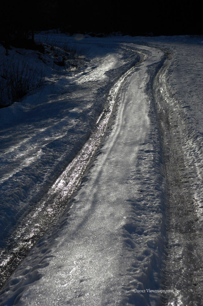
So that was our day, the return through the snow patch was easy as the ruts allowed us through without getting stopped. Done with the side road we soon were back to the mainline with an hour until sunset. As we wanted to be off the FSR before dark, we made for home without much sightseeing. The drive went quickly and we were soon on pavement having beaten the sunset by a few minutes.

Doctor's Bay

Last week Ethan and I explored sections of the West Harrison and I enjoyed it so much that I decided to come back this week with Geoff. I wanted to do some exploration further up the lake as it is an area we have seen little of due to the time it takes to get there. I had also heard that there is an ancient petroglyph at Doctor’s Bay – the Kaiyama Petroglyph which gave the area its name. So off we went to see what the region held and take a few photos of the glyph.

The drive to the start of the FSR went quickly and without excitement, we drove through Mission and though we were stuck behind slower cars some of the way we still made it to the FSR in good time. We drove up the mainline with only a few short stops to admire the view but when we came to the Wood Lake campground I noticed it was open this weekend so we drove in so I could gather a few photos of the lake. We drove in the first gate which got us to the wrong area but here we chatted with one group of campers that we had met last fall on the East Harrison. They remembered my camera! It was interesting chatting with them again. We then left the site and entered the second gate where we found the spot I was hoping for. Unfortunately the place was crowded with campers and I didn’t really have a chance to wander the area as much as I had hoped.

Done with the lake we continued up the main line, past 20 Mile Bay, and eventually came by a side road leading to the lake that seemed to be newer and so we drove into it. It didn’t go in very far nor did it offer any views of the lake below. Geoff backed the truck up to turn around and in the process ran the truck up a bit on a rise. We then pulled away and he happened to look back and noticed our spare tire on the ground! Going over to it we saw that his backing up had snagged the tire on a submerged stump and it had ripped the supporting cable. At least we have all the pieces. Now we just need to replace the cable and put the tire back – it takes up too much space in the back.

Finally we arrived at Doctor’s Bay area and what we thought might be an access road down to it. The road was quite rough and a bit over-grown though it did appear that some clearing had been done. We started down the rough road and over a stream crossing that didn’t give us much room for error. Not too far past the stream the road surface became a rock face and it looked a bit much for us to try and the road ahead looked questionable, so we turned the truck and parked it. We were still hopeful that the road would lead to the bay and so we got some gear and started down the road on foot. There was a fork at one spot that lead up a slope which Geoff decided to try. He found an amazing view of Harrison Lake from the point and begged me to come look. I was already down to the bay and thought I would check it out later. We had a planned radio contact in less than an hour and so I wanted to see as much of the bay and possible glyph as I could.

I made my way along the road which paralleled the shore. It eventually came to two abandoned buildings one looked to be an old chicken coop. The road ended here. I then made my way to the sandy beach, the place is truly quite remarkable and I quite enjoyed taking photos of the bay. As the water level was low I was able to walk out to a small islet and gather some photos from there. In mid-summer with higher water the area would require a boat to reach, we noticed a small dock on the close side of the islet – obviously someone comes by here in the summer to camp and enjoy a secluded spot. I looked for the petroglyph but my best guess co-ordinates indicated it was around a point and the beach ended against cliffs so I wouldn’t be able to get to it from here without swimming. I opted to return to the beach where Geoff had caught up to me and we started back to the truck, it was getting close to the time for my radio contact.

The way back up the road seemed to go quickly and we were soon setting up the antenna. It went up fairly quickly except for the stakes, pounding them into solid rock proved a bit difficult. But we got the assembly done and I was chatting with the guys at home only a few minutes late. While I chatted, Geoff got our kitchen going and cooked our lunch. Once done with the club members I switch to the 15m band and found a chap in Havana, Cuba with whom I was able to have a short chat with. Lunch was now ready and we stopped to eat after which we took down the radio gear. Now that we had seen the road and inspected the rough road section we felt we could drive it should we come back.

As there was another marked road on Doctor’s point we returned to the mainline and searched it out. The start of the road looked rough but it cleaned up quickly and we actually had a decent road to follow for a fair distance around the side of a rise. At one point we were stopped by a tree that had fallen off the cliff face on our right. Its roots were still up the face! We sawed the top off it and dragged it back off the road so we could pass. Geoff made short time of the tree and then we drove on to the end of the spur. According to my map the glyph was only a 100m down from the road but it was steep and forested so we decided to not try hiking it today. Perhaps another trip is warranted.

Just across and up a short distance along the mainline there was another side road following the cliffs to the north. We decided to drive it before heading home. Here we found a nice northerly view of the lake. The road continued along the cliff face and soon we came by a stream crossing where a tree had fallen across the road. It being late, I almost decided to call it but the road looked inviting so we hooked a strap to the tree and dragged it out of the way. I sure am glad we did as the road led to a grand clearing with an amazing view of the north end of the lake. We parked here for a bit and soaked in the grandeur of the spot. It would be an amazing spot to camp out.

Well it was now really starting to get late and we needed to get back to pavement before sunset so we crawled back to the main line and there we made good time south and soon we were driving the pavement at Weaver Creek. It was a great day in the hills, sunny and warm, not too dusty yet and very few people driving around.

Harrison West

It was such a lovely day to enjoy the back country and so I was expecting to find some good opportunities for photos. I also organized a radio test with the guys at home so set up and operating had to be slotted into our driving schedule. Our first stop on the way in was at the first side road off on the lake side of the road. This branch follows the transmission line all the way back to the Harrison River. That is a lovely drive with a great view at the end but for today we stayed at the start of it and gathered a few images of Echo Island. The water colour was exquisite and with the warm sun I was just thoroughly enjoying being here.

After admiring the view and studying an abandoned truck down slope from the road we continued heading up the mainline. At one point I spotted a nice small swampy pond below the road with an access road just back from where we were. I had Ethan turn back and we drove down the access road and I got out to walk to the pond where I gathered a number of photos of the stumps in the water. Their reflections were quite impressive in the still water. After enjoying the pond, I pushed my way back through the bare brush and returned to the truck. The access road curved around the lake and eventually joined the mainline. 

We started back up the West Harrison and came up to a truck we had passed earlier. They pulled over to let us pass them once again. This happened twice more before we finally lost them. They were likely getting a bit curious about our disappearances and return. The road was completely clear of snow but it was filled with several groups of quads which were swarming past us throughout the day. They often looked surprised to see us there. Before we arrived at the Mystery Creek fork, I was concerned that our clear road would be blocked by snow as it was at this point we encountered the first snow on the road a few months back. Back then the road had been plowed up to this point and then continued on up the Mystery fork. Today it was reversed and our fork was clear and the Mystery side completely snowed in! As it was now getting towards lunch time we decided to head to 20 mile bay and eat our meal there. We were surprised to find the gate to the main campsite open and so we made our way in and soon were stopped in one of the best camping spots. There was only one other group spending the week-end enjoying the place.There was such a great view south that we decided to relax a bit before lunch, I gathered a few photos and then started setting up my HF radio equipment. Meanwhile Ethan organized our burners and food and started preparing lunch. After eating, I started operating the radio, it was too early to try the guys at home so I chatted with a few across the continent. After a few contacts the chap camping a few spots down from us wandered over and asked about the equipment. I spent the next 40 minutes talking about ham radio with him. When he finally had had enough it was time to call the home team. It was an easy contact and we chatted for a half hour. Then it was time to pack up, gather a few more photos and then head out.

We continued north up the mainline taking a few forks that seemed like they would offer some lake views but they all were blocked by trees and so we just continued up the road. Soon we were weaving through blow-down where numerous trees were hanging across the road. The largest of the trees had been cut to allow passing, but one still had to carefully weave between them to get past. Along this section we were encountering a bit of snow on the road but nothing deep enough to even be slippery. 

I wanted to get back to the small peninsula at the delta of Bremner Creek. It was the spot Geoff and I ate lunch last time up this way and it had some gorgeous lake views looking north and south towards Doctor Point. As we got closer to Bremner Creek we stopped at a small waterfall for photos. Each of these little falls offers unique angles to enjoy and with some slow shutter speed photos, they can really look spectacular. Eventually we arrived at the campsite at Bremner and there I gathered a number of lake photos. As it was now getting on in time and the sun would soon be blocked by the western hills, we decided to start for home. 

The return trip went quite quickly. We did stop at one other waterfall but otherwise Ethan was determined to see how fast he could get back. The area around Doctor’s Bay has a number of side roads which I would like to explore and also some historical Petroglyphs that I have wanted to see for some time. Today we had run out of time but perhaps next trip I will make it our goal to explore the bay and photograph the glyphs if we can find them. The drive even with the one longer stop took just over an hour to get back to the start of the FSR. So we made really good time and still managed to see some lovely sights to note for next trip.

Chehalis and Fleetwood

It has been over a month since my last visit to the hills thanks to the weather and I was getting a bit frustrated. All week the forecast was showing a mixed bag for the day and so we were hopeful that it would turn out well for the drive. Well along comes the morning and the forecast for the day had worsened but still offered some hope. So despite the light drizzle we set out for the Chehalis area. We hoped the road would be clear of snow as their seemed to be some year-round logging going on. 

Our drive to the Harrison Mills area went much as always except for the increasing amount of rain. Finally reaching the start of the FSR we could see only thick cloud above us and little hope for improving weather. We made our way up to Elbow Lake and there we came across one party of campers enjoying the location and the rain. We stopped for a few photos and then continued on. The road was indeed clear of snow though we could see deep pockets not far from the road and most side roads were covered. A few kilometers past the lake we came by a lower side road that we had not travelled before and so we decided to explore it, the snow wasn’t too deep and there were some ruts we could follow. This area offered a number of branches which we tried. One ended at a clearing with an upside-down camper that was full of bullet holes, Geoff of course had to add a few. Not far below us was the Chehalis River so we followed a path down to the river and there we enjoyed a lovely view of the river running through a mini-gorge. It is definitely worth returning to.

Returning to the truck, we tried a few more branches and eventually came by the truck which had made the ruts. It was parked and the driver was not to be seen. Its position made it a challenge to turn around but eventually we squeaked by. Done with the side road we returned to the main line and continued along. Eventually we came to the active logging area and one logger was indeed moving logs just off the road. The road clearing ended at this point and the road past the area was deep in snow and not drivable! A side road Geoff had been on in the Fall and the one he was hoping to drive today, was right in the midst of the clear-cut and not cleared of snow. It was a lot less exciting to look at with no trees around it, so we decided to head back and find a spot for lunch.

Just before the prison we turned up a side road and followed it along to an overlook. Along the way we drove passed another camper where someone seemed to be staying for the long-haul. Driving pastthe camper we reached the end of the road and stopped to eat lunch. Once done with lunch we set off for the Fleetwood road which was the FSR on the far side of the Chehalis river. This road has seen us drive past for years so it was about time to explore it. I wasn’t sure how the snow level would be but we thought we would do what we could.

Surprisingly we made it the whole way in to the washout that blocked access to the connector back to the main Chehalis road. We also found that the area had a large number of side branches which climbed up the side of Mt Keenan – one of the Hemlock ski-hill peaks. Those roads were deep in snow and so we could travel them only a short distance. We did come across an old mining area at one point where we found an old decrepit shack and a pile of core samples. It was worth scouting on foot so we spent a bit of time walking through the snow looking over the mine area. We didn’t find a mine shaft and so it may be worth a return visit when the snow is gone to look further.

Once done with the mine we drove back exploring a few other short spurs, by now we had a bit of sunshine interspersed with snow and rain. Though the sun was brief it did wonders to liven up our mood. Finally done with the portion of the area we could travel we returned to the pavement and set off for home. Though the weather limited our opportunities, we still had a fun time seeing some new sights, several of which warrant return trips. On arriving back home we learned that they had had a lovely sunny day, just as it was forecast! We just didn’t stay home to enjoy it.

Return to Squamish Valley

The Squamish River area is a lovely scenic spot in which to enjoy the back country. It is easy to reach and being a long slowly climbing valley, it provides easier winter access than most areas. Two weeks ago we drove the valley in fresh snow and made our way quite some distance through the virgin snow but we didn’t get to the confluence of the Elaho River. So after two weeks of better weather we felt that we would give it another try, hopefully the snow depth will have dropped due to the sunshine.

Our day began well and we made our way to the highway, our first treat was of the Fraser River which was covered by a low layer of fog. Crossing over the river on the Port Mann Bridge brought us above the fog and presented some lovely views of the fog below. It was quite amazing and I took a few photos as we sped across the bridge. The balance of the drive to Squamish and the start of the FSR went without incident and we were soon at the logging road.

The initial road was well travelled with two deep ruts reaching to the gravel. It looked easy enough that we decided to drive it without putting on our tire chains. As we made our way in we saw a few other vehicles but the traffic was very light and we had the place to ourselves. After driving a fair way along - past the dam and a number of the side branches, we came by a car angled off the road (ruts). As we passed the car the driver flagged us down and begged us for help. He was stuck and hadn’t been able to get out for over an hour. The situation didn’t look too hard so we moved the truck to a side location and started pulling out the winch cable. As our angle was wrong we decided to use the snatch block and pull him directly back to the centre of the road. We soon had him back in the ruts and able to move once again. Looking at his car we noticed that he didn’t even have snow tires! Not really a good set up for the road conditions as he learned.

Once done with the recovery, Geoff pulled out his newly acquired semi-automatic assault rifle and fired off a few rounds. It worked really well and he was able to squeeze off five shots in a couple of seconds. Needless to say he was quite impressed. Meanwhile I took a few moments to do some of my own shooting of the scenery. Once done with the location we continued up the road and came to a waterfall that I shot last time. I spent some more time taking additional images of the water. The ice was now gone so it had quite a different look from the first came we stopped to shoot it. Continuing past the waterfall the snow depth was slowly increasing and the ruts no longer always exposed the gravel road bed. Soon they were just deep ruts in a thick layer of hard snow.

By the time we reached our furthest point from two weeks ago the road was getting a bit harder to travel so we stopped at a straight stretch and there we put on the tire chains. That gave us good traction and we continued up the road. Soon we came by the B800 branch where it seems a majority of the vehicles making the ruts had stopped for a big campfire and possibly even a camp. Beyond this point the ruts continued but they were not as well defined. Our going started to be a bit labored and we were struggling for traction on some of the slopes but it was not too serious so we continued up the road. At one point we came by a section of road that butted up on the river edge. Here the road made a rapid drop to river level and it was here that we noticed one rut where the driver drove right over the missing gravel road bed. It would seem that the one tire would have been suspended in midair as the vehicle moved forward – a bit too close for my comfort.

Not much beyond the spot of three-wheel driving the road moved away from the river and started to gain elevation a bit faster, here was where we started to slip and soon ended up with the tires out of the ruts. Now our chains worked great in churning up gravel and digging a hole for the tires but the snow was hard enough that it just bottomed us out even more. So it was winch time for us! We set up the winch to pull us across the road back into the ruts. This took a few minutes and soon we were moving north again, slowly towards the Elaho. Only a 150meters further down we again slipped out of the ruts and ended up bottomed out. We again pulled out with the winching equipment and got ourselves back in the groove!

By now we realized that the ruts were no longer able to keep us in them and that we would not be able to make much distance before getting stuck again. So we decided that this was our end point for the day. We noticed that the ruts only went a 100 metres further themselves. So even they called it at this point. We noticed that the spot we were at was where the previous drivers had turned around so we opted to do the same. Being in a longer truck, we had to turn very carefully lest we get stuck so Geoff made a 20+ point turn as he slowly rotated the truck around. He managed it without a problem.

Once turned, we decided to set up camp for a bit of lunch and rest. Geoff also set up a target for some rifle practice. It was a decent place to eat lunch, the burners heated up the water in quick order and soon we were enjoying a hot meal and some tea. Once done with food Geoff took some shots with each of his rifles while I spotted his accuracy with my binoculars. He did quite well, getting pretty close to the centre of the target with all of his guns. By now the sun had dropped below the western ridge and the temp started to drop, so we packed up and started on our way home.

The drive back along the FSR actually went quite smoothly, we found it much easier than heading out. I guess we worked up the groove enough that it was now more easily driven. We did stop at a few places so I could gather some photos and Geoff did some shooting at one spot. Soon we were at the start of the road and there we checked over the truck and noticed nothing out of place. It looks like this time we actually didn’t break anything! Once back to Squamish we stopped to buy a coffee with our free drink coupons. Then it was up the sea-to-sky highway for the drive home. We did have a nice sunset so we decided to pull into Porteau Cove and park so I could gather a number of sunset photos. We also stopped at Lions Bay for a few late sunset photos before continuing on to home. It was a lovely day and though we didn’t reach the Elaho we did make it 3 kilometers further up the road but still around 6 short of our goal. I guess we’ll just need to try again in March!

Silverhope River and Kilby

Despite the poor weather forecast I was hopeful that we could get in at least part way along the Silver Skagit Valley to gather a few images of the lake and peaks. So when we left home in a slight drizzle I wasn’t too concerned since I thought the weather would improve further up the valley. Alas, it got worse! Much worse in fact. By the time we reached the start of the Silver Skagit it was snowing hard with huge flakes. We persevered and started up the road, the initial paved section was cleared but the huge piles of snow to the sides were ominous.

Soon we reached the end of the pavement only to find a few trucks pulled off to the side the road - ahead was deep with snow with a deep pair of ruts in it. It looked to be a challenge so we put on the chains and started up the road. The ruts proved a challenge alright as the snow had a thick crust that stubbornly refused to let us choose our own path. At times we broke free and shattered the crusty snow so that we could make our own way up. This proved a slow and painful process. After a kilometer we stopped to review the condition of the road and our truck and concluded that we were not ready to admit defeat yet.

Pushing further on, we slowly inched our way through the deep snow and made our way up a rise and past a widened section of road. Eventually we came to a spot with a nice view of the Silver River. Here we stopped so I could gather a few photos. Ethan checked out the road ahead and felt that it just wasn’t getting easier and that we wouldn’t likely get much further. So we decided to not push on. Just then another truck came up the road behind us and pulled even. We told the couple occupying the truck of our decision much to their disappointment. They had been using our ruts and if we didn’t go on they would be stopped as well. So hearing our decision they backed up to the wide section of road and pulled to the side to set up a small day camp. Their large propane heater looked quite inviting. They planned to spend a few hours enjoying the area with their dogs. I gathered a few more photos and then we returned down the road. We removed the chains at the pavement and made a quick jaunt to The Blue Moose Bistro in Hope for lunch.

After lunch we decided to travel back along highway 7 rather than the main route. This would allow us to see more of the area before heading home. This proved to be a good choice as we did find a number of lovely sights along the way. The snowfall was too heavy to bother with photos but we both enjoyed the view. Continuing past Agassiz and Mt Woodside we decided to take a detour to the Kilby Park site. This proved to be well worth the time as the view across the bay offered some lovely scenes of the cloud shrouded peaks to the north-west. I would have liked to have stayed longer but the heavy hail chased me back to the truck and so off we went to continue our drive home. The rest of the drive was growing in normalcy the further we drove west as the amount of snow was significantly reduced, soon we were driving in a wet environment rather than a snowy one. 

Despite not getting to see much back country we did enjoy some heavy snow and a few intriguing views. So the day wasn’t a complete loss just much different from what we had planned.

Shannon Falls and Squamish River Valley

This past week we had a good dump of snow throughout the valley and though it had started to rain a bit along the coast, inland and higher up it was still a frozen wonderland. This left us with a dilemma, where could we go where we could actually get some distance into the hills and not be stopped at the start of the logging road. After thinking through a number of possibilities we decided on the Squamish River Valley. This is a long road with little elevation gain. So we felt that if we could get past the first bit, the rest of the road would not get much worse. Destination decided, we set off for the start of the road but first a few stops for fuel and food items.

As we approached Squamish, we decided to make a quick detour to view Shannon Falls. This proved to be a lovely visit despite the rain which started half way through our time there. The main channel of the falls was surrounded with beautiful ice sculptures which added some amazing contrasts to the already spectacular sight. If it hadn’t started to downpour I would have tried a number of additional shots but by the time I had captured a few I needed to get out of the rain.

Done with Shannon, we continued up the road and soon were driving along the paved section in the First Nations area. The trees with their mossy coats covered by snow and ice were quite interesting to look at and quite changed the feel of the drive. When we finally arrived at the start of the FSR we came upon two parked trucks. The first had stopped to unload some ATV’s the second had slid nose first into the ditch and there it sat seemingly abandoned. There before us was the deep snow covered road with two deep ruts that led up the road. I almost called it quits at that sight but we decided to give it a try. So we found a slightly drier spot and put on the snow chains right at the start.

Chains on, we entered the FSR and started down the ruts. The road despite its deep snow cover was still as bumpy as ever as we made our way over the deeply potholed early section of the road. Glad to be past the worst of it we soon approached the bridge over the Squamish River leading to the Ashlu valley. The deepest ruts continued on over the bridge but that was not where we wanted to go. We did stop on the rise to the bridge so we could get out and look around. I walked a ways along the bridge and gathered a few shots of the river and mountain scenes. We noticed that there was a campsite setup on the far side of the bridge, with a chap busy working on his campfire! A bit too wet and cold for me.

Once done with the views from the bridge we resumed our drive up the valley. The snow depth dropped a bit and we were able to continue on with little problem. There were some ruts leading us on but they were two narrow for our truck – obviously left by the ATV’s that we had noted earlier. Soon we were past the fenced equipment yard and then the small power station, enjoying the quietness of the area. The rain had stopped by now and we actually were able to enjoy a pleasant drive along this early part of the road. Soon we came by the B200 fork and noticed that the ATV’s had set off up this branch. It looked a bit steep for us to do but the mainline ahead of us offered lovely virgin snow so we continued along.

A ways further the slope between us and the river broadened out and offered a nice flat area. It was along this stretch of road that we had our first major treat of the drive. Looking down towards the river we spotted a herd of Elk travelling along the river. As we caught up to them they stopped to look us over. There were around 10 animals. We stopped to enjoy watching them and soon they decided that we were too interested in them so they set off directly away from us towards the river. In very short time and distance they were well hidden from our view, and so we resumed our drive up the valley.

Our next stop was at a small stream waterfall that was trickling between icicles and snow coated branches. It was a lovely sight and I stopped to gather a number of photos. We continued our drive up the road and by now we were fish-tailing it a bit as we made our way along. We hadn’t yet realized that our auto 4x4 mode had quit on us but we were able to keep going so that we did. We continued along for some time further and soon we were struggling up a steep section of road just barely able to make it to the top. Clearing the rise we stopped and noticed a second herd of Elk just down from us. This group had 12 animals but they were a bit more skittish and they quickly walked out of view. 

Starting our drive again proved difficult on the rise as we were sliding around quite a bit - we still hadn’t figured out the issue with the 4x4 mode. So with the challenge we were facing we decided to end our drive forward and to turn back. The U-turn proved to be quite a challenge and took Geoff some serious ingenuity to finally get turned around. Facing back we decided we were overdue for lunch and so we stayed to set up our stove and cook some food. While stopped we watched the Eagles in the trees as they watched us. They truly are a majestic bird as they take off from a perch. Done with lunch we packed up and started back. 

Only a bit later we were getting concerned about our difficult driving and loud clanking sound, so we checked over the chains and noticed that the left rear had broken a link. We tied the loose end off and continued on but soon it was loose again. So we opted to take off the chain and see what we could do with three. I felt that we could try manually locking the front hubs as well. That done we started up the road again and boy was it easy driving now! We suddenly realized what our problem had been. We stopped so I could check the 4x4 vacuum hoses to confirm our suspicion and sure enough one had been ripped in two in the deep snow. If we had discovered this before we turned around we likely could have made it all the way to the Elaho. But we hadn’t and were now well on our way back.

The drive continued with little problem – gone were our fish-tailing episodes and driving in and out of the ruts was easy. It was nice to know that we were handling the snow with no difficulty but we were disappointed that we hadn’t figured it out sooner. The drive continued to offer us some nice views and we found that another driver had followed our ruts about ¾ of the way along our distance. They gave up far too soon. When we finally reached the start of the road we saw the truck that had been nose down in the ditch drive off, free of its entrapment! There we took off the three remaining chains and made for the drive home. We had a brief sunny period just before sunset while driving the sea-to-sky highway and were able to capture a nice early sunset photo over Gambier and Bowen Islands. The rest of the trip went easily until just before Port Mann Bridge where we got stopped in a backup from an accident. This cost us around 30 minutes as we slowly inched our way passed the mangled cars. Though we hadn’t held out much hope for the day, it proved to be a good one and was a very enjoyable drive.

Silver-Skagit Valley

January is usually a tough time to explore the hills with a 4x4, the snow line is low and one can’t get in far enough to enjoy the back country. For this reason I was looking for an area with a long valley road that didn’t gain a lot of elevation. After considering various places we have been to, we settled on the Silver Skagit area. This road is quite long, has many side branches, amazing mountain and water scenery and gains elevation slowly. Since I hadn’t been there in well over a year, I felt it was time for a return.

Ethan got to the house around 8:30 and helped me reload the truck. We had previously completely emptied it due to the broken tonneau cover which was now replaced. The new one works nicely. Once loaded we set off to gather a few food supplies and a full load of fuel. We were a bit disappointed that the weather report had changed and moved the start of rain to the morning, so that was not at all encouraging but we set off with hopes the rain would clear enough for some decent photography.

Upon reaching the start of the FSR we were still in a light drizzle but it didn’t seem enough to stop us from going on. Not far into the valley there is a lovely view of a waterfall across the river. Here we stopped so I could gather a few slow shutter photos of the falls. There is an upper section that I would like to try to get at some later date. Done with the waterfall, we continued in and took the fork leading to the west–side of Silver Lake and the start of the Sowerby FSR. We climbed that road and soon were into snow and there before us was a very rough, water washed section of road. The bare rocks made for several meters of serious bumps but we got through it and continued up the snow covered road, by now the rain had turned to snow and we enjoyed a moderate snowfall. Ethan spotted a nice opening to the creek below us and I was able to gather some shots of it. We continued on up the road but not much further we started slipping and sliding and unable to climb further up the road. I didn’t want to put on chains here as I didn’t feel we would get much further even with them. So we turned around and made our way back over the very rough area and all the way to the main Silver-Skagit road.

Back on the mainline we continued in past Silver Lake and on down the valley. There were very few people out here today so we had the place to ourselves. By now the snow had let up a bit so we were able to see the peaks around us fairly well and we marveled at the beauty of the place even in the dead of winter. Driving the main road seemed to offer much to see so we opted to just continue down the road and stop for lunch near the bridge over the Skagit River. It was a fair ways down but the road seemed fine and so we kept going. We did come by another truck heading out at one point; they seemed to be stopping to photograph things like us. 

Around a kilometer before the bridge the snow had gotten deep enough to bottom out our truck and even with chains on we were no longer moving. So we decided to not push on for the final distance but now we had to get ourselves moving again. It was here when we discovered a major problem with our reloading of the truck. It happened that we had forgotten to load in a shovel! So here we were, in desperate need of digging out a bit of snow and no shovel to do it with! After reviewing the situation we did a bit of work by hand and after throwing a chain we were finally able to get moving again. It was a challenge as we kept digging down with the chains which then bottomed us out again. After around a half hour we had inched our way back up the road a hundred feet and were now able to back our way up the road to where we could turn around. Soon after turning around, Ethan stepped on the brake and noticed it was a bit soft. This we attributed to the icy road and so we didn’t pay too much attention to the brake. We still hadn’t had lunch and were now irritable enough to not care about the brake. After driving a few kilometers we came to a shaded area under some trees where we could set up the burner and cook some food.

Once the water was on and we had settled down I took a look at the hoses on the front wheels thinking that the 4x4 hose had pulled loose. It was fine however I saw that the right front brake line was severed and dripping brake fluid! Not a good scene at all. There was no way to reconnect the two halves of the hose so I needed to find a way to close off the source end and see if we still had any braking ability. Finding a way to seal the end proved a bit of a challenge. It really made me think about our need to properly inventory our support equipment so that we would be able to deal with minor issues. After scrounging through all our cases and cutting open one of my fingers, Ethan finally found a screw, which was part of my radio antenna, that we could screw into the hose. It seemed a good fit and soon we were past the point of hand tightening. Now we had to use a flat head screwdriver but where was it? Searching for it yielded no driver. I remembered that there was a flat head attachment to the socket set we had packed but it had opened up and spilled its contents all over the bottom of one of our cases. We did finally find the needed pieces and secured the screw.

Driving worked reasonably well if one remembered the strong pull to the left when braking. After checking that the screw was holding we continued on out at a leisurely pace stopping to take photos of the various mountain scenes as we came by them. By now the snow had stopped and we had decent views of the hills around us. So the day worked out quite well despite the few problems we encountered. This coming week I will need to send in the truck to be repaired once again but then it seems to visit the shop at least every month.

The Far West (Day 8)

Today my adventures began a bit later, 1pm. Carolyn had a gathering to be dropped off at and then I was free to explore. Once she was at her destination in St. Thomas I called up Ralph on the radio and chatted with him for a bit. Then I zipped west along Fingal line, soon I was past the furthest I had gone two days prior and into new sights.

I wasn't finding all that much colour along here even though the sun was bright and the sky clear. So I just kept driving. I decided to check out a couple of favourite spots that I had found on previous trips. Duttona Beach was one of these sites and to it I went first. As I walked the short path to the beach I startled a raccoon which quickly climbed a dead tree next to the path. I finally had a subject to photograph! 

Done with the treed raccoon, I continued to the beach where I found a deep layer of open shells. The layer was so deep walking on it had the feel of walking on foam cushions. One sank in an inch or two with each step. The layer stretched away in both directions along the beach, the number of open shells was mind boggling. As I returned to the car I took a few more photos of the raccoon before departing. I had to retrieve Carolyn at the end of the day which gave me a fixed period of time to be out driving. As I still had a few hours before needing to collect her, I felt it was a good day to drive far enough to see some new areas. So I continued along the Talbot trail to new areas west of me.

The road was incredibly straight and long, that in itself was an interesting experience. As I drove west the area between the road and the lake opened into a wide low plateau with a greyish colour tone, and now I was in the midst of a wind farm with its huge rotors scattered across the plain. I was also getting close to the famed Rondeau Park and so I picked a route to it that looked like it may have some scenic sites along the way but still I didn't shoot much. The park wanted a $16 fee to enter but I only had a half hour max before I needed to return so I didn’t bother with it.

On the return drive I found a few new spots that were a bit more interesting and colourful which enticed me to gather up a few photos. As I got closer to Port Stanley the trees became more scenic and I was able to take a few last photos before parking and finding Carolyn. Though I didn't take many photos the drive was interesting and I enjoyed the variety of sights.

East of the Port (Day 7)

Today the sun came out in patches as it fought its way through the broken clouds. I left for a drive before noon and had high hopes of finding some brilliant colour in the full sunshine. My first stop was to be Hawk's Cliff road. Upon reaching the end of the short side road I found the place swarming with a couple dozen people who were out watching for the raptors as they flew past.

I wandered along the shoreline noticing how there had been more erosion over the past year and the cliff edge had moved much closer in one spot to the cultivated field. There wasn't much colour along the fields this year but I did stumble into a thicket of branches which were interesting. They looked really quite neat from within their midst. After wandering a short distance along the bank gathering a few flower photos, I decided the area wasn’t doing it for me so I decided to head on out. Driving back along the side road I crossed Dexter line and continued driving away from the lake to the next side road, Roberts Line.

This side road passed through a number of forested patches and here I found large swaths of rich colour. I found one tree that was deep red but it was not in the bright sunshine so I decided to wait until the clouds parted and it was fully lit up. It took 10-15 minutes of patience but I was rewarded with some amazing full colour. Done with that patch of trees I continued east along the road staying just ahead of the bright sun. This allowed me to gather photos of the trees in subdued light and then again in bright light as the sun caught up.

As I came towards Port Bruce I discovered another amazing patch of trees on Jamestown Line but they were not yet in the bright light. I waited some time for the sun to come out but it still seemed a long time off and so I lost patience and moved on. I drove through the roads of the port and found a number of great shots, there were a few more I would have liked to have taken but they were in private yards and not readily accessible. I then started driving back home but took another side road the brought me back to that last clump of trees I had been waiting to shoot on Jamestown Line, this time the sun was shining on them and I gathered a few photos in quick order.

I continued the drive west along various side roads and found a few more photo ops to enjoy before I returned to the inn. Later this evening I noticed that the sky was clear enough for a decent sunset so I drove to the beach a bit before it set. The wind was up and standing on the sandy beach was cold but I did manage to gather a few shots. Then it was back to the car for warmth. A good enjoyable day and I think I managed to find a few brilliant patches of colour.

Subscribe to 2012