
On the way (Day 1)

Our morning began with a leisurely departure from the house around 10:15. We loaded up the car and had Nick drive as he would need to take the car home again once we were dropped off. So started out and we made for the local mall to complete some final tasks before setting off for the airport. The drive was after rush hour so things went quickly and we were soon at the airport looking for a spot to stop and unload the car. Cars along the curb weren’t moving so we just stopped double parked for a moment to unload the bags and leave.  Check-in was fast, no waiting and the priority security line was short so we were soon in the lounge checking over the food choices, lots for me nothing for Carolyn.

Once time came for boarding we made our way to the gate and waited a few minutes to get started. The seats were large and comfortable and we were soon settled in and being pampered by the flight crew. The monitor we each had was quite big and offered many options, I just liked the simulated forward view of the plane as it travelled east. Mostly I read, dinner was decent and soon we were offloading in Toronto. The baggage took 20 minutes and fortunately ours were of the very first to arrive so we were soon on the way to get our car. Budget had us on our way very quickly and now we faced the highways. Fortunately at 9:30pm the roads were not overly busy and we made good time to Grimsby.

As we approached our exit I was looking for the hotel which normally stands out all alone on the north side of the road. This year I almost missed it as the area has built up so much. The hotel is actually a bit hidden now behind new towers and apartment blocks. The side roads around the hotel have been upgraded, two new traffic lights many new buildings… quite a change in the two years. But the hotel looked unchanged, we got our regular room and it looked just as we left it two years ago! Well we had arrived safely but were quite hungry so we called Carolyn’s cousin Mike and he met us at the local Boston Pizza where we had a few morsels before bed. A good start to our annual vacation.

Ontario 2018

Submitted by admin on 20 November 2018

We missed last year so it felt good seeing the old sights again after 2 years. The colours were nice but the trees in Port Stanley needed another week or so to be at their best.

The Garnet American Loop

My truck now has canopy to replace the old worn out tonneau cover. Today would be its first in the hills so we needed to load it up with our equipment for the first time. This took 45 minutes extra before we could leave as we moved items around making more space in the cab.  It needs more arranging but we made good progress and the two boys fit nicely in the back seat leaving the centre console free for normal use.  We set out for coffee and fuel and then beef but the beef was out so we grumbled along without it.

As we passed Agassiz we started looking for the forest fire that closed the road earlier this summer. We eventually found a blackened slope on our left. It was a very steep area and the trees were brown but not black so it was a bit hard to spot the actual burned area as we drove past. We passed Ruby Creek and then turned off on to the Garnet Creek FSR. It looked to be in good shape so we were encouraged that we would be able to make a day of the area. We quickly pulled over and switched the truck to 4x4 mode and then started up the road. The old viewpoints were overgrown with alder but the road itself was in good shape.

When we came by the steepest section that in winter offers an ice covered wall to enjoy, we saw that some major road work had been completed shoring up the downslope side of the road with railings and support structures. This road was going to stay open! We soon came by a cleared section where recent logging had been completed. The cut slash did provide us with some nice wood for the campfire Geoff wanted to have during lunch. Driving on we passed the fork to the American, we continued along the Garnet to where we had previously found a lovely road-end with a great spot to park, camp and enjoy the creek.

We drove in further and soon encountered a more recent clearing and in fact the nice secluded camp spot was now wide open in a clearing! There was still a treed area along the creek but the camp site was now wide open. It took away the picturesque aspect of the area but it still was a decent camp spot and the trail to the creek provided access to some lovely scenes of the creek. We wandered along the creek a bit to gather some photos while the boys climbed rocks and ran around looking at various items of interest to boys of 8 and 6. With the buffer zone of trees the scenes along the creek weren’t too impacted by the new clearing just a few meters further away. It is still a lovely spot to sit and soak in the feel of the creek.

Well, we soon got the expected cry from the wild of “I’m hungry”, so we packed the boys back into the truck and backtracked to the fork with the American Creek FSR. Turning up that road we gained some elevation as we followed along the power lines and soon we were switch-backing up a well-travelled road looking for the small lake near the summit of the pass. Soon we came by the lake and continued on as the road wasn’t much further. Geoff drove past it but I spotted what looked like an over-grown road as we drove the mainline. He continued on a bit and came by another side road that could be it. We stopped to review it but it was not a road. We then decided to review the road I spotted.

When we arrived at the location the side road was well hidden in over-growth and Geoff wasn’t certain about it. But we decided to drive in and see, after a short decent we rounded a curve and the road finally opened up and we could actually see a road. The next obstacle was a swamp area, the road bed looked quite soft and hopefully was not deep. We had crossed it before but it was drier on that trip. Well, we gave it a bit of speed and slurped our way across the mud sending tons of it flying in all directions including on the new canopy, it no longer looked out of place.  The swamp crossing proved not too difficult though I wouldn’t want to stop there. Next the road mounted some huge rocks and we were driving across the side and top of large bare granite. This was fun as there really wasn’t a discernable road here. We continued up two sets of rock faces to settle next to a transmission tower where we had a lovely view of the lake below us. We had arrived. Geoff set about chopping the wood we picked up earlier and then lighting the fire, I got supplies organized for lunch, the boys meanwhile ran about exploring the rock and wild black huckleberries that surrounded us.

Soon the fire was hot enough for the boys to cook a wiener, I cut some long sticks from the huckleberries and the cooking was on. Liam cooked his nice and slow, Ben charred his wiener in short order! But they both had fun and soon the main meal was heating and ready to eat. Done with lunch Geoff set up some target practice with the 22. After a bit of shooting Liam wanted to wander down to the lake, so I took the plates to wash and we started across the berries. They proved much harder to cross than expected and Liam had a tough time getting through them. We did finally reach the water and I cleaned the pots a bit. By now Ben and Geoff stared down the slope to join us, Ben had even more difficulty as the plants were as tall as he was!

Once Geoff reached me near the lake, Liam wanted to explore another part of it, I needed to get the pots back to the truck and clean my hands as they were now quite covered in grease. Geoff continued on with the two boys but Ben had fought the plants quite enough and so the three of them turned back before much distance was gained, now they just had to climb the 100m back up the slope to the truck. It proved a hard slog as now they were moving against the lay of the plants! Eventually they arrived at the truck having had their fill of the plants.

We packed things up and started back off the rocks, the swamp wasn’t too difficult to re-cross and soon we were on the mainline. We decided to continue along the loop, I had heard that there was a washout on it but we decided to take a chance and see. The road was showing signs of greater use as we drove so we thought it would be fine. Sure enough we soon came by two trucks where guys were collecting firewood. We took a side road shortly after, this one climbed the slope of Dog Mountain and I wanted to see how high up we could get. We only got a short distance before it was blocked by a washout. There had been recent logging in this the area and the roads were good as far as that went but beyond it they were ATV width only.

Done with the side road, we returned to the mainline and continued out to the Fraser Canyon. We reached it without any washouts blocking our way and now we were on the highway heading for the Blue Moose in Hope. Stopping at the café we ordered some hot drinks and washed up. Then it was back on the road for home. The return went without incident and we got home before dark. A nice short trip to enjoy some back-country and prove out the new canopy. It worked well though we noticed that when the truck is stopped on uneven ground the back door catch is a bit sort to secure the widow, so we will need to lengthen it a bit.

Black Mountain in Colour

My friend Ralph recently purchased a new portable antenna and he wanted to hike a local summit that wouldn’t be overly taxing. After reviewing a few options we settled on Black Mountain for the adventure. Our day began at a nice leisurely 8:30 when Ralph arrived at my place and we set off for the summit. Normally we would be taking my wife’s Bolt for the drive but today it was my Volt. Earlier in the week my garden tractor took exception to the all-electric and shot out is rear window with a rock! So, after looking over the missing window one more time, we left in good form for a coffee stop and then it was off to the parking lot.

Our drive went quickly as traffic was light and we soon were driving in to the lot at the base of the ski-lifts. There were quite a few vehicles parked but still lots of room and we were able to get one close to where we wanted. Once parked, we got our gear on and noticed that it was fairly warm out and calm. The sky was overcast with rain expected later but for now it was very pleasant. We started out for the trail to the summit.

This trail is very well travelled and nicely maintained so it allowed us to make good time. With the cooler air we also didn’t need as many stops. As we ascended the slope I had to keep stopping to admire the fall colours that were out in full swing. I hadn’t given that any thought before the start but out here I was very nicely surprised by all the colour. I had many opportunities to capture some nice fall scenes. The small ponds along the trail really offset the colourful huckleberries and ash, I couldn’t help but admire the beauty of the trail that seemed to be missed by most of those zipping past us. Though we took our time up the trail, we soon arrived at the small lake at the saddle between the two summits. There were a fair number of people around but the cooler day had kept many off the trail so it wasn’t overly crowded.

After admiring the lake a bit and chatting with a group enjoying the scene we made our way the short distance to the north summit. We arrived at the summit around 11am an hour before our scheduled start. The trail went much faster than I had expected but this gave us time to relax and eat some lunch before setting up the radio gear. I took time to take a number of photos from the top, Mount Tantalus in the distance was particularly lovely this morning and the thick clouds cast a neat look to the Lions.

Once done, we lunch I set up my yagi and Ralph got his new Alexloop antenna assembled. Soon we were both putting out calls. I managed 10 into the local area while Ralph made 5 more distant contacts including two summit-to-summit. He was a bit disappointed in the lack of activity the antenna seemed to be having and wasn’t sure if it was an issue with the antenna or just poor conditions. So we set up his wire vertical to see what it would do. It did no better so it leaves us a bit unsure what to think about the loop at this point. By now the calm we enjoyed at the bottom was replaced with a brisk breeze at the summit. I also noticed some rain showers on the distant mountains that were slowly approaching. We did get a few drops on us so it was definitely time to pack up.

While we were on the summit operating and then packing a number of the groups that arrived were curious about our activities, I was able to explain the program to them and hand them a card explaining things.  That card is really quite useful. Starting back down I stopped at a few spots to gather more photos but by now the distant showers were no longer distant and we were getting wet. So after one last capture of a colourful scene I packed the camera into my bag and we started back down the main trail in earnest. Fortunately, much of the trail is protected by trees so we didn’t get a lot of rain on us. It wasn’t raining that hard but we kept moving lest it pick up. We were damp but not overly wet by the time we reached the car. The one thing we both felt was a bit chilled so we decided to seek out some hot soup once we got off the summit. The drive down went quickly and we dropped in to the closest Safeway to pick up a few things in their deli area. The hot soup felt good and we were well set for the drive home.

So, the day finished with us successfully activating the summit, testing Ralph’s new antenna, as well as providing a nice short hike into some lovely scenery. The fall colours were a pleasant bonus and the radio contacts achieved our goal for the day. Now to plan the next one.

MacNab Peak

I recently added MacNab Peak to the list of summits in the SOTA program and I wanted to get a first activation on it. The old logging roads though likely overgrown still looked fairly open and I was hopeful I would be able to drive them a fair ways before needing to hike the remainder. So I planned my adventure with my son Nick and we set off for the summit. The drive in went quite quickly as we made only one stop for fuel and then we were soon approaching the start of the Norrish Creek FSR.

The drive up the mainline went quickly but I read with some annoyance that the gate blocking off most of the FSR was to be closed again in January. We just learned of its opening and now it will be closed again. We soon approached the side road that leads up the slope of MacNab and there we were greeted with a locked gate! Not at all what we had planned. Rather than reduce as much of the drivable road as possible we suddenly were faced with all of it. This added 2.5km of road to our hike and 300m extra elevation. I decided to go hiking but I didn’t expect to reach the summit.

We started up the road and enjoyed the views as we passed them, it was a steep road and though clear and easy the steepness paid its toll, by the time we reached the last drivable spot we were already quite tired. The extra distance added enough extra time to the hike that it would have been far too late in the day to be at the summit. We rested for a bit and then continued up a long straight stretch of the road, it slowly deteriorated in quality as we progressed but it was still quite easy for walking. Eventually we reached a large cross ditch, on the far side the road was in very poor shape and it would have slowed our progress further. The area was still open but the ground was now completely covered in low plants without any open space.

As we knew we weren’t going to make the summit, the additional effort needed for the next section seemed a bit much for Nicholas and so we called it at that spot and there we ate our lunch before starting back down. As usual the return hike went much faster though we still had to be careful with each step on the loose gravel. The views we did see were quite nice though limited to the Norrish valley. The most interesting was a brown toad we found on the road as we descended. We arrived at the truck in reasonable form, disappointed that the gate robbed us of the summit but still feeling good about the fresh air and exercise. In the end we only hiked 7.25km but it was over road that was steeper than the higher sections I had planned for. I will need to try for it again when the gate is open.

Squamish Valley

I find the Squamish valley to be full of many fascinating mini-adventures. The area is quite large and the mountains seem to be huge. The Squamish and Elaho Rivers offer a wide variety of areas, from deep gorges and fast rapids to lazy wide river areas that hide the power of the river. The only negative of the area is the time it takes to get there. So it had been over two years since my last visit. On that trip we came to see the remains of the Elaho forest that burned in one of the bigger forest fires. Today we just wanted to introduce Geoff’s boys to the area.

We left the house a bit after 8:30 and made good time on the highway until Horseshoe Bay, there we encountered the road half closed off for a bike event. The whole length of the highway from Horseshoe Bay to Whistler was down to a single and even alternating lanes. The traffic wasn’t super heavy but it was slow going due to the event. Eventually we arrived at Squamish and filled the tank with fuel and then set off if the valley. On the way we called my radio friend John to see if he was home, today he was and when we came by his home we dropped in for a few minutes. Three years ago when Geoff and I last visited, Geoff had dropped in hunting knife and John had kept it for him waiting for the return visit that never came.

Well, after a short visit and collecting the lost knife we piled back into the truck and started off along the FSR. We didn’t want to do a lot of driving so we decided to head for the area just past the confluence of the Elaho to where the Squamish valley widens out and where there is a nice area that is very popular for camping. We made fast time along the road stopping only once to give the boys a few minutes to explore the sights. Once we neared the bridge over the Squamish we slowed down and starting looking for any campers on the river. We found only one group camped along the river, right at the start of the area. We continued past and found a nice area about 1 kilometer further up the river. Turning off the road, we picked a nice location to park and there we started to explore the campsites.

After a bit of walking around we started cooking lunch. As with most things cooked in the hills, it tasted good once we had it ready to eat. After the food we walked along the river for a distance exploring the various camp spots, the area is quire broad and though fairly flat, the ground is packed with smooth stones embedded in the soil, fairly easy walking but sleeping on the ground would be a bit hard. On our return to the truck we came by some grasses with grasshoppers jumping around. The boys were interested in them though it took a bit of coaxing for them to hold the little creatures.

Once we had our fill of the river we packed up and drove up the Elaho to the gorge where we showed the boys the deep gorge and fast water. They seemed quite fascinated with the steep cliffs and river below. Back in the truck, we started up the road looking for a place to turn around. Driving along the gorge, we soon found a side road we hadn’t explored before and there we drove in the sort distance it went. It was a good spot to do a bit of shooting, so Geoff set up some small targets and the boys had turns trying to hit them. Done with target practice we returned to the Elaho mainline and started out. As we approached the camp ground we came to a side road with a structure in the distance. This caught our eye and so we turned into the road.

The road led to an abandoned works yard for the Interfor forestry company. It looked interesting so we parked and got out to explore the various old  buildings and other items left behind. The main workshop was still standing and in fair condition, some side buildings were collapsed. It was fun wandering around looking at some of the old stuff that once was a busy works yard. In the back were two old log movers that had been left behind. They were quite large machines and Geoff and the boys climbed their ladders to get a closer look from above.  Done with the machines we returned to the truck as the weather was starting to get wet. We did explore one side road off the works yard. It lead off quite a distance to another building, on closer look it was a metal sided structure with danger printer on it. Seeing its distance from the other structures and composition it was easy to surmise that it held the explosives needed for road work! It was still locked up and though we doubted any explosives remained, the building was not open. Well, it was getting on in time and the boys were tiring so we started back for the mainline and our way out.

We had no traffic for quite some distance. At the 16.5km point we passed two busses used by the river rafting tours, they were waiting to pick up a cold customer. As we reached the start of the FSR a few more SUV’s passed us on their way in. It was really very empty for a week-end, I guess the bike event and questionable weather kept them away. Well we were back on pavement and we made quick time to Starbucks in downtown Squamish. The road closures were cleared away and the road was running full speed. After short stop to get some drinks we were back on the road and headed for home. Though a shorter visit, it was refreshing to be back in this area and enjoy the views.

Brandywine Mountain

I had been talking with my Ham friend John Bell about doing another hike while he is in town. He suggested Brandywine Mountain as one that looked not overly difficult and was worth 6 points for the Summits on the Air program and at the time it was not yet activated. So despite my concerns about the amount of elevation gain I signed on for the workout. In the couple of weeks since we planned the hike another ham beat us to the first activation but we decided to go for the summit for the points alone.

Come the morning of the hike I set off from the house for the spot I was to meet John and from there we would continue on together. When I got to Highway 1 it was busy but traffic was moving along quite well so I was hopeful the rush hour traffic wouldn’t be overly harsh. Well half way across the Port Mann Bridge traffic stopped still. It was very slow going all the way to Gaglardi after which travel resumed at the posted speed! That was very odd and I really don’t understand how that works. I made decent time the rest of the way to pick up John but was a half hour late.

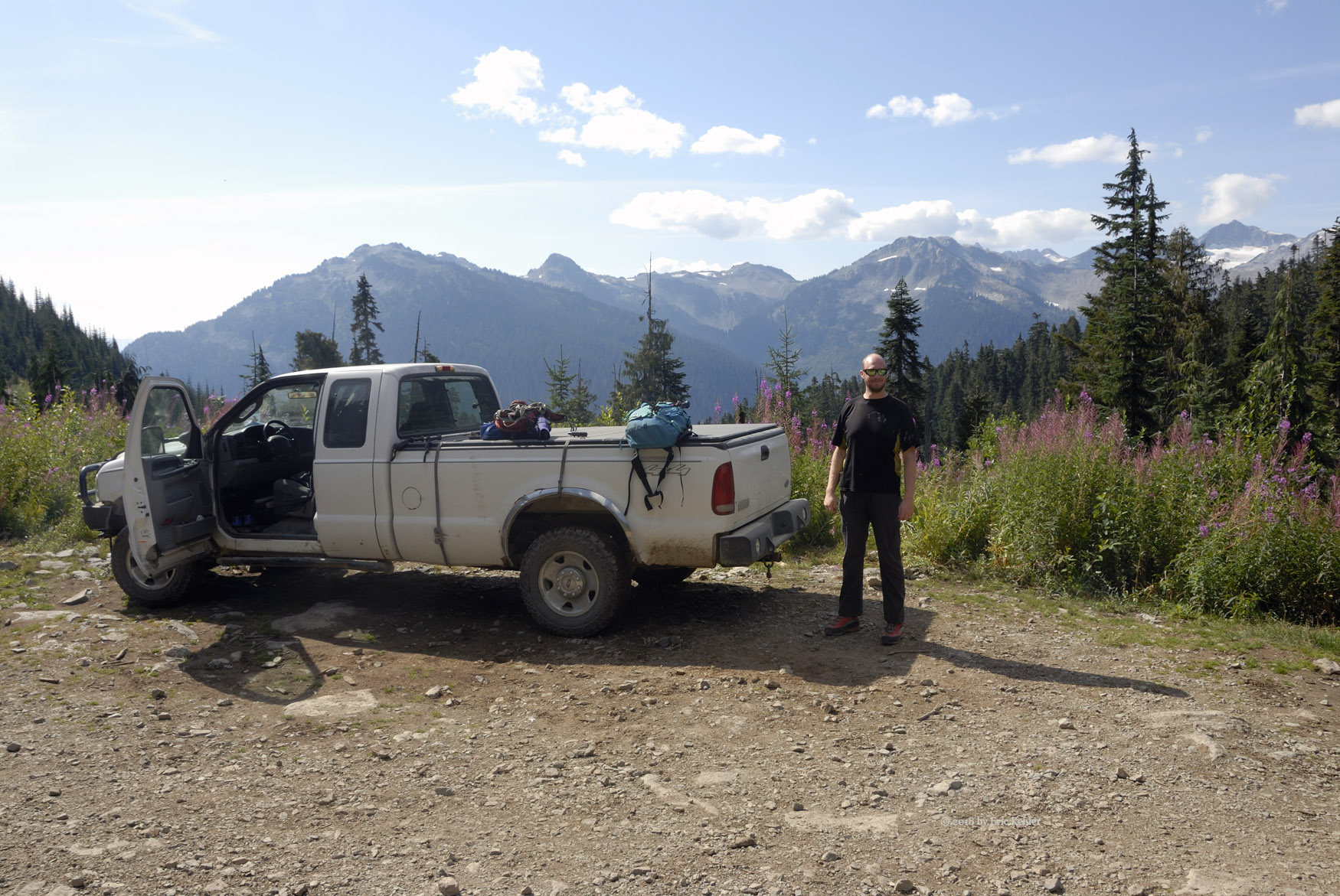
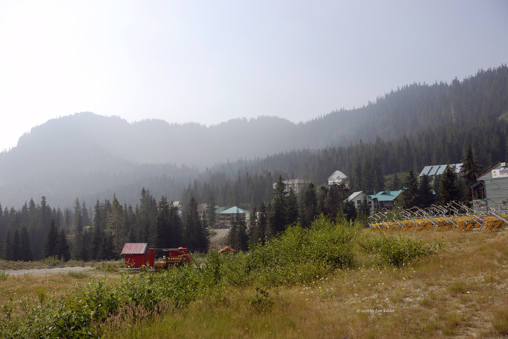
The drive to Squamish went smoothly and once in town I put out a call on the local repeater for VE7CUU – John. He responded immediately and provided some tips for the drive up to Brandywine. He would be listening for me when I got to the summit. We soon were pulling off the highway and onto the forestry road leading up to the Brandywine meadows. There are two spots that hikers regularly use to reach the meadows. The lower spot with 500m of extra elevation to hike is for those with feeble vehicles. The upper road is very rough in places and has some extreme water bars to navigate. It is for roads like this that I have my back-country truck and it made quick work of the upper road, we didn’t even require the winch. Once at the end we turned the truck around and found a nice spot to park. The views were already pretty good.

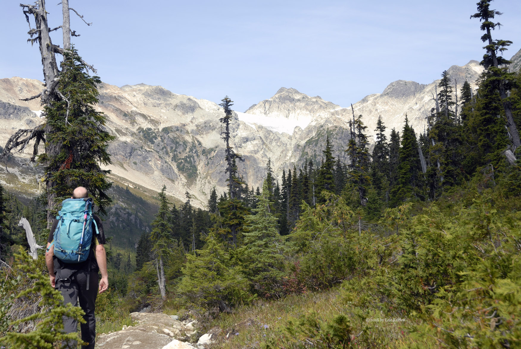
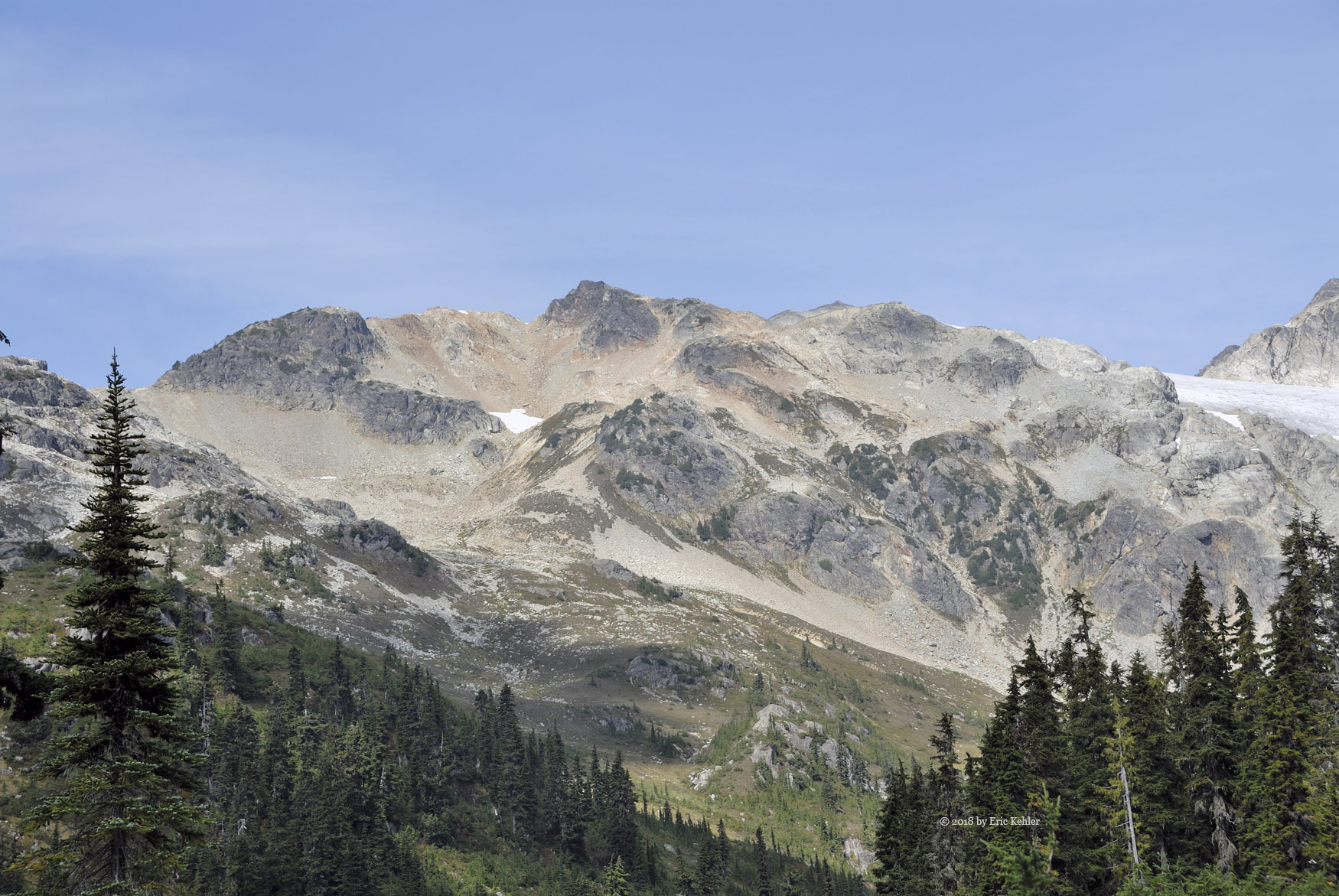
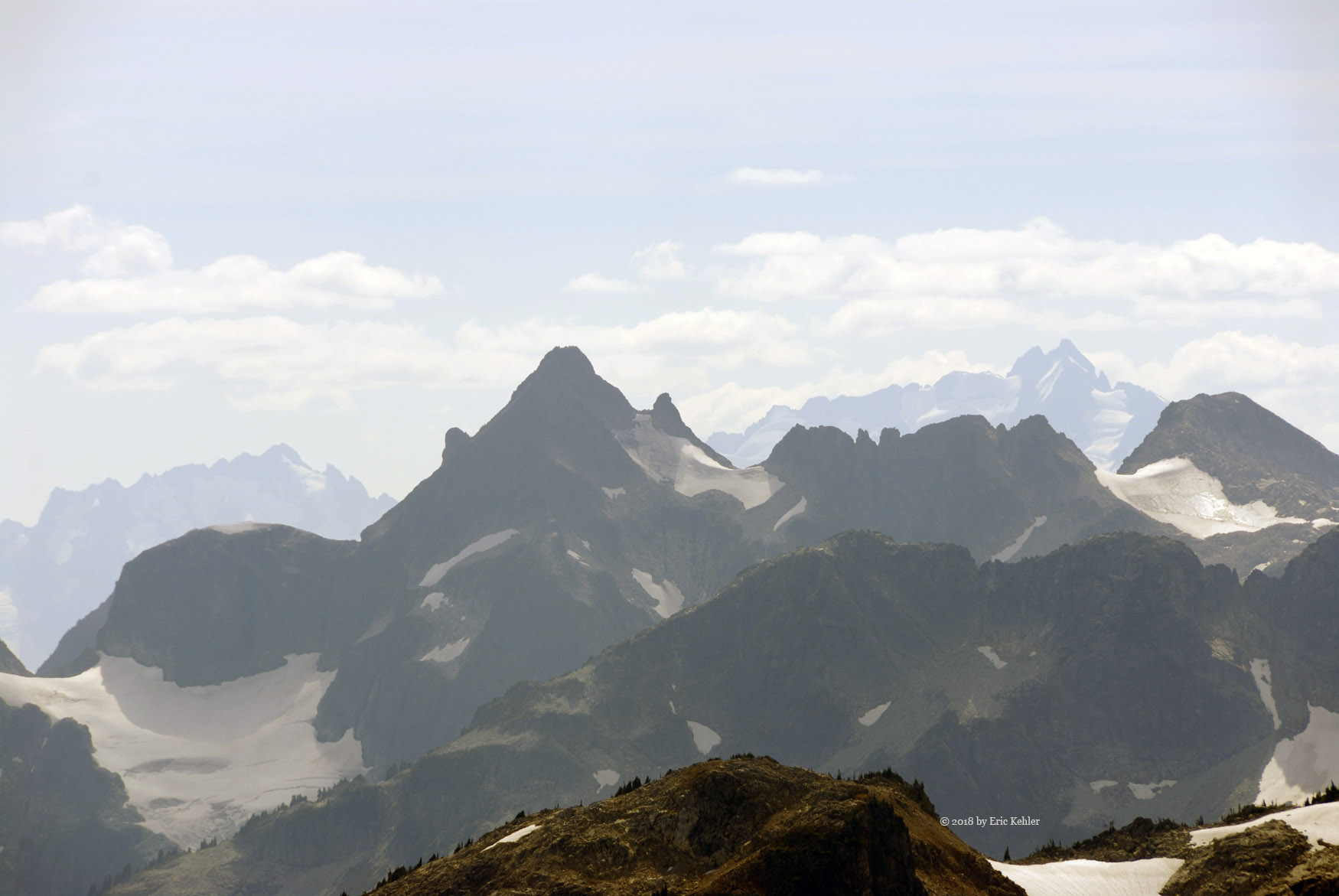
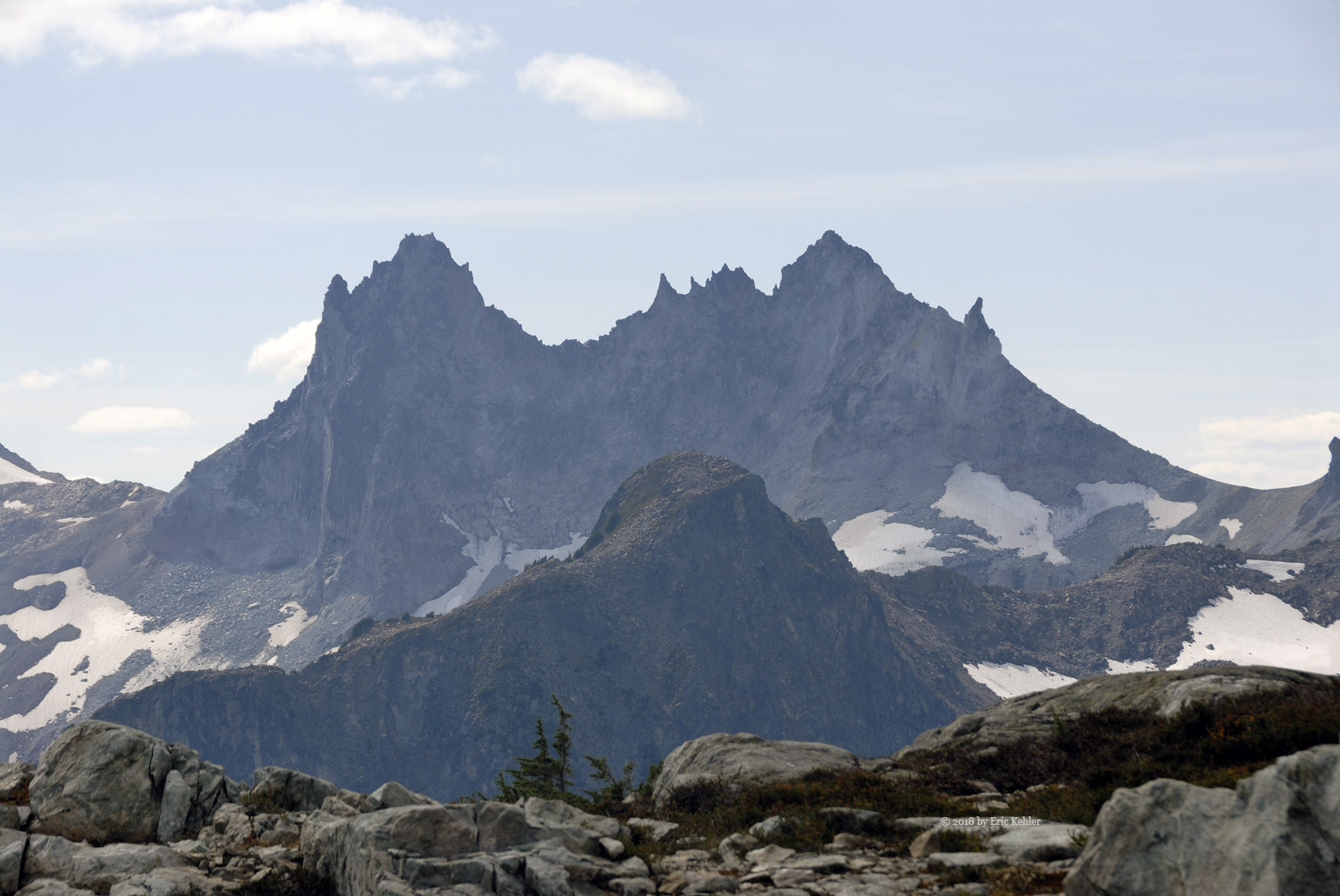
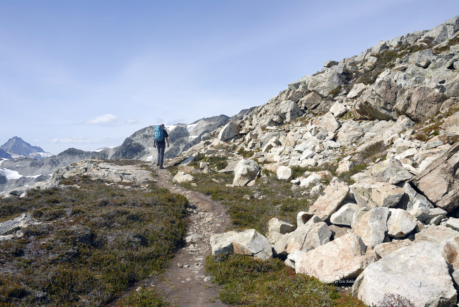
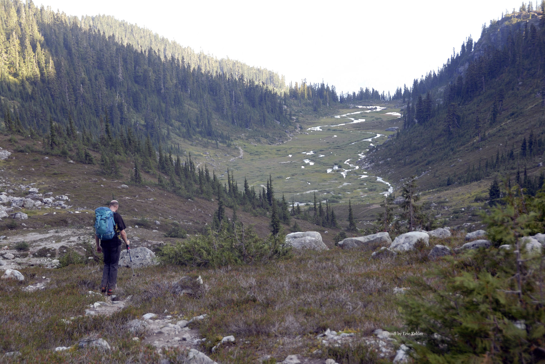
Once we were loaded up with gear we set off along the route. The trail to the meadow is well travelled and maintained, it is an easy hike and we made good time to the start of the meadows. When we reached the open section of the valley and had our first glimpse of tits length we were overwhelmed with the beauty of the area. It became instantly clear why it is such a popular destination. But our goal was that tiny summit at the far end of the valley. So we continued along the trail drinking in the sights and sounds as we enjoyed each new scene. When we reached the end of the broad valley we stopped for a good rest before tackling the next section which was a steep scramble up the rock strewn slope to the ridge.

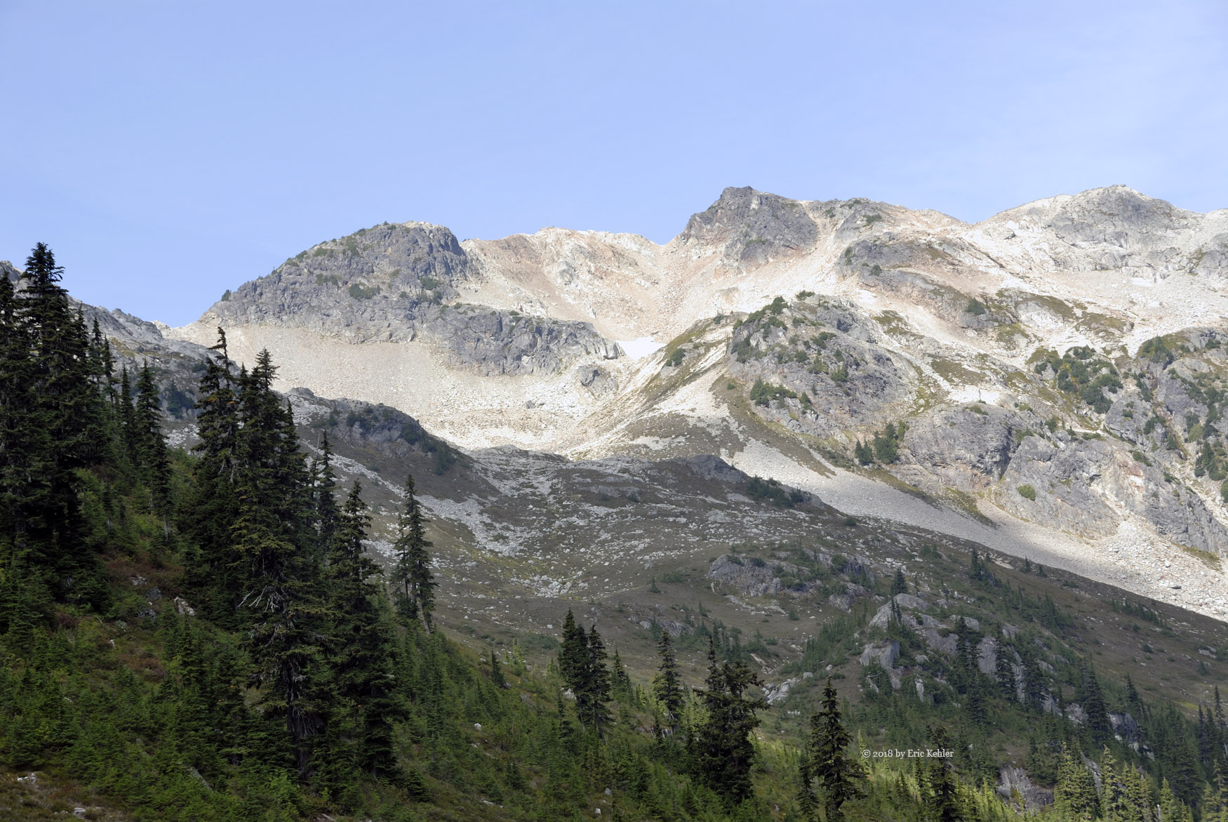
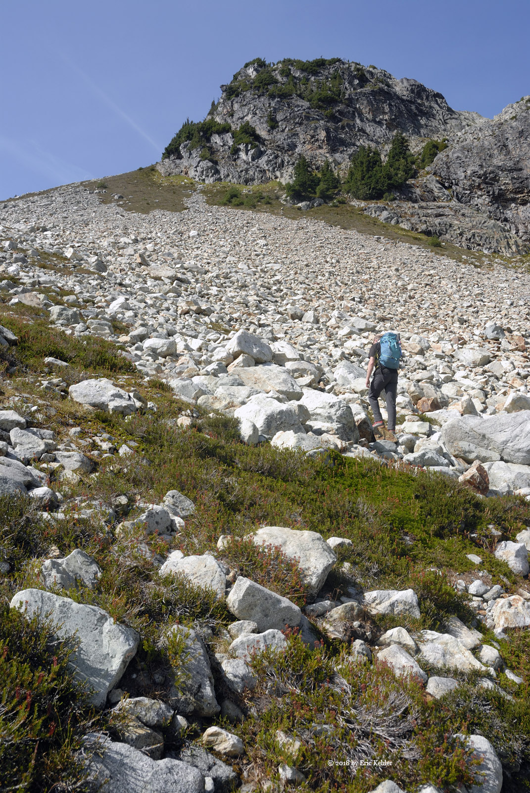
Well, with a final look back on the nice easy hike along the meadow we watched another group of hikers make their way towards us with their dog. Now looking the other way and way up we were staring at the steep rock covered slope to the ridge 400m above us. I’m sure John simply was picking out a route, I on the other hand was wondering just what I was thinking to agree to this. John encouraged me by saying he was looking for the easiest way up, I wasn’t convinced it would be much better than any other. But we were here and the points were above us so I started up the slope trying to step on solid ground so I wouldn’t need to redo some steps or worse, require a medivac. After what seemed like an interminable progression of severe penance I made it to the saddle on the ridge. John was some welcome encouragement and his advice that we stop for a longer rest and eat some lunch was more than appreciated.

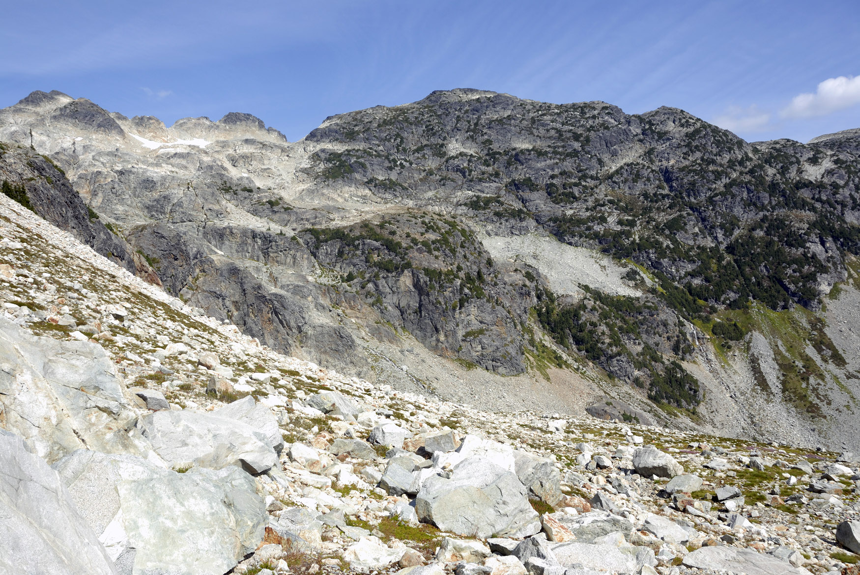
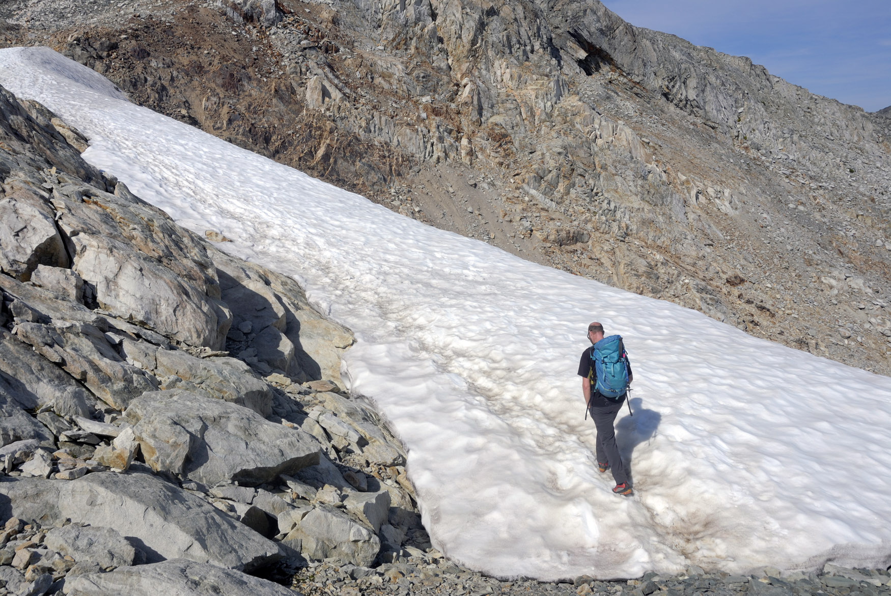
By now it was clear we would not be on the summit at our posted time and as we had cell coverage we updated our postings on the web. We looked back down the steep slope and noted that the other group had progressed a quarter way up but there they stopped, we didn’t see them again so I guess they decided not to over tax their dog with the rest of the scramble. The next section of the trail was along the ridge, the first bit had some short steep spots but generally it was a very pleasant walk as we slowly gained elevation to the summit. There was one spot we had to drop down 20m but nothing too much then we reached a section with a snow field that we had to cross along the top edge. Finally we reached the final rise to the summit.

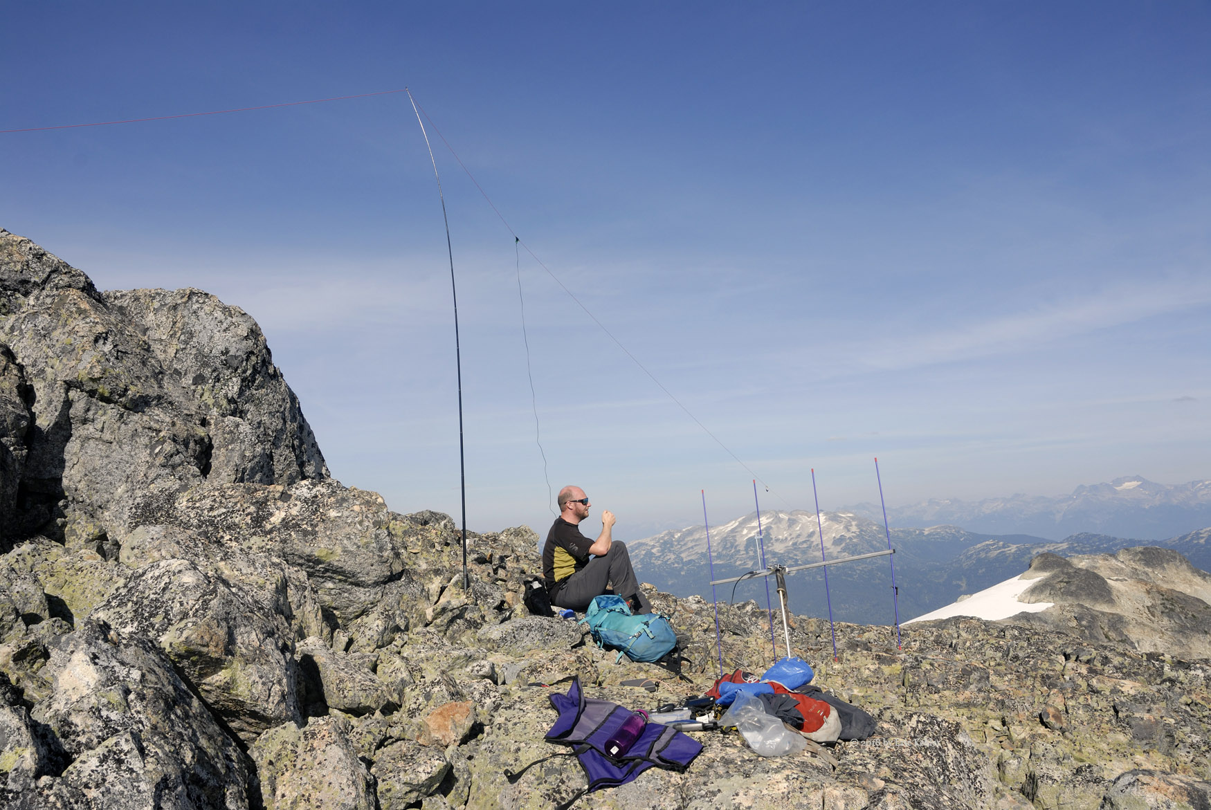
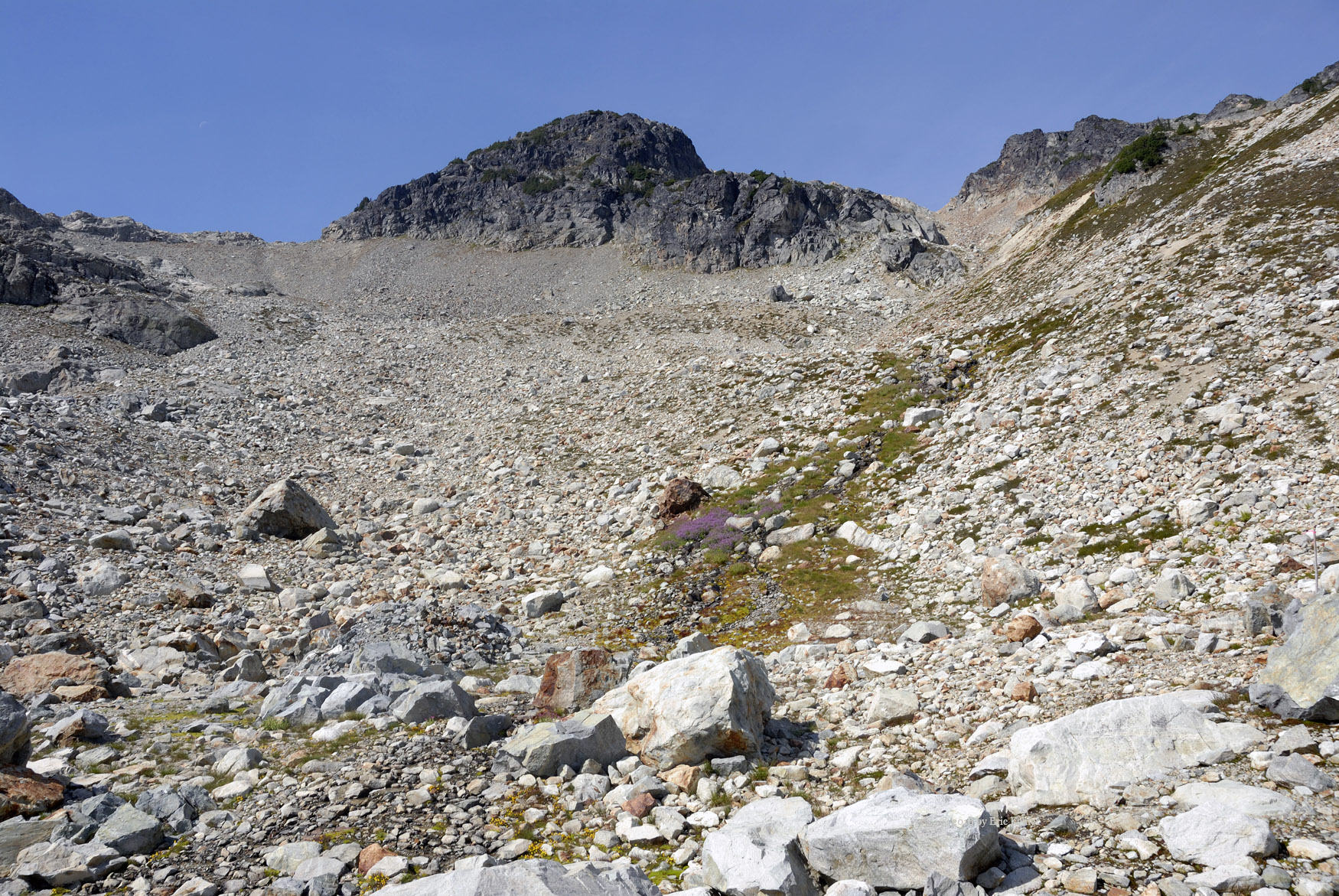
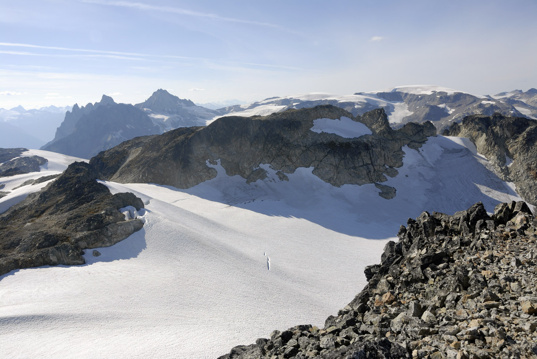
The way ahead looked quite challenging and there appeared to be a trail leading to the left of the slope so we decided to follow that, hoping it would lead to a route up. It brought us to the flank of the summit with a talus field of large boulders. We decided to make our way up it and before overly long we were on a broad shoulder just below the summit, well within the activation zone. We selected a spot to stretch out on and there we started to setup our antennas. I gathered a few photos before putting the yagi together. With the beam and the 30 watt amp I borrowed from Ralph, I was hopeful I would reach back to Vancouver and the southern Island. I grabbed a few bites more of my lunch and put out a call, I almost instantly had a response from VEYGDH (Keith) on Salt Spring. Next in the long was Ralph who was mobile while driving home to White Rock. Next up was John in Squamish and a guest he had, I was able to work my wife Carolyn at home and ended with Wayne (WA6MPG) on Orcas Island. So it was a well-rounded group with contacts covering off much of the region identified in the coverage map I had generated. Meanwhile John was busy making some 20m contacts on my KX2. Its 8 watts were doing a bang up job for him despite a slow start and poor band conditions.

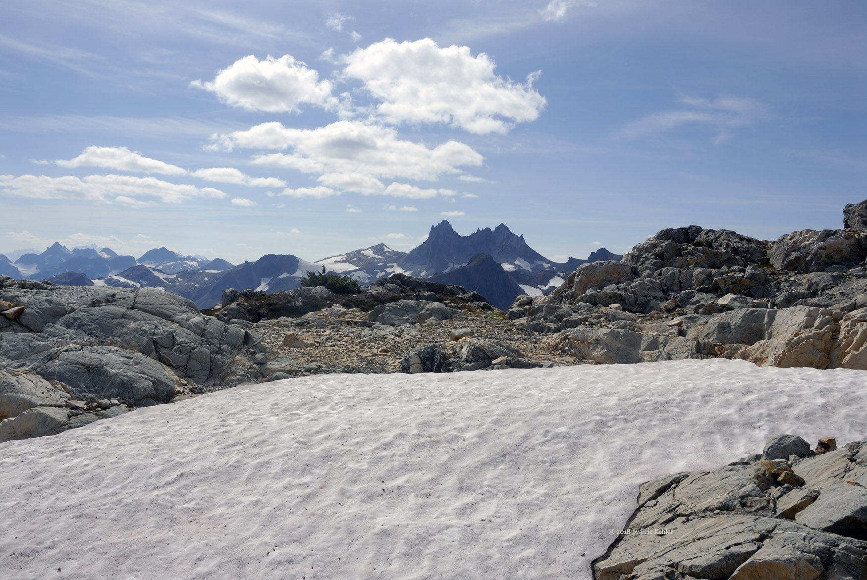
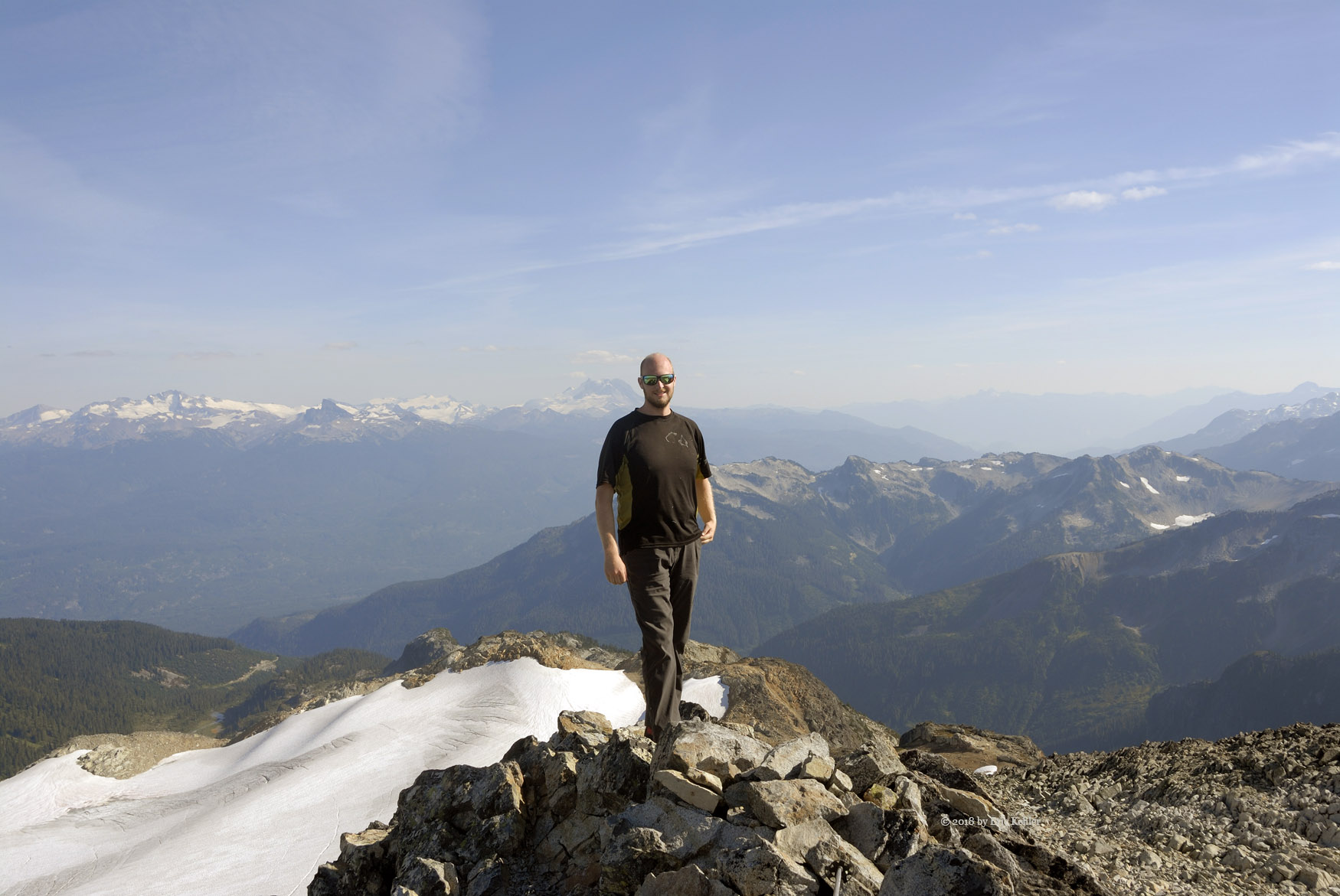
Once we had completed the needed contacts we packed up the gear and decided to walk the short final bit to the pinnacle of the summit. It was a quick scramble up the large boulders. The view to north now opened up and we saw some huge snow fields directly below us as the NW side of the summit was a sheer drop. John found a small geocache waiting at the summit. Well we could stay and enjoy the view for a long time but it was now after 4 and we needed to start down.

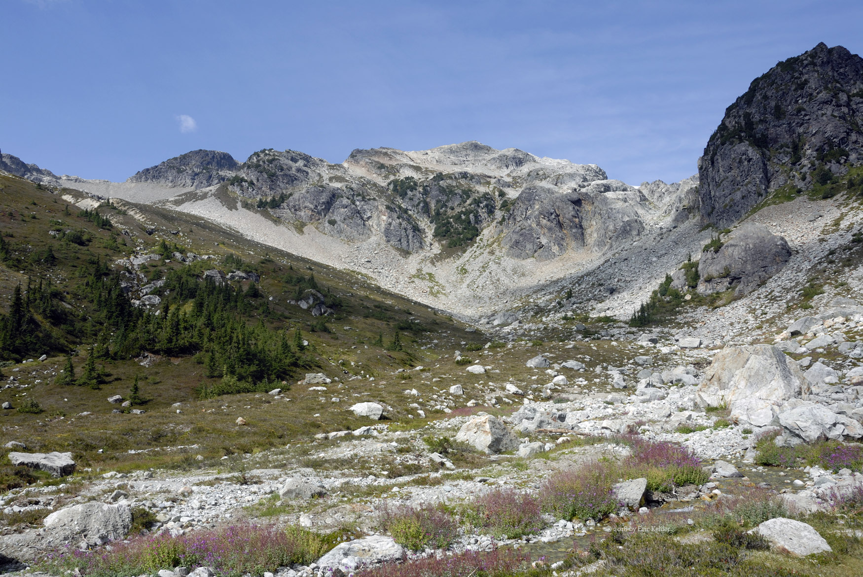
We decided to take the more direct path down off of the summit to the ridge. This proved much easier that that path around the flank and it allowed us to make up some time. Down we continued, over the snow pack, and back up the secondary peak. We stopped at a few points for photos but soon we were back at the saddle point above the steep rocky slope. Taking another longer rest we got well rested before the steep descent. That went fairly easily, I am much better at the descent on the slope though I did have a few slight slips along the way. Finally we reached the bottom of the slope and stopped to refill our water flasks in a nice fresh stream of ice melt. The colourful wildflowers along the stream caught my eye and I gathered a number of close-up shots of the yellow and purple flowers.

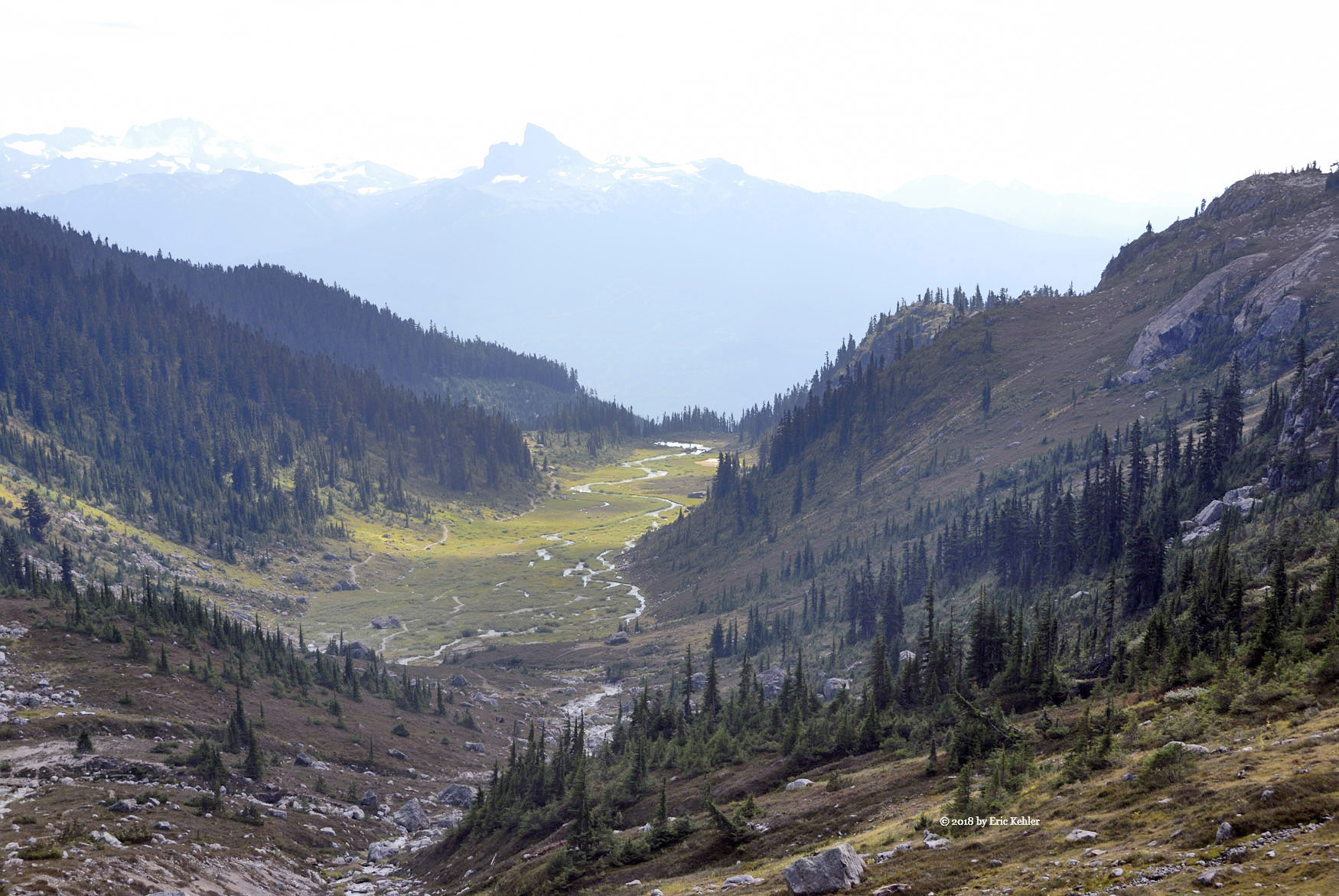
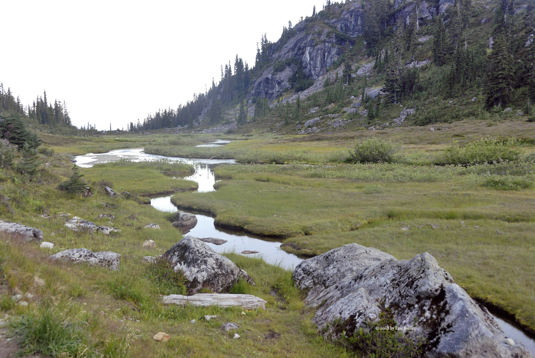
The next section at the head of the valley was a bit wet with the numerous streams we had to cross but it wasn’t that muddy so with careful foot placement we made good time down the final bit of the slope and soon we were back on the well-travelled trail along the meadow. We kept up a good pace as the sun was getting low and we wanted to be off the trail before sunset. With the quick pace I developed a bit of a muscle cramp in my lower back, but with a short rest and some electrolytes it was soon gone and we continued to the truck.  As we reached the end, a couple was just started up the trail. They were spending the night and were a bit surprised when we told them that they had the meadow to themselves.

We got our gear loaded into the truck and rested a bit when John noticed the last light on Black Tusk and Garibaldi across the valley. We both gathered a few photos and then the light was gone. So we still had some dusk to make our way down the rough part of the road and we got back to the main road before dark, but it was dark by the time we reached the highway. As it was now 8 pm we were quite hungry, we decided to grab dinner in Squamish. John settled on a Mexican place called Mag’s 99. It had good food with large portions, we arrived just before a large crowd of young folk. John said the line-up was often quite long. After each of us ordering a burrito Maximus we settled in to wait for the monster. And monster it was, I wasn’t sure I could eat all of it but I guess the workout on the sloped left enough room because I surprised myself by consuming it all. The final drive to West Van went quickly and there I returned John to his car and I set off for home, arriving a bit before 11pm. A full 15 hours of mostly fun. I hadn’t been convinced I would be able to complete a hike with so much elevation gain but I am sure glad I gave it a try and succeeded.

Lynn Valley and Elizabeth

Wen my kids were young we visited the suspension on several occasions. Each time the boys had fun crossing the bridge though some had more challenges with it than others. My youngest son Ethan, Elizabeth’s father, was one who had no issues crossing the bridge as a teen. So we planned for the week-end adventure and when the day arrived the two came to my house and together we ventured for the park in the electric Bolt. It was an easy drive up and we made good time with the light traffic on the highway.

When we arrived at the park the first parking area was a bit over half full but I drove past and looped past the small café and there I spotted a nice open space to park. I think it is the closest one to the bridge! Not bad for a casual time start. We parked and then made a pit stop before heading for the bridge. At first sight Elizabeth was a bit unsure but Ethan stepped out onto the bridge and helped her get started. She was fine after that though she moved each step very carefully while holding tightly onto the railing. The bridge was vibrating a bit with the traffic but nothing serious. We slowly made our way across while gathering a few photos.

Once across we headed upstream to the 30 foot pool. The trail was very nicely maintained with many wooden walks and stairs. Once we got down to the creek level the trail branched out into many smaller ones and we followed one to the creek. There we wandered over the rocks in the creek bed. Elizabeth slipped at one point and banged her leg but she was soon fine and back on the move. We finally arrived at the pool and there we clambered over the rocks to get a view of the small waterfall at the far end of the narrow gorge. We spent some more time climbing rocks to get to the middle of the creek and a better view of the waterfall. Once we had our fill of the area we started back towards the bridge.

Along the trail we stopped to explore the mossy trees and nurse logs that made up the floor of the valley. We found a shallow cave in the rock face and explored it. Then it was climbing a huge rock for some photos. We slowly made our way up to the bridge and then continued past down the creek to the Twin Falls Bridge. It was getting much busier as the day progressed so we didn’t stop too long at the lower bridge. Now we had a long series of stairs to climb to get back to the car level. It was a bit of a work out but we got there. We looked over the offerings of the café but found nothing that would work for all of us so we decided to visit the ecology centre and then head out for lunch.

The ecology centre had a number of interesting exhibits that caught Elizabeth’s eye, many I remembered from many years earlier! It was an interesting display and we learned a few new things about the local wildlife. Once we had completed a circuit of the centre we returned to the car and started out. A car was waiting to take our spot before we even got into the car! It had gotten that crowded and the parking areas were all full.

We left the park and looked for a restaurant for lunch. Fortunately it wasn’t very far before we found a suitable location and there we enjoyed some cool air while we enjoyed a quick meal before heading home. A short day but a worthwhile experience for Elizabeth. I had wanted to revisit the area for a while, so it was a good outing for each of us.

Mounts Newton and Work

I had planned to activate two summits on my next trip to Victoria. Both would be a first activation for me and so I was looking forward to the hikes and getting them in the log. First up was Mount Newton. Normally one can drive up most of the way to the summit and then just walk the last bit but with the extreme dry summer conditions the road was closed to vehicular traffic. So I planned to walk the entire length of the road in. Now that may sound hard but the hike still was only a mile in length!

I arrived at the locked gate around 10:30 and reversed back down the road to find a spot where I could park. There were no parking signs along the road from the gate down past the start of the park but not much further out there were spots amongst a couple other parked cars. I pulled in to a spot and got out to get my gear loaded. One of the other problems with the dry summer were the forest fires and the smoke from them was thick in the region. It was quite dense today and was a concern for me doing even this level of exercise. But I got my pack on and started up the road.

Not much after the gate I met another hiker who was doing a cross trail, they commented on the air quality and how it was making walking much harder. I agreed with her and after a moment to get a drink I continued on up the road. A service truck came down the road and disappeared into the smoke. So I knew some people were still going to the summit. The road continued upward at a decent rate and as I got closer to the top it dipped back down to a parking area and access to a picnic area. Here the road that continued to the summit was further gated and the paved road became gravel.

I climbed over the edge of the gate to continue my way up and there I met a group walking back down. They indicated that there were no views of anything other than a park worker painting a staircase. I continued up the final stretch of road and arrived at the summit area. At the summit there are two groups of buildings. The slightly lower one has a massive cell tower and a radar system for the airport. The higher fenced off area is occupied by a large dome building. I walked to the official lookout next to the tower and scouted out a location to set up. I chose a spot only a few meters from the lookout platform.

Looking around at the heavily covered cell tower a few meters away and a spinning radar antenna for the airport I wondered if any 2m RF would find its way through the field to my antenna. Persevering, I set up the yagi and Ralph’s 30 watt amp and put out a call.  I very quickly had my first contact in the log. Followed by two club members back home and then a number from across the water in Washington. After 20 minutes I had 14 in the log, a record for me. Well that felt good and it seems that the towers beside me had little impact.  So as there was no view, I packed up the gear and started back along the road. On the way up I spotted a side trail that looked like it went towards the summit so on the way down I found it and saved a few steps. Soon I was back to the car and ready to set off for my room. A good adventure, record contacts despite the heavy smoke and no view.

My plan for Friday was to activate Mount Work, for this trip my cousin who lives in Oak Bay joined me. He arrived at the hotel at 9:45 and we quickly set off for the start of the trail. I had selected the southern route as it was shorter and the steepness was not too severe as the summit is only 450m high, this trail was marked at 2.3km so a pleasant walk for the morning. Today the weather was a bit cooler and we did have a sprinkle of rain so the air was much clearer than on Wednesday. The drive to the start was encumbered by numerous construction sites that always proliferate like a virus in the summer and we had to work our way through them at a snail’s pace. But eventually we arrived at the trailhead. We quickly got our bit of gear loaded and we were off on the well-worn trail to the summit. The trail was actually quite pleasant and we met a few on the route, some walking others jogging.  As we gained elevation and neared the summit we finally had some nice views of the region to the west of Mount Work. It was actually quite nice being able to see into the distance.

When we arrived at the summit we scouted out a decent spot, the summit itself is fairly broad with trees but has no view itself. So I picked a spot that would hold my pole upright and had the least trees in the direction of Vancouver. I quickly set up the yagi and got out the amp and then I discovered that my bnc to sma connector was missing! I had left it and my logbook at the hotel! So much for using the yagi, all I had was the pitiful small rubber antenna. Well it was all I could do so I started calling – nothing, Ralph was trying me from White Rock – nothing heard either way. Eventually I put out a call on the local repeater and a local chap answered and said he would try me on 2m. We made contact even though I didn’t register on his S-meter, he said the audio was clear. He was surprised I got in to him with the small antenna. After trying for a while with nothing further I remembered I had my KX2 in the bag so I set it up and scanned the band. Not much was out there on 20m but I did hear a station working a pile-up, it was in Slovenia. I tried calling a few times but didn’t really expect to be heard.  I put out a call and eventually made one contact. I would have kept trying but by now I could see that my cousin was getting restless, so we packed up the gear having successfully activated the summit but not with enough contacts to gain the whole point. The hike back down went quickly even with stopping for a few photos. We did see one deer just before we reached the parking lot.

Well even though the second activation was hampered with missing equipment, it was still a lovely hike and I enjoyed the time out there hiking and chatting with my cousin. He was interested in doing another summit on my return trip in the spring.


Mount Keenan Adventure

Mount Keenan was a summit on the list I have wanted to try for a number of years. It was first activated by another radio operator a few years back and it looked like one that wouldn’t be overly difficult to do. So I convinced Ralph to join me on the adventure and when he had some time we would set out and climb to the summit.

Back in July Ralph indicated that he would be able to join me for the adventure mid-week in August so when the day arrived he came to my house and we set off for the summit at 8:30. The drive to The Hemlock Valley resort area should have taken around two hours, but as we approached Deroche we were stopped by a train at the crossing. Normally uneventful but it stopped not much past crossing the road. It sat there for a while then backed up a bit while another train sailed past on the second track. Then it moved forward a back a few times before finally backing up out of the way. The whole process took upwards of 15 minutes! Quite annoying. From there the rest of the drive went quickly.

One of the concerns I had on selecting this summit was whether we would be able to drive up to the ridge line or if the access would be gated off and we would have to hike all the way up the slope from the base of the chairlifts. When we arrived the gate was open and in we went, now to pick the road up. I found one that seemed about right that followed along a ski lift. We drove it to the top of the lift and there the road ended, so I returned to the bottom. After looking around we didn’t see anything better so I decided to go back up the road we tried and turn at a small side road mid-way up. Sure enough that road opened up and we were able to follow it to the top of the bowl. There we made a few turns and we were able to follow some narrow roads through encroaching hemlocks towards the ridge I had plotted on Google Earth as our access route. The road got quite narrow for my big truck and when I reached a fork I turned the truck around and parked it just in on the branch. I hoped it would be out of the way of any ATVs. We then got our gear in order and set off for the start of my plotted route.

A short way along the road it opened up and the area would have been a good spot to park. Well I wasn’t sure what to expect so I guess parking where I did added about 500m to the hike. But the walk along the road went quickly and was quite easy. When we arrived at start of my track we were standing at the top of a drop, so we continued along the road another 100m as it descended a bit, then we cut across a small meadow for the forested ridge that we would be following. So far it was going quite well. The first bit of the route was through mature trees with little undergrowth but even here the dead branches were a bit of a nuisance. Then we broke out of the trees into more open areas with thick clumps of black huckleberry which we had to push through. It was slow going as we made our way up the ridge alternating between the trees and the clumps. The smoke in the air didn’t help either.

So as we continued upwards, time was ticking by quickly and our progress seemed interminably slow. As we got closer to the summit area the trees thickened and we were able to spend more time squeezing between them instead of fighting the shrubs so things were looking up. However,  looking a bit further on the steepness of the ridge increased dramatically. Now we were fighting the slope instead.  We took a good breather and then started up the next section of the steep slope, it ended on the top ridge. We eventually arrived at the top of the ridge but it was somewhat west of the marked summit. The area was within the SOTA activation zone but it seemed to be about 100m west of the map’s location. I scouted out the area but in the direction of the marked summit the ground dropped quite some distance. I continued to walk the area and look over to the marked summit but I didn’t see much of a rise beyond the dip. It looked like the location was off a bit, even if there was another rise it would only be a meter or two higher. So we decided to stay where we were and eat some lunch. Once we had rested I set up my yagi and Ralph got his HF antenna strung into the trees. Then we were both busy putting out calls. I managed to get 5 in the log including one summit to summit with a chap on Moose Bench in the Olympic Peninsula, around 195km distant. Ralph logged 6 CW (Morse code) contacts.

Well we had completed the task and logged enough contacts to get our points for the summit so it was time to head back. The return went faster as we weren’t fighting gravity to the same extent but the plants blocked our view of the ground more and so watching our steps was harder. Pushing through the dead branches and thick undergrowth took its toll and we were both exhausted when we finally emerged back on the road way. The final stretch along the road in the hot sun saw us dragging ourselves forward to the truck. Once back and cooled by some AC we felt better. The route we travelled wasn’t hard to follow as the ridge was fairly narrow and so finding our way along it was fairly easy, pushing through the trees was not.

Well, the drive back down to the ski lodge area went without issue and soon we were back on maintained roadway and no longer bouncing around. The final descent from the lodge to the Morris Valley road seemed to take quite some time, I was tempted to stop to gather some photos but I was just too tired to bother. So we continued down and once on the main paved road our drive home went without further delay. A good day’s effort though much more than we had expected.

Subscribe to 2018