
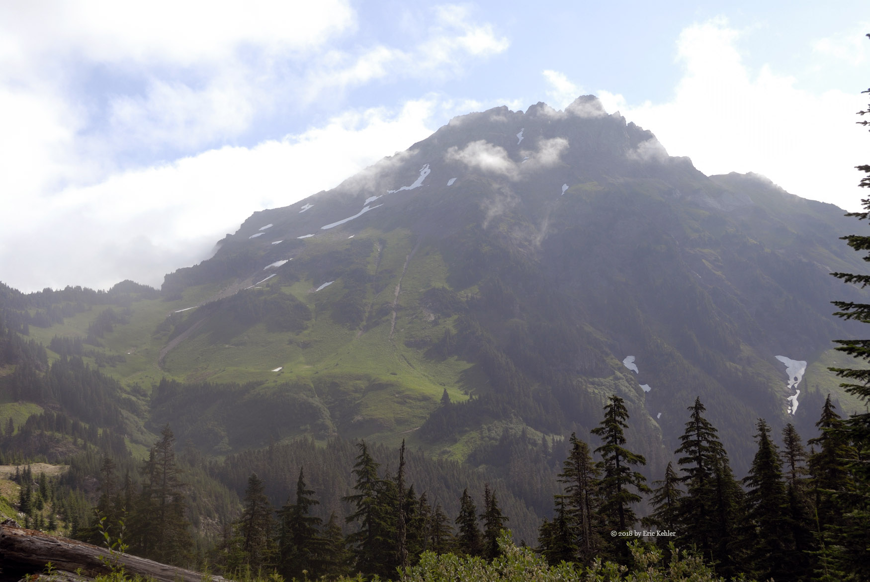
Hiking Weatherhead W3

Earlier this year I added a number of new summits to the list on the Summits-on-the-air program. The smallest of which was the Weatherhead W3 peak between the main Weatherhead peak and Stave Lake. This little guy was just under 500m in height and so I thought it would make for an easy target to hike and activate on a short afternoon. I first considered it with my son Geoff but when we came out he had his two sons and the weather was a bit wet so we decided it wasn’t the trip to go hiking. That was a wise decision looking back on it.

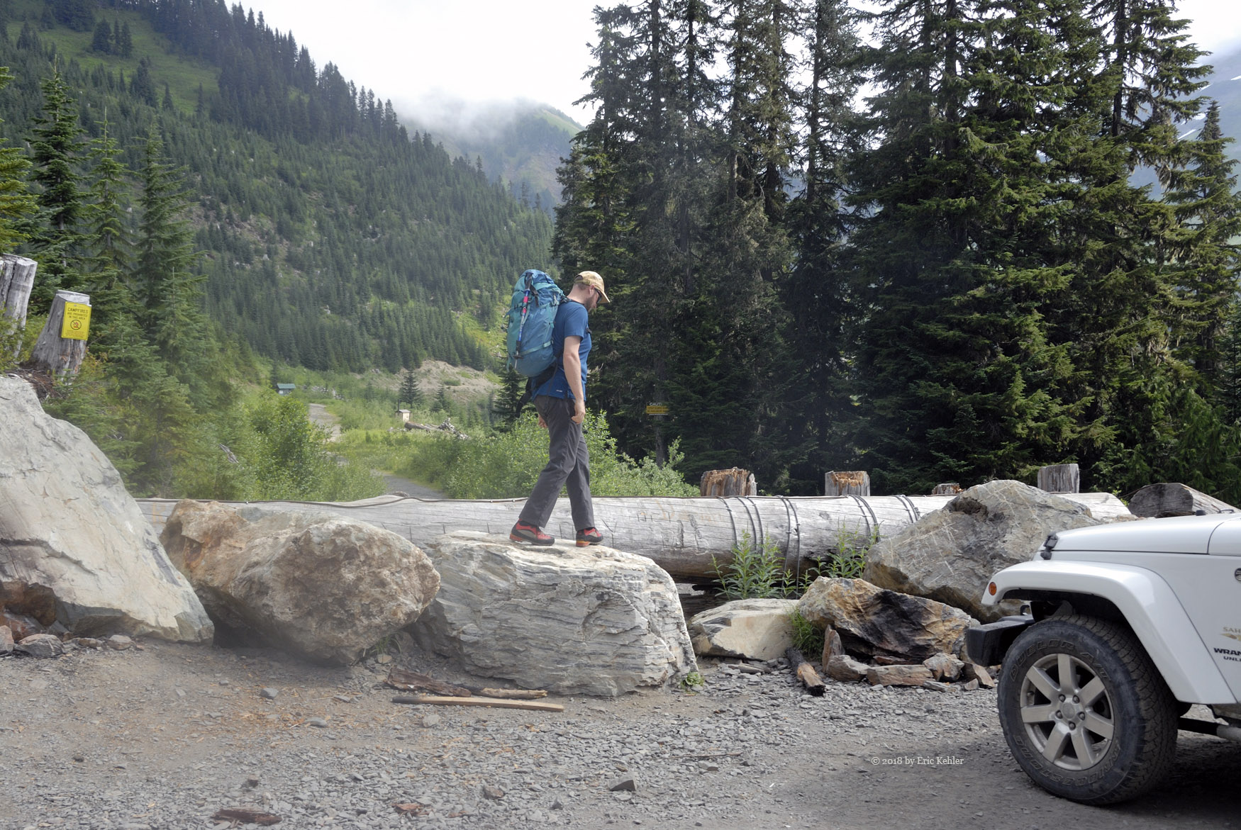
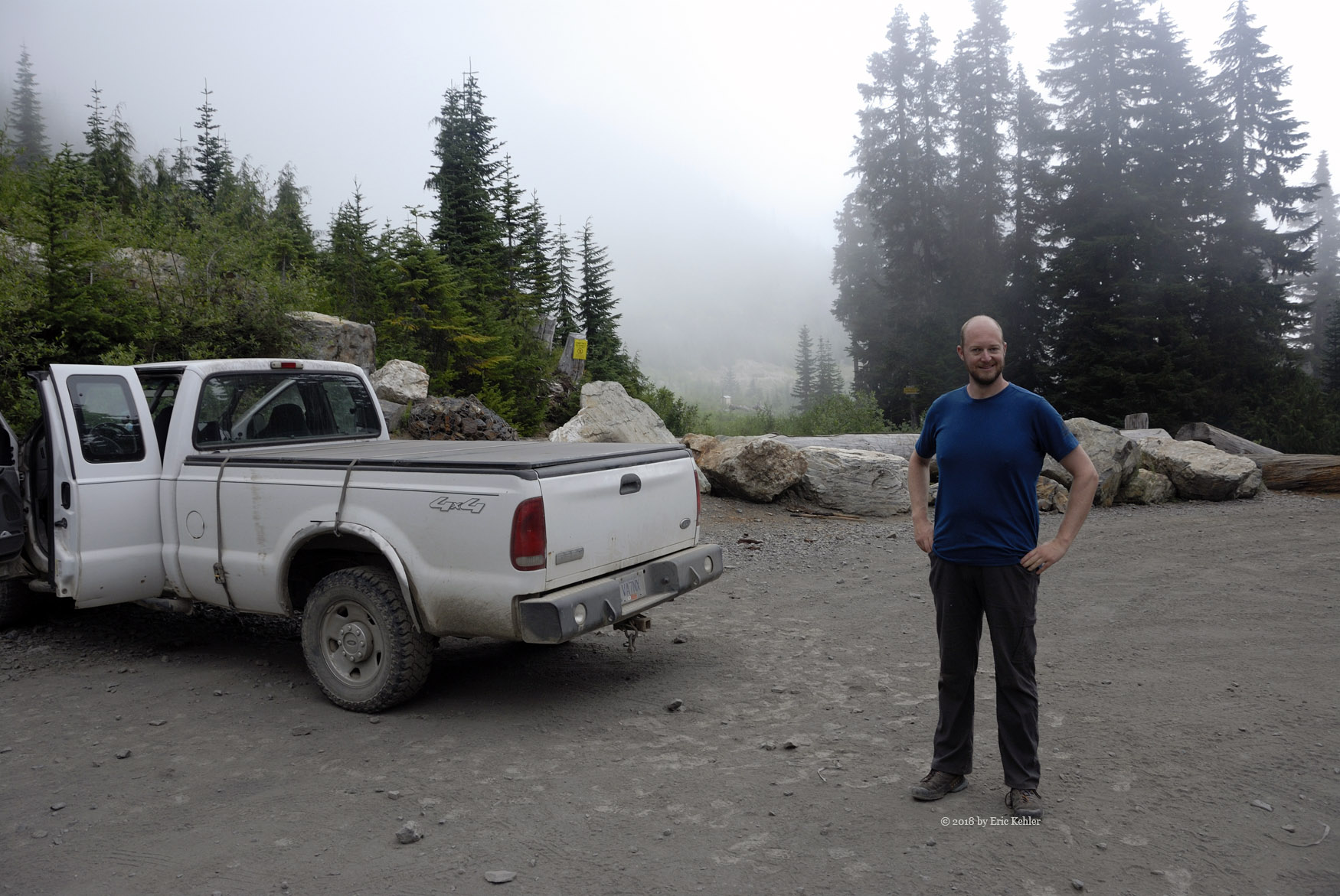
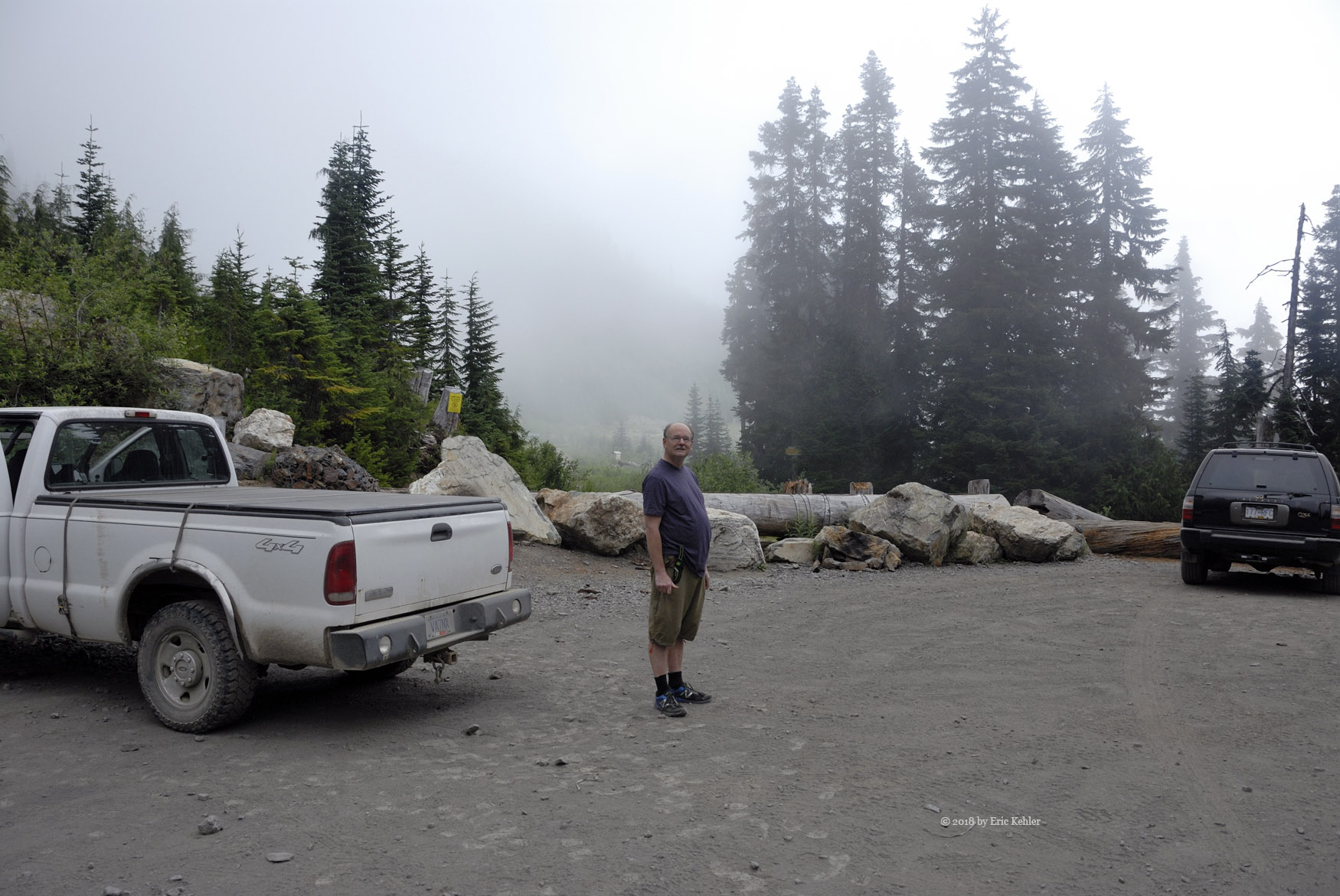
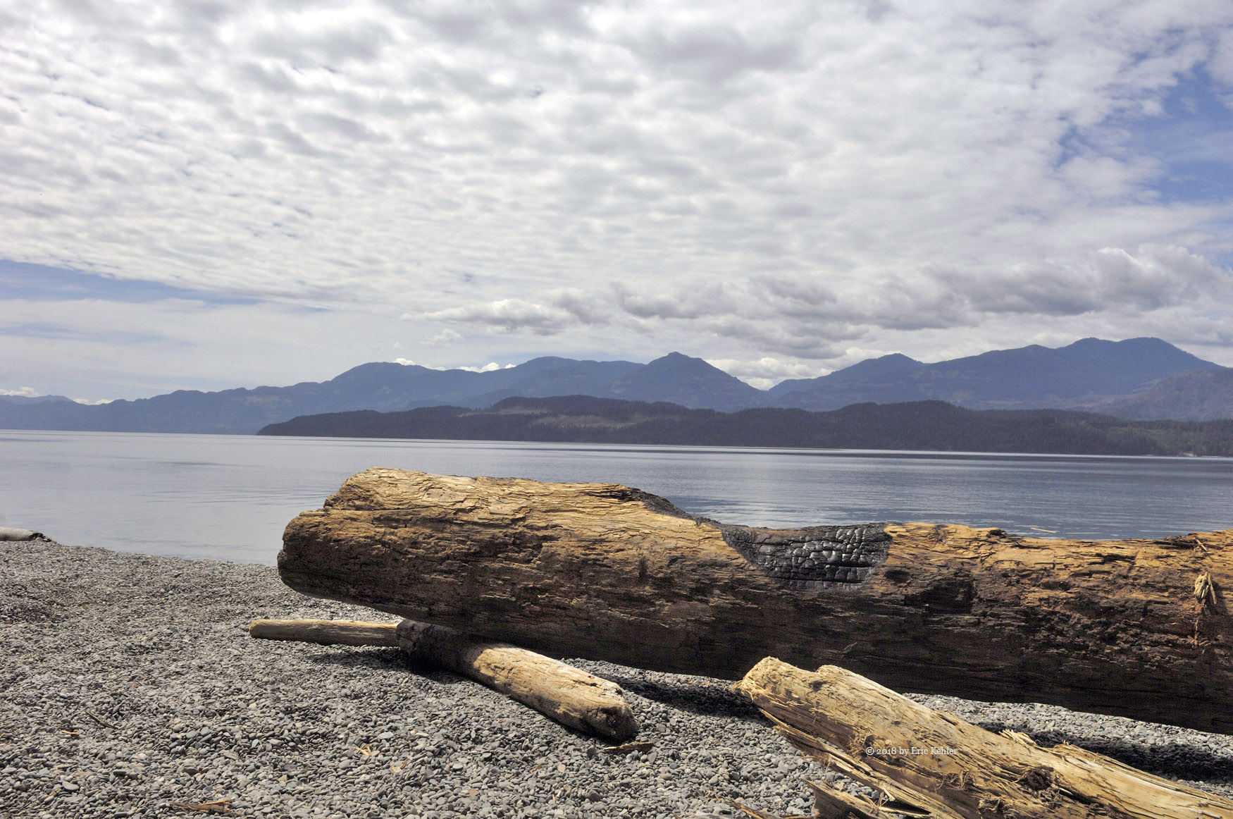
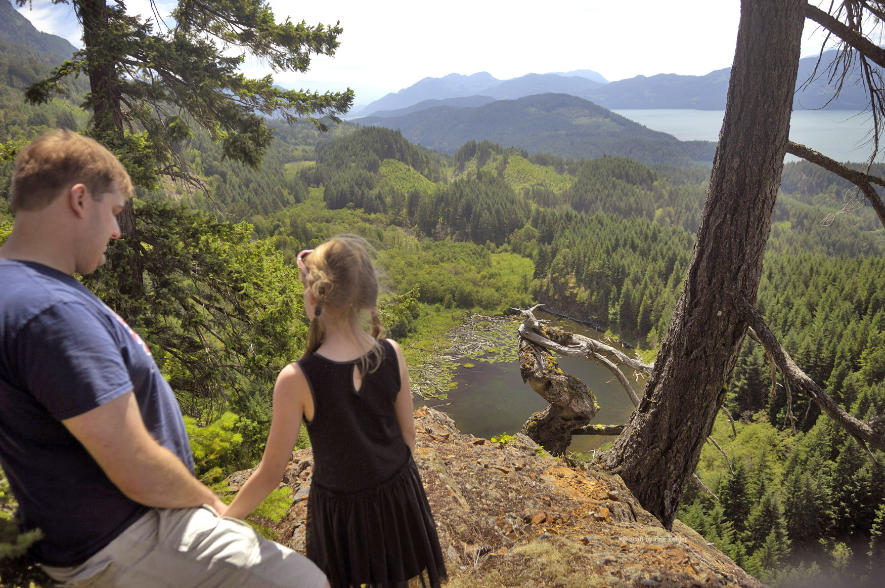
It was now August, the day was dry and my other son Nick was willing to join me and give it a go. So we set off mid-morning and made for the Lost Creek Forestry road. Traffic wasn’t bad for a long week-end, likely everyone was still getting up after a last night of partying. On the FSR we noticed there was a lot more traffic than when I was here with Geoff. We drove up the mainline and soon arrived at the turnoff for the spot I felt we would need to park at to start the hike. The road was in good shape and we got to the fork and a second one without a problem. We parked right where I had expected to and there we got our gear organized and the truck locked up for our hike.

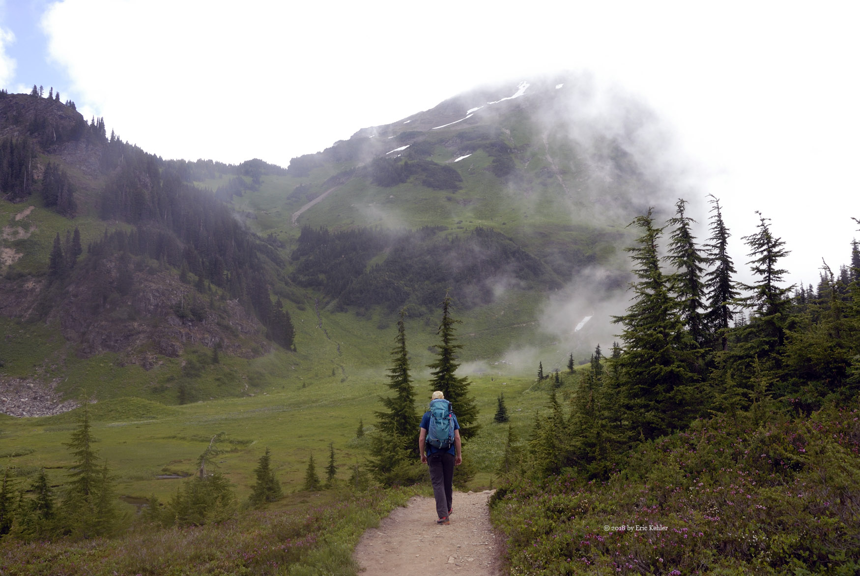
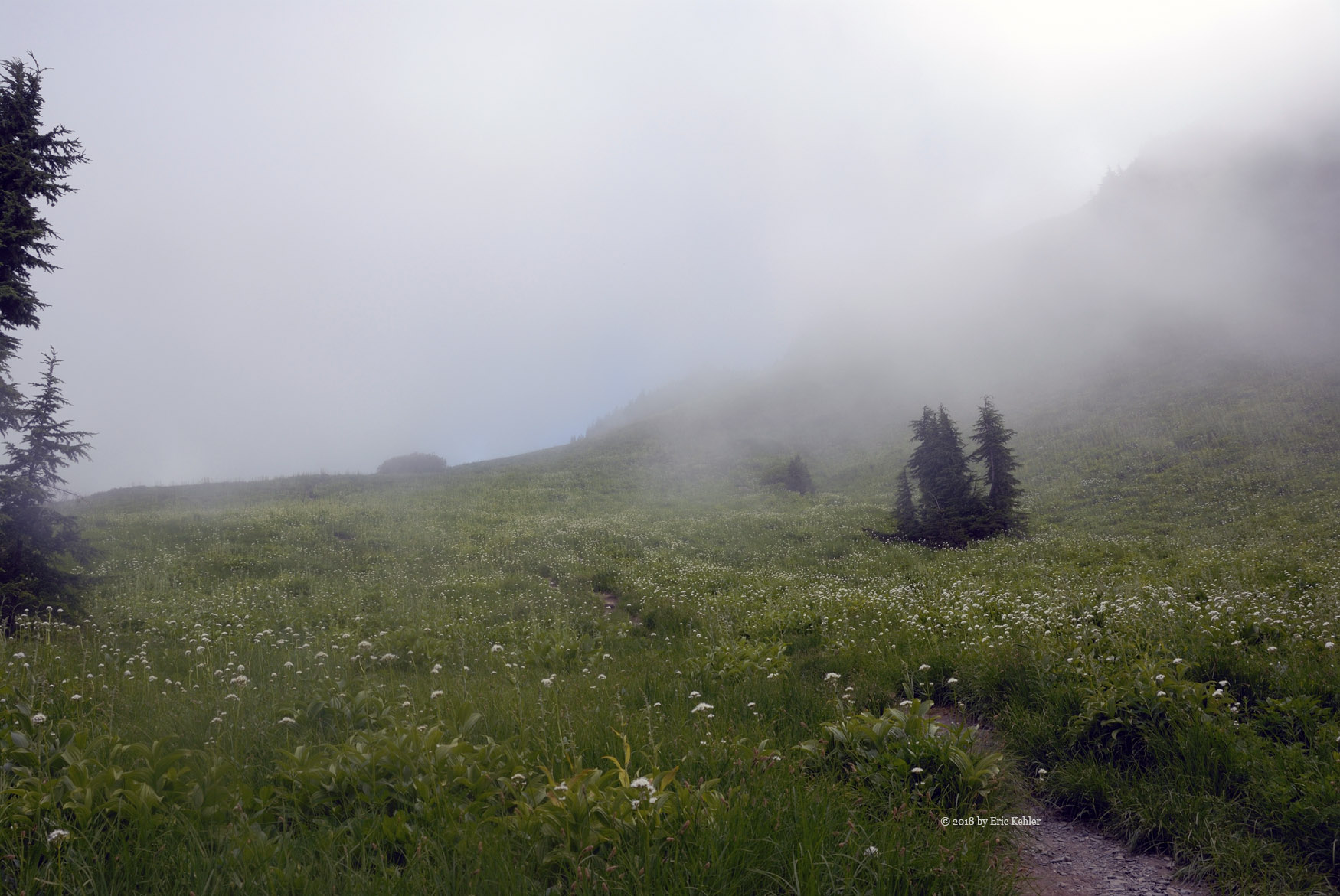
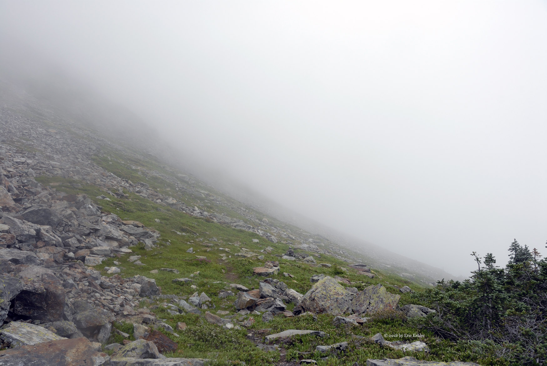
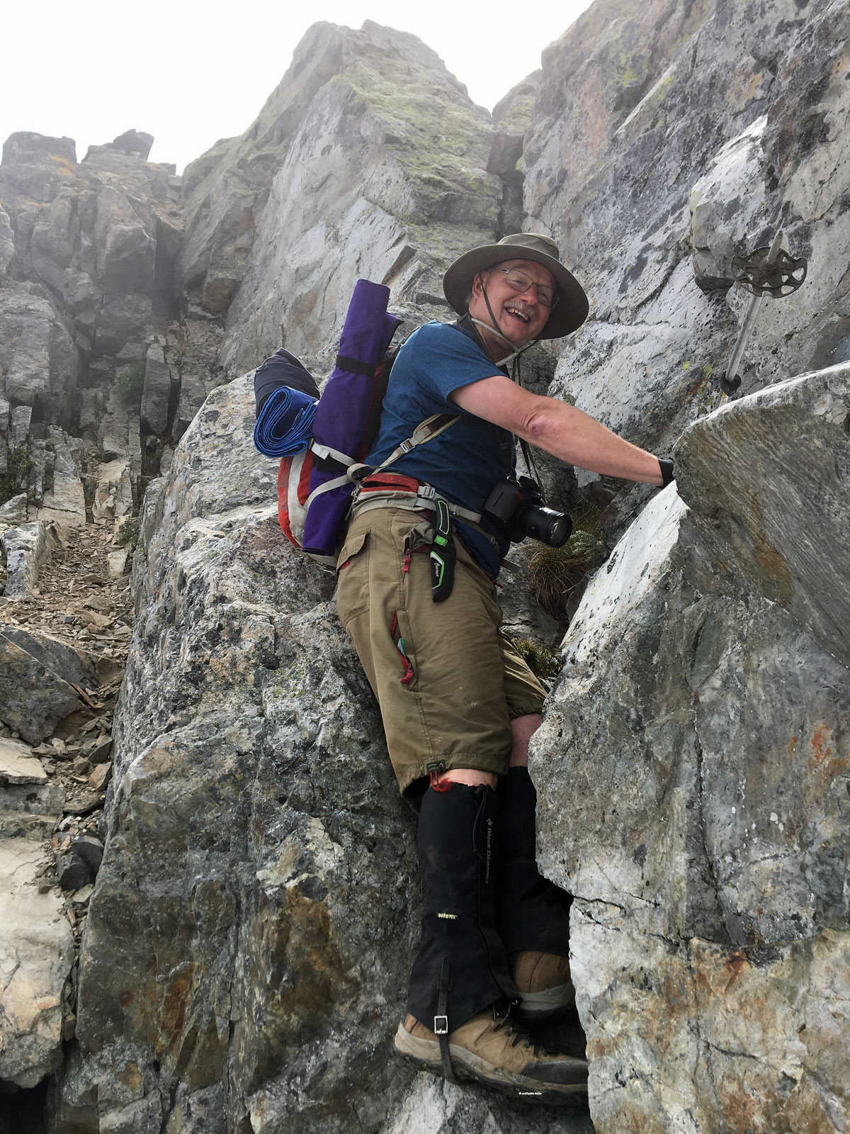
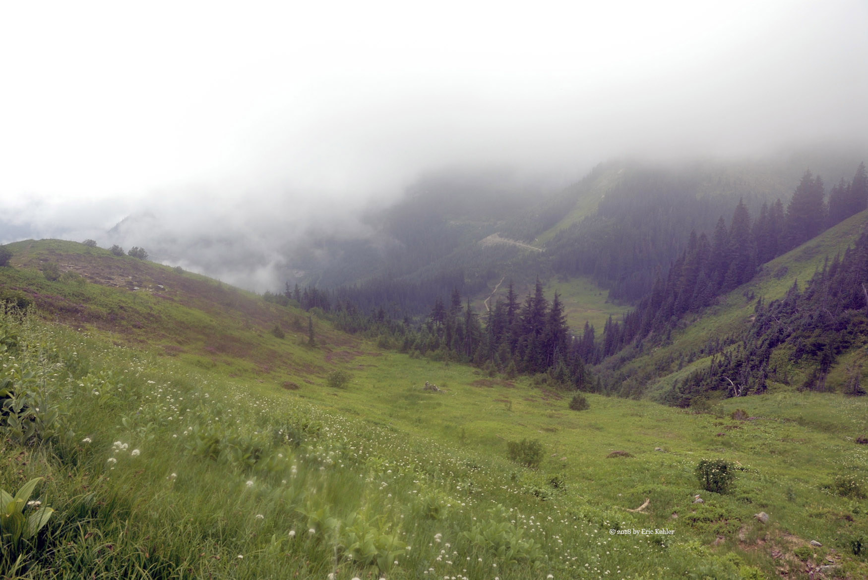
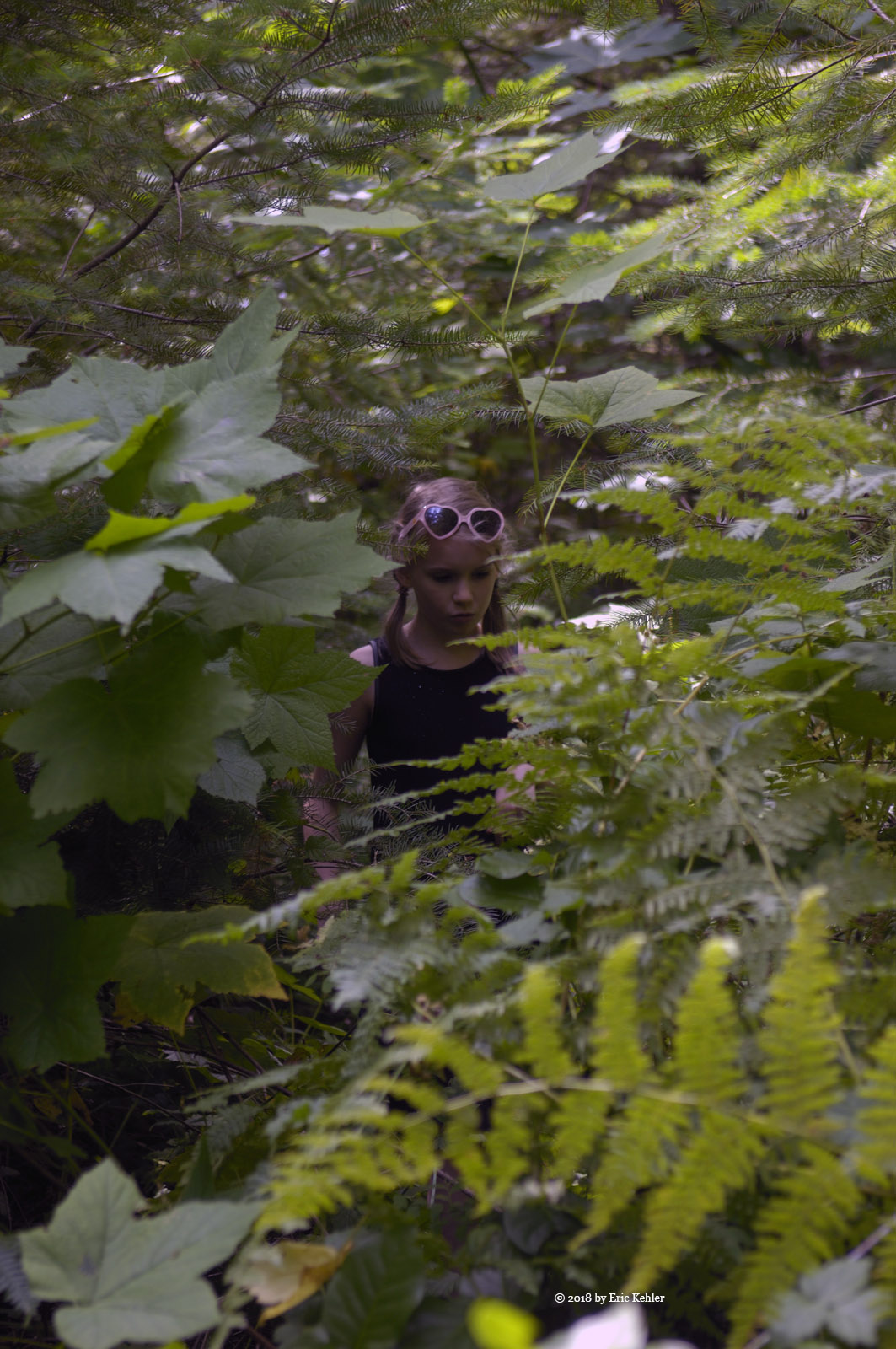
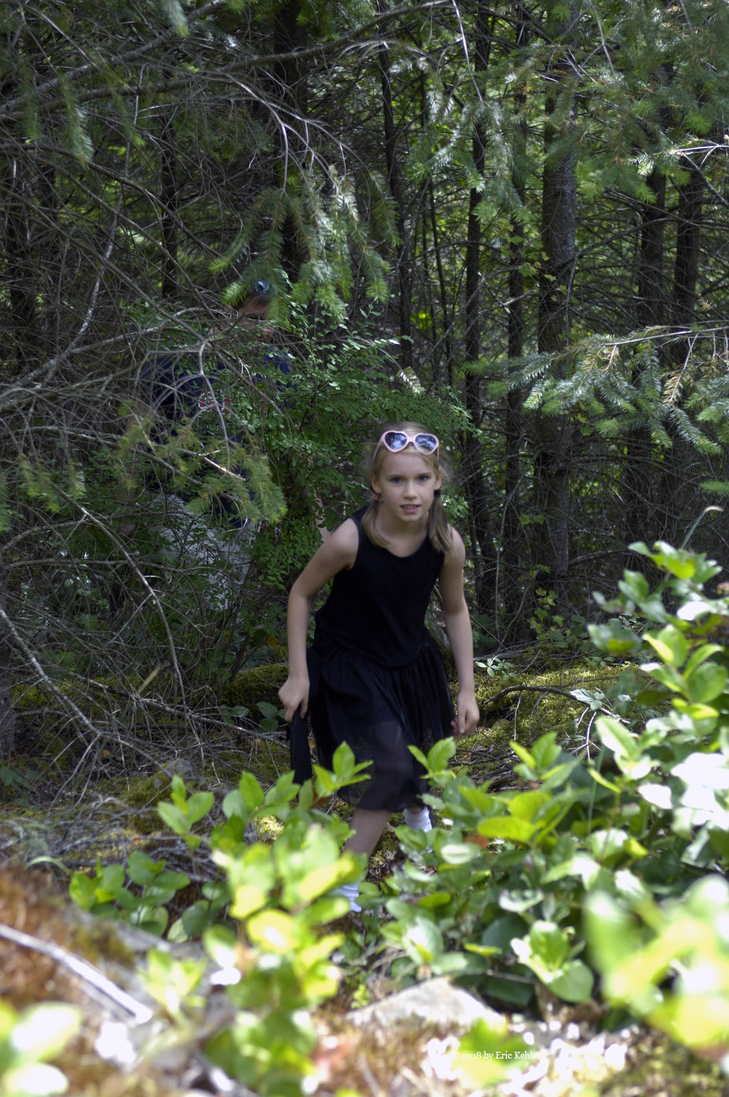
The initial part of the hike was along the over-grown road that we were parked at the start of. This went fairly quickly as it was mostly clear, just a few overhanging branches in the way. When we got to the area I marked as to where we turn up slope ugly dense undergrowth stared back at us! We pushed through the initial bit hoping it would change to mature forest soon, but it didn’t. We continued up very slowly pushing our way through the tall thimbleberry and small hemlock. It was a tiring task. After quite some time we achieved a short open area at the base of a small cliff, it was a good spot to rest for a bit. The next section started off steep and was a bit more open with more mature trees in this area but it still was difficult terrain.

Soon we dropped down onto an upper roadway. Now this road looked to be in poor condition on the satellite view but it showed signs of use and likely we could have driven to this spot! So that was a bit annoying but we just moved on. We followed the road a short way and then cut in up slope. The undergrowth continued heavy but it was for a short distance and then we finally entered the mature forest. Now the understory was thin and we could plan our way up the steep slopes fairly easily. After dropping down a short distance we started up a steep slope and there we stopped to rest. It was here that I noticed my one radio that had been clipped to my belt was missing.  Fortunately it was on and Nick gave a call on his and could just hear my lost one in the distance. I dropped my pack and retraced my steps while Nick continued to call out on the radio. I found it just inside the last of the thicker bush area.

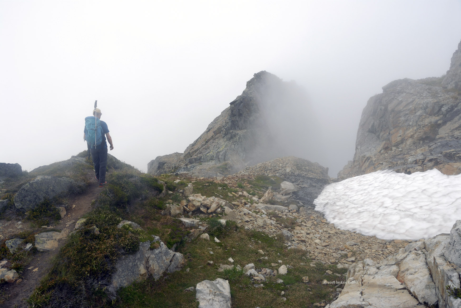
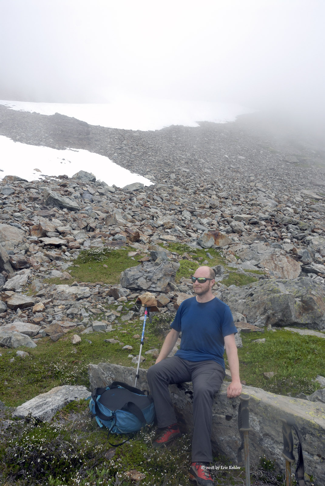
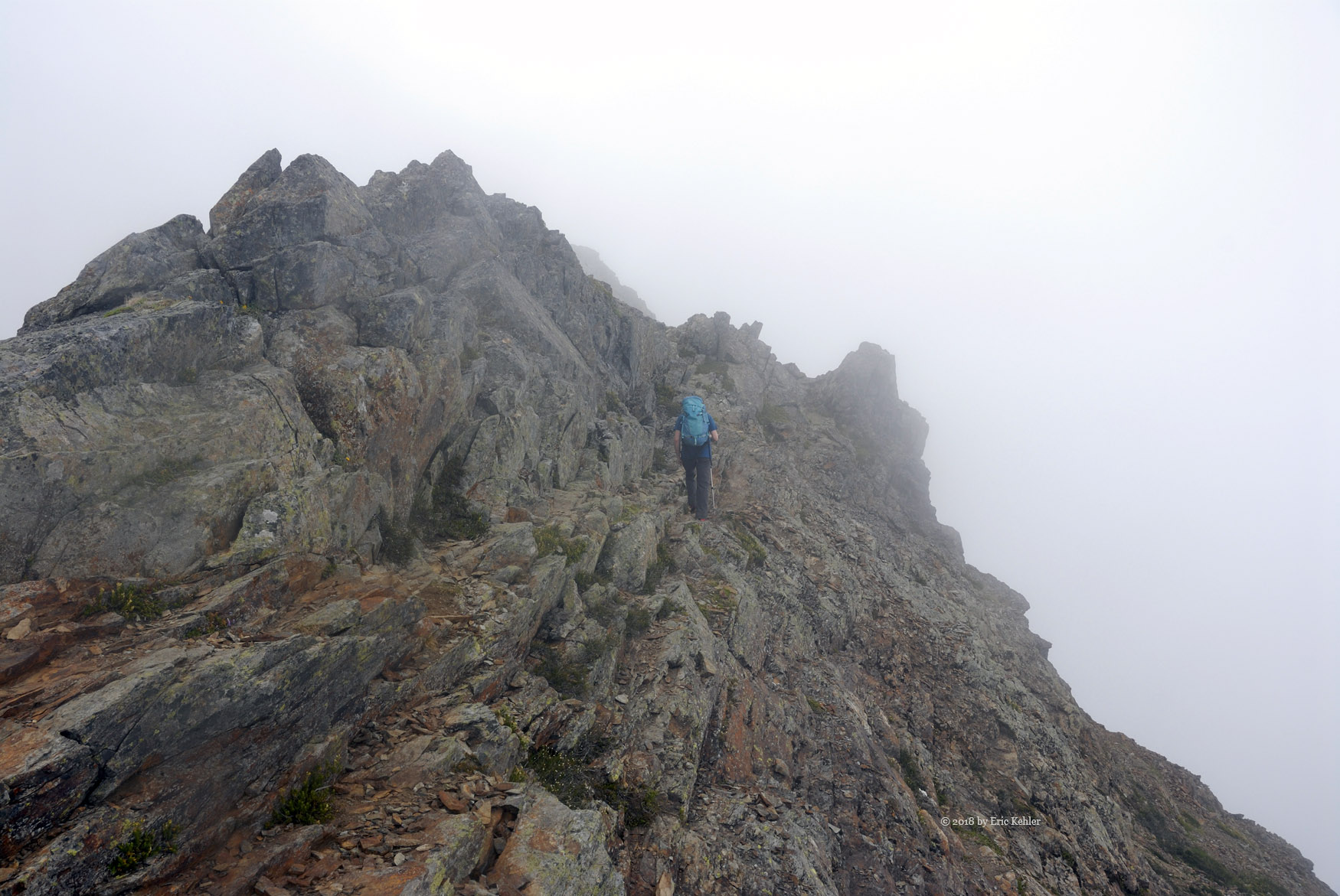
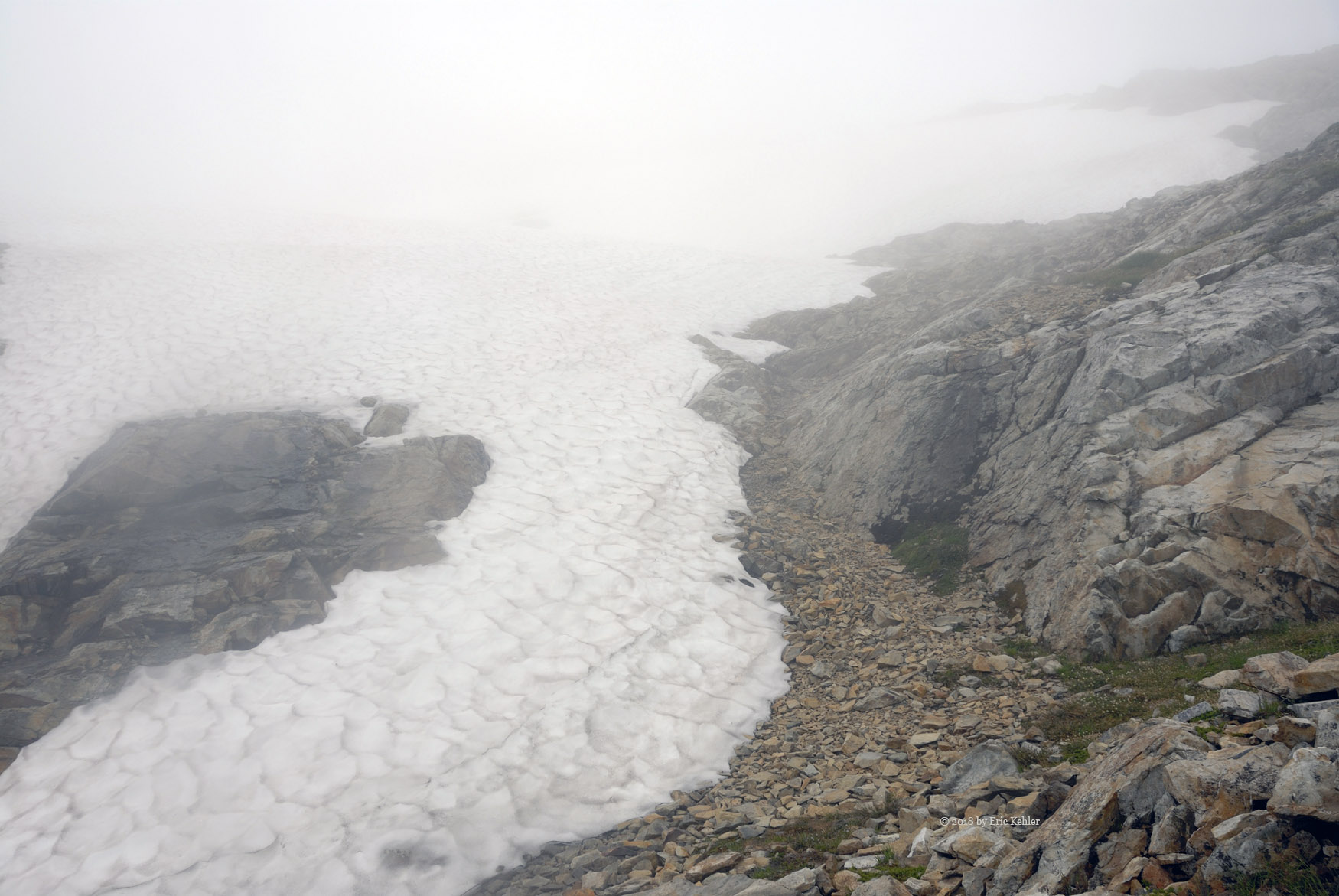
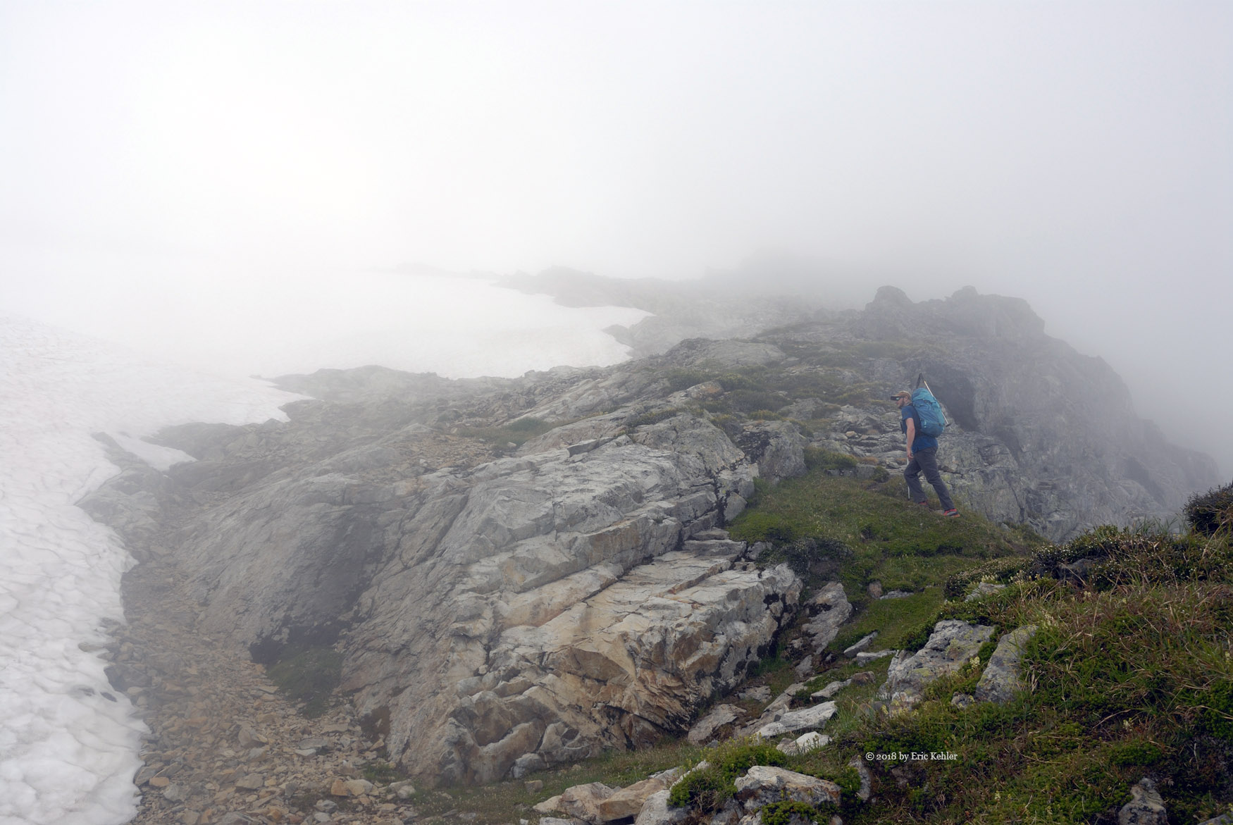
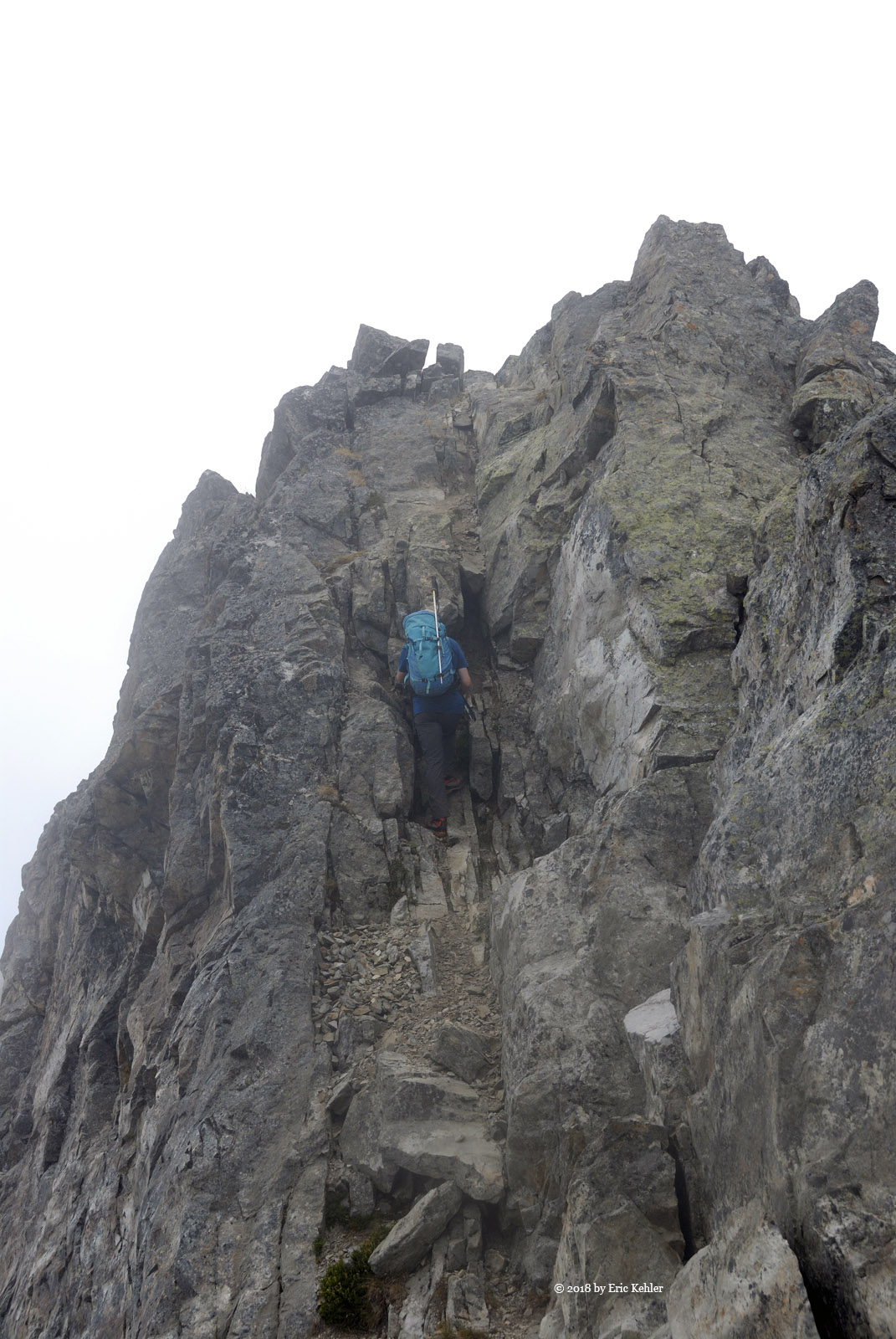
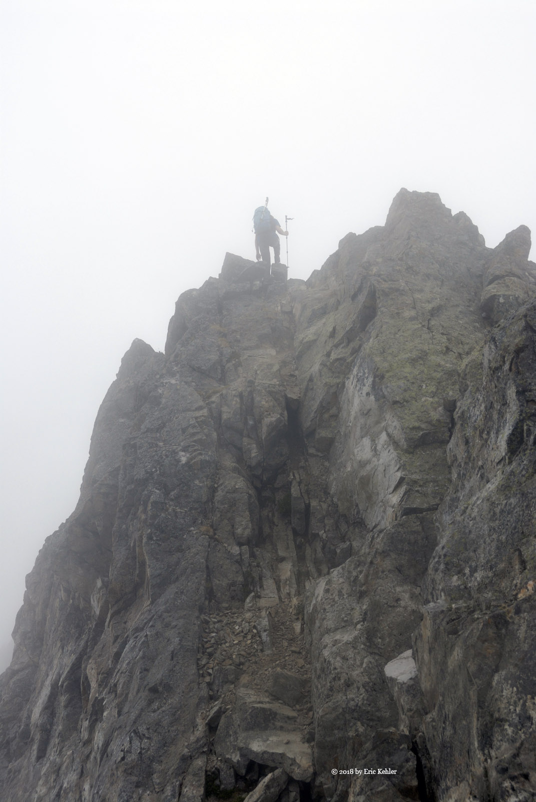
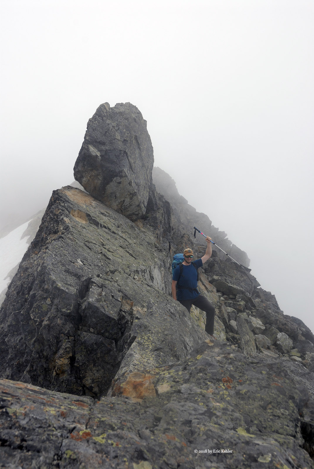
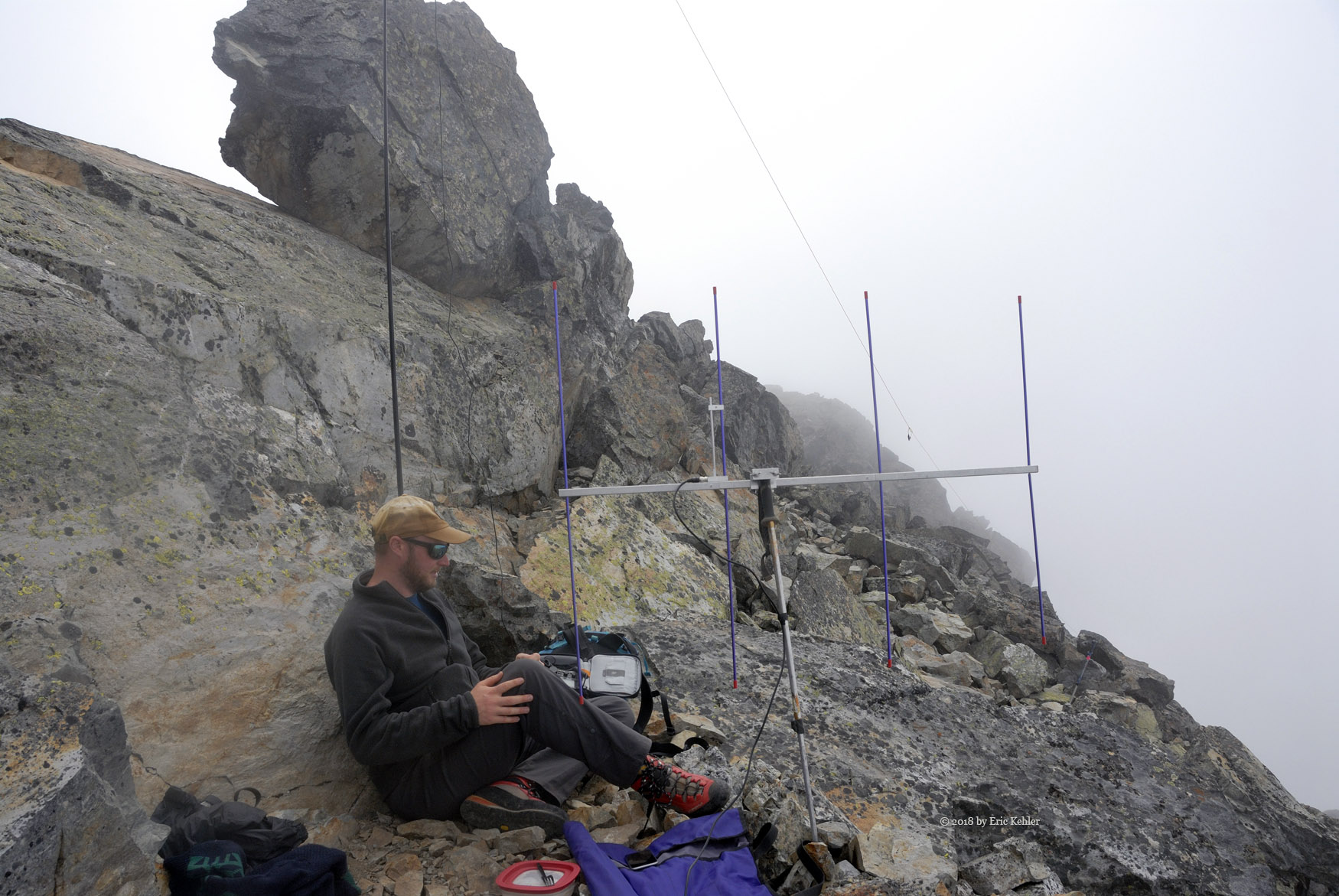
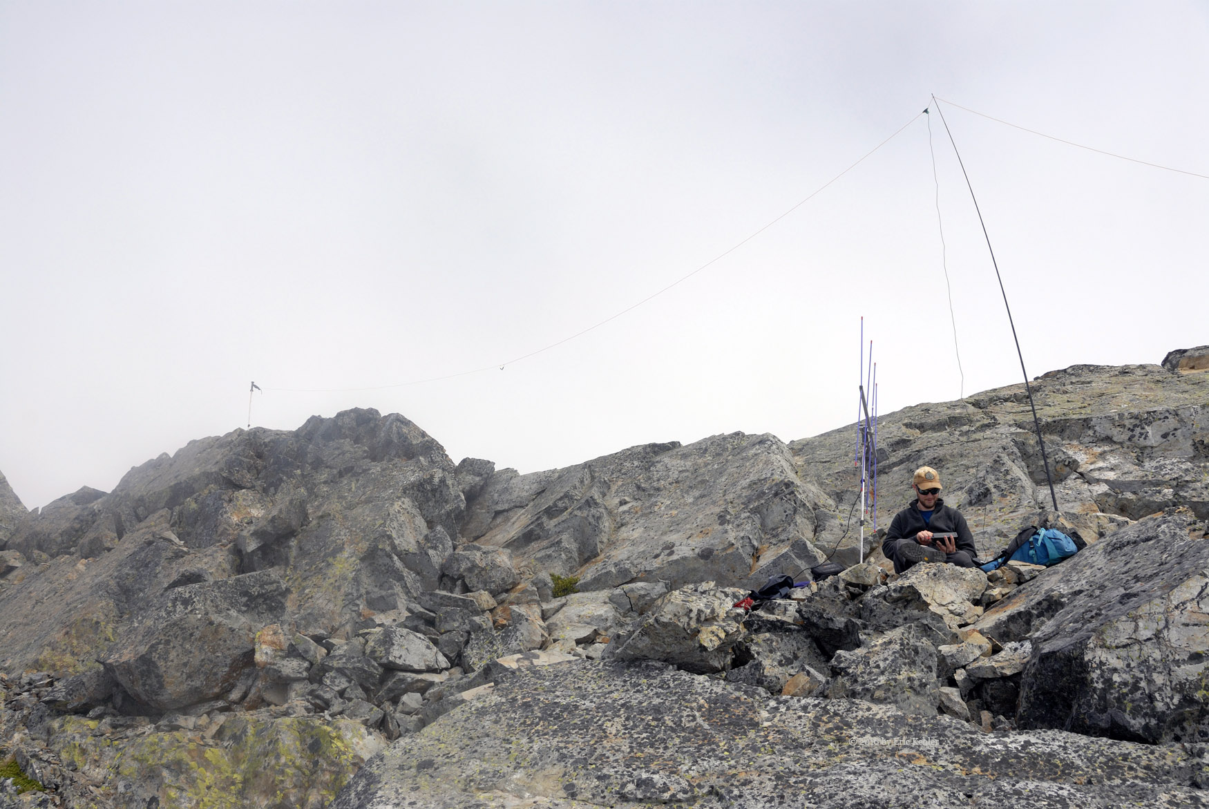
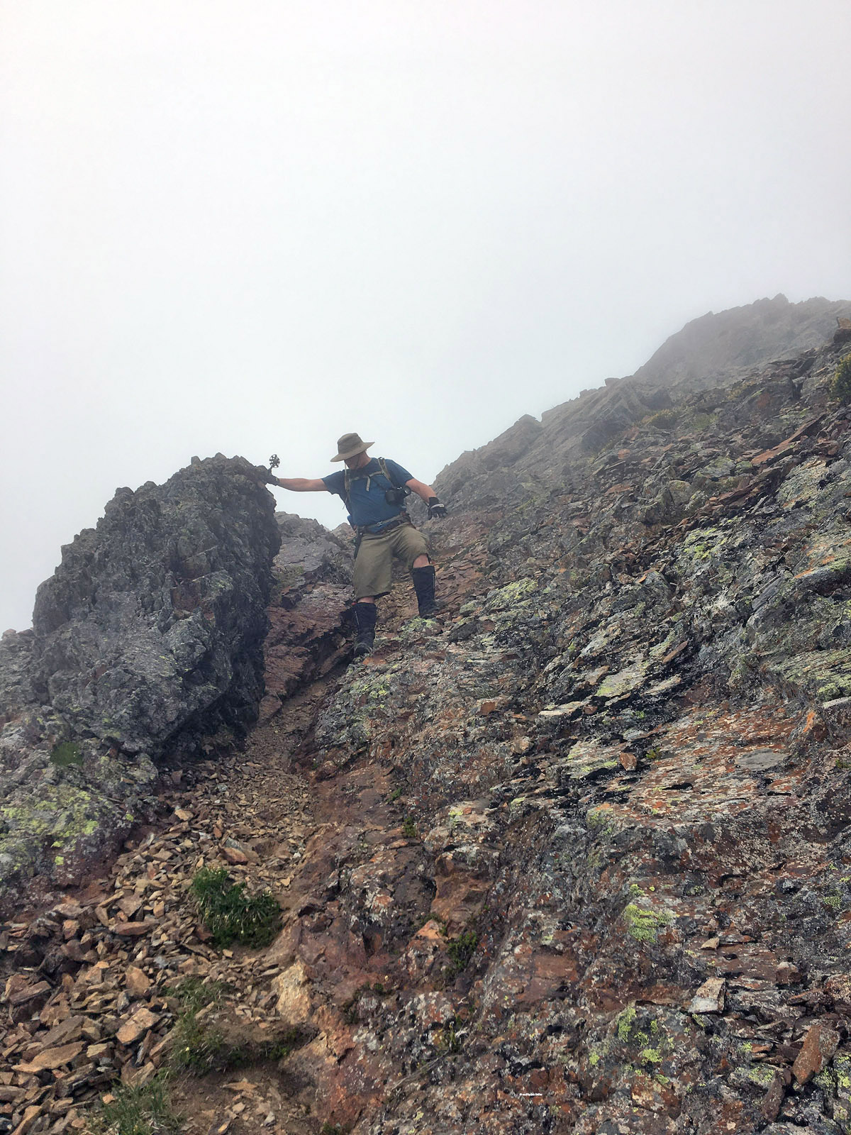
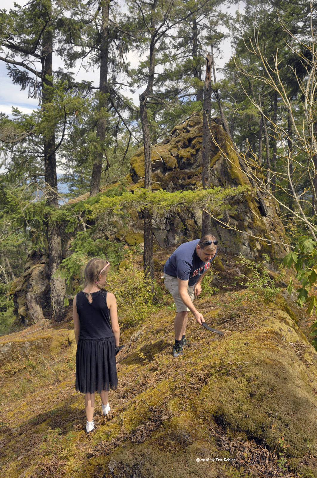
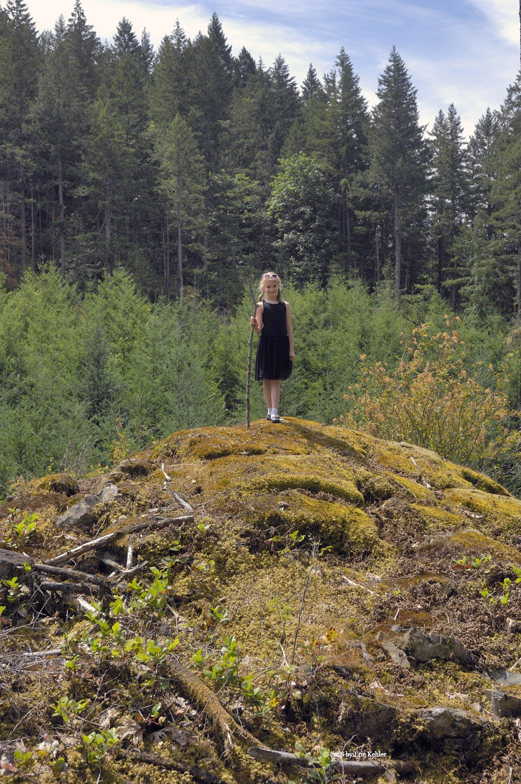
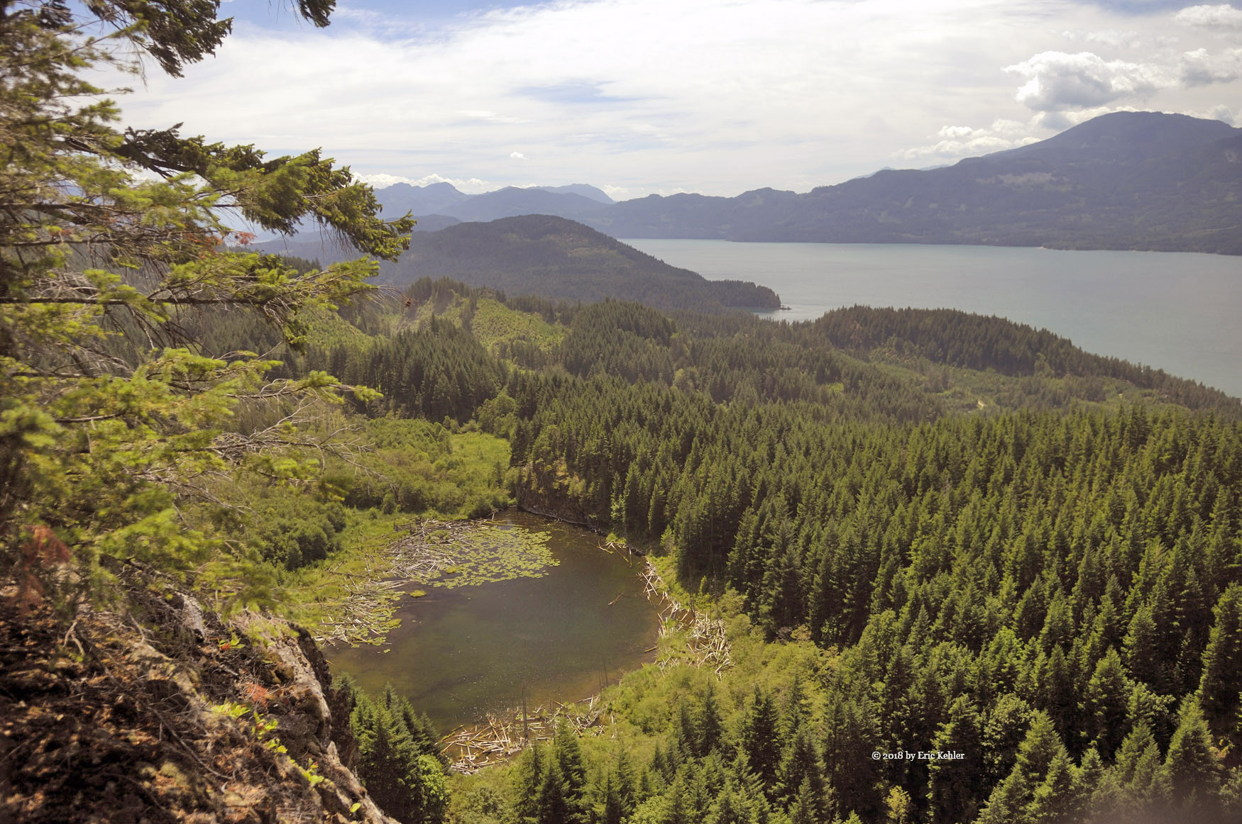
After returning to Nick I let him decided if he felt up to continuing, he didn’t want to be defeated by the summit so on we pushed. The route went over several steep inclines followed by some level and even drops as we made our way closer to the summit. Finally we arrived at the broad top of the hill and there we found a nice level spot that enjoyed some sun, most of the area was blocked by the thick tree-cover. After a breather I set up my yagi antenna and started making calls to activate the summit. I was able to work my wife and then Ralph. Next was club member Ken but I had no luck reaching a fourth contact from the summit despite trying for 45 minutes.

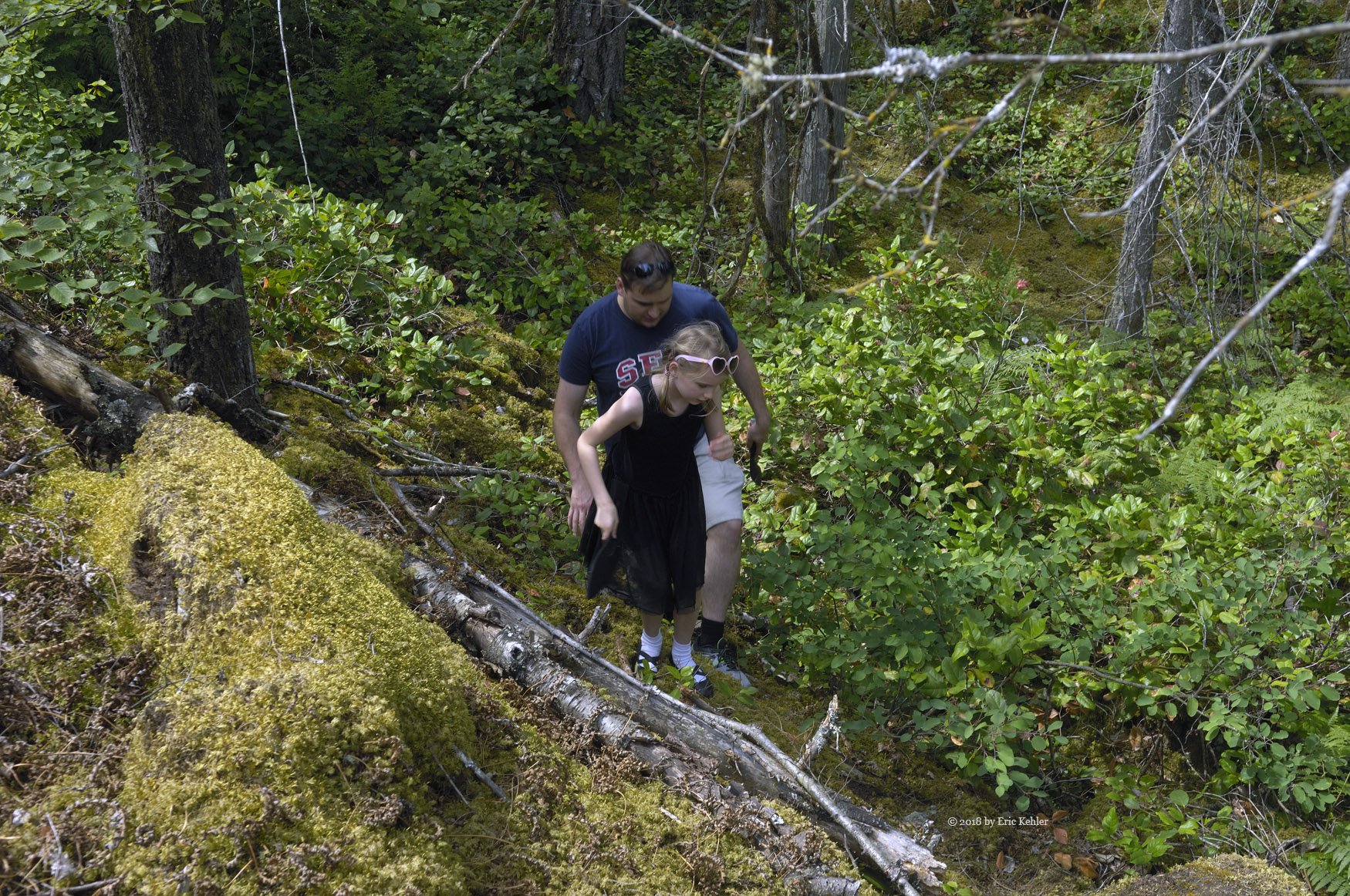
Well we had been up there long enough, and as the ascent had taken 3 hours we wanted to get back before much longer. We made good time dropping down through the mature forest and the short section before the upper road went quite quickly. If only the truck was here. Now Nick picked a spot to descend to the next clearing but he was too far east and we ended up having a small cliff to navigate as we made our way down. Soon we were back to the small clearing above the dense section. We dove in and swam our way through it, getting scratched and poked as we moved. Nick had a number of slips as he descended but fortunately nothing of a serious kind. Reaching the bottom road couldn’t come fast enough and we were both quite exhausted when we popped out of the Thimbleberry onto the road.

The last walk back along the bottom road seemed to take forever but we did finally reach the truck and were able to get a good rest as we packed up and started off the road with the truck. So it was a difficult hike but we enjoyed the success of reaching the summit and getting the first activation of it. Hopefully the next one will be much easier.


Activating the Lady

For the past few years I have wanted to return to Lady Peak and to be the first to activate it in the Summits-on-the-air program. I last hiked the mountain back in 2010 and though I got to the top ridge I was a bit shy of the summit. On that hike the clouds were quite thick at the top and it made it look like twilight. Visibility was low enough that the next part of the hike looked like a looming pillar in the dim mists. I was there with another hiker I met on the route and we both felt it was not safe to push further. The location seemed to be at the summit elevation so we felt like we had gotten close enough.  Recently I wanted to retry that section and get to the marked summit location.

So here we are in 2018 and I had the opportunity to do a hike with John Bell who is a professional outdoor guide. He also wanted to activate the peak and so it was an opportunity I couldn’t miss as he was likely the only one I know who would do this hike. We decided to go mid-week as the weather was cooler and the crowds would be absent. The Lady Peak hike shares the initial trail with the Mount Cheam hike and on the week-ends that one may have 200+ people on it. So as we neared the parking area this morning I wondered about how many vehicles would be parked in it,  there was only one jeep! That was so nice compared to last time!

We quickly got our gear organized and started off, the day was forecast to have a chance of rain but as we started out the sky was mostly clear and we had some nice views of the summit. John set a nice pace, fast enough to make decent time but slow enough to not get too tired. This got us moving along at a good pace for me and I think I was going faster along the trail as a result. One hour in we were at the point where the Lady Peak trail leaves the Cheam trail and there we took a few minutes to rest before starting up the steep section ahead.

Now this next section of trail follows a shortcut from the original Lady Peak trail. It is much steeper but saves quite some distance and now shows as the marked route. The trail makes its way up alongside a bare section then turns east to gain a more level section at the base of a steep incline of loose rock. At the top of the rocky section is a 20m cliff face that we must cross to the edge of to continue up. It was around 16 years ago on this very section of rock where I was struggling to climb a few feet at a time that I met a chap sailing down the slope at a fast pace, we chatted and I learned he had started the hike less than 2 hours earlier, I was already well past 2! It was at that spot and moment that I chose to start an exercise program so that I could hike these summits more effectively. Well here I am making good time and barely needing to stop for a rest as I hiked past that spot of 16 years ago!

As we neared the cliff, I mentioned to John that on previous hikes I went to the right, John looked to the left to see if he could spot a trail but none was seen so we crossed the loose rock and started across a snow pack. It was slow going as we had to carefully plant our feet to prevent a slide. We angled down a bit and soon were at its base and making for the far side of green Heather to continue our way up. Following some cairns we soon were above the cliff and on a worn trail heading towards the western ridge above. As we reached the next snow field we stopped to rest a bit and then started up beside the snow. Soon we reached the base of some large rocks, John scouted ahead to find the trail, I mentioned that we stayed below the rocks and bore south before ascending higher. Having viewed the other route he saw that it ended in a drop, so we continued below the rock face and soon were able to start climbing again.

This next section involved steep scrambling over various types of rocks and loose gravel and after a 100+m we reached the upper snow field which was melting and making a stream that flowed down slope. There is a narrow gap just to the north edge of the bottom of the snow field that drops off to the far side of the ridge. Much of the melting water was falling through that gap. With a bit of cloud blowing up through it, it looked very ominous.

At the top of this snow patch the we found the trail that continued to the summit. Up here the far side of the ridge has a deep drop down the north side of the mountain. We hiked just below the ridge continuing towards the summit. It was right around here that I stopped on my previous hike. Fortunately today the clouds were higher than our current elevation and so we had a good view of the rocks and narrow gap that lay before us. The gap was only 2 feet from the sheer drop off the ridge so I was a bit hesitant to continue forward. This location was now within the valid activation zone for SOTA so we could operate here but I really wanted to do better this time. John went on ahead to explore the rest of the upper ridge. He just scrambled up the gap with barely a stop. After a few minutes I decided to edge closer to see how it looked.

The gap actually didn’t look too bad as long as one concentrated on the rocks and not the drop a couple feet to my left. So I started through the gap and soon I was on top of this pillar and looking down on John as he made his way back towards me. He was glad to see that I had given it a go. I continued on and there we found a wider spot to rest and eat lunch. As I settled in I heard a call on the radio from Ralph back at home in White Rock. As we were talking my wife Carolyn joined in and I got them to switch to simplex and soon I had both Carolyn and Ralph in the log book using my simple hand-held with a small whip antenna! The summit was activated!

After lunch I set up my main 2m radio and yagi antenna and John stretched out his HF antenna, he was trying my KX2 radio for this adventure. We both got in the needed number of contacts for the day and then we packed up. Now we were excited that we gained the points for the summit but though the clouds were not overly thick they were below us and so our view consisted only of our ridge and a 100 or so meters below. In other words, no view! It was a good thing we didn’t primarily come for a view. A shame,0 but it isn’t much different than that of Cheam which we have both enjoyed on an earlier hike. Well we started to retrace our steps back down the slope. John picked a few different routes as we descended trying to find an easier path. We made good time and soon were back to the more level section below the upper ridge but above the cliff. Here John found an alternate marked route that lead down the opposite side of that cliff face we had to go around on the way up. This route is shorter and leads through short stubby trees, they provide good grips for lowering oneself down the steep face. Near the bottom we relocated a flagging marker to make it more visible to those ascending. We came out very close to the spot where we decided to turn right when we were on the way up!

Continuing down we made good time down the loose rock and then through the heather to the point where our trail joins the Cheam trail. We did hear voices from that other party at a few points as we descended this slope but never did we see the people. So we really had the mountain to ourselves. After a short rest we followed the well-travelled trail back down to the bowl and Spoon Lake. As we approached the final section overlooking the lake we saw another larger group gathering next to it. They were on their way up. We finally reached them next to Spoon Lake and they asked about the views, we told them that the clouds were blocking any. But they continued on. It being 4:30 already I questioned the wisdom of them continuing on at this time. Hopefully they didn’t try for the whole distance. We were soon back at the truck and offloading our gear. A long day but rewarding and well worth the effort. Now to face the rough road ahead. I am looking forward to doing another hike like this one with John, he is a fun partner to go with and makes the hike go so smoothly.

Lower East-side Harrison

Today was Elizabeth’s second adventure into the hills with her grandfather and dad. Ethan thought a gentler road with a lake would be a good second trip and so I suggested the east Harrison and to there we went. Our morning began a bit after 8am with the loading of the truck and the essential first stops. The one key stop Ethan required was to Davis Meats to pick up some real beef jerky. Once the beef was in hand we made quick time to the start of the forestry road.

Elizabeth is still learning on how to deal with bio breaks as an 8 year old girl in the bush. Today she thought a dress might work better. So she arrived in a black one that looked cute but the black leather shoes were perhaps not really the best fit for the day. So we set off and did our best to help her along. Once we reached the logging road we switched over to 4x4 mode and continued in to the Slollicum falls. Here we stopped so Elizabeth could see the waterfall and for me to capture a few more photos of the waterfall I have probably shot more than any other. It is always an amazing sight.

After the waterfall we decided to head down to the cascade peninsula area and visit the small rock cliffs that impressed Liam earlier this year. The rocks blocking the road were still out of the way but the trees were now in full leaf so the road was much tighter to pass through. We inched along pulling in the mirrors to keep them from getting wrecked. Driving through the tight space was quite interesting to Elizabeth. Once we got to the end of the spur and the wide turn-a-round we parked and set off through the side-growth for the rocks. This trip the Thimbleberries were tall along the trail, I walked easily through them in the early spring, and today they were taller than Elizabeth. Ethan and I made a path for her and she slowly made her way through them and up to the rocky ledge at the base of the rocks. From there the way was much easier and we were soon on the top of the first one. She seemed to enjoy the adventure so far. Once down again we decided to hike up a second rock. Soon we were heading back to the truck. When I was almost back I heard an ATV on the road checking out the route and they were just leaving as I emerged from the Thimbleberries.

Well it was around 11:30 so we decided to head somewhere for lunch. The main camping beach up at 21km was my suggestion so off we went to the beach area. I was hoping it wouldn’t be overly crowded as it is so popular. When we arrived at the start of the hosted area we stopped to chat with the guy who is this year’s host. He said he arrived in mid-April and has been here since. Previously he was hosting a spot near Lund. He said that the area hasn’t had too many issues.

We drove along to the northern end and found a spot to park, there were a good number of cars but the place was not nearly full like it can get on a long week-end. Once parked we walked to the beach and picked a spot between some logs to cook some wieners for hot dogs. They did taste good up here. While we were enjoying the beauty one of the campers started up their loud rap music. Not really my style but I was thinking why do they need to bring the city up here where they come to get away from it? Well we were almost done eating so we were soon packed up and back on the road.

I wanted to return to the bear creek fsr and see if the locked gate was still ‘unlocked’. Alas when we got to the gate the chunk if link that had been cut out was welded back in place and so the gate was once again locked. We did park at the gate and walk the 150m up the road to the viewpoint which is really quite lovely. After capturing a few photos and walking around the spot we returned to the truck and continued back towards home. I suggested we take Elizabeth to a cliff face with an amazing view. So we turned up the required road and soon were gaining elevation on the side of Lookout Peak. It really isn’t far in to the spot I wanted to show her. Once we arrived and parked we made our way through the stubby pines to the top of the cliff face. It is a great view of a small lake and the big Harrison behind. Elizabeth seemed to like the view and Ethan was able to give her some good teaching on heights and cliff faces. Done with the cliff we returned to the truck and started for home in earnest this time. Ethan needed to be back early for a gathering at his place this evening, so it was time to start back. Though a shorter trip it seemed to fit well for Elizabeth and I know I enjoyed the few hours in nature.

Saint Marks Summit

After completing a hike up Black Mountain last year I turned my attention to the next summit in the area. So for the past year I have been planning on doing Saint Marks some time this season. Since I wanted to do it as new summit in my Summits-on-the-air program it made sense to have Ralph along so we could both get it in our logs. So a few months back I talked it over with Ralph and he was willing to give it a try. A few weeks before our ascent I saw that John Bell was in the area and I invited him along. He was already booked that day but the day before the hike his plans fell through and he was available.

So our adventure begins with Ralph arriving at my house at 7am and us loading into my wife’s electric car for the journey to the trailhead. We met John at the start of the Cypress bowl road and drove up the slope together. We were early enough to find a close parking spot and so we got settled in and our gear on for the hike. Having John along made life on the trail easy as he has hiked the summit before. He took us on a slightly longer route but one that is more scenic and interesting.

The first section of trail is through an old growth forest and some pleasant lily filled lakes. The trail then ascends up the lower slope of Mount Strachan as it makes its way north and to the Howe Sound Crest Trail. The early section of the trail in very well maintained with a solid gravel bed to walk on. Even though it was steep in places it made for a quick walk to the ridge. Just past half way point the developed section of trail stops and one continues on the original one. Now it is still a decent trail but one has to now place their feet carefully due to the many roots growing across the trail. This section of the hike was much slower and tiring.

After a second steep section we emerged near the summit of Saint Marks to find dozens of people roaming around enjoying the various views from the numerous lookouts. The views of Howe Sound are indeed truly amazing. After taking in the sights ourselves we stopped to eat lunch as it was only 11:30 the trek having taken us about 3 hours.

Once we were done eating we started scouting out a position to set up our radio gear for making some contacts. Ralph had his KX1 for CW on 20m, John set up his small transceiver on 40m in the voice mode and I used my hand-held with the 4 element yagi on 2m. Ralph was the first to make a contact but he struggled to pull in the needed 4 due to a very busy CW contest that was crowding the bands. I made a few contacts including with a chap driving the sea-to-sky highway right below us!  I soon got my 4 contacts but John was having trouble with 40m as Ralph’s signal was over-powering his radio, so he had to wait for Ralph to be done. But then he managed to get two other stations both of which were on other summits. It took quite a while to get his 4th. John ended up using my 2m setup but with the yagi pointed due north – straight at the granite face of the Lions! That worked and he had his 4 contacts.

Done with making contacts we packed up the gear and started back for the car. The trail was challenging on the descent with all the rocks and roots but fortunately we made it across the challenges safely and soon we were back on the improved trail thankful to be done with the roots. The rest of the hike went smoothly with the tree of us hams chatting about various radios and antenna projects. There are a number of interesting ideas to try which may help make our weak signals more effective!

Once back to the car and sitting down I could hardly wait to get the A/C going and some cool air blowing on me! We descended the road to John’s car and said goodbye, he would be returning tomorrow to start a 3 day hike along the same trail but continuing all the way north to the end! So it was a successful day, exhausting for Ralph and I but just a warm-up for John. Still, I look forward to hiking the next one.

Twin Lakes

I had hoped to spend the day climbing a hill in the Lost Creek area east of Stave Lake. And so my planning include getting the summits identified and coordinates loaded into my gps. Then to head on out and pick one that looked like we could hike it. Geoff was able to join the adventure along with his two older boys and so we were mostly ready for the adventure. Now all we needed was a cooperative nature with a dry day. Alas nature was not cooperative and the day had showers throughout the morning.

Despite the weather, the day was exciting and full of adventure. We set off for the usual spots when setting out for the hills and soon we were approaching the start of the Lost Creek FSR. This area used to be a huge hangout for those shooting guns at targets. It had gotten crowded with shooters, often too close to each other, and so last year the area was closed to target practice.  On arriving we noticed a distinct lack of vehicles in the area! That was quite a relief.

My first summit was to be Weatherhead Peak and we drove straight to the side road that the maps show as leading up the slope. Well just in from the start is a new gate, locked and annoying. So it was on to the next lower peak. It looked possible but the rain quickly dampened our interest. So we decided to head out to the twin lakes side road. This offered a few options as the area was open to target shooting but the road had a huge diversion on it which prevented the truck from accessing the lakes. New roads on the south side were now there so we took the turns which got us on the newer roads. Driving these along the side of Alligator peak was interesting but we were above the lakes and they were not easy to access from them. So when we reached a difficult cross-ditch we decided to forego further travel and try for the old road that did snuggle up on the larger lake.

We back tracked and then continued on to where the old division had stopped me earlier. Today the ditch was well eroded and travel across it quite easy. So on we went and soon we were pulling into a small spur that ends at the lake. Here we arranged the truck and took a few moments to rest before setting up a tarp as the clouds continued to remind us we were in their territory. The boys were having fun running around, exploring a small pier over the lake, tossing rocks in the lake and eating some salmonberries and wild blueberries.

The day did improve as noon came and went. We cooked a nice hot meal over our stoves and ate enough to be satisfied for the day. Done with food, it was back to skipping stones on the lake and doing a bit of target practice in the only area not restricted. Ben managed to fall in the lake and get his pants soaked. That was OK since we had a change for him, except we soon saw that that did not include a second pair of shoes! Once we had tired of the area we packed up the tarp and gear and started back up the short spur to the twin lakes fsr and saw another vehicle waiting to come down. Not sure how long they had been waiting but they moved out of the way as we came up and then they quickly took our spot by the lake.

Well we were done with the lake and so we decided to explore the rest of the side road to see what we could find. The road continued around the lake and onto some views of Stave Lake below us. The road was quite over-grown in places but we were still able to push through and over some deep washouts. The last time I was here was back in 2009 when we were able to get to a nice viewpoint overlooking Stave Lake. Today, we continued along the road to find the spot but were stopped about 600m shy of the location. At the time, we weren’t sure of how much further it was so we decided to stop pushing forward. The place we did stop at had a bit of a view of the lake and to add interest a good sized garter snake to amuse the boys.

We turned the truck around and started back, on our return we had to push a tree out of our way as the angle to get past it didn’t work as well in this direction. Then we came to the worst of the washouts and got stuck trying to cross. Well, I guess this is why we have the winch so I ran out the line and got ready to pull us the few feet needed to regain traction. Geoff plugged in the control cable and clicked the button, nothing. He tried the outward direction and that worked. The needed inward motion was not happening. Not the best feeling. I tried a few more re-plugs of the cable and jostling of the connector. That seemed to work and now we had a usable winch. A few more minutes and we were across the stream and on our way again. The road was definitely much rougher than 9 years ago but we had fun exploring the area and as it was now getting on, we decided to head on out for the day.

Well, it didn’t get me to a summit but I was able to review the summits and I am now ready to try for a hike later in the summer. My two grandsons seemed to quite enjoy their adventure and they saw a number of new things so the adventure continues.


Stawamus Chief #3

I have wanted a return to the Chief summits for years now but they never seemed to be on the agenda. My first climb was back in 2004, 14 years ago so it was definitely time to revisit the area. It was not a hike that Geoff or my other partners wanted to join me on so it needed to be tackled on a day when they were not available. Well that day finally came and the summit was calling. I also wanted to do it as it would be a new unique activation for me in the summits-on-the-air program.

The morning began at 6:30 and saw me finish loading the car. As this hike didn’t require any forestry roads I was able to drive a car right to the parking lot at the start of the trail. Today I took Carolyn’s all electric Bolt with the goal of seeing how its range held out. So once the gear was stowed I started out for the nearest Starbucks to finish the prep for the hike.  Wouldn’t you know it but when I got into line for coffee it was quite long but once I got my coffee there was no line! So typical and annoying.

The drive went quickly and soon I was looking for a parking spot, the day use area was full and cars were roaming around looking for a gap, the rock climber’s area was also full. Fortunately there was a third lot a bit further along that still had lots of space and there I parked and got my gear loaded. I started my hike by walking back through the chain of parking lots and then the campers’ lot and the actual campsite. And then I saw it, the start of the 2000+ foot climb, a set of stairs made from placed rock. That was new since I was last here.

The rock stairs quickly turned into steep wooden stairs that continued upward for a long distance lost between the trees! The stairs were familiar though they looked well maintained and likely replaced since I was last here. The trail was full of people climbing and descending the stairs. It was a busy place obviously very popular with the improvements in the area. I started up the wooden stairs stopping frequently to regain my breath before trying to raise a weary leg to the next stair. It was very trying especially seeing all those 20 year olds sailing past seeming to miss the whole point of doing penance on a long staircase.

Eventually the wooden stairs end and one is done with the first really steep section. Next came some nicely groomed stone steps that wandered through the trees to some distance place. I continued following them like a dog chasing a rabbit, slowly gaining elevation as the trail made its way up through the valley on the back side of the rock face. Eventually I came to a fork where the route to the third summit splits off from the first two. Most of the crowd was on the left fork but I was headed to the third so the right fork was my choice. This route was much rougher and less travelled, it actually provided some periods of solitude between small groups of people passing by me. The trail was quite steep in places with uneven boulders and loose rock which made the trail a bit more challenging, more so on the return.

After what seemed a long journey I reached the upper fork where the trail connects with another that crosses between 2nd and 3rd peaks, here one can go either way. I continued upward to the higher third. The last bit of trail wasn’t overly long or steep and soon I was breaking through the trees and onto the top of the rock slab that forms the chief. The third summit is very broad and even has a small pond on its top. There are clumps of stunted pines scattered across the broad area and other hikers were able to find small nooks to stake out as their own. I continued to the very highest point and there I settled into an area next to some pines which offered a bit of shade yet still provided a good view of the city of Squamish below. I dropped my gear and wandered a bit gathering a few photos of the views. It was now just past 11:30, I had completed the ascent in 2.5 hours, not all that bad, even considering the pace set by some of those younger people.

Well I could now take a bit of a rest and eat my lunch before setting up my radio gear. I soon had my 2m yagi pointed at Squamish and started putting out calls for a contact, nothing. I kept trying but no response. It was getting very irritating, I didn’t put out all that effort to be left shutout. So I decided to set up my HF radio, here the pines came in handy for stretching out the antenna. The HF bands were virtually dead except for one strong signal that was chatting with another station but he couldn’t hear my small signal.

So it was back to 2m and eventually I got a response! Finally, I had activated the summit! I kept trying for the 3 more contacts I needed to get points. My second contact was with John a local ham who I have visited with during some trips into the local hills. He said he would get his brother to call me from his home on Salt Spring Island. Meanwhile I got a third contact from a local in the homes just below me. Finally John’s brother got through and I had my 4 contacts! So satisfying. We chatted for a while and then I packed up the radio gear. And started the trek down.

I decided to take the fork to the second summit and on the north sub peak of the second I watched a guy walk a slack line suspended between the second and third summits. It was only spanning a drop of 600m! There he was slowly inching his way across the rope. He did slip a few times but his harness caught him and he was able to get back up and continue on. I was getting vertigo just watching him!

I dropped off the summit and returned to the trail I ascended on, this time making my way back down and over the rough rock that I did on the way up. It can be much harder going down, one just doesn’t need as many rest breaks. Not much before the wooden stairs I did manage to finally slip and fall on a rock. I scuffed up my left knee but not much more. A bit further and I was on the wooden stairs and making my way back down to the ground level. There I stopped to chat with a couple who were guiding a small group of friends. He had done only the first summit but we commiserated about him needing to wait for others, while I was alone and could go at whatever pace suited me. I looked at my clock and saw that I had made it down in 1.5 hours! Actually a very good time – 4 hours return for a hike listed as requiring 5 to 7! I guess I shouldn’t feel too bad that some of the youngsters passed me but I suppose I did better than many.

I continued on back to the car and enjoyed a nice cool fruit juice and then started the drive for home. The car did really well on the curves and hills and once home I realized I had used only half of its range. So the electric did well and had no problems with a 200+km trip. I can now feel I have completed the Chief, having been on its highest summit. I guess I can try the Stawamus Squaw next!

Norrish Creek

Afew weeks earlier I had discovered that the gate blocking the Norrish Valley was no longer closed. On that day I drove in a ways and decided it really needed a full day to explore the area. Well today was that day, joining me for the adventure was Geoff and two of his sons – Liam and Ben. It was Ben’s first time in the hills with us so it was going to be a special day.

As usual we started off with the normal stops for coffee, fuel and beef before setting out for the hills. In all it went quickly and we were soon on the start of the logging road. Ben was quite annoyed at first at all the bumps and jerks we were experiencing as we drove the start of the mainline. We didn’t press the point that this was actually one of the better roads. In no time we had arrived at the nasty gate and sure enough it was open. So in we went and made fast time to the 18km point which was where I turned back last time.

Today we stopped at the wide cleared area as I did before and let out our two young ones to stretch their legs. Ben was quite amazed at the sights, he ran around climbing some rocks and piles of logs. Next he wanted to shoot his air rifle. Geoff setup a coffee cup for a target and then worked with Ben showing him how to hold his rifle and aim it. Though he tried to get him to aim properly Ben was more interested in just firing it off in the general direction. Safety instruction was paramount in Geoff’s teaching.

Once we had rested a bit we piled back into the truck and started up the valley to the next fork. This fork was supposedly the current mainline around the lake and on to the next valley. So we turned up it and followed the major branch at each turn. Our first direction led us to the service road for the transmission line. We continued to the first tower and there we stopped to have a look. The sides were quite steep which was creating a concern in Ben. He wasn’t sure he liked being out here.  We coaxed him out of the truck and soon he was just fine. Liam on the other hand had gotten too close to the edge and slide down slope about 10m. It was to slippery on the steep incline to come back up directly so we directed him sideways to where the slope leveled off a bit. He was soon back up with us.

The next fork led us to Davis Lake. On my map this looks to be the major route but just past where the road starts around the lake the road is washed out and beyond the washout the road is well over grown with much windfall covering it for as far as one could see. Definitely not the main route anymore. We stopped to explore the end of the usable road the boys looked over the small stream and then some huge rocks which formed a shallow cave. Once we had returned to the truck we backtracked and then  continued up the current mainline heading east.

The road forked again with us choosing the lower right-hand direction. This continued along the Norrish Creek valley heading south-east. The road was quite drivable but we eventually came to a deep washout with a high embankment blocking part of the road. In a shorter vehicle it would be very doable but in our truck it would take some careful planning and the return would have required winching. So after gathering a few photos we returned to the previous fork and started up a very steep road. This continued well up the slope and eventually we came by additional branches one we tried which looked like it would continue around the slope to the next valley but it stopped us very quickly with deep snow. We decided to follow another fork which led us upwards eventually stopping just below the ridge where the towers were situated. It was a broad level area with a great view of the valley below. We had it to ourselves and as it was lunch time we decided to cook our meal here while enjoying some sights, sun and even a couple of radio chats.

While we rested, Geoff did some target shooting with his .22 and Ben continued to shoot his air gun. The lower part of the road was restricted for shooting but way up here we were out of the zone and so could do our little bit of target practice. Once done with lunch and shooting we started back down stopping at each branch to explore the options, at the first stop we discovered a very interesting ground vine covering some rocks, the stem of it was incredibly strong.

We continued trying side spurs as we descended to the mainline but all were quite short and we were back to the bottom very quickly. By now we all felt a bit worn out so we decided to call it a fun day and start out. The bumpy return went without incident. There were a few ATV’s out but the place was quite empty, pleasant to visit. Ben seemed to quite enjoy his first adventure with us. So I am looking forward to our next one.

Chilliwack Lake – Sort of

The grand kids are coming of age, all too soon, Liam has been on a few trips but today was to be the first for Elizabeth. Ethan wanted to start her off easily so we picked a nice trek to Chilliwack Lake and the wide beach area two thirds the way down the lake. This would expose her to a bit of rough road and then allow her to enjoy the beauty of the lake. Well, most of our plans worked out but not quite all.

We began the day as usual with the arrival at my home of whoever was joining me for the day. We loaded up the truck and realized that Elizabeth had no jacket. Now the day started warm but up in the hills it is less predictable and the clouds were thicker now than when Ethan left home. My wife found a jacket for her and we set off for coffee and fuel. The drive along the highway went quickly as did the drive along Chilliwack River Road. We stopped at the Lindeman Lake parking area to use the outhouse and then made our way to the start of the gravel road.

The first thing we noticed was that the park had a no campfires sign posted! Now that would get in the way of a wiener roast. But we continued on to the road and soon we were bouncing all over in the potholes. This road does tend to be very bad for them and so it was a rough drive over the next number of kilometers. We came by a couple of nice waterfalls that caught Elizabeth’s attention and so we stopped for her to look them over. Finally we came to the spot to park for access to the beach area.

We parked the truck and made our way down the trail to the water. Unfortunately we were stopped well short of the beach! The water level of the lake was very high with spring runoff and the path was under water! Looking forward we realized that the beach area was also mostly submerged. At first I thought of working my way through the trees to get to the beach but we decided it wasn’t worth the bother as the beach was mostly missing and with the campfire ban it was better to look for a spot outside the park where we could eat lunch.

So we returned to the truck and continued further south along the road eventually coming to the far end of the road where the bridge is barricaded. A bit before the final bridge the creek was over-flowing its banks and washing across the road. It wasn’t deep but it would be a fun drive for Elizabeth to experience a water crossing. So Ethan took her across and back again while I took a few photos. A bit back from the water was a side spur that was less travelled which headed east into the bush area. It was a deactivated road but without the potholes it was actually much smoother.

Eventually we came by a pair of downed trees blocking the way forward. It wasn’t too much effort to get out the chain saw, and soon we were on our way. Not much later the road opened up into a clearing and here Ethan thought we could spend lunch and build a small campfire safely away from any trees or grasses. Once we had settled on the spot Ethan remembered he had found my lens cap fallen on the ground fairly early on and he handed it to me. As I was putting it back in my pocket I realized my cell phone was missing! Did it fallout at the same place? Ethan wasn’t sure where it was that he found the cap. I thought that perhaps it fell out when I was sawing the trees so I drove back there and looked around but found nothing. So it was back to camp for lunch.

After cooking some wieners and s’mores, we packed up the site and started back to the main road. When we came to the sawn trees Ethan suggested we have another look. So we drove past the trees and parked. As Ethan was making his way back to the trees he spotted the cell phone leaning against a weed at the side of the road. It wasn’t near the trees but was near the spot where I was starting the chain saw! So I the end we found the missing item and life was even better once again.

We then continued on to the main road and drove up to the viewpoint just north of the beach area we had planned to be at. By now the wind was really whipping down the lake. I think our secluded spot nestled up the side valley was the better place to spend the afternoon. I gathered a few photos of the lake and mountains and then we made our way back up the rough road to the pavement. That road does tend to wear one out with all the jostling around the cab. But we got out in one piece, I’m not sure what impression we made on Elizabeth but hopefully she will look forward to a second trip.

The final drive along the Chilliwack River road and highways went without incident and Elizabeth was catching a few moments of rest while her father drove us home. I enjoyed the adventure, not as much exploring as I would normally do but it still felt refreshing to be out in the hills breathing some fresh air.


Sunset in Ocean Park

The Ocean Park Beach area is a lovely location for viewing a sunset. Easy access and a clear view of the setting sun. Today there weren't many clouds to add some colour but the scene was still beautiful as the sun sank below a distant cloud.

McKee Peak

Ralph hadn’t activated McKee Peak in the summits on the air program and as he was looking for an easier hike to start off the season, McKee was a good choice for the day. I hiked it last year with Carolyn so I knew where to park and the basic route up the trail which made for a quick start and no unwanted detours.

We left my home at 8:30 and made for the normal next stop – coffee. That is normally followed by a fill-up for the truck but today we were on pavement the whole way to the trail-head so we used Carolyn’s EV. It felt good zipping by the gas station running on pure electrons! Soon we were pulling into the parking area and getting our gear loaded and ready for the hike. It is only 3km each way so not an overly tiring hike but it still takes some effort. The initial trail has a few steeper sections but it soon slows the elevation gain for a bit as one reaches the level of the highest houses. There is only one spot where the trail nears a property and the house can be seen, everywhere else is quite secluded.

As one nears the summit, the trail opens up into a wide meadow, this is the only area where one gets some view of the valley. It was fairly hazy so not much could be seen from the summit today. The pollution is definitely getting much worse in the valley. Continuing on, we soon reached the summit and the radio tower that takes the prime location. There were a couple groups at the summit with their bikes talking over the ride and their planned descent. We moved to the south side of the tower and there Ralph stretched out his wire vertical and I my 4 element yagi.

I soon had Carolyn in the log and then a few more stations including on summit to summit with a chap on a peak in the southern part of Whatcom County. Ralph was now working stations across the continent on CW so I decided to eat my lunch. Not much later a rain shower decided to water us and got things a bit damp, my tarp proved useful in keeping me dry, fortunately it wasn’t long lasting. As the rain slowed we packed up and started back down the trail having successfully activated the summit.

The walk down went quite quickly and we were soon back in the car heading for home. A nice easy outing and fairly close by. I can hardly wait for the new updated summits list to come out with a number of additional lower summits that can be done in a short period of time, but I think I will need to get my Morse code into use for many of them.

Subscribe to 2018