
Lady Peak

The weather report showed mixed weather for the day though the likelihood of rain was low there was still a fair chance of being caught by it. We therefore set out early in order to get a good distance along the trail before the heat of the day and to hopefully get back before any rain came. This was also our first drive on the logging roads with our new F250 truck! The old trusty Pathfinder had finally become a bit unreliable and I was no longer comfortable taking it off the pavement. The new truck performed very well for us, it handled the cross ditches on the road easily though the potholes shook us up a great deal. With so little weight in the back and the truck having heavy duty suspension, this road which was badly potholed made for a very shaky drive.

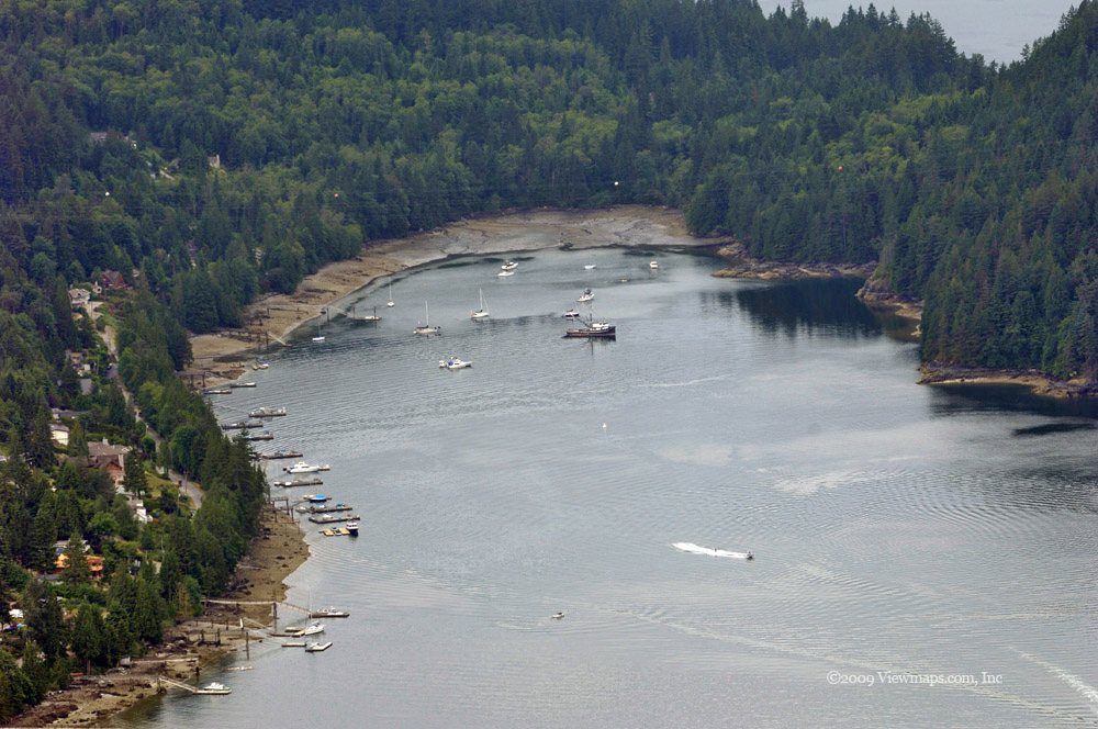
We arrived at the end of the road and the normal parking area at a good start time and immediately began the setup the cross-band repeater. This proved to be a bit slower than expected due to the swarms of flies that were devouring every exposed piece of skin we had. The number of flies we had to fight off was the most I have had to deal with on any hike so far. After setting up the mast I had to fiddle with the beam direction to in order to reach the White Rock repeater, after pointing it south-east and bouncing off of the Cheam range we were able to have reliable communication to White Rock. 

When the antenna was set, we started off on the hike. Once we had cleared the parking lot and its shade trees the number of flies dropped to a more endurable number. We made very good time along the remaining logging road and on into the alpine meadow with the small stream. Spoon lake was still completely covered in mud and dirty snow. It certainly looked a mess again this year. It seems that it isn't ice free till late in August. We made our way over a thick snow pack, past where the lake should be and started on the steeper accent on the slope of Lady Peak. By now the sun was starting to be fairly hot and our progress was starting to slow. 

We were still making decent time through this initial section on the slope and on past the small wooded patch and the long sloping alpine meadow, but soon we started to feel the heat more seriously. After a few rest breaks we had made our way past the meadow and were now on the more rugged slope leading to the saddle point between Cheam and Lady Peak. I had decided to try and find the proper trail to Lady Peak this year rather than follow our previous route which cut up the slope through some very steep areas. So though the trail was longer it was less steep.

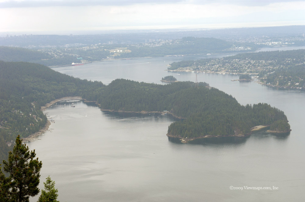
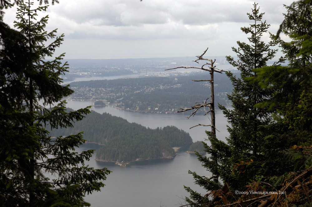
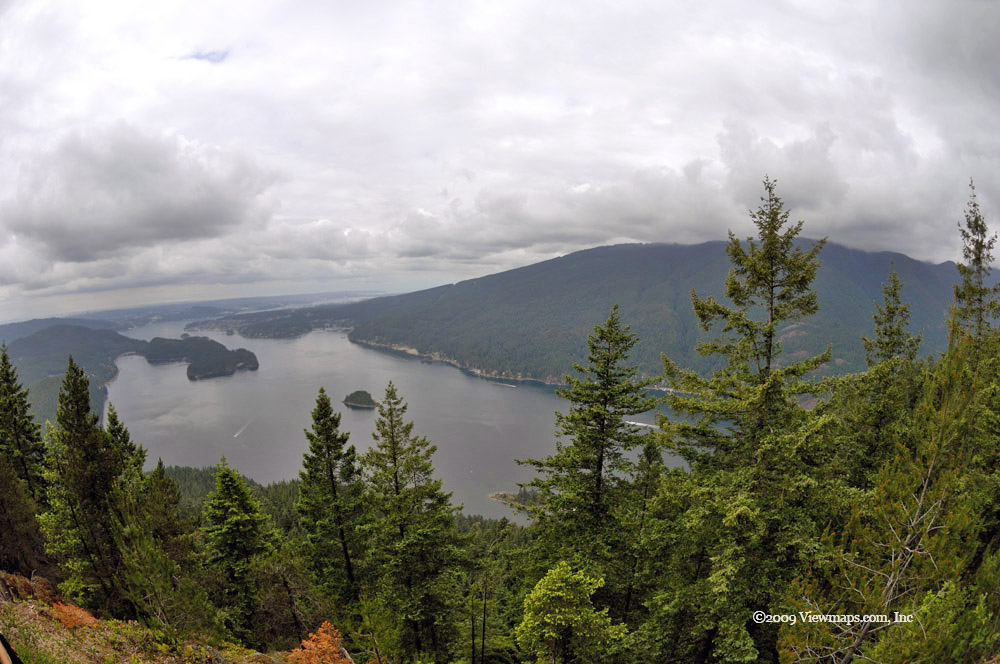
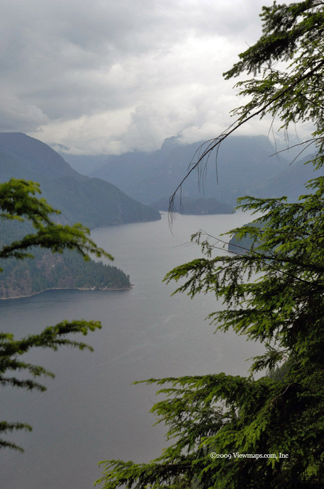
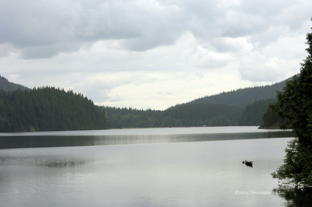
We arrived at the small lake in the saddle and then made our way to the northern limit of the saddle where we had a great view of Waleach (Jones) Lake to the north. Here we stopped for lunch and an extended rest. Next was the tricky part of finding the start of the Lady Peak trail. This was supposed to be easy as I had the waypoints marked in my new Garmin 60CSx GPS. But shortly after we set out on the trail I accidentally reset the unit and erased everything from its memory! So much for pre-planning! The unit is much better than the old Magellan Platinum unit but learning all its controls will take a bit longer to master.

After lunch we set out on the search for the trail head. As there was still snow pack in the depressions it made following the less used trail difficult and we had to try a few alternate routes before locating the start. Once on the trail we made our way up the first section which was quite steep and soon we had made our way up onto a small ridge having lost the trail in the process. Though it was a lovely view and worth the visit we would have to retrace our steps to try and find the path. On our way down we did spot the trail on the opposite side of the ridge and so we decided to make for it and recover some of our lost time. By now the weather was starting to turn and it looked like rain would soon be upon us. 

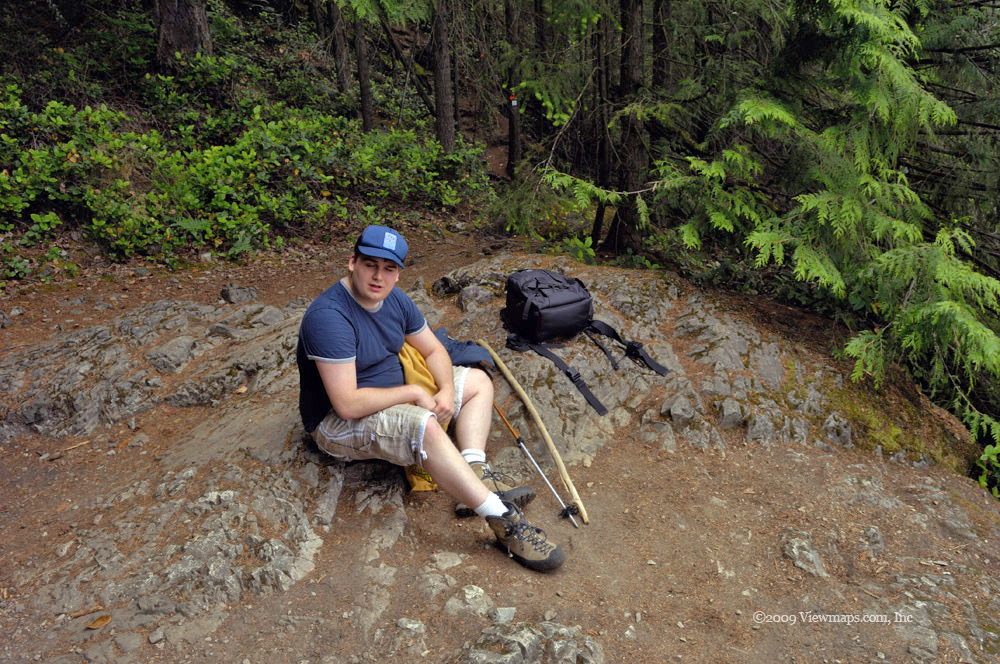
We made our way along the trail and past the spot where the short cut of our prior trip joined the path we were on. The next section was a steep scramble over loose rock which took its toll on me. Half way up the first of the light rains hit us. I was concerned that the rocks would become slippery but the rain soon slowed to a slight intermittent drizzle and so we decided to continue. We made our way past the cliff and up to the high alpine meadow but by now Ethan's foot had gotten quite raw and sore and so we stopped to evaluate our situation.

As we rested another group of hikers came by and continued on up the slope. As the rain was getting heavier again and his foot getting quite sore we decided to stop at this minor ridge line and head back. It was disappointing to not reach the peak but between the weather and sore feet the wisest course of action was to reschedule the hike to next season when we could try again. After carefully picking our path back down the cliff and across the steep loose rock section, we were soon on the trail through the wild flowers heading to the place where we lost the trail on the way up. This time we were able to follow it and should have no trouble following it on a future hike especially since I now have a complete GPS track to look at.

As we made our way down we came upon a group of hikers I knew from my church photography group and so we had a pleasant chat as we made our way along. Keeping up with the young people was a challenge for my old bones but it was nice having a few more people to chat with. Once back at the truck we quickly took down the antenna. The flies were motive enough but we could see some rapidly approaching rain squalls and so we wanted to be done and safely inside the truck before the first one hit us. We made it with a few minutes to spare! The drive back to the main road though bumpy went without incident and soon after reaching pavement the real rain hit and we could barely see through the windshield as we drove along. Turning back when we did was fortunate as we were able to avoid the serious rain. So I guess I will need to reschedule the hike for next summer when we can try again for the peak.

Mount Seymour

I enjoy the variety of hikes one can take from the parking lot on Mount Seymour. They offer some lovely settings from small lakes to grand vistas of greater Vancouver. To date they have all been quite easy hikes with limited elevation gain. Last year I didn't feel ready to do the main peak hike but this year I ran out of excuses. So I selected Mount Seymour for the second in my summer series of 5 peaks of 2009. We left the house early so that we could get a fair distance into the hike before the heat of the day became too hot.

On arrival at the parking lot we found the gate across the road blocking access to the top lot so we had to park in the over-flow area. The one advantage of that was that this area had no parking meter to siphon off a few dollars but it did delay our start. Once rested from the drive, we quickly got geared up for the hike and made our way up the last of the road to the main lot and then on to the trail. The initial section of the hike can be done by either following a small hiking trail or by walking up the ski slopes to the upper lift. The ski runs are open and boring so we chose the smaller hiking trail. Though perhaps a bit longer, it did offer more interesting sights.

As we made our way past the numerous small ponds that litter the upper regions of the mountain, we were swarmed by lots of flies. They can be very annoying not only because they bite but they mess up my photos with ugly fuzzy splotches in places on the image. Waiting until the view is clear can take much patience - a quality I tend to be lacking while shooting. As we continued our way up the slope, it wasn't long before we were at the cross roads where the upper lift starts. We made our way past a small pond, Sugar Bowl Pond, and continued up a steep section to Brockton Point. 

At this first peak we took a bit longer rest and I was able to gather a few panoramic views of the valley. The flat smooth rocky ridge was dotted with several small puddles that were helping to add to the number of flies tormenting us. We continued on the trail talking with several groups sharing the trail with us. There was one large group of hikers who were heading to Elsay Lake for the night. A number of them took some extra time to hike up to second peak for the view before continuing on to the lake.

As we were on Mount Seymour where the main wide area repeater is for the region I decided to not bother setting up my cross-band repeater. Though there was now a rise between me and the repeater we were able to maintain good reception throughout the hike. I guess being only a couple of kilometers distance makes up for some terrain issues. 

As we approached the ridge just north of second peak we encountered our first section still covered in snow. It was melting and very soggy but its coolness was a nice respite in the mounting heat of the day. Though we were chatting with people along the trail it wasn't until we reached this ridge near the second peak that the number of people on the trail became apparent. There were quite a few people out here hiking though most stopped at the second peak not bothering with the final distance to the true summit of Mount Seymour. Of course I wasn't satisfied to stop here, I had to make it to the summit. So we continued along the trail descending a section before heading up to the next ridge on the way to the summit. By this point I was getting quite tied and sore but we were getting very close to the end and so I kept pushing on. At one point the trail was a bit hard to find but we kept going in the general direction and soon found clear markers again. We finally arrived at the final climb and soon made it to the top where we flaked out for a desperately needed extended rest!

After a good drink and tasty lunch I got started on some photo taking. The air was hazy so I didn't get the quality of shots I had hoped for but I guess the valley is almost always hazed over these days. So it probably doesn't matter when you go as you still won't be able to see clearly. There were a number of small groups on the peak with us - the trail is definitely a popular one due to its proximity to Vancouver and relative ease.

Once rested we started down, just below the peak Ethan came across a friend of his from his high-school days who was up there looking for a geo-cache. It was a very small cache well hidden in the rocks and he was having a challenge locating it. We quickly made our way back to the second peak and the ridge with the snow. A number of people decided to use the short section of snow for a sit down slide to help speed them on their return. They were surprised to discover just how soaked their backside got over the short distance!

The return always goes much faster and easier but on this trip my back was acting up more than expected which slowed me down on the way back. It can be very annoying at times. After a number of short breaks we finally reached the upper parking lot which was now open and full of cars! I guess we were just too early when we arrived. So we still had a bit more hiking along the pavement to reach the second lot. It sure was nice finally reaching the car and being able to sit down for a longer period.
The hike was not difficult and definitely offered many lovely views and scenic sights along the way. I recommend it. This hike completed the second of five for the summer and was a great choice, hopefully the remaining three will go as well.

Hope Mountain FSR

I have zipped along the Hope-Princeton highway for years, either heading to Manning Park for a week-end of camping or on through to Penticton for a visit. But in all these drives I never stopped to give the various logging roads a second thought never mind a visit. So it was well past-due for me to see what they offered. As I was planning to hike Hope Mountain in August, this trip would allow us to scout the area and find the trail head in advance of our hike.

So Geoff and I set out in the Pathfinder and after picking up a few food items in the town of Hope we made our way to the start of the FSR. The first half kilometer of the road is actually paved but then quickly deteriorates into a rough road that is actually quite steep. It wasn't very far along the first steep stretch that we started to see smoke trickle into the cabin again. The exhaust pipe was leaking again and overheating the floor beneath the driver's accelerator foot and burning the rug. Geoff stopped to check out the situation and decided to slit the melted rug section, as he did I yelled out saying I could see the road through the cut! We peeled the rug back and discovered to our dismay a 4 by 6 inch gap in the metal with a hot leaky exhaust pipe not an inch below it! 

It was now very obvious why the rug burned as the RPM's went up! We were just starting our exploration and with this we couldn't safely continue driving. After a session of expletives from Geoff we stopped to figure out what we could do to drive home. We came upon the idea of using a flat rock to slide over the hole and hopefully provide some protection from the heat and exhaust pipe. As there was a lot of broken rock around it didn't take long to find a suitable rock. We slipped it over the hole and padded it with some heavy outdoor felt we found along the road that we kept soaked. It was working quite well so we decided to continue our exploration and see what we could discover.

The road wasn't too difficult to travel though there were a few very steep sections and tight switch-backs. The road lead up to a ridge line and then dipped over a short ways to where the road ended with a lovely view of Wells Peak. We decided to have our lunch there and after a quick bite Geoff did a bit of target practice with his rifle. We hadn't seen the trail head yet so we retraced our path to fork a third the way back down. The other spur was much more over-gown and didn't go too far but when we got out to explore on foot at the end of the spur we found some ribbons marking the trail. Feeling good we started our way back.

About two thirds the way back to the fork we came face-to-face with another truck. This guy was in a nice shiny truck and as the road was a single lane with tall growth on both sides , he just stopped there in our way. It became apparent that he wouldn't go around us lest he scratch his truck and he wouldn't back up even though he had only a short distance. So Geoff got out his chain saw and cut a few alders to make a widening we could hide in to let him pass. Some guys really are clueless in the back-country. We got to the main FSR and made our way back down stopping for a few photos along the way.

We arrived at home before long having cut the trip short due to the exhaust issue. On reviewing the makeshift floor we saw that the rock had split in the heat. We decided we could repair the hole with a sheet of metal and so we drove to Canadian Tire to get some components and soon we had riveted a solid piece of sheet metal over the hole. It is now likely stronger than the original. We packed on some fiberglass matting next and then put back the truck's rug. It was now quite usable again, though I wasn't so sure I was willing to trust the truck in the bush again. 

The trip was shorter than planned but we did find the trailhead and explored a new region. So I felt we had accomplished the main point of the trip. Now I really need to consider what I must do to have a reliable truck for the hills.

Diez Vistas

A few years back when I was not exercising regularly I hiked to the lower trail around Buntzen lake with difficulty. I said back then that I wanted to get to the point where I could do the hike with greater ease and even the higher ones along the ridge. So today's hike was the culmination of several years of dreaming and a determined exercise program. It was a great feeling knowing that one could achieve strenuous goals if one worked toward them.

The hike itself starts in the large Buntzen lake parking lot. Upon arrival we took a quick stop at the main beach area and then made our way to the floating bridge that crosses the south section of the lake. The bridge was recently upgraded and the actual floating section is now quite short. For most this is a big improvement but it came at the cost of much lost scenery in the lake. After crossing the lake we left the main trail that makes its way around the lake and started up the slope along the Diez Vistas trail. This first section of the trail is quite steep and continues this way untill you reach a lovely viewpoint of Belcarra and Bedwell Bay. Though not counted as one of the 10 views it was quite amazing already. I had high hopes for the actual 10 vistas! The trail continued up further and we soon came to the first of the 10 views. There were quite a few gathered at this point enjoying the sight as they reclaimed their breath.

I chatted with a few fellow hikers between taking my photos of the scenery, all felt the sight was worth the effort. After a needed rest from the climb we started out to the second of the viewpoints. This part of the trail was much easier as we were now traveling along the ridge line of the rise between the lake and the Fjord. The second viewpoint was also quite pretty and offered a slightly different view from the first. As we continued along we discovered that the remaining viewpoints offered less and less of a view as they were being over-grown from below by a new generation of evergreens. The last spots were completely blocked and no longer offered any view of the inlet. It's a shame to lose those views but nice that the logged trees are now recovering. I really do struggle with mixed feelings about where the proper balance should be between allowing nature to reclaim everything or not. It seems to me that some minor trimming of a very small number of trees would be worth the sacrifice if it would help to build a greater appreciation of nature in others.

As we left the last of the views we were surprised by a few drops of rain that followed us for most of the final sections of the trail. The north end of the trail was much like the south with a steep section where we descended back down to the main trail that loops around the lake. Once we connected with the lower trail we chose to follow it to the small suspension bridge that crosses the north end of Buntzen lake and then took a breather at the north beach. The drizzle had gotten a bit worse by this point and we decided to not stay long; so we pushed on to the car lest the rain start falling more seriously and catch us far from a dry haven.

So we started the final leg of the hike along the eastern shore of the lake. About half way back the sun came out stronger and the rain stopped for the balance of the hike. The trails around Buntzen are popular and we had many fellow hikers that we chatted with along all sections of the trail. I am glad there are so many out enjoying nature but it does tend to distract one from concentrating on the beauty of nature. So we finished the trail tired and sore but with more energy to spare than we had the time I struggled around the lower trail a few years back. I guess you could say I achieved my goal and now I can try a number of other harder trails in the summers ahead.

Squeah FSR

Though I haven't done many trips through the canyon, every time I did drive the highway I was amazed at the sights. Every few miles brings amazing new vistas to one's eyes to ponder. In driving the canyon I saw glimpses of logging roads across the river on the opposite side of the river from which the highway was on and that intrigued me immensely. Over time I developed a growing desire to explore the canyon from the side opposite to the normal flow of humanity. The southernmost section of the canyon sees the highway on the west side of the river. On the east side exiting the town of Hope on the north is a logging road known as the Squeah FSR. This road wanders the eastern flank of the canyon for several kilometers and on the map leads to a small native reserve called Squeah. I wasn't able to confirm that it still reaches Squeah as we did not travel on a road branch that led there. So either we missed it or it is no longer passable.

The drive along the FSR is fairly easy as far as FSR's go. The first section of the road was well maintained and made for an easier trip than what we have gotten used to. Access to the actual river, though close by, leads through private native areas and so we made do with higher elevation views of the river. We did notice a few natives out on the river catching fish but the distance limited one's ability to get interesting photos. Maybe one day I will plan ahead and arrange some time with the indigenous people of the areas I visit.

About mid way along the road we came to a lovely view spot and took a break for a few minutes. I got a number of photos, Geoff did a bit of target practice with his rifle. Then we continued on up the road and finally came to some much less travelled sections which added a bit to our challenges. At the furthest point we stopped to eat a bit of lunch. Once fed we took a second minor spur but soon came to the end of that road as it was over-grown and impassable, the map had teased us with a long line that we couldn't follow.

We made our way back along the road and when we came to the small lake we saw on the way in we stopped to explore it. We found a number of campsites along the northern edge of the lake with a few campers in them. The lake was a very pretty setting and despite the forecast of showers I am sure they all would have a great time there. The one campsite had a small wooden dock out into the lake that was very scenic and I took quite a few photos of it from various angles. After spending some time taking photos and chatting with the group enjoying the area we barged in on, we made our way further back along the road.

We tried a few more short spurs as we came to them but it was starting to get late and so we were getting a bit anxious to head out. Soon we came to a side road that indicated it was the start of a hiking trail that led to Ogilvie Peak. That was too much to pass by so we turned off and started up the road, after a number of switch-backs and narrow sections we reached the end of the cleared road. It was heavily overgrown! That was very disappointing as we were still a fair distance from Ogilvie Peak. The last few hundred feet of the road showed some recent work done in clearing so while I took a few photos - the point at the end of the cleared road had a great view - Geoff got out his chain saw and started clearing a bit more of the road.

As we made our way back to the truck after doing our separate activities, Geoff let out a cry of anguish, he felt a sharp pain in his side. At the truck he checked over the place of pain and discovered a tick busily digging its way into his skin. We did a few things to try and get rid of it including calling for advice on the ham radio. A ham operator suggested getting some grease on it which we tried and were able to get the tick to back out a bit, but it was still clinging tenaciously to Geoff's side and causing him major discomfort so rather than risk breaking it, we decided to get to the nearest emergency room we could find. 

Soon we were back on the main FSR and on our way to the town of Hope. I remembered that we actually passed by the hospital on our way in so that was our next destination. Once at the emergency admitting we learned that there was only one person in front of us but that the single doctor had just left for dinner! So we had an hour's wait for his return and then a bit longer for him to see the previous person. Once past the waiting room it only took a short while more for the doctor to review the situation and extract the beast! It was now much later than we had planned but at least we had an easy drive the rest of the way home. Geoff's side was no longer hurting and the swelling was already subsiding.

So the adventure on the wrong side of the canyon was indeed eventful. This was our first tick attack in all the years we have been exploring the back country and I hope it will be the last. The views and sights we saw confirmed my suspicions that the side of the canyon opposite to the main highway would offer much to see and enjoy. I will be returning to explore the wrong side further up the canyon in the months ahead.

Hollyburn Mountain

Though it was early in the season, Hollyburn isn't a particularly high peak and I was confident it would be hike-able, which is why I felt it would be a good one to start off my 5 peak series. The trailhead was also an easy drive for us and so it would not take long to get to the hike. On my first hike up Hollyburn I had just purchased my cross-band repeater radio and had trouble with it on the hike, so with my now more complete setup and greater experience I felt this hike would be a good test. So for all these great reasons we set off to the parking area and had hopes of a fun day.

We arrived at the parking area to find only a few cars and a broken ticket dispenser. After reviewing a number of spots we ended up back at the location we parked in last year. We soon had the radio set up and it was definitely doing better than last year so we continued along optimistic for our morning. Soon we were hiking along the power line trail up to the first lakes and the upper warming hut. The weather was perfect for the hike - not too cool or hot and with a few clouds for interest. The tail along the power line was clear but wet in places, we did see a few small patches of snow as we travelled along.

When we arrived at our first lake we were surprised to find it mostly frozen over. This limited the photos I took as the dirty snow didn't make for the best of scenes. Soon we made our way further along the power line trail and saw the warming hut in the distance. Then we noticed the trail we were to be following just past the hut. It starts on a ski run and it was still covered in hard packed snow! Now this was interesting - just how were we to find the trail when it was covered in snow!

So we slowly approached the start of the snow unsure of what we were going to do next. Looking up the run we could see low hanging mist that obscured much of the way. But a number of people were making their way up the ski run and upon closer inspection we could see a well travelled path up the mountain. So we decided to follow the path straight up the run and on into the blanketing mists. It looked like it was going to be a fun hike after all but more challenging than we had planned for.

The path along the snow wasn't too difficult during the first section which made its way along the ski run. The snow here was well packed and easy to walk on. The snow actually smoothed out the trail and made for a straighter and easier hike than the normal summer trail and with the mist swirling around us it added to the atmosphere. Soon however we reached the end of the groomed ski run and the snow became less packed though the footsteps continued upward so on we went. Soon I was hearing the sounds of rushing water but on looking around no water could be seen, then it became apparent that the river was beneath us and we were walking on a thin layer of harden snow. Not much later I fell through that layer and sank up to my waist! It was a bit un-nerving knowing that the ground was hollow under our feet.

We continued up the slope and the trail thinned out as more and more people had stopped and turned back but we were determined to reach the peak and so we continued our trudging along up the mountain. We did encounter a few other determined souls along the way and when we did reach the peak we found a few others already there enjoying the rest, though the anticipated view was missing due to the thickening mist cover. We did recognize a number of features from our first trip here but it certainly had a different look to it when covered in snow and blanketed in fog.

After a nice rest but not long enough to get too cold from the fog we started out on our return journey back down the snow covered slope. We made good time going down whilst sharing our thoughts with a few others who were making their way up to the peak. Soon we were back to the warming hut where we decided to go in it and see what was in there. It wasn't all that interesting but it did display a few trail maps of the mountain which proved informative. Once that small room was fully explored we set off back down the power line road to the car. This last part of the hike was now also covered in mist as the weather had worsened a bit since our departure and the sun no longer made its presence felt on those in the parking area. Once back at the car we soon had the radio taken down and we had a good rest, the hike had left us a bit chilled and definitely much wetter than expected but the car had a decent heater and soon we were warmed up and drying out.So our first peak of the season was a bit of a surprise but the hike gave us an insight into a very different mood of the mountain and a taste of winter snow hiking that the more fit and experienced hikers enjoy. I guess next year we will need to start a bit later in the season. My second peak isn't planned till mid-July so it should be well clear of snow!

American & Emory Creek FSR's

The Fraser Canyon has numerous interesting logging roads branching off of it but in all the years I have been exploring the back country I had not gotten around to trying out this region. So it was with much anticipation of new adventure that we set out today. Our lastest trip was on Garnet Creek FSR which connects to the American Creek FSR and we were well along it hoping to reach the canyon but we were stopped by snow. So for today's trip we thought we would start at the canyon and try the loop in reverse. After a brief stop in the town of Hope to pick up a sub for our lunch we were back on the highway heading up the canyon to the first logging road.

We soon came to the American Creek FSR and set off up the road, soon we passed a very discouraging notice that warned us that the road was closed at the 5km point. We kept going hoping that it was a warning only for those faint of heart and that the blockage would not be too much for us. The early part of the road was heavily used as there were homes built along the road - not much of a back-country area yet. Soon we arrived at the washout and after careful study we regrettably felt it would be too risky to try to pass in the Pathfinder - an ATV would have been no problem. So our hope to link back to the Garnet Creek FSR was stopped dead very early.

We returned to the highway and continued on up the canyon, soon we came to the BC Nickel Mine road and started driving it. We came to a triple fork where we stopped to chat with some dirt bikers to learn the best choice to follow. After a few tips we were soon heading deeper into the hills. We soon came to a transmission line access road and decided to follow it south. We had seen the old mine on the map and as it was quite close by we thought a detour to explore it would be in order. We were soon close to it according to our GPS where we saw a large mound of tailings with fool's gold sparkling in the sunshine. After walking around the area for a while and not locating the mine shaft we retraced our path a bit and continued north along the power lines. In a few minutes we joined the Emory Creek FSR and decided to explore it for the day. 

We made good progress along the road and selected a number of branches that followed the power lines for quite some distance. We were soon heading south straight towards the place we were stopped at on our prior trip. We were getting very excited as we had just over 3km left to go to connect up to the other road. But then the dreaded event happened, we encountered snow on the road! and very soon it was impassable. So here we were a mere 2.5km from the other road and no way to continue forward. This was so very frustrating but what could one do. So we took a few minutes to get angry at the situation and then retraced our track. We tried a few branches the first of which looked like it might parallel the lines south along the opposite side of the valley from our first attempt, but the road was much rougher and soon it was blacked by trees with snow not much further along. So we retreated further, resigned to our fate once again.

We continued to explore the various branches and after crossing Emory Creek we saw a number of interesting creek rapids that called for some photos. At the furthest point along the actual FSR we stopped at an overlook of the river and enjoyed a brisk breeze in the heat before heading back. We decided to take an extended romp around the creek bridge crossing and I was able to get a number of interesting water shots. Soon we were back to the point where we entered the FSR from the power line road but we noticed it continued east and so we decided to follow the FSR back to the canyon rather than the via way we came. The initial section was quite decent but soon the road narrowed to a quad trail but this didn't deter us. We kept going but unfortunately we came to a rock fall that with the narrow path was just too risky to continue so it was back to the power line road and retracing our path out.

Once back on the highway we quickly made our way back into Hope and then on home. The trip was a great deal of fun and we definitely want to try to find that mine shaft . So a return trip is definitely in order. This area was quite busy with dirt bikers and ATVers so it was a bit nosier than most trips but we did have a good time exploring the area.

Ruby & Garnet Creek FSR's

I had never given much thought to exploring the back roads east of Agassiz for years and then last April I finally got out to explore Ruby and Garnet Creeks but it was too early in the season and we were quickly turned back by snow. So here I am 6 weeks later trying again and hopeful that the snow would be gone. We started out on Ruby Creek and retraced our path from April. The vegetation had grown up and what made for decent viewpoints in early April were now blocked by greenery. I was quite surprised to see just how much of the view was now obscured.

We made our way up the FSR and soon came to the place where we were blocked last time. Today the road was dry and clear for as far as we could see, so on we went. We did get quite a bit further along the Ruby Creek FSR but not on roads marked on the Topo map. We were eventually blocked by a washout and took a few moments to rest before retracing our steps to try a few other side branches. The accessible area was not nearly as extensive as I had thought it would be and soon we had exhausted the road. As we made our way out we were approached by another back country explorer, he asked if we had seen any black bear in the area and we gave him the bad news that we hadn't.

After that we decided to head straight out and so we made our way to the highway and set off for the next FSR - Garnet creek. Last time we barely got into the road before snow held us at bay. I really wasn't expecting to find much as the map showed even less road than Ruby Creek. We quickly made our way in and as we approached the place we were turned back in April we startled a young black bear who had been making his way along the road. He quickly turned around and ran up the road before diving into the under bush and down the slope to the creek. I guess the hunter we met earlier picked the wrong road for the day. Just past the place the bear left the road we came upon a beautiful cliff face that the road skirted along. The rock wall went straight up on the east and straight down on the west! There was a tiny streamlet creating a lovely little waterfall down the face onto the road.

We continued on and kept going much further than expected. We eventually came to a sign pointing out two separate FSR areas that we could explore. One was American Creek FSR. On checking the map we saw that the American Creek FSR continued on to the Fraser Canyon and would offer us a path out without retracing our steps, so we chose that and made our way over some rougher road. This part of the road travelled along the power lines and gave us a number of nice views of the area. At one higher point I tried my truck radio on the White Rock Repeater to see if I could reach it. Surprisingly I did work into the repeater and chatted with one of the club members who was mobile in White Rock. We then continued up the road try for the canyon.

Alas, only a half kilometer further along we came upon that white blanket that blocked the road once again! We were so close to the highest point of the road but there it was blocking our way. So we took a rest to eat a bit and then set off back the way we came. This was disappointing but not completely unexpected. We explored a couple of side roads on our way back but as it was getting a bit later and the light was no longer as good, we decided to leave the rest of the roads for another visit. The deep part of the Garnet creek was left unexplored and will need some serious attention in the future. We stopped on a fairly new bridge over a tributary creek to Garnet . It looked new enough that I am fairly certain that there is active logging in the area we skipped over today. So the roads will likely be fairly good and readily available on a return visit later in the year.

While on the bridge Geoff did a bit of target practice with his rifle. He seems to be a fairly decent shot - hitting a ribbon tied around a tree dead centre! Having the rifle does make one feel a bit safer in bear country. We made our way out while stopping for a few more photo ops along the way. So in the end, the Garnet Creek area ended up being much bigger than I expected and we didn't get to explore all of it. The road is definitely worth another visit - exploring the Garnet area and the American as we later learned that the American Creek FSR is washed out fairly early on and the only way to access the bulk of it is through this area. I will be back but perhaps next time on an ATV.

Upper Shannon Falls

For years I have driven past the Falls on my way past Squamish catching a quick glimpse of the drop as I sped past. I have even dropped into the park at the base of the falls for a longer look several times. While I was there enjoying the cascading water and the roar I noticed a few signs detailing the path to the upper falls. It looked to be a steep and arduous hike so I kept putting it off until I was in better shape.

This season I decided to give it a go as a starter hike. Though the hike is only 5km return from the Shannon Falls parking lot, it is quite a steep hike and would give one a good work out. We decided to start the hike from the Chief parking area cutting down the length a bit. I had also planned to use this hike as a test of my new dual antenna setup for by back country radio repeater. This site doesn't require ham radio to be in touch but it would provide a good work out for the new setup. Unfortunately as I was placing the equipment I discovered that a key piece was left at home, so I was only able to operate it in the standard way I used last year. At least it worked well.

Once the repeater was ready Ethan and I set off. We were joined on this trip by a friend of ours - Luc. He is a local artist and poet and was looking forward to the trip to discover some new sights for inspiration. Our initial portion of the hike follows the trial to the Chiefs and so we were soon climbing the steep stair cases and trail that hundreds of others hike every week-end. I am really quite amazed at the numbers who hike the chief. Once we made our way up the steepest section our trail set off south away from the crowds inching their way to the top of one of the Chief peaks. Considering how many were on the Chief trail it is surprising at how few do the Upper Shannon Falls trail. We met only a single family of this trail. but that just makes it more of a wilderness experience.

Once off the Chief trail our path traveled a fairly gentle climb for some distance before we encountered another steep section. This section wasn't very long and soon we arrived at an out-cropping that gave us a lovely view of Howe Sound. We stopped here to grab a bite while we enjoyed the scenery. We got hit by a few drops of rain but it soon stopped and we were relieved that the rain hadn't started up yet. After the needed rest we started back on the trail to the falls. We soon discovered a small pond nestled between some rocky cliffs that was empowering a field of skunk cabbage. The flowers were just starting to open so the air was not yet full of the nefarious odor.

After a few more minutes of hiking we came to a final steep section before arriving at the upper falls. The upper falls are not nearly as long a drop as the lower falls but one can get right up close and feel the power of the water as it raced past on its way to the main drop a few hundred feet further along the creek. I had hoped one would be able to view the main falls from this trail but the trail didn't make its way to the lip of the main falls though I could see tracks leading through the undergrowth towards the drop. I took a few moments to see if I could see the start of the main drop but I was tired and decided to not risk it. 

While enjoying the creek and catching some needed rest Luc felt inspired and started a new poem of the adventure. Though he shared a bit of his writings with us while on the rock ledge, I never did hear all of it and will need to get back to him to hear the whole thing. Well, after a reasonable stay we decided it was best to start our return as the clouds were starting to look more threatening and I didn't want to have to clamber over rocks that were now slippery in the rain. As usual our return went quite quickly and without incident. The numbers still heading up the chief trail as we were making our way down was quite surprising considering the worsening weather.

Before long we were back down on level ground at the base of the chief climb and making our way through the campsites to the truck. We quickly took down the radio gear and were just getting into the truck as the rain hit! Pretty well perfect timing for today's hike. We decided to take a brief detour and head into Squamish for a drink at the local Starbucks before driving back home. Overall a good starter hike for the season and the two view highlights made for a lovely reward for the effort expended.

West Harrison South

I have been skipping past the south part of Harrison Lake for years as I made my way further north into the more travelled areas. This southern section seemed almost mysterious as there was a fairly large area with no roads marked on it. Yet I was sure the area was accessible to me in my 4x4. So Ethan and I set out to try and find the hidden entry point to this part of the lake. Our first stop was to explore the area around tiny Morris Lake. Morris is reached by a minor road branching off next to the Weaver Creek fish hatchery.

I was hopeful we could reach the Harrison River but shortly past the lake we ran into signs telling us we were on private property. Not a very friendly notice and though I understood the road to be public I wasn't certain and so we decided to go no further and return via a higher newly cleared road. The upper road offered a few great views of the little lake and the mud flats we passed on the way in. This initial trek didn't take long and we were soon along our way on the actual West Harrison FSR.

We took a brief stop at Grace Lake where there were a number of camping groups already setup for the week-end. I didn't want to disturb them too much so we didn't wander over their sites too much. As we traveled further in we noticed a small road heading off the main FSR and we tried it but got only a few hundred feet before being blocked by a narrow road, we will need to try it again with a ATV. We continued up the FSR and soon reached the first look-out over Harrison Lake. We pulled over and stopped to enjoy the view and get a quick bite to eat. The day was partially overcast with the forecast of showers, one could see the worsening weather as we ate our sandwich so we weren't expecting much from the rest of the day. 

Once fed, I looked around and noticed the transmission line service road heading due south with an access point right next to us. As I had spent last week-end travelling a service road, I thought that this one may be our way to explore the hidden region. My topographical maps show the logging roads but they miss all the hydro service roads so this convenient road was not shown on my map. I was hopeful it would take us to the last tower this side of the Harrison River. The real question was whether the road was passable with our truck. We set off and enjoyed the views of the lake and the steep cliffs of Echo Island. The road wasn't too bad along this first section but soon we rounded a curve and were faced with a 100 yards of snow covered road. Now normally when one finds snow on the road this time of year you are pretty well done travelling forward so I was quite disappointed.

But Ethan glanced over the patch and though it was on a bit of an angle, it didn't seem overly deep and the road past the patch seemed quite clear for some distance - this patch was actually the only snow we encountered - so we made our run at it and after a few tries got through, the first travelers of the season! We made our way past a number of great viewpoints of the lake, planning to visit them on our return. After a few challenging washouts and steep sections we reached the end of the road at the last tower this side of the river. At first I was somewhat disappointed at this location as there was virtually no view of the lake or river, but I decided to get out and walk over the area just past the cleared tower area.

It was sure worth the effort in making ones way over a rough rocky section. The view of the Harrison River was spectacular! Standing under the power lines as they dropped down and over the river to the other side was an incredibly lovely view. Standing there near the edge gave me a mild sense of vertigo and I needed to pull back for a few moments before continuing with my photos. I returned to the truck and encouraged Ethan to come back with me to enjoy the view. So I grabbed the rest of my camera gear and we returned to the over-look and grabbed a few more shots. While there the rain finally caught up with us and we scurried back to the truck to stay dry and to get past the rocks before they got slippery. This view alone was worth the effort of the day. Now to get to that first tower on the other side!

As we took a rest in the truck while we let the shower pass, I reflected on the look of the road in front of us that we had just travelled to get here and recalled my thoughts from earlier in the year when I was staying at the Harrison Resort. Back then Ethan & I were looking across the lake to this area where we saw a road that looked very inviting and we wondered how we could get to it - well here we were travelling it! It certainly was as good as we had imagined it would be.

After the short shower we made our way back this time taking a number of short side branches to the individual towers and the viewpoints they offered. Some offered phenomenal views north along the lake and as the clouds and rain were intermittently obscuring the distant hills we had an endless variety of moods to the region to capture. As we drove north we came to a side road that after some reflection we figured it was the far end of the road we had been turned back on earlier! A few more stops for photos and we were soon back to our lunch spot and the main FSR. 

It was an amazing short journey. The weather far from ruining the opportunities actually greatly enhanced the photo ops. I was very pleased with the trip and the sights were encountered. I definitely want to go back to that last tower and spend some more time capturing the sights. It would be an interesting spot to pick the season properly to capture a sunset over the Harrison from that location. I guess I will need to do some sunset research with Google Earth.

Subscribe to 2009