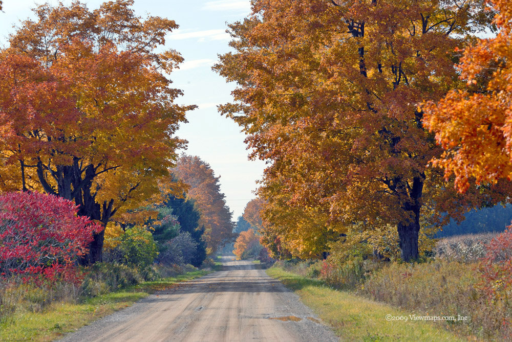
Ruby Creek FSR

I have driven through Agassiz many times on my way to Harrison and I have driven the south side of the Fraser to the town of Hope, but the north side of the river between the two towns was virtually unknown to me. So I thought Geoff and I could get out and explore that area, there are a number of roads leading off the highway and I was confident we could fill the day with as many as needed to fill a day exploring the region. 

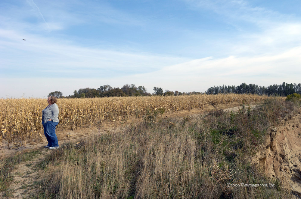
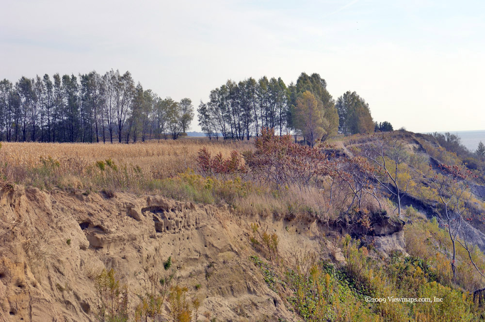
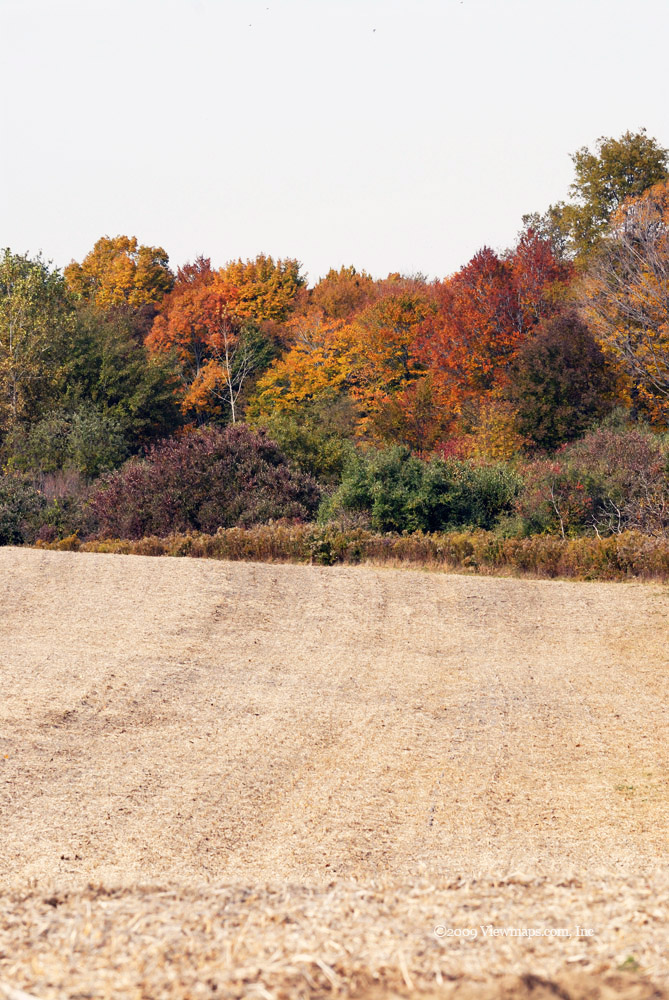
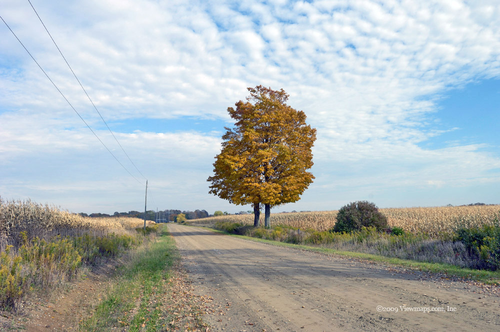
As we made our way east of Agassiz along the highway we drove onto an island - Seabird Island. Though an island by name the island is separated from the surrounding area by sloughs that were quite narrow and mostly dry at this time. I really don't think it still qualifies as an island any more. We took one detour to explore the eastern end of the island and captured a number of lovely shots of Mount Cheam and Lady peak. 

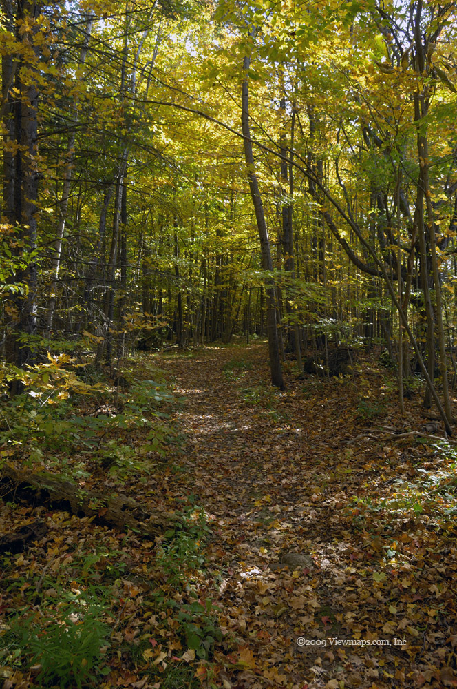
We returned to the highway and continued east to the Ruby Creek FSR. We pulled in a few hundred feet and stopped to check our gear and the road radio frequency. While stopped a 4x4 came barreling up to us from the highway and stopped to check out our intentions. The guy lived in the property that borders the FSR and was constantly fighting people dumping garbage on his property and along the road. We had a pleasant chat and commiserated about how we couldn't believe how poorly some people treat the back country. After our chat and the gathering of a few tips for viewpoints we started up the road.

Our first stop was on a small knoll that was being used by a transmission line tower. It was a lovely overlook and gave us a bit of a view of Deer Lake which is a popular camping area in the Sasquatch park and is accessible from Harrison Lake road. As we wandered around the tower we commented on the lovely crackling sounds coming from the overhead power lines. It is really quite surprising at how loud they can be. The tower was one of the shortest I have seen, the wires seemed almost too low for safety but I'm sure they are still a fair way above ground.

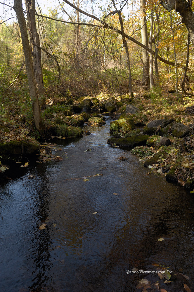
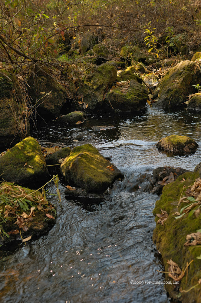
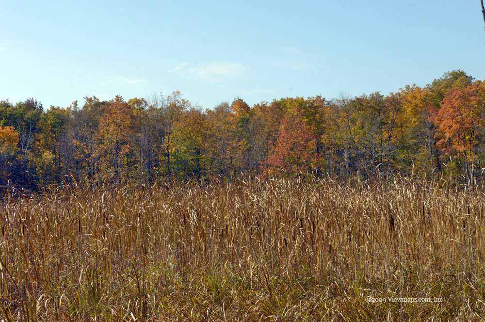
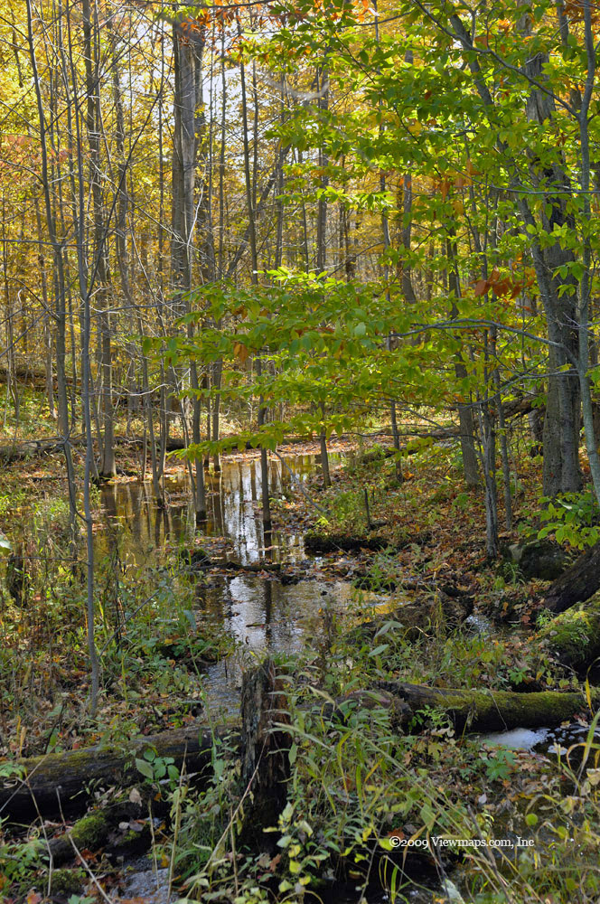
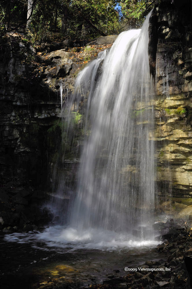
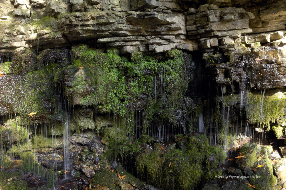
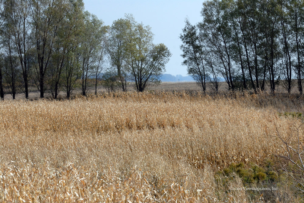
After gathering some photos we drove along a few other short spurs to see if they offered any viewpoints. Then it was back to the main road and further in. We soon came to the branch the leads to Deer Lake but it was washed out a number of years ago and so the road didn't go far. Back on the main we started climbing and soon came by a small creek that crossed the road. Geoff got out and climbed along it for some distance to get some shots, I stayed on the road and concentrated on the tiny waterfall it created. Then it was back on the road and climbing. Unfortunately we were stopped by snow within another kilometer. So we retraced our path to the lowest point and took a side road through some marshy areas to a second set of transmission lines.

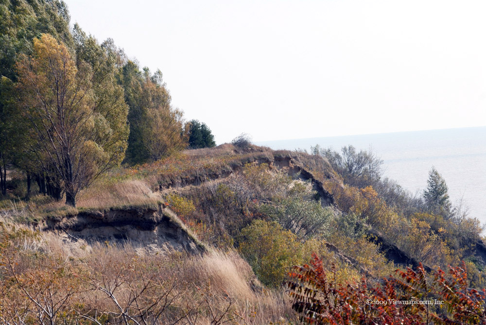
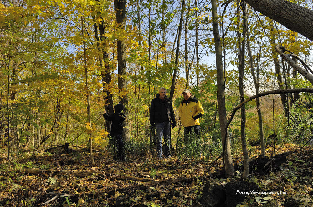
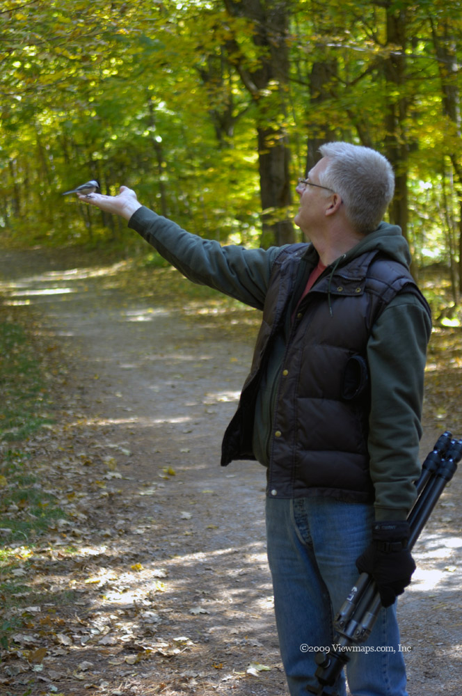
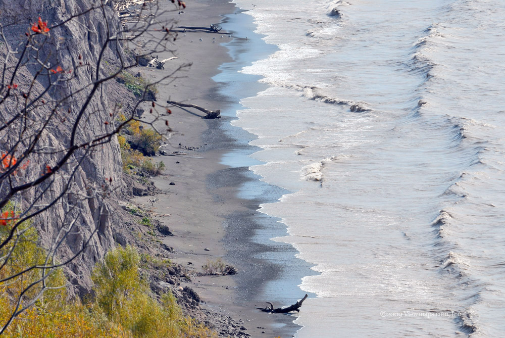
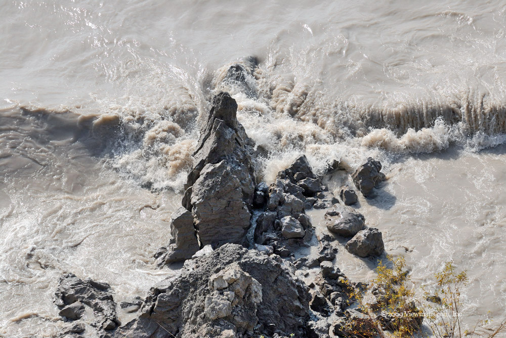
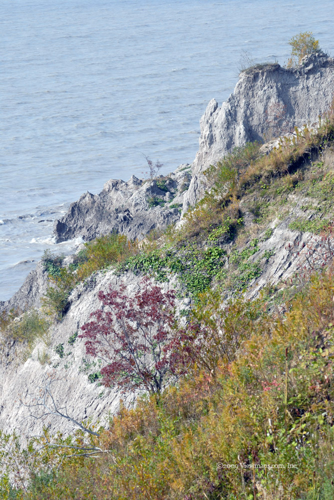
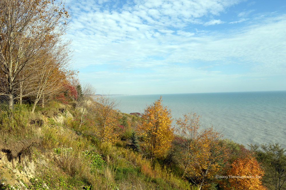
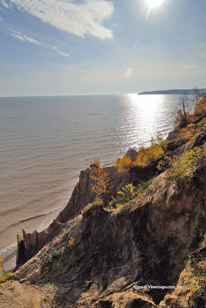
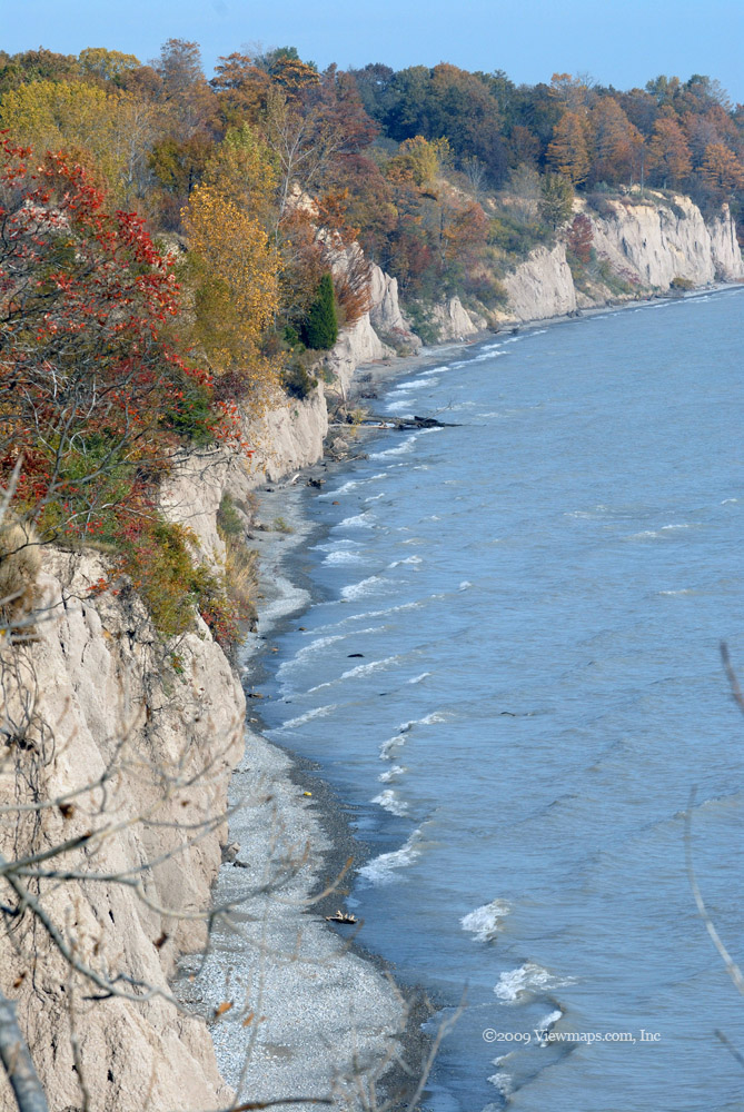
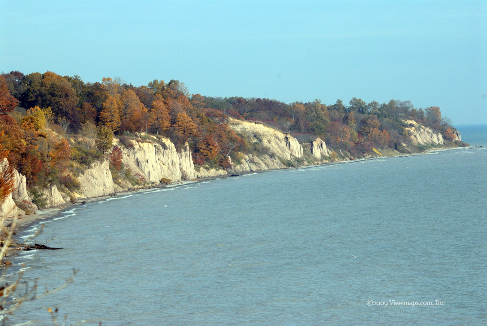
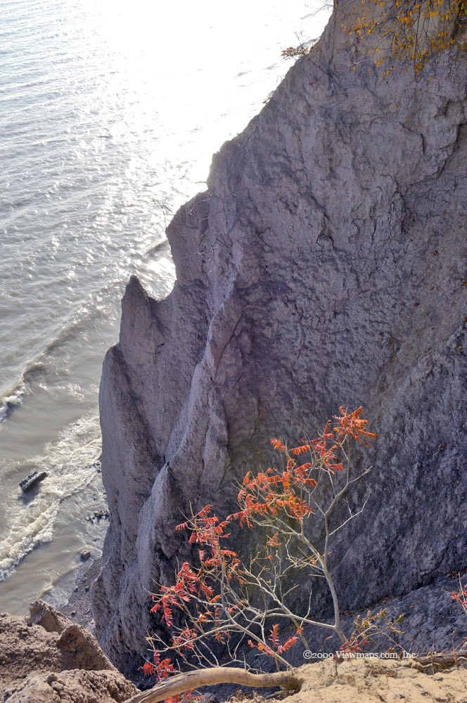
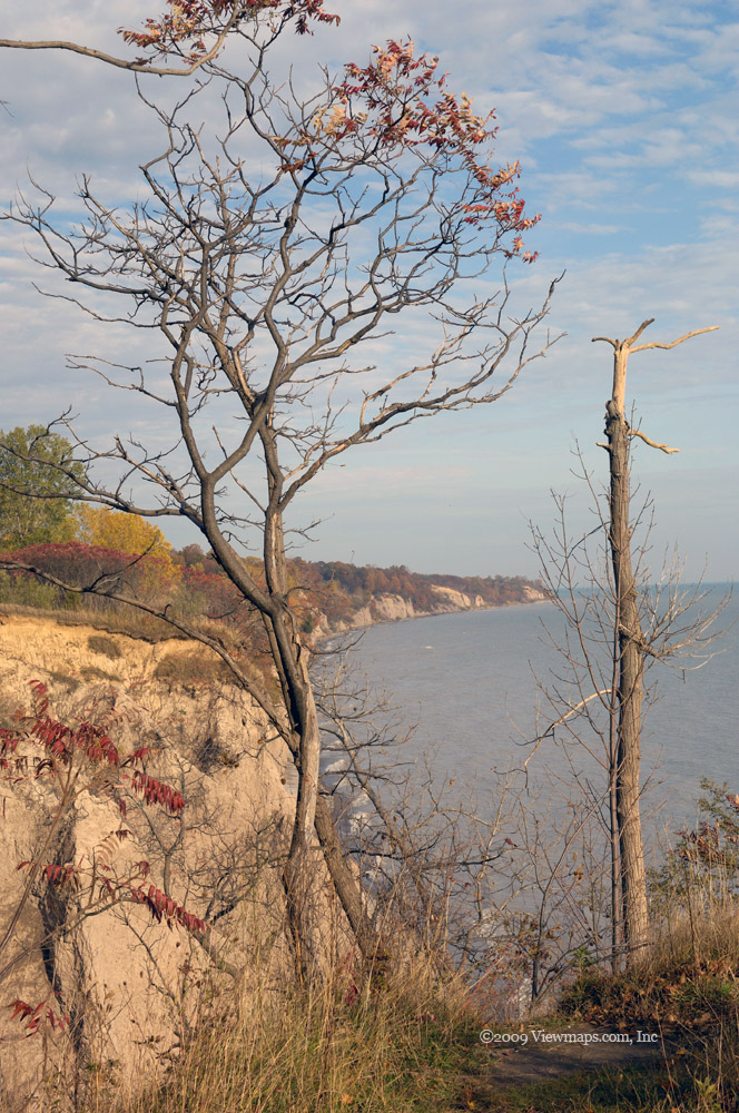
As we made our way along the side road, we were blocked by a senior and his wife collecting firewood. We chatted for a few minutes, they told us that they loved the bush and that he has been coming here for many years to collect wood and clear some of the deadfall. Once across the lowlands we traced the hydro service road up the slope to check out some viewpoints we could see further up the line. The road was very steep in one place and I wasn't sure we could traverse it, but Geoff felt quite confident and so up we went. I am glad we did because some of our best photos were taken just past that rise, next to a tower on an overlook. We stopped for some photos and then continued up the service road a ways until we reached another steep wet area that we thought would be best trying another day. So we retraced our path and then continued along the service road through more lowland and mud before the road connected back to the main FSR.

The sights we saw were quite good but we were only able to get in a few kilometers. The snow blocked us from the bulk of the road so we put a return trip on our calendar for next month. We got back to the highway and drove into Hope for a late lunch - we found the Blue Moose Coffee House. It was quite a chic little eatery, a bit of a surprise to me considering the smallness of the town. After lunch we returned to the highway and tried the next FSR - Garnet Creek. We didn't get far in before we were again stopped by snow. Then we had trouble with our transmission, it wouldn't to go into first. Geoff got under the truck and reseated a few of the wires connected to the transmission and we were soon back in good shape. A few more photos were gathered and then it was time to head back. Another road to explore later in the season.

Chilliwack Mountain

The weather was questionable as we left home but I hoped it would clear up by the time we reached the Chilliwack area. Alas, clearing was not in the cards, rather we got rain and even flakes of snow. We arrived at Chilliwack Mountain with minimal delay and exited the highway to make our way to the north side of the mountain where the access road was. I was immediately surprised to find the area fully developed with high priced homes lining the road all the way to the top of the rise! This was not a back country trip after all but a trek through a pricy residential area.

The road up the mountain was interesting as it made its way up the slope. There were many nice homes with great views all along the road and numerous new homes being built. The area was a mixture of new and old communities all sharing a lovely view of the valley below. Once we reached the top the weather worsened and we encountered light rain and some snow. So we didn't stay long on the slope - most of the view was obscured in fog and rain mists so the trip did not give me a good feel of the place. Once back down we headed further along the Fraser River and came to a nice view spot of the Fraser River looking westerly. Ethan noticed a hissing sound coming from under the truck at that spot but we couldn't confirm its cause, so we continued on along the road and soon came to a field where there were a number of lovely solitary trees to photograph.

It was while I was taking tree photos that Ethan confirmed that we had a tire puncture. We still had a usable amount of air in the tire and decided that changing it here in the mud was to be avoided if possible. So we got back in the truck and drove the few miles to the freeway interchange we were on earlier as there were a few service stations there. The paved area of the station made it easier for us while we changed the tire. So this cut our adventure short and once the spare was installed we set off for home. Being tired and wet with the continuing poor weather made it an easy decision. 

So it wasn't the best of trips but I did enjoy a few of the views from the higher elevations and look forward to a return trip when I can better see the valley. I could wish for more public access along the road to the views as it seems that most spots have become private property leaving visitors no access to the views.

Snowshoeing on Airplane Creek FSR

It being earlier in the season than the previous time we were here, I wasn't expecting to get as far up the road by vehicle as we did last year. But I was determined to get as far as we could go before starting our hiking. So it came as no surprise though still a bit of a letdown to find we were stopped about 300 meters from the start of the road! We didn't quite get up the initial steep hill! So after viewing the situation where we stopped inching forward I decided it was best to just back down and park along the Foley Creek FSR which is level at the point the Airplane Creek FSR branches off.

Unfortunately, backing down the hill was a bit more problematic than we had expected and soon we were off to the side and quite stuck. We couldn't move up or further down. So we started the process of digging out the truck enough to get the chains on the tires and clearing out the snow piled up under the truck. This took the better part of an hour to complete, but once we had 3 of the tires chained we were able to rock the truck out of its rut and back onto the main part of the road where we were able to put the last chain on. We then carefully backed down the slope to the level area. This time we had decent traction and no longer slipped off the road.

Once parked, we set up the cross-band repeater radio that I use for hiking safety. The deep snow made it a challenge for finding suitable anchor points for the guys ropes. So we just kept the height to a minimum. Then we were off on our footed adventure. Just past where we were stopped in the truck there is an side-road to an area the usually becomes the drop-off point for ATV's and as I hadn't been in it before we decided to see what it might offer. We were surprised to find that the road continues past a small berme and right over the actual Airplane Creek via a heavily decayed bridge. The road continued on up the slope to parallel Foley Creek. Since it was a new area to me we decided to keep going and see what we would find.

The snow was fairly deep and made for slow going but the snowshoes worked well and we had a good time making our way up the road. We unfortunately didn't get high enough to get to some good viewpoints and had to make do with partially obscured views of two different peaks. After a couple of kilometers of hiking in the snow, we reached a southern exposed stretch of the road which was bare, so we ended up hiking the final third of our hike carrying our snowshoes. By the time we reached deep snow again the wind had picked up and the temperature was dropping so we decided to stop at that point, capture a few shots and then head back. The return trip went so much faster as we were almost skiing down the slope!

Once back to the truck we packed up the ham radio and were soon ready to depart. We were quite relieved to find the truck take off and get onto the road with no problem. I really didn't want to have to dig it out again! So it was a pleasant hike though a bit lacking in photo ops.

North Mission, Hayward lake

I noticed on my map a few logging roads north of the town of Mission that seemed to offer some views of Stave lake. After reviewing the possible views through Google Earth I was determined to get there and see them for myself. So we set off for the area, it wasn't a bad day, partly cloudy and cool but not overly cold which was nice for February. We didn't have much trouble finding the final road leading to the FSR but once we got on it we noticed that there was deep snow piled up along the sides, so I was quite apprehensive about our chances of getting very far along the road. Alas when we finally did arrive at the start of the road we found it blocked by ice and a locked gate. It did look promising however for a follow up visit in May, I hope the gate is unlocked by then.

As that was blocked, we tried a second road not far away and discovered that it has been permanently closed and converted to a hike which leads to a viewpoint of Hatzic Prairie. So we will need to return once it is clear of snow. Since our main target was unavailable we moved onto the Stave Lake area. As we approached the dam I noticed Hayward lake to the south which I had never explored so we started off there. It was a lovely find. The lake is managed by BC Hydro and as such is kept quite clean and available. We parked the truck in a large paved area and took a brief stop in the facilities which were actually open. Then we walked along the lake for a bit gathering some photos. There were a number of groups out walking and enjoying the nice day. We met a large Dane/Mastiff cross dog which was bigger than my own Danes. He seemed to have much the same personality as a Dane.

After exploring the lake we stopped near the truck for a bit of lunch then we continued north along the river on towards the dam. We learned that the river flow and lake level was lower than normal for some maintenance. This gave us a few different sights of the river which would normally be submerged and not visible. There was still ice covering a large section of the river and an old tug boat was frozen in its midst. While walking we came to a hydro exhibition area where they had samples of transmission towers, transformers and other power related items with some explanatory commentary. It was quite interesting and offered a few unique photo ops. We then made our way to the dam/generating station which we discovered was a museum and actually open. The person on duty encouraged us to buy a ticket and view the exhibits but as it was getting late we took a rain check so we could get out and capture a few more images before the light was lost.

We walked back to the truck and set out for the Stave Lake mud flats where 4x4s go to run in the mud. The area was still quite hard and frozen but there were numerous determined groups out there camping and enjoying a camp fire. It was getting later and we wanted to see more of Hayward Lake, so we didn't stay long. We drove back to the main road and made our way to the south end of Hayward lake. There we found a second dam and generating station. This one was quite interesting as it had a one lane bridge along the top of the dam which forced cars to take turns as to which direction was active. While there I noticed that there was a fair amount of traffic crossing the dam and all without problems or electronic control devices. I got a few interest shots of the dam and area before we continued south to head home. 

We drove past the south Stave River area which is a large area of wetlands which look like they would have a lot of birds during the warmer parts of the year. This section looked moderately accessible and will need its own return visit some day. Once past the wetlands we arrived at Highway 7 and quickly made our way back across the Fraser river and on to home. The weather had definitely worsened by this point and so I was glad that we were done for the day. We stopped at Tim Horton's in Abbotsford to warm up a bit before continuing home. Though we didn't see much of our primary objective we did discover Hayward Lake which neither of us had seen before. It was well worth the time to visit and will be worth returning to. So all told, I ended up with several more places to visit again, it seems one cannot exhaust the number of areas to explore even within the small Fraser valley region, and there is a whole province to explore!

Hilton Falls Conservation Area - Ontario (Day 2)

I always look forward to my return to Ontario to explore some of the back areas and see what beauty the autumn change brings. This year I was joined by Mike and his son Luke as before but we added Mike's brother-in-law Steve to the group. Steve enjoys the back country and is familiar with a number of the areas worth exploring. He suggested the Hilton Falls Conservation Area for today's trip. It's fairly easy hiking and offers some great forested areas to enjoy.

So we started out from Grimsby , met Steve in Burlington and set out for the Conservation area. We parked in the back roads area next to the park and quickly started up a trail. The trees looked great with leaves in all stages of falling. We soon came to a little stream that we crossed over where we found a number of interesting photos angles to shoot. It looked like it would be a great hike. We traveled off the path for a ways to get a look at a swamp area but couldn't find a decent vantage point for taking some photos of it.

We returned to the path and travelled further, soon we came to a fork and noticed a nasty sign posted on a tree along the left path. It was telling us that this wasn't the proper way to the Falls and that we need to go to the official entrance. So we decided to take the other branch and circle around another swamp area and back to the car. It was a lovely hike and we had many opportunities to collect images of some small streams and various trees. Eventually we were back to our starting point, but as it was still quite early we needed to choose what to do next.

We decided to drive around to the main entrance to the park and explore the actual Falls from there. We were shocked to find the price of entry was $5.00 a person but we were here and so we paid it and parked so we could explore the Falls. We made our way along the well groomed trail to Hillton Falls enjoying the colours and fresh air. At one point Mike noticed some small birds flittering in the nearby trees. He held out his hand with some seeds and soon they were quite willing to eat out of his hand. After enjoying the birds for a few minutes we continued along to the Falls.

Once at the Falls, we scouted the area for some good angles and soon found ourselves at the bottom looking up at the water fall. Though not a very big drop, it still has a majestic quality to it. I was able to capture a number of different angles and exposure settings of the creek. The whole rock face was seeping with water which was also very pretty. Once we had all gathered a number of images and explored the creek from all sides, we set off downstream to an old viewpoint Steve remembered from years back. We found the spot but the view was over-grown so we didn't have the desired scene.

We climbed back up the escarpment and found a plaque describing a circular hole that had been formed by the creek in years past. Then it was back to the trail and the walk to the car. It was a lovely setting and a good first day out in the trees for this trip. The differences between the forests in BC and here are quite amazing and though there aren't the huge mountains , the subtleness of the hills here pack an amazing amount of grandeur into the area, and it is often more accessible.

Webster & Tews Falls Conservation Area - Ontario (Day 3)

I was looking forward to a return trip to the gorge. Last year we had good weather but we were a bit after the peak colour. So this year held great promise as we were just before the peak and the day was looking very agreeable. Mike and his son Luke picked me up mid morning and we made our way out to the gorge. We decided to try a different route this year to avoid driving through Hamilton. So we made our way up the escarpment east of the gorge and drove west until we reached the parking lot on the Tew's side of the conservation area . We paid our five dollar fee - much nicer than yesterday's rate - and collected our gear.

We walked over to the trail that skirted the bluff and joined a number of others making their way to the observation area overlooking the Falls. It was a beautiful sight again as we reached the platform. The water volume was a bit higher than last year giving a bit thicker ribbon of water as it descended the rock face. The colours were definitely fuller than last year and they gave a great contrast to the rock face and water fall. We waited patiently enjoying the view as a number of groups came and went , then I was able to position the tripod for some longer exposures of Tews. It was a bright day and I couldn't get the exact exposure I wanted, so my waterfall is a little less silky than I would have preferred. I need to make a neutral density filter a priority for my kit.

After enjoying the view for some time we moved to the second viewpoint and grabbed a few last shots of the waterfall. We briefly chatted with another photographer who was busy shooting the scenery like us. We made our way along the upper trail that leads to Dundas Point stopping every so often to collect a few images. This trip we stayed on the main trail until we got to a spot that we really loved last year and there we clamored down to the edge of the drop. We all took some photos though Luke seemed a bit hesitant to get near the edge, probably a good level of caution for a pre-teen.

We returned to the trail and made our way further along not stopping until we got to the side trail that led to the main overhang prior to the point. The sun was just right to bring out the dense colours of the trees this morning. It was an amazing view, leaves ranging in colour from strong rich greens through yellows, oranges and deep reds. It was so beautiful I could have stayed there for hours. But we had a dead-line - Luke had a birthday party to get to by 3pm! We continued on to the actual point and grabbed some more photos. Once we had enjoyed the scene and refreshed our souls, we set off back to the car. Due to the time constraint we had decided to remain on the top of the gorge this year and not do the circle route like we did last year.

Soon we were back at the car and we drove around to the Webster side parking lot. This lot was almost full and we just managed to snag a stall after it was vacated. There were attendants collecting fees on this side this morning but we had paid at the other side and so we were waved through. It wasn't until later that Mike remembered that he had an annual membership and didn't need to pay anything! Oh, well, the extra fiver goes to a useful cause. After parking we set off for a top view of Webster's Fall. The flow volume was much higher this year and looking at the bottom we could see that the places we collected images from last year would not be accessible so we decided to remain at the top. 

After collecting a few images we moved further along and found a small trail down to the cliff edge which we followed and found the photographer we met at Tews grabbing some photos here. This time we had a lovely chat with him, Mike spent quite awhile chatting while I took my photos. He had a Nikon camera and through our chatting we learned that he was hoping to own a 70-200mm one day. I pulled out mine and let him try a few shots with it. I think that made his day, of course now he wants that lens even more.

After a few more images I packed up and we returned to the car so we could get Luke to the party he was invited to. Once we had dropped him off, Mike and I decided to find a restaurant for a late lunch. We had a good meal and then set off back to Grimsby. Later this evening Mike's eldest daughter would be celebrating her 16th birthday and we would have a chance to meet more of the extended family. It was a good day of hiking and picture taking and family fellowship over a home cooked meal.

Hawks Cliff Road (Day 6)

I have visited these cliffs on all of my previous trips to Port Stanley. There is something subtle yet powerful standing on the cliff edge watching the waves break on the beach far below. The place always seems to be windy, keeping the waves aggressively breaking on the beach below. The sandy cliffs are slowly eroding, depositing silt in the lake water below which is coloured gray with sand. As I watch the waves pull back from the beach, the thin layer of water glistens in hundreds of shades of blue-grey. It is really an amazing sight. The sound of the waves alone is a soul refreshing experience but adding the view, multiples the effect the area has on ones spirit.

Though the weather wasn't the best, I had been cooped up a few days and just had to sneak out in the brief break between the storm fronts. Today Carolyn joined me for the short trip to Hawks Cliff. On arrival at the cliff, I noticed that this year the corn field was yet to be harvested and the tall stalks blocked my view of the distant trees. So I concentrated more on the eroding cliffs and the waves breaking on the rocks below. The wind is continuous here and always seems to have a bit of the grit from the shore carried along in it. It doesn't take long before one is tasting the grit and wiping sand from ones face.

The leaves seemed a bit dull up here this morning, possibly due to the mostly overcast skies but I still was able to find a few spots where I had a clear view of some stands of colour that were quite spectacular, this time on the west side of the road. I walked along the cliff only a short way today as Carolyn was with me and I didn't want to ignore her for long. She doesn't often travel with me when I go out taking photos so it was a special treat having her with me. She found the hundreds of bird nests dug into the side of the cliff quite interesting unfortunately neither of us saw any birds using them - probably hiding out of the wind.

After I had taken a number of photos with my regular zoom lens, I needed to change to my long lens but changing them at the bluff would have damaged my camera due to the grit. So I had to pack up and trek back to the car to change lenses and then return to the cliff edge to take the shots. It was disruptive of my concentration but necessary. Sometimes technology must be babied to keep it safe. Once I had collected a number of telephoto shots I returned to the road and found the stand of colour across a field to the west of the road. I had been a bit disappointed up to this point in the lack of colour, but here I found it and this field had been harvested so I had a good view of the trees.

As I completed the shots across the field another photographer drove up and parked. He shot wildlife and had some gorgeous long lenses and heavy tripods. He hauled them out and walked to the cliff face where he set up to capture some birds. He said that a group of hawks were just down the shore and slowly making their way this way. So he was getting ready for their arrival. By now the day had gotten a bit duller and we had seen enough of the cliff so we returned to the main road. I had hoped to stop at a few more sites but the day had deteriorated enough to make me want to get back to my warm room at the inn, so we set off back there and spent the rest of the day relaxing with a nice book.

Western Elgin County - Ontario (Day 7)

The day was starting off really nice for capturing some photos - some cloud and reasonably warm. It being the best day yet in Port Stanley, I quickly decided not to waste it and so after a leisurely breakfast I set out along the back roads to the west of the port. I had traveled some of these roads last year but this time I planned to go further and explore more of the shore. The first few miles of road were familiar to me from last year, but the better weather and more vibrant colours made the drive fresh and interesting.

The initial section was along Lake Line which starts off paved but soon becomes a gravel road. The first section of road was a bit drab but I did pass a couple of maple syrup farms with names I recognized from labels in the local food store. So that was an interesting surprise. I was interested in dropping in on them but felt I needed to keep going so as not to lose the sun. Perhaps next year I can come back and see their operation. I continued along to Iona Road and drove it for a short distance. I arrived at Fingal Line and continued down it until I came to the small church and cemetery I enjoyed last year. I gathered some more images of it - this year the fuller trees hid the church so it was harder to find the shots I wanted.

I continued along to Port Talbot but couldn't actually find anything there. The map shows an historical homestead but I couldn't find it despite driving a ways down a long road that turned out to be a private driveway. Once the mistake was discovered, I quickly turned around and left before the resident dog caught up to me. I continued west and noticed on the map a small park on the shore - John E. Pearce Provincial Park. I decided to check it out next. Upon arrival the gate was shut and locked but another car was parked in the entrance so I decided to do likewise. It sure seems odd that the parks are all locked up and ignored so early in the season.

I grabbed my gear and set off down the park roadway towards the lake. The road was covered in leaves and surrounded by tall trees, it was a lovely adventure making my way along the road. Soon the road turned parallel to the lake so I left it and made my way to the cliff edge. The view of the lake was lovely but I couldn't get a clear shot of the shoreline from here so that was a bit disappointing. I returned to the roadway and soon it came to a small parking lot next to an open grassy area that continued to the cliff edge. Upon reaching the edge here I had some great views of the lake and the beach far below. The place was a lovely find and made the trip. I stopped to drink in the beauty, the other visitor came by and chatted for a few moments before moving on. I then continued east along a bluff trail and found some more viewpoints to capture some photos at.

Next I set off back to the car to head out but when I got there I noticed a hiking trail across the road. It was a continuation of the park and so I decided to hike it for a short ways to see what views I might find along it. The first part of the path runs along the edge of a private house and yard, they had put up numerous signs pointing out that the trail went one way and going the other put you on private land. They obviously get a lot of people losing the trail and crossing their land in error. The trail was restful and offered some interesting sights but it got deep into the trees and didn't open up into any views - at least for the distance I walked. By now I was getting quick tired and my inspiration for photo taking was rapidly diminishing. The sun was also getting low reducing the light levels too much for decent photographs - it was too breezy for slow shutter speeds. I returned along the way I came and returned to the car. The park was definitely interesting and I need to return a bit earlier in the day so I can walk the whole trail as I do think it opens up to a view of fields not much past where I turned back.

I got back on the road and decided to head back to the Inn but not directly. I wanted to drive through a few of the smaller towns mentioned on the map to see if they had anything of interest. The first of these was Wallacetown followed by Iona. Next came Shedden and Fingal. These last two both looked interesting and seemed to have some potential angles to explore but I was definitely beyond interest in photo taking by now so I didn't find anything inspiring to stop me long enough to grab some photos. A shame really because they were both interesting little villages. A return visit is definitely in order. I think I should plan a day trip to all the small villages around the port just to capture the essence of them.

Once out of Fingal the clouds had thickened and were starting to spit at me . So it seems that my timing was quite good for the day and I got back not much before the rain started in earnest. Over-all it was a very successful day for photography and I did manage to find some excellent scenes to capture.

Alton, Ontario & Region (Day 11)

Our last few days in Port Stanley were spent hiding in our room out of the wet weather. Then our drive to Alton yesterday was mostly a busy day, though we saw some lovely sights, I tend to focus on getting to the destination and not take photos. A shame really as I would not likely find those scenes again. But today was shaping up to be a decent one for photography so I packed up my gear and put a new battery in the gps and set out. I decided to head south towards the Brampton area as the escarpment criss-crossed this area and I was hopeful I would find a number of opportunities. I had spotted an interestingly named town on the map and I was anxious to see it.

The initial part of the drive saw me head through a few scenic areas with tourist stops but as of yet I wasn't inspired to stop and grab a few shots. I knew that once I did get started I would soon find an unending supply to capture but so far it was a slow beginning. As I made my way south, I travelled through a few small towns that all looked like they would be worth a return visit but today I just kept driving. Before too long I came to the town of Terra Cotta. The name itself was interesting and the river running through it finally broke through my inspiration block and I was out of the car taking pictures at the side of the road.

The Little Credit River looked lovely as it crossed the highway and travelled along the edge of the town. I would have liked to walk it for some distance but it seemed to be in the midst of private property so I made do with a few shots from the roadside. Now that I had found my first captures I checked the map and found some back roads leading to the Silver Creek Conservation area. So I set out to find the road and make my way through the countryside. This area is actually quite rugged with many steep drops and rises as the roads make their way across a wide broken section of the escarpment. Unlike the Grimsby area where the escarpment is a single cliff face, here the region is broken up with numerous ridges reclaiming the same elevation gain time and time again, much like a wrinkled Kleenex. It was quite a pleasant surprise to find so many small valleys and creeks within such a short distance. It makes for an unending supply of variation, each isolated from the others and unique in character.

I finally arrived at the conservation area and enjoyed a lovely view of Silver Creek and the colourful hillside as it wanders between two ridgelines of the escarpment. After driving to the ridge over-looking the creek I discovered that I had arrived at a crossing of the Bruce Trail. The weather was good and the area looked inviting so I parked the car and set out on the trail in a north-easterly direction. The trail at this point is at the top of a ridge and offered a few spots looking down on the creek. Unfortunately most of the viewpoints were over-grown so they didn't offer much for panoramic photos. The trail made its way over rough stone that was well weathered over the years. Being Fall, the trail was covered in leaves which made its own beauty and I was able to get a number of shots of the trail itself. I tried a side trail that looped back to the main one but half way along I lost my way due to the trail being covered by the leaves. Fortunately it was only a short distance from the main trail and I cut across the distance and was soon back on the main path and heading back to the car. There were quite a number of couples and families with dogs out walking the trail which seemed to make it all the more inviting.

After I had worn out the limits of my back I returned to the car and set off back to the Inn. I decided to drive through the small town of Erin and saw many people milling about having recently left their church services. I stayed on the main road where I saw a number of interesting stores to explore some day but I didn't see any photo ops here. Soon I was back at the Inn where Carolyn and I set out to find a place for a late lunch. 

After lunch at the second mill in the town we returned to the room and I went out to capture some shots of the mill dam and waterfall. Though not a very high drop it did have a decent flow of water and I spent some time trying to capture a decent image of it. I was badly hampered by the lack of a neutral density filter which left me unhappy with the images I took of the falls. I will definitely need to make it a priority to get a filter. Once done at the falls I wandered the grounds of the inn for a bit and then returned to the room to get a bit of rest before dinner. It was a good day and opened a new area of interest for me in Ontario. I will need to return here next year to see more of the region.
So the stay in Ontario was nearly done and I was able to get out on 5 days for picture taking. Perhaps not as many as I would have liked but the colours this year were great and the trip was a success. I guess I will just need to return next year, and find some more sights to explore.

East Harrison Highlights

It was mid-winter and I desperately needed to get out to see some sights and gather some decent images. I was certain that the east Harrison area would give me many sights to enjoy once again - I was not disappointed. My goal was to capture some shots of Slollicum Creek (Upper Rainbow) Falls and then explore Cook's Cove before it got crowded with campers. So we set off for the FSR and the sights we might stumble upon.

As we arrived at the entrance to the FSR we noticed a number of trucks parked along the side having delivered their loads of ATV's. it looked like a busy day for ATV's along the road, we'll need to keep a sharp eye out for them. The road was wet and muddy which made it slippery but at least the dust would be minimal. When we arrived at the first viewpoint of Harrison Lake we got out to get a few images of the lake and northern mountains. It is truly a lovely sight from there.

Our next stop was the bridge by Rainbow Falls. The falls were looking very nice today and I was hopeful they would produce a few quality images. So we drove over the bridge and parked. No sooner had we exited the truck when we were greeted by the first of 15+ double unit dump trucks. They zipped past us in groups of three. It would seem that just after I carefully made my way through the deep mud to the centre of the bridge another group would appear on the road forcing me to get back off the bridge for safety. Then I would try again only to have to get back off. It wouldn't have been too bad if it weren't for the 2 inches of wet slippery mud all over the bridge. After several on and offs I eventually finished getting my photos of the Falls. Once done on the bridge and back in our truck I never saw another truck! It would seem they were there just to get in my way!

We then made our way to Cooks Cove. But on arrival we noticed that there was a gate across the entrance. That was most annoying, when the road was first opened the access was freely available but now that it has become a popular campsite, they have done several sanitation improvements and locked it off! I really do prefer it when the back country is less popular as it seems that as more people come fewer things are left available. Fortunately, it would seem that others were also confronted with the gate and made a path around it, so we followed the rough path around the gate and drove down into the main area. I suppose that they will block it off even more next year, a shame really as it shouldn't be needed.

The beauty of today's visit is that we were by ourselves. Half way through our stay a small boat made its way in and dropped off two people for a short visit, and as we were heading back to our truck a dirt bike came down the road for a quick look. So it was very quiet and pleasant for photo gathering.

The first area we explored was along the western edge of Macs cove. This edge leads to a point that I had wanted to reach on previous visits but it wasn't an easy traverse. As the lake level was quite low this time of year, the path along the edge was much easier to walk so it was a good day to make our way along the edge out to the point. We quickly walked out over the exposed and hence dry rocks to the point where we could look back at the cove and campsite area. After collecting a number of shots we stopped to eat a bit of a snack and then set off back along the rocks to the main beach area. Our next area was to walk out along the main jut of land that separates Macs from Cooks cove. I have been out here each of my prior visits but the narrow sliver of rock has always presented me with lovely sights to capture. I really love the thick moss ground cover as it makes walking quite gentle.

After a number of stops along the outcrop I reached the end and settled down to enjoy the view for a few minutes. It really is a lovely sight. I also worked a repeater with my hand-held radio to see how reception was from here. It seemed quite usable as I chatted with Carolyn at home for a few moments. We then made our way back and continued east along the main area of Cooks Cove. I decided to not go any further up the beach for today's visit and so after a few shots from the beach we set off back to the truck to eat lunch and then head out.

On the way out we decided to try a side road to see how far up into the hills we could go but we didn't get very far. The road quickly became impassible due to snow and ice. So we returned to the main FSR and made our way out. We stopped at the small park on the side of the lake just below where the FSR starts and gathered a few more shots from lake level of the town of Harrison and some of the homes and islets nearby. After that we drove into town where Ethan booked a stay at the Harrison Resort. I felt a bit out of place as our truck was covered in mud and we weren't exactly in the best of attire, but the hotel staff accepted us as we were and gladly took the reservation. I did sense a sigh of relief from their valets as we drove off!

Subscribe to 2009