
Hunter, Garnet & Ruby Creeks

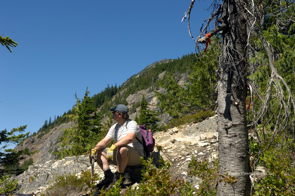
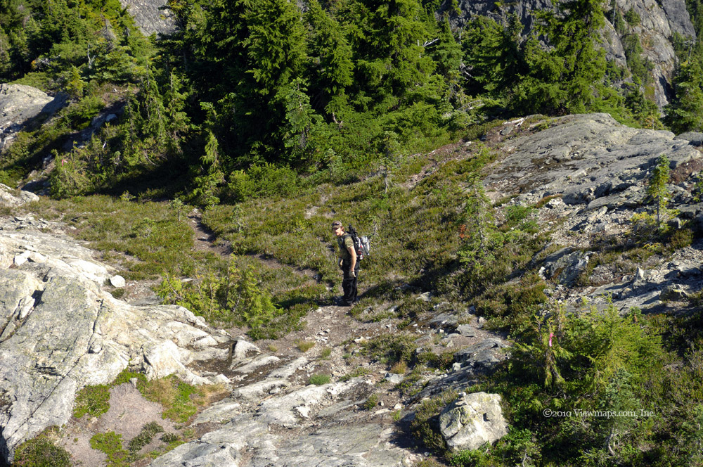
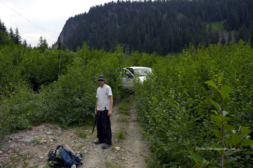
I hadn’t been into the back country since before my Ontario trip in mid Ontario and I was starting to feel a growing sense of desperation. So today’s trip was long overdue and definitely something I was looking forward to. Originally Ethan was to drive for me but he got sick on Friday and as Geoff had been planning to head out on his own he was more than willing to join my adventure and together we set out for the first of our destinations.

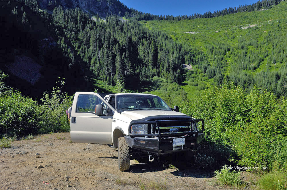
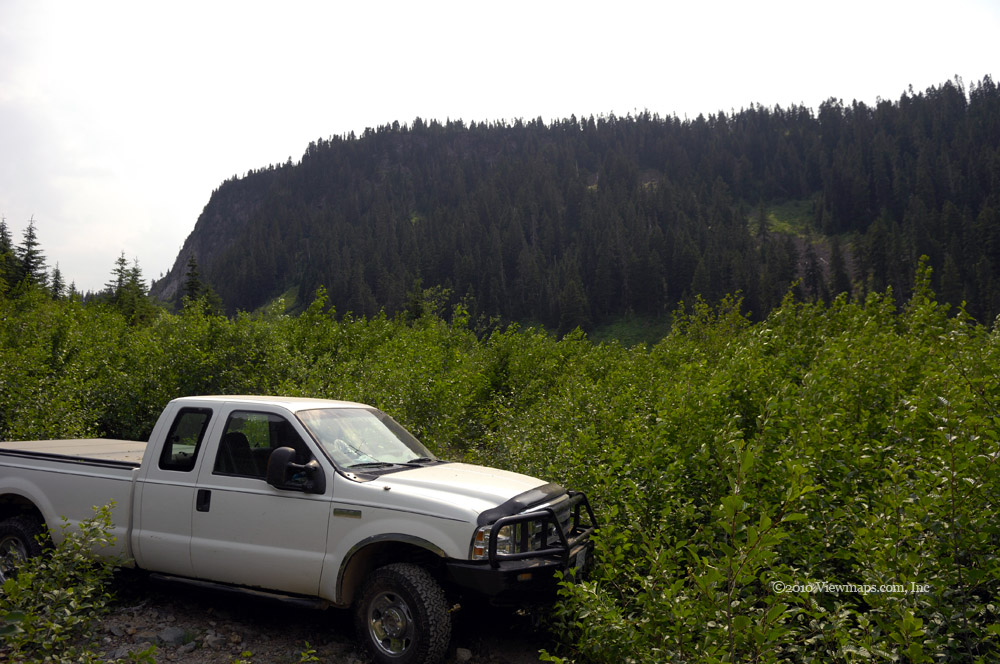
As we hadn’t been into the hills since the start of the winter season, we didn’t know what to expect. We quickly made our way to the Hunter Creek entrance and switched over to 4x4 mode then we started up the steep opening section of the road. It wasn’t long before we were driving through a few inches of snow. When we reached the short section of road that hugs a cliff face we were presented with rocks strewn across the road which were covered in snow. It looked a bit daunting as the snow made the rocks look much bigger than they were. Another vehicle had made its way through here and so we felt we could keep going. It was then that the lumps revealed their nasty secret.
Many of the snow covered lumps were actually chunks of ice that had peeled off the slop above. They were getting packed into the snow cover making a steep sheet of ice. Very quickly we butted up against some rocks with the front tires and couldn’t get any traction. The back was slowly drifting towards the edge of the road so we stopped and decided to use the winch to pull us over this section of road. The winching went quite smoothly and we were soon on basic snow covered road. We drove a few hundred feet further up to a level section and there we put on our chains. We then had better traction for the next few kilometers.

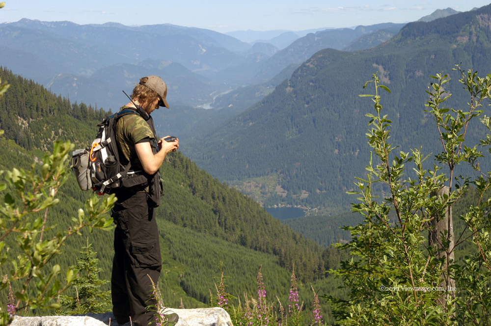
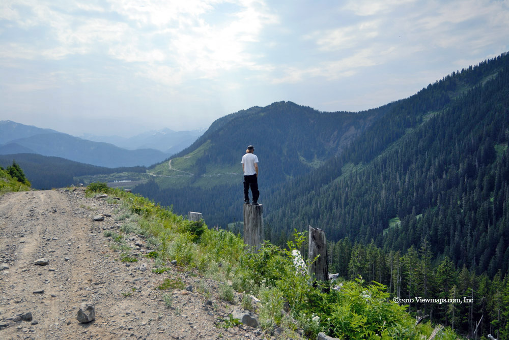
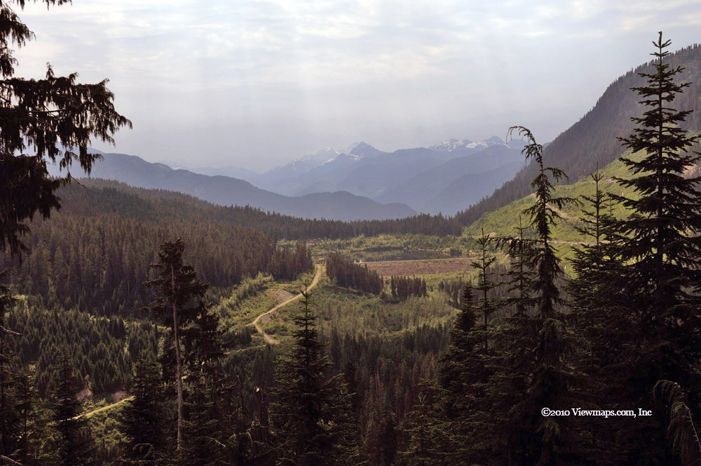
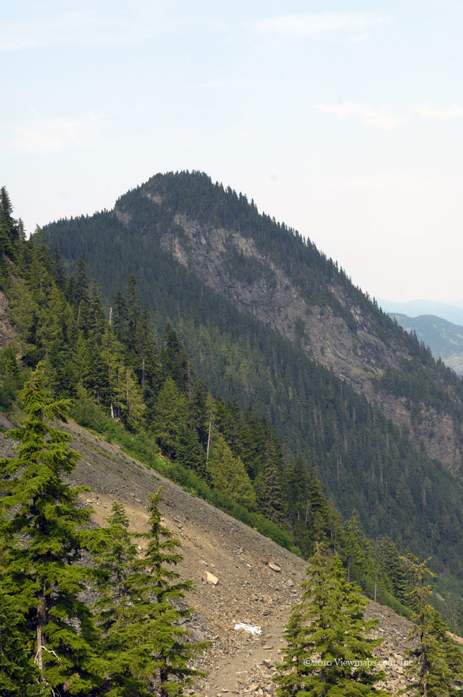
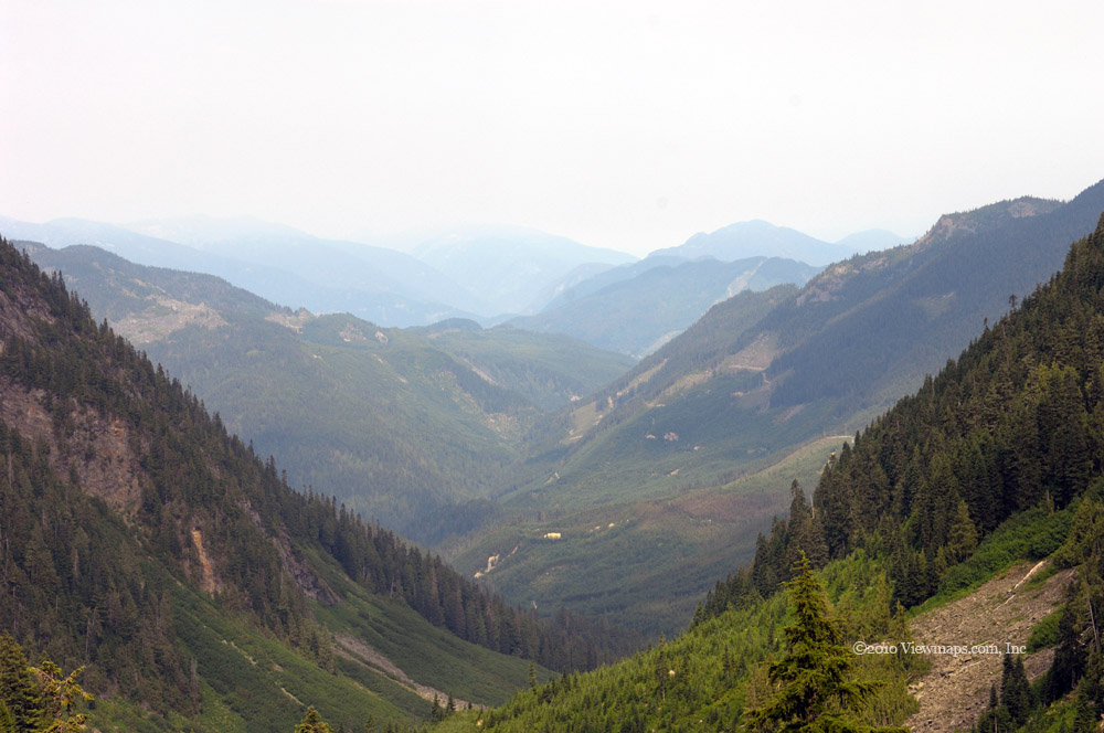
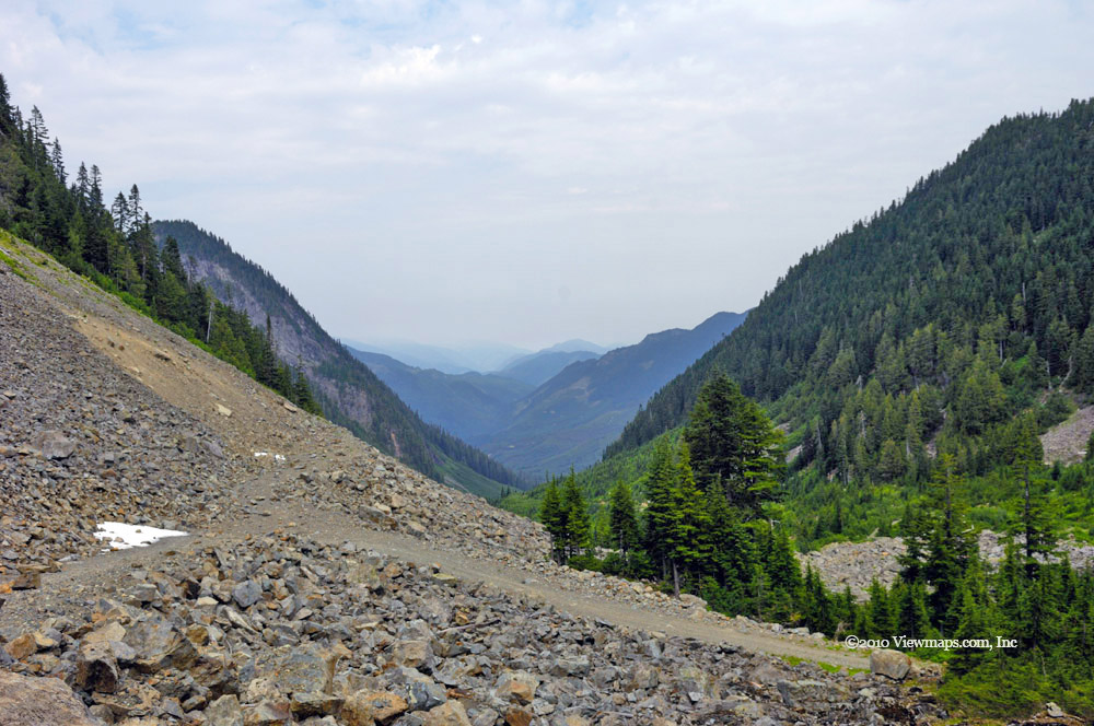
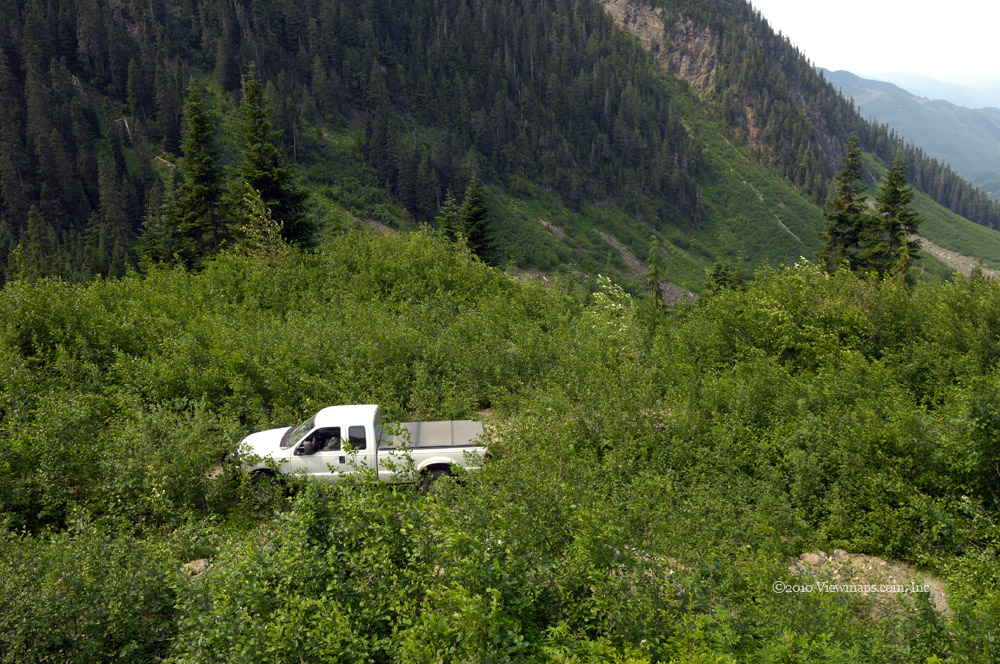
Even with the chains we were spinning out on the steeper section of road and by the time we reached the 500m elevation point the snow had gotten too deep for us to continue so we pulled off into a wider area where we enjoyed a view of the valley and I was able to gather a few shots. I also managed to get some images of the waterfall I spotted on my prior trip, this time it was covered in ice and had a very different flavor to it. Once I was done at the turn around we started back down the road and had no trouble so we were back to the start of the road before noon. It being early, we decided to visit Garnet Creek across the river.

So we made our way to Hope and then back along highway 7 to the entrance to the Garnet Creek FSR. The start of the FSR was snow free and we gingerly made our way through the deep water filled pot holes. As we gained elevation we were soon driving through snow but the elevation gain was slow so we were actually able to make our way quite some distance into the valley. We did see a new sign warning of a locked gate but we never saw one on our travels even though we passed the active logging site. That was fortunate as I really get tired of being stopped by gates.

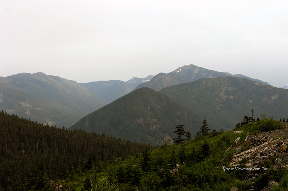
Soon we arrived at the narrow section of road that hugs a vertical cliff face which normally has flows of water falling down it. Today the water was frozen in a huge display of icicles. The number and shapes of the ice was amazing and well worth the drive just to see it. Unfortunately the road at this point was on an incline and covered in frozen water! So we had no traction on the ice and had to winch ourselves a second time. Once we had cleared the incline and the ice field we had no further traction problems on the Garnet Creek FSR. We drove up to the point that the road splits down Garnet Creek and off to American Creek. That was the furthest point a previous driver had gone as well. We decided to push no further and as it was past noon we ate our lunch while enjoying the snow covered scenery. Our return drive was very easy, we did take a short diversion at one point to get a clear view of the valley but soon were back to the highway and as it was still early we drove west to the Ruby Creek entrance.

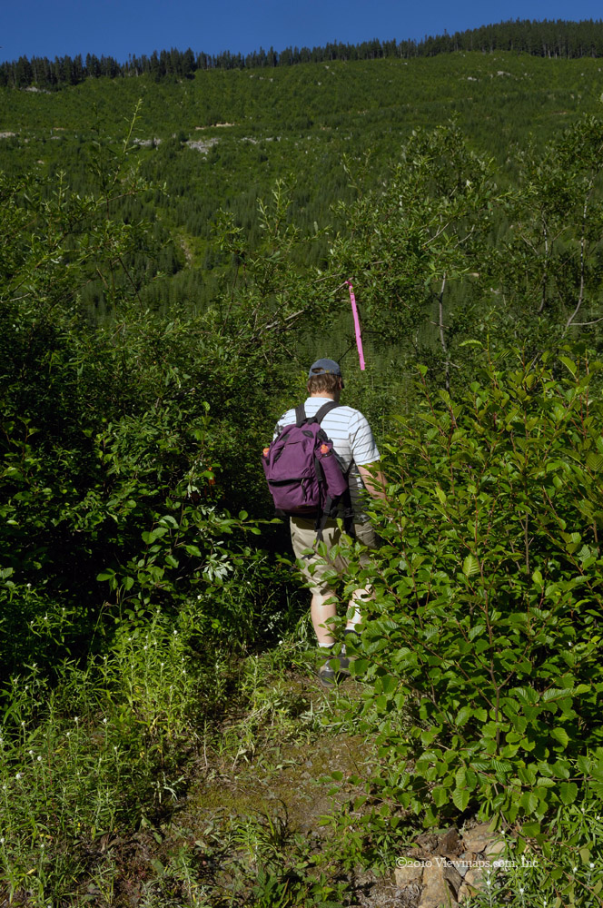
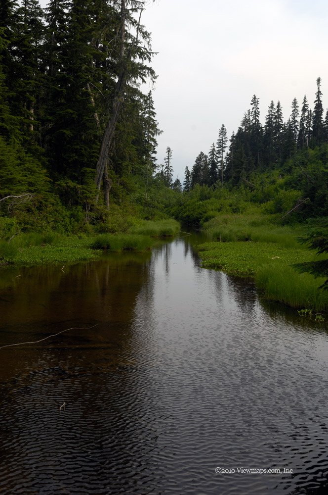
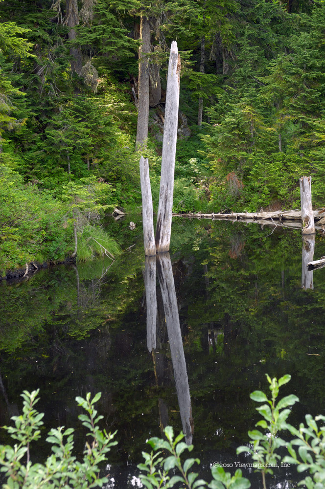
Ruby creek was also fairly low level for quite some distance and so we got past the front hills into the marshy flat lands without delay. There we saw the recent activity of Tamihi Logging. They had a few machines stored at the side of the road waiting for the snows to depart next spring. We made our way over the low ground we had traveled before but the soft and wet ground with a bit of snow cover made it hard to follow the transmission line road up some steeper sections. So we only reached a couple of spots in this area. We then returned to the main line and continued further in and discovered that the old road leading to Deer Lake was now fixed up and ready for logging. I was hopeful it would allow us to reach the lake. Alas it went a fair ways toward the lake but veered off before it and so the last part of the road was still impassible though we did get a number of nice shots of Mahood creek. Once done with this new spur we continued up the main line and soon saw more new short spurs that had been cleared and an old fork was now drivable down both branches so we started exploring the once closed road. It gained elevation quickly so we didn’t get in far before the snow stopped us, but it is worth a return in the late spring to see how far one can get in.

Once done with the mainline we returned to the lower marshy section where we drove a few side roads to various viewpoints before returning to the highway. Once back on the pavement we enjoyed a sunset and were able to get a few shots of it as we crossed over the Fraser near Agassiz. Though we didn’t get in very deep we did have some good sights and a lot of fun driving the snow.

Anderson River North FSR

The Anderson River area is divided into three main sections. A few weeks back Geoff and I did a quick peak into the north valley, then Ethan & I explored the southern one in detail. Today Geoff and I returned to Anderson North. At some future time we will do Anderson East which has a different entrance and is actually further north than the north branch! After our last trip I needed to make a few repairs to the truck and so today it was nice to have it handling better than it has for months! We quickly made our way to Hope and then up to Spuzzum where we turned off the highway for the hills. It being the end of a long week-end, the speed patrol was out in force tagging drivers not paying attention, we found if interesting listening to the comments by the truckers about all the speed traps and speeders.

Once on to the FSR we reconfigured ourselves for off-road travel and immediately started to see some lovely colours. The early section of road was past its prime and not as full as it was two weeks ago when Ethan and I were last here. But new trees were now changing so there was still much to enjoy. We soon were up to the southern viewpoint where we stopped but the colours were not the best this time so our stay was brief. We continued north through the steep rock-fall section where we spotted some interesting colours up slope which gave me a few rich contrast photos. In looking down slope I tossed a few rocks off the road and managed to hit a small maple that had already lost its leaves but was still holding its seeds. Just as the rock hit a gust of wind grabbed the thousands of seeds and carried the cloud of them up towards us and we were momentarily encased in maple seeds. It was amazing to see but happened too fast for me to get a photo! Such a shame.

We then continued into the Anderson valley proper and soon saw some lovely rich yellows bathed in sun across the valley. The colours mixed with the strong greens of the evergreens were already worth the trip! It was definitely prime time for colour changes in the north Anderson River valley! As we made our way to the bridge over the Anderson I enjoyed the glimpses of colour across the valley and we were able to stop at a few clear spots to gather some photos. At the bridge with the sun cooperating I had some great views of the Anderson River Mountain slopes ablaze with colour. We took the left branch just past the bridge and made our way into the North fork. The first section of the road made its way through some amazing colours which I hoped I would be able to capture from across the valley. Soon we came to a fork that crossed the North Anderson and paralleled our current road but on the south side of the valley. We took that fork and crossed over the river to a much less travelled road.

The South main was partially over-grown and allowed travel for only a couple kilometers before it was blocked by growth. The views into the valley were nice but not as exciting as I was hoping for. We decided to back-track and look for the spot the road continued east and into the next sub valley. We found the continuation but couldn’t get very far as the road was over-grown and covered in loose rock which we couldn’t see due to the falling leaves. After bouncing over one large rock we decided it would only damage the truck to continue so we returned to the clear road and the north side of the river. 

We continued along the north side and soon passed the furthest point of our prior visit. Just past that spot the road forked again and we again chose the lower path that crossed the river. This time the road was in good shape and we made our way east for quite some distance. Geoff spotted a Grouse which he was almost able to bag but it nipped into the trees just before he got a shot off. They managed to elude him the whole trip! This section of road was quite drivable except for a few larger cross ditches that had some erosion issues. As we continued along we slowly gained elevation and made our way into a blind valley between Reh, Gemse and Serna Peaks As it was now 1:30 we stopped on a wide straight section of road to set up the antenna for our 2pm radio test.

The antenna went up quickly and soon we were on the air. We unfortunately didn’t make contact with anyone from home. Though I didn’t hear stations on our frequency, Carolyn at home reported later that the band was full of activity around the chosen frequency and she wasn’t able to get through to us or hear me over the other stations. These NVIS contacts do seem to be challenging. Once done with the trial we packed it away and continued along the road as it climbed the slope of Gemse Peak. The road had some challenging cross-ditches along this section. At the top we noticed a parked truck and just as we stopped next to it the owners appeared - coming down slope above us. They were just completing their climb of Gemse Peak. The one chap I talked to has climbed all the peaks in the area this summer and hoped to get in a couple more before the season closes. He said there was a skiff of snow on the road when they arrived this morning!

We gathered a few more photos and then started back down the road. As we made our way back to the main line we tried a few smaller forks but none went very far due to over-growth. The other sight that this section of road provided was a very varied selection of mushrooms. They were popping up all over the road in various types and groupings, the mushrooms offered some lovely macro photography opportunities and the light was strong enough to not need flash, which was good as I didn’t pack it. Once back on the north road we continued east and came to the one active logging section where we were able to take a branch that went steeply up slope and provided us with some great views of the mountains to the south. By now the weather was getting duller as the clouds had moved in to bring some rain. After exploring the slope a bit we returned to the main and continued east. The road was now deactivated and we had ditches to contend with again.

We were able to make our way to the end of the valley and were eventually stopped on the slopes of Llama Peak. Here we noticed the hoof prints of a mid-size moose in the loose road surface. It had crossed the road heading down and then returned back up again to hide in the upper section of the valley. While we checked out the hoof prints the weather started to spit freezing rain on us, so we started our return to the pavement. It was now 5:30 and the sun would set in an hour so it was indeed time to return home. I really wanted to be off the roads before dark and by now the light was too dull for decent photography.

The drive back to the highway went quite smoothly; we did make a couple of short detours along the way but nothing that took much time. As we made our way through the narrow valley that forms the entrance to this area we came upon a group in a pair of pickups that were gathering Christmas greenery. Part of the same group we met a few weeks before. We reached the start of the FSR with 7 minutes to spare before sun-down. The drive to Hope was in spotty rain but we made good time and picked up a coffee at the Blue Moose so that we would be in good shape for the final drive home. The truckers were reporting a few slow spots and accidents on the highway which allowed us to avoid them so our trip home went smoothly and quickly. A great visit and full of lovely colour – if only it could be year-round.

Lorenzetta – Hunter Creek FSR

I have driven past the Hunter Creek area for many years; occasionally I even stopped at the rest area along the side of the highway. This only emphasized the presence of the valley to the south that seemed hidden behind a steep cliff face with no clear place of entry. Over the years I kept telling myself that we need to check out that area but the time to visit never seemed to arrive. So finally I decided to schedule the trip to Hunter Creek and see if there was anything to see. Well the day finally arrived and we were on our way to the rest stop and the valley behind it.

Upon exiting the highway we turned onto the side road and started looking for the entrance to the FSR. We initially drove past it as it seemed marked for private use but after driving well beyond the spot the road showed on the map we returned and tried the private road. We soon saw the familiar forestry sign naming the road and we felt relieved as we finally located the entrance. Parked to the side were a few forestry machines so we knew the area was still active. 

The first part of the road is quite steep as it makes its way along a cliff face to the entrance to Hunter Creek. Once it reached the south going valley the road leveled off and we had a wider road to drive. The road was laced with a series of partial ditches that came only half way across the road on alternating sides. It made for easier travel than having to deal with a normal cross-ditch. Soon we crossed Hunter Creek where we had a lovely view of the creek bed and the swirling water as it made its way over and around large rocks. Our next stop was at a small clearing where we had a view of the mountains to the west. I also noticed a lovely patch of mushrooms scattered over the clearing that provided a few interesting photos ops.

Leaving the clearing we next came upon a small creek with a lovely waterfall that was worth a series of slow shutter photos. We continued up the road and came to a fork, we selected the busier branch to the right which soon re-crossed Hunter Creek and headed up the far side of the valley. The road gained elevation quickly and we passed a couple of branches that looked inviting and which we planned to explore on our return. Soon we were in the recently logged area and there we met another vehicle on the road. It was a family – the father was hunting, his wife and three kids out for the drive! We continued past them and soon started down a larger cross-ditch. But at the bottom we couldn’t move! It seems that the transmission was not turning the tires despite the RPMs of the engine. The chap we passed offered to pull us back level, which we accepted. After looking over the truck and not noticing anything we decided to head back down – quite dejected as the day seemed lost.

Once back down and across the creek to that first fork we decided to head up the other side it as it seemed less steep and the truck wasn’t showing signs of any worsening problems. So we slowly made our way along and through the cross-ditches as this branch was deactivated. As we crossed each ditch without problem we felt bolder and we kept going even as we gained elevation. Soon we came upon the family again while the father was scanning the slopes for a deer. He never did find one up there. We continued along the road to a view point where we ate our lunch. Then we continued further along the road, we came to an older area that had been logged perhaps last season. Once past the logged area the road showed signs of being little travelled and we had rougher conditions to over-come. The road was still quite passable and the truck acting fairly well so we continued along for a few kilometers until some rock fall narrowed it a bit too much. We parked the truck and walked the short distance to the end where we had a lovely view of a rock face, a fall-coloured slope and a view of the Fraser Canyon. From there I could actually hear the noise from the freeway!

After enjoying the sights at the road-end we started back to the truck and then made our way slowly back along the road. A couple of the cross-ditches seemed steeper in our return direction and one of them bent our rear bumper! We were able to bend it back a bit so it doesn’t look too bad, but it still needs some further straightening. Before long we were back to the initial fork and onto well-travelled road. Soon a pair of motor bikes passed us as they made their way into the valley.

We stopped a few more times to take in the fall colours and to enjoy the area. I didn’t want to chance some of the rougher sections until the truck is looked over. So there are still a few sections that need more exploration. Despite the truck issue we enjoyed a full day out there and saw some lovely sights and colour though it wasn’t as much colour as we could have seen if we had travelled further up the Coquihalla. So the area was definitely worth the effort to explore.

Anderson River FSR - South

I first found this region two weeks ago with Geoff when we took a quick look in the northern branch of the river valley. The colours of the leaves were just starting to change back then, so here we were two weeks later and I was expecting some nice colours and a chance to explore an entirely new area. It has been over two months since Ethan was on a major driving trip, so I was hoping he would find the area interesting and the driving a challenge for him. The weather looked to be perfect for the activity and we left home expecting a good drive.

The drive to Abbotsford and on to Hope went quickly and without incident. There are a number of spots along the highway between Bridal Falls and Hope that I have passed numerous times that keep calling out to me and I keep wishing we would have the time to explore them. I guess I will need to plan a trip to the area lest they never get seen. In Hope we topped up the tank, bought some subs for lunch and called home on the radio. They could barely make me out even though I was line-of-sight to the repeater. I figured that we had to have an antenna issue so I got out to check it and sure enough the loading coil had come loose. Once it was tightened I had great reception for the trip. I sure am glad we were able to solve that quickly as it would have been less obvious in the hills.

We left Hope and made a b-line for Spuzzum and the FSR entrance. There are a number of access points to the Fraser River in both Yale and Spuzzum that I would like to explore but it seems to always be the wrong time to get down there and see what they might offer. Perhaps we are just in too much of a hurry to get places and should really just take the time to enjoy the trip to the place. Once across the river we quickly set off up the FSR. The first section of the road seemed unchanged from two weeks ago looking down slope but looking up, one could see more colour in the leaves. We stopped at a couple of places to gather some photos. Then the road leaves the Fraser River and heads straight east through a very narrow valley. It was a very scenic section and we stopped in a couple of spots to photograph. The small creek looks like it might be worth a slow walk along its banks to see what sights might be discovered.

Once through the narrow gap we made our way up the slope and soon came to a plateau with a forestry weather station. We stopped to look it over – not much different than my home set up except it has tougher built equipment – needed for the harsher winters. Our next stop was at the high point of the road as it moved to the next valley. Here the colours were deep in reds and oranges and was in fact the most colourful point of the trip. I gathered a good number of shots from this location and even a few more on our way home later. 

We next came by the burned out building that Geoff and I first saw last trip. While Ethan looked it over I noticed a lovely purple coloured shrub that I explored from a number of angles. It was a lovely mixture of reds, purples and greens. Once done with the shrub we continued along and down into the Anderson Valley. We crossed the river and chose the right branch leading to the southern portion of the river and virgin scenes for us. The mountains in this area have a large portion of exposed rock faces and the peaks are generally completely exposed which gives a unique feel to the place. I quite liked the look of some of the better known mountains-they would make a great outing for a rock climber. As we continued along we came to a major branch and chose the right arm again this one re-crossed the river and led to the hills along the southern flank of the river. We continued for some distance heading south-east and soon came to an active logging area. We continued on past to a blind valley where we collected a nice variety of images of the slopes and their interesting colours. At one stop we found a large collection of mushrooms which had their own notion of beauty. 

We backtracked out of the blind valley and tried another side branch. This brought us to an area that was still being logged; some heavy equipment was parked along the side of the road. It was back to the main line and then another side road. This one was partially over-grown but we pushed our way through it without much difficulty. This road led up the flank of the valley and soon we were at 1300 meters with a great view looking back on the path we had travelled. As it was now time to set up for my HF radio test, we selected a spot with the valley view as a back drop and set up the antenna. It went up quite quickly and within 20 minutes we were on the air. I soon heard Don (VA7GL) from our club and we had a nice chat for 15 minutes. I wasn’t able to make contact with Carolyn or other club members but we did prove that the setup was operating. I then tried 20 meters and chatted with a chap in Texas. That done we went to take a photo of the setup but just then the wind knocked over the masts! So we had to push them up and grab a quick shot while Ethan held the centre pole. Photos done, we packed it up in 10 minutes.

Once the radio was stowed I walked back to t a nice little waterfall that was along the side of the road just past our operating position. It splashed into a small circular pond of tannin coloured water and was a pleasant spot to enjoy the water and the sounds of the waterfall with no bugs! We then returned to the main line and drove north to the first branch we came upon and started down the left fork. About 2km in we encountered a truck heading out. We chatted with the driver for a minute, he was the operator of the logging equipment we would soon come to. He was curious about our activities as we were a rare sight back here. We continued on down and soon came to the area that was being actively logged. The machine he was using was a one man harvester – grabbing, cutting and de-branching all in one!

We made our way past the work area and were now on deactivated road where we continued for a few more kilometers to the end of the valley. At this point we were only 2km from the Coquihalla Highway. It was unfortunately on the other side of the ridge. I would like to do some off trail hiking one day and just climb this slope here and see if the highway could be easily spotted from the ridge line. But not today – it was already getting later and we had quite some distance to go to get out. We now set off for home and on the way we stopped a second time at the place we stopped at coming in where the colours were great and the view quite amazing. Here Carolyn reached on the radio to tell us that she was soon heading out for the evening to baby-sit for Geoff and that we should grab dinner on our way home.

We continued out and once on the highway we made good time reaching Hope where we grabbed a coffee and some food at the Blue Moose. It was still pleasant out but one could see the weather starting to turn. So after a quick bite we set off up the Fraser valley for home and a chance to unwind after 10+ hours of driving. Now I just need to return to see the northern valley in detail.

Siwash Creek & Anderson River FSR's

In August we drove the valley from the south end but we didn’t get very far up the FSR as it was far too over-grown for our truck to follow the road. So we were inspired to try the road again but this time from the north end to see how close we would be able to get to the furthest point we made in August. Our day started off well and we made good time to Hope but there we were stalled by the slow filling of the gas tank. It has been a problem for a couple of months but today it was really slow and we ended up restarting the process twice as we just couldn’t tell how close we were to being full. Once that was complete we headed up the Fraser Canyon to Spuzzum and the start of the FSR.

Two things I noticed upon entry were that the name of the road was Anderson River FSR not Catermole as the book shows and second that it was gated at 13km. So we proceeded with uncertain expectations. The road parallels the Fraser for a few kilometers offering a few viewpoints, but soon heads east through an extremely narrow valley, shared with a moderately flowing creek. Once through the narrowest section we arrived at a fork. Both choices seemed well used but the southern one had an open gate on it. The gate looked like it hadn’t been closed for quite some time so we felt fairly comfortable heading on in.

Soon after we started down the road we came to the first of many branches. The area seems well covered by roads leading to all areas of the valley and we were trying hard to select the branch that seemed most likely to reach the far end of the valley. We came upon some interesting features as we drove; the most noticeable was that autumn was indeed starting. Many of the maples had started to turn colour and offered us some lovely reds and oranges. It should be really nice in a couple of weeks. About mid valley we chose a road leading to the left and after making our way along it for a while we came upon a chap gathering branches along the side of the road. We continued past him but soon came to the end of the road. On our return we stopped to ask him what he was doing. He was gathering small branches for Christmas decorations – they are shipped to eastern Canada. He says he can fill his truck in about four half days of work netting him around 3 grand! Not bad for a pleasant romp in the back country.

We returned to the fork and took the right branch and after trying one other short spur we continued south until the road was once again too over-grown to continue. At this spot we were only about 2km from the place we stopped at coming north. We back tracked a few hundred meters to a wider cleared area and there we set up the HF radio for our 1:30 communication test. While we were setting up a group a dirt bikes and 2 atv’s came out of the narrow road having just passed through the section we couldn’t. They said that they had spent an hour building a small bridge for their atv to be able to cross a stream! I guess that would have stopped us even if the road didn’t. They eventually had to return back through the over-grown section despite the strong reluctance of the chap on the atv! Meanwhile I was trying to reach home on the HF radio but was unable to make contact. I did hear chaps in San Diego and one in Germany who were both working a contest. After 15 minutes of trying we packed up the gear and started back up the road. 

On the return we stopped at a cliff face that had some lovely fall colours and I took a number of photos. It was here that Geoff spotted a large toad lurking in the grasses. I picked him up for a photo shoot as he was the largest critter we had seen so far today. A bit further along the road Geoff spotted some Grouse and since the season for them had just opened he grabbed is shot gun and set off after them. Unfortunately for him he didn’t get a good opportunity to shoot one.

As we neared the start of the FSR we took a major westerly branch which led us up the slope to the ridge that formed the eastern side of the Fraser Canyon. The road was well maintained as it was used to service the transmission lines that were snaking their way north. Though the ridge looked down on the Fraser, the trees and general topography prevented us from seeing down into the valley. We didn’t explore much of this road so there may be spots with a good view into the valley – a return visit is in order.

It was back to the main FSR where we came upon a hunter slowly making his way north, he was clearly looking for deer or grouse. Once back to the original fork we decided to try the north fork to see if the gate that was reported as being locked truly was locked. After winding our way up for a few kilometers we finally arrived at the gate. It was open and though it could be locked, it looked like it had been open for quite some number of months. That was encouraging. The area was looking quite interesting so we decided we would take a bit of time to have a quick peek into this area. Once again we were quickly faced with numerous forks to pick between. Selecting a major northern one we followed the Anderson River east for some distance and eventually had a great view of several of the Anderson Area Mountains. They have a distinct look to them – quite steep and barren. 

As it was now after 5pm we decided we just couldn’t continue further in so we turned back home. It was disappointing in a way as we almost never stop traveling a road until it ends or is blocked. But time was marching on and we needed to get home. This Anderson River area is huge and offers many branches to explore. It will be at least a full day’s visit just to travel it. On our way back we stopped at a burned out building that we had noticed on our way in. The support timbers were still there along with crumped metal roofing, but everything else was gone. I wondered if it was the result of the conflict between the loggers and environmentalists that took place here around 6 years ago.

Once done with the building we continued on out and soon we were travelling south on the highway to Hope. Not very far along Geoff’s eagle eye spotted a mother bear and cub walking along the far bank of the Fraser so we made a quick detour to find a good view point of the pair. I took a number of telephoto shots of the two but they were too distant to get anything good. As they slowly meandered south along the river we returned to the truck and continued on to Hope for a good latte at the Blue Moose. The drive home went quickly and without incident this time. So we were home around 7:45, an 11 hour day of driving! A bit tiring but the sights were lovely and the area definitely worth spending more time in.

Lady Peak

It was 6 years since I first hiked Lady Peak, on that hike two of my sons, a nephew and I hiked the peak in the heat and reached the ridge line just short of the actual peak of the mountain. I have wanted to try it again ever since. Last year Ethan and I gave it a go but due to weather and a minor foot injury we were unable to reach even the ridge. So we planned a repeat attempt for this year. ¬ Today Ethan and I gave it another try.
In planning for the hike we were keeping close watch on the weather leading up to the Saturday. On some days it was saying that it had a chance of rain, fortunately by late Friday the rain warning was gone and we were left with cloud clearing by noon. This was good news and we went to bed with high expectations. Up early so we could leave by 7AM to get a good start on the slope before the heat of the day, we arrived at the parking area at 9:30. A few other trucks were already parked and a few arrived while we were getting setup. The Cheam hike certainly makes the trail busy. At least the part up to where we turn off for Lady Peak.

The drive along the Chipmunk FSR went quite smoothly, it seemed a bit less bumpy than on our previous visit which was a welcome development. Ethan made good time along the FSR even though he caught up to a couple of other drivers who took their time in deciding to let us pass them. It seems that Ethan has now gotten quite comfortable with the cross-ditches and doesn’t need to slow to a crawl to get over them safely. 
Once parked, we did a quick radio check and determined that we would not require the bigger antennas for today’s hike. So we were soon off and on the trail. The first section is quite easy along the remainder of the road and we made very good time. Then it was into the bowl between Cheam and Lady Peak where Spoon Lake was glistening in the fleeting rays of sun. The clouds were still hugging the peaks clearing only briefly for quick glimpses of the peaks. This was starting to concern me as I really wanted to get some view for our effort.

The cool weather made the hiking much less tiring and we were just zipping along with little need for rest stops. Even I was able to go much further on the steeper sections than I normally have in previous hikes. This felt great and our time was very respectable. I figure the time it took us to reach the saddle between the two mountains was half or even less than what it took me on the last hike up here. That felt great as I always felt a bit embarrassed by the number of rest stops I needed on the incline. Once at the saddle we did stop for a bit to eat and a good rest then it was off to find the trail to Lady Peak. 

The trail leaving the saddle is not well travelled and is hard to spot in places. It is also not that well marked so it was easy to lose it at a few points. We did manage to find it quite quickly each time we lost the path and so our progress was not significantly slowed by the lack of a clear trail. Soon we were past the shoulder between the peaks and up to the first steep shale covered slope of Lady Peak. Climbing over this loose rock can be quite tricky as a wrong step can send you down slope rather than up. I was able to pick out a path along the edge of the loose rock which seemed to make the climb easier for a couple hundred feet, but then I had to cross the rock slide to reach the area that provides a path up a vertical section. It went quite well and soon we were at the top of the first vertical portion and into an alpine heather field.

Though steep, walking the heather was easier as the ground was solid and not constantly trying to slide away during each step. Soon we reached the spot where we turned back last year and after passing it a hundred feet we stopped for a rest and a snack. It felt good to pass last year’s attempt while still having lots of time and energy. So after a rest we continued up the trail. Our next bit was to cross a snow field and then to search for a cairn in the distance. Our elevation had by now brought us into that cloud layer we were fretting about from below and it made it difficult to see things more than 150 feet away. As we gained more altitude the visibility dropped to only a dozen or so feet!

The slope was getting steeper again, with loose rock, so we needed to be very careful as we moved up lest we find ourselves boxed into a dead-end. At one point we did need to back track a bit. As we made our way up the cloud kept us from clearly seeing the ridge above us and we kept thinking we were almost there, but as we reached each succeeding ridge we saw another to climb to. After 30 minutes of this we finally did reach the main ridge with a vertical drop on the far side. Here we took a good rest and wondered where the trail went next. 

We walked the ridge a bit to the south and dropped down a few feet to cross a short wall. Here we were met by another hiker who had caught up to us. He had been this far before and generally knew the way forward. We did end up taking a slightly harder way to reach the next section but we did manage to get back to the ridge on the far side of the wall. Ethan’s leg had cramped up and so he decided to rest here for a few minutes, while I and the other hiker continued on. We next had another wall to cross before reaching the final slope near the peak. I was surprised at finding a small stream up here and the amount of water flowing through a narrow gap this close to the peak was unexpected. It seems that the ice field above us is actually quite extensive and probably never fully melts over the summer. 

We continued along the side of the snow and soon reached the top edge of the slope and the peak of Lady Peak. There was a short ridge to the south leading to a spire that went a few feet higher than us but it would require rock climbing gear which was well beyond our ability. We stared off into the thickening cloud and enjoyed the non-existent view. At least we knew from the gps that we had reached the top! After nibbling a few snacks we returned to the lower ridge where I had left Ethan and there Ethan and I stopped to eat lunch.

It was a good hike so far despite the cloud. Surprisingly the ground was still dry so we didn’t have to deal with slippery rocks as well as the loose ones. After lunch we started on the way down. The wind had picked up quite a bit by now and it was actually getting rather cool. We both had on an extra layer of clothing which kept us warm but we had only a single pair of gloves between us. The cloud was even thicker on our way down which made us more dependent upon my GPS but we were able to follow it quite easily and soon we were back to the more familiar area where we could find our way with little problem. We took a short cut on the way down which cut off a significant section of the trail and got us below the cloud sooner. It was definitely hugging the slope to a much lower point than when we went up. The rest of the hike to the truck went quite quickly even though we stopped for photos at various spots along the trail. 

Once back on the FSR we came up to a cyclist who was racing along the rough road. He was sailing over the cross-ditches and was out running us along the road. That was most distressing – not able to keep up with a bicycle! But those ditches made us to slow down more than they did for him. Over all it was a great day of hiking and we enjoyed the success of our adventure, perhaps a return visit on a clearer day could still be considered.

North Mission

Last year I visited the area north of the city of Mission. There we found a number of logging roads that continue on after the end of the paved road. They were locked when I was here before due to the winter conditions. So I made plans to return and explore them in the nice weather but it just never seemed to happen. Today, my regular drivers were all unavailable, but my third son - Nick - was on holiday and he could go with me. As he is not an experienced FSR driver, this was my chance to return to these easier roads. So we set off for the roads north of Mission. Alas the gates were still locked. It looks like I will need to get a key to access them. Our second destination was a hike leading to a viewpoint overlooking Miracle Valley.

The hike wasn’t too long nor did it involve any steep climbs, it followed along a logging road so the grade was reasonable for its entire length. The direction seemed generally right according to the map but it seemed to be taking a few wrong turns and descending a bit much. I was starting to get concerned that we may have missed a turn but after hiking for 3.25 km we reached the viewpoint. It was a nice view of the south end of the valley but was now over-grown which partially obscured the view. It was still a lovely day and we enjoyed the easy hike even without a clear view of the valley. Once back to the truck we decided to try a few more FSR’s that are in the immediate area, but they also were gated. 

I wanted Nick to enjoy some FSR driving so I had him drive the Stave Lake road up to the mud flats where 4x4’s go to drive through mud pits. The lake level was high and most of the mud flats were covered so we didn’t see very many out there working the mud though a few intrepid drivers were doing their thing. We drove out onto the flats but stayed to the harder travel routes as I really didn’t feel like getting stuck in mud. The sun was at a good angle for gathering some shots of the lake and various beach angles. With the warm breeze and general fresh air it was a lovely spot to enjoy for a while.

Once done with gathering some photos we returned to the main road and picked our way along the FSR until we got back to the Dewdney Trunk Road. We detoured to the Hayward Park beach area to use the facilities before heading south to the Ruskin Dam and another small recreational area just below it. Here I gathered a few more photos of the lower Stave River. It was a short lazy sort of visit but we were both a bit tired at this point and so we didn’t want to wander too far along

After our visit to the Ruskin park site we continued back to Mission and set off for a leisurely drive home. Nick did very well on the drive and handled the gravel quite well. He said he enjoyed the driving. Perhaps I will have a new back-up driver available for my explorations in the hills.

Hope Mountain

It was exactly a year ago that we first tried to climb Hope Mountain. Last August the weather was cloudy and the ground at this level was completely fogged in! That not only reduced visibility to near zero it also drenched all the plants along the trail which made us cold and wet before we got very far into the hike. Back then we planned a return to conquer the trail.

Arriving on site around 9:45, we quickly got organized to start the hike. It was our hope to make good time before the heat of the day. Once we were on the trail things progressed much faster than last year as the trail was dry and we were able to move along it much faster despite it being fairly overgrown in many places and hard to follow. It took us around an hour to reach the first ridge line which is where we stopped on our first attempt. This time we could actually see the peak from the ridge rather than just cloud. It looked challenging but now it was already much closer than when we started. Just before we reached the ridge we saw another group arrive near our truck and start up the trail after us.

So after a rest we started down the far side of the ridge to an old logging road which we followed along towards the peak. Soon the trail departed the road and started up slope taking us through even more overgrown trail sections. It was hard to follow the trail in places but we did manage to keep on it for the most part. The GPS route I had downloaded only had major junctions on it so I wasn’t sure we were always properly positioned. But since we made it to the top I guess we were close enough.

As the trail wended its way up towards the first saddle point we had ever nicer views north into the Hope area and Fraser Canyon. Soon the trail entered a nice treed section that offered some respite from the growing heat. Unfortunately the bugs were even worse in the shade and by now the bug repellant was starting to wear out. By the end of the hike I was well bitten by the bugs and I knew I would be in for it over the next few days. 

Once at the first saddle point we started up the next rise, initially we continued through trees but then they parted and we were scrambling over loose rock for some distance. This was followed by some steeper sections where we had to make our way over larger rock outcrops. Fortunately there were enough grooves and flat areas in the rock to make it relatively easy to hike over. As we made our way to the top of this sub peak the steepness subsided a bit but we were again in the hot sun. It was here that the other hiking group finally caught up to us and waved by as they zipped past. Finally we reached the top and started back down to the next saddle point. This downward section was back in the trees which continued up the final slope. Despite the tree cover, this was a very steep section which slowed me down in the heat.

Eventually the trees gave way to a more level trail which opened up on to an exposed shoulder. There was a lovely pond here which provided me a nice place to get some rest along with a number of interesting photos. If we weren’t in a hurry to reach the peak, I could have stayed here longer to really explore the photo opportunities this pond offered. But we had to keep moving lest we run out of time before summiting. Needless to say but the bugs had now found us and were making the visit less enjoyable. So far this hike I had been communicating back home via the cross-band repeater in the truck. It was still quite usable even though we were now separated by two ridge lines, radio does still quite amaze me.

The final climb wasn’t that long but I was very tired and it being steep I was having to force myself forward every step. Ethan was also having some difficulty at this point; meanwhile Geoff was already at the peak! There was a short overhang we had to work across which wasn’t too hard but it did demand careful attention and a bit of planning to make it safely across. The final part of the climb was not difficult but was still fairly steep and so I was moving quite slowly. Eventually I reached the summit and was able to get some needed rest. 

The view from the peak was stunning. One can see peaks in all directions, the Fraser Valley was partially blocked by mountains and that which was visible was obscured by smog. Looking south down the Silver-Skagit valley was a lovely sight in its own right. I could have stayed here till sunset but I was not prepared for overnighting it though it sure would have been a nice spot. Just down from the peak proper are two small ponds with many usable places to set up a tent. Maybe one day I will try that. Hope Mountain has four communication repeaters on it, three on the peak and a fourth just down from it. They were well served with several solar panels and battery storage packs. 

Once done with the top we started back down and made quite decent time heading down. I was taking it easier than I often would go as the path was steep and my footing was not always that secure. Geoff zipped along at a fast pace and ended up waiting a half hour for us back at the first ridge line we crossed on the way up. At least with radio we were in constant communication which made it seem like we were all together. I really don’t know why others aren’t packing good communication gear with them.

Despite being very tired and ready for the trail to end, we did get back to the truck in one large piece. I am not sure how much I left behind to the bugs. The hike was definitely pushing me to my limits but it was sure worth the effort. I just wish there was an easier way to reach these lovely viewpoints. I would love to visit each of the peaks I could see from up there. 

The drive home proved to be as much an adventure as the hike. We were listening in on the trucker frequency to hear of a car fire on a side road but visible from the highway. It was just west of Chilliwack and when we arrived near it the flames were shooting quite high. While this was going on, the highway was closed for traffic a few miles further west due to a grass fire that was burning between the two parts of the freeway. This drove people in all directions to find a way past. It certainly didn’t help that the Abbotsford airshow had just ended for the day and all those cars were also on the road. We didn’t get home to 8:45pm! So we were gone for 13 and half hours. A bit more than planned but then that is what the back-country is all about.

Siwash Creek Road

The area between the two highways has attracted my interest for some time but seemed to always elude my planning process. Well today we finally made it to the first of the roads which connect the two highways. My original goal was to enter the road from the Fraser Canyon and drive south-east to the Coquihalla but in planning the trip I discovered a few items of concern and so I decided to reverse the drive. It seems that the area at the north end of the road has had some environmental activism which may have closed off sections of the road. The south end als

 was listed as gated. So which end to chance first? As the Coquihalla side had more secondary areas to explore I chose it as being the area where we would have the best chance of getting into the hills quickly.
My secondary goal was to do another HF radio test and so I was looking for some spots hidden behind a few mountains. Spider Peak in the Siwash Valley caught my attention and soon it was my prime choice for the test. It was quite southerly along the road and seemed like a good goal when we were expecting to come from the north but once I switched directions I was concerned that we would be well past it before the scheduled test time. My fears were not borne out in the end.

Our drive started with a long delay at the Hope Subway. A large group had gotten in there just ahead of us and with the slow staff; we were stuck in there for over 30 minutes. Then it was to the gas station to fill up the tank. Eventually we were on the highway again heading for the turn-off. Once we found our exit we crossed back under the highway before heading up the FSR. I wasn’t able to reach the Hope repeater until we had gained some elevation but once up a bit I was able to contact Carolyn at home to let her know we were now in the hills. I had hoped the gate would be open on the road and when I called the logging company that was responsible their staff couldn’t even figure out where Siwash Road was! It seems it had been long enough that staff turn-over had lost this bit of history. 

Soon we saw the gate and noticed that it was propped open. Upon closer inspection we saw that the lock was still in place but that the gate had been nicely sliced open for us. That was very convenient and so we kept on going. Soon we arrived at the abandoned Carolin mine. The buildings showed some recent mining – they had been stripped of copper wire and were starting to decay. After exploring them we drove to one of the entrances to the mine shafts but it was partially collapsed and full of water. Scenes of the mine having played out; we now continued along the FSR passing a few more decaying relics of the mine. I was able to gather a few images of the valley as we gained some altitude but nothing was particularly screaming out to me.

Before long we came to a viewpoint looking far up the valley to the north-west. It was quite pretty and one could see sections of road far into the distance. Our new question was how to get to it. We had two forks ahead to pick through. We chose the one that looked most traveled but it seemed to be heading in the wrong direction, soon it wound around a small pond before heading up a steep slope. We followed up the slope into a short upper valley that had signs of excavation but soon the road ended and we had to turn back. Unfortunately, on the way in, we had chewed up the mud and it was now a bit slippery and we indeed did get stuck. Our winch made quick work of the situation and soon we were heading down the steep slope to the pond. There we found stacks of mine core samples which looked interesting. Then it was back to the view point where we decided to try the lower road. It soon came to a slide area where we had some boulders blocking our way.

After clearing a few of them we snaked the truck through and continued up the road. It was indeed the way up the valley but it was so over grown that we were knocking brush over as we made our way along. In many places we couldn’t even see the road from inside the cab. By now it was getting close to time to set up for the radio test and so we started looking for a bit of a clearing to work out of. The road was becoming even more impassable so we had to settle for a spot along side of the road which was clear for only a short distance. This gave Geoff an excuse to haul out the chain saw and cut down some Alder. Once he had cleared a run for the antenna we got it stretched out and up into the air.

As soon as I got the antenna connected to the radio I was able to hear the guys back home chatting amongst themselves wondering where I was. I was able to break in and we had a lovely chat between me and 4 club members. My operating location was basically where I had originally though it would be good to setup – tucked in behind Spider Peak. Once we had chatted for around 20 minutes we signed off and then packed up the radio kit. Geoff turned the truck around and we made our way back out the way we had come. It was just too over-grown to continue forward, not knowing how much more of this heavily overgrown road we would need to traverse.

Though we were disappointed at not being able to see most of the valley, we just didn’t feel that the driving was all that safe due to the poor visibility of the road. We will need to try the drive from the north end and see how far we can get coming that way. If we are close to our turnaround point then we would be able to push through otherwise we’ll need to try it in an ATV. When we returned to the mine we found a couple more entrances to the mine but these were well gated and so we didn’t get to see very far into the dark. A flash-light would have helped as well. 

We next drove up a side road to a good sized man-made lake above the mine. It was likely made to hold water for the mine. We chatted with a couple who were camping on the end of the lake. After exploring a few short spurs around the lake we returned to the main FSR and set off for the Coquihalla. As we still had some time we took a side road back to Hope, it passed by the Othello tunnels area and we decided to take a quick look. Unfortunately the park which was made for the attraction was crowded and there were no parking stalls so we continued on our way to Hope and the Blue Moose Bistro where we both ordered a nice Carmel Macchiato for the drive home. Alas the return drive was to present some challenges of its own.

As we approached Chilliwack we heard the truckers talking of two fires. The first was a car fire that could be seen from the highway. It was indeed viewable with flames high into the air and much smoke. But the more problematic fire was yet to come. It seems that the highway was closed up ahead due to a grass fire alongside of the road. This backed up traffic for some distance and we spent the next hour inching our way along the highway and various back roads. So it was a very long day by the time we got home and both Geoff and I were quite tired of driving.

Elaho River Valley

Ireally quite enjoyed the Elaho and the distant Squamish areas when we visited the sites previously. The only reason I haven’t been here more often is due to the long drive time it takes to reach the start of the logging roads. Today’s trip had a dual goal, we wanted to explore the lovely area again but we also wanted to try another HF radio contact from an area well beyond normal communication range. The area selected for the radio test was the far end of the Elaho valley at 12:30pm.

We left home around 8:30 and quickly made our way to West Vancouver and our regular shopping spot where we picked up a coffee and some sub sandwiches for lunch, then down the sea-to-sky to Squamish. The construction for the Olympics was now long finished and the road very nice and much easier to drive. I was surprised that final third of our drive, the area just south of Squamish, was not much improved. This section of road seemed quite poor compared to the road further south. I guess they ran out of funds before they got here.

In Squamish we refueled and set off to the start of the FSR. This part of the drive went quickly, it brought back memories of previous trips – I really like the name of the small community called Cheekye! The first part of the FSR along the Squamish River was quite easy to drive but very dusty and we didn’t stop much along here as I was concerned that we have the time needed to be ready for the radio test. About a third of the way along, we caught up with a bus bringing rafters up the river for their ride down. After a few kilometers they pulled aside for us to pass. So we got ahead of their dust clouds which improved our mood as we could actually see the road now.

When we reached the fork to the Elaho, we stopped to gather a few photos of the immediate area before setting off up the Elaho valley. The road soon takes a steep climb as one approaches the Elaho Canyon and when we reached the canyon we found another rafter bus stopped along the road waiting for its passengers to catch up. Here, we stopped to gather a few shots of the river far below. I find this area quite attractive but would like to gather some photos from the river level. Not sure if there is a trail leading down from here but it would be worth exploring more thoroughly. We did spot some rafts on the river below, they were waiting in a small cove that provides some shelter from the main river as it makes its way through the gorge. 

We then set off up the valley and spied a number of bridges across the river with roads heading in that looked like they would be worth exploring one day – so much to see! We continued along to the far end of the road. As the time approached noon we started looking for a site to setup the gear. We wanted a clear area not on the main FSR so we wouldn’t have problems with other traffic. Finally, we spotted a road spur that branched off above the main road. We drove a 150 meters up to the spur and parked. It was a good site and we stretched out the antenna along the road in front of the truck. We had a bonus of a lovely view of Mt Ralph to the south. The setup of the gear took around 20 minutes which left us about 10 minutes to spare before our first contact window. I heard a few stations on the radio including one in Estonia which I tried to contact but unfortunately didn’t get through. At 12:30 I started calling to the team back home and though I could faintly hear some voices, I wasn’t able to make contact. I then waited for the next contact window at 1pm. This time the voices were a bit stronger and I was eventually able to make contact with Carolyn at home and then a couple more club members. So the test proved successful and we had a nice chat with the team back home. After 15 minutes we signed off and packed away the HF gear so we could continue our explorations.

Since we were very close to the end of the road, we nipped down the short spur to where hikers set off for an over-night hike to the Meager Creek valley but at the trail head we saw a notice that a bridge was out and that the through hike was closed. That explains the lack of activity! We then tried another side branch, this one we had to clear a large tree off the road when we were here 5 years ago. Well we saw the log still lying along the side of the road where we had dragged it 5 years ago. It was more weathered but basically just as we had left it! We drove past to a lovely rock over-hang which we really enjoyed years ago and said then that we would return. It was a great viewpoint and I gathered a number of photos while Geoff hiked around it and explored some of the crevasses mid-way down the face. Though it had gotten hot, we were enjoying the old memories from the site.

After the viewpoint, we returned to the main FSR and back-tracked to the previous branch which led us down to the river level and some lovely soft soils. The road way was solid and a bridge allowed us across the river. We then squeezed through a gap just wider than the truck as we made our way up the far side of the river valley. We were able to work our way up a side valley a short distance before the road was blocked by a washout – but that was just short of the end of the road so we didn’t miss anything. After a few shots of the sideof Mt Ralph we returned to the Elaho mainline and as it was getting later we started back in earnest, there is so much to see that we skipped past – such a shame.

We stopped at a couple of spots along the river to enjoy the sights, at the first the river was slow and meandering, a family was camping on the wide bank and watched us take a quick tour of the area and some photos. Next we stopped on the side of the road where we had a great view of the white water section of the river. Once done with that location we decided to head on home so we drove the rest of the FSR with no further stops. As soon as we reached pavement we felt and heard an odd sound coming from the truck, upon checking we found a flat tire! That was most un-welcome as we were tired and quite ready to get home. At least we were on level pavement so changing the tire down here would be fairly easy. So that took the next 30 minutes as we swapped out the flat for the spare. Looking at the flat I realized it was pretty chewed up and would likely need replacement, so just a bit more expense for the day.

It was great fun to be back to this area as I have wanted to return for some time. I need to come back again a bit sooner to try a few more of the side roads. The radio test proved successful but a bit restricted if the propagation is not favourable. So this will need some more testing from other sites.

Subscribe to 2010