
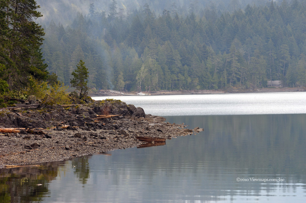
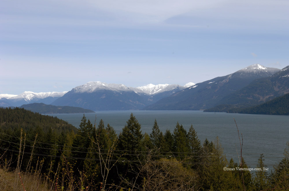
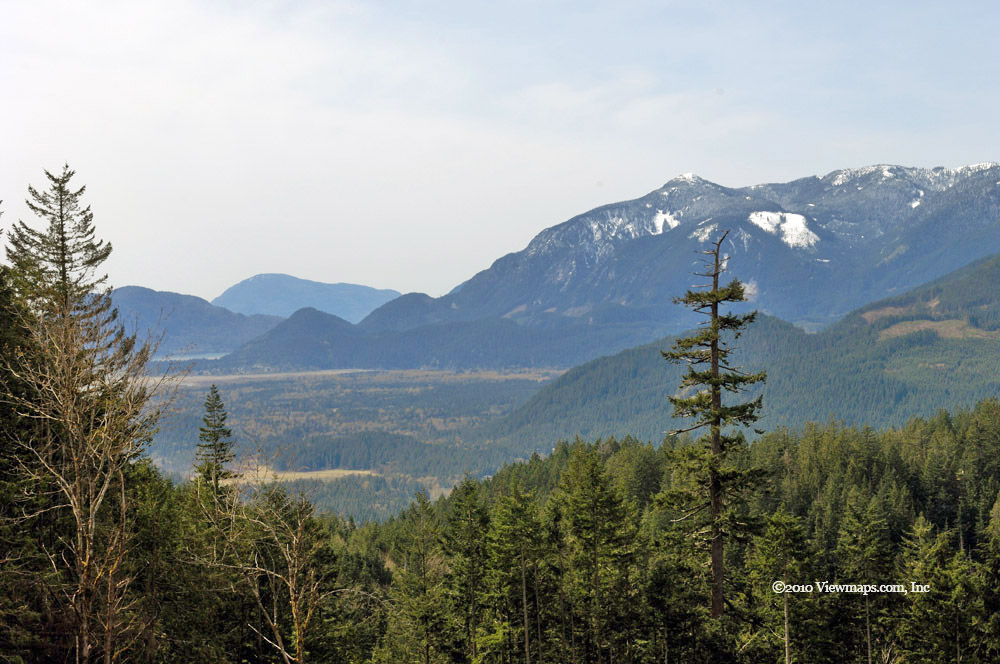
Goat Mountain & Ridge

W
e set out for Grouse Mountain nice and early (at least for us), so we could get through most of the hike before the heat of the day. The drive to Grouse started poorly; as we pulled into the Cloverdale Starbucks I realized I had forgotten my wallet. So after convincing Ethan to pick up the tab we returned home and I grabbed my wallet. Then it was back on the road and off to the north shore. This attempt went without further incident until we got to the Capilano Suspension Bridge. Here we noticed an inordinate number of cars and pedestrians. The shoulders of the road were packed with parked cars. We were concerned that the parking lot was over-full and that we would have a long hike just to get started. Fortunately the lot was quite empty. It seems that the free roadside parking was being used by another event. So we were now parked and ready to buy our skyride ticket to head up the slope.

After parking and buying our tickets we crowded into the gondola and rode up the mountain to the ski area. After a few minutes getting oriented, we headed out along the paved walkway. I couldn’t find the trail book so we were going on feel and hoping we would find the right path. We stopped to look at the grizzlies before continuing along the path; fortunately I checked another pouch and found the book which confirmed our current direction. Our next task was to make our way around the side of the rise that forms the peak of Grouse. Soon we came to the tail head and sign pointing out the various hikes. It also warned that the trail to Goat Mountain was closed to Alpine conditions! That was not at all encouraging.

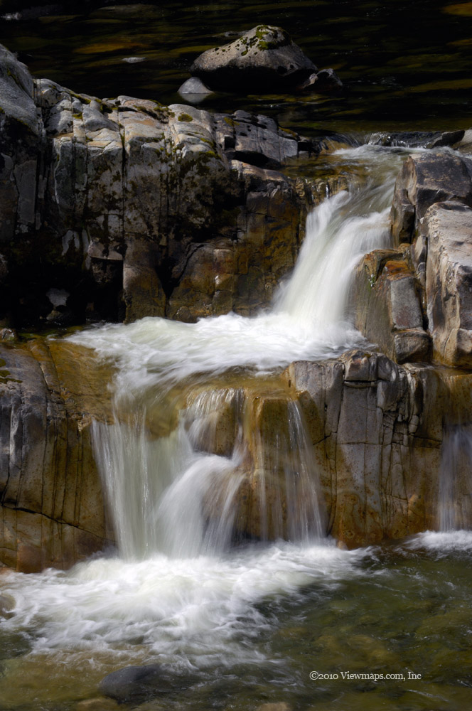
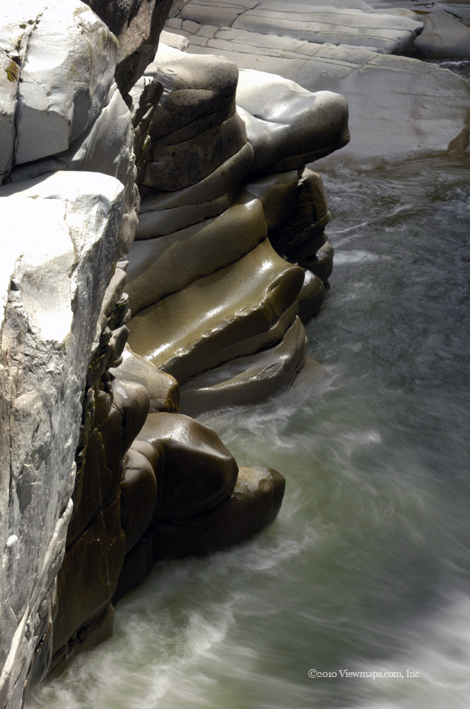
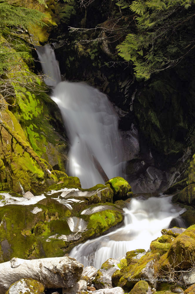
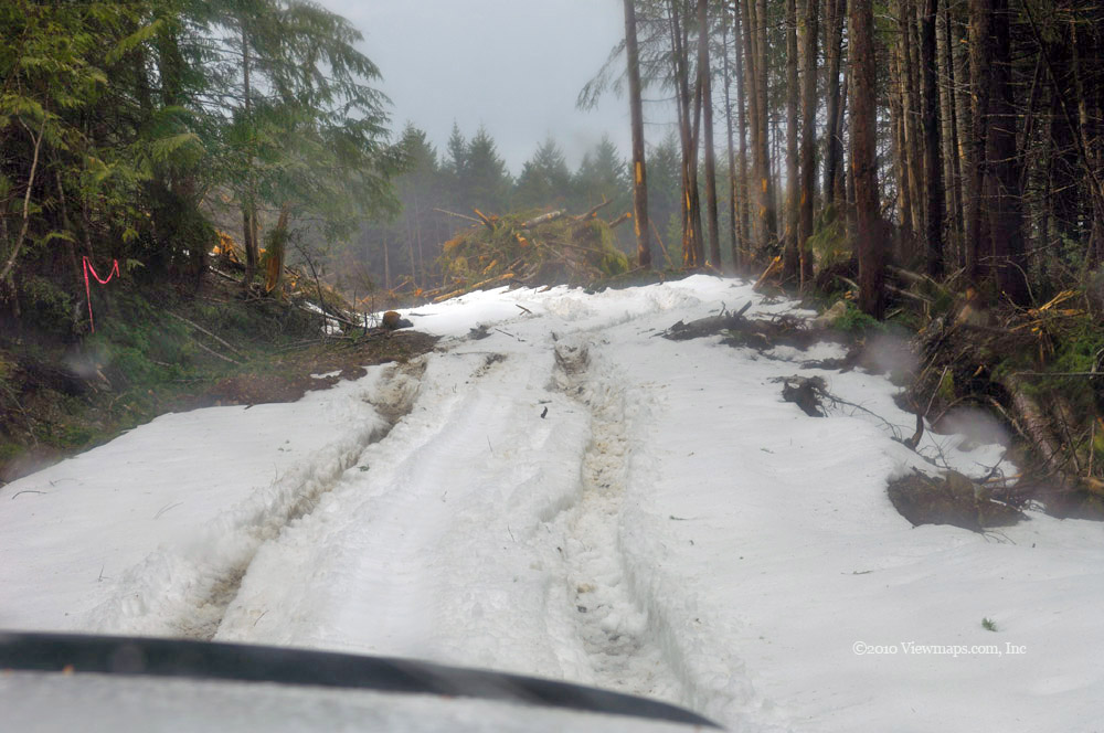
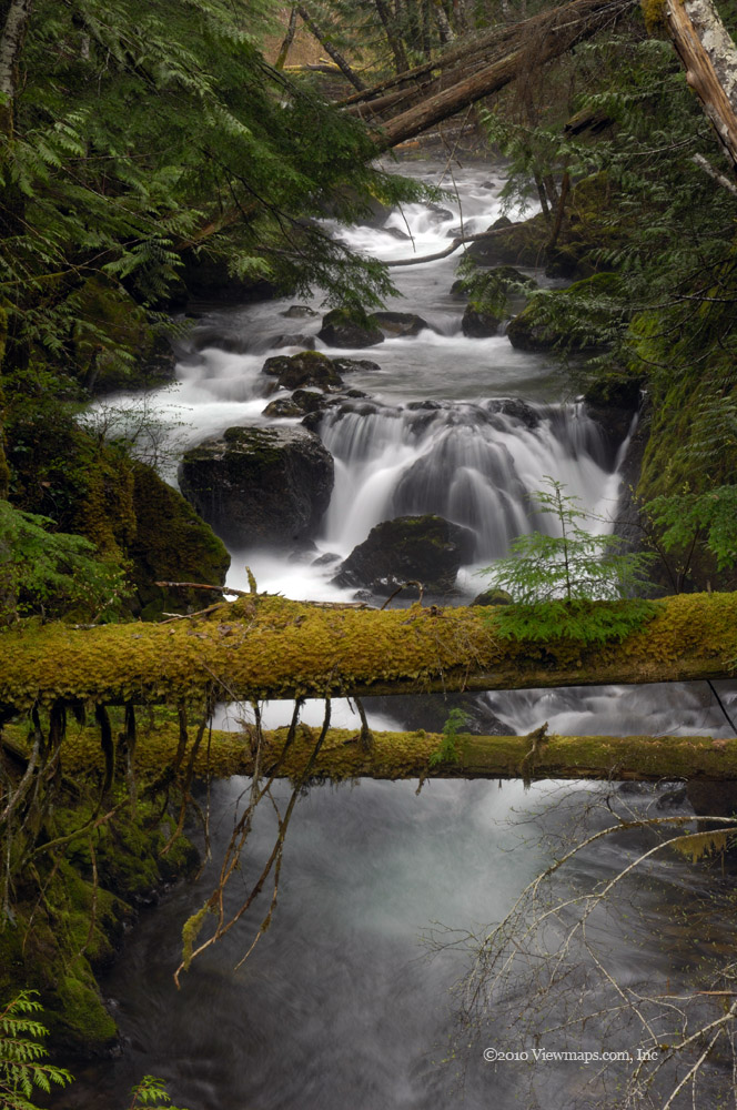
The first segment of the trail was clear and we decided to continue along until we could make a final determination. The trail made its way up the slope at a fairly steep rate and soon we were crossing fast flowing streams and walking over patches of packed snow. We came to the zip line tower which was closed, after getting our breath we continued on up the trail. Soon the snow was getting deeper and more continuous; at least the path was well marked by foot prints. We continued along slipping every now and again. We could hear water flowing beneath us at a few points! Fortunately we didn’t break through into a stream.

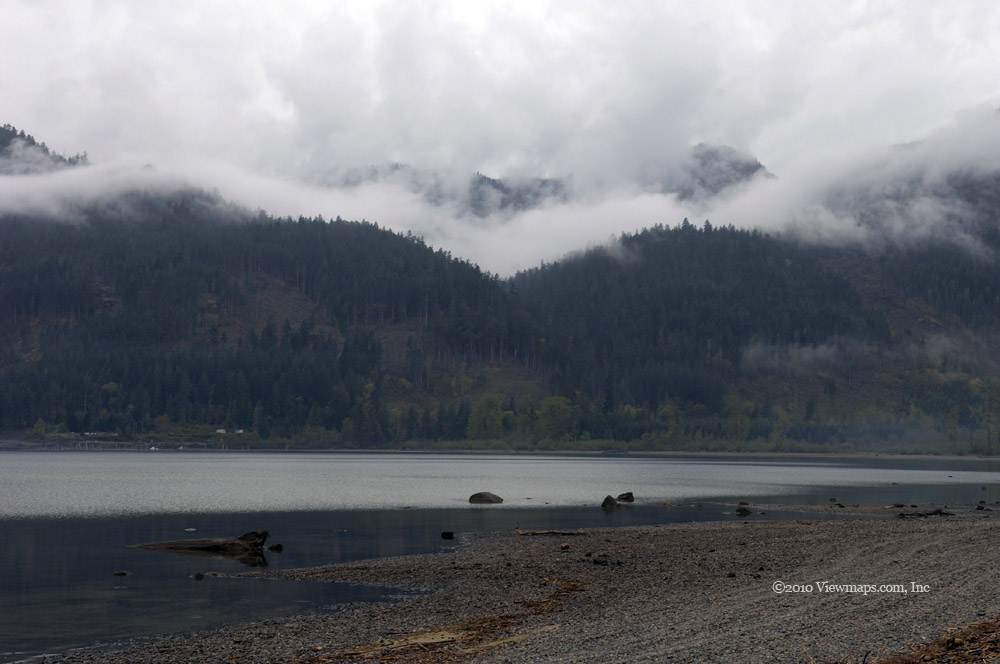
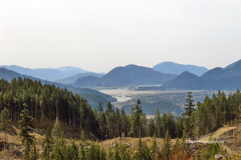
As the snow was deepening we came across another chap who was coming back, he had chickened out and not gone much beyond where we were. But others were on the trail and so we continued along. So far the trail wasn’t all that difficult and it was cool in the growing heat of the sun. Around this point we looked back at the peak of Grouse and had a good view of the back-side of the wind turbine which has been erected to supply a portion of the power for the ski hill. We also had a lovely chat with the guys back home via my hand-held radio. 

We continued on the path as made its way up and bisected steep slopes – it really was rather a neat scene. Ethan zipped up the slope at one point to check for the trail ahead, on his way back to me he slipped and took a slide down to the trail. Though cool and wet it was a lot of fun and he repeated it a couple more times along the trail.

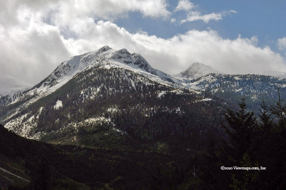
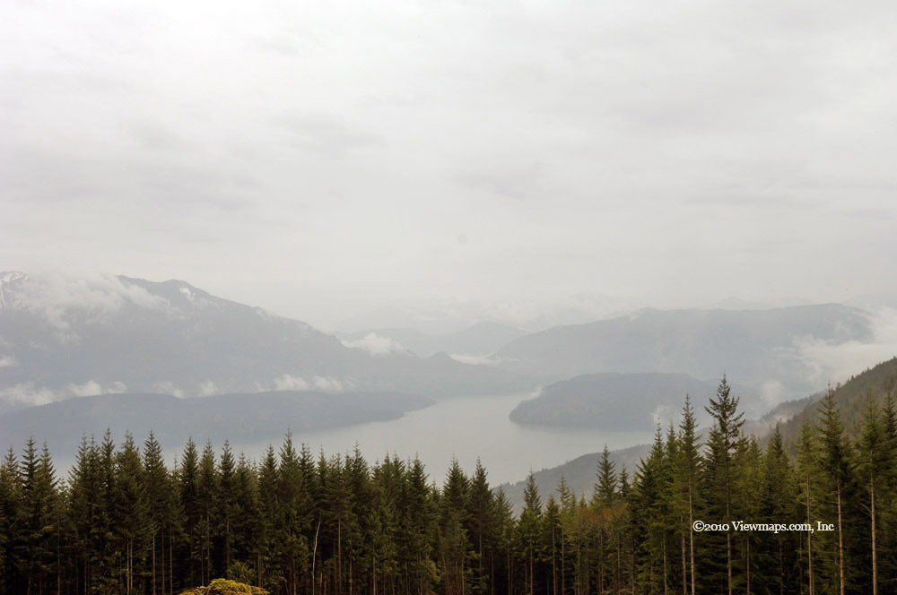
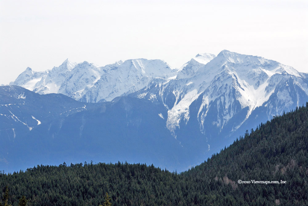
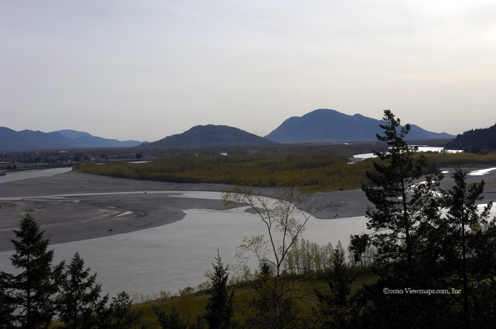
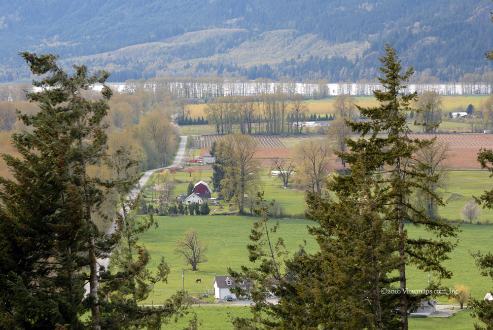
Soon we were pushing through some sections where the traffic was much less and the tracks were likely not from today. But at this point we could see the Peak of Goat Mountain so we just took one step at a time and pushed on. The way was steep in places but didn’t seem overly challenging – at least until near the end of the way up. The final 200m of the trail made its way up some very steep snow patches. Ethan and I tried to walk along the edge of it but we soon came to a difficult crevasse that looked a bit daunting to me. By this time another couple had caught up to me and found an easier way past this rock face. So I crossed over to them and we made our way up the other side joining Ethan above it. The final bit to the peak was not at all steep and made for a gentle hike. The view from up there was quite amazing and well worth the effort. We stayed for a good half hour – the other couple had flaked out on some exposed rocks sunning themselves. I pulled out my radio and enjoyed a nice chat with the guys at home.

After taking some photos and chatting with another hiker who had joined us we started on the way down. This time we came across a few more that were determined to make the peak and we gave them a few tips for the final section. The hot sun had really been busy with the snow and the sounds of the buried streams were now much louder and faster than on the way up. It was tiring walking through the snow but we made good time on our way down – the trail being very easy to follow! Even the very steep section near the peak seemed easy to traverse.

Once back to the zip line I was getting quite tired and needed some good rest time but we were close to the end so we pushed on and before much longer we were back to the trail sign where I signed in my return. The gentle slope of the trail to the main facilities was a pleasant place to get ones breath back. When we arrived in the ski area the crowds has greatly increased and many were gathered around a nature talk about Eagles with one big specimen on display. They really are huge birds when seen from a few feet. We stopped to hear the end of the presentation and then made our way back to the skyride for our trip back down. 

The hike was a great success despite the snow and well worth the wait and determination needed to complete it. I hope the remaining peak hikes will be just as fun. Though we were quite worn out, the drive home went smoothly, but we were glad to be back and able to finally get a good rest –the hot tub helped as well.

Return to the Silver Skagit Valley

We explored the Sowerby FSR as our first adventure. Previously we were stopped by deep snow along the lower stretch of the road. It had taken us awhile to get unstuck from that adventure and we were determined to return to see more. We zipped along the road and well past the place where we were stopped before we even knew it. The valley had very steep walls and gave us a nice feeling of isolation. We encountered a group of ATV’s exploring the road like us, they had been here a few weeks earlier but were stopped by snow, we had a couple of chats with them along the way. 

We slowly made our way up the north flank of Mt Stoneman and enjoyed the views of the Sowerby valley and Isolillock Peak. A small pond caught my eye so I planned to shoot it on the way back rather than stop on our way up. As we neared the ridgeline of Mt Stoneman we once again encountered snow and it blocked our way from crossing over the ridge. Though there was likely much less than a kilometer of covered road it was dense enough to stop us. So we back tracked to the pond and I gathered a number of photos. We continued our way back down the road to the valley floor and then set off along another spur that led to a closed valley. There we found a nice stretch of road to stretch out my 130 foot antenna.

This was our first NVIS use of the HF gear in the back country, we selected a spot that was surrounded by mountains to ensure that the signal had to bounce off the ionosphere but be close enough for good VHF coverage to aid us in setting things up. The selected spot had a tall mountain between us and home so this spot, along the north-western flank of Mount Stoneman, should ensure the correct propagation was happening. We stretched the antenna out along the road and tied the long end on to a stump above the road proper. The near end was supported by one of our portable masts. We pulled it tight and hooked it to the radio. Unfortunately we were not able to reach Carolyn at home. We did manage a contact in Oregon so we knew it was working but not for local distances. After trying a few configurations we decided that we would need to rework the design and setup a bit for our next try in the Elaho Valley. We packed up the gear and resumed our exploration of the area.

After leaving the Sowerby FSR we dropped into the Silver Lake park camp ground area which was closed previously. There we walked the west side of the lake and helped one couple load their boat onto the roof rack of their SUV. It was a pleasant spot but I do prefer the views from the other side. As we still had plenty of time we decided to re-explore the Yola Creek FSR. Last time it was covered in snow and ice which made a lovely scenic setting. Soon we were on the road. It was a much tighter fit with the trees in leaf and the road was much bumpier. We got only a short ways past our previous stopping point as the road got too narrow for us – and ATV would have no issues. Along the road we noticed that many of the campsites had piles of garbage left behind. It was quite disgusting. I sure wish people would learn to pack out their crap when they depart.

After the Yola we tried the Cantelon north section and this time made it to the end of the road. As this road had good elevation we had a lovely view of the Silver-Skagit Valley. On our way along this road we stopped to mark the cross ditches with flagging tape for others as they were difficult to spot. Hopefully it will help a few future users of the road avoid some bad bumps. Once we were off the Cantelon we set off for home. We had a stop at the north end of Silver Lake where I got a few lovely pastoral type photos of the lake and a few fishing. Then it was ainto Hope for a quick stop at the Blue Moose for a coffee before our drive back home.

Tsileuh Creek Revisited

We hadn’t done much exploration up the Fraser Canyon before our previous trip to the Tsileuh, so the area was constantly presenting new adventures for us. In March we drove the road in increasingly deep snow until we finally reached the point we needed to stop. So now that the snow was gone we decided to try the road again and see what adventures were to be had further up the road.

After re-loading the tank and getting some lunch in the town of Hope we made our way to Spuzzum in short order where we left the highway and started up the FSR. It wasn’t long before we were stopped by an excavator replacing a culvert that crossed the road. We got out to chat with the operator for a few minutes, he was friendly and curious about our adventures. He quickly moved the old pipe that was in our way and we zipped past him while he finished that section and set out for the next obstruction on the road.

Soon we reached the place we were stopped at last time and the road looked good. So we continued along and soon came to a stream crossing. The stream used to flow under the road but due to debree, the pipe had gotten blocked and now the flow runs across the road. It was flowing fairly fast and I was thinking that at this rate it won’t be long before the water has cut a deep enough trench that the road will no longer be passable. Last March we had snow-shoed to this point but the water was well hidden by the snow. 

Just past the stream the road starts a steeper climb up and around a bend and as we followed it we very soon came to a slide area where there were a number of large rocks blocking the way. After carefully surveying the possibilities, we decided that it would take too much time and effort to get past this section of road. This was very disappointing. I decided to head back to the water crossing and gather a few stream pictures of the water flow above the road. Once done taking the photos I grabbed my tripod and slipped it over my shoulder only to hear my camera go sailing to the ground lens first. Then I heard the crinkling of glass as it hit the gravel road! I was not very happy at this moment as I had my 70-200mm lens on the camera.

I picked up the camera and turned it over, the broken glass was all from the lens filter, and the actual front glass of the lens was unmarked. That was a huge relief; the filter would be a cheap easy fix. I took a number of wild flower photos with the lens and confirmed that it was undamaged. It was back to the truck and back down the road. We had to fight our way getting turned around on the road and squeezing back through a narrow passage, but it was a fun challenge. We then drove up another side branch where we were stopped by a single boulder. We decided to pull it out of the way and attached a recovery strap to it and gave it a drag. Unfortunately the rock flipped over onto the strap and the dragging frayed the strap quite badly.

Once past the rock we drove the road until we reached a blue pickup where the driver was busy sawing firewood. We stopped to chat with him for a few minutes before continuing on up. We didn’t go all that much further before we stopped and ate our lunch. On our way back down we chatted with the firewood chap a bit more and then watch the excavator casually pick up the rock we had dragged and drop it off the road! He made it look so easy. Another quick chat with the operator and we were driving back down and exploring another short side road – this one Geoff and I had travelled before. I wanted to try one spur that snow blocked us on last time. It seems that the snow hadn’t prevented us from seeing much, so we were done quite soon.

We decided to head back to the highway and do a few stops on the way back to Hope. But soon we were having trouble with the engine and not getting any power to move on the hills. We slowly made our way into Hope and a garage where we reset the error codes and replaced the fuel filter. The engine was not getting the fuel pressure it needed and had switched to limp mode. I hoped changing the filter would help, but later when I got it into the dealership we determined that it was the fuel pump that had to be replaced. It was not a nice ending to the day. The drive home along the highway was full of anxiety but otherwise un-eventful. Soon we were home and able to rest after a long day. Though the road was a bit of a disappointment, we enjoyed our chat with the two we met who were working on the road, and the views of the back country were still as lovely as always.

Hiking Mt St. Benedict

W e have been trying to do this hike for a few months now, so it was a relief to finally get on the trail and explore the sights to be seen. Our original goal was to hike to McKay Lake which is a small alpine lake below the summit of Mt. St. Benedict. But as the season progressed we thought the snow would be gone which would allow us to try for the peak itself. So we set out with high hopes of seeing some great vistas from the peak.
We left early so we could get started before the heat of the day and made good time to the end of the drivable section of the Lost-Murdo FSR. When we arrived we were greeted with a less than encouraging sight. A pickup was already parked up there and it had been vandalized. Someone had thrown a rock through the passenger window and rummaged through the cab. It left us feeling a bit uneasy as we setup our radio gear and packed away stuff in the back. Things like this can really set you off for a while. After considering things for a bit we decided to head on up and do our best to enjoy the day. 

The first leg of the hike was along the logging road that we could not drive with the truck – now an ATV could have gotten here! It was already getting hot as we made our way up the road but soon the route left the road for a trail through the trees. About 45 minutes into the hike we were greeted by a couple of chaps heading out, they had spent the night by the lake. After a brief chat we determined that they were the owners of the truck, I had the sad task of reporting the situation to them. They were surprised as they had not left anything of value in the cab.

The trail between the road and lake made a slow climb up to the lake elevation and crossed a number of open meadow areas and thicker forested portions. It was a pleasant section to hike. We got to the lake in just over an hour and took a good rest before starting off on the climb to the peak. The lake is quite lovely and scenic but does seem a bit lacking in places to camp around its shore. The level was high due to the late thaw which could explain the lack of camping spots.

Once rested we set off for the peak, another pair of hikers were at the lake when we arrived and had set out for the peak just before we left, one of them does a lot of hiking in the area and was looking forward to this hike. We started up the trail and soon encountered some steep sections which slowed me down quite a bit. We met another pair of hikers coming down; they warned us of deep snow up above. As we continued up we started fighting through muddy sections due to the thaw and it made the way a bit more hazardous for us as we tried not to slip in the mud, it was even worse on the way down.

Soon we reached the snow level and sure enough it was soon quite deep – 2m along the ridge – at least it was hard packed enough along the top that we didn’t have to fight it too much. By now I was really starting to run out of steam and we still had a fair ways to go. We had some great views of the various peaks to the north, east and west which made it all worth the effort. After some distance along the ridge, I was really starting to reach my endurance with fighting the snow and steepness of the route. It was already approaching 3pm so we found a bit of cover and sat down to eat our lunch. Once fed, the two girls we met at the lake were on their way down and encouraged us to try for another small pond just over the next rise and grab some photos from there. So we did continue to the pond but that was the furthest for us today. We took a breather and then set off back to McKay Lake. The route down was actually quite challenging as the melt water had turned even more of the path into slippery mud. Geoff and I both went for a few slides but nothing too serious. We did finally make it back to the lake by 4:30. A nice long rest and then we were off to the truck. We encountered a few more hikers heading in as we went along but I’m sure they were only going to the lake at this time of the day. 

So it was a bit disappointing to not make it to the peak but then our original goal was only to get to McKay Lake which we did with little difficulty. The views from the ridge were great and I do think the hike would be worth repeating later in the season when the ridge is snow free. That should allow us a faster hiking time and not be quite so challenging. Geoff definitely wants to give it another goal, so I guess I will need to put it on our list for next year.

We were back at the truck by 5:30 and were happy to discover that there was no vandalism to be found. So we packed up the radio gear and set off down the bumpy side road. It does look like some logging will be started part way up the road, so it will likely be in better shape before long.

Norrish Creek

The first peak we drive past on the way up Miracle Valley en-route to Stave Lake is Dewdney Peak. The map shows a road along the top ridge line and it has intrigued me as a place to visit. I was hopeful that we would be able to get up to the ridge and see what views were to be had. The main concern I had on starting this trip was the notice of the new gate that was put in at the 9km point to protect Davis Lake and environs as it is a watershed. I wasn’t sure if the gate was before the access road to the side valleys which I hoped to explore today. So when we made our way in and came to the first side road well before the 9km point I was quite relieved.
The first side road went west and it was into an active logging area so the road was quite decent for the first section. Once past the logging area it was still quite passable as it made its way up to the ridge. At the point it reached the ridge the road forked north and south, since the southerly direction was shorter on the map and led to Dewdney, we elected to explore it first. Not far along we came to a lovely marsh which offered a number of interesting views. I would have liked to gather more photos of it but I didn’t have boots so my access was quite restricted. The road continued through a narrow section once past the marsh and then climbed a bit before ending in a fork. One side was blocked by a berm the right-hand branch descended the west flank of the peak. We decided to follow the right branch. It was passable for about 150m before a swampy area blocked the way. The road continued past the dip and we decided to get out and hike it to see if there were any views from just across the narrow gully.
Upon reaching the far side the road ended at a spot with a lovely westerly view of Miracle valley and the Fraser valley beyond. It was a great spot to enjoy the sights. Ethan was picking out some large buildings he could see way off in Langley! The site would be a decent location for a radio repeater – good view, easily accessible, good elevation. Once done enjoying this view, we returned to the truck and back to the fork where we hiked the other branch. It didn’t go as far but did offer some nice southern views looking across at Sumas Mountain. 

We again returned to the truck and drove back to the first fork on the ridge, this time heading up the northern branch. It was looking promising but very soon got to a steep narrow area that would be passable to an ATV but not us. So that was a bit of a disappointment. We returned and dropped down off the ridge where we came across an enterprising brown squirrel that allowed me to get a number of photos of him before he ran away. These native browns are no longer found in the low areas as an introduced black squirrel has pushed them out. We then looked over the area being logged before returning to the main line along Norrish Creek. 
We continued in to the 9km point where the gate was located. It was a very fancy setup – electric controlled with remote management! It was open! But the next side branch was this side of the gate so we set off up the side road. Though this area was littered with numerous branches and further roads, most were not passable for us in the big truck. We were able to make our way far enough along one route to a place with a lovely view of the valley where we enjoyed a late lunch. Then it was back down to see the gate again. But on the way down Ethan didn’t see a pothole and when we hit it the bounce knocked me hard enough that my neck was in spasm. So we decided to call it a day and start our way out.
Not too far out we spotted a van down a small side road that was having trouble getting back up to the main line and we offered to winch them up which the readily accepted. Once they were safely on the main road we continued out, stopping only for a waterfall photo along the side of the road. Though my neck had settled down somewhat by this point, it would get much worse over the next two weeks before it was fully recovered. The trip was a decent one. There are many more roads to explore this side of the gate and I think we could get access beyond it by contacting the right people.

Hike to Mt St. Benedict

Geoff and I first came upon the hike to Mt. St. benedict earlier this year when we first drove the Lost Murdo Creek FSR. We had driven past its entrance many times and had finally decided to explore it. When we got to the furthest passable point we stopped to enjoy a waterfall and while I was shooting it a group of hikers came by on their way to McKay Lake which is nestled below the peak of Mt St. Benedict. This caught the attention of both of us and we decided then to return to see the lake. As the warmer weather approached we thought we could also try for the peak itself.
So today we set off with a weather report promising cloudy by dry conditions. We were hopeful as it wouldn’t be overly hot for the hike. As we drove through Miracle Valley on our way to the main forestry road the first drops of drizzle started to fall and by the time we reached the start of the Lost Creek FSR it was drizzling! very frustrating to say the least. Well we had a secondary goal for the day – trying out Geoff’s new shotgun. So we decided to take time at the start to try out the gun and then hopefully the drizzle would be done and we could start the hike.
We drove in past the Murdo turn-off and made our way to a place that is commonly used for target practice. No one was using it yet so we picked the best spot and tried a number of different types of shots. Geoff had bird shot, buck shot and even single slug shells, and he tried all of them. The single slug had quite a kick to it and he wrenched his arm a bit while firing it. After a number of rounds and trying to hit some clay pigeons I threw for him we decided to head up for the hike as the rain had stopped. On the way we were stopped by two people needing some directions.
We made our way up the Murdo FSR quickly and were soon parked and starting to setup our cross-band repeater. No sooner had we finished setting up then rain hit us hard. It was mixed with hail and just kept coming. We decided to give it another 20 minutes to see if the rain would clear. It didn’t and now the area was soaked and not really desirable for hiking through. So we grudgingly decided to call-off the hike. We waited a bit longer for the worst of the rain to stop and we packed away the radio gear and were about to drive off when the rain stopped and the sun peaked through! Some days it just doesn’t seem to work out. But as everything was wet, hiking was still not something I wanted to do. As we had time to spare, we decided to see if we could drive past the waterfall and up the road.
Well with the rain wetting the ground the gravel was a bit softer than expected and as we approached the narrow spot in front of the waterfall the rear tire slid down towards the road edge and a drop. We had been in this situation years ago and knew that we would only slide further down whether we moved forward or back. Our only way out would be to pull ourselves with the winch. So we set that up and quickly got past the problem. Once moving again we edged our way up the road through a few narrow spots but soon came to a steep exposed bit of rock. If it had been dry we may have tried it but wet it was not worth the bother. So we turned around and made our way off the Murdo Creek FSR. Crossing the narrow section was easier on the way down, and didn’t need any winch support.

Norvan Falls

I’ve had this hike on my to do list for quite some time. It could be done year-round but the warmer drier season definitely makes it more comfortable. This hike is in the Lynn Headwaters Regional Park which is a very popular location for all sorts of visitors. The place was packed and on our departure people were close to fighting over parking spots! The hike is just over 7km each way, though quite long it is very level making an easier hike than many I have attempted.

Ethan and I arrived just before the main crowds and were able to get a parking spot in the first lot – grabbing a spot as it was vacated by a departing visitor. We set up the truck’s cross-band repeater and linked it to the White Rock repeater. It worked quite well for the entire hike and provided good coverage even at the Falls – our furthest point. 

On the way out we chose an alternate route which had a bit more of a climb to navigate at the start. Then it slowly made its way back down to the main trail. During this segment my tripod separated and we were unable to reattach the head to the tripod proper. I was counting on having it for some slow shutter shots of the water fall and now we have the burden of packing it but without the use of it. That was the most frustrating part of the hike. Back at home later it took only a few minutes to adjust it back into proper position!

The water fall its self was a very pleasant view – the spray from it was quite cooling in the heat and actually made it a bit too cool at times. There were quite a few groups that were enjoying the location when we arrived and the stream of new-comers was continuous. A few hundred meters below the falls is a suspension bridge crossing the creek. It was really quite a well-built bridge for the area. But then the whole trail was built up with many dozens of small wooden bridges over every soft spot along the way. You could almost call this hike – the trail of a 1000 bridges! There sure must be a lot of funding available up here to build that many bridges. It is almost a shame as other parks seem to have insufficient funding.

Our return trip took us closer to Lynn River than the out-going segment. This segment was flatter but it was still 7km long and I was extremely tired by the time we were finished. 14km is definitely a bit of a push for me at this point. Hopefully one day I will find it much easier, but at least I was able to get it done and not much above the average time for the hike – and that with stops to gather photos. The park provides a hiker registration system where you can sign in at the start of your hike and then hand-in a return slip upon your return. Though not every-one uses it, I think it is a great idea. Since it costs nothing, ignoring the service is just foolish.

Limping the final feet back to the truck we finally were ‘home’ and able to get a bit of rest before we had to take down the antenna and radio gear. As we packed up, a car was waiting for our spot but as we were taking a bit longer than average with all the gear another spot opened up sooner. The guy was heading for it when another driver tried to grab it. This led to some harsh words but the other patrons were on the first guy’s side and so the interloper relented – fortunately another spot opened quite soon after and all were happy. I guess I’ll have to return but with a working tripod – the falls are definitely worth taking some good photos of.

Ashlu Creek

Iavoided the sea to sky highway for much of the time they were working on the highway in preparation for the Olympics. But they are now over and life has returned to normal. So it was time to return to the Squamish valley and finish the exploration of the area that we never completed over the years. My last trip to the Ashlu was in January 2007, we didn’t venture very far up the road back then as they were busy blasting rock for the new run-of-the-river power project. The construction was quite disruptive of the roads and I was hopeful the project would be done and we could explore it again, and reach the head waters of the Ashlu.
Driving along the upgraded sea-to-sky highway was quite pleasant, the southern sections were significantly improved but the northern half, south of Squamish, seemed little improved –perhaps they spent everything on the southern part. We touched up the fuel at Squamish and I took a few shots of the Chief. Then it was on through Cheekye and the native lands. I love their speed sign ’60 ends’, I wonder just how fast you can get away with through there!

Soon we were entering the Squamish mainline and the quick exit onto the Ashlu. The roads looked good and the construction seemed finished. We crossed the Ashlu and started our way up the steeper section of road that hugged the western side of the valley. We soon came to the new power house. It looked finished, a few workers were doing some finishing touches on the exterior but otherwise we saw little activity around it. Continuing up we came to the major bend in the creek where there is a nice over-look with views up both directions of the bend. The river looked normal – perhaps a bit less water flow than before. We stopped at creek level a bit further up and took a few more shots from the creek bed. We noticed a radio controlled siren alarm that is used to warn of a rapid release of water. I’m glad it didn’t go while we were there. Its presence seemed a bit ominous!

Next we made our way to the 25 mile bridge where I took a number of shots of the river rapids and the main river gorge where Geoff had a bad slip on his prior visit. The roads were still in very nice condition, and so we continued up the river and came upon a nice viewpoint showing the new dam constructed for the power house. It was holding back a bit more water than I had expected but the small lake it formed was still quite small. The dam uses inflatable bags to hold back the water which struck me as quite interesting.

After taking our time looking over the dam we continued up the river. We unfortunately didn’t make it to the end! We also got stuck at one point and had to winch ourselves but it was a tricky winching as there was a tree stump snagging our rear axle so we couldn’t just pull. We had to chop some trees to place the logs under the truck to raise it over the stump. But after a half hour we were past the obstacle and on our way. After a few more kilometers we were stopped by a large slide and were unable to get past it. Most disappointing. On our return we spotted a trail down to the river which we followed and had a snack on the river bank. Returning to the 25 mile bridge we found a side branch that we hadn’t tried before and shortly after entering it we came upon a couple of guys clearing the road of over-growth. It seems that one of them has made it his summer’s task to clear this side branch enough to get to a few forgotten hiking and rock climbing sites. It’s a big job but he sure seemed keen to do it. They had done over a half kilometer so far today.

We next explored the south going branch of the road – this was where we watched some helicopter logging a few years back but the road soon closed over and we had to stop. The map teased us as it shows the road continuing back to the first section of the FSR. We did stop to make some radio contacts before crossing back to the west side of the creek. Our next stop was at the actual dam site where we noticed a sign stating that the dam construction was now complete and accepted. It was dated for just the prior week! We then continued up to the end of the west road where there is an abandoned mine site. We were intrigued by the old buildings and took time to wander through them all and get a feel for the old mine. It had been a gold mine with other metals but now it is quite derelict. The main rock grinding building is still in good shape but all the copper wiring has been removed! It was interesting but definitely a bit depressing.

After our fill of the mine we returned to the start of the Ashlu FSR where I gathered a few more photos of the mountains of the Tantalus Range. They were really quite spectacular in the afternoon light. Another explorer joined us to gather a few photos of the peaks. Soon we were back on pavement and making our way home. A nice trip though disappointing that the upper river was not accessible in our truck – We may have been able to work an ATV through it. It’s just one more reason to get one soon.

Cartmell, Simms & Mystery FSR's

The thing with the West Harrison area is that it is a huge region with new areas being logged every year which gives us new spots to explore and enjoy on a regular basis. Though I do prefer the treed areas, the logging does make it possible for me to explore the back country and for that I am thankful. Today we set off straight for the next side road up the mainline to see what we could find. 
As we made our way in we spotted a road off on the lake side of the mainline and thought we would see where it went. It actually just dropped down to the Hydro service road which was following the towers. The spur had a steep drop as it connected to the hydro road and we had to take a second try at it to get down safely. The Hydro road made it way along parallel to the mainline we just left and so we decided to return back the way we came as it didn’t offer the sights we were seeking. On the way back up the spur we stopped to enjoy the thick mosses that were covering the trees flanking the road. The rich greens were quite amazing. After taking some photos we returned to the main line and then turned off at the Cartmell FSR.

Our first excursion was in a recently logged area, the roads were good but winter had downed a few trees which we had to clear to get past. The road didn’t go in far and we soon returned to the mainline. The next exit gave us much more to explore – up both sides of the Cartmell Creek valley. Shortly after leaving the West Harrison, the road crossed over the creek, the bridge had a lovely warning sign on it stating that the bridge was unsafe. But after close review it seemed to be a fake sign posted simply to annoy explorers like us. So we crossed over without the slightest of issues. We were able to make our way along two further branches of the road. The main one only stopped as it was getting heavily over-grown and as it was raining the ground was quite slippery. We will need to return on an ATV. We did enjoy a number of great vistas of Harrison Lake.

Back to the bridge and up another branch just past where a number of trucks were parked. We selected what appeared to be the main road at each turn and soon we found ourselves on the Simms Creek FSR. This area was undergoing new logging and the area had some good road interspersed with deactivated. We continued along the Simms until stopped by snow. It may be worth a return visit later in the summer to see how far up the creek we can get. We returned back to where we connected to the Simms and elected to continue on it see where it came out. Eventually we made it back to the Harrison mainline.

It being after 3pm we decided to skip the next few side roads as Geoff was interested in getting to Chehalis Lake from the east to see what the slide looked like from this side. So we zipped along the mainline to the Mystery Creek FSR and turned west. I couldn’t just pass by the view of Mystery Creek as we drove over it. So we stopped long enough for me to get a number of slow shutter speed shots of the creek. We continued along to the connector by the Chehalis River but were immediately stopped by a large berm across the road. There was a path carved in it that ATV’s were readily using but it was a bit narrow for us so we felt very cheated and decided to turn back. We did try the first branch that we came across but made it only a short way before snow stopped us. The map showed the road heading to Mount McRae and so it wasn’t likely it would have helped us anyways. So we grudgingly set off back to the Harrison mainline but as we approached we decided to head in a bit more to visit the 20 mile bay camp site.

On arrival we were met by the site host and we chatted for a few minutes before parking and taking some time to relax with the lovely views of Harrison Lake. The clouds were giving us ever changing patterns against the hills and I could have stayed there for some time enjoying the sight. But it was now almost 5pm and we had to head home. So we returned to the truck and set off for home. The return drive went very quickly and we soon found ourselves driving along the pavement heading for Lougheed highway and home.

West Harrison and Weaver FSR

Today was supposed to be the day Geoff and I were to hike to McKay Lake which is on the slopes of Mt. St. Benedict. But I ran into a snag, yesterday while cutting the lawn a rock flipped up and broke the back side window on the truck, I didn't notice it until after the repair shops were closed! So today we had a plastic sheet over the window but it wasn't secure and we felt it unwise to park the truck unattended in the back-country in that state. So we chose to delay the hike and return to the West Harrison area and check out the first side branches we came to.

We arrived at the start of the West Harrison around 11:30 and quickly noticed that the early section of the road was under construction. It would seem that the first few kilometers of the road were being leveled off and straightened out to improve traffic flow. I guess there are enough recreational users in this area now that they cause problems for the logging trucks. Once past this work zone and the currently extra rough road, we soon came upon the back entrance to the Weaver FSR. Back in May 2003 I had driven the first 2km of this road but stopped short of exploring it in detail, so today looked like a good opportunity to resume our exploration.
Today's trip continued past the last trip by taking the left fork and then repeating that until we were stopped by a large log that was blocking our way. The road beyond looked inviting so we decided to give the log a new home. We attached the winch cable to it and pulled it to the side of the road and soon we were making our way past. The road split again several times as we made our way up to a rise overlooking Harrison Lake. We had lovely views of the lake and back along the Harrison River to where we crossed over it on our way here. The road was mostly clear but there was a thin layer of snow in places which helped to keep the air cool. After driving though the various short spurs through this area we stopped at a viewpoint and took a few moments to eat our lunch.

We returned to just before where we moved the log and tried another branch that led to a second hill-top unfortunately we were stopped by a large tree that was leaning across the road. If we had the chain saw we could have cleared it but doing so by hand was not attractive so we returned to the previous fork of Weaver FSR and continued along to Francis Lake. It is a smallish lake but still large enough to have several campsites around it and today there were a few groups out fishing. Though the road was not too difficult to drive, it was still hard enough to keep the less seasoned 4x4ers away. The lake sites are maintained by volunteers and they seem to be doing a good job of it.

Once we had enjoyed the lake for a few minutes we continued to the end of the road segment and then returned to the main path that continued on to the heavily used access road to Weaver Lake. It was very wet and soon extremely steep and narrow. We decided to not try it in the truck and so we back tracked to the original fork and set off along the right hand branch. Soon we were making our way through some swampy regions and past another 4x4er who was stopped on the side of the road - later we learned that he had stopped and was deciding if he should continue but since we had gone on he thought he would try it. Not much later we came to a stream crossing with steep sandy banks. We dropped down into it but were stuck getting up . The loose sand like gravel just spun out and dropped us onto our under carriage. We had to pull ourselves up the bank with winch. The other truck then tried it and though he got stuck at first eventually he got up the bank. We then continued forward but it wasn't long until we were stopped by a washout - only an ATV could go on. So we returned and as we crossed that gravelly stream we got stuck climbing the far side. So we winched our self across it a second time. It was actually a fun little stream with a lovely small waterfall just up from the road.

We then returned to the main road and continued further in to 10 mile bay where we dropped down to the lake and I got a few shots of the views from there. A large group had set up tents a bit further around the bay and a number of the campers were out exploring the shoreline. As it was now approaching 4pm we decided to head back home.

Soon we were back to the pavement and making our way through Harrison Mills and as we started the climb up Mt Woodside we saw a new sub-division off to the south, over-looking the Fraser Valley. Since the gates were now open we decided to see what the views would be like and we drove along the lower of two roads as it seemed to head out towards a viewpoint. After passing a few newly constructed homes we reached the end of the road and saw a gravel path leading up to a small building constructed to provide a lovely view of the Fraser. We decided to park and head up to the small structure and enjoy the sights. It was a lovely spot and would be a great place to enjoy a winter sunset.

After a few minutes taking photos we returned to the truck and drove through the rest of the sub-division. That first spot was definitely the best developed so far, but I could see that they were eventually going to open some higher stuff with even better views of the valley. It was now almost 5pm and so we returned to the highway and made a quick return drive home. Though not the hike we planned and the missing window made for a much noisier drive, we did enjoy the day and found some lovely new spots for photos.

Subscribe to 2010