
Silver Skagit - South End

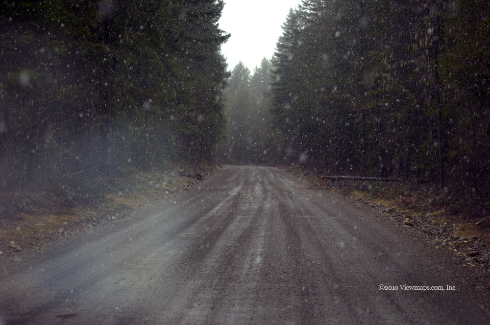
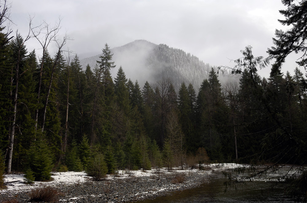
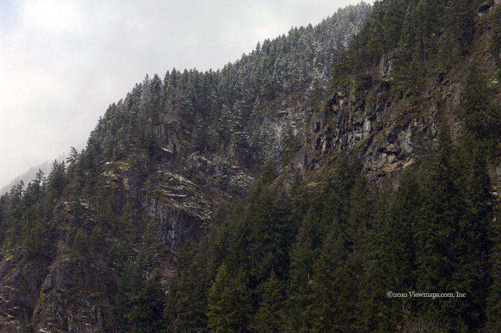
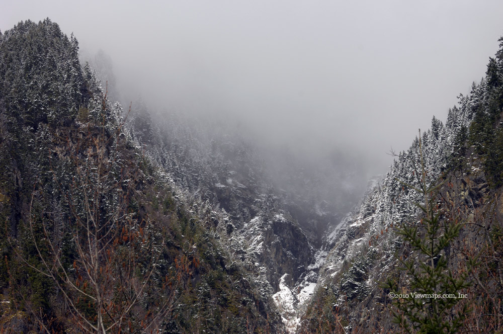
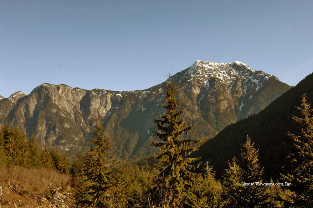
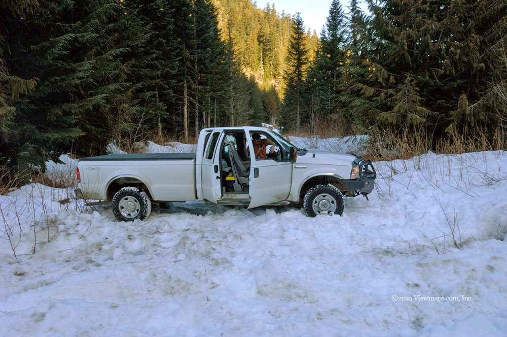
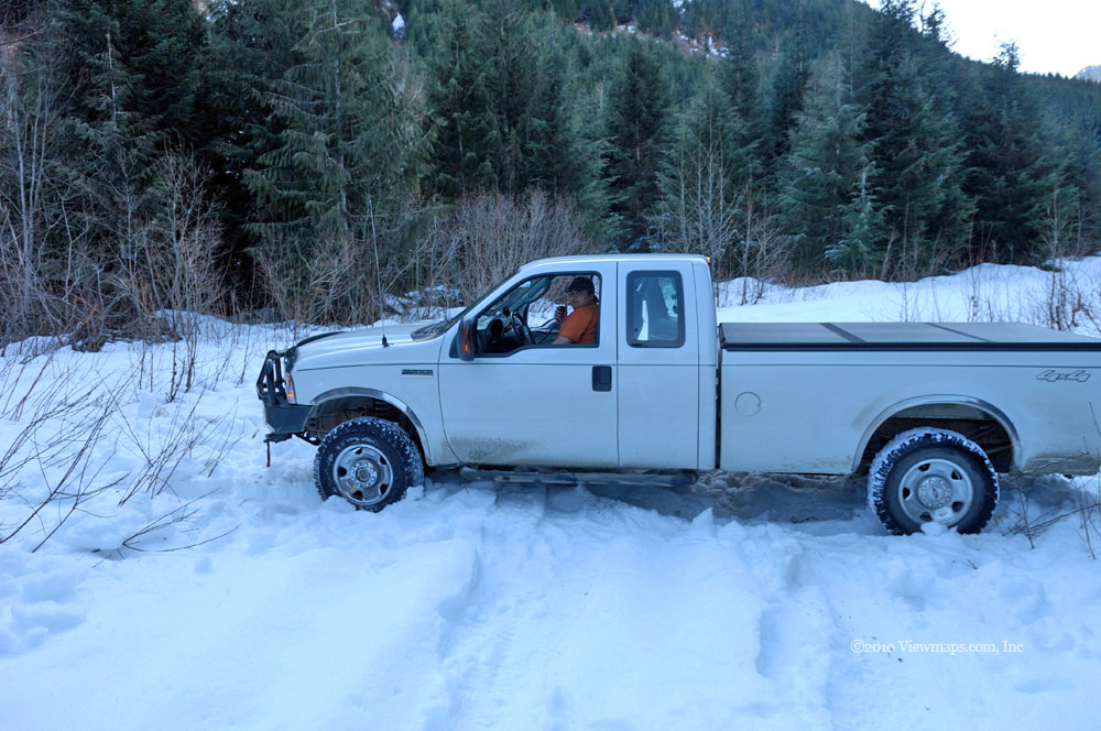
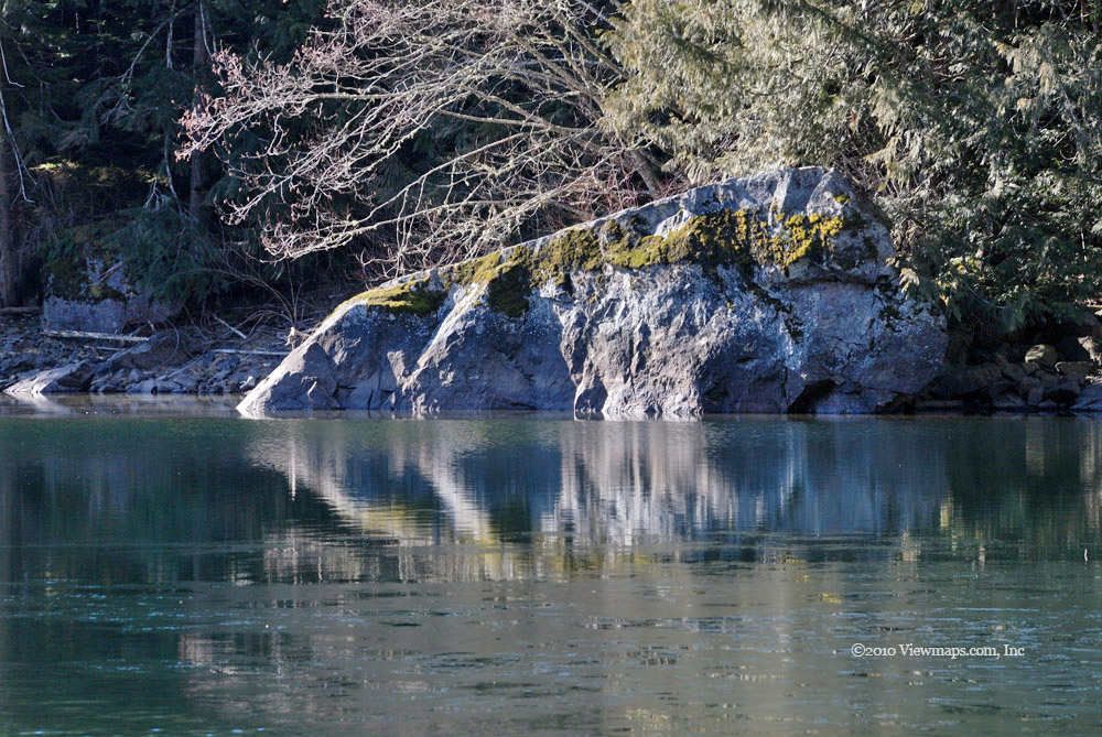
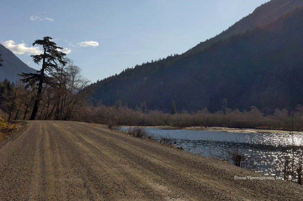
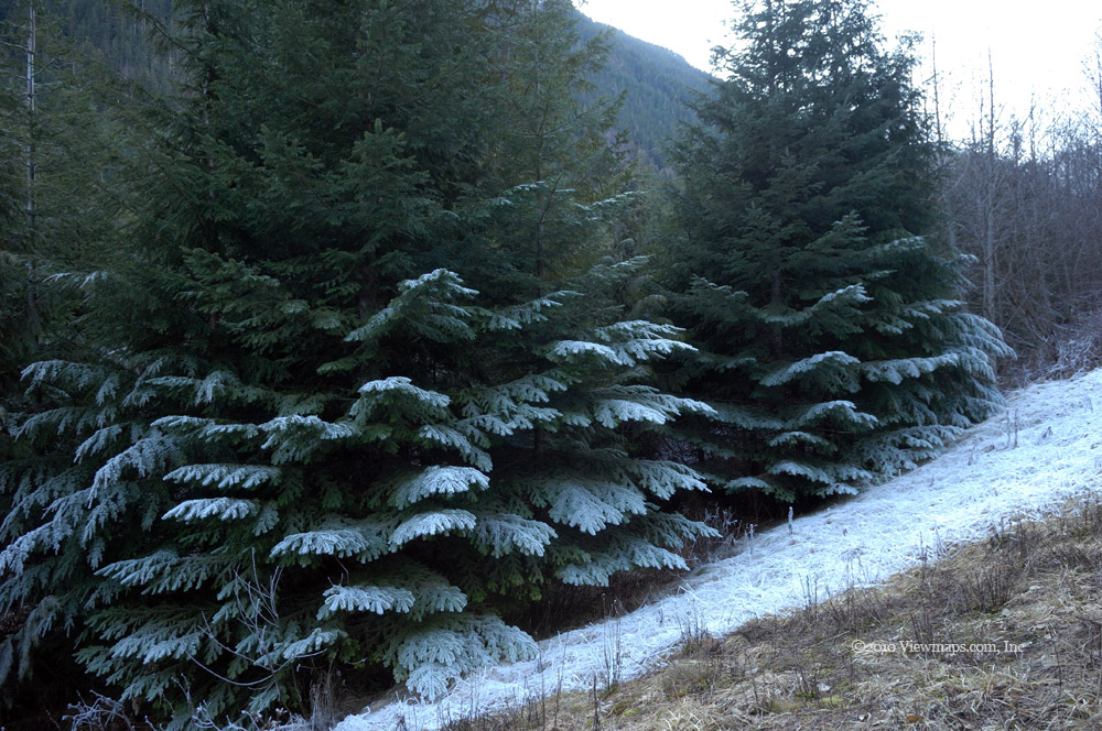
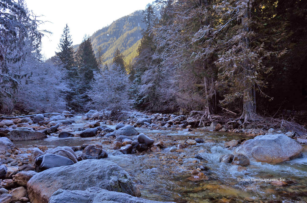
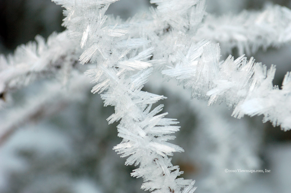
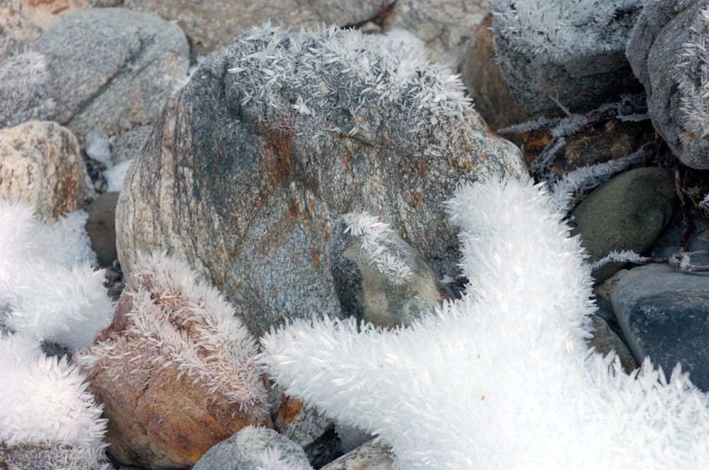
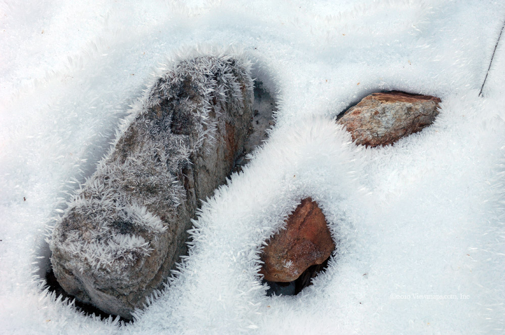
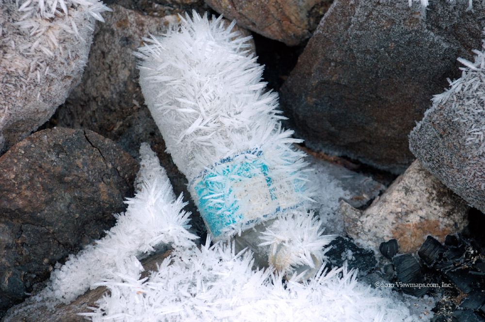
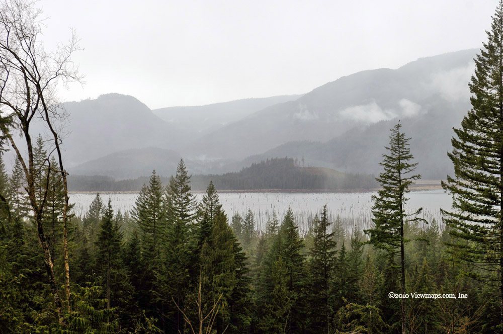
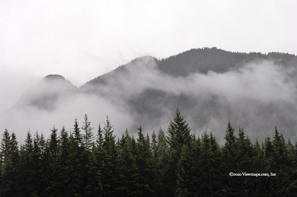
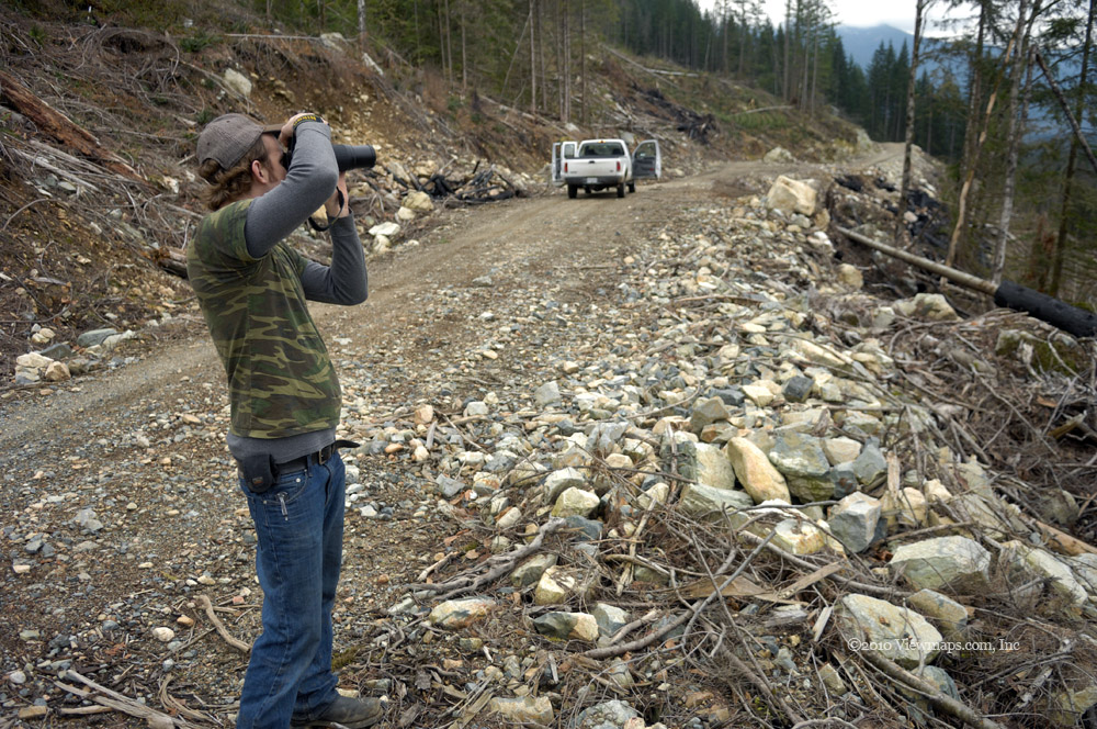
This being our third drive into the Silver Skagit valley, we zipped past the areas we have explored earlier and planned to spend the day at the south end and explore Ross lake itself. The early kilometers passed quickly and we were soon crossing the very rough pot-holed section of the Silver-Skagit road which slowed us down to a crawl as we weaved around some of the worst of the holes. This section of road is sure a contrast to the northern section which is graded and well maintained. As we made our way south the weather got progressively worse and by the time we crossed the Skagit river we were in a heavy snow! The ground was covered with an inch of newly fallen snow. Later when we stopped to chat with a few campers, they said it had fallen just this morning.

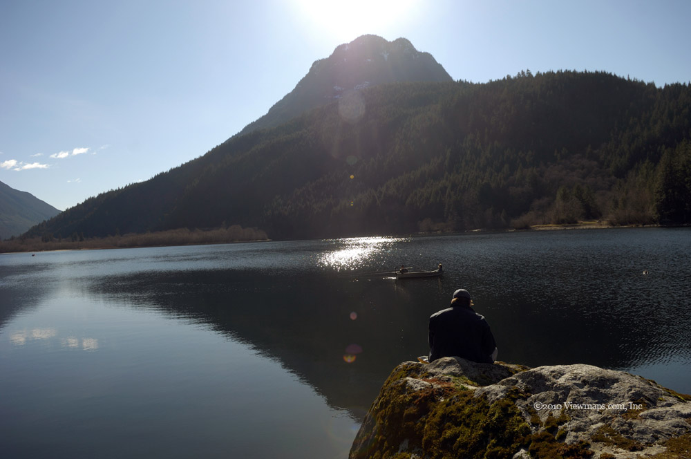
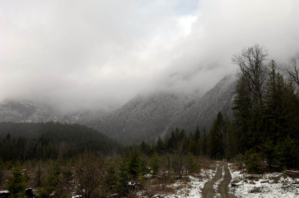
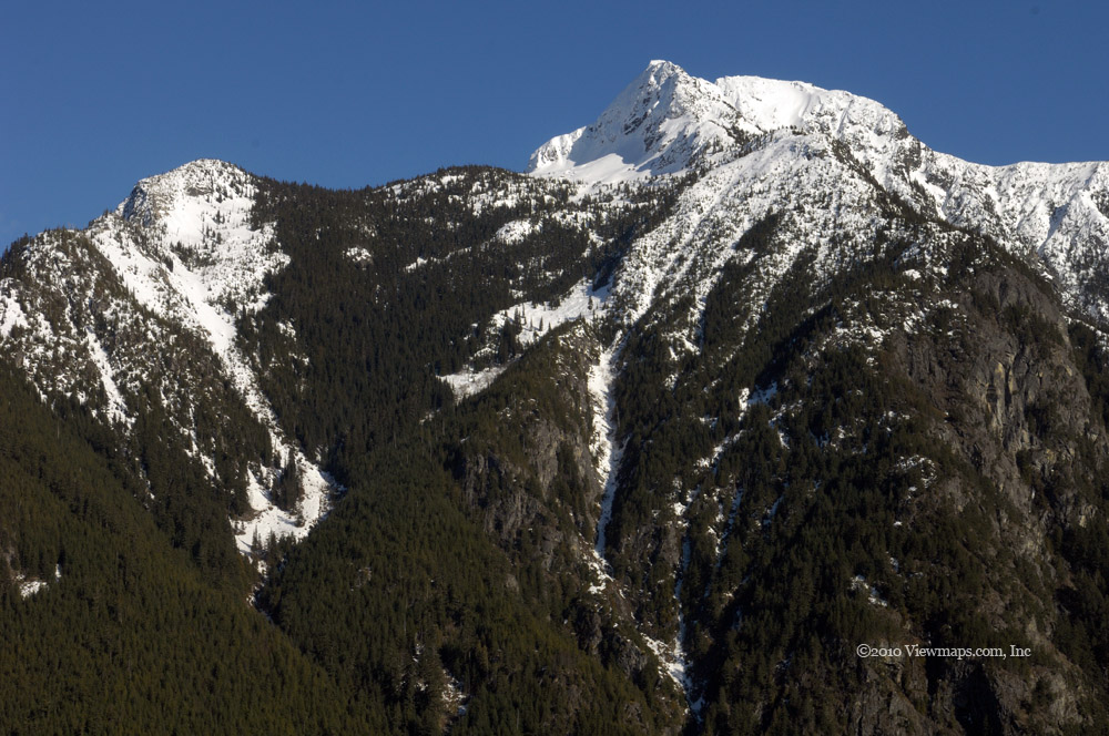
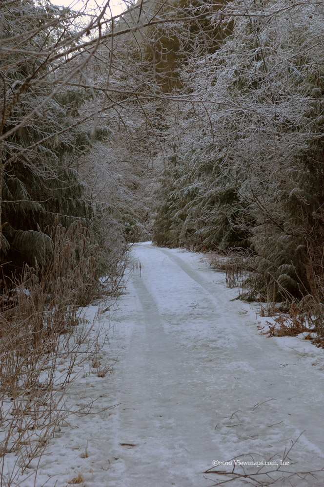
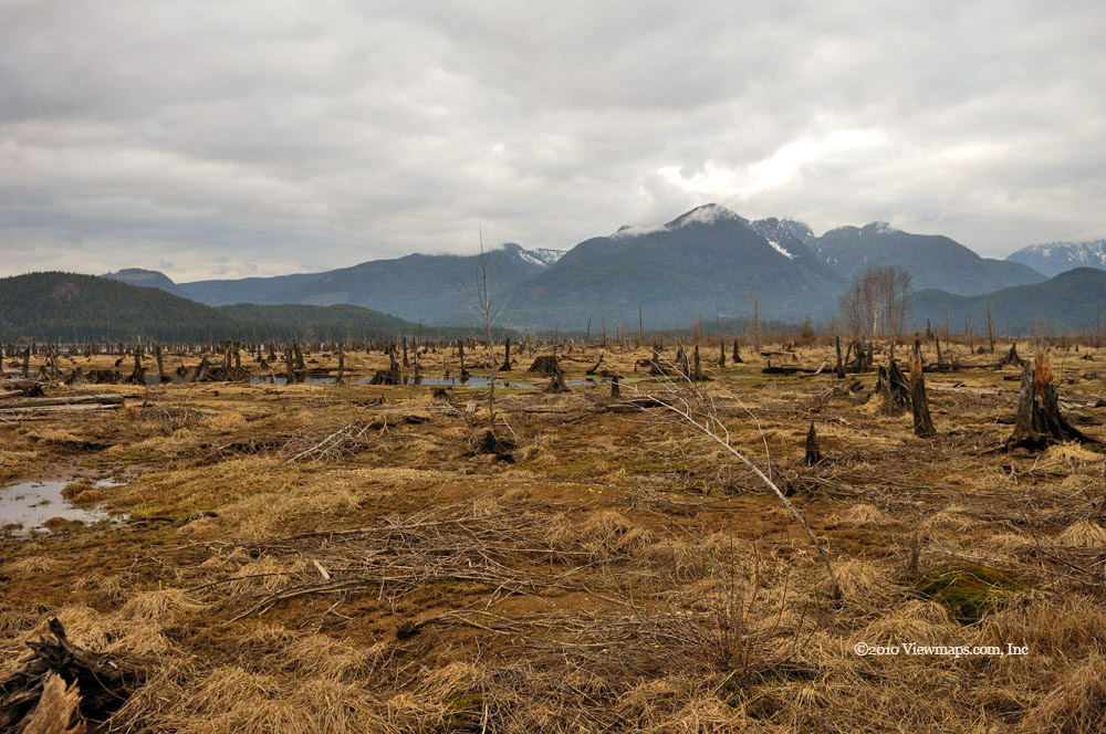
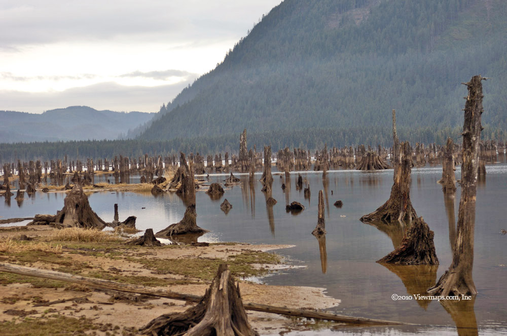
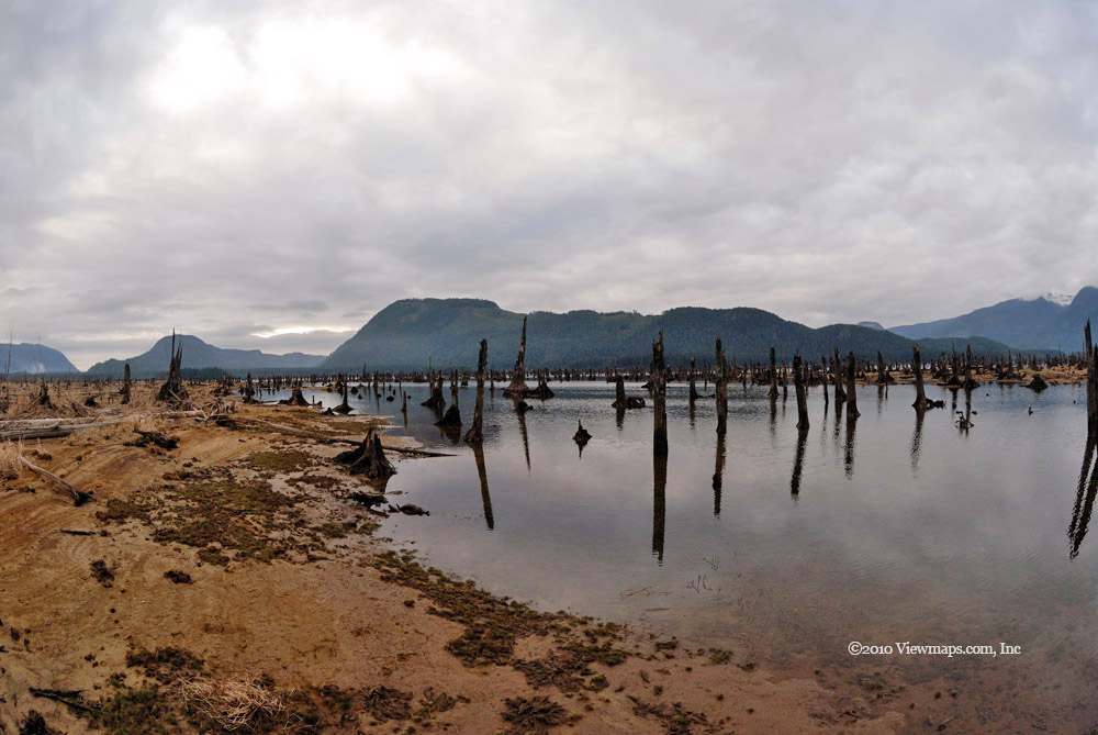
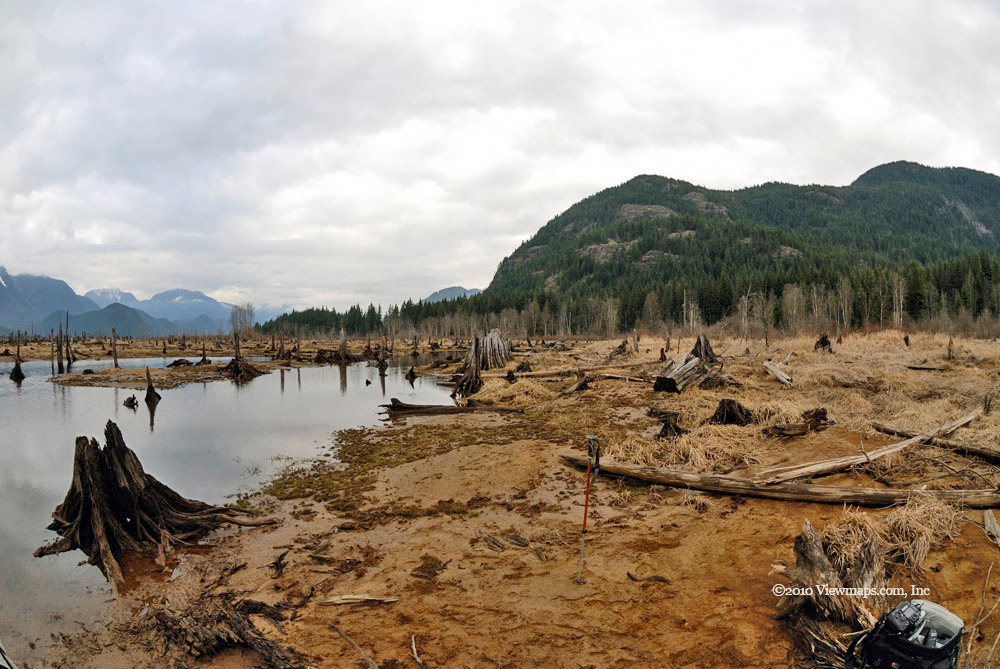
Driving this southern most section saw us travelling through a tree lined road-way. The area being a park, it seemed that the trees were much thicker, but it could also have been the enclosed feeling one gets from being in a heavy snow storm. By the furthest point south the snow had let up and though still overcast we had a drier day. As we reached the area by Ross Lake we were stopped by a locked gate. It seems that the park camping area was closed and therefore no one was welcome to even drive around the site. This is one thing I really dislike about our so called parks, they are so much more locked up and restricted than the open back country - doling out wilderness experience in small controlled quantities. So now I will need to return when the park protectors deem it time to visit.

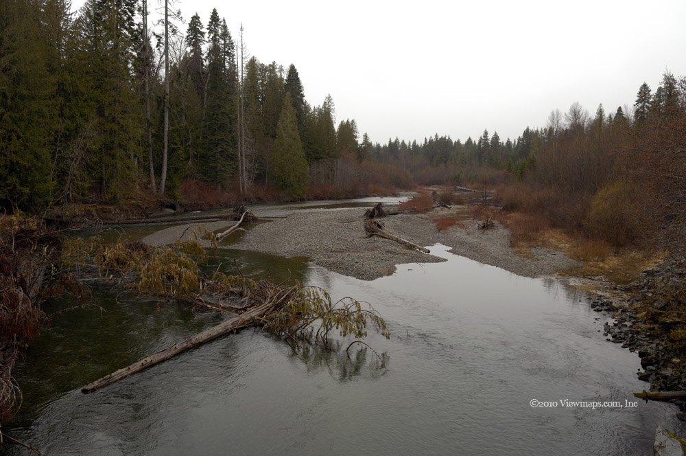
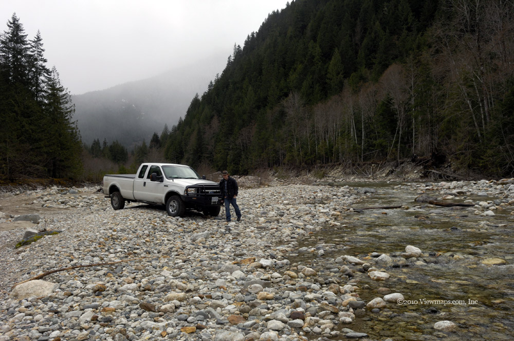
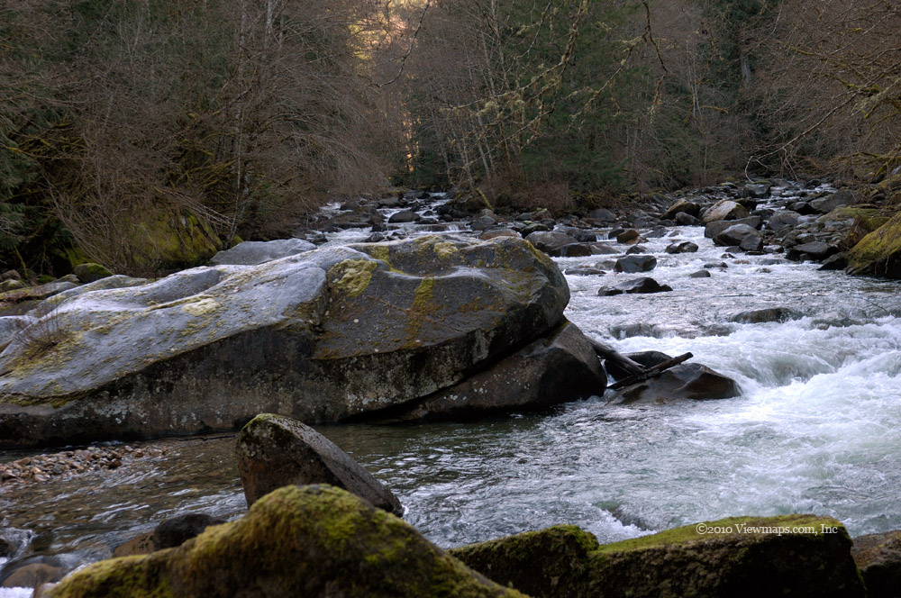
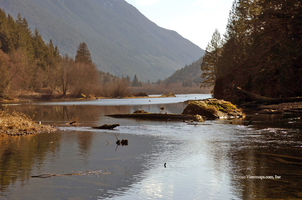
We did check out the small foot bridge that crosses the river. I remembered it from years back when the boys had fun crossing over on it. The Skagit river itself looked quite lazy and unexciting at this point just above the lake. Though the few fallen trees we could see would make canoeing a bit if an exercise. After a bit of a walk around we started back just as another intrepid driver was arriving to be disappointed by the locked gate. As we reached the snowy section we were greeted by a heard of deer running across the road. We wcould watch them peering out at us from behind some under-growth 150 feet from the road. I guess they were surprised to find us there so early in the season.

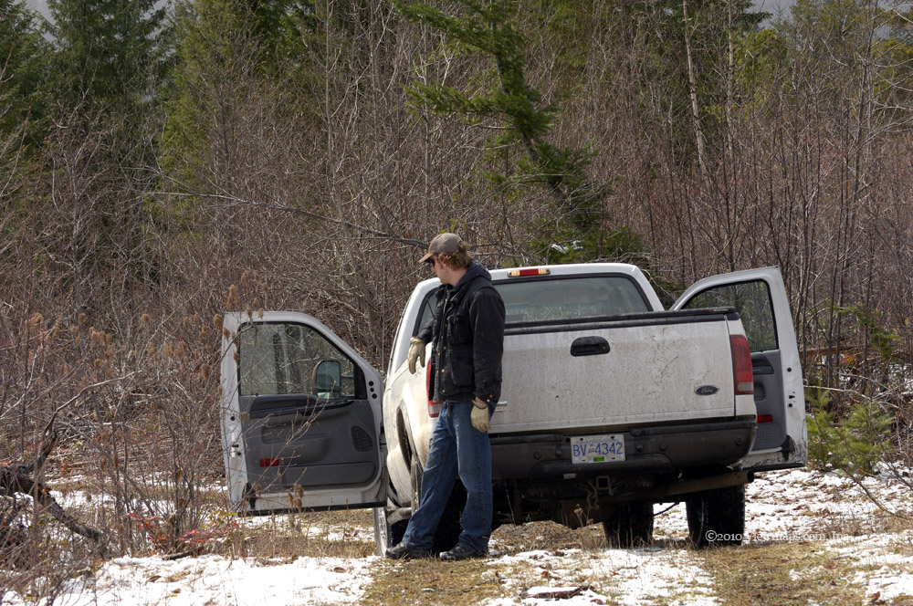
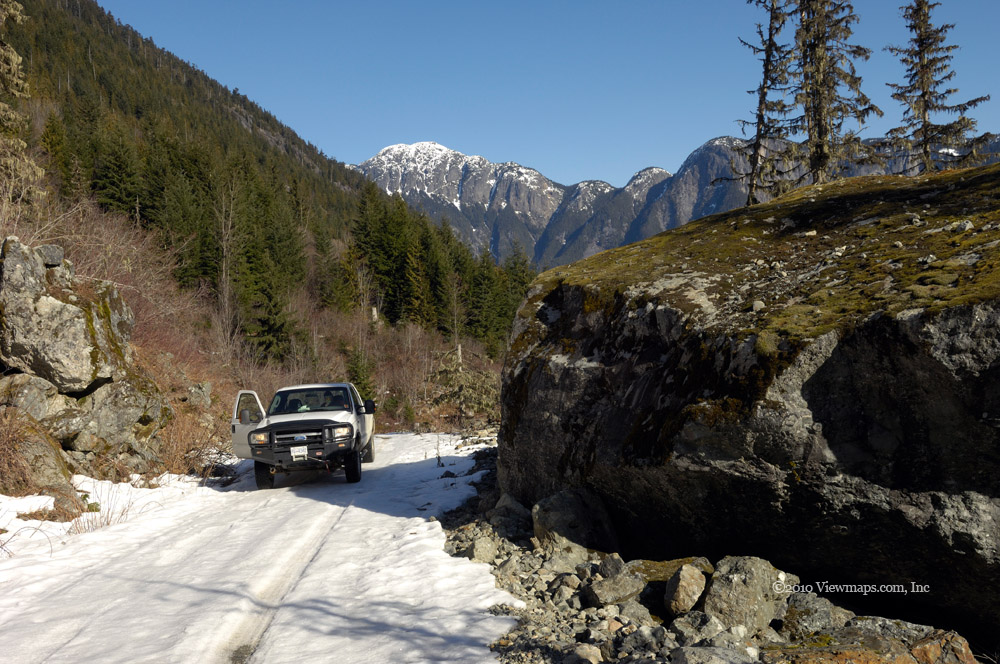
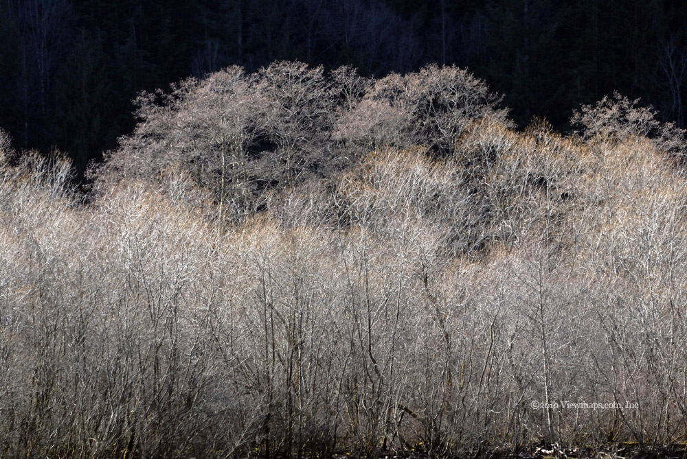
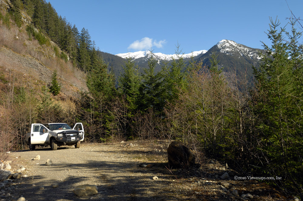
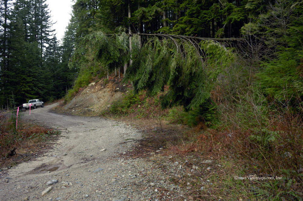
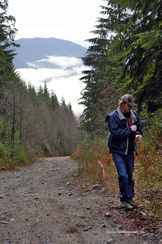
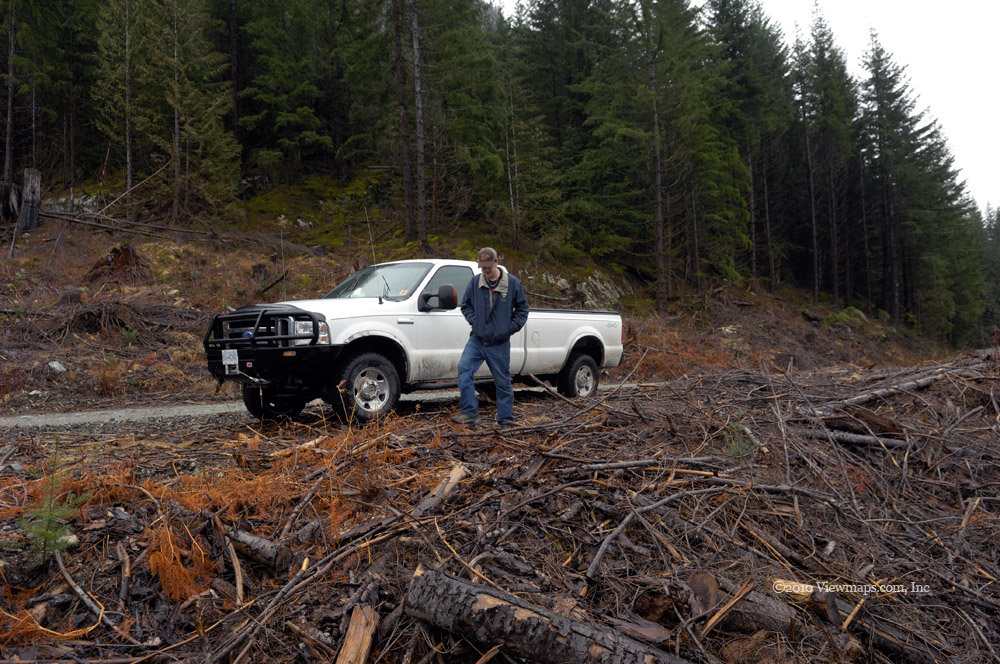
We crossed back over the Skagit and immediately turned into an open camping area where we found three sites occupied. We stopped to chat with one of the groups- a family with late teen kids. They told us how they woke up to find themselves in a snow storm and watched it pile up as they enjoyed breakfast. But it was already melting rapidly and the snow wouldn't be around much longer. We continued north and soon were out of the park where we could drive some of the side roads to check out the region better. Though still cold and dull we did make a few stops where we could explore some of the flat wider sections of the valley. We were hoping to locate a small side road that we found years back that led to an old cabin tucked into some trees beside a stream. Though we tried a number of promising spurs we did not find it.

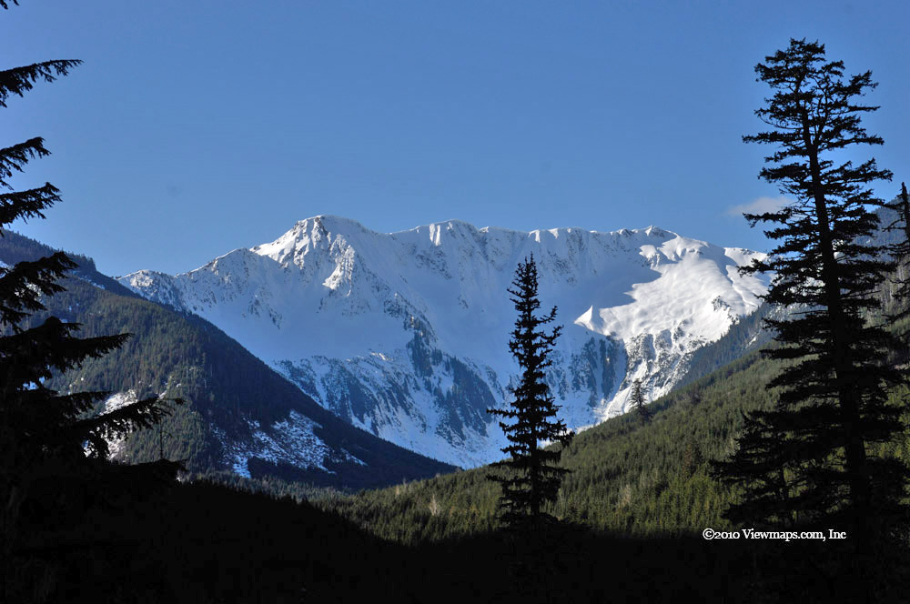
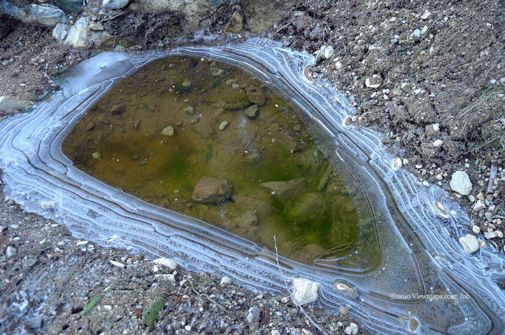
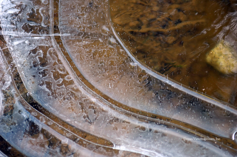
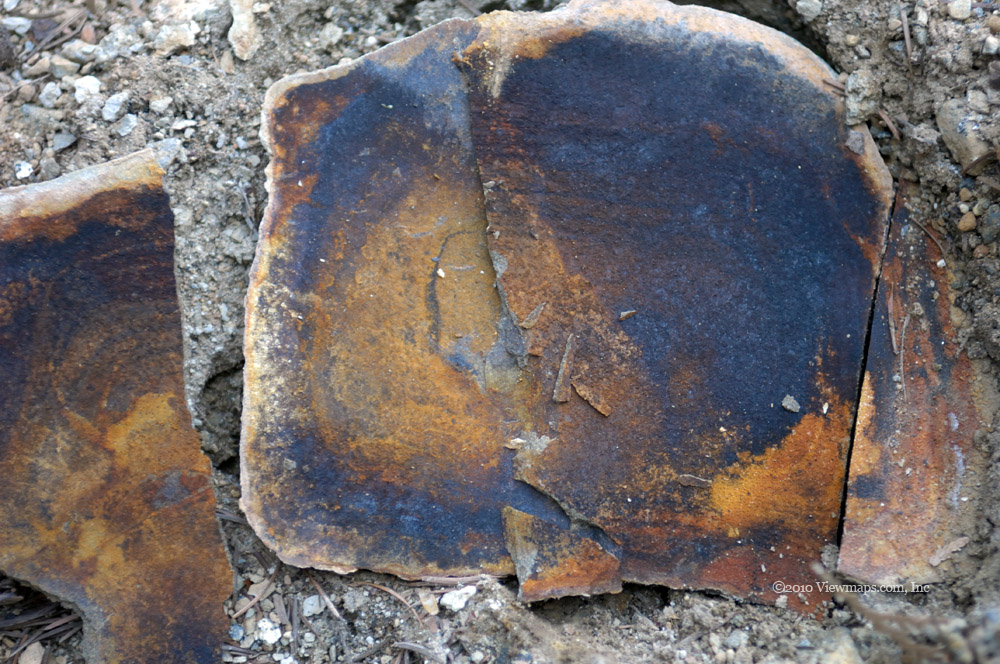
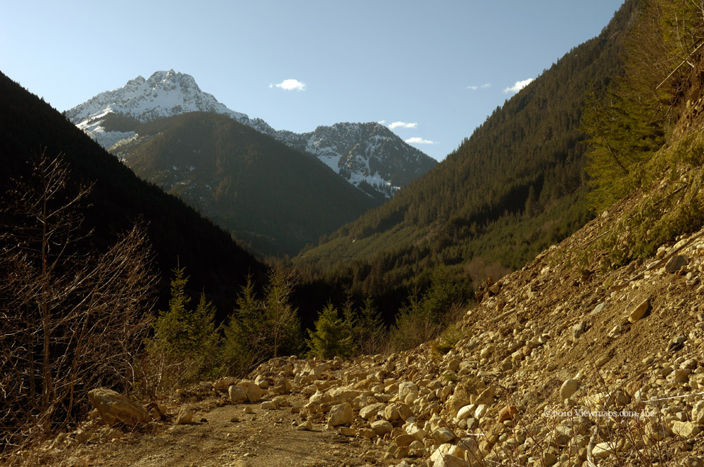
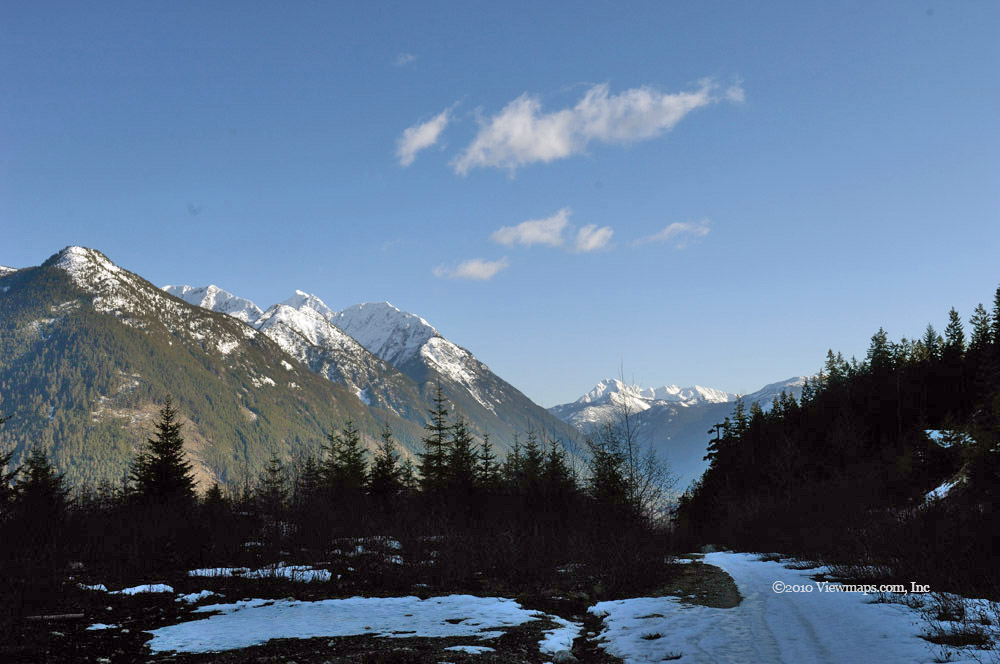
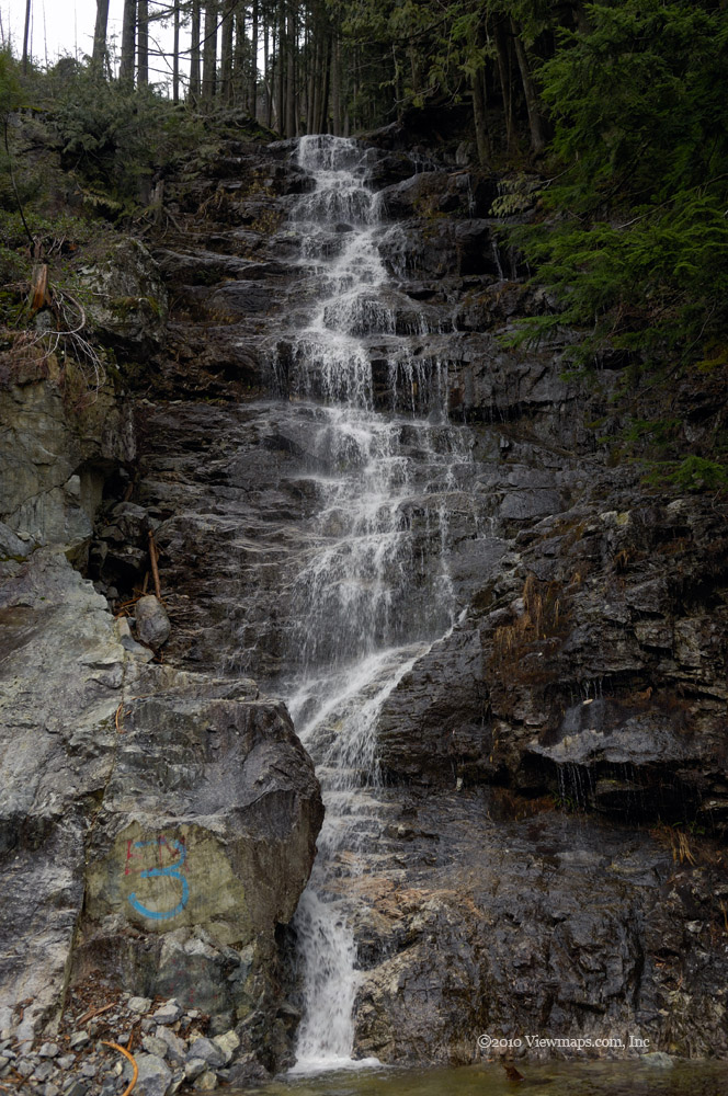
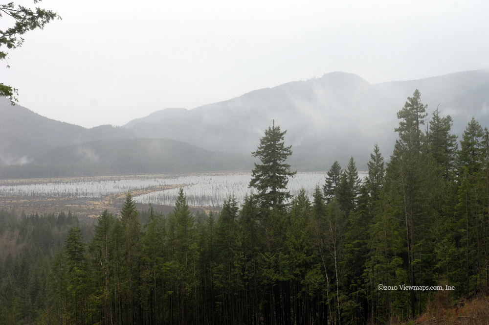
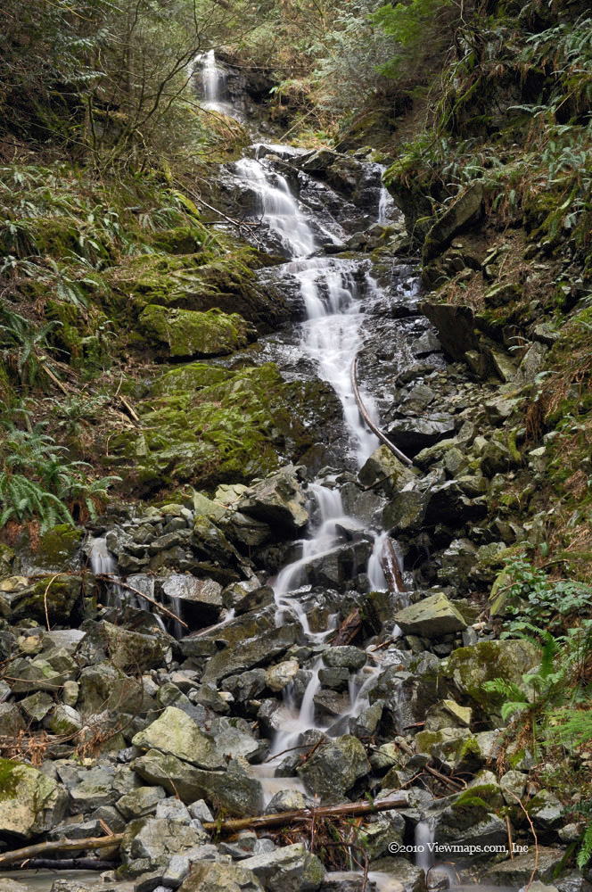
We continued north and were heading out when we discovered a side road just north of Silver Lake that we hadn't seen before, so we decided to give it a go and see what it would offer. It did seem to be leading to a vantage point over-looking Silver Lake but we were stopped short of a good view - perhaps another try when we have an ATV. So it wasn't the most successful of trips and we will need to retry it this summer, but still we saw a few items of interest that made it worthwhile.

Silver - Skagit Road - take two

A month earlier we were getting quite a distance into the various side branches along the Silver Skagit valley but today it seems that the snows had more time to arrive and clog up the roads. So though we tried a number of side roads none allowed us much access. The snow got in our way in almost every road we tried. 

Our first stop was at Silver Lake, I quite enjoy this small lake and the amazing mountain views one has while resting on the massive rock that juts out into the lake. The peaks around the lake are quite majestic and offer an endless variety of sights to explore. I need to figure out how to get in closer to each of them somehow. Once I had captured some reflection views off the lake and a few shots of the water grasses, we set off down the road to find a new side road to explore.

On the way down I thought we could try a side branch of the Cantelon again. Last time we got up to a nice area with great views up and down the Silver-Skagit valley but snow stopped us from getting higher. I was hopeful that a month later might allow us to get further. Alas, we did get past the point we were stopped at last month but only by 150 meters! So no new views were available to us. I guess we'll just need to do it one more time, probably not until June. So back down the road and across the bridge that crosses Cantelon Creek. On the way up there had been a large group of late teens hanging around the bridge with a number of ATV's, this time it seems like they were off exploring the area.

We next tried Hicks creek but were blocked by a closed road very early, then on the east side of the valley we explored some new roads just being prepared for fresh logging later this year. We stopped for a snack on a bit of a ridge overlooking the valley where I setup the cross-band radio's vertical antenna so I could reach the Hope repeater - it worked well despite it being hand-held. Back to the main road and our next side branch was the Silverhope Creek FSR. This road forms part of the trans-Canada trail and one can follow it to Chilliwack Lake. We were stopped by a rock slide this time - passable by ATV but we didn't try as we could see snow not much further up the road. On our way back to the main road we stopped to enjoy a small beaver pond . It was a lovely little pond, a couple of makeshift campsites beside it confirmed it as a popular destination for some solitude. Back on the main road we spotted a small Grouse on the side of the road. As is common, it just stood still while we drove up to it and stopped next to it where I grabbed a few photos. Then once we started driving away it finally ran for cover!

Moving on further we came to an old abandoned granite quarry where we found dozens of huge rectangularly cut blocks of granite. They were all numbered and ready to ship - at-least at one point. Today they are over-grown and obviously abandoned in a granite grave-yard. The blocks were quite impressive as a group, all organized in rows. Leaving the granite we tried one more side road for the day - the Maselpanik. Again we didn't make it very far before being stopped by snow but on our way out we tried a freshly made road parallel to the main Silver-Skagit road and discovered a large excavator parked across the road. It was waiting for a better day as its bucket had been ripped apart I guess from a large rock. Then we returned to the main drag and decided it was time to head out. After bouncing along some rough potholes for awhile, we definitely felt like we had been bounced around enough for one day. A little past Silver Lake we spotted a lovely moss covered tree that was catching the dropping sun just right to show off the moss in a neat way. So we stopped for a few shots before heading to Hope and the Blue Moose to relax over a cup of espresso. An interesting day but I found this middle section a bit less interesting that the first section of the valley, possibly due to the little distances we were able to make into the side roads. It does deserve another visit in the summer when snow will no longer be a limiting factor.

Tsileuh Creek FSR & Alexandra Bridge

Our last trip up the Fraser canyon was back in September, so it was about time we returned and resumed our exploration further up the canyon. Though it was still early in the season, the low snow falls made me hopeful we would be able to explore the full extent of the roads we would find. On our previous trip up the canyon we explored the Spuzzum FSR. Today we would try the next one - Tsileuh Creek FSR which leaves the highway at Spuzzum and skirts the northern slope of Spuzzum Mountain before heading west along Tsileuh Creek.

We arrived at Spuzzum in good time having stopped only twice along the canyon to capture a few shots of the Fraser. It being a dull day with a touch of drizzle, the images were not popping out like they would have on a brighter day. Once in Spuzzum we quickly located the entrance to the FSR and made our way up the fairly well traveled early section of the road. As the road was still actively used for logging it was in decent shape though there were definite signs of being ignored over the winter. As we gained elevation we were soon into snow and the prospects of making to the end of the road seemed unlikely but we continued along. 

As we came to our first turn we were presented with a lovely view of the Alexandra Bridge. This old bridge built in the early 1900's is a single lane suspension bridge. It was the only means of crossing the Fraser in the canyon with a vehicle in those days and the private builders were able to charge a sizable toll for the privilege. Continuing along we soon came the our first obstacle.

There in front of us blocking the road was a recent rock slide, not many rocks but as it was off season and the loggers were not around the rocks remained on the road. We looked over the situation and saw that only the two largest rocks were in the way. They were not overly large so we hauled out our recovery straps and hooked up the first of the rocks and pulled it to the side of the road. Once clear we went after the second and soon the way was open enough for us to pass. As we continued along, the road slowly gained elevation with increasing snow depth. It wasn't all that much further that we came to another rock slide but this one was buried in snow and we couldn't safely determine how to cross it so we decided to stop at this point. But there seemed to be something of interest not much further up the road and as it had only a slide grade and we had our snow shoes - we decided to give it a hike. 

So it we backed up a bit, parked the truck in a wide section, strapped on our snow shoes and set off up the road. After about a half kilometer we came to the area we had spotted, but didn't find anything of interest. The road switched back at this point and start up a steep incline, but as it was starting to snow, we opted to return to the truck. It was a fun excuse to get out the snow shoes and trek along the road. The snow was quite heavy which packed easily and made our going fairly fast, so we were back at the truck quite quickly.

We ate a bit of lunch and then returned along the road - we took a branch that forked off near the start of the FSR and explored some logged areas unfortunately the views from this area were not that inspiring so we didn't remain here very long. As it was too early to head home we decided to explore the Alexandra bridge close up. So we zipped up the highway a ways, crossing the replacement bridge for the old single laner and soon were making our way down the old road leading to the bridge. Near the bottom a tree had fallen across the road blocking access to the final 150m so Geoff took the opportunity to use his chain saw on it and clear the way.

We parked the truck close to the end of the road and organized our camera equipment. I setup the cross-band repeater but we weren't getting into the Hope repeater that well from here and I didn't feel like putting up the larger antenna so we mainly just chatted simplex between us as we explored the bridge area. The bridge is quite interesting and offers some good insight into the engineering capabilities of the early 1900's. It's a shame that the bridge has been neglected for many years and is rapidly deteriorating. If they don't do some basic stabilization on some of the cables and the western support pillar it will soon be unsafe to walk across. That would be a shame as it is a neat experience to stand over the river and stare down through the metal grating to look at the water flowing past.

I gathered a number of shots of the various poses of the bridge and then switched to my close-up lens to get some detail of the cables and decking. The close-up shots were rich in patterns and detail but a few of them did expose the decay creeping into the bridge structures. While we were exploring the bridge another couple came by and took a number of shots as well. They had been here many years previously and commented on how much it had degraded since then. We both got interested in the numerous graffiti writings that had been scratched into the paint all along the bridge. There were some with repeat visits - each marked with the date. Another was listing lovers when they visited together and again years later stating they were still together! I thought it would make an interesting study to come back and shoot all of the graffiti and put them together in a book of some kind.

Once done with the bridge we hiked back to the truck and set off for Hope and a coffee at the Blue Moose Bistro. Though a bit wet and dull, the day was fun and I quite enjoyed exploring the bridge. I definitely will be back to reshoot it and try to collect some of the graffiti though I think it would be a fairly long task to get it all!

Lindeman Lake

Hiking to Lindeman Lake is an easy hike to start the season off with yet it offers some stunning views of a lake and mountain setting. I quite enjoy the area and if one just does Lindeman and foregoes the longer hike to Greendrop, the day is quite easy on one's cardio. Ethan and I arrived in good time and quickly set about putting up the cross band repeater antenna. We were out of practice and it took a bit more time than normal but once up it worked well and we were able to reach the Mount Sumas repeater without difficulty. This was our first full use of the equipment since we installed the second battery in the truck and I was anxious to know how it would do.

The initial trail is downhill along an old logging road to Post Creek. I remember there being a foot bridge across the creek but it seems to be missing, I guess a washout carried it off at some point. A shame as I had hoped to grab a few shots of it. After a brief look around the campsite area we started up the trail and were soon making good time climbing the steep initial section of the trail. Still we were no match for groups of young people who were regularly passing us. At the log bridge across the creek where we stopped to get some photos, a couple of young women stopped on the log to pose for me. We grabbed a breather for a few minutes and then tackled the steepest section of the trail. After taking a few breaks on the way up we were finally at lake level walking along the creek just past where it exits from the lake. The ground was quite soggy so one had to carefully pick each step. The collection of fallen rock here is quite spectacular from a scenic perspective but it certainly makes walking over it a challenge.

We returned to the main trail and found ourselves in the main camping area. Several groups had already setup for the week-end and they were about making more noise than necessary but they seemed to be enjoying themselves. A pair of dogs were not doing quite as well. An off leash dog was trying to be friendly to another pair but they weren't much interested and I was sure a full dog fight would erupt any second. The owner of the off leash dog repeatedly retrieved their dog but each time it returned to leashed dogs only to get growled and nipped at again. I don't know why the guy didn't just tie it up for a while, it would have been safer for all around.
Next we made our way along the north side of Lindeman Lake stopping in a few spots for some lake photos. We looked across the lake and noticed a few walking the far side but this side was hard enough with all the rock slides to get over. I really didn't feel like trying it off trail, perhaps another day. At the last slide before the end of the lake we stopped for lunch. There was a huge rock jutting out into the lake which had a lovely view so we climbed on to it and ate our sandwiches. While enjoying our view and food a few groups made their way past us. The lake was a busy place today, fortunately, the noisy ones at the campsite were mostly muffled by here so we weren't bothered by them as much.

Food gone, we continued along the trail and up onto the wooden walk that carried us past a particularly steep section, then it was down to lake level where we crossed the creek to a grassy section. There we met a small group of photographers enjoying the area and taking a number of photos of their small campfire. It seems like they were looking for some specific photos that centred on the smoke of their campfire. While I grabbed some shots, Ethan lazed in the sun and drew underwater patterns in the sand. I shot from a few locations along the shore here and took a number of bracketed shots but the reflections off the water were moving enough that it made for a funny looking HDR image. So I will need to try a different approach to getting wider dynamic range when water is involved. Once done at the lake I wanted to walk up the trail a bit further to a spot I remembered which had an interesting look to it. It was before the next rock slide so the distance was short and the trail easy.

The area was as I remembered it and I took a number of creek and log shots to wrap up our furthest point along the trail. I would have liked to hike in further but the time I went to Greendrop the crossing of the rock slides greatly tired me out and I just didn't feel up to fighting them any more today, I still had to get back over the few along side of Lindeman. Besides, the sun was getting lower which significantly reduces the available light up here. Midsummer with the sun more overhead, the time available with enough light extends much later but such is not the case in early March. So we back tracked along the trail gathering a few more images. 
I forgot to mention that the handheld radios worked very well up here, we had no trouble reaching the truck and then on to White Rock where Carolyn was waiting with another handheld to talk with us. The technology definitely works well and I was pleased with the setup. A few people asked about the radios and antennas and were interested to learn about the emergency support we could provide.

By the time we reached the main campsite the sun had dropped below the hills and the forested sections were now quite dark. It was surprising at just how dim things were in the forest with the sun below the horizon. When we finally got back to the road and the truck I was surprised at how bright it still was out in the open. Taking down the antennas and mast went quite smoothly and quickly and soon we were back on the road heading home. We stopped one final time to get a few shots of Mount Edgar which had some nice late sun light on it.

A lovely hike to open the season with, it did show that I still have a ways to go with my exercise program, but generally I did quite well and should be able to do a few peaks again this year.

Upper Silver Skagit Road

The Silver Skagit area has been calling out to me for years as I zipped past it on the way to Manning or adventures up the Fraser Canyon. It just never seemed to be the right time to explore the region. Perhaps it was the long drive to Ross lake that dissuaded me, or some forgotten memory from my first trip back near the start of my back country adventures. Whatever the reason, today we would make a break with the past and see what the area had to offer. Our goal would be to explore each side road as we came to it, hopefully they would lead to some exceptional scenes. So after our regular stop in Abbotsford and refueling in Hope we set out for the Silver Skagit Road.

Our initial exit from the highway took us into the small community of Silver Creek. After a short drive to the end of the main road while looking at the various home construction styles and avoiding some ill-behaved dogs, we realized we were on the wrong road and that the one we wanted was on the other side of Silverhope Creek. So it was back to the highway, across the bridge and now we were finally starting our adventure into the back country. The road is paved for a couple of kilometers but soon turns to gravel as it crosses Silverhope Creek. From the bridge I noticed a huge rock in the middle of the creek which caught my eye and it became my first subject for the day. Back on the road we soon came to a small water fall across the creek which intrigued me.

Soon after the waterfall the road split we chose the right branch which led to the west side of Silver Lake but it was gated off just past where the Sowerby FSR branched off. Being the only way to go, we set off up the Sowerby towards the flank of Isolillock Peak - such a fun name for a mountain. It was a lovely drive up the road, we had some great views of Wells Peak, Mount Stoneman and Mount Barr. There was one steep stretch where we had to take a second run to get up. The ice was quite slippery and we were sliding towards the sharp drop just past the edge of the road as we spun our tires on our first try. Once over, we had only a brief thought about how we would do coming back down this section. Unfortunately we didn't get much further before the snow got deep enough to stop us in our tracks. We were on a level area with wide shoulders so we opted to turn around - that took us quite some time as we kept getting stuck. While working our 180 and digging out some snow, I enjoyed a radio chat with Stuart who was calling from the White Rock area.

Once turned the ride back was quick and without challenges. We found another small side branch off the FSR that we tried out - there was an interesting ice covered puddle at the end point which caught my attention and I took a number of close-up photos of it. Ethan hiked past the road end to see if there was a view worth grabbing but it proved to be too obscured a view. So it was back to the main road and on to Silver Lake where we walked on out to a large rock that jutted out into the lake. We grabbed lunch on the rock while enjoying the sights and ambience. We watched a pair motoring along the lake fishing while I chatted through the truck's cross-band repeater to some of the club members back in White Rock. Once rested and done lunch we continued on down the Silver Skagit Road.

Passing a number of short spurs that led back to the river and to a small campsite at the head of Eaton Creek trail, we slowly made our south down the road. Though interesting, none of these spurs offered much of a view to enjoy. Eventually we arrived at the Cantelon Creek FSR. This side road looked more promising being the longest so far this side of the lake. Once past the bridge over the Cantelon Creek we chose the left branch and set off up the valley. The road looked down on the creek which was still covered in deep frost and looked so wintery compared to the bright sunshine and lush greenness all around. Unfortunately it wasn't long before we encountered a slide, picking our way carefully over the loose rocks we soon came to a second slide. This one was just too deep in loose rock for us to get over - a route available only to an ATV. So we returned to the fork just this side of the bridge and made our way up the slope overlooking the Silverhope creek. It was a lovely view of the valley and the various mountains on the east side. But at the 950 meter point the snow once again stopped us. - At least the view of the peaks was worth the trip on its own!

Back down and across the bridge over the creek. We came upon another side road which we decided to explore and soon we discovered that we were travelling along the Cantelon creek headed for Yola Creek. We were on the Yola creek FSR and traveling through that deep frost valley we viewed from above! it was an absolutely amazing scene here. The ice and frost seemed so strange when just a few feet up the slope it was sunny and green. We eventually came to a frost covered campsite where we got some amazing images of ice crystals on branches and rocks. The road continued on but the snow was getting deep and there was a water crossing ahead with some steep edges which we decided to not try due to the partial snow cover. So this road will definitely need a second visit come summer.

We returned to the main road and decided to head out, a bit disappointed that we didn't have a need for the winch - obviously we didn't push ourselves hard enough today. But not much before we reached Silver lake we spotted a problem. There on the side of the road was a pickup with the driver side wheels on the road and the passenger side down a steep drop on the shoulder. The road here had been graded and the road gravel ended abruptly at the shoulder two feet above the natural ground level. The truck was stuck- bottomed out - in the loose gravel on the side of the road. The guys in the truck were trying to get help but so far no one stopped to help them - it was our chance. Though we likely could have used a recovery strap to pull them out, using the winch seemed so much more fun. So we hooked them up and pulled them onto the road. They dropped off a 20 in thanks. So we did get to do some winching after all. We made our way out without further incident and felt that we had had a full and successful day, and already planning for a return trip to explore the next section of the valley.

Murdo Creek & Lost Creek FSRs

Shortly past the start of the Lost Creek FSR is a narrow insignificant looking side branch that I have driven right past over the years. This branch is actually the start of the Murdo Creek FSR which opens up into a fairly significant area for exploration. So today we decided to see what it would present to us. The road was little used and though the bridges were not overly solid they were rated enough for our truck. We gingerly picked our way over a couple bridges and up the slope eventually reaching a level stretch with a bit of a view looking down into Davis Lake. Geoff noticed a current trail marker on the side of the road, so we stopped so he could explore the well groomed trail while I grabbed a few photos. Later we learned that the trail was the first leg of a hike to Mount St. Benedict which follows along the FSR for the next segment. 

After checking out a number of things that caught our eye, we set off further up the road passing a couple of side branches which will require an ATV to try. We were eventually stopped by a slide. Just before the slide was a lovely waterfall where I took a number of photos. As I was shooting the falls, a group of hikers making their way up the trail caught up to us, they were quite surprised to find a truck up here - perhaps a bit disgruntled with having hiked this far and not needing to. Geoff gave them some directions from our computer map and then they continued on past the slide on their way to a small alpine lake.

Once done with shooting the falls we returned back down the road where we met a truck making its way up. They had a pair of dogs running alongside the truck - both were quite tired, perhaps not the wisest way to treat a dog. Soon back on the Lost Creek FSR , we drove past the cars of the hikers parked near McDonald Falls. By now we noticed that the clouds were getting thicker and it was already starting to spit rain at us, not a day I would be going on a longer hike! Once past Davis Lake Park we enjoyed a cloud obscured view of Stave Lake and the surrounding hills. It was interesting to view but did make for a dull setting - not really that good for photography.

We drove by a side road and decided to follow it to Stave lake. The first section of the road was quite passable but soon we encountered some very steep sections - bending our right running board as we continued on. We finally got down to a small creek bed which we drove along a short distance. We had been here once before in the Pathfinder but couldn't make it up the far side bank. That was a few years back, today the climb up the far side was quite worn down by ATV's but it would have required us to winch ourselves up and in the worsening weather it was not something we long considered. So it was back up the road where we again bottomed out on the dips that challenged us on the way down. We drove up another short spur where we enjoyed a view of the lake while we ate lunch.

Back to the main road and on up to where we could get a view of Salsbury Lake from above. Unfortunately the trees had grown quite tall and there was no good view of the lake. We did finally get a glimpse of Salsbury from a little way past the lake but the weather was rapidly deteriorating and after capturing a few more images of the cloud covered lake and mountains we decided to call an end to the day and head back home. I thought we could try a few of the roads that exit out onto the paved roads along Miracle Valley but each one was blocked by private residences and offered no access to the back woods. This was most disappointing. We did come across one gated driveway with some serious keep out additions. They really were pretty serious at keeping people out. Later I learned that it was a legal grow-op of some size so the strong gates made a lot of sense.

Though the weather was not that good I did discover a new area with a lovely waterfall, and a possible hike to do come summer. The trip also re-emphasized just how desperately I need to get into an ATV to explore those many areas just out of reach for our truck.

Nesakwatch Valley & Chilliwack Lake

My previous drive up the Nesakwatch FSR ended abruptly only a couple of kilometers in by a large slide that blocked the road. In coming today I was hopeful that i could get past that slide and that one could get far enough to have a good view of Mt. Slesse. I last hiked to the plane crash monument in the summer of 2004, so I was hoping to find the way open and the possibility of perhaps another hike up to the monument one day. The drive to the start of the FSR went without incident and soon we were bouncing our way along the gravel. I stopped to gather a few early photos of Mount Pierce but we were quickly approaching the wash out.
As we made our way up the rise leading to the old slide I saw that the way was now passable. One group had parked their truck and opted to walk on over it, but though it was quite rough we had no trouble driving across the slide. We slowly made our way along the road grabbing numerous photos of Mt. Pierce, Crossover Peak and Mt. Parkes. They were nicely snow capped and they offered some lovely traditional mountain photos for my collection. I tried a few bracketing shots but wasn't very happy with the results when I reviewed them back on my computer. The contrast range was just too wide for the number I took. I guess I will need to shoot even more shots next time.

We made our way over a few more slides that had once blocked the road but they were all crossable for us though we did come to a slide that scared a few more drivers enough to park and continue on foot. Finally we arrived at the spot where there was a short spur off the road which in past led to the starting point for the Mt. Slesse hike. The road was now over-grown and obviously no longer in use. The trail it seems had been relocated since the natural bridge over the creek had been washed out. Looking up the main road we saw a new problem.

The road now had a huge gaping hole running down its middle and across it to the lower side. it seems that recent water flows had undermined the road in the short steep section just ahead. It was passable by ATV's as was proven by a group of them that were returning having been up the road to the snow line. We decided to park the truck and to hike the kilometer or so to a good view point of Mt. Slesse. Our first task was to set up the cross-band repeater. Since we were traveling only a short distance I decided to just use the dual band whip antenna but this needed a short position change of the truck for us to work the Abbotsford repeater reliably. It is amazing how a few feet can make such a difference out here.

Radio setup, we were off past the washout and slowly making our way along the road. After a short distance we came upon a sign marking the new start of the Slesse trail. Soon we did come to a viewpoint where I got a number of shots but we had an even better spot a short way further along. After a rest we returned to the truck and made our way back to the entrance to the FSR. We stopped to look at a locked gate that led to the Centre Creek FSR. I have wanted to explore that area for years. Though locked there was an ATV path around it and it looked like we could do it as well but I wanted to visit Chilliwack lake so we passed on the opportunity.

Back on the pavement we soon passed the start to the Lindeman Lake trail, there were cars parked up & down both sides of the road, it seems that it was a popular destination today. We would have been one of them if Ethan had been up to a hike today, hopefully next trip he will be feeling good enough for hiking. Soon we were past the entrance to the Chilliwack Lake Park and on the lake road. It is so terribly bumpy, I am certain that they leave it this way just to discourage people from driving it. We found a number of lovely views of the lake and the peaks around it. The water level was low so I was able to get a few shots from the rocks that form the sides of the lake. 

We continued to the small beach area that forms part of the Paleface Creek delta. I fell in love with this spot on an earlier visit as it has amazing views to both ends of the lake and has a neat rock formation that juts out into the lake. As we arrived we noticed another truck parked near the trail that leads to the beach so we knew we had company. Once on the beach we spotted a chap with his dog fishing off the rocks and tending a small camp fire. It added an extra dimension to a few of my shots. We chatted for a bit while I took some more photos as the sun dropped below the western peaks. His dog was quite friendly and seemed to enjoy our company. 

As we chatted we got on to the upcoming Olympics and he mentioned that he thought it a bit ridiculous that they were having to truck in snow from Manning Park. I hadn't heard that but it did seem odd to me. I kept shooting and once the sun had dipped down we returned to the truck and started our long drive back to the pavement of the Chilliwack River Road. It seemed even rougher on the way out - perhaps because we weren't stopping very often. It sure felt good to be back on pavement and a smooth ride. Tonight we opted to travel the highway on the way home rather than the country roads. So we inched our way through Sardis and got on to the freeway. we weren't on there long when I spotted a pair of double car dump trucks hauling stuff west. I couldn't believe it! We actually came upon some of the trucks hauling the snow to Cypress! It was quite funny but there they were. We heard some truckers commenting on the whole project on the Ladd frequencies as we drove which made for some interesting listening. It seems to have made quite an impression - this need to move snow.

The trip was a lovely adventure, not new ground, but places that can be visited repeatedly and always give new sights. I do hope to try the Nesakwatch area again but next time I will have an ATV.

Stave Lake Wetlands

It was back to Stave Lake even though it had only been a month since my last visit. We covered so very little ground last time that I thought another trip was in order. For today's trip we would concentrate on the lower section, to reach it we took the first branch past Davis Lake Park. surprisingly, by the end of the day we had covered even less area than on our previous trip! Weather wise it was a decent enough day but the rains had definitely left the lower sections of the road very muddy.

Our first excursion on to the flats saw us mostly in the truck, we chose a road that looked like it would take us to the lake. As we made our way down to the flat section near the lake, we soon came to a giant mud puddle blocking the road. The last time we were here was a few years back when we were in the Pathfinder, this puddle turned us back at that time as we didn't have a winch and really didn't feel like getting stuck in the middle of deep mud. Today we zipped through the puddle, by hugging the right edge we got across through with no issues. We then followed the road, which was really more of an ATV path, through more muddy sections and between some narrow gaps between stumps. Soon we determined that the road ended well before the lake and the short remaining section of road was even muddier than what we already travelled, so we opted to turn back.

Unfortunately the return trip proved more of a challenge than the one heading out. With the slick mud and numerous fallen trees that crossed the road we soon found ourselves unable to get enough traction to ride up a log. So we dragged out the winch cable and pulled ourselves over the log. Very soon we had to repeat the chore and then we came to a steep incline that was too muddy for traction and we had to use the winch a third time within the half kilometer! The winch made short work of the situation each time so it was definitely a needed tool for today. We arrived back at the large mud puddle and this time we didn't hug the side as closely and as we made our way across our rear right dropped into a deep hole, fortunately we had enough momentum to keep moving! and we didn't need to get out and get wet.

After that we returned to the higher section of road which led south between Davis and Stave lakes. It was easy driving here and soon we saw that we were within a quarter kilometer of the edge of Stave lake so we decided to park and take a hike out to the lake. The first section of the hike was through low growth and brambles and then a narrow strip trees, we quickly got to the place marked as the edge of the lake by the GPS. Funny but there was no lake, it seems that the low water level had exposed this area and it was now mostly grassy patches with criss-crossing troughs of water throughout. There was only around 150 feet of ground to cover before a slightly higher forested section could be reached so we thought we would give it a try and see if the lake was on the other side of the higher ground. We had to make a small bridge out of fallen logs at one point but after a short while we had worked our way across and were now in the forested section. It didn't take long to cross this small patch of trees but there was still no lake at its far edge. 

We did find soft sandy ground leading far out to the true edge of the lake. Now we could actually see the lake and all the thousands of tree stumps left behind as the lake filled. We slowly picked our way across the sand trying to avoid the softer sections that sank who knows how deep. Soon we came to a small finger of water where we stopped to gather photos. We decided to not head out further as the scenery here was quite amazing with all the stumps. After resting a bit and taking a variety of shots we started back to the truck. We made much better time on the return, I guess we knew what to expect and what we were doing. As we neared the final treed section a number of loud gun shots went off to the south of us. The shooters were doing some target practice but it was far enough away to not be an issue, but we did head to the truck as quickly and directly as we could.

Once back we gathered our breath and decided to head to McDonald Falls. This trip I had my tripod and I could get some slow shutter speed shots of the water. After a few images of the falls from a number of locations we returned to the truck and set off home. The weather had worsened by this time and we were actually getting a few drops while shooting the falls. So it was a good time to be done and set off home. It was a fun trip but we covered very little of the area so I do feel a third visit is in order in the near future.

Chipmunk Creek & Mount Thurston FSR's

Back in early December I had hoped to drive a loop from the Chipmunk Valley FSR through to Mount Thurston and out but the snow stopped us quite early in the loop. So since the weather had been so unseasonably warm this January I thought we could give it another try. We set off directly for the Chipmunk FSR this time and started the loop with great anticipation. The first section of the FSR was dry and easy driving and soon we came upon a convoy of 8 jeep size 4x4's also making their way along the circuit. They were together and interestingly all hams with radios. I chatted with one of them and set the second channel on my radio to monitor their frequency.

As they were parked planning their route, we passed them on our way to our first photo op. Soon we came by a good view of a lovely waterfall across the valley for which I stopped to gather a number of shots. During the time shooting, the convoy passed us. Done with the waterfall we were back on the move and soon we were past the cross-ditch that trapped us on our last trip. There was no snow at this point so we were getting hopeful the loop would be possible. But after just a couple more turns we started to encounter snow. We then heard the convoy talking about the challenge of a cross-ditch not much further ahead and we knew the loop was becoming less likely.

We were making good time on the relatively level section of the road and soon we caught the last of the convoy jeeps. He slowly made it over the challenge we heard them talking about, our truck found it quite easy to do. We were now traveling in shallow ruts but it was easy driving for the next few bends. Then we finally arrived at the fork, right going to the Mt. Cheam hiking area, left to Mt. Thurston. The left fork starts with a steep but short climb that we started up but soon were spinning and not moving. So we put chains on the front tires and easily made our way past this steep section. We did manage to break a few links on the left tire chain in the process, so we stopped so I could repair it. 

While working on the chain we heard the convoy talking about ever deepening snow and needing to pull each other. So we made a decision to not go any further today. We returned to the fork and took a run at the other branch, as it was a steady rise we only got a half kilometer before we were starting to slip - and that with chains on! So we stopped there and had lunch with a lovely view of Lady Peak. After lunch we started back down and when we reached a broader flat section we stopped for a bit to gather a few photos and Ethan tried a few shots with his bow. A number of ATV's came by heading in, we chatted with them briefly.

Soon we were back on the way out and before long we were on the Bench road. We decided to try the loop backwards to see how far up the south slope ofThurston we could go. Not too far in we came by a lovely viewpoint where I gathered a number of shots of the peaks along the Chilliwack River Valley. Then it was back to driving up the narrow road. At around 1300 meters we finally hit the snow level and very quickly we were stopped by it. We backed down a short ways until we reached a slightly wider section of the road where Ethan did a 12 point turn to reverse his direction! It was a bit challenging in the narrow space we used. We tried a few more short side branches on our way down but before long we were back on the bench road headed out to the pavement.

It was a lovely drive, full of adventure and impressive mountain vistas. We didn't succeed at the loop again this trip but I didn't really expect to do it mid-winter. Maybe in a well equipped ATV! Which I will have one day. The drive home was blessed with some lovely views of the Cheam range and then just before home, we saw a exquisite cloud formation in the sunset. It was interesting enough that I had to find a clear spot to grab a few shots. We turned onto 184th and noticed another photographer taking some photos on the side of the road. So we parked near him and I joined him in capturing the sunset.

Lighthouse Park Revisited

It was looking like this week-end was going to be a bust for enjoying the back-country. Both of my regular companions were unavailable one due to spouse demands the other due to a work-place injury which may keep him off the roads for a few weeks. So what was one to do? Well I do have two other sons, one of which had just started a two week vacation. So I booked Nick in and off we went. He isn’t experienced with driving the FSR’s so this gave me my chance to visit the park again. Nick always enjoyed it there so it was a win-win location for us.

Being close and easy to reach we decided to leave around 10AM and be on the trails before 11:30. Well our goal was easily met if the traffic and road construction were under control but they were not. The Freeway leading up to the Port Mann Bridge was backed up for a couple of miles and then the rest of the highway from the bridge to Cassiar Street was slow. So what should have taken around 15 minutes took more like 45! I really don’t like waiting on the parking strip!

Eventually we arrived in West Vancouver and stopped at the small mall where we picked up a few items for lunch. It was here that Nick informed me that I would need to do the rest of the driving! I guess the traffic got the better of him. We finished our purchases and quickly made our way down the hill to the park. Being near noon it was already quite full, which was a major concern I had about coming this late in the morning. But as we arrived at the top section of the parking area, we found a spot that had recently opened up and we grabbed it before anyone else tried – it helps being in a big truck!

With parking settled we did a quick radio test to determine what would work for us, my hand-held into the UBC repeater was what we settled on. Once we organized our packs and I grabbed each of us a walking stick, we were off to the start of the Arbutus Trail. These eastern trails are much less used than the west side trails and so it gives one a more secluded feel to the park which is always enjoyable to me. We made our way past some lovely large trees that provided cool shade for our hike as it was now past noon and starting to get rather hot. The clouds that covered the whole sky when we left home were now quite gone and the temperature was rising rapidly.

We continued along the trail until we reached the rocky point on the south-eastern end of the park, this area is named – Eagle Point . I really quite enjoy this section of coast and when we arrived we were quite alone but as we ate our lunch several other groups came by to enjoy the view. I took a number of shots of the rocks and tidal pools. There were quite a number of boats crossing the bay from majestic sailboats to fast noisy power boats. I really would like to get out on the water again.

After lunch we continued along the trail to the main camp area of the park where large crowds were gathered. I took Nick to the traditional view point looking down on the Lighthouse where I took a single picture of it. Then it was off along the Shore Pine Trail to Jack Pine Point (also called Shore Pine Point). We arrived at the point and made our way to a section of the rock with a great view of the lower rocks and the entrance to Howe Sound. It really is a spectacular location. I noticed that many of the Arbutus trees were showing severe stress due to the lack of rain this year. Some had died or at least they looked like they had. It is a shame as they seem to be fairly slow growers as they cling to the rocks. We stayed here a while as we rested from the hiking so that we could get a good dose of the beauty and fresh air. 

After we had our fill, we set off along the trail for Juniper Point where I have taken many amazing photos over the years. Along the trail we met an overly energetic dog which the owners had to keep calling back to them, I’m sure it did the hike a dozen times to their one. Soon we came to the Juniper Point trail and shortly into it Nick pointed out a tree stump that when alive had grown in some very interesting shapes. Once at the point we joined a group of visitors and rock climbers. It really was far too popular for my liking. But then it is good that so many are now enjoying the great view from the rock cliff.

We took a short rest here and I gathered a number of additional shots. My favourite tree was still perched on the rock face looking much as it has in the past. It sure would be a shame if it was gone as it adds the character to the place. Once done with the photos we returned to the trail and continued on to the truck. Nick was definitely glad to be back, he had reached his limit for the day. It took only a short while to pack up and then I had the opportunity to drive us home. The drive actually went very smoothly - only the one slow-down between Cassiar and Boundary roads, but the other direction was not so fortunate. Once home we unpacked and relaxed. It was a nice trip and I enjoyed the return to the park. It was the lighthouse radio week-end so I guess I should have done some HF work from the lighthouse but I wasn’t really prepared for that and will need to plan for it next year.

Subscribe to 2010