
East Harrison - Slollicum

The Harrison area has a huge number of side roads to explore which are relatively low in elevation so they are a good winter area to explore. Today we wanted something easy and not too far in as we had no cover for the back of the truck and hence we would be traveling with minimal equipment. So I thought we could try the first side road off the east Harrison as it was an area we hadn’t seen in many years.

Arriving at the start of the road we saw promising signs that the weather would be decent and perhaps offer us some brighter scenes. We checked over the truck, loaded in the road frequency on the radio and started off. The first branch came quickly and soon we were traveling back south just 100 or so meters above the mainline. For today’s adventure we decided to follow the right-hand rule – taking the right branch of every fork we come to. So our first decision kept us traveling low and parallel to the mainline below us. Not much past the first fork we encountered two fallen trees across the road. Tracks from a previous driver showed that he had turned back at this point. We didn’t have our chainsaw so we would have to drag the trees to the side.

The larger of the trees was a good sized tree and would be a bit of a challenge to move. We attached the winch near the root end and started to pull. We moved it a few inches but then the truck started sliding towards the tree. We felt a different angle might still allow us to move so Geoff repositioned the truck and we gave it another go. This time the tree started sliding and soon it was up and over the hole created by its root ball. Dragging it the rest of the way along the side of the road was easy and soon we were onto the smaller of the two. It moved very easily and in little time we were winching in the cable and off to see the road we had opened up.

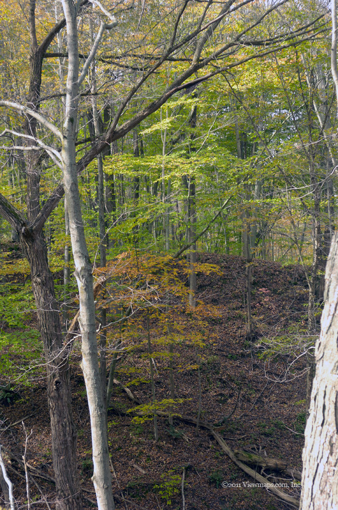
Though this area on the southern flank of Slollicum Peak didn’t cover much distance, we had a large number of short side branches to explore and one more pair of trees to move, not sure why they were in pairs. So we ended up spending most of the day just in from the start of the forest road and bumping along the edge of the Sasquatch Provincial Park. The area was rich in dense mossy forest which made for a very rich green environment. Both Geoff and I commented on how amazing this type of forest growth was and how it must have been truly spectacular to see an original growth forest like this. I mentioned a few I had seen and he seriously wanted to visit an area like that.

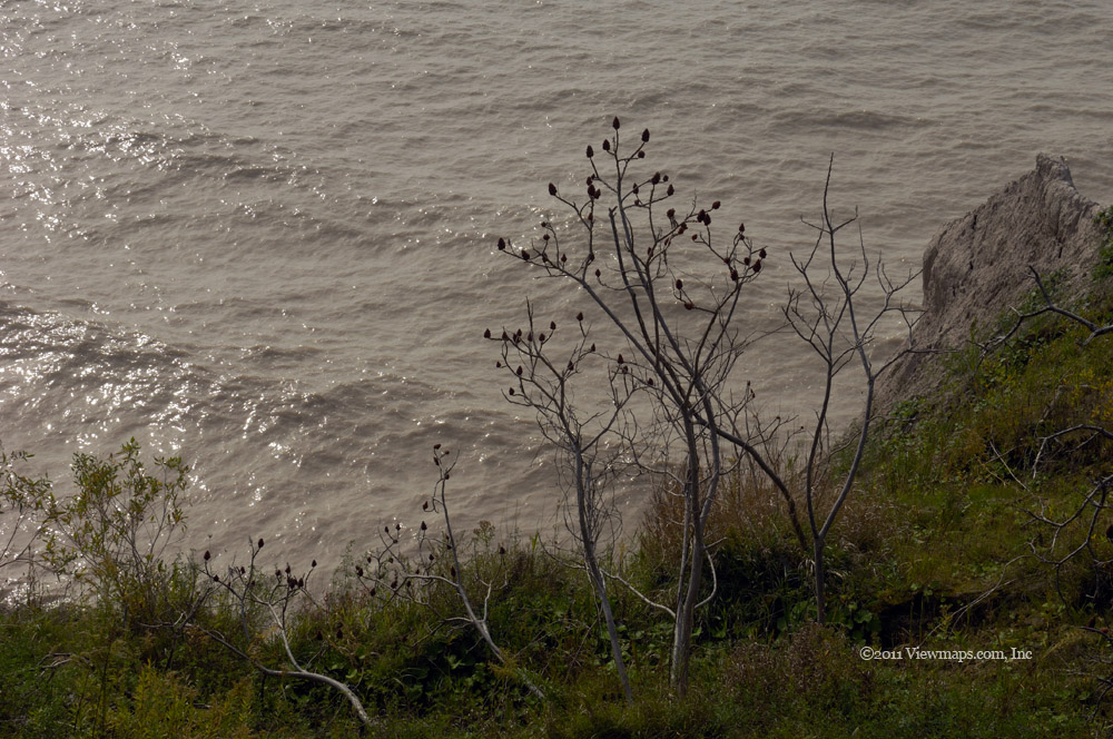
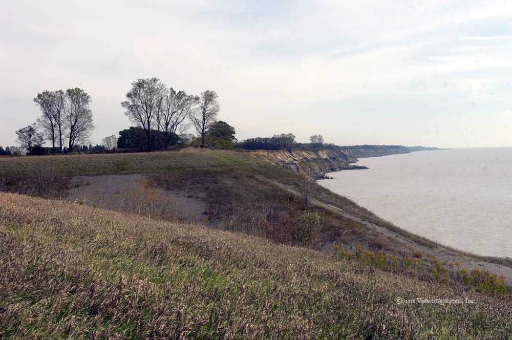
Done with the lower section we backed up the road to almost the original tree barricade and made for a higher area. Here we found some lovely views of Harrison Lake and western mountains. The sun was giving us a nice lighting effect for my photos. We reached the end of all of the roads we tried except for one. On this road we encountered a deep cross-ditch that was a bit too steep for our long truck so we opted to come back another day when we could adjust the ditch a bit. Unfortunately this was the branch that made for the higher slopes with some good potential for nice views. We will need to come back here in the summer.

We returned to the main side road segment and crossed back across the first trees we moved and then followed one more side branch. This was a short trip but we had some amazing views of the lake. As we still had a couple of hours until sunset we decided to head further up the East Harrison to the next side road which branched off just past the bridge over Slollicum Creek and the Slollicum Creek (upper rainbow) Falls. This road made its way along the slopes between Slollicum and Lookout Peaks. We were able to gain some higher elevation along this route and eventually found ourselves in a couple of inches of snow. Nothing deep enough to stop our drives but it was a reminder that we were not likely to get all that much higher this time of year. 

As it was now past 3pm and we still hadn’t stopped to cook our noodle soups we looked for a place with some fresh water and a view. This we found at the start of a new fork, so we set up our burners and soon were enjoying some warm soup, noodles and tea. It is nice getting a bit of warm food when out here in the damp cold, and with the sun nearing the horizon, the temperature outside was dropping. Once done with cooking and packing away the equipment, we decided that it was now too late to start exploring the road ahead of us. We would need to return to check it out. This area proved to have a lot of road to visit but some was ATV only style and we will definitely need to come back with one to see if we can reach Slollicum Lake.

We followed a fork which was lower down and which we hoped would lead us back to the East Harrison mainline. This road went through a swampy area and soon reached the mainline just above Cooks Cove. So after a day of driving we had only travelled 10km up the mainline! There truly is an amazing amount of backcountry to explore and the beauty is indescribable! It was now past sunset and the light was rapidly fading so we made our way south along the road so as to be done with the FSR before it got dark. Over-all we saw only a few other adventurers out here today – a few trucks and a couple of ATV’s just not a busy day for people enjoying nature. It does seem to be more of a summer sport for most. I think an enclosed ATV will be a must for us to be able to explore year-round.

So the day seemed much more successful than our previous trip – on Boxing Day. We had no equipment issues and the sun provided a much brighter and cheerier mode. The mosses in the trees really popped in their colours today which added to the feel. It was a great finish to the old year.

Harrison East, Talc and Silver Creek

Geoff hadn’t been back to the east Harrison area since the start of the summer so he was anxious to return to the Silver Creek area, I wanted to gain some altitude to enjoy a bit of snow. As the east Harrison provides a large number of options one can explore, it was the choice for the day. Our day started off normally but then we had a rock tossed at us on the highway chipping our windshield. Fortunately it was small and easily repaired. After a stop in Agassiz for some lunch supplies we zipped through Harrison and began our drive along the FSR. 

Our first stop was down on the Cascade peninsula where we parked the truck to explore some rocky rises. They were heavily covered in vibrant moss which looked so nice from the truck and even close-up. Geoff decided to follow the mossy rocks down the slope and managed to find an easy walk all the way to the beach. There he enjoyed the view for a bit before coming back up. I stayed nearer the truck as we hadn’t closed it up fully for an extended absence. Once back to the truck Geoff did a bit of target shooting then we returned to the main line and continued up the road. 

A bit passed Bear Creek we came to another mossy overlook that we got out to explore. This area provided a series of steep steps all moss covered. A faint trail continued its way down to the lake but this time Geoff stayed near the top. Again the moss offered a vibrant lush look to the slope which accented the trees growing on the steep cliff face. It was another lovely spot to enjoy and we both found the views refreshing. Continuing up the road we arrived at the camping area just before the Bear Creek log yard and here we parked at the beach and I gathered a few photos of the lake and western mountains. While here we finally came across another vehicle travelling in the area, they were the first one we saw.

I put out a radio call to Carolyn and then we set off once again. As we passed the log yard we saw the road up the South Talc was open and so we opted to drive up there to see what it offered. As we gained elevation we were presented with amazing views of the lakes and cloud shrouded peaks to the north. It was a lovely drive up the north slope of the ridge. There were a number of branches as we made our way, each time we took what looked to be the major fork. Soon we were running south along the west slope where we had glimpses of Harrison Lake below. When the road finally was too over-grown to continue we turned around but the trees snagged the rear bumper and ripped off the section that was bent up! The remaining bumper though solid was very odd to look at. As we neared the fork it started to snow. I got out of the truck at one point and noticed that the snowflakes were each an amazing six sided crystal, looking just like ones sees in photographs – they were actually very pretty.

We took the other fork and continued up the slope eventually reaching the 850m point where the snow was now deep enough to give us some traction issues. The snow was coming down a bit faster and as it was past noon we decided to set up the camp stove and cook some lunch. Geoff was anxious to try out my new stove which he happened to buy for me for Christmas. It worked really well melting the snow for water. The only negative was the snow- even though it was undisturbed; there was enough dirt in it to make the water seem a bit grungy. We boiled water and made some noodle soups and then packed up and returned to the warmth of the truck as it was getting a cold. It was here that we learned that our tonneau cover was not co-operating. The seams were separating and we had to shove it back together to get it to stay on.

Once packed we started back down the side road and continued down to the East Harrison. We next continued north up to the Silver Creek area where we decided to explore the old mine shaft again. Geoff had his bright rechargeable light and so we thought we would have decent light this time. Alas once we started into the cave his light started fading as the charge just wasn’t good enough! So here we were on our third visit and still we had only poor lighting for the darkness. The ground of the mine was much wetter this time and we had to hope over pools quite often as we made our way in. After a walk to the end and back we decided to try one more side road before packing it in for the day. 

The branch we chose was a bit passed the air-strip and called the Pine creek FSR. As it was getting towards sunset we had one chance to select a good path up it to a view point for some last photos of the day. We were fortunate in that we chose well and soon reached a high enough point to have a lovely view south of the Silver Creek estuary. I gathered a few quick shots and then we made our way back to the East Harrison for our drive back to pavement. It was soon quite dark and our feeble truck lights were not giving Geoff much help along the wet road. Fortunately he was able to find his way along and we made it back to pavement with only one incident.

Just before leaving the FSR Geoff stopped the truck to lock up his guns and there we noticed that the tonneau cover had once more separated and needed to be reassembled. Unfortunately as Geoff was trying to fix it he saw that the connecting piece had been lost somewhere up the road! So he couldn’t put it back together. At slow speeds the weight would help keep the cover in place but on the highway it wouldn’t. So we folded up the two loose panels and put them in the box and then continued on home. So now our cover was toast and we would need to replace it. Over all the day was good but a bit expensive in truck repairs!

Lost Creek

The East Stave Lake area is a popular location as it is easy to access. I enjoy returning as there seems to always be something new to look over. Ethan and I set out to explore some of the side roads today so we arrived at the start of the road in good time and there I noticed that the logging road radio frequency had changed. It was new to me so I had to reprogram the radio before we could use it. That took a few moments during which time a silver pickup came by and passed us. Once set, we zipped along the first part of the main road. It was clear of snow and ice and in fact the day was quite mild, I would have preferred more sun but this was the day we got.

We continued in for some distance passing the Davis Lake area and rounding on the NW shoulder of Mt Weatherhead. Then we found a side road to zip up. We soon came by a few more forks but we took the most interesting each time and soon we were driving through a narrow over-grown area. To our right the slope drops down steeply to a narrow ravine. As we drove along I noticed that the ravine was littered with a pile of old tires, there appeared to be 50 to 70 of them scattered across the rocks. Not the most impressive of back-country scenes. Continuing on we came to an old bridge that had developed some sink holes. I got out to check over the strength of the bridge and felt that we were good to cross, so that we did and soon reached a further fork. The two branches were both being well encroached by trees along the sides and we felt that it was now more an ATV path than one for us. So we turned around and crossed back over the bridge. 

Half way back along the narrow road we came face-to-face with that silver pickup. They seemed a bit at a loss on how to deal with the situation so I had Ethan backup a truck length to a wider spot and there we pulled off the road a bit to let them pass by. They made it around us with only a ‘bit’ of vegetation noises beating on their truck! Continuing on we came back to the earlier forks and tried them all but never getting too far as the roads ended before much distance. We then returned to the main Lost Creek road and drove along for the next side road.

Heading up the next we passed a few forks again taking the more major one each time. Soon we were climbing high enough to be driving through snow. Rounding a bend we came face-to-face with the same truck again. This time they pulled around us to make room. We chatted with them – two guys with a young child, they were enjoying the snow and planned to eat some hot dogs up here somewhere with a small campfire. Shortly after we passed them we came upon a frozen pond where I gathered a number of photos. We continued up the road past some viewpoints of the valley dropping to Stave Lake. As we continued up, the road started to narrow down again and we finally drove far enough that we slide sideways into a small sink hole at the edge of the road. Here we had to use the winch to get out of the hole. That took a few minutes but we were soon heading on up. We got a further kilometer before stopping due to narrowing road.

The return went quickly and soon we passed the silver truck once more. We explored a second branch of the road but it ended in a bridge washout but here we gathered a few nice snow photos. We continued back along the main road section where we came by a few clumps of frozen mushrooms which made for some lovely interest shots. A bit further we came by the two with their truck one last time! This time they had started a small campfire for cooking their lunch. After checking out one more branch we returned to the main Lost Creek FSR and made our way passed the ‘rifle range’. Here one chap was shooting what seemed to be an automatic rifle; his shots went off in rapid succession. They were aiming at a human outline in the distance.

Once passed the noise makers we continued along to Salsbury Lake where we stopped to enjoy the frozen lake and eat our lunch, it was a lot more peaceful here with the noise from the target shooters muted by the trees. I saw some interesting macro shots of the snow and ice on the trees that caught my eye, unfortunately my flash ran out of juice after only a few shots. In behind the open camping area I followed a trail that led to a huge rock and the shell of a teepee. It looked to be a lovely summer camping spot but in winter it was a bit barren.

We finished lunch and returned to the branch that at one point continued on down to Cypress point on Stave Lake. It was unfortunately still blocked by a washout. I noticed that ATV’s had created a path across the creek, it sure was tempting but even that trail was a bit more challenging than most ATV crossings. I doubt it would be passible in high run-off periods. We returned to the main Lost Creek road once again and continued along it to the next fork which we took but it unfortunately it didn’t go far due to another bridge washout.

As it was now getting later, I decided to head back. On reaching the branch to the twin lakes I couldn’t resist driving up to them. So we took the side road and started up it. This area had some active logging on it and so we followed that branch first but didn’t get passed the logging area. We returned to the twin lake road but were stopped by a steep cross ditch that the loggers had put in to protect their section of road. It made it impossible for our truck to continue to the lakes. That was very annoying. So after trying a couple of approaches we decided to give up and head home.

Coming through the rifle range again we noticed the human outline was now burning. I guess they needed a more interesting scenario to shoot at. I did notice that even with their automatic rifles and close distance to the target, it seemed rather devoid of holes! I guess number and speed of firing don’t make up for an accurate shot. We continued on out and were soon on to the pavement with the Lost Creek FSR falling far behind. It was a pleasant day a lot duller than I would have liked but it was still nice getting out in the fresh air.

Waleach Lake and Garnet Creek

It had been quite some time since I last visited Wahleach Lake also known as Jones Lake. Last time was also in early December and on that trip the weather offered snow and the lake was mostly frozen over. It was a much colder day than it was today. At lake level the road was covered in rutted snow but it was easily driven and we had little trouble driving the eastern shoreline road. Our adventure for the day began shortly after starting up the road to the lake. A short distance up the road we stopped to adjust the truck and there we noticed the remains of a deer off to the side of the road. It had been caught by a hunter earlier. With the truck ready, we continued up the road and soon found ourselves in snow, it was deeply rutted and so we had no traction problems as we continued the climb to lake level.

Once we reached the start of the lake we drove in to the day use parking area and I walked down to the edge of the lake. The water level was down quite a bit from its high point and so I was able to get out much further than normal. The ground was covered in about 15cm of snow and gave a nice crunching sound as I walked along. I was able to gather a number of lovely reflections from this point unfortunately the cloud cover was low and obscured the peaks. Done with this spot, we continued our drive south stopping at a few places to gather up the changing views. As we made our way south the road became less used and by the far end we were starting to feel the depth of the snow. We stopped at the washed out bridge where I was able to gather some interesting shots of stumps left in the lake, by now the clouds had dropped even lower and I was not getting great views of the area. So we decided to head across the Fraser and explore the Garnet Creek region again.

Arriving at the start of the Garnet Creek FSR we immediately noticed a sign warning of active logging. Being late in the season we doubted there would be anyone out today, but you never know. The road ahead was covered in thick mud in a long undulating stretch of potholes – one’s body took a good beating as we made our way along this section of road! Once past the mud-bath we started climbing and were glad the road was back to a more normal level of roughness. After a few kilometers we came by the first of two logging sites that were the target of the posted warnings, as expected, they were closed for the winter. We continued past it and the second site and soon came by the sheer cliff wall that I was hoping would be covered in thick ice. Unfortunately it was wet and devoid of all ice. This was a major disappointment as the spot is quite amazing to behold with the huge icicles we found here before. Continuing up the road we soon crossed the bridge over a tributary to the Garnet , here we stopped to eat lunch and I gathered a number of photos of the creek below.

Done with eating and the creek, we continued up the road and took the less used Garnet Creek branch instead of the American Creek route. Here we encountered a small washout but we were able to get past. The road was climbing steadily and soon we were in fresh snow and enjoying the remoteness. Unfortunately we quickly came up to a fresh washout that in the summer we could have dealt with by dropping in a few logs but this time of year it was a show stopper, so we reluctantly decided to forego our attempt to reach the Harrison. Returning back to the fork with the American we turned up that branch to see if we could make it all the way to the Fraser Canyon. 

After about a kilometer the road started to get deeper with snow and there we enjoyed the ruts of an earlier traveler for an easy drive for a further kilometer. At the end of the ruts where the previous person had quite, we stopped to put on our chains and push on. We did get another three-quarters of kilometer up the road but we were starting to drag the underbelly of the truck and as the road was starting to rapidly climb we decided that we wouldn’t be able to get much further, so we stopped at a minor fork and I gathered a few photos of the valley below the road while Ethan turned the truck around. The drive back was easy compared to the way up and soon we were taking off the chains and driving on bare rod again. 

As we returned along the road we opted to turn up the newly logged sections and see what they had to offer. We tried both areas and were able to get some distance into the recent logging area before the road ended. At least we climbed high enough to get some better views of the valley. As the day was getting even duller and the cloud level dropping further we were quickly running out of visibility, so we decided to call an end to the day and we set off for the highway and the drive home. So although we didn’t find what we had planned on seeing, we did have an enjoyable drive and I managed to gather a few decent photos of reflections and creek rapids.

West Harrison and Sloquet Hot Springs

My kids were teen-agers when I visited the Sloquet hot springs over 10 years ago. Back then we made a night of it, camping out at the site next to our truck. There were a number camping there back then, all taking turns in the improvised pools that retained the hot water. It was a fun week-end and the boys all had a good time. When Geoff and I arrived there today, we found numerous tents pitched on the snow and down at the spring there were a few enjoying the water. It brought back memories of my first visit when it was less known, today the area is a popular forestry campsite with improvements – even the pools were better constructed and larger!

Over the years I had tried a couple of times to revisit the Sloquet Springs but never quite made it. So today, despite it being late in the season, we were determined to get there. We got off to a late start as it being voting day, I had to make a stop at the polling place before setting out. Having finished with one’s civic duty we rushed out to grab a coffee and some lunch supplies and then raced to Agassiz for final refueling and a few additional food items. It was past 10:30 by the time we reached the start of the West Harrison so time was definitely ticking away quickly. 

Not far up the road we encountered the first of the snow. It wasn’t deep and didn’t really slow us. We found some nice views at the first branch off the mainline and there we stopped to gather some photos before continuing on. As we had a mission, we actually passed by a number of interesting sights so that we could have sufficient time for the main goal - that was hard but necessary. At 20 mile bay we did stop and gather photos from the beach. This area is just too scenic to drive past without stopping. The lake level was way down so we were able to walk out some distance and gather some photos from a unique angle. The submerged posts and hazy distant peaks made for a wealth of opportunities. I wished I could have spent the day there but we had to get going all too soon.

Continuing north, the road was soon covered in a deeper snow layer, fortunately there was a nice set of ruts we could follow which make the drive faster despite the occasional icy spot. At the estuary of Bremer’s Creek there is a small camping area with a few unimproved camping spots. We first found this spot a few years back, back then I marveled at the views one had of the lake from the location. So today this was one spot we did take time to visit, and amazing lake views we did enjoy! It really is a lovely spot to camp at. Perhaps one I day will.

Once we were done with the small point we continued up the Harrison, it is at this point that the road gets really rough and weeds out the casual backcountry driver. It didn’t seem all that bad to us but I remembered back when we first drove it at how difficult we found it. Once past the worst of the roughness we encountered the deep stuff and were sliding a bit, the ruts helped us to stay centered. The snow kept getting deeper as we made our way deep up the Tretheway valley before crossing the creek and starting back to the lake. Once back to the lake the snow became shallower and we were soon dropping down to lake level at the end of the lake.

We had now left the West Harrison and were on the West Douglas FSR passing through an abandoned forestry camp. The odd thing here was that the road was plowed! We continued along the cleared road thinking how lucky we were. Soon we passed the new run-of-the-river power plant on Tipella Creek. It looked quite small in the face of the mountain behind it. Continuing on we soon caught up to a slow moving car which appeared to come from a side road that looked like it led to a small settlement. They pulled aside to let us pass just before our turn-off onto the Sloquet.

The Sloquet road had a foot of snow but the way was easily driven as there were nice ruts down the road here as well. It seems that the road has been kept drivable by workers manning the power lines to the generators at the far end of the valley and by the stream of campers going to the hot springs. We followed the ruts right to the camping area and the path down to the actual spring. We were both surprised to find numerous campsites set up with tents and tarps and firewood. It looked like people were here to stay awhile! After parking we made our way down the trail to the hot spring and there we found a few soaking in the biggest pool. A nice open sided cabana had been built for people to change in and hang up their clothes – far too developed for an unknown location!

After looking over the spring and pools, Geoff and I returned to the truck and we reluctantly started for home. We still hadn’t eaten lunch but Geoff didn’t want to set up his burner here so we decided to head back to the Harrison FSR and find a spot along it to stop. The drive back along the Sloquet went quite quickly as did the short section along the Douglas. Heading up the initial climb of the Harrison went quickly as well and soon we came by a spot with a nice view of the lake where we stopped for a few minutes to gather some photos. By now the snow was getting too deep to set up a burner so we continued on across the Tretheway again. Just passed the bridge over the creek we encountered a convoy of 4x4’s heading north a total of 6 vehicles were making their way together, likely for the hot springs. Once they had passed, we got back on the road and continued south. It was now less than an hour to sunset so we had to find a spot to set up soon.

We eventually reached the small point with the campsites that we stopped at on the way in and here we picked a spot and setup our burner for some hot soup and tea. I was able to get a few shots of the peaks to the east as the final rays of sun hit them. Unfortunately as the light faded, the wind picked up and we were now getting very cold very fast. At least the truck was warm and once done with eating we started off for home. The light was now rapidly fading and we wanted to get passed the roughest road before dark so we plowed on and soon were onto easier road where we stopped so I could make a radio call to Carolyn at home. Out here moving the truck a few inches can make or break a connection, so it took a few back-and-forth moves to find the sweet spot. Done with calling home we continued on and soon were passing 20 mile bay and the Mystery Creek branch where the road was now better serviced. The balance of the road though dark was an easy drive and we made good time getting back to pavement. The rest of the drive went without incident and we arrived at home just past 7pm. It was a long drive over some challenging conditions but we had a great time, saw some old sites and I was able to collect a number of great photos.

East Harrison, Shovel, Kookipi and Nahatlatch

It being early November, the season was rapidly closing for any trips into the higher elevations. So if I wanted to try the loop from the East Harrison to the Nahatlatch it would need to be today and even now it may once again be too late to cross the pass at 1170 meters. But we would try, the last time I attempted the road was back in late April but we were stopped early due to snow. The last time I actually crossed the pass was back in September 2000, so as you can see it is well past time to get through it.

Ethan and I left at the regular time for the hills and we were soon picking up lunch supplies in Agassiz then it was off to the start of the East Harrison FSR. The initial section of road is now very well maintained and we made good time up to Slollicum Creek (upper rainbow) Falls where I regularly take a series of photos. As time was a bit uncertain today, I kept it quick at the falls and we were soon passing Bear Creek. The road between Bear Creek and Silver River is quite a bit rougher than the first section but we still made good time and encounter only a couple of others along the way. The watchman at the Silver River log yard waved at us as we left the yard, he seemed much more concerned with the pack of ATV’s that had arrived just before us.

The road continues to degrade as you pass the air strip and soon we were driving our traditional rough road. When we finally arrived at the high bridge crossing the Silver River we stopped to gather some photos of the gorge, I really enjoy the beauty of this segment of the river and standing on the bridge gives one an amazing view. I just wish one could do better at capturing the grandeur on camera. Not far past the bridge is a small stream with a lovely waterfall which is easily seen from the road. We stopped so I could gather a number of slow shutter photos of the stream. Then we continued up to the fork where the Shovel leaves the Harrison. Back in April Geoff and I enjoyed lunch at the bridge just past the fork but today, I wanted to try for the end of the Harrison FSR before trying the pass, so we continued north along the Harrison and soon were past the spot that Geoff and I got to last time. We had some great views of the western peaks and soon we were driving a lovely moss covered road. Eventually we came to a major pair of cross-ditches that we took as the end of our driving. We likely could have continued but the road beyond looked poor and I was starting to get concerned about having time to try the pass, so we opted to turn back and leave the way ahead for an ATV trip.

Crossing over the Silver River again and starting up the Shovel Creek FSR, we soon encountered a chap on a motorbike coming down from the higher levels. We stopped to chat with him and he said that he turned back due to snow. Now this was not an encouraging report. He also told us that a conservation officer in a truck had driven some of the snow but had also turned back due to a rock slide further up. So now we were both really quite worried that we would once again be defeated by the road, but we thought we would push on as far as we could go. Sure enough we were soon driving through some shallow drifts of powder and staring at the tread paths of the two vehicles, those of the motorbike were soon missing and we continued up and into deeper snow with only the path of the conservation truck for company. As the depth approached 9 inches we arrived at a bridge over a stream where there was a rock slide. It was here that the truck stopped and gave up the onward drive. We took a few moments to consider the gap between the rocks and decided it was nothing difficult and so we squeezed between the rocks and soon popped out the other side of the slide. Ahead of us was virgin powder a foot deep it looked so great and the sun gave an amazing look to the area.

The road continued upwards towards the pass with the snow gradually deepening but as it was soft powder we had little traction issues. At the highest point the snow was still very drivable for us, though we did have our chains on for safety, we likely could have done it without. We stopped at a few spots to admire the view and the virgin snow around us. Over the pass we continued down with the snow rapidly diminishing on this side and before long we came to a turn-a-round point for an ATV. They had turned back not far from the highest point. We followed their trail down the road to the Nahatlatch feeling much better about our chances of completing the loop. Now we just had to hope there wasn’t a slide that only ATV’s could get over.

The rest of the road went quickly and soon we were crossing a bridge over the Nahatlatch River. As the first of the main lakes was only a short distance further up the road, we took a few moments to head to it so that I could gather a few photos. Done with the lake we started heading out to the Fraser Canyon. I did stop for a few photos of the river before we reached the main canyon which allowed me to capture the feel of the river. All too soon we were in Boston Bar and starting out on the highway. The drive had tired out Ethan so I was now driving the highway. Once we neared the Alexandra Bridge area I put out a call to Carolyn on our radio to let her know where we were. At the town of Hope we stopped for a coffee and a bit of food then Ethan drove the balance of the trip home having rested enough while I drove the canyon.

So we finally achieved a run through the pass between Harrison Lake and the Nahatlatch River, as the snows were coming I doubt we could have made the trip a week later, so our timing was perfect for this year. I wonder how long it will before our next trip around the loop. Hopefully sooner than another 11 years!

A trip to the Pinecroft Green Frog Tea Room (Day 8)

It was a rainy day today and I hadn't planned to get out but Carolyn wanted to go to a particular restaurant for lunch which was well past the town of Sparta. So rather than just drive there and wish I had a camera - should we spot some good looking trees - I brought my camera along.

We did see a couple of nice looking groups as we drove along the John Wise Line which I stopped to capture. The second was near the restaurant so I decided to get it on the way back. The actual restaurant had some nice grounds that would normally have made for a lovely walk and probably had some nice items worth photographing but the intermittent rain kept me from exploring the grounds. I will need to return as the food was very good and deserves a future visit.

As we retraced our path, I stopped at the location we spotted on the way in and there I enjoyed the reds of the trees while I took a few photos but it was getting duller by the minute and I didn't want to stay long. The drive back went quickly with nothing to attract my camera. The rain and winds got very heavy not long after we reached the safety of our room.

Hawk Cliff, Sparta Area (day 7)

After a nice breakfast packed up the gear and set out for the cliff. Arriving in good time I saw a crowd of cars parked at the end of the road including a school bus! I did find a spot to park between two cars and I gathered up my camera. As I made way to the cliff I saw that the group of kids were gathered around a chap explaining about raptors. He had a smaller one on his hand with which I suppose he was demonstrating some natural behavior. I didn't stop and soon I was at the cliff edge.

The place looked much the same as in prior years, I walked east along the edge of the field and noticed a number of monarch butterflies flitting around. Looking across the field I was disappointed to see very little colour in the trees. I walked along the cliff for some distance and noticed a couple of spots where the edge had worn away a bit more. I don't know why the owner doesn't plant some trees along here to strengthen the edge. After walking for a while I returned to the car and started back down the road. In a small dip I saw a few colored trees and so I stopped to take a few shots, while there I spotted a raccoon in the distance heading for the small stream. I returned to the car and drove off to the main road and then continued across it.

Not far along the side road I passed a number of people sitting at the side of the road watching hawks in the field. I noticed a few birds but didn't stop to watch. I drove to the next side road and soon I started to see a few bushes of colour. Over the next two hours I did a wide loop around the town of Sparta and found some interesting back roads with colorful pockets eventually I found myself in Pleasant Valley where I crossed a pair of one lane bridges but I found the colours a bit drab in the valley.

Once back on the west of the valley I came by an apple orchard with trees that were full of huge bright red apples. The trees were so loaded that I just had to stop to get a few photos of the trees. I could hear staff harvesting the field somewhere in the distance. Once done with the orchard I continued along eventually arriving at the main road to the port. I decided to head in and call it a shorter day. So I did get some better spots today but still not all that great. We'll see how the rest of the stay goes.

Port Talbot, Duttona Beach (Day 6)

My first day in Port Stanley on this year's holiday, it was nice to have a sunny day rather than the forecast rain. So as I wasn't sure if I would have any more good days, I set out to find some sights to photograph. I decided to head west along the coast line as I always felt closer to the back country in this area. 

I filled up the tank and set out along Warren Street and Lake Line. This path seems to get one into the colour the fastest of all roads from Port Stanley. I was soon passing farms and stands of trees but very little colour. It seems that the trees were either bare or green! Later I met up with a chap who was out taking photos like me who said that the high winds had dropped the colored leaves and only the green were still on the trees. They should be turning over the next little while. Unfortunately today the bushes were not looking all that exciting and I won't be here when they are. 

I did find one small section of forest with some colour and I stopped to watch the light play on it as clouds came and went hiding the sun for a few minutes at a time. After gathering a few photos I continued on retracing my old path to the Pearce Park. The trees were quite bare near the old church cemetery I visited on past trips so I zipped past and soon arrived at the John Pearce Park.

As I was organizing my cameras for walking, the other photographer came by and we chatted for a bit. I waited while he took a few shots of the entrance to the park and then I started down the circular road. It was thick with dry leaves which made for a lovely crunching sound as I walked along. But the trees were not all that interesting. I did gather a few photos of the lake and beach from the cliff edge; I decided to stay on top as the lake level was high and the beach almost non-existent. Returning to the car I continued along the lake side road to Duttona Beach. 

There is a public walkway to the beach that I found last year and so I drove to it and walked out to the beach. I didn't have a lot of maneuvering room with the lake level so high but I did get a number of interesting shots of the waves and high winds. I made my way back to the car while a chap in the next house busily organized his wood pile for winter. It seemed that most of the cottages were empty only the larger ones seemed to be occupied. Done with Duttona, I continued west to Port Glasgow. I hadn't been this far before so I was hoping for some new opportunities.

Along the way I explored the village of 'Eagle'. It seemed to be a bigger year-round community with some serious water treatment facilities down at the lake. I had a nice view of the lake from the cliff but saw no access route to the water. So I continued on to Port Glasgow. Arriving at the destination, I was disappointed to find that it was mainly a group of trailer parks. The place had a grassy park along the cliff edge but trees had grown up and there wasn't much of a view. I could see a path leading down to the beach but it seemed to be part of the trailer park so I felt I should avoid it. Needless to say that with the lack of colour and access, the place was a disappointment. 

Time had progressed fast and I felt it was now time to head back, so I took the highway for the first section of the return trip. I did pass a few cemeteries which looked interesting but I didn't feel compelled to stop, perhaps tomorrow. Soon I was back to Port Stanley and able to get a bit of rest, it does tend to tire you out.

At sunset I decided to drive to the local beach and capture the setting sun. It was very windy and sand was blowing and piling up on the road. One smaller car was stuck in the sand drift and needed a tow from a truck to free itself. I found a parking spot out of the worst of the wind and hauled my equipment to the beach. It was a fight moving against the wind. I got the tripod setup and lens mounted but the wind was shaking it so much I was not sure I would get any usable photos. 

While I was shooting, some wind surfers were busy getting their sails organized it was fun watching them being propelled by their sails. One chap repeatedly jumped 10+ feet in the air at the end of each speed run. I captured a few shots of them just before I packed up for the day.

Lake Erie Gale (day 4)

As we had poor colour on our drives up north yesterday, we thought we give the area to the south a go for today's trip. After a brief stop to pick up Luc, Mike's son, we started up the escarpment and started looking for spots of colour. It was not long before we realized that this area wasn’t any better.

We continued driving south trying various side roads hoping for a bit of colour. We did spot small patches but they were generally around homes or encumbered by power lines. So we kept driving and before long we realized we were getting close to Lake Erie. We were only a few kilometers away from a small residential area named Lowbanks. Mike had often heard of the area growing up as we were also close to his childhood home, but he had never been there. So we thought we would check out the area and hope we would find some waves in the high winds.

We reached the narrow road that runs along the shore and we immediately saw waves breaking over the breakwaters. With the high winds it was quite spectacular. We parked and took a little while to enjoy the high winds and gather photos of the surf. We drove east along the road to a small park where we met a chap who was getting ready to do some wind surfing. We decided to park and walk to the beach to gather a few more photos. There we felt the full impact of the wind, it was incredibly strong, blowing us over and spitting sand and water into the air. We did manage a number of shots but holding the telephoto lens steady was virtually impossible. We then slowly followed along the beach to where the windsurfers were. On rounding the point we immediately entered a wind shadow and there we stayed to watch two chaps out on the water. They were having a terrible time trying to get into position. After many tries one of them finally got up and had a few second run before he fell again. As we were starting to get cold, we returned to the car and set off of the nearest town for lunch.

On the way to the town we passed a few of the large wind turbines generating power. They really are huge and it gave Luke a feel for the size of the monsters. We arrived at Dunnville where Mike pointed out some of the sights based on his childhood memories. It was an interesting bit of nostalgia. We had a nice lunch and then started on the drive home, it being time to start back - we were still hoping to find some colours.

The return drive went by all too quickly and soon we were approaching Grimsby and the end of our day. We never did stop to take leaf photos! It was a good thing we had a wind storm to enjoy. So the day was near an end and we had water photos with no fall colours, perhaps I will find more colour as I make my way south-west to Port Stanley tomorrow.

Subscribe to 2011