
Milton Heights, Rattlesnake Point and Waterdown (Day 3)

Another day with a forecast for rain! So our prospects for some good photography were not looking promising. We left the hotel around 10:30 and set out for the area north of Hamilton and Burlington. We were hopeful that this region would be a bit more advanced in colour change than the area south of Hamilton. Well it was further along, a bit too much.

We drove the side roads for some time but with the thick overcast clouds the light was very dull and this hid what colour there was even more. So we did a lot of driving without stopping much. We did find a few small cameos of colour that we could enjoy looking at but often not take photos of. One such area was along the road leading to rattlesnake point. The windy road had offered some nice colours but there were no parking signs everywhere which cramped our style considerably. We could have parked at the conservation area for $13 but the rain hit hard at that moment and we really felt we would not get our money's worth so we drove on, besides who wanted to go for a long walk in heavy rain

We eventually gave up driving north and started back south towards Hamilton. We did find a number of small spots but they were usually buried deep across some residential neighbourhood and so we couldn't get the angles we needed to have usable photos. We did spot a number of lovely large homes for sale but they were a bit much for our afternoon budget.

Soon we felt noon hour hunger taking hold and we set off for the nearest town which happened to be Waterdown. We had a good lunch at a very popular pub in town and then continued out of town to where Mike remembered a small waterfall could be seen. This one proved very accessible and we gathered a number of photos of it.

While at the parking area for the waterfall the time came for my scheduled radio chat with Ralph back in Surrey. I tried one of the Hamilton repeaters but was unable to activate the irlp link. Eventually I tried a Niagara area repeater and there I was able to connect to Surrey and had a nice chat with Ralph. Once done with him a Niagara chap - Len - gave me a call and we chatted for a few minutes more. Once done with the radio we took more shots of the waterfall and then continued on our way back to the hotel. The weather was a bit better for this final portion of the drive but we had little chance for stopping. So we had fewer scenes to shoot but still we enjoyed a great drive through the back country.

Borer's Falls, Grapes and Colour (Day 2)

All week they had been forecasting rain for the day so when I got up this morning I was surprised to see some blue sky and a bit of sun. Perhaps we were going to be lucky and avoid the rain for our first outing. Only time would tell, so I got ready for breakfast and then at 10am Mike came by and the two of us setoff for our first destination.

Mike had looked up a list of the more popular waterfalls in the area and had picked three for us to visit. All three were new to us and so we weren't sure what we would find. Our first stop was Chedoke Falls, unfortunately we were unable to get a good view of the falls from up above it and we could see no easy route down to where a good view could be found. This was a serious disappointment but we didn't lose heart as we still had two more to view, so we set off for the second one.

Our next stop was just around the bend, Cliff View Falls. We drove past the park and parking area on our first attempt but after a quick U-turn we zipped into the parking area and found a spot. On exiting the car we could hear the water so we were hopeful that a good view could be found. We made our way to the edge of a grassy area to where a trail leads down a steel stairway of close to 300 steps. This trail connected to the Bruce trail near the bottom of the escarpment, as we still could only hear the water we felt that we needed to brave the continual rush of people running up and down the stairs doing some sort of deranged exercise program. Though we annoyed a few by slowing them down to our pace, we slowly descended the stairs carrying our heavy camera bags. The pain was still a future event not much considered during out descent to find the falls.

Before much longer we had reached the bottom and still had no view of a waterfall. We walked west from the stairs and there we saw a small portion of the stream but it was behind a locked gate! Now this was annoying after all that work coming down the stairs. So we struck out again. We were at the edge of a golf course where we had a few scenes of some colorful trees which took some time to capture, but all too soon it was time to climb the stairs.

A short distance up I could see where some had jumped the railing and trekked off towards the stream where they likely could see the waterfall. But we felt we should stay on the approved path and so we slowly made our way back up to the car feeling quite frustrated, not to mention the clear indication from the joggers that we were in their way. So we now set off for the third spot of the day.

Borer's Falls was the final choice of the day. We made our way through the town of Dundas and soon were climbing the escarpment once again. Rounding a final bend we came to a small parking area that provided access to the Bruce trail. We continued past and hoped to find the waterfall. The road rounds a ravine and at the point of it Borer's creek passes under the road and just to the side we could see the top of the falls. Not seeing any good parking we returned to the parking lot we passed earlier and there we studied a posted map to look for access points to the falls. We saw three viewpoints marked and we set out for the closest one. This view was of the lower portion of the ravine and offered a few scenes of colored leaves. We spent some time enjoying the co ours and gathering some photos. We then returned along the trail and continued past the lot to follow the edge of ravine. We stopped to take some photos of a vine of tiny grapes before continuing to the waterfall.

From the road we followed a short trail to the very edge of the falls. There we gathered a few shots from the cliff edge. We had to be careful as the ground was wet and slippery and neither of us really wanted a flight to the bottom. After a few shots we continued along the main trail to the second marked viewpoint and here we finally had a great view of the waterfall. We took a number of photos and some slow shutter ones as well. Then it was back to the car so we could get lunch.

We stopped in Hamilton at a gourmet hamburger spot where we both selected a lamb burger. It was very tasty and we both quite enjoyed our meal. Even the French fries were great. Done with lunch we decided to go look for some grape vines with their grapes still on. For this we set out for the escarpment south of Grimsby. We soon passed a few vineyards but they had all been harvested. Not giving up quite yet, we continued on to the ridge road where we soon found a part field still full of purple grapes.

We grabbed up our gear and set out for the field where we spent some considerable time taking photos of the vines. We used several of our lenses to try and capture some interesting new poses of the grapes. It was a fun spot and Mike and I both quite enjoyed taking a range of photos. As it was well after 4 pm we packed up and Mike dropped me off at the hotel. So we had a good day of photo taking with only a few drops of rain. Our fears of the weather were unfounded; I just hope that tomorrow will be just as favourable to us.

Hunter Creek

Our last trip to the creek saw us stopped by deep snow quite early along the road, so I felt it was time to get back there before the snows returned and blocked our way for another six months. Geoff did not want a long day or one far out so this site was ideal for both of us. We got off to a slow start as the second battery in the truck was acting up. The negative terminal was not conducting properly which took a bit of time to identify. Once fixed, we set off for the creek. The drive went smoothly and soon we were nearing the entrance of the logging road.

At the entrance we stopped to chat with some loggers and there, we learned of the heli-logging taking place not far past the first bridge. It sounded like we might not get past the operation. But we pushed on in and soon crossed the bridge and read a sign warning to check in before proceeding as the helicopter carried the logs right across the road. I called up and was answered by a truck heading up. When he caught up to our position we told him we would follow him up. We had to coordinate with a truck coming down and then wait for a second one to get loaded before we could scramble across the staging area. The mud was a foot deep across it and we were quite happy to get across without getting stuck. We even got a nod of approval from one of the loggers.

Past the operation we continued up the road and soon passed the place Ethan and I had trouble on the previous trip. We continued to the end of the valley where we finally started to drive over snow. The main route across the creek and onto the opposite side of the valley had a log across the road which we pulled out of the way and managed to barely pass. Continuing we arrived at the actual crossing of the creek, it was also blocked and would have taken much more work to get past. We didn’t feel like fighting it so we back tracked and took a higher branch where I was able to get some close up shots of the wall of mountain at the end of the valley. Then we returned much of the way back up the valley to take a another branch which led to the ridge-line road.

This branch switch-backed up the north end of the ridge and soon we were high enough to get some nice views of the valley and the helicopter we passed earlier. We continued up and near the end we were stopped by a slide. So here we parked the truck and continued up the road on foot, reaching a wide clearing we stopped to enjoy the view and there we set up our stove to cook lunch. After lunch and a bit of target shooting (it was getting too cold to stay) we returned to the truck and back down to the main line where we drove to the next fork which followed the main Hunter Creek tributary. We found a huge tree stump that was hugging a massive rock – Geoff got on top of it for an interesting photo. We continued along a couple kilometers until we were blocked by a slide. So we stopped to look around and then decided to head out.

The drive back to the logging site went quickly and there we waited for the helicopter to drop load, we started to chat with the workers but the driver of the log hauler flagged us on so we quickly zipped back across the deep mud and started on our way back down the road. A fun trip but not the best for photos, at least we have now completed the roads in this valley.

Indian and Mamquam

Two weeks ago we tried the Indian River FSR but were stopped by an active work crew repairing the road; they said to come back in two weeks as they would be done. So here we are two weeks later to see what the valley would reveal. We zipped along the first part of the road in record time as the clouds were thick and we had no views of the peaks. I did stop once to gather a few interesting shots of the clouds amongst the trees but otherwise we ripped up the road in our new tires and soon found ourselves at the tad pole pond. We got out to check out the pond again but found far fewer tad poles eking out a living along the shore line. That was a bit of a disappointment but it wasn’t to be out last. 

We continued along the road and soon passed the open barrier and crossed the temporary bridge. The day wasn’t the best as the clouds were thick with the odd drop of rain but they did add a dramatic look to the steep slopes beside us. Soon we were passed the placed we reached last trip but there were too many signs of active road work ahead as we inched southward. Soon we came by a Hydro work crew clearing brush from beneath the towers. Then we followed a huge rock carrier as it ambled down the road to pick up another load. Once it turned off we continued on a couple more kilometers to where a lone excavator was repairing a water crossing. We watched it for a bit but soon realized it was going to take too long for us to be able to get past. So there we were, a few kilometers further down and just at the start of the interesting section of the river but we could go no further. So it was back up the road.

Along the return we did drive out onto the flood plain of the river at one point for a few river shots, the colour change was just starting along here and we were able to gather a few shots of the trees on the far slope but nothing too dramatic. Done with the river scene, we continued on up the road and decided to continue along the Mamquam. Just before we reached the Mamquam, we spotted a Doe eating along the edge of the road, when she saw us she meandered off the road a bit and stopped to watch us. I got a few decent photos of her before she walked further into the brush. Once back to the main FSR we b-lined it to the double bridge and there we followed the road south east along the north side of the Mamquam River.

The initial few kilometers of this segment of road was very potholed and made for a very rough drive. It was getting a bit tiring before long and we were both getting a irritated with the road. It didn’t help that the road was low in the valley with thick brush along both sides of the road - we had no views and the drive was not interesting. Finally we came to the first of many forks and here we chose the right hand branch. It continued for a kilometer or so before it ended at a washed out bridge. The river was quite fast flowing through the gap and it was not a surprise that it would need regular maintenance to stay usable. We back tracked to the fork and took the left branch.

The left branch made its way to slightly higher ground and here we encountered a few more forks as we made our way passed where the lower branch stopped, soon we were crossing the Mamquam and off to explore a long valley to the south. We kept taking the right hand fork as each came before us and soon we came upon a lovely pool to the side of the road with a small waterfall feeding it. It was a very pretty sight and finally made this part of the trip seem worthwhile. I gathered a number of photos of it including some long shutter shots. Just past the pool was a motorbike rider taking a rest; he was the first person we encountered in the deep Mamquam. Just as we were packing up to continue, his two companions returned having been exploring the further part of the road. We drove on and soon we were gaining a bit of elevation and gained some views of the valley which we had been travelling up. It was a pretty sight and when we reached the end of the road – a washout stopped us a few hundred meters from the end – we stopped to heat some food for lunch. While Geoff was preparing the food, I tried out the radio and got a surprise.

I first tried the planned repeaters to the south. I figured that the valleys run north-south and may provide access to the Vancouver area repeaters. Sure enough, the ones I tried were reachable. I chatted briefly on the Surrey repeater but then I decided to try the White Rock repeater. Ken answered back! It was quite a surprise to work that repeater from far back in the back country, but there we were chatting away. After a chat, Geoff had the food ready and we had a hot meal. Then it was back to exploring the other forks we had passed by. The clouds had thickened a bit and it was a bit darker but we still wanted to explore a few side roads. The first fork brought us to a bit of colour. The second branch got us into some altitude with a lovely view over the valley. At one point we had a magnificent view of the clouds below us slowly piling into the valley.

We next tried a road the ran further up the actual Mamquam River but it was getting quite overgrown and it being late in the day we opted to stop and not push our way through it. We felt we had time for one more side road and picked the next one which ran up the Mamquam River on the north side. This road much more major and it climbed up out of the valley and soon started to offer us some amazing views. As we neared the top ridge, we soon had a lovely view of Seed Peek to the north. It was partially obscured in cloud but a bit later, as we made our way back, we had another view without the cloud. It really was a very nice view. There was a small pond up on the shoulder of the ridge that offered some interesting contrasts to the peak.

We had less than an hour of sunlight by now so we felt we had to start down and out. As we rounded a knoll I gave a call on the White Rock repeater and Carolyn answered! Another surprise but it allowed me to inform her of our return times – much simpler than through the planned repeater links we had organized. Done with the radio we started down the road and immediately encountered a startled bear. It wasted no time in watching us; it just ran off down the road and was soon out of sight. We continued down and were soon on the main line and we reached the end of the FSR just before sunset! Excellent time for the return run. The rest of the trip home was uneventful and we made good time on the highway.

Anderson Colours

The early Fall is the most colourful time for outdoor photography, one just needs to find those spots where the colours are rich and easy to see. One such spot is along the Anderson River FSR where the road climbs over a ridge and follows it into the deeper valley. In planning the day’s trip we were fighting the weather, rain was forecast and we had to decide if it would be drier to the east or north-west. This morning the forecast favoured heading to Hope and up the Canyon so that was the direction we set out for. I wanted to find some rich colour scenes to photograph and the ridge of the Anderson quickly came to mind, so that was our primary destination for the morning. Our drive to the start of the FSR went well and we were soon ready to find the colour but we also had the added bonus of breaking in our new tires! On our last trip we wore out the old ones and had to replace them with a new set of four. This time round we bought some Toyo Open Country MT’s which have a more aggressive tread than the previous, so I am hopeful they will do better for us.

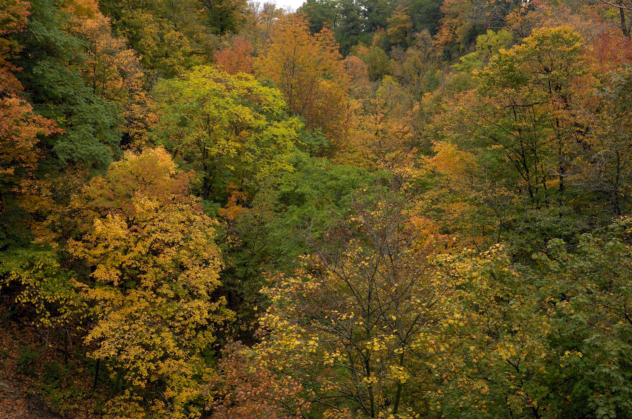
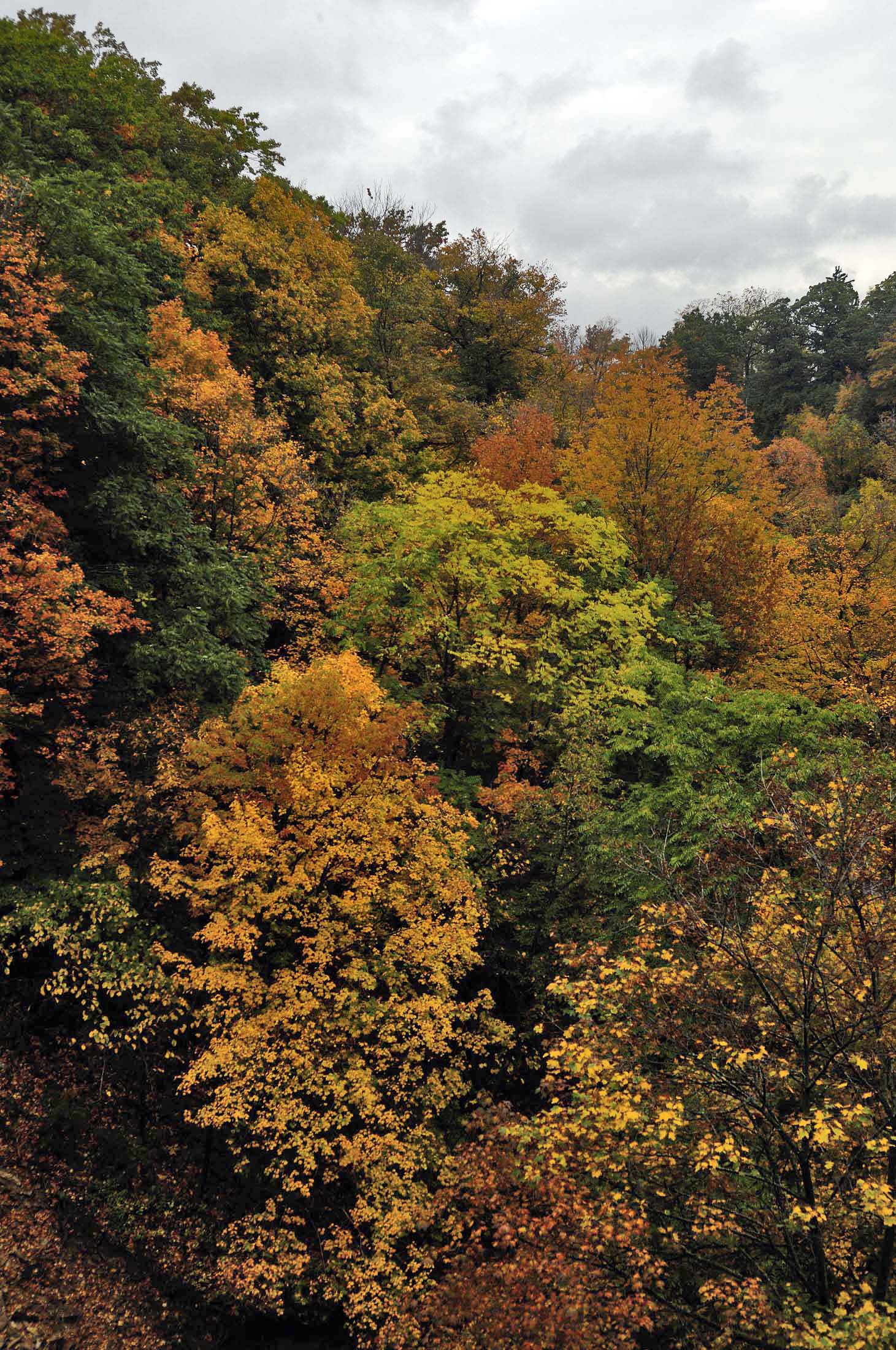
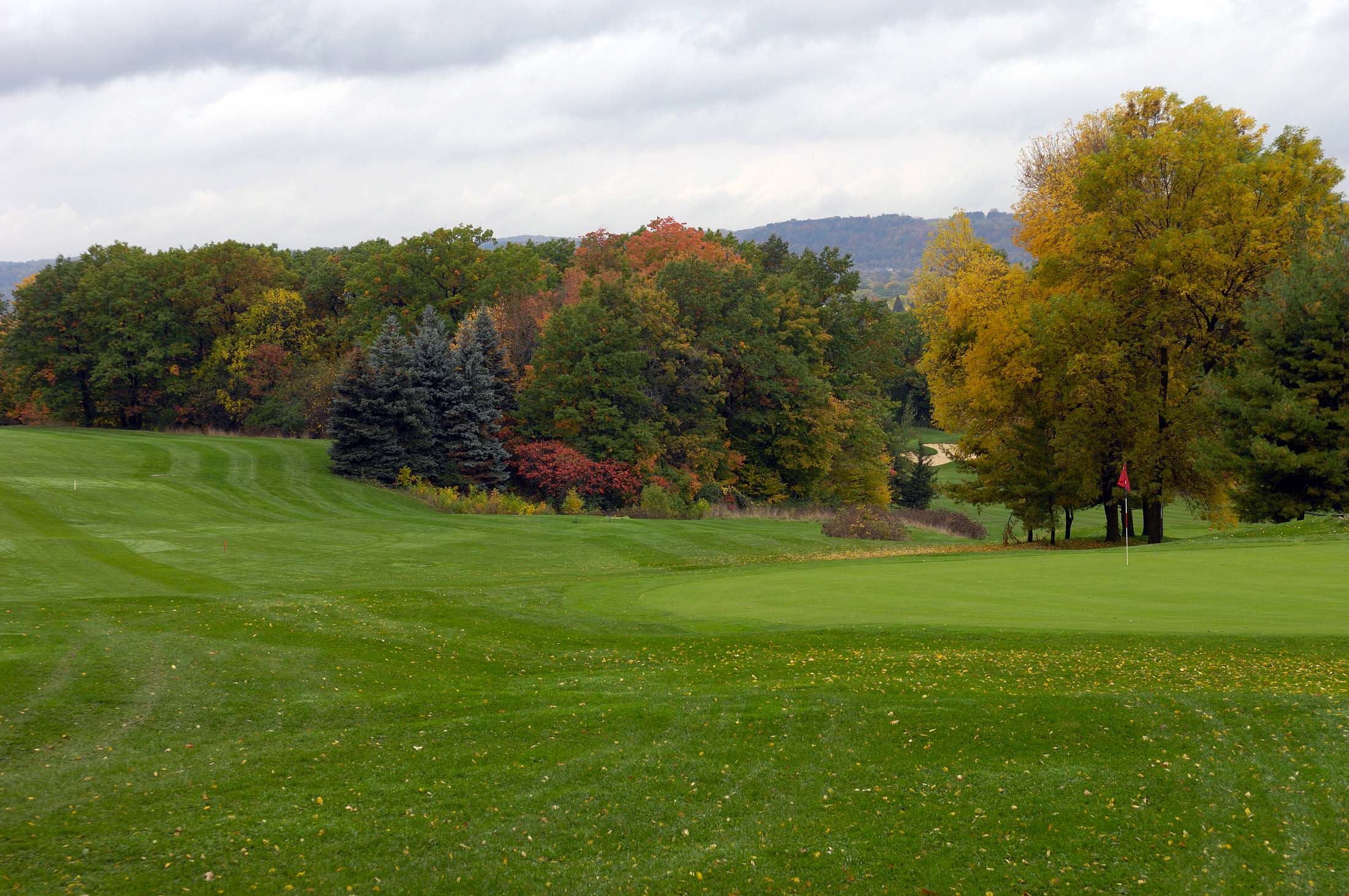
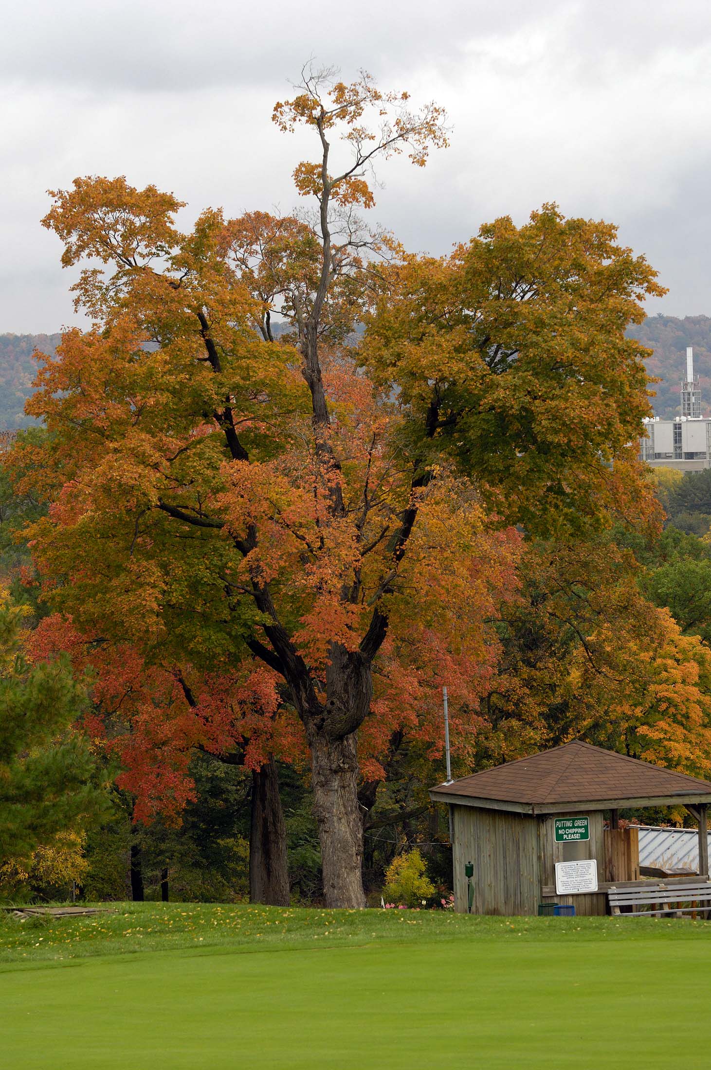
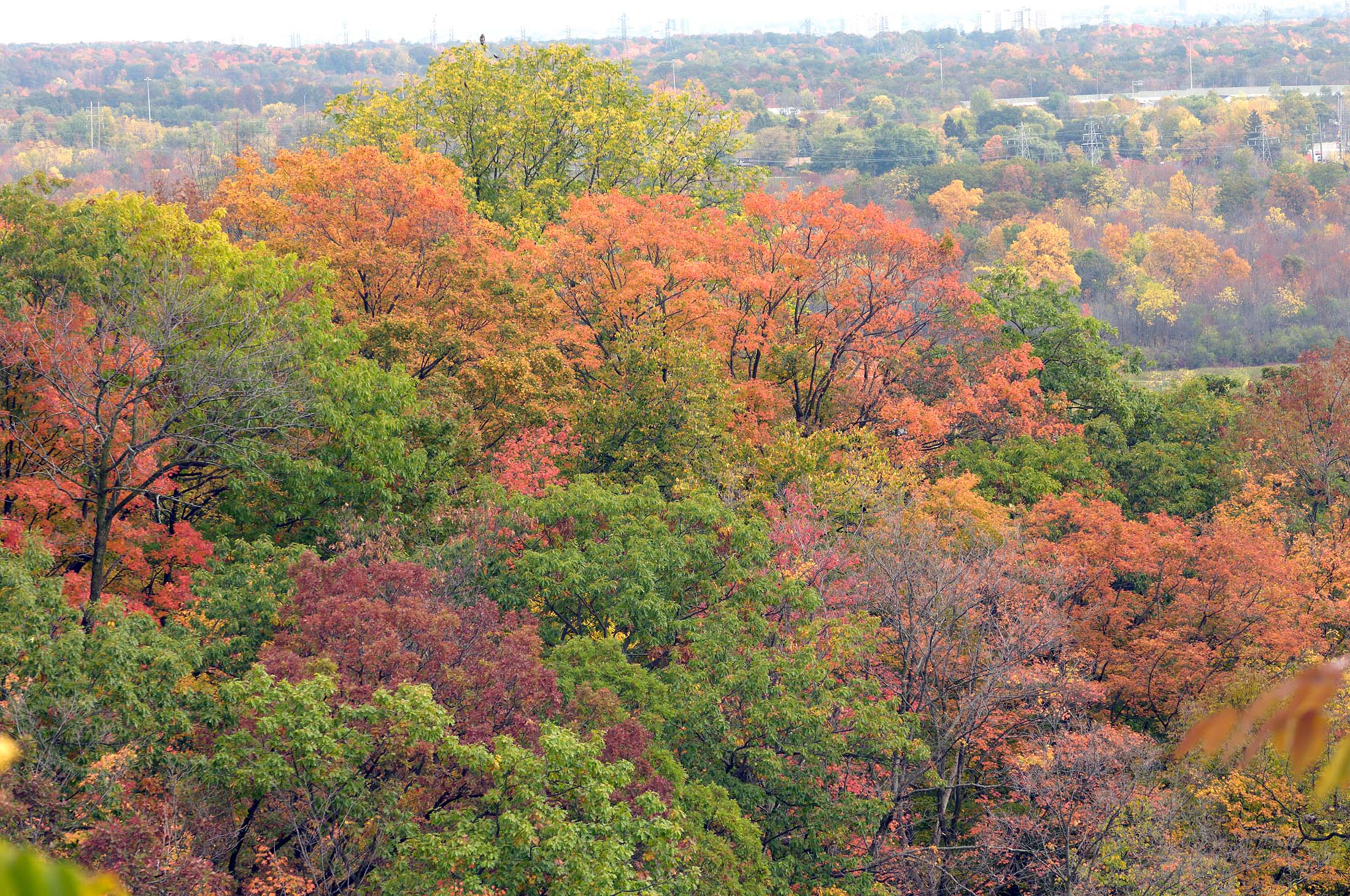
Not far along the road we saw our first patches of colour, these lower trees offered mostly yellows but they did contrast well with the rich greens and being early in the season there was still a lot of green for a back-drop. So today, they did provide some dramatic tones. As we made our way higher, we soon started to see some oranges and then as we neared the ridge the place erupted in reds. There were so many shades of red it was incredible. Some of the trees were still decked out in rich green and together we had the best display of greens, yellows, oranges and reds that I have seen in this spot. We hit the timing perfectly for this year. I spent time slowly walking up the road over this section, taking lots of photos of the hundreds of trees that offered their beauty for any takers.

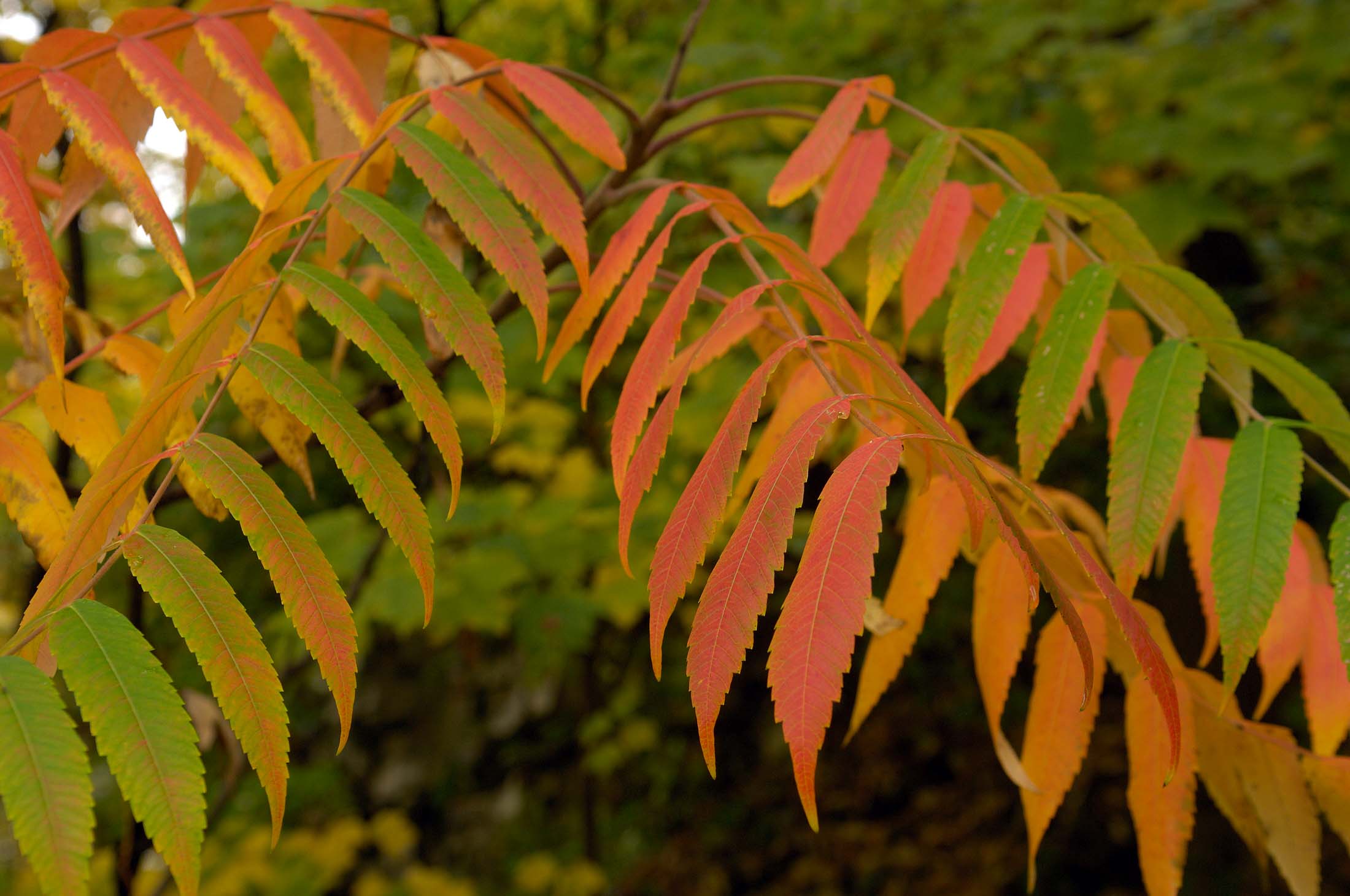
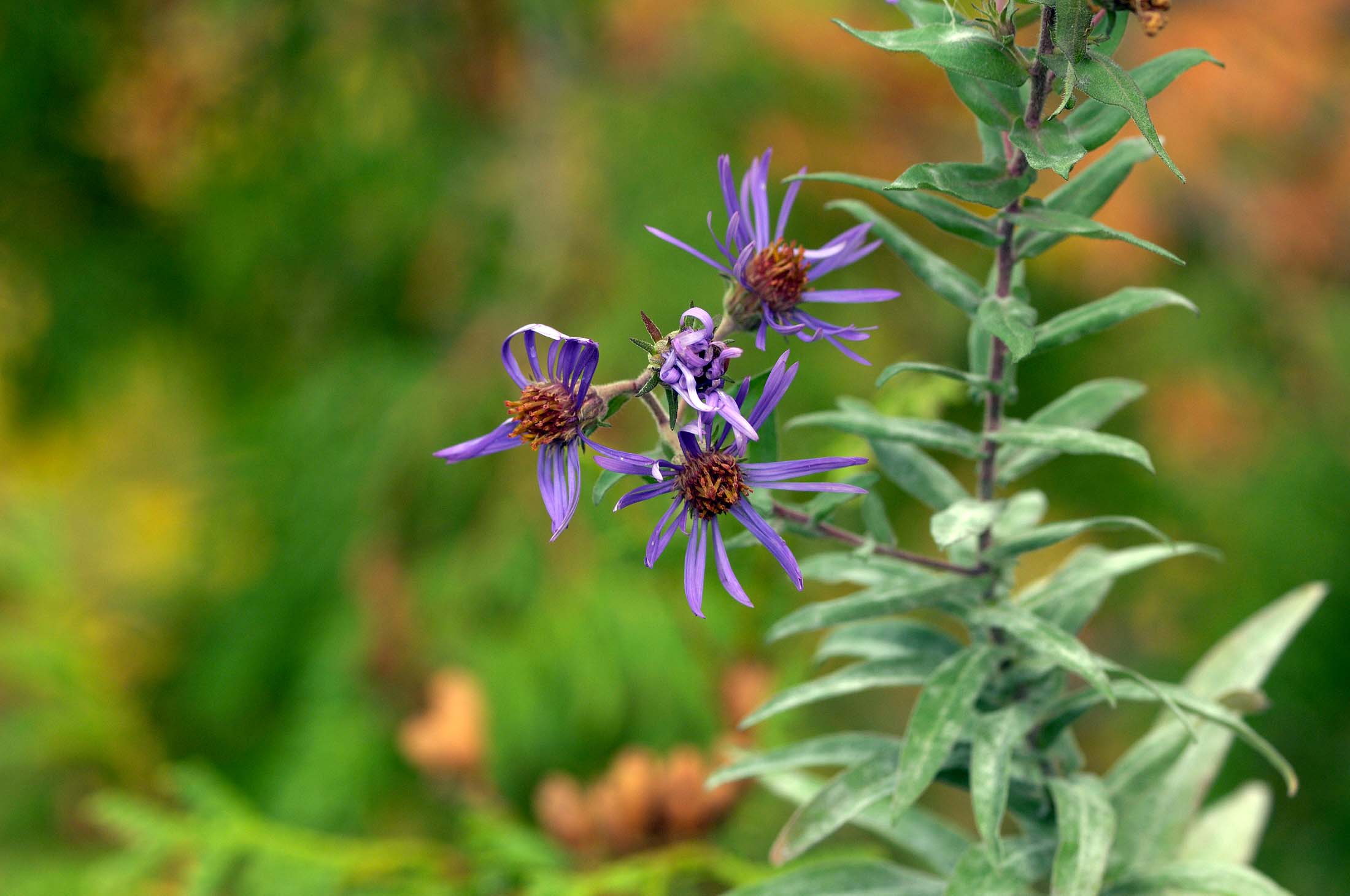
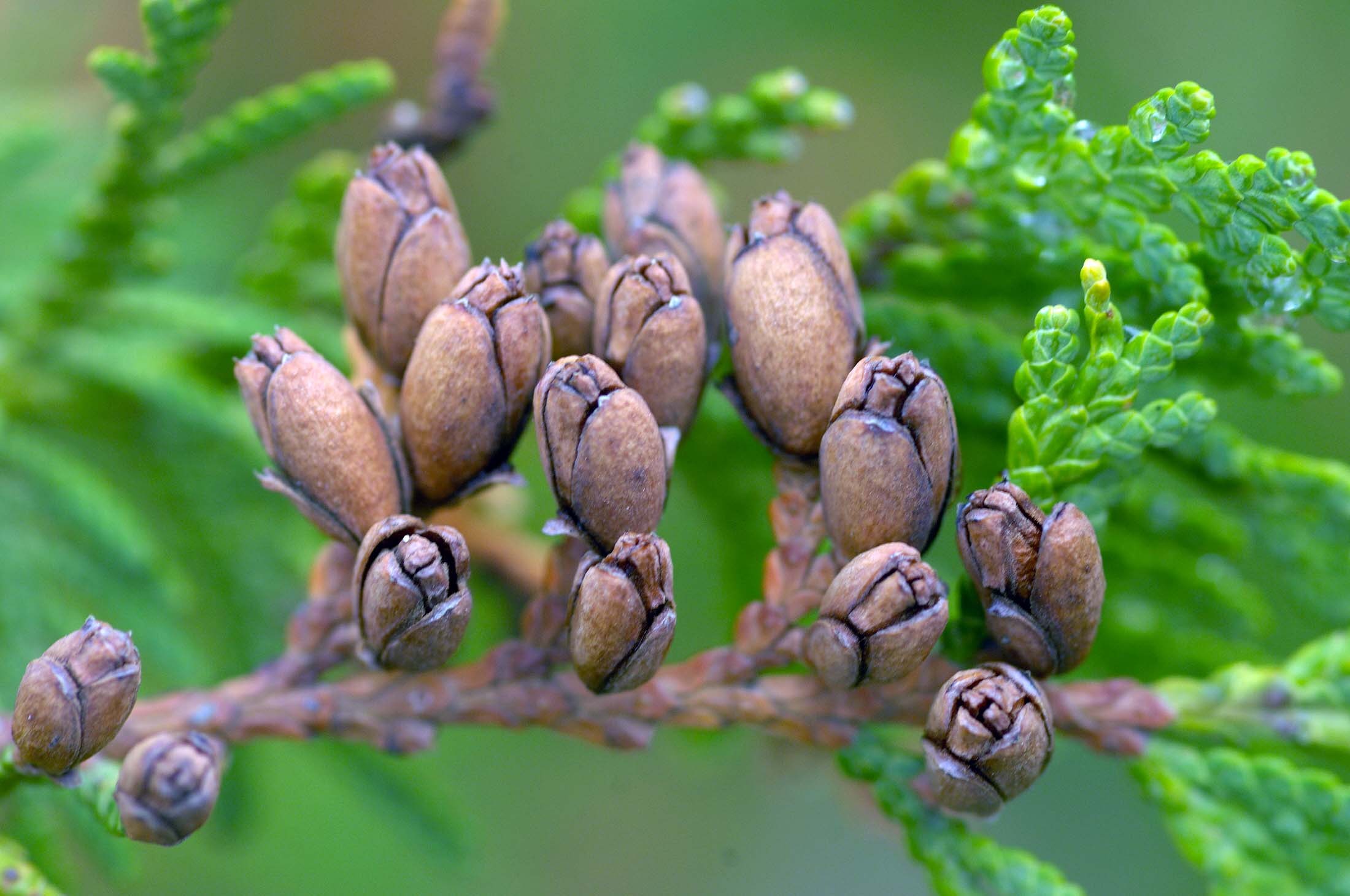
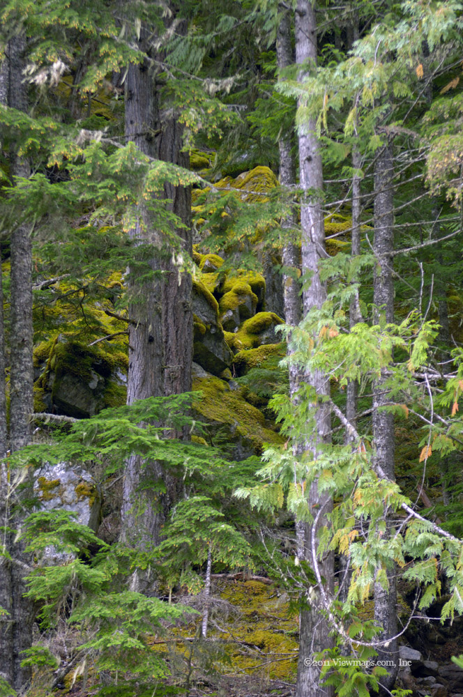
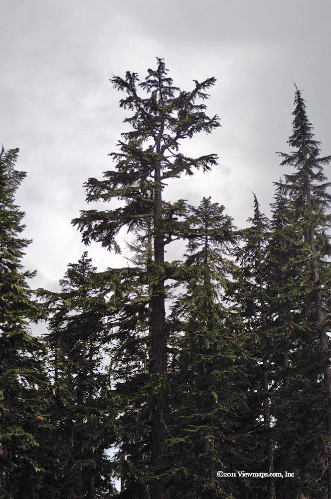
After basking in the richness of the colours, we continued along the road to the old burned out building where I remembered a bush that had some rich reds last year. This year it was a bit early and the bright reds weren’t there yet but the bush still had many leaves in various stages of transition that made for interesting close-up images. So I spent a few minutes with my macro lens and gathered some images of individual leaves. Next we started down the road to the bridge over the south Anderson and there we turned north to follow the North Anderson east. The season was a few weeks early through here to see much broad based colour but one could still find smaller patches hidden amongst the trees.

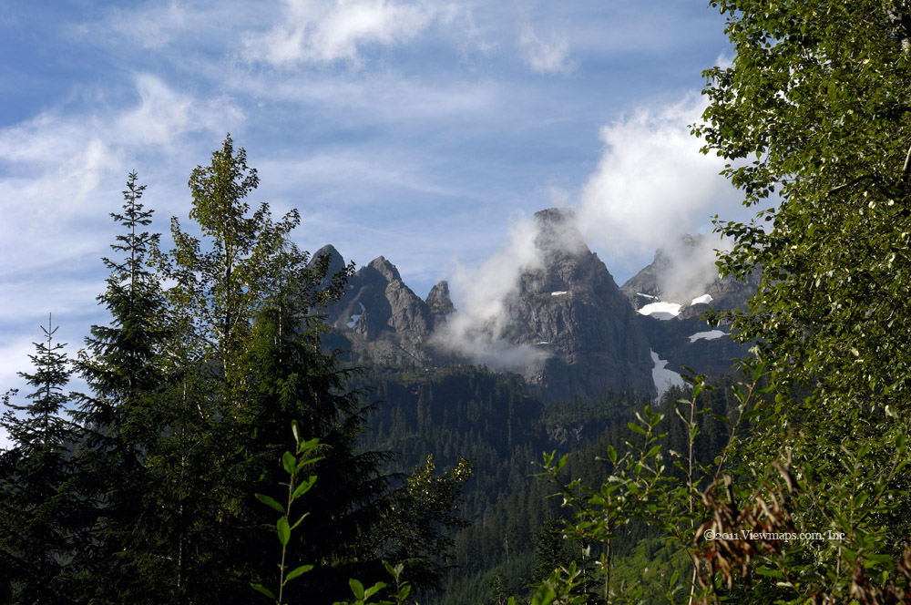
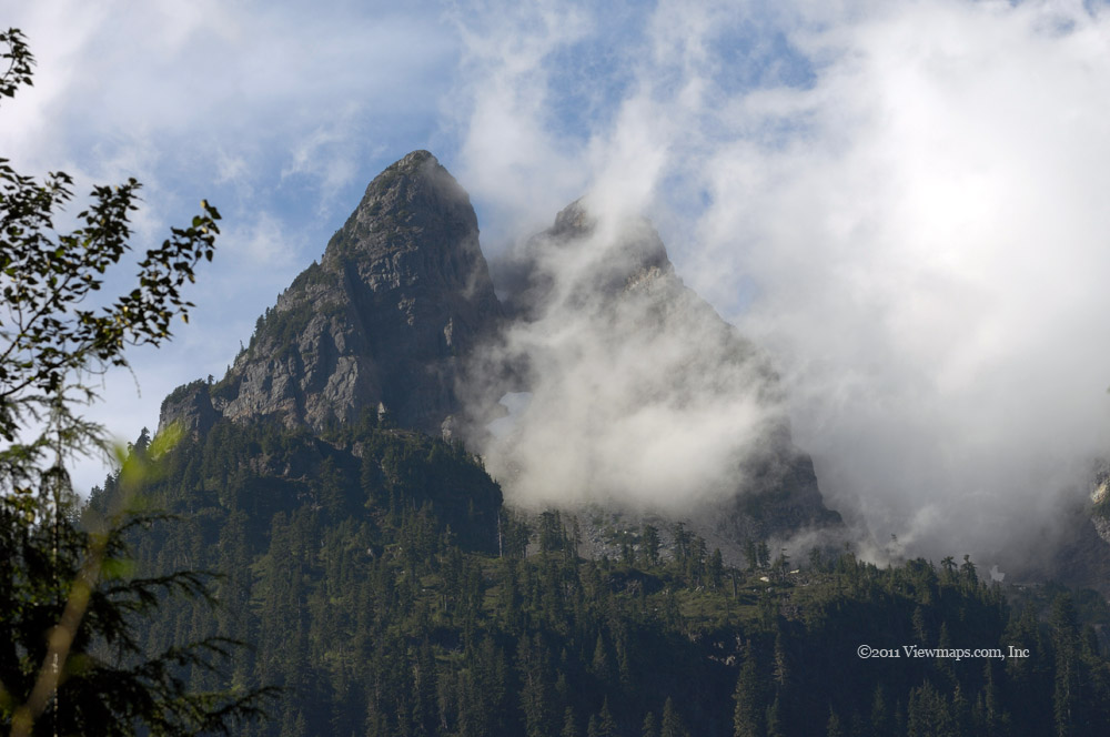
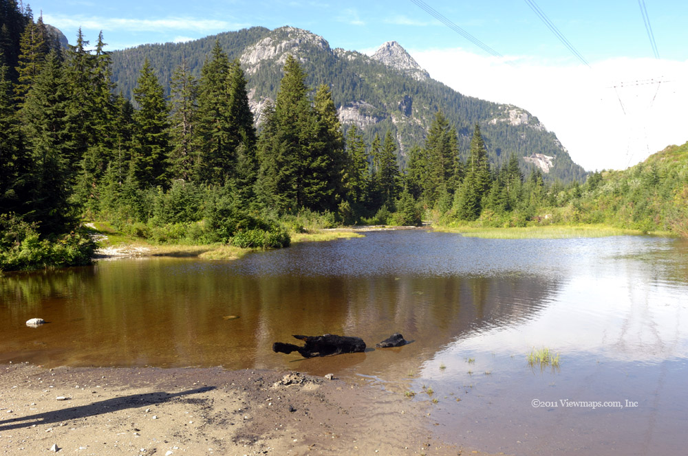
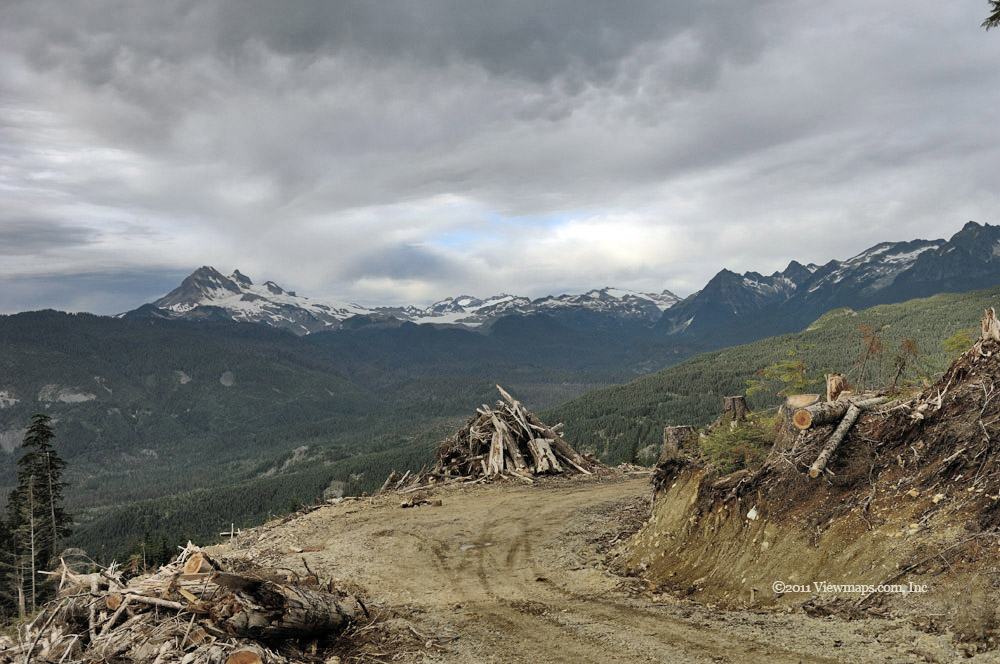
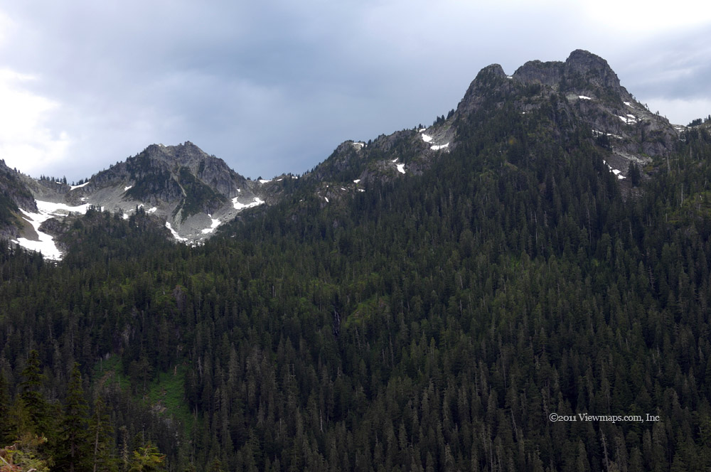
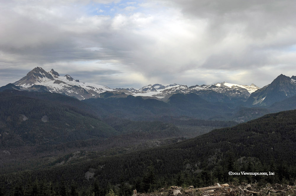
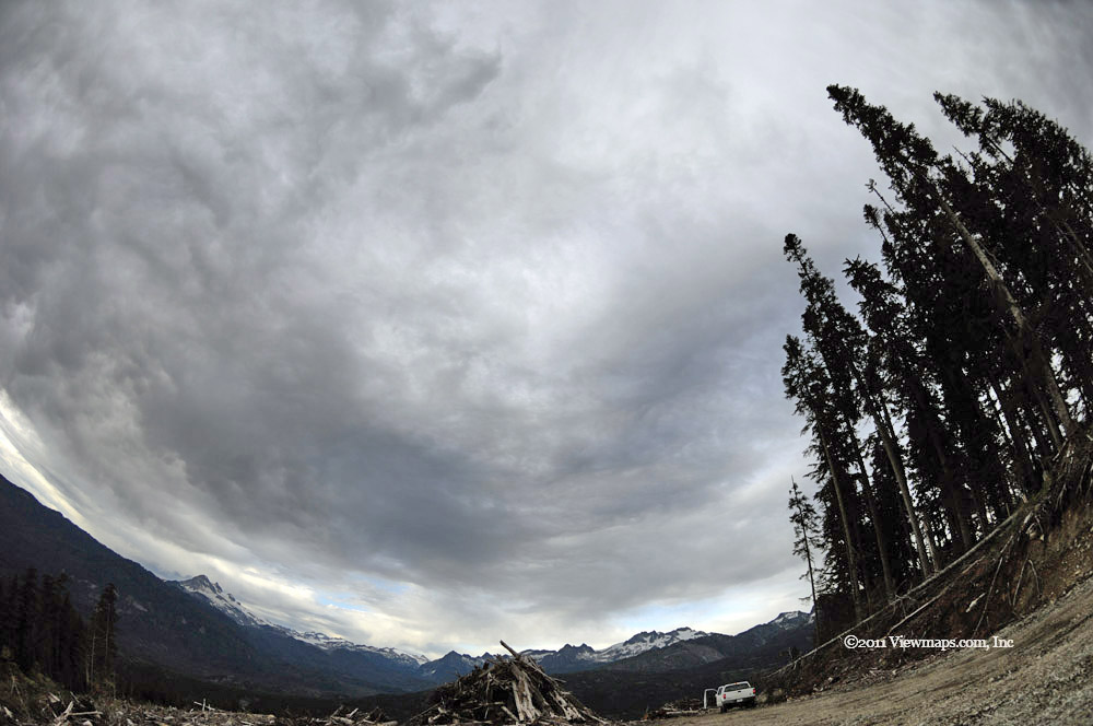
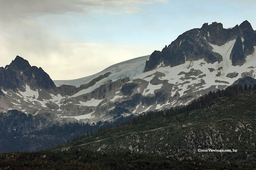
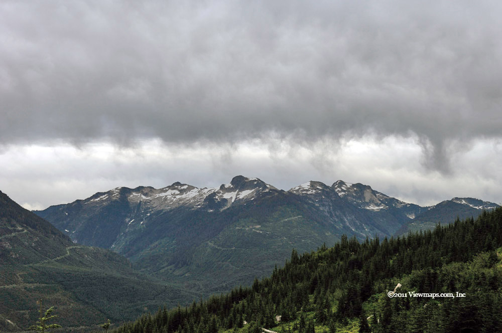
On a trip I made last October along the south side of the river, we found dozens of clumps of interesting mushrooms, so we set out to see if they could be found this year. Unfortunately, we were not able to find many mushrooms and those that were out were very tiny and not photogenic. We eventually came to a washout that we felt was best to not try as we weren’t having much luck finding mushrooms. So we turned back to the main line where we continued east along the north side of the river. When we came to a more recently logged area, we climbed up the slope to a point where we had a good view of the valley. It was here where we ate lunch. Though we were in view of the main group of peaks for the area, the clouds were completely hiding them from view, and while we ate the clouds moved in thicker and dropped a bit of rain on us.

Done with lunch we started back, I wanted to try a side road that on the map connects to the transmission line road we drove earlier in the summer. At that time we didn’t drive to the end of the road, so today I hoped to complete the loop. The initial section of the road was fairly easy but then it started to get steeper and rougher. We had one corner to cross with a washout just past the bend. In rounding the corner we almost dropped the right rear off the road! We had to retry the corner a couple of times before the wheel made it across. Once past the corner and stream, we started up a very steep shale section, not much further and we would be up to the tower that Geoff and stopped at last time. But it got so steep that with the ground moist, we just spun out. We couldn’t climb the slope! And I couldn’t even find a large stump to tie the winch cable to. So we reluctantly had to back done the road, a mere 400 meters from our destination. 

Rounding the washed-out corner this time went easily as our angles were better and soon we were back to the main FSR. Our next destination was down the south going fork of the road following Siwash Creek. Here I wanted to climb the ridge that forms the east side of the Fraser Canyon and see if one can follow the transmission lines to a point where they drop down to cross over the Fraser. We found the side branch we needed and made our way up it to the ridge with the power lines. There we continued along the logging road which crossed over to the west side of the ridge, here we should have been able to see the Fraser but it had gotten so foggy that we couldn’t see down into the valley. That was disappointing but at least I know where there is a view that we could try again in better weather. In reviewing the power lines and the road situation, we soon realized that the road didn’t continue much further south along the line due to a vertical cliff face being in the way. It seems that the last few towers were serviced by helicopter and not by truck. That was unfortunate and so I guess I won’t get to the spot I was hoping to reach, at least not by driving.

Being late in the day, we didn’t have much light left and what we did have was dull due to the thick cloud cover, so we decided to head home. Once back to the start of the FSR we checked the new tires for wear. Fortunately, they didn’t look at all worn. That is great news, and I hope the extra heavy tread lasts better than the old tires. On the way home we stopped at the Blue Moose Bistro once again for a drug fix and some calories. It was a good trip and we enjoyed the sights.

Return to Mamquam

We arrived at the start of the FSR in good time having stopped once for some food supplies and the traditional coffee and then a top up of gas in Squamish. The weather was promising to be decent in the morning but less so as the day progressed, so we were hopeful that we would have decent lighting for photography. Our first thoughts were of the Indian River FSR and how we have wanted to get down it again; the road has been closed for years. So when we arrived at the fork we opted to try the road and see if the road was clear.

We made our way down the Stawamus-Indian FSR in good time. Soon we reached the place we got stopped in the snow at the last time we came this way. With no snow to think about we zipped past and soon had some nice views of Sky Pilot and Ledge Mountains. They were quite impressive looking with cloud rising up the far side and blowing through the gap between the two peaks. Every second had a different look to it as the cloud swirled around the group of peaks. After enjoying the view for a while a chap on a dirt bike came by. He stopped to see what we were looking at and then had a bit of problem restarting his bike. We continued on stopping for more photos of the group from a few angles. But then we saw ahead of us an SUV and the bike stopped on the road.

We pulled up to the two vehicles and got out to see what the issues were. The road ahead was open as a wall of cement blocks had been moved aside, but an ominous sign was posted just to the side warning that proceeding could subject one to fines! Well not being one to take back-country signs that seriously as most are left overs, we decided to continue on in. The chap and the bike came along as well. Soon he was well beyond us as we stopped every so often for photos. Soon we crossed over a bridge made of train cars and there we spotted a parked truck and excavator treads heading on down the road. We kept going thinking how nice all the recent road work was. Before much longer we came to the road crew and there we stopped to chat with them as they took a snack break. The senior of the two told us how they come by to repair the road every three years and that they would be done in two weeks. But then they told us the bad news – they would be closing it off again in a month! It seems that they only open it for a brief time every third year to service the power and gas lines. Such a shame as it is an amazingly scenic valley.

After our chat we started back and soon were greeted with a number of ATV’s & bikes exploring the newly opened road. We came back to a small pond and there we stopped to take some photos and discovered that it was full of tad poles. It seems to be very late for them and I hope they survive the winter. We tried a few short side roads, the last of which promised an alternate route back to the Mamquam. Alas after a steep descent, we reached the end of the drivable road, a narrow foot path continued down to a creek that had washed out the old bridge. Here Geoff, on his way back to the truck slipped on a rock as he jumped across the creek and ended up with a sore and wet ankle. As it was now time to find a spot to set up for our 2pm radio contact we started up the steep section of loose gravel. Unfortunately we couldn’t get traction and so we had to get out the winch and pull ourselves up. That took too long and we missed our HF radio window. Well there is always next week.

Once back on the Mamquam, we continued east and took the next major side road on Raffuse Creek. It was here that we found the back bone of a deer suspended on a tree. The bones were no longer there and the road was clear all the way to the upper section of Alpen Mountain. We stopped for lunch at a spot with a great view of the town of Squamish. The roads were in quite decent shape up here even though the cut trees were quite old looking, that seemed a bit odd but I guess the market dried up and the logs were left. There were a number of side roads that were too washed out for us to cross which would have taken us higher but they will need to wait for our ATV.

Once done with the Raffuse area we returned to the Mamquam and though it was 4pm , we opted to head in for one more branch of the Mamquam. I had planned to stay on the SW side of the river rather than cross over it as I have done in the past. This route hugs the river for a few kilometers before heading up-slope. As we made our way up we got better and better views of Mamquam Mountain and its ice field. The peaks that form the crest were quite spectacular and we had some great opportunities for photography. The wind had picked up and thickened the clouds which offered some interesting shapes for our mountain shots. Higher up we also had a great view of Mt Garibaldi, it is also a spectacular peak to see. As we reached the end of the first of two upper branches we traveled, we had an amazing view of Alpen Mountain just across a narrow valley. It has an interesting quad peak appearance which presents many angles for photography. At the end of the second branch we found some old trees that had developed some bizarre branches, they were quite unusual and well worth a few photos.

It being past 5 and the thick clouds were making the light quite dim; we started on our way out. Our tires were quite chewed up at the start of the trip and Geoff was sure we would blow at least one of them. Fortunately all were still holding air! When we got to the start of the FSR we pulled off into the Chief Rock Climbers parking area to pack up Geoff’s guns. There he heard the hiss of a tire, the rear driver side tire was leaking – not the one Geoff expected to go first. So we swapped it with the spare and soon were on our way home. The drive back went quite quickly as the traffic was still quite light. So now I get to purchase a new set of tires- it has been only 12 months! But we do push them hard.

Furry and Britannia Creeks

We started our day with a quick drive to Horseshoe Bay but there we encountered a major delay. It seems that the Sea-to-Sky Highway was playing host to a major cycling event which went from Vancouver to Whistler! To accommodate the cyclists a lane of the highway was blocked off and cars were shifted over to make room. The numbers of cars made for many delays as they threaded their way along the normally free-flowing road. This was quite irritating as we never once saw a cyclist. They were all past where we were. When we finally got to the entrance of the Furry Creek FSR we found a police car blocking the way in. At first he was waving us on but after I got out and chatted with him about our intent and activities, he opened the barricade and let us onto the road. So finally, we got our start on the back-country portion of our day.

I have driven the early section of the road a number of times but I never got to the end due to snow blocking the way, so today our goal was to reach the end of the northern fork and see just how far it goes. Not far along the road we spotted a black bear strolling along but once he saw us he took off and soon ducked down and off the road towards the golf course. Not much beyond he departure point we had a great view of Howe Sound where I had to gather a few images. We continued on in along the road that Geoff and I got stuck on when we last drove it. On the map the road is shown to continue on to the Seymour Lake area, though I doubted we would be able to drive that far, I was hopeful that we would get close. 

We tried a few side roads as we drove along and I was able to gather a number of interesting mountain shots and even some close-up work on some thistle seeds. It was a pleasant drive and soon we were past the place that trapped Geoff and I last trip. We made a few kilometers further before we were stopped by a river crossing that was a bit steep for the truck to try. The area around here was heavily inundated with trails for dirt bikes, including some makeshift bridges across the creek. Rather than push our luck with the crossing we opted to turn back and explore the side roads we passed on our way in.

We gathered a few more shots of the valley, creek and to the far west – Howe Sound – it is a pretty area and despite the thick dust clouds we kicked up as we drove, I enjoyed the simple scenery along the road. As we neared the start of the road we could either switch over to the south side of the creek and revisit that trail and perhaps even get a closer view of the heli-logging going on or follow an unexplored road heading north towards Britannia Beach. The latter choice was more appealing and soon we were on virgin road. 

In short order we were in behind the old mining museum that has been a frequent site for movies, here we discovered an old abandoned mine shaft where we could walk around and stare down into a water filled pit – or all too easily slide into. Ethan tossed a rock into the pit but being water filled it gave us no indication of how deep it might be. It does seem a bit dangerous to leave it so accessible. Getting bored with the mine, we continued our drive east and soon were making our way up Mineral Peak to where a current open face operation was still active. We continued past the mining area and out along a narrow stretch of road that made its way up the cliff. It was not in the best shape and soon we were stopped by a washout. As it was well past noon we decided to stop for lunch and enjoy the view west from the side of the cliff face. While eating lunch we heard a strange sound coming from far below us. It was a rumbling sound and also very repetitive which gave a spooky feel to it. This was seriously interesting me and I got out my binoculars to try to find the source of the noise. Eventually I spotted a small waterfall that had a pulsating flow of water, it matched the sound I was hearing and so my search was over and the mystery solved.

After lunch we backed down the road and opted to forgo a side branch that would have taken us to the top of the ridge. It was just too narrow a turn for a long truck like ours. So we returned to the mining area where we turned around and started back down the road. When we got back to Britannia Creek, I got out to explore the rock formations that the creek was flowing across. It was quite interesting and I was able to gather a few water shots of the creek. A bit later, on another side road, we came to a dammed section of the creek where the water was now dropping over a 30+ foot cement wall. The dam wasn’t forming a lake as it had probably silted up over the years of neglect.
As we made our way out we found one more side branch that led up the northern side of the valley to a more recent logging area. Here we had some magnificent views of Howe Sound and the islands to the south of us. It would make an amazing winter sunset location. We drove a few of the branches in this area and I took time for a few short explorations on foot. But it was getting quite hot and I much preferred the coolness of the A/C in the truck. So we made our way back out and down an alternate route to the highway at Britannia Beach. Just at the end of the logging road where it changes to pavement we came across a closed gate – surely we weren’t going to be locked in! Fortunately it was closed but not locked. So we made our way past and down the road to the highway.

The balance of the day went smoothly as we drove the sea-to-sky with no more barricades. The highway was quite congested by the Cassiar tunnel as is often the case but once past that we made good time for home. It was a good day of driving and though our intent had been to also see the Mamquam area, we never made it that far, perhaps next week’s trip.

Zoa Peak

Earlier in the summer I was still uncertain as to which peaks to hike this year. In perusing the hiking book we finally noticed the Zoa Peak hike as being about the right length and in a new region. So Zoa was selected as our final challenge for the summer. Zoa is located just a bit north-west of the summit of the Coquihalla Highway, so we had a fair amount of driving to get to the start of the trail. As the weather was expected to be hot we planned to leave the house quite early so we could get the bulk of the hike done before the day got hot. 

Geoff arrived at the house at 6:30am and we on the drive a few minutes later, stopping in Abbotsford for the traditional coffee and then in Hope for lunch supplies and a breakfast sandwich as I didn’t have time for my normal bowl of cereal. Once done in Hope we returned to the highway and were soon at the Falls Lake turn off. We left the highway and made for the parking area for people visiting the lake and starting our hike. Now the maps showed some logging roads and service roads that looked as though they would take us up past the initial portion of the hike which follows a pipeline. Since neither of us like hiking where a truck can drive us, we decided that we would take a few minutes to see if the road was drivable to the spot on the pipeline right-of-way where the trail leaves the pipeline. 

Following the logging road we soon came to the connector leading to the pipeline service road. It was steep and rough in places but nothing all that challenging for us. So continuing along we were soon on the right-of-way just above where the trail leaves the clearing. This was great as it cut off a third of the elevation gain. The spot we found to park in also allowed us to set up the truck’s cross-band repeater with a solid connection to the repeater back in Hope which in turn was linked to Sumas Mountain and then to home. So once parked, our first task was to set up the antenna mast with the Yagi antenna. In starting to organize the mast, we ran into our first problem of the day.
Where Geoff had parked the truck there was a narrow ledge along the passenger side of the truck for me to work from and as I was reaching items in the back of the truck I was slowly sliding to the end of the truck. Then suddenly I felt a burning sensation in my right leg which led to a rapid repositioning. I thought little of it as I had bumped the exhaust pipe before. I made my way around its protruding presence and grabbed a few mast items to take to Geoff. When I got to him he immediately noticed my leg, it seems that my brief contact had caused a fairly serious burn on my calf! So we stopped the mast work and Geoff got out the first-aid kit and covered up my burn. It didn’t seem to be bothering me much so we continued with the antenna set up and then we got ready for the hike. The Yagi gave us an excellent quality link to Hope.
Communications established, leg bandaged, we were now ready to head to the trail and start up the next segment. Our first section of the trail was quite steep for a few hundred meters but then dropped to a fairly pleasant grade for most of the remainder of the trail. As we were quite high in elevation the trees were not overly thick along the trail giving a pleasant open feel, but thick enough to provide lots of shade. The trail was quite easy to follow with a well-worn path through the ground cover for most of the way and on the rocky spots they had a good number of cairns to show the direction. The trail we followed seemed to follow a different path than that described in the book. It avoided climbing the first of the two peaks, electing to stay level and round the first peak on the north slope. This was fine for me but it did leave me a bit uncertain as to whether we were on the right trial.

As we gained altitude we soon came by snow patches and one final steep section before we achieved the rounded top of Zoa Peak. Once on the top the trail carried on past the seemingly highest point to a cairn on the western edge. There we found a large cairn with a number of spots that camp fires had been built. There were also several trails branching out in various directions leading to clear spots between the trees where one could get a nice view of the peaks in each of the directions. As it was a rounded dome, there wasn’t any single place that offered a 360 degree view. Being tired, we opted to eat lunch before we explored the side trails. 

Geoff had brought his single element stove, so while he was setting it up I did do a bit of exploring and found a lovely view of Yak Peak to the south. After gathering a few photos, I returned to Geoff where he had some boiling water for tea and we took a few minutes to enjoy a warm beverage before gathering some snow for the hot dogs. After boiling them for a few minutes we had a warm meal up on the top. The day had actually gotten a bit cloudy and cool at this point and with a fresh wind we were actually getting chilled and both of us put on a jacket! It seems that the heat we had expected had decided to give us a pass. By the time we had finished eating and were ready to move out to explore the side trails, another couple with their dog had arrived, the clouds had gone and the day was suddenly getting hot.

We followed the trails and forged a few of our own paths to locate some good angles at the surrounding peaks. Soon we had gathered a nice collection of photos and decided it was time to start on our way back to the truck. The return hike went well and we made good time along the trail. In the end we traveled 6km on foot, somewhat less than what we were expecting from the notes in the book, but we weren’t unhappy with that but this did leave us with some extra time. So rather than just head back to the highway, we decided to see where the road went. We were curious to see if it connected back to the highway having bypassed the old toll booths. We made our way along the north slope of Zoa Peak and soon were inching through a road with overgrowth encroaching the road. We soon came by a viewpoint of the Coldwater valley below and a well groomed road, we just had to hope our road connected to it. After making our way along and down the slope we finally joined the major FSR. We felt it was getting a bit late to explore this area so we chose to return to the highway. At one point we crossed the river where a number of campers were parked, their two dogs came out and generally blocked our way. One of the campers finally came out and grabbed the offending hound so we could pass without squashing it. 

Once on the highway we saw that we were past the tool booth area, so one could indeed have bypassed the toll but the cost of travelling the side road would have made it uneconomical. We soon were back at the Blue Moose Bistro in Hope ordering a nice latte and then on the road to home. It was a good hike for us, we enjoyed the scenery and also not having to kill ourselves on extended steep slopes. In seeing Yak Peak just to our south, we felt called to try it next season. It looks challenging but should be one we could achieve, so the first of next year’s peaks has been identified – only two more to find.

Mt. Seymour – Goldie, Flower and Dinkey

I have always enjoyed the hikes on Mt Seymour. They can range from very easy to quite challenging; today I needed a shorter hike as I had a major family event to attend in the late afternoon. I was thinking about shorter drives until I realized that my third son – Nick – had a week off from work and would enjoy a short hike. So in thinking about hikes, Goldie Lake jumped to mind. It isn’t a very difficult hike, a decent length and the numerous angles of the various ponds offer many photo ops. I hadn’t been there in three years so a return visit was due. I felt that a quick stroll up Dinkey Peak would be a fine finish to the day should we be up to it.

Though Mt. Seymour is close-by, we wanted to leave a bit earlier than normal so that we would beat the worst of the day’s heat. So we left around 8am with Ethan driving and Nick exploring the rear seat. The drive to Starbucks in Cloverdale went without incident as did the remainder of the drive to the North Shore. Soon we were climbing out of the truck and getting our gear in order. Up on Seymour we are only meters away from the Mt. Seymour repeater, so setting up communications for the hike involved simply dialing in that frequency. I also used my three GMRS radios so that Nick could join Ethan and I with radio coverage. Once ready, we started down the trail – the day was already starting to get warm so it was a good thing we had picked an easy trail. 

Not far down the path we discovered a snow bank! It seems that the year is so late that even at low elevations one can still find patches of snow in the shadows. That was quite unexpected but it did add a fun dimension to the day. We made good time to the first lake despite meandering along taking numerous photos as we went. The ground was quite dry except where the snow was melting, so we had quite the range of trail conditions. The one thing we did have plenty of was flies; they were quite thick but thanks to some Deet spray, tended to ignore us. 

The Goldie Lake chain offered some amazing reflection images of the trees and rocks surrounding them. I find reflection photos to be among my favourites. They can be very subtle to outright amazing to look at. Today I had an interesting range of subtle effects as the stillness of the lake surface made for strong reflections while still providing good views through to the bottom. Upon arrival at Goldie Lake itself we stopped for a short break enjoying a few snacks before continuing around for more angles. There were a few more snow patches on the trail as we rounded Goldie. At the juncture to continue the Goldie Loop or head off for Flower Lake we opted to tackle Flower Lake next and so we started along the Flower loop trail. This trail segment was muddier than the Goldie trail perhaps as it is a bit lower and travels through several swampy areas.

It was a pleasant trail and offered a number of interesting sites to photograph. During this entire loop we didn’t encounter any other hikers which seemed a bit odd. We finally did catch up with a couple once past Flower Lake and onto the final leg climbing the ski slope to the parking lot. I guess most people parked in the lot were doing the major hikes, the easy hike goers were yet to arrive! Once back to the parking lot we stopped at one of the picnic tables on the north side of the lot for some rest and a snack. There we noticed a black bear across the small pond eating berries on the slope above the pond. A few others were watching him as he slowly moved around searching for berries. The main path leading to the upper peaks was just beyond a small clump of trees and there many people were passing oblivious of the bear just a couple dozen meters away! We watched him slowly make his way down to the pond where he pulled up a garbage bag that had sunk to the bottom and then he took a leisurely soak to cool off. We gathered a few shots of the guy before we set off for Dinkey Peak and the final view of our day.

Leaving the bear, we started up the first section of the Mt Seymour trail. This area was quite busy with hikers and though steep in a few places we were soon done with it and off on the side trail leading to the overlook on Dinkey Peak. The spot is very easy to get to and offers a remarkable view of the Fraser Valley. It is well worth the effort to get to it. Here we took time to eat lunch and enjoy the scenery. After munching a few calories, I gathered a few photos from the bluff before we started back down the trail to the parking lot.

Once back to the truck we were happy to get into the A/C and cool off. The lot had filled up quite a bit since we arrived; I guess there are many who don’t mind hiking in the heat. Our drive home started off well but as we neared the highway we encountered a backup. What should have taken 5 minutes more ended up taking us 25! It seems that an accident had occurred on the highway just before the bridge. As we passed the collision, the vehicles didn’t look too bad but one was facing the wrong way. Once past the spot the flow picked up and we made good time the rest of the way home. It was a good choice for the day, Nick enjoyed the trip and I had plenty of time to get ready for the family dinner soon to begin.

Squamish Valley – High Falls Creek

Three months ago we had tried to see the area but it was too early in the season for the snow to clear, so today we returned to see the rest of the first two side roads. Geoff was my companion for the day and he arrived just after 8am and we set off for a coffee in Cloverdale, lunch supplies in West Vancouver and fuel in Squamish. Eventually we actually reached the start of the Squamish Valley Mainline. En-route I contacted John a local Ham radio operator who lives a kilometer from the start of the Squamish Main Line. He would be keeping an ear out for us should we need help.

Our goals for the day were simple – finish the first two side roads along the Squamish Main Line and to do a bit of radio chatting from a high location. Once we arrived at the start of the logging roads, we tuned the radio for the road frequency and switched the truck to 4x4. Soon we heard a pair of log haulers coordinating their positions for passing and warning each other about nuisance recreational drivers, I regularly find their comments amusing. The distance to the first side road – B100 – is not long and we were soon heading up the slope. As I had done most of the side branches last time with Ethan, we kept to the major road until we passed the point that I was stopped at last time. We were able to reach the end of the road and also a few of the upper branches. There really wasn’t all that much beyond what we did before but it was nice having completed the area. I did find a few interesting scenes along the newer area.

Having completed the bulk of the B100 area we returned to the main line and made our way to B200. This section is much larger than the first and even though we spent most of our day here we explored less than half of it. Last trip, towards the end of our day we came upon a pair of hikers who were wandering along the back section of the road looking for the continuation of the trail they had hiked up. They never did find it, so it seemed a bit odd to find two more groups doing the same thing today. It seems that the trail leaves a bit to be clarified. Reviewing the hike in a book later I learned that the trail simply follows the road back down! Once we passed the hikers we chose the left branch which leads up to a sub peak of the region. It was a road we could have tried last trip but due to time constraints didn’t explore. The road wound its way up the ridge and soon came by a small pond where I found a few interesting angles of the reflected stumps in the water. We continued up and soon came to a section of road that was being encroached by alder along the sides. We pushed our way through and soon had clear road again.

We continued up the road but as it was approaching 2pm and my scheduled radio time we had to quickly find a spot to set up the antenna. Shortly we came to a fork with one branch stretching east-west and soon we had the gear in operation. I put out a call on the 40m band and John answered back. We had a brief chat and then I continued calling for club members, eventually a chap in Oregon responded followed by another in Idaho. It was fun talking with them; Ken from home was able to talk to the Idaho station who then relayed the info between us. So it would seem that the signals were skipping over White Rock this afternoon, but we were able to communicate with others a few hundred miles further away. Next I tried the 20 meter band and chatted with a station in Las Vegas. He reported a strong signal and after a short chat we parted and as it was approaching 3pm, I decided to close down and get back to exploring. 

We continued up the branch the antenna was stretched out on where we found some nice views looking south into the Squamish Valley. Then we returned to the fork where we had lunch and the radio chat and set up the other. Some trees had draped across the path and before Geoff could react they managed to snap off the whip of the commercial radio antenna! That was not a pretty sight. We were able to remove the broken piece and insert the remaining length back into the coil. We lost less than an inch so I was hopeful it wouldn’t cause any issues. On replacing the antenna onto the bracket I first checked it against the other whip and discovered that the two had been placed backwards! So though the damaged whip was shorter than before, it was longer than the wrong one that had been in use! So once swapped, we were actually in better shape than before! I still want to test the thing but it does seem to work just fine.

We returned back down this side ridge road and continued up the main High Falls road to the place the snow blocked us last trip and then continued on in. Soon we had found the start of an ATV trail that John had mentioned to us. This narrow trail connects the Squamish roads to those on the far side of the ridge which is accessed from the Sea-to-Sky highway. We had hoped we would be able to drive the truck along it but it was far too narrow for us. So we would have to content ourselves with staying on the B200 side. We next explored an area of more recent logging where we found many interesting items. There was a small pond which had some interesting reflection images. Geoff decided to walk around the pond to get various angles of it, at one point he slipped on its steep upper slope and strained some leg muscles, fortunately it wasn’t too serious. 

After the pond we continued up higher and soon found a high point where we had a nice view of Black Tusk to the east. That was a bit of a surprise to see but I checked it out on the map and it definitely fit what we we saw. It certainly is a dark rock! Perhaps one day I will hike it. As it was now getting quite late and we had a long drive home, we decided to forgo further exploration and head out. That was unfortunate as there was still much to see. I guess we will just need to come back one more time. Just before the end of the B200 road we noticed a short side spur with what looked like teddy bears stacked up at the far end. That was too much to ignore so we pulled into check it out. It was a target practice spot where stuffed bears were the targets. That was too much for Geoff to resist, so he set up a bear and took a series of shots at it. It seems that the pellets zip right through the bear pulling out bits of stuffing but leaving the hide intact! Once Geoff had finished shooting two bears we returned to the truck and continued on the way out.

When we came by John’s home just outside of the logging road, we decided to stop in and visit for a few minutes. It was a short but fun time talking about his antennas and the engine of my truck which was a newer model to John’s truck. Then it was off for home and a nice soak in the hot tub to relax after the bumpy roads.

Subscribe to 2011