
Mt Lincoln

I was still a bit stiff from our last mountain peak hike and so a shorter trail was what we wanted for our second peak hike of the season. The Mt. Lincoln hike just outside of Yale was definitely the top contender being only 3km and easy to access. After considering a few others, Ethan and settled on this one and made plans for the adventure. Though it was a shorter trail, it is quite steep which was a bit of a concern for us as Ethan didn’t hike the last peak and so he was worried about how he would do on it. But there is only one way to find out so we left the house at 7:30 and made our way to Yale stopping for gas & coffee in Abbotsford and then some lunch supplies in Hope.
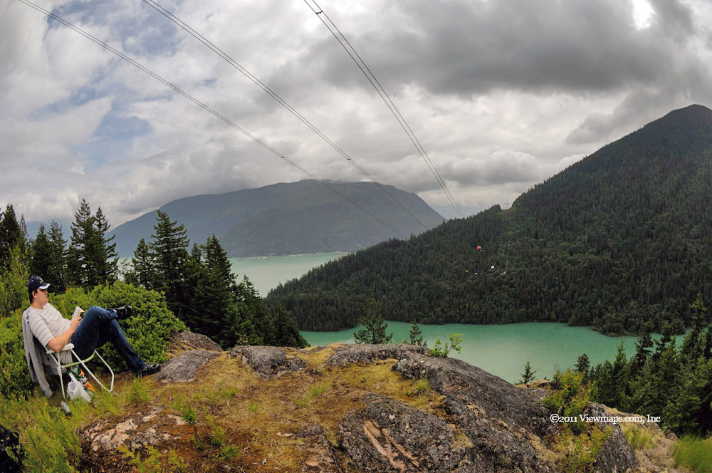
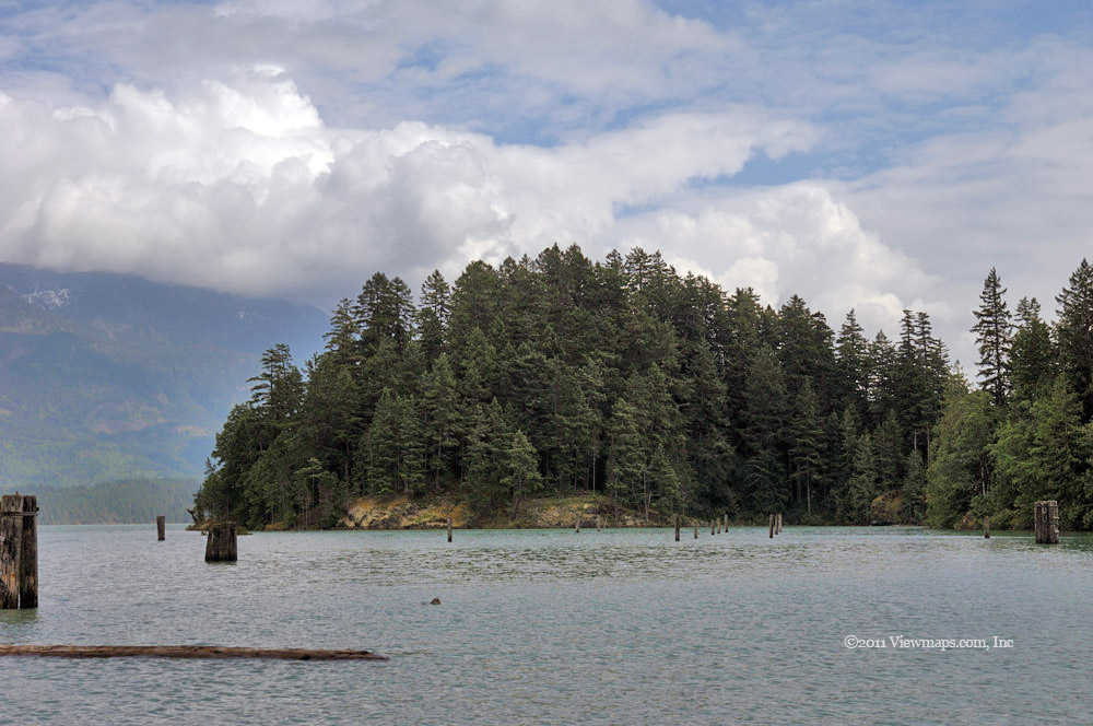
When we arrived at Yale we drove to the end of the side road to check out the view of the slope and any obvious conditions we might encounter. It looked fine from below; we had a chance to gather a few shots of the two train tunnels before parking for the hike. The day was still overcast but climbing in temperature so we wanted to get on the trail asap before the heat came. We parked the truck at the place indicated by the hiking book and tested out the radio. We were able to use the simple truck mounted antenna so that saved some set up time. Then it was off along the highway to find the trail head.

After crossing the highway, we made our way north along the road passing Mary Ann Creek to where we saw a sign announcing the start of the trail. Dropping down from the road we found the narrow opening leading to the trail. Our first impression of the trail was favourable, it was well trodden and easily followed at this point and so we started up the first of the reported 47 switchbacks that make up the path. The trail was through a mature forested section so we were protected from the sun most of the way and it hid us from the highway noise quite early. As we made our way up the steep path and past a few switchbacks we finally came to a rocky section where we had to scramble over a field of boulders. I really have grown to dislike this type of trail and hoped that it wouldn’t be a long section with many repeats. At least here we could look down on the truck parked below and there we spotted another pair of hikers getting ready to tackle the trail.

Continuing on we found that the trail was becoming a bit less obvious in places and so we needed to be very careful as to locating the correct path. It seems that the worn look was all most people felt they needed to stay on the trail and so there were very few markers in place. At one point we did manage to lose the main trail and start down an older side trail that climbed the slope on the left of the active one. Eventually it petered out and we were making our way with no trail of any kind. I figured we had lost the true trail and rather than back track we made our way to the right and soon came upon the well trodden path for our continued travels upward. By now the other hikers had closed the gap and soon would be passing us. The one positive of our detour is that we skipped a very steep section where a rope was in place for hikers – we used it on our return. The steepness of the slope was starting to wear on us as was the temperature as the sun was getting much more constant as the day progressed.

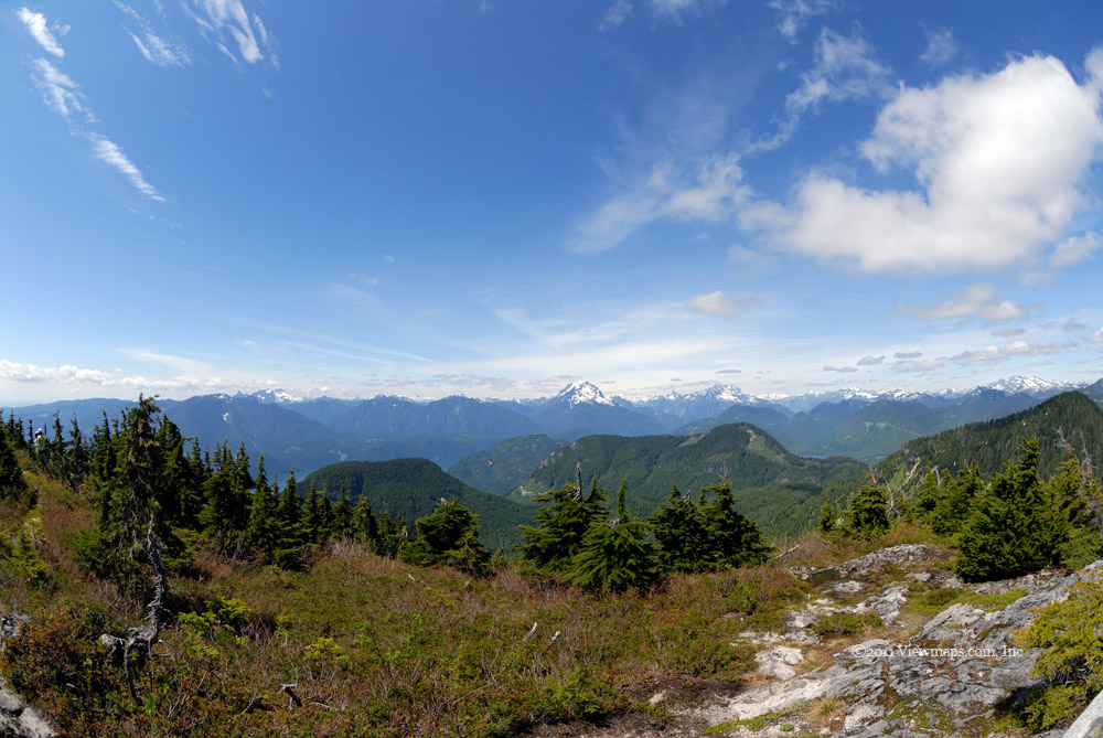
After getting past another steep section where a support rope was in place we were offered a lovely view of the canyon below. It wasn’t even over-grown! After a brief rest we continued along and soon came by section where the trail scrambled along a narrow ledge and then over a rock face. Here another rope was anchored to the rock in a number of places but it did require one to be very careful as to one’s footing. Once past that exposed section the trail continued the final climb to the peak, there was one more short rope supported area and then the final sprint to the top. The crest of the peak was quite wide with many places to sit and enjoy the success of our pursuit. 

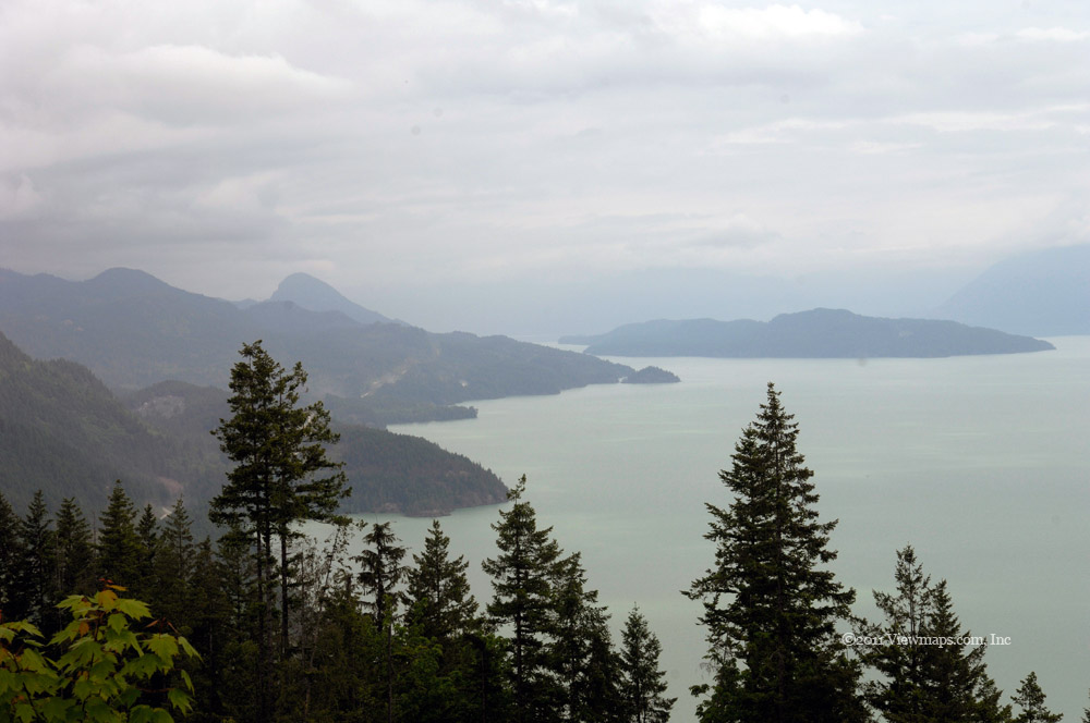
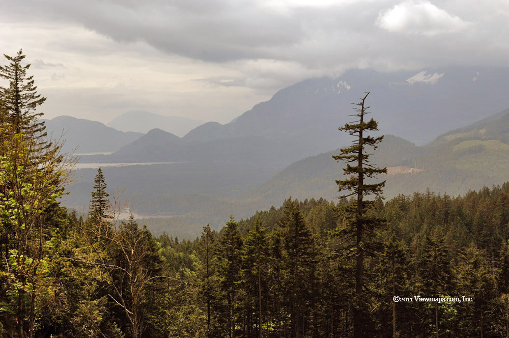
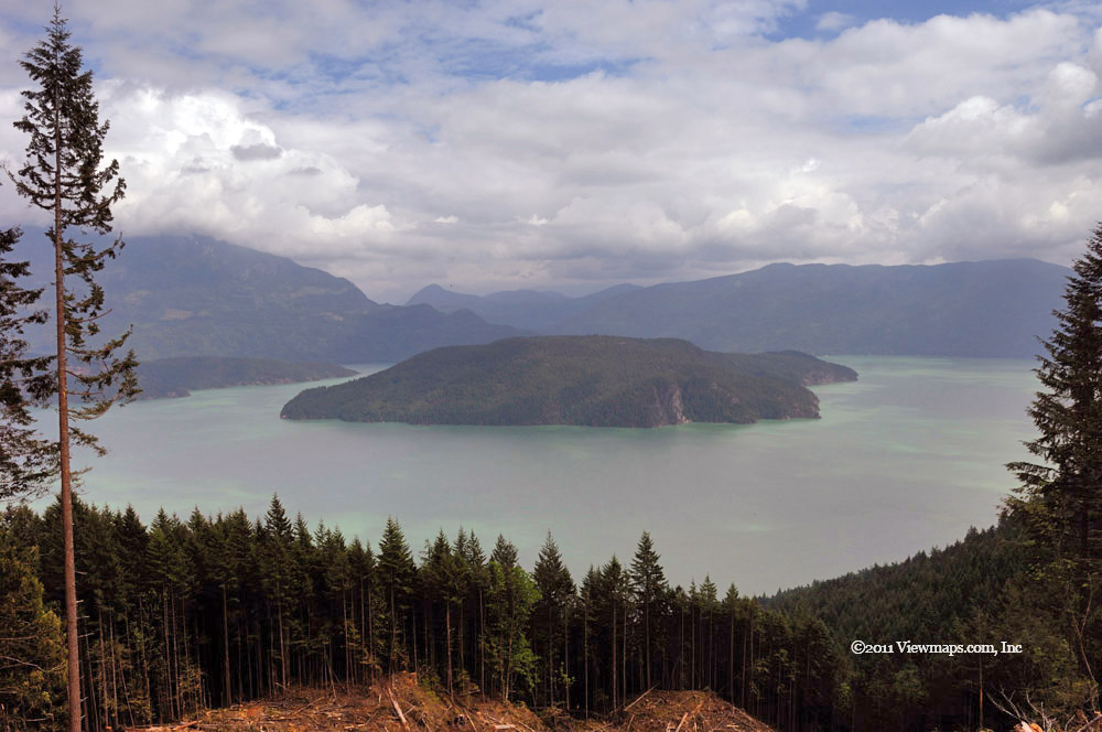
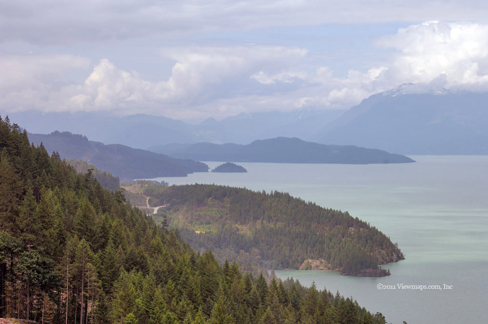
Previous hikers had built up a very tall and thin cairn placed on one of the sub-peaks. Though it was quite solid it was so thin it looked a bit odd. Ethan and I ate our lunch while sitting on the rocky outcrop and after regaining our breath and rehydrating we took a tour of the extended peak area. There was a small cairn marking the highest peak of the multiple small rises found at the top of the mountain. There is also a radio repeater up here that I took a few minutes to look over. Then I started taking a number of photos, the best were of the Fraser River directly at the foot of the mountain. Looking down we could see the place where we stopped in the truck earlier and where Geoff and I stood to watch the fire helicopter putting out the blaze a few weeks back. Though we were on the burned hill I didn’t see any signs of the fire along the trail or at the top.

Done with picture taking, we started back down the trail. Though not as tiring, the downward trek is actually much more strenuous on the legs and joints. Those roped sections were really quite wearing on me. We made good time heading down and soon came by the section we had bypassed on the way up. Here we found a very long roped section. The rope was very handy on heading down but I noticed that the portion tied around the tree was getting quite frayed and was desperately in need of being replaced. I wish I had some rope to improve it. Not much past the end of the rope we came by the fork where we had made the wrong turn. Ethan noticed that the two paths were both similar in look though the wrong one had a small rock across the path, not at all obvious to us. So he added a few more boulders to block the wrong one and I added a bit of flagging tape to the correct path. Hopefully the next hikers will have an easier time of it.

While at the fork Carolyn called on the radio and we had a bit of a chat wile I took a short breather. The sun had been out in full force now for almost two hours so the day was rapidly heating up and starting to zap our strength, so we were in a hurry to get done with the trail. Moving on we were soon over the last (first) of the rocky sections and on to the lowest segment of the trail. It was a welcome sight seeing the trail head sign once again as I was getting quite tired by this point. The final spurt across the highway and to the truck was in full sun and so we got hot very quickly. Once back to the truck we got the AC going and started cooling off. We quickly got the gear reorganized and my computer set up and started the drive home. Our first stop however was a brief visit to the DQ in Hope for something cold.

The choice of trail was a good one for us and we quite enjoyed it and the view from the peak. Surprisingly the GPS showed the hike being 5km not the 3 shown in the book, so it ended up being longer than planned. I guess they converted their numbers wrong on this one. So that makes it two down, one more peak to go this summer.

Mt St Benedict Summited

A year ago June we finally had our chance to hike the mountain after a few false starts thanks to the weather, but even on our last attempt we were quickly stopped by the deep snow along the ridge line. The 2 meters of snow slowed us to a crawl and the heat wore us down. So we planned to try again this year. I planned the hike a month later in the season hoping that the deep snow would be gone and that we would have an easier time of it. Alas the season was cool and the snow melt much delayed so despite it being a month later we had the same depth of snow to fight. The big difference this year was that the day was much cooler – ideal for hiking – which allowed us to make much better time on the ascent to the ridge. We were on the peak by 1:30 whereas last year we turned back at 3pm while still on the ridge.

The other main change from last year was that this time we set out to summit the mountain, last year we were originally only trying for the lake below the summit and added the try for the top once we had rested at the lake. We wanted to hike in the cool air so we left the house by 7:20 which got us to the start of the hike by 9:20 – still lots of time to hike in the cooler part of the day. On arriving at the start of the Lost-Murdo FSR, we noticed that the road had seriously degraded from last year. It was far rougher on most sections than what we could remember. But we continued up and soon reached the wide section of road, just below the slide area, that we parked at last year, with not a truck or person in sight.

Once parked Geoff and I tested out the radio conditions and started to set up my dual band co-linear antenna. That took around 15 minutes to get up and secured. It wasn’t perfectly vertical but then it wasn’t that high so we felt it would do just fine for our needs. So with the truck secured, the radio set up and communication confirmed we continued up the FSR past the lovely waterfall at the washout and over the very rough road as it made its way up. The road had become the chosen channel for snow melt and the water was flowing quite heavily down the road, it had washed out all the lighter sand and so we were scrambling over loose rock for the next kilometer. Not only did we need to fight the slippage of the rock but we had to avoid the deeper streamlets of water. It was actually a very tiring section of the hike, and coming back down proved no easier. At least the temperature was ideal and we were able to make decent time on the road.

At the place the trail leaves the FSR we came across a chap who had been camping out along the side of the road. He had been there a few days enjoying the solitude. He hadn’t actually hiked for the peak as the past few days the area had been in thick clouds and visibility was nil, today was the first clear day he had seen. We left him at his camp and turned off the road for the path to the lake. It was a bit wetter than I would have preferred, it seemed that every small stream was running with fresh snow melt which made for a muddy path in places. We reached the lake quite quickly and took only a few minutes to enjoy the beauty of it while we ate a few snacks, then we were off to start the steepest section of the hike – the climb to the ridge.

As we made our way to the steepest segment I noticed a few snow patches that were near the trail in the shadows. I didn’t recall seeing snow this low last year so I was starting to get quite concerned that we would be fighting even deeper snow this year. Our ascent over the steepest section went with only a few short stops unlike last year when the heat really wore us down. Geoff did develop a stiff leg muscle, that we had to take a few minutes to stretch out but once that had settled down we continued up to the ridge. Alas, as we got closer to the ridge there before we spotted the ominous white stuff piled deep and unblemished – no trail to follow! It seems that if there had been earlier hikers their path had melted away and so we had to try and find a trail over the snow.

I did have my GPS track from last year and so we were able to compare our position with that from last year and were doing quite well at picking our way along. We were also joined by a chap who was the lead hiker of a larger hiking group who were doing the peak today. He was new to the hike so he was looking to us for some guidance on the trail. We made our way along the ridge and were soon up to the small pond where we stopped last year. It was more snow covered than last year so I guess we actually had deeper snow today than on our previous attempt!

Not stopping at the pond we continued along the east flank passing the cliff face for the easier access around back. We didn’t have any footsteps in the snow to follow and only the occasional marker so we were working hard to try to figure out how the trail progressed. It seemed we did get a bit to the east of the actual trail for a ways but once we felt we were getting further from our goal we cut across a steeper treed area for what looked to be a better spot for the trail. Fortunately we found a marker and continued on up an exposed section of the trail for a short distance. Then we were back in snow looking for markers which we started to find more easily. Soon we had reached the summit where the snow had fortunately melted and so we had some nice rocks to stretch out on. About 10 minutes after we had arrived, the big hiking group arrived at the peak; a couple of the members came by and thanked us for the path we had made for them! At least we were the first of the day to reach the summit.

We rested ate lunch and I gathered a number of photos of the surrounding lakes and mountains. We also had a few chats on the radio to friends back home. Some of the other hikers were asking about the radio set up and found it quite interesting. Once done with the top we started down the slope following the now much more obvious trail in the snow. It made travel go much faster though we lost the way briefly where the trail squeezed through a tight section of trees. As we reached the end of the snow I was really glad to be done with it but now we had to make our way down the really steep muddy section. That proved harder than expected and I think I ended up being slower descending the segment than I was climbing it.

The rest of the trail to the truck went smoothly, my knees were very sore and tired but the trail was not difficult so good time was made – at least until we reached the loose grave on the road with the stream running through it. I was really getting tired of the terrain by this point but the truck was not much further so I just pushed on without taking any rest breaks. It was sure nice to get to the truck and have a chance to rest for a few minutes! We got the radio gear stowed and started the drive down. When we reached the first fork in the road we noticed that there were some from the hiking group standing around, they had parked their 4x4’s at this point. They had driven most of the rough road but called it quits on the last half kilometer of really rough road. A few others still had to hike to the bottom of the trail! Though bumpy, it was probably made worse due to our broken leaf spring, we finally got off the Lost-Murso FSR and now had smooth driving the rest of the way home – a soak in the hot tub was definitely needed as soon as we got home. It was a great hike – 9km return with and elevation gain of 750m - though I know I will be paying for it over the next few days.

Buntzen Lake

I enjoy Buntzen Lake, it has ample parking – at least if you are early – has a variety of subject types and a range of hiking opportunities, all in an easy driving distance. So you could almost say it is an ideal location, perhaps that’s why it is so popular. Today I needed a short day trip as I had an evening anniversary party to get to and I also wanted to do a practice hike to prepare for my first peak in 2 weeks. So Buntzen Lake and the lower lake trail around it were a good choice for the day. Previously we always hiked the lake in a clock-wise direction, this always left us worn out by the time we did the return along the eastern side; so for a change we decided to hike the trail in reverse and explore the eastern shore first.

Our day began with an easy drive to the parking lot where we were able to get a spot quite close to the beach area. Here we prepped our packs and set off for the start of the trail. The lot was quite empty when we arrived but there was a constant stream of new arrivals that seemed to keep going all day! Once on the trail the cares and noises of the crowds were gone and the only reminder that we were in a busy park was the constant stream of other hikers or joggers passing us as we slowly made our way up the trail. 

Our first stop was at a marked viewpoint overlooking the lake. Well it was probably a decent viewpoint at one point but now it is heavily overgrown by trees and the only view is a narrow look back at the main beach area. I think they should take down the signs or do some tree trimming. This does seem to be the fate of most viewpoints I come across. Continuing north we stopped at a few points for a variety of scenes ranging from back-lit trees to small ferns growing along the side of the trail; all the while we were dodging the onslaught of joggers and dogs making their way back to the parking area.

Soon we had reached the north beach where we stopped for a snack and rest, I gathered a few shots of the lake and then we were off across the suspension bridge as we started the return trip along the western shore. The trail was quite nicely improved in all the areas that were muddy or eroded – very nice but it does make it less of a back-country experience. The return trip offered some nice views along the way but most were partially obscured by trees, one could leave the trail for better access but today was not the day for me to go wandering, so we made do with the limited exposures the actual trail offered. The floating bridge across the southern end of the lake was upgraded a few years back making the crossing much better but in building it they cleaned out all the old logs and other scenic material, so it is now quite sterile and we didn’t have much to see while on it.

The final section from the bridge to the parking area was through tall growths of salmon berries which were nicely ripened and offered a few enjoyable treats as we made our way back the final distance. The parking lot was now almost full with people stopped waiting for cars to exit. Even though the far end of the lot had many open spots it seems people were waiting for closer spots. One truck stopped for our spot when we first arrived but I let them know we would be awhile so they reluctantly moved on. I don’t know why a few hundred feet saving is so important to them! As our time moved quickly on the trail we hadn’t eaten lunch yet so once rested a bit we ate our lunch in the truck before heading back home. It was a lovely hike but I do think I need to revisit some of the spots and wander off the trail for better viewing angles. Always more can be gleaned from any location, so Buntzen will see me again before too long.

Anderson River Valley

Earlier this year I had tried the roads along the first range running parallel to the Fraser Canyon but the snow was still too deep to let us in. So here we are a couple months later hoping it would be passible. Fortunately it was. Now it was getting too hot and filled with flies! One really gets tired of providing hard grown nourishment for blood suckers and flesh nippers that fly away without a word of thanks.

Our day started when Geoff arrived at 8:30, we had a bit longer of a sendoff as the truck had been unloaded for the radio event last week so we first had to reload all our back-country gear and then Geoff’s equipment. Once on the way we quickly drove to Abbotsford for the traditional caffeine adjustment and then we were on the way to Hope. As we approached the place the news had reported a major mud slide which had closed the highway earlier in the week, we were hopeful of seeing something amazing. Alas the slide area was so small that it really disappointed us. It was just another case of the media sensationalizing something. Yes the road was closed but it was nowhere near the magnitude one was led to believe.

In Hope we picked up lunch supplies and quickly continued our way up the canyon to Spuzzum and the start of the logging road. It was really nice to finally get on the FSR and start jarring the body into various contortions due to the roughness of the road. We enjoyed a lovely view of the swollen Fraser River as it was squeezed through the narrow gorge below the Alexandra Bridge. Having been down at the foot of the bridge at low flow, the rise in level with the associated volume of water is really quite unfathomable. We took the second side road off the main line and were soon driving past the spot the snow stopped us earlier this year. The road looks so different with the vegetation covering the trees!

Once we attained the ridge we encountered a fork, as the southern section was shorter on the map we elected to attack it first. There is a small pond along this route which I wanted to photograph so off we went. We soon came upon another fork where we took the less travelled. This fork soon bent north and got more overgrown, fortunately it soon connected back to the mainline and we were able to continue the loop back up to the first fork we encountered. So back down the southern branch and this time we took the right-hand branch and continued along the line of transmission towers.

The road made its way over some rugged terrain and soon we were enjoying some lovely eastern views of the mountains leading up the Anderson River. Then we finally had a view of the small pond and made our way down to it. The road split once more and we followed the right-hand path as it made its way around the pond and up the far western side. The road continued along the power lines and soon came to a phenomenal viewpoint looking south. We could see the Cheam Range in the far distance which was quite a surprise. 

After enjoying the view and exploring the details with our binoculars we opted to return to the pond for a closer look and then back to the first fork to head north rather than continue down the slope. We had a radio contact planned for 2pm and I wanted to be as far north as possible so back we went stopping at the pond for some close-up shots including a few at water level. The northern branch of the trip seemed to be in better shape than the southern so we made some good time covering the distance – we took one short spur that crossed some muddy sections that presented a small challenge on our way back. Fortunately we didn’t lose much time in it. The road continued down to the Anderson River where we encountered a bridge across the water which looked to be recently upgraded, that seemed a bit odd considering the state of the road. 

As time was approaching the point we had to set up the radio, we started looking for a nice spot to deploy the equipment. I wanted a level area with a view of the river below. After another 10 minutes of driving we finally found an ideal location and we put up the equipment. It took us around 20 minutes to be on the air. My first calls went unanswered but soon I discovered that I had not connected the final coax connector to the radio! Once that radio was actually attached to the antenna we heard the guys from the club back at home! While I enjoyed a chat with the gang, Geoff hiked further along the road looking for things of interest. When I was finally done with the guys I switch to the 20m band and heard a chap calling from Poland who I then contacted!

Now that I had finished, I called Geoff on our hand-held to get him to return. He was far out and down the slope. He said he could see me in the distance but even with the binoculars it took me some time to spot him. Things like this make the size of the backcountry and the smallness of a person really obvious. While he walked back I packed up the radio gear and soon we were on our way. This section of road had some badly angled cross-ditches and with the shadows falling across the road they were very hard to spot, so on several occasions Geoff hit the ditch a bit too fast and we were bounced all over the interior of the truck. The last bounce really strained my neck and I hope the pain won’t last long. We explored a few more side roads but as time was running on we elected to skip a few, on later review I determined that two of the skipped roads opened up larger areas which may mean we need to return!

We had a great time up here having had several trips cancelled due to rain or other events so it was with a bit of sadness that we finally returned to pavement for the drive home. I really would like to get an ATV and motor home so we could spend a full day driving the roads. As we approached the town of Yale I decided it would be a good day to explore a short road that goes between the highway and the Fraser River. I have wanted to check it out for some time and as the river was in its exciting phase, today would be a great opportunity to see the river close-up. We made our way along the road and soon came by a small crowd of people standing around chatting. We parked and I got out to photograph the river and then noticed the item of interest to the crowd – the hill above us was on fire and a helicopter was dropping water on it! We stopped to watch the progress of the fire fight and I gathered a few photos of the process – a very interesting end to a day’s adventure.

West Harrison - Southern Area

The planned destination for the day was up in the air until this morning as the weather was uncertain and I wanted to visit the spot with the best chance of sun. So after I climbed out of my comfy warm bed to explore the cold realities of life, I determined that east was the way to go for today. Once Ethan arrived to drive, we started off for our coffee stop in Abbotsford and by the time the first few ounces of caffeine had their effect, we determined that the West Harrison was where we would spend the day. We continued along the highway to Agassiz where we picked up lunch and topped off the fuel. 

As we approached Mt Woodside we considered heading up there first but as it was socked in with cloud we continued on past and soon were making our way up the start of the West Harrison FSR. Shortly we encountered some very rough road and delays due to road construction! Now I really hate road construction on the roads around home but to be bothered by it in the backcountry! Now that is just plain irritating. But hey, they have straightened and leveled the road in this early section and though it still has some ways to go, it will be nice once done – so nice that even small BMW’s could make the drive – oops sorry, one already was inching along this very rough road much to the humour of the watching construction workers.

Once past the construction, we continued to the first lake view where we turned off onto the side road which follows the transmission towers south to the Harrison River. Ethan and I followed this road a few years back when we had to push our way through snow to reach the end. Today we were later in the season and the snow was gone, but now a logging company was active on the road and they were busy improving some of the road sections. They had a security trailer set up at the start of the area but no one was home when we drove past. We continued down the road as it snaked its way along the line. At the far end where the line crosses the Harrison River we stopped to admire the view we had come for. It is an amazing place to enjoy the scenery. We noticed that the river was very high; flooding areas of the shoreline across from us and the colour of the water was a milky green – very pretty for the camera. Once we had soaked in our share of the view and watched a few boats make their way up the river, we returned to the truck and started back.

Half way back to the West Harrison, Ethan spotted a side branch that he wanted to try. Unfortunately just as he entered the road he dropped down off of a hidden boulder and pushed in the right front panel of the truck. This prevented me from opening the truck door fully so we had to stop and see what we could do to fix it. A good crow bar comes in really handy at time like this and we just happened to have one. So after some trials I was eventually able to find a spot where I could leverage the panel support and pry it back in place. It is still a bit tighter than before but the door is fine and it doesn’t look damaged, so we packed away our repair tools and continued back to the mainline. I figured that side road was not worth the bother. Upon reaching the security station however we found our way blocked by a pickup truck.

As we approached the driver got out and came over to me, after he determined that we posed no threat he stood down and we had a lovely chat about their logging work. They are a small firm with a license for a few small lots down slope of the transmission line road. He said how they were taking extra precautions so as to not expose the cleared area to sunbathers at the Harrison Hot Springs beach area. They won’t see a thing from the town he prided himself in saying. I said it was a shame that they had to take such measures just for PR. After a short chat he encouraged us to explore some of their other newly minted roads where there were some great lake views. So we said our good byes and continued on to the mainline and then off at the next side road leading to Francis Lake and some viewpoints just before the small lake.

This road has some deep cross-ditches which played with our rear bumper some more but we reached the end of the highest road and there we stopped for lunch. I gathered a few shots heading SW up the Harrison River Valley. Unfortunately the sightlines were the best so I didn’t get as many photos from up here as I thought I would. While there a small ATV zipped up to us and turned back at the end – it sure makes quick time over these roads compared to us. Done with lunch, we started back down and stopped in at Francis Lake for a quick visit. I didn’t really feel that inspired at the little lake though the few people fishing on it seemed to be enjoying the place quite well. We turned back down the Weaver FSR and started up the Hemlock Valley FSR. This section was freshly used by the logging company and was in great shape for driving. Last time here with Geoff we got stuck on a sandy creek crossing but today there was a culvert across the creek and we almost missed noticing the spot. 

We continued up the Hemlock FSR through several active logging sites and eventually stopped where they had dropped a few trees across the road. We could have pushed on but the road became overgrown not much past the spot so I decided to turn back – call me a wus maybe but after the body bending of earlier I didn’t want any more for today. Part ways back were some of the new roads the chap had mentioned so we started up the first and soon came to a very steep section. Ethan wasn’t so sure about this spot but the truck struggled up it and once the road leveled a bit we were stopped by a large tree harvester. While I took a few photos, Ethan went to look over the machine. Then he had to turn the truck around – on the steep slope. Heading up or down wasn’t too scary but being on it sideways did elicit a bit of anxiety for both of us. Fortunately the u-turn went smoothly and we were making our way back down the steep slope to a fork. The other branch led to a lovely clear view of Harrison Lake.

Once done with the view we saw that we were at the end of the road and so we returned all the way to the West Harrison mainline where we continued north to 10 mile bay. The first thing we noticed down in the camping area was a huge mound of trash! Why people leave their crap behind still eludes me. Garbage was strewn across the area. The individual spots people we occupying were reasonably clear of trash, I guess they had picked up the close stuff and dropped it in the big pile – better than nothing I suppose. While we were there we noticed a fire warden making his way to each campsite telling people of the half meter size restriction on campfires. No tickets today but perhaps later.

Done with the filth of the campsite we returned back to the mainline and started back home. There was one more road I noticed on the way here that I wanted to try before we stopped for the day. When we found the side road we set off up it and eventually found a decent view but I determined this wasn’t the road I had seen earlier, so we returned the mainline and continued along to the correct side road. Unfortunately it had a very solid locked gate across it a couple hundred meters in. A disappointment but the day had been quite enjoyable and so this wasn’t too big a let down. It being late we started for home. As we arrived at the construction site, we watched with growing humour and amazement at the cars making their way back across the construction area. I have to believe that they wouldn’t have driven it if they had know what to expect. All too soon, we were back to the pavement and done with the day’s adventure, there I put a call in on the repeater to Carolyn. A nice area to see and not even very far up the road!

Tulameen Country

Our day started off well. We were heading out for the Sowaqua FSR with a radio chat planned for 2pm. We made excellent time to the Abbotsford Starbucks and then on to Hope for fuel and some lunch supplies. Our next stop was exit 192 on the Coquihalla at the start of the Sowaqua FSR. The road looked quite good and we started off with high expectations. Well, less than a kilometer along the road we encountered rock slide - rocks of all sizes strewn across the road from the cliff above. Though blocked, we thought we could see a path through the rocks and so we seriously considered pushing through. After making it a few meters we got hung up on some medium sized rocks, not even the bigger ones. and so after this reaching an impasse so quickly we decided to call it! Now that was a disappointment. In an ATV we likely could have made it over the rocks but not in our truck. So now what?

Reviewing the maps further up the highway I skipped past the next one as I had talked with the logging company who stated that they had a locked gate there, that left the Tulameen FSR at mileage marker 228 – not all that far on the freeway, so off we went and soon we were there and trying to decide which branch of the first fork to take. This would be an often repeated decision during the day’s events. We also spotted a new road frequency which we had to program into the radio, so that delayed us a bit. After pondering the choices for a while, Geoff spotted a small sign showing us the correct branch and we were soon on the way in. The road was well maintained with the snow cleared and piled up along the sides for the first number of kilometers. That was good as I really didn’t want to get stopped at the start again.

We noticed that the map showed a loop route which we could take allowing us to stop in the town of Tulameen for a breather. So we set off on what seemed the less major road first which coincided with the plowed road. All was good as we started south into the alpine country and we had little trouble with the road. The area had a very different feel to it compared to the more coastal areas we have been doing so that was a refreshing change but it did tend to make the place look a bit less photogenic – at least on this first trip – I will need to develop an eye for this style of backcountry.

At the southern end of the loop we came to another fork, the left set off for Tulameen, the right on a dead end trip far to the south. With it being still very early we chose to try the right branch first, it was a good thing as some of our best photos were found down this leg. After driving a while we came alongside the Tulameen river for the first time and soon spotted a small side road leading to a lovely little camping spot. We got out and explored the site a bit – it would be a nice area to camp with the river just behind the trees – the sound of the river was refreshing. Continuing down the road, we came by a small stream where a short spur led to what looked like an equipment storage area. So we left the main road and followed the road that paralleled the stream. At the bottom I found a few interesting photo ops and Geoff explored the abandoned equipment. Then it was back to the truck and on to the main FSR. Soon we came to a small forestry camp site - Sutter Creek. Here the Creek cut a narrow gorge through the shale and with the high flow offered some excellent photos. We decided to explore the area on foot, our goal was to get to the gorge. We soon found that the bank was so steep that we needed a rope to climb down from the campsite to the edge of the gorge. Fortunately we had one and we were able to get real close to the water and the shear walls of the gorge for some intimate photos. This spot deserves a return visit. After exploring the site and making our way across some deep snow drifts we packed up and continued on down the road.

Not much beyond Sutter Creek we came to a side road leading to a mining operation. Their road was plowed and clear of snow but the main forestry road before us was blocked with close to two feet of snow! I guess the miners had actually made a huge difference to the condition of the road we took for granted as the uncleared section was totally impassible. Seeing open road before us, we decided to travel up the cleared road for a bit and ended up chatting with a worker who was clearing more road for the mining camp. By now it was getting close to the time to set up for the radio contact so we returned to the mainline and started back up the road looking for a good spot. That campsite we spotted earlier was not too far away and likely just within range of where we could get to in time. So we sailed back up the road and soon were at the campsite with no extra time.

We rushed into setting up the equipment and antennas and had the whole thing deployed and operational in 15 minutes! A new record! We used a single centre pole which worked really well for us. I turned on the rig and immediately heard some of the White Club members chatting away. After getting their attention we had a great chat lasting for 30 minutes before I decided we needed to pack up and continue our drive. Packing up went quickly. While I was on the air Geoff explored the campsite in more detail and found a bear skin that had been left by hunters who had caught the bear earlier in the season. Done with the radio and the site we made our way back to the fork and took the east branch this time. The road soon had a number of branches where we had a bit of guess work to find the right way amazingly we made it without any mistakes!

The road now paralleled the Tulameen River though it was far below us with a very steep slope between us. In a few spots the road was starting to cave in so I guess it won’t be usable for all that many more years. At one point we discovered the remains of a small bear cub, a shame to find that. I do hope it wasn’t because of a hunter or a road collision. The road was rougher than the first section but we made good time and we soon found ourselves in the town of Tulameen. It is a very tiny town, we didn’t take time to explore but did drive to the end of the main road to the edge of Otter Lake where I grabbed a few photos. The lake level was very high, flooding some of the grassy beach. Done with the lake, we drove back to where we could continue the loop back to the Coquihalla. We noticed a large number of properties for sale, so perhaps there are some vacation spots that one could get at a good price.

Starting back up a gravel logging, road we switched the truck into 4x4 mode but to our dismay it wouldn’t kick in! This was a little unnerving but as the road seemed to be fairly good we didn’t think it would be a problem. As we made our way along stopping for photo every now and then we retried the 4x4 mode and eventually the truck switched over. So at least the last portion worked as planned, but I will need to get that checked into. We passed innumerable side roads as we made our way out- so much to see on a return trip! The final push to the freeway went quickly and after a brief stop at the rest area we started off for home. The drive now went very quickly and soon we were struggling to pick up the Canucks game on a radio – with a broken truck antenna that radio proved useless. My Ham radio should be able to pick it up but the truck was putting out too much interference so instead we used streaming audio through Geoff’s IPhone! The wonders of technology! We made good time home where we were able to relax our sore muscles from the long drive with a soak in the hot tub.

Squamish River Valley

May has been a very wet month so when we finally had a decent morning to get out, we jumped at the chance to head up the Squamish River Valley and try a few new roads. Ethan arrived at the house shortly before 8:30 and we were soon heading for the Sea-to-Sky highway and Squamish. The initial drive went very smoothly and we were soon topping off the tank just past downtown Squamish and ready to hit the logging roads. 

Our destination for the day was to explore the first few side branches off of the mainline. B100 is its official name and we started up the road, it was actually in decent shape as it had been logged not all that long ago. Not too far up the road we came to our first of several lovely small waterfalls. I really enjoy the look of a nice silky smooth waterfall so we stopped so I could setup my camera gear to capture the small falls. Today was also the first test of my new backcountry manager software system that I am developing. So far it was working well and I was able to tag a number of good spots for future visits.

After a couple of switchbacks crossing the same stream each with a vastly different looking waterfall, we came to a straight section of road where a large diameter tree had fallen across the road. It looked like it would be a fun challenge to clear the tree and on examining the obstacle we decided the best approach would be to saw off the upper section and then winch the heavier trunk off the road. The lower end was quite thick so we opted to drag the top end. This required us to set up the block so we could get a proper pull across road. Once the tree was cut we attached the line and started dragging the tree. It all went very smoothly and quickly, almost too fast! More issues would have been interesting but then getting on past the tree was our real goal. Once it was off to the side of the road we stowed the tools and continued on past.

The higher areas offered some lovely views of the Squamish River but all too soon we were stopped by a snow pile that had slid across the road. Included with the snow was a large log that had come down with the avalanche. It was quite a large log and I am sure it would do serious damage to any pickup that got in its way when it was moving. Realizing we were done with this main branch we back tracked and tried each of the side roads in turn. We had lunch on one of the side roads and then at 1:40 we stopped to set up my HF radio gear to try some HF contacts. But the band was completely dead. I heard only one station on the air which was very odd. I had set up the antenna with only a single pole that leaned against the truck as I did last time but perhaps the metal of the truck was interfering with the signals. I’ll need to move things further out next time.

Done with the radio we continued our way down to the mainline trying a few more side branches as we went. Since it was still early we decided to try the next major side road – B200. So we continued up the Squamish River Mainline and took the B200 off ramp. This side road looked to be even more active than the first and the road was an easy drive as we made our way up. Soon we reached a point with an amazing view of the Squamish River. It will need a few return visits under different lighting conditions. Continuing up we soon came to a major fork and selected the left one heading north. The road continued up a few hundred meters but we came by an avalanche slide that left a lot of snow blocking the road along with a huge torpedo log! So that was the end of the drive up the north branch. Back to the fork and now we set on up the southern branch.

This fork lead through some nice mossy slopes and cliffs as it wound its way around the ridge that parallels the Squamish valley, heading east and away from the valley the road makes its way into the High Falls Creek area where there are a large number of side roads and areas to explore. Upon rounding the ridge we came upon two hikers that had worked their way up from the Squamish Mainline through a trail that joined the road at this point. They had been looking for the continuation of the trail but were not having any luck with that. As we continued on past we kept an eye out for the resumption of the trail but we didn’t find it. Soon we were stopped by snow covering the road in a bit of a dip. Being late we decided to head on out and so we made our way back to the hikers - we mentioned that we saw no trail along the road ahead much top their disappointment. We continued our drive down to the mainline. Half way back to the B100 branch, we came upon a young black bear that was running along the road away from us. When he noticed he was losing ground, he set off into the bush for the river bank. He was quite small so I am quite sure there was a bigger momma around, best not to explore on foot!

Earlier in the day we met a radio Ham on the VHF radio when we were checking-in to Carolyn back at home. He told us he lived just before the logging road began and so once we got off the FSR we drove up to his place and stopped in for a short visit. John was a fun chap to meet and we had a nice first visit. He offered to be a radio support for us on future visits to the area. That may prove very helpful in the days ahead. After our visit we made our way to the Squamish Starbucks to load up on caffeine to ensure a safe drive home. The drive back went quickly and we had no traffic issues to complain about. Overall it was a good day of driving and seeing some new sights, the new software worked quite well and should prove useful for future planning.

Harrison East

The winter this year piled on 50% more snow than normal in the hills and it will take quite some time yet for the higher roads to be passable – most annoying. So I still need to keep finding low elevation trips to fill my wanderlust for the back country. The East Harrison offers a lot of side roads to explore and goes for over 60kilometers itself, so I thought it would be a suitable place to spend the day. I also wanted to look over the small abandoned mine shaft we saw earlier in the year and then continue north along the Silver River to see the lovely gorges the river flows through.

So we set off just after 8:30 and made our way to Abbotsford for coffee then Agassiz for fuel and food supplies for lunch; that part of the trip was routine but soon we were beside the lake and onto the FSR proper. Our first stop was at the first viewpoint for the customary look out over the lake, we found the cottages across the way quite interesting today and noticed a road connecting some of them that caught our eye. We wondered if it connected up to the road leading to Cook’s Cove – previously we noticed a new gate on a side road there that just may now lead to these cabins. Perhaps next trip we will explore it a bit more.

Once past the cabin area we made our way up to the mine shaft. There we pulled out our flashlights and cameras and made our way into the dark. There was now one new problem – the big flashlight seemed to have no juice for the bright beam and my small light was intermittent! What a great start to exploring a dark cave. We decided to continue on in despite the poor lighting, once our eyes had adapted to the dark the feeble light that we did have seemed to be sufficient to explore the cave – so we went deeper – hoping all the time that they wouldn’t just up and die on us at the far end! Once we reached the end we stopped to look over the graffiti there and then Geoff set up his tripod and started taking some long exposure images while I moved the light around. It provided some interesting images with all levels of exposure. We slowly made our way back while I gathered a few close-ups of some of the water effects on the walls.

As we returned to the truck we saw a group of campers heading towards the cave – they didn’t seem to have much light either so I wasn’t sure how far in they would go. But we were now done with the cave and ready to move on up the Silver River to see some of the sights in the gorge. There were a number of side roads we passed that looked interesting but we were keen on reaching the end of the main line before time ran out so we would need to try them again another day. The next stop was at the confluence of the Clear River and Silver. Here we found some interesting pools and rapids to hold our attention for a while. Continuing up we soon arrived at the old logging camp. Unfortunately the camp was all gone and was actually completely cleaned up! That sure came as a surprise.

Next stop was the high bridge over the Silver River just past the start of the deep gorge section of the river. As we reached the bridge two chaps on ATV’s were stopped on the bridge blocking our way so they moved a bit for us to pass. We parked on the far side of the bridge and I gathered a few shots while they set off up the road. The view from the bridge really is quite remarkable and I quite enjoy the spot, though getting too near the edge of the bridge does induce a bit of vertigo so I need to be quite careful while taking photos from the bridge.

We continued on up the road, passing a small waterfall on a side stream and a number of deep narrow side gorges that would make fascinating images if one could rappel down into them somehow. Sadly that is well beyond my abilities at this time! We finally made our way to the fork which leads back across the river and on up the Shovel Creek FSR. There on the bridge were the two chaps in their ATVs again. This time we stopped to chat with them for a few minutes. Geoff continued to talk while I made my way across some logs from an old bridge structure to where I had a nice view of a waterfall. It was just barely visible from the bridge being obscured by trees but here I had a great view of not just the water but also of the roar from it. Soon Geoff joined me and after more photos we returned to the truck.

It being lunch time we decided to stay at the bridge and eat. I also wanted to set up my HF radio gear and do some communication tests. Geoff meanwhile wanted to try out his new portable single burner stove. So while he boiled some fresh river water, I listened on the bands to stations from the east coast and Europe. Once done with lunch and radio tests we packed up and continued up the East Harrison. Shovel Creek was blocked by snow only a few dozen meters past where we stopped for lunch!

The road on past the fork was somewhat poorer in quality and we enjoyed the pleasure of more potholes and bumps! But we didn’t get all that much further before even the East Harrison was covered in dense snow. So the extent of our journey was now set and we could only turn back and try a few of the side roads as we came back to them. Our next stop was just in from the main line where a short spur tracks along a tributary stream. At the end we found an old gutted truck chassis that Geoff gave a once over.

Back to the main line we continued south to the site where there used to be another side road which crossed over the Silver River. Here the logs from the old bridge were stacked up blocking access to the river. They were quite serious about preventing vehicles from attempting to cross here. It was a shame as the old road on the far side showed some interesting possibilities on the map. The river at this point was quite fast flowing as it made its way through the rocky gorge. We were able to get up close to it for some interesting shots. While I was taking photos Geoff was busy sifting through a small area of sand looking for flakes of the good stuff – he did find one shiny flake but we weren’t sure of its composition.

A few drops of rain hit us so we returned to the truck and continued during our way out. We made a few more short detours on some side roads but nothing took much time and so we were soon back to the main travelled areas. At Bear Creek we took a few moments to watch a tug pull in a barge to the shore to off load some heavy equipment. It was quite interesting to see how they swung the barge around 180 degrees to make it possible to drive off the equipment. Once bored with that we continued on south and soon were off the FSR and onto smooth pavement. The rest of the trip home went quickly except for the brief stop in Sardis for a coffee. A pleasant trip and one I will need to repeat this summer so I can explore the farthest reaches of the East Harrison. That area I have not seen even after all these years.

Chilliwack Lake Relaxation

Today was my regularly scheduled trip with Ethan, I had been planning to do some serious driving but I wasn’t feeling the best so a quieter trip was definitely the best plan for the day. I thought we could also take the time to try a bit of HF radio work and to sit along a lake where we could enjoy a nice view and the warm sun. So we set off at the regular time and soon were making our way along the highway to Abbotsford. As we were going to be sitting, enjoying the day, we needed to stop at a store to pick up some portable chairs. Once done gathering some fuel and coffee we spotted the local Rona where we bought a pair of foldable chairs. 

Back on the road we were soon in Sardis buying lunch at a newer Subway, this one is not much before we turn on to Chilliwack River Road. The little mall is quite new and most stores were yet to be opened. The drive along the river went quite quickly, there didn’t seem to be many out yet for such a lovely day. Soon we were by the Military base where I spotted an amazing view of Mt. Slesse, so we stopped and I gathered a few shots before we continued on to the lake. The road along the lake was terribly rough and pot-holed like last time which reduced our speed to a crawl. Along the way we passed a couple of cars parked along the side - the drivers having given up on the road. 

Just past the start of the lake we came to a bend where a snow slide had occurred and which was still blocking the road. We noticed a bit of a path across the top so we thought we would give it a go. I got out to direct Ethan as he made his way up the snow bank and around the sharp turn. Part way across the truck started sliding down towards the lake. Ethan revved it a bit, spitting snow, the tires caught and he made it the rest of the way with little further trouble. Now we could continue down the road with likely few others brave enough to try the obstacle.

After shaking ourselves to the core we finally came to the point I thought would be a nice place to set up for the day. Ethan wasn’t convinced it was the best spot so we continued past and drove to almost the end of the road before he agreed that it was indeed the best spot for our needs. So after back tracking to the point we parked along the edge and started to set up the radio gear.

My first goal was to get the 2 meter Yagi in place so that we could contact Carolyn at home. I pulled out the antenna from the case and discovered that the bolts that hold the elements to the boom had bounced out and were now missing. So this posed a problem – how to attach the elements to the boom – well I did have duct tape! So in the traditional Canadian fashion we taped the antenna together and hoisted it into the air. The radio picked up a strong signal and I was chatting with Carolyn with a clear channel! Another duct tape success story!

Once the VHF link was in place, we started on the HF wire antenna. We stretched it out and hoisted it up to the working height and soon I was hearing callers from South Dakota, the eastern seaboard and even one station in Europe! I tried calling a couple of them but they were all busy with a contest and serious pile-ups, so I unfortunately didn’t reach the contest stations. That was a bit disappointing, but the radio work wasn’t my prime interest for the afternoon. With gear in place I could now relax with a nice book as I soaked in the sun over-looking the lake! Ah what a lovely afternoon to enjoy the solitude of the quiet outdoors.

While we enjoyed the sun were we soon surprised the stealth arrival of a pair of cyclists. They had traveled the road and were continuing on down to the far end of the lake. Their cycling being so silent, it was quite a surprise to suddenly have some other people moving past the truck. A bit later as we were packing up another pair came by the first two still hadn’t returned past us. Taking down and stowing the gear went quite smoothly and soon we were back to the bumpy road for the drive up the lake. The return drive seemed a bit less gut wrenching but I am sure it was just that we were relaxed from the sun and perhaps used to it. 

The snow pack loomed ahead of us and though we still slid a bit on the return we made it across with little concern. By the time we got to the paved road a large crowd of vehicles had accumulated at the entrance to the closed park. Some were parked and walking in to camp despite it being closed. I guess they really want a campsite rather than to just park at the side of the road and camp in any number of easily accessible spots. There really are so many to choose from.

We made our way past the parking lot to the road and were soon well on our way back home. It was a lovely warm day; the viewpoint was a great spot to spend the afternoon soaking in the ambience. Now I was nicely rested for the Easter week-end. Though I didn’t take many photos I did get a few great views of the lake and one small stream and we were able to test out the communications gear and figure out what maintenance was required – I’ll need to buy some replacement bolts for the antenna.


Western Shore of Lighthouse Park

It being Good Friday, my third son, Nick, had a day off when he could join me for an outdoor adventure. He doesn’t get many chances to go with me as he normally works the week-ends. So today was a rare opportunity for him to get out in to nature with me and he wasn’t going to miss it. I hadn’t originally planned to go out today but Nick was keen and so we picked an easy day hike to enjoy the sunshine in. The park being close by, we left a bit later than normal and we made our way to the trans-canada highway and on to West Vancouver. The drive went smoothly; we were both quite amazed at the changes to the highway that have taken place in preparation for the new bridge.

Once off the highway we stopped in at the small mall near the park and picked up some food for the hike, then it was down the windy road to the park. As it was late morning the park was already quite busy and finding a parking spot for our truck was not simple, eventually we found a wide section of the lane and parked along the roadway. We weren’t even out of the truck before another pulled in behind us. By the time we returned later in the day there was a line of parked vehicles including in front of us!

So the parking was settled, we started off for the bluffs, I really enjoy the western coast of the park so our first stop was Juniper point. When we arrived there was just one young couple enjoying their time on the rock, they looked like they would rather have been alone, but it wasn’t long before the crowds started arriving. Nick and I stayed for a while enjoying the view and sun, I got a number of photos of the sights. When it was time to head back to the trail and on to the next point Nick had an interesting idea. He wanted to try and make our way to the next point by clamoring over the cliff faces! I wasn’t sure we could make it as the rocks were quite steep and rugged but I was willing to give it a try.

So we found a little used path off of Juniper Point and made our way down to the next minor point along the shore. We had to try a few alternate routes before we could get to the water and a good view but we did find a path and had a lovely view back towards Juniper Point. The rock face had signs of other hikers but it definitely wasn’t a well-travelled area. After enjoying our success for a period we started on to the next point. This one required us to move further in-land to where we could find a passable crevice to scale that led to the top of the next rock face. We made it with only minor back-tracking and soon we were enjoying another great view of the water and the other points.

We were able to continue along the shore line in this way and soon came to a spot where we made our way down to the beach - the tide had gone out a decent amount by this time and we had an easy route the remainder of the way to Shore Pine Point (Jack Pine Point). Along the way we spotted a collection of various starfish that I was able to get a few photos of. They do come in an interesting array of colours. Once at Shore Line Point, Nick made his way to the very point and felt quite good about his achievement. But it was still early and we had time to continue on south to the next few points. This area was more commonly traversed but it still was fun to pick a path through the cliff.

The final view point is almost as high as Juniper and has some steep cliffs dropping to the sound. It is a great place to soak in the sun and sounds of the ocean and a number of pairs were doing just that when I arrived. After gathering a few more photos, we left the cliff face and made our way onto the interior trails. We selected the Song Bird trail to take us back to the truck. This was one I hadn’t been on before so it was another new experience for me in the park. Eventually it joined up with the main interior road and we continued along it to the parking area.

So though I have been hiking the park many times over the years, today we found two new adventures that brought renewed interest to our day. The bluff scramble was fun and very scenic. The trail proved restful and quiet. Once back to the truck we considered the tight fit that we were now in with a car behind us and a truck in front and with a third car impatiently waiting for our spot! That was too much for Nick so I took over the drive and got us on to the road and soon we were back on the highway heading for home. It was a lovely sunny day and we both had a fun time in the old standby park!

Subscribe to 2011