
Florence Lake FSR & Stave Lake

A few years back I found a lovely viewpoint nestled in a loop of a logging road where one could see Alouette and Stave Lakes together. The spot was far up the ridge of land that separates the two lakes and the only way in is by the Florence Lake FSR which starts at the Stave Lake Dam. I wasn’t sure of the condition of the road so we set off with high hopes but no certainty of reaching our goal.

Geoff arrived at the house a bit before 8:30 with his son Liam who would be spending the day with my wife. After getting a few things packed I loaded in my new computer. Our previous unit has gotten very flakey and I was concerned that it would die at any moment, so I had been looking for a good reasonably priced replacement. Last month Asus starting shipping their new tablet called the Eee Slate. Though no threat to an iPad, it runs windows 7 has a solid state hard drive and runs my mapping software without a pause. So it looked very promising and after waiting for a few weeks for it to be back in stock I bought it. 

Soon we were on the road heading for Cloverdale to grab a coffee and some lunch supplies. In planning the trip we determined that the shortest and quickest route to the start of the FSR was to take the new toll bridge across the Fraser. So we zipped up 176th to the new causeway and were soon in Maple Ridge- that new bridge sure makes travel time to that area fast. Then it was a short hop along Dewdney Trunk to Stave Lake – 50km from home and our fastest start to a driving trip.

The initial section of the road is very heavily travelled by foresters, hydro and recreational users and as such was in the midst of some major construction upgrading. The road was very rough with many patches of harsh potholes which slowed even Geoff down to a crawl! Now it has to be bad for that to happen. As we made our way in we checked out a few side roads but they were all gated which was leaving me with a growing concern about our chances at being able to travel the ridge line.

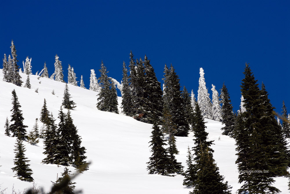
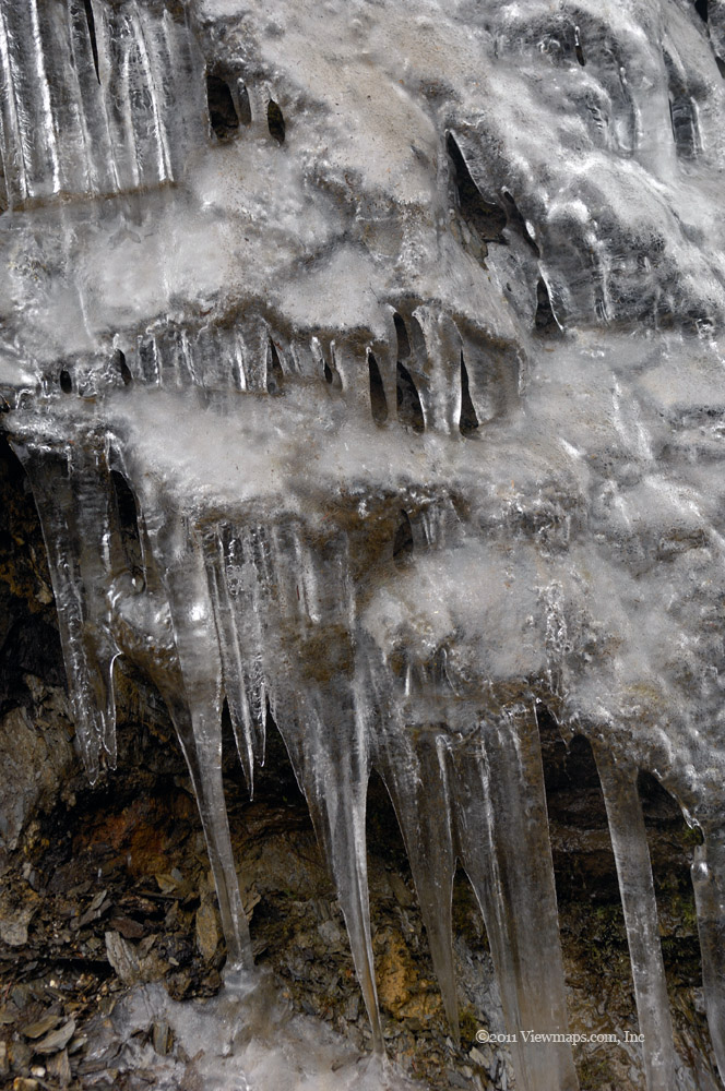
Soon we came to the major fork where the bulk of the recreational driving turn right to follow Stave Lake but we went left to climb the ridge. The first point of interest was Sayres Lake. We didn’t have great views of the lake from the road so we kept climbing the ridge. As we gained elevation and being on the north slope of Mt Crickmer, we were soon encountering snow. That was a growing concern as snow this time of year is very dense and once it gets higher than the undercarriage we would be stopped. So finding it this early was not a good sign. But I noticed that the road was actually plowed clear of the snow and then I realized that this was likely to provide access to the hydro water pipes linking the two lakes. That meant that the road would likely be quite drivable at least to the point the pump road splits off from the FSR.

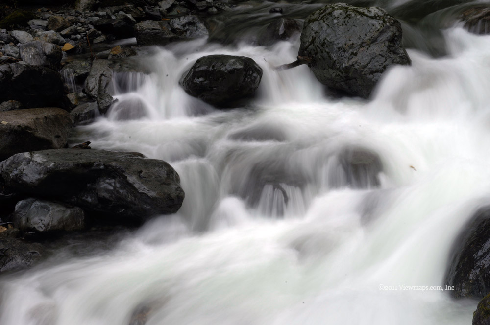
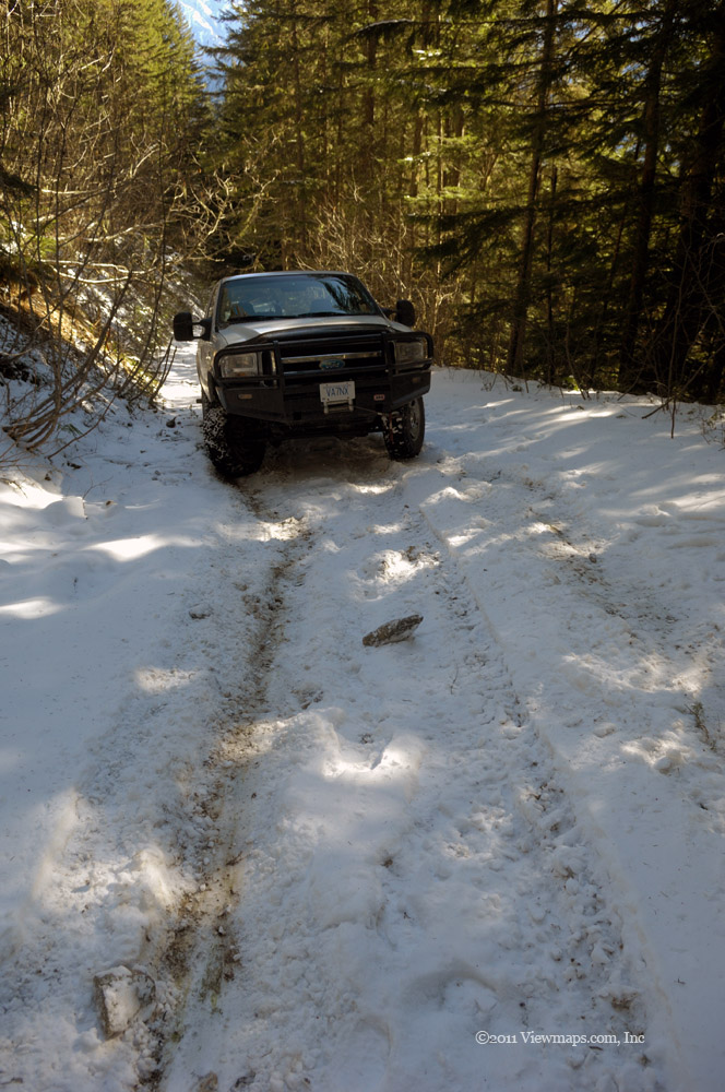
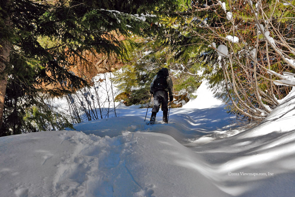
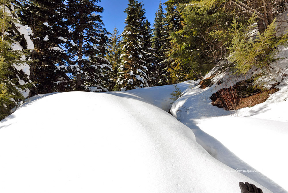
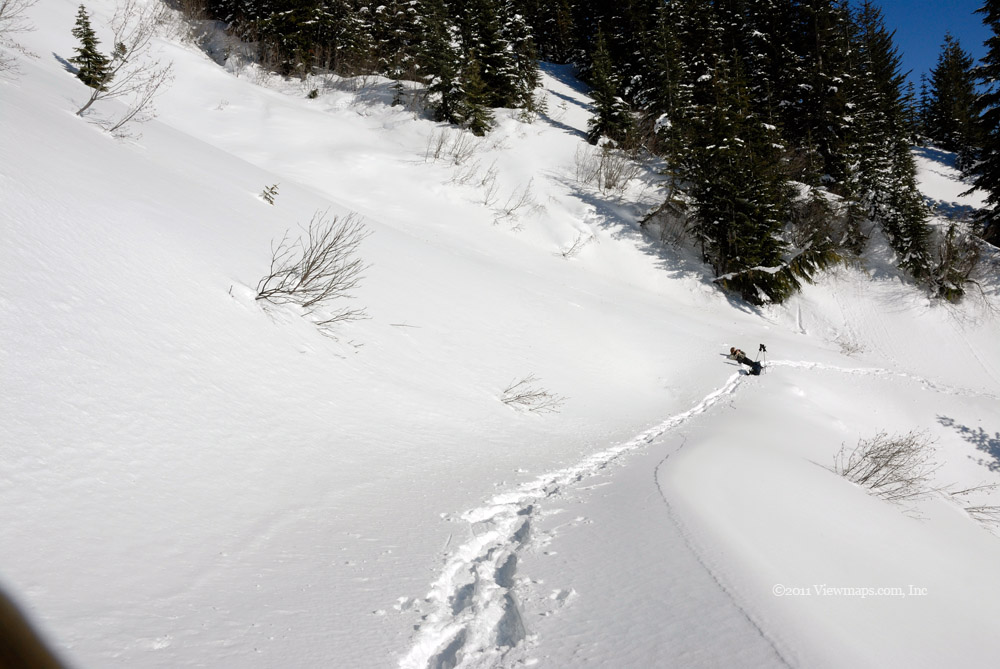
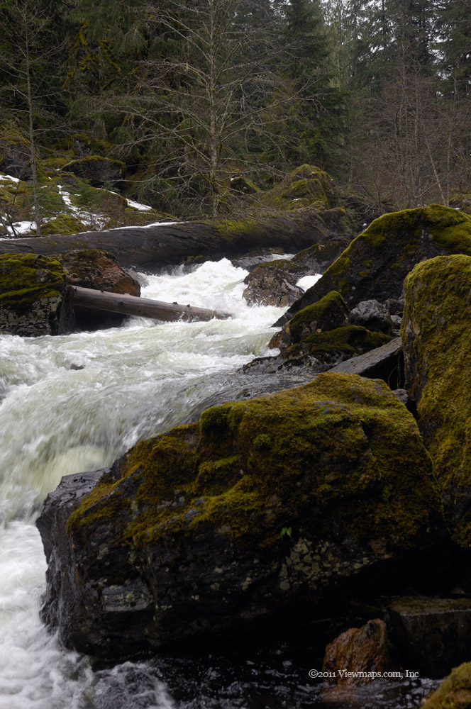
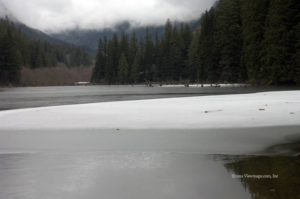
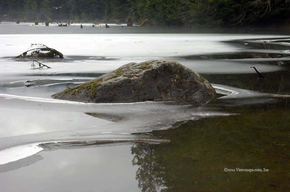
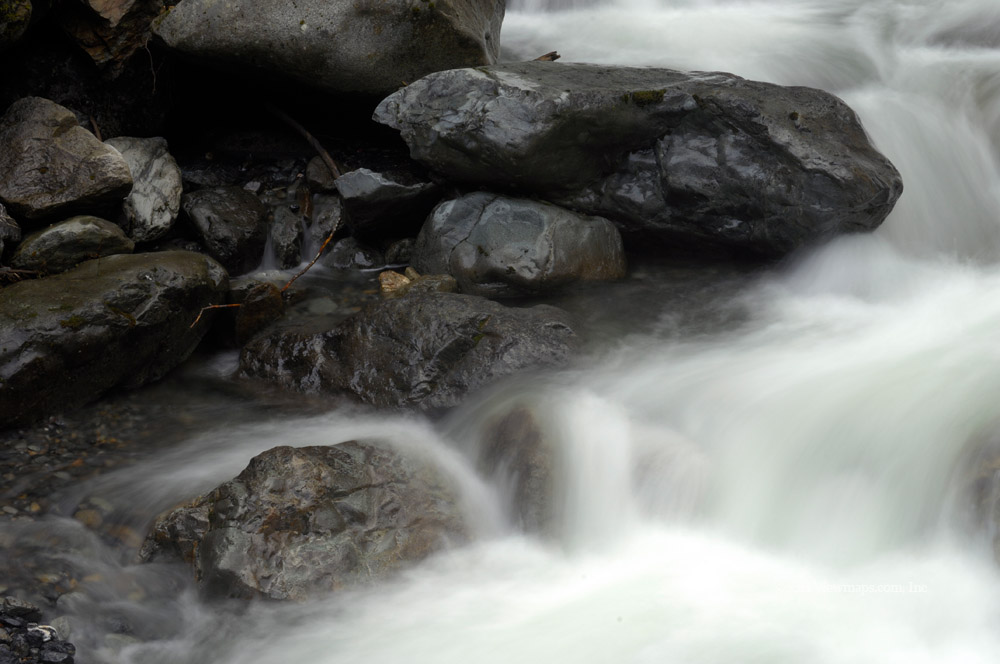
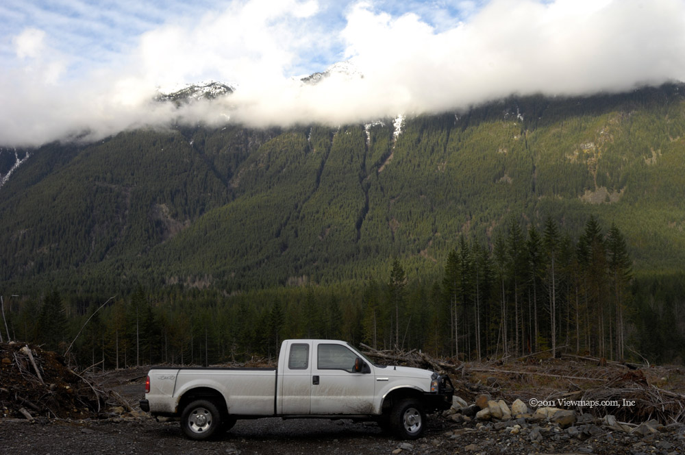
Feeling a bit relieved, we continued along soon passing Morgan Lake and Florence Lake. We stopped at the far end of Florence Lake to capture a few shots looking down on the lake. We continued on to the fork and sure enough the way down to the hydro facility was snow free whereas the FSR was covered in snow but with two ruts heading up slope. Geoff set the wheels into the ruts and pushed our way up the road. This continued past some lovely viewpoints of Stave Lake and then Alouette but soon the truck was struggling with the depth so we put on a pair of chains on the front tires and continued along for a bit further. But all to soon that was not enough so we parked the truck and thought about our options. 

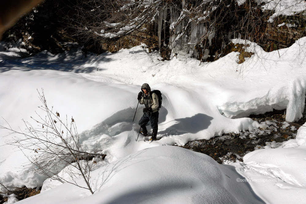
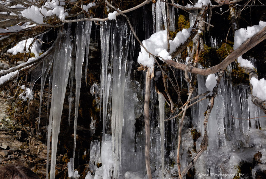
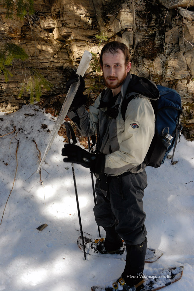
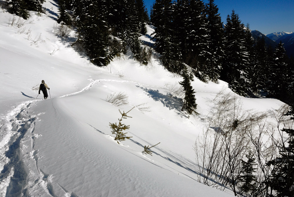
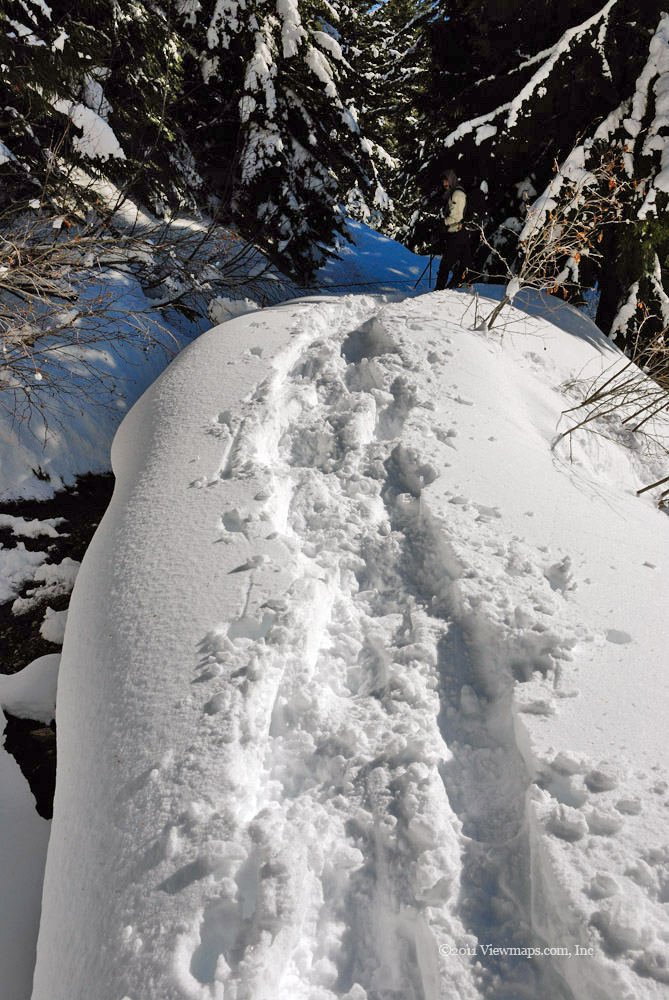
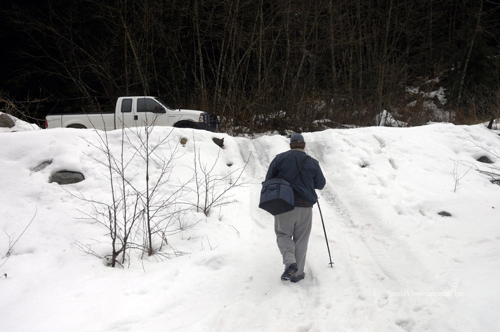
At the point we were stopped the viewpoint we were aiming for was only a half kilometer further up the road and since we had our snow shoes we decided to give it a go. Geoff and I quickly prepped the truck and got ourselves into hiking mode and set off up the road. The hike went smoothly as the heavier snow made hiking it easier than when we were trudging through the deep powder back in February. As we rounded a final curve we spotted the viewpoint and made our way up on to it. The whole time we were able to follow a previous track in the snow. Well we made it to the spot but we were quickly distressed with what we found.

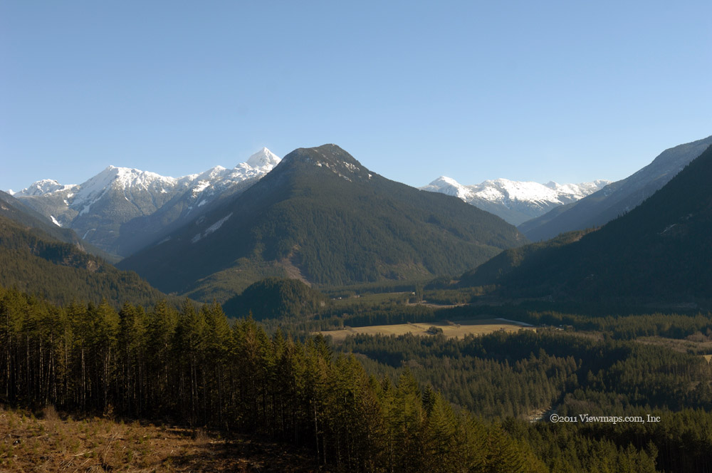
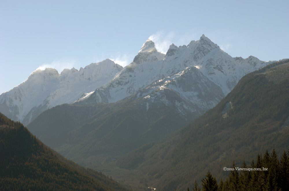
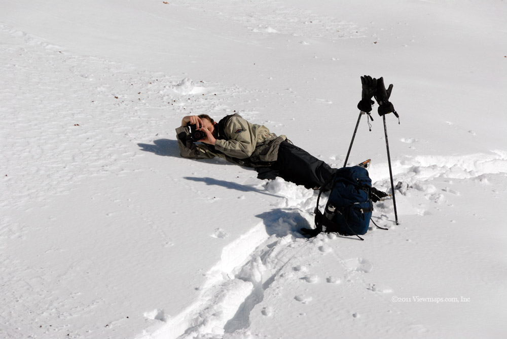
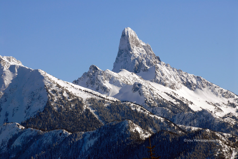
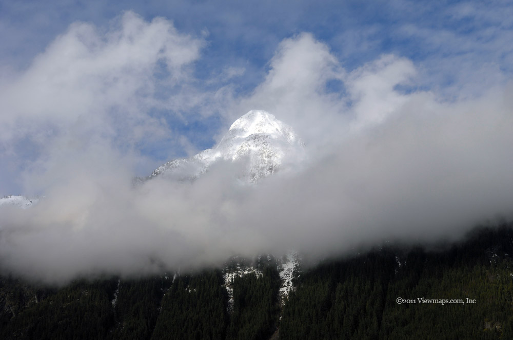
The intervening years had not been kind to the view, the young trees planted all throughout the area had grown quite a bit and now the view was blocked by trees! This was not what I was expecting and it was very disappointing. Not to be defeated, Geoff looked around and saw that the slope behind the viewpoint could be easily hiked and we walked up to a large group of rocks that were around 20 feet higher. There we had a better view. But continuing on further we found an even better spot with the view we had come for. It truly is amazing and breath-taking. Geoff was wondering how one could buy the land here and build a house to enjoy the view. After some time of enjoying the sights we reluctantly started back down the slope and road to the truck. It was lunch time and so we rested and enjoyed our subway foot-long.

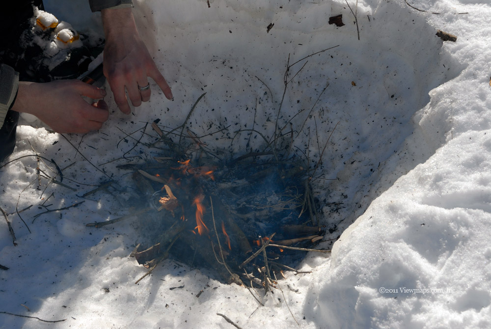
After eating we started back whilst trying each side road as we passed them. At one road we discovered a huge number of criss-crossing bear tracks – it looked like a highway! Fortunately the bear was not to be seen. A bit further we stopped to chat with a group who were enjoying some target practice. Two of the chaps studied my new tablet and GPS setup and were quite impressed with it. The computer was working like a dream and had none of the troubles the old one was having – problem solved and before any data loss!

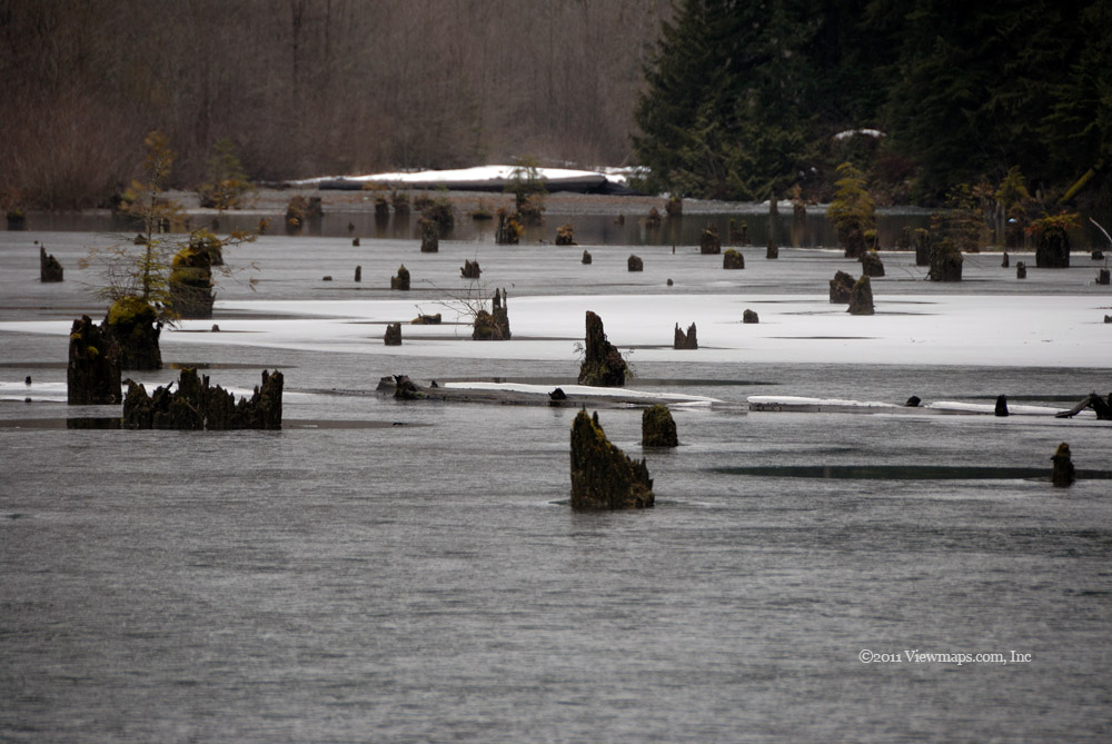
Once we were back down to the crowded area we took the right fork to explore the mud flats along Stave Lake. There we found some nice places to capture a few photos. At one spot we found an SUV that was stuck in the mud, a larger ATV was helping to pull it out. They managed to get the SUV back to firmer ground. So we drove on to other points but soon decided to head on out. But then we found a major new problem. As we drove out we came to a spot where the road was blocked by numerous groups standing on the road gawking at a truck that was precariously hanging off the road. Two trucks were hooked on to it trying to keep it from sliding down the side into a small stream where it likely would have flipped. They held it fast but couldn’t pull it back up. We offered to help and so we hooked the winch line to the truck and slowly pulled it back to the road. No problem for us. That winch certainly has the power!

After the winch work we drove on out of the area and stopped for a relaxing coffee in Haney before the final jaunt across the Golden Ears Bridge and the short distance home. A great day, not as sunny as I would have liked but we had a good variety of adventures and a good shakedown of the new computer. I guess I am ready for the next trip but it won’t be next week as my granddaughter has her first birthday next Saturday.

Deeks Bluff

The Deeks Bluff hike has been a fun hike which I have walked a few times. The last time I visited the bluffs was before the construction on the sea-to-sky highway reached the area below the bluffs and so today I was a bit apprehensive as to what changes I would find. The southern access was the one I have used in the past and now it was no longer a safe choice as the parking area no longer exists. As compensation, the northern end was improved and now a paved parking area is available for hikers. So it was with much excitement and a bit of uncertainty that Ethan and I set off for our hike.

The drive to the parking area went quickly and the improvements to the highway were nice – at least for the drivers. Once in the parking lot, we needed to find a spot with good radio access to the UBC repeater that we planned on using. One would think this would be a no brainer but the power transmission lines cross right over the lot and so the radio signals were being impacted. After trying a few locations we settled into one with a view of Howe Sound and started getting ourselves ready for hiking. 
The initial segment of the hike is along a logging road. The road is in drivable shape and we were wondering why we were hiking this section rather than driving. But we needed the exercise so we continued the hike along the road enjoying the sights as we made our way up. It was a pleasant enough walk along the road though I was getting impatient for some views of the sound. As we continued along the road we were wondering more and more about why we didn’t drive this section but then we saw some trees which had fallen across the road and were blocking it. So we felt a bit better and continued on past the fallen trees.

Soon we came by a lovely small waterfall where I took a number of photos. Continuing up the road we soon came to the place the trail leaves the road and we started making our way south, in behind the bluffs. The trail was quite passable but the ground was very soggy and wet in a number of places. We did make it around the puddles without getting soaked, so that was a nice bonus. After skirting our fifth large wet section we finally arrived at the fork where a side trail leads up to the first viewpoint. This is the highest viewpoint along the bluff hike but as it was the furthest one when one starts the hike at the south end , I only hiked up it once before. The short climb to the viewpoint was quite steep here but at least it was of short duration. 

The view from viewpoint was well worth the effort to get here. The trees are still low enough to not block the view and so one can see quite a bit of Howe Sound. When we arrived at the peak, the sun was starting to warm the place quite nicely and so we quickly dried off while we enjoyed our lunch. Ethan took some time to read his book while I scouted around for some alternate angles to photograph. I found the stubby pines to have some interesting character and paired with the large mossy rocks, the area offers a wide selection of imagery. I think I could spend much longer up there then we had time to do. As we had enjoyed a lovely view and likely the best one of those along the bluff, we decided to head home rather than continue along to the next viewpoint. The hike back went quite quickly as it was mostly downhill. When we came by the fallen trees we noticed that someone had cut them and now the road was open for driving, so we decided we would drive back up to the waterfall once we got back to the truck.

Continuing down we enjoyed a few views of the mountain peaks surrounding us –they are still quite snow covered and offered striking contrasts to the dull greens of the trees on the slopes. About a half kilometer from the end we were caught by a shower that kept increasing in intensity. Fortunately we had only a short distance to go. Shortly after reaching the truck the rain stopped and we were able to start driving up the road. When back to the waterfall, I got he tripod out and captured a number of slow shutter speed photos from various angles. Since it was still early we decided to continue up the road to see how far it went.

The road did go a couple kilometers past where we left it on foot - on into a flat area that was a bit swampy. This whole region is marked for a future housing development. Once that starts I am sure the Deeks Bluff trail will no longer be available though the individual side trails may still offer access to the viewpoints. So I guess we were lucky that the economic slowdown occurred and delayed the destruction of this lovely hike. Perhaps a return next year would be in order.

Anderson River FSR & the Alexandra Bridge

It had been over a month since my last trip to the hills and I was getting a bit anxious to get back out there. Today, Geoff joined me and we set out for the area around Spuzzum. We had hoped to get up to the ridge line looking down on the Fraser as the last time we were up there we only had a short amount of time and so could only travel along a few roads. Looking up at the ridge from the highway enticed me enough to want to try and reach the spots that looked like they would have some great views. So that is where we set off for this morning.

The drive up to Spuzzum went quickly and soon we were crossing the Alexandra Bridge and starting up the logging road. We decided to try a spur that led up the slope not too far in. The road was not too rough but definitely more overgrown than the mainline. After we gained some elevation we spotted a downed tree that was blocking the road. Geoff quickly got out his chain saw and started cutting away at the narrow end of the tree. He was quite pleased to have a good excuse to use his saw and so he worked on the incision with serious attention. While he was busy with the tree I took the opportunity to hike up to a small rocky outcrop hoping I would have a view of the valley but it was too treed to see anything. Returning to Geoff I watched him cut deeper into the tree and then his bar got stuck! Fortunately my chainsaw was also in the truck, so he got it out and finished the task with it. Once the tree was down his bar dropped out with no effort. Now that it was down we dragged it off the road and then zipped past the stump.

The road didn’t go all that much further as it led to a hydro tower. But there was a reasonable view from the base of the tower so we took a few minutes to enjoy the setting. Then it was back to the main line and on to the main event. The road was clear until we got in to the narrow valley connecting the canyon to the open range beyond. The snow wasn’t all that deep but it was heavy and we knew we wouldn’t get far before bottoming out. So we turned back and tried a second side road that lead up to the ridge just north of the main line. We gained some good elevation thanks to the south west orientation but as we got higher we slipped around to the north side of a rise and the snow was deep on the steep road. Soon we were stuck and sliding to the edge. Rather than take a chance with the situation, we hooked on the winch and pulled us up the short icy section and away from the edge. Once past the ice we were able to turn the truck around and carefully drove back down that snowy section.

We were back on the main line with most of the day still before us. So we had to find some more things to explore. As we drove out Geoff spotted a nice view point of the Alexandra Bridge so we stopped to gather a few shots. While crossing over thick moss covered rock we noticed some interesting lichens. So it was back to the truck for my macro lens for the next while I gathered macro photos of the various lichens and grasses growing on the side of the rock face. Once done, we returned to the highway and continued north to Hells Gate and Boston Bar. We stopped at a couple of points to take in a few viewpoints of the valley, unfortunately most were encumbered by power lines or overgrown trees! It can be quite the challenge to find a decent view of the river.

Just before Boston Bar we turned in to the second Anderson River FSR and hoped that with it being on the southern slope of a mountain, we would have better luck getting into the back regions. Unfortunately it wasn’t long before we were stopped by snow once again. Turning around we drove an alternate route down to the highway where we enjoyed a view of the town. It isn’t much to look at with a population of under 900. As it was now after 3 and we still hadn’t eaten lunch we decided to head home. A short distance back we stopped at Hell’s gate to eat lunch; the attraction was still closed for the season so we could only look across at the river below. After lunch we continued on down the canyon stopping once again just before crossing the Alexandra Bridge. 

Just north of the bridge there is a pull off that is partially hidden by trees, as we hadn’t looked it over ( assuming there was nothing there), we decided to do a quick look just in case. Well we did discover a road heading south along the river – between the main logging road and the river. We followed it until it was blocked just before entering a native land area. As we came back another spur took us to the foot of the Alexandra Bridge. Now we had a very different view of the bridge. So we decided to get out and walk around the footings, capturing some views of the bridge from various angles. It really showed off the height and size of the bridge – very impressive. One thing that didn’t impress was a large rusty bolt lying on the ground next to a key footing. I sure hope it wasn’t missing from the bridge! The bridge certainly does rattle and shake with each vehicle that crosses over it though – that is a bit unnerving. Geoff actually moved the truck from its first position as he noticed gravel falling on it from the bridge deck. We take so much for granted – just assuming that of course it was solid and in good repair.

Once done with capturing angles of the underside of the bridge we returned to the truck and then the highway, soon we were well on our way back to Hope and the Blue Moose Café! Our first coffee of the year in Hope was nice and set us up well for the final leg of the drive home. Though we didn’t get into the mountains as planned, we did discover some interesting sights just off the highway. It really doesn’t take much to find fascinating items to enjoy.

Snowshoeing on Mt Mercer

Al week the weather forecast for Saturday was for bright and sunny, and so for the entire week I was expectant of having a chance to get out and enjoy a nice hike on my snowshoes. The question in my mind was where to go. I wanted to get some elevation so one would have great alpine views. That meant I needed a south slope of a mountain as anything else would stop the truck at much too low an elevation. The Mt Thurston FSR sounded like a good choice and after checking some of the potential views on Google Earth I was very optimistic. But the snow level was unknown and if we couldn’t get above 1000 meters then the hike would be too long.

Geoff arrived shortly before 8:30AM and we got the truck ready along with our hiking gear but before we could start out I had one problem to solve. Geoff had to bring is his son over for Carolyn to watch which meant she wouldn’t be near the radio, since I really wanted her available, I had to set up the unit downstairs before we left. This took a bit of time but we were soon communicating and Geoff and I were on the road. Our first stop was the usual Fuel and Coffee in Abbotsford followed by a stop to buy sandwiches in Sardis. Then finally we were on the Chilliwack River road for the long drive up the river.

There were a lot of cars and campers parked along the river, the sun seemed to have brought out the numbers. Before long and the onset of boredom, we were off the pavement making our way along the Foley Creek road to the Chipmunk then the Chilliwack Bench and finally the Thurston! A lot of logging roads to get to the one we needed. The initial few kilometers of the road were quite good as there was new logging on the lower sections of the slope but soon we were past the active area following a road in bad shape. There were long stretches where water had eaten away at the road leaving deep trenches down the centre. It made for some scrambling as we maneuvered our way up!

Soon we were driving in snow and thought wthat we would stop to put on the chains at the next level section. Very soon however it became deep snow which stopped our way forward. Unfortunately we now had a new serious problem! When we stopped moving forward, being on a steep slope, the truck started sliding back down! This was not a good situation as the road wasn’t that wide here and the steep section went on for several hundred feet, if we picked up momentum it would be unlikely that we would be able to stay on the road. I really didn’t want to spend my day winching the truck up the slope to the road or worse, ‘wait’ for search & rescue to drag some bodies home. As we started sliding, Geoff was getting very anxious in his adrenalin enriched state but he kept a cool head and started guiding the sliding vehicle away from the road edge. We initially picked up a bit of speed but then the right front started dragging on gravel and we slowed down. In the end we had slid for around 30 feet before the front right gripped some gravel and we stopped. After a moment to recover our thoughts, we decided to put on the chains right there on the slope and not bother trying to find a level spot. They went on quite easily and we then had no problems on the slope though our confidence was a bit shaken at first. Unfortunately the snow got even deeper very quickly and we were forced to call it. Now for the critical question, had we reached the 1000 meter point which would allow for a nice hike or were we too low and would have to forego our plans? In fact we were at 1100. So the hike was on, now to find a wide spot to park the truck!

We didn’t find much of a widening but it left enough room for an ATV should one decide to venture by. In fact as we were getting our stuff ready for the hike 4 ATV’s did come by and zip past us. This was a disappointment as I had hoped to travel some virgin snow not follow in the tracks of a busy ATV route. Alas, they only got a short distance beyond the truck before they too were stopped by the deepening snow. So we would indeed get some unsullied snow to trek over.

The initial portion of the trail was not too difficult as the snow was crusty and only around 2 feet deep. But as we made our way up and into more exposed areas it got softer and much deeper. The wind had also sculpted it into deep drifts with trenches along the upslope side of the road. The hike was a constant up and down as we made our way from trench to drift. Over much of the trail we were sinking in a foot even with our snowshoes. We had a number of water crossings where small streams had cut a swath through the snow. The challenge with these was that the drop from the top of the drift to the stream bed was 2+ meters and on several occasions we almost toppled down into the water; the climb back out was no easier.

As we approached the upper regions with less trees and more exposure, the snow hid the path of the road and we could only barely make out the route. It being a bad year for avalanches, we decided that the exposure of the area was not worth the risk of continuing on. We had reached a spot with a great view of the southern peaks – Mt. Slesse to the SE, the Border Peaks and Tomyhoi due south and McGuire to the SW with Baker peeking out behind it. It was a very spectacular sight of the peaks in the winter with the wind blowing the snow off of them - was well worth the effort needed getting here.

While at the top of our hike we decided we would eat our lunch, it being after 2! While resting, Geoff wanted to build a small campfire on the snow. This had been a ‘burning desire’ of his since watching other hikers build a small fire on the peak of Hope Mountain to cook their lunch, so he gathered a few twigs and hollowed out a small area to house the fire. It didn’t take him long to get the wood burning and we now had a lovely little fire to warm our hands on. It was certainly a nice treat for my freezing fingers. Once we were done eating and soaking in the beauty we smothered the fire – not hard with all the snow around - and reloaded our packs and set off back down the slope.

The return hike was so much easier and faster than the way up. We were moving so fast at times that it was easy to trip up and fall into the snow- which I did a few times. Even with stopping for a few photos we were back to the truck in very little time. Now we could get warmed up properly. We got the gear stowed and Geoff edged the truck away from the edge of the road and into the travelled portion but it was far too narrow to turn around so we backed down the road for some distance before we could turn around – even then it was not all that wide or an easy task. Once turned, we bounded down the water eaten road and far too quickly we were back to the main bench road and then the pavement.

It was a great day with an awesome hike and many fantastic sights to remember. I do believe we picked well for the day’s adventure. Hopefully I’ll be able to get in a couple more snowshoe adventures before summer arrives.

Foley, Airplane and Centre Creeks

Today the weather was cool and cloudy so I didn’t want to chance a hike but at this time of the year one wouldn’t get far in to explore a new area. So I decided to try to drive the Foley Creek FSR once again, and see if I could reach the headwaters. Ethan arrived early so we got off to a decent start and made our way through Abbotsford and Sardis picking up fuel and lunch and of course a good coffee. Then it was onto the Chilliwack River road for the long drive to the start of the Foley Creek FSR. The drive went without incident and the weather seemed quite constant for the duration of the drive.

Once at the FSR entrance we started up the pothole covered road passing a few campers with trailers parked along the river. The number of people was low as camping would be a bit uncomfortable this week-end. Soon we were rambling alongside Foley Creek as we made our way up the road. We actually didn’t meet anyone driving the road our entire way up. Soon we were up to the lake where we decided to park the truck and hike down to the river just downstream of the lake. The ground was damp but not overly wet and the heavy moss covering trees and rocks made for a very richly coloured environment to enjoy. Once we reached the river I noticed that we were further from the lake then I had expected and so we would need to return to the truck and drive up the road further. But while here I gathered a few river level shots.

At one point, while taking a few shots from a rock out a bit from the bank I looked down to find my radio on the river bed under 6 inches of water with the battery detached! Not an exciting find! I quickly grabbed the radio and battery and shook the water off thinking well it was only a $60 radio. But when I snapped the battery in the unit turned on and it was working just fine! I doubt my more expensive Ham radio would have done as well. We returned to the truck and drove up to the lake where we explored the west end of the lake, we were still a bit before the main camp area and so had more swamp to work our way through but that was a fun challenge, picking our way around the deep mud. Once done with the lake we continued up the road hoping to reach the end. Unfortunately, not far beyond the lake the upper road was blocked by a new slide and we could go no further. So once again I didn’t reach the headwaters.

We returned to the lake and drove along the lower road to the creek on the east end of the lake. But here we encountered snow and couldn’t make any progress. As it was now past noon, we decided to stop and have lunch. While we were stopped we finally saw some other explorers, they were on ATV’s and were returning from having made their way further in along the lower road, I did envy that a bit. Once done with lunch we decided to back track and drive up the Airplane Creek FSR. 

The initial section of road was clear of snow, it was on this early section that two years ago we got the Pathfinder stuck and had to dig ourselves out! Today we sailed past and on up the road for quite some distance. We noticed another recent vehicle track and so followed it up a fork eventually reaching the SUV where a couple had parked and were taking some time to enjoy the area. We stopped to chat with them and locate our position on a map for them. They were scouting the area so that come summer they could return and hike the Cheam Range. It was too cloudy to see the peaks and so they didn’t get as much done as they had hoped, but at least they got a better feel for the roads. After chatting, we continued up the road to its end but soon found ourselves in cloud with no view. We decided to head down to the main fork and try the other branch which is where the couple had gone. We soon caught up to them as they were stopped by deep snow. The snow started much sooner on this section of the road as it wound around the north side of the slope. We chatted briefly again and then set off for the entrance.

We made one stop just before we left Airplane Creek, near the start of the road there is a fork leading east, it only goes a short distance as the bridge over Airplane Creek is not usable except for foot traffic. There I was gathered a number of photos of the creek rapids. Once done with the creek we decided to return to the Chilliwack River road but not head home quite yet. The last time I was in the Nesakwatch area I noticed that there was a growing path around a locked gate leading to the Centre Creek area. That was an area I have wanted to see for many years. So I thought a quick look at the condition of the gate and bypass would be worth the time.

We arrived at the gate only to discover it wide open! Well the opportunity after 10 years of denial was too much and we decided to drive though and explore the area. The initial section travels parallel to the Chilliwack River through swamp marshes and Salmon breeding grounds. It is for this reason the area is kept gated. We drove on through and soon came to the start of the Centre Creek FSR which we started up. Unfortunately we got in only about a kilometer before we were stopped by a fallen tree. Had it been earlier in the day we would have cleared the tree but we only had about 10 minutes of time to explore so we opted to drive further along the river to see where that road went. We did manage to reach a cleared section with a lovely view of Williams Peak to the north. The clouds were shrouding the peak at times which made for an interesting display of the mountain as we watched the sun dip lower in the sky. But our time was up and we wanted to get back to the gate before too long lest it get locked on us.

The gate was as we found it earlier so we had a lovely short visit to this ‘protected’ area. I do hope the gate remains open later in the season so we can explore the full length of the Centre Creek FSR but I have a feeling it was unlocked by mistake and that would soon be corrected. The drive had worn out my driver so we switched seats and I took over for the drive home. After a quick stop in Sardis for a booster coffee we made our way along the freeway for home. Though it was another dull day, we did get out and see a few interesting sights and had a good time exploring nature.

Mamquam and Furry Creek FSR's

Today being the last Saturday of January and my first trip of the year, I felt compelled to get out and see something despite the likelihood of rain. When Geoff arrived at 8:30 the sky was quite dull and the clouds were getting thicker, so we didn’t know what we would discover and weren’t sure the light would be good enough for photos. But we loaded up the truck and set off for our first stop – coffee in Cloverdale! Geoff wanted to stop at the Wired Monk on 168th as it was in an old heritage building with some historical stories posted on its walls. I found the place quite interesting and the coffee good. After a short look around, we left for West Vancouver where we picked up lunch supplies.

Soon we were barreling down the Sea-to-sky to Squamish. The road improvements for the Olympics made the drive go quick and before long we were at Porteau Cove where we stopped to look over the parking area for the Deek’s Trail hikes. The road work closed off the south access to the trail, a real shame, and for some time I have wanted to look over the replacement they built as a peace offering. The parking facility wasn’t bad and provides for a number of hikers. I’ll need to try it as an early warm up hike for the season. Once done with the review, we zipped to Squamish for fuel and then we were on the Mamquam after a few years absence.

The last time we explored here they were building a run-of-the-river hydro project and we had to avoid many construction vehicles. Now the project is complete and power is pouring into the grid! The work was generally well hidden and only a string of power lines for a couple kilometers and a large surge tank reminded one of the project. A small lake could be seen through the trees just upstream of the intake but it also was not that visible from the road. The initial section of road was bare and wet so we made good time to the fork where the Indian River FSR branches off south. As the gate was open we decided to head down it to see what we could discover. 

The road slowly climbed in elevation and we soon encountered heavy snow, but there were ruts to follow so we decided to put on the chains and continue in. The chains went on easily and we were on our way. Unfortunately we got only around a quarter kilometer before the snow got too deep for us and we were not only stopped but stuck! After a quick survey, we decided that since the tires were out of the ruts we felt that the fastest way to get out was to winch ourselves over a bit to get back in the rut and then back down to a wide section where we could turn around. The winching went smoothly though getting the cable placed proved interesting as we had to make our way through waist deep snow to get to a suitable tree. Once the truck had traction we backed it down the slope to the turn around spot. Geoff had to rock the truck repeatedly as he slowly managed to reverse the truck’s direction. It was a test of patience as he made very slows gains, but he didn’t get stuck again and we were back moving once again. Once past the place where we put on the chains we stopped and quickly removed them before returning to the main Mamquam road.

As we made our way in we tried a number of side roads until stopped by snow, they all offer some good driving opportunities come the thaw. On one of the side roads Geoff spotted a skeleton hanging off a tree branch! It was quite strange seeing it there – someone’s idea of a joke. Soon we were well down the mainline and at the bridge that crosses the Mamquam River. There we stopped for lunch and decided to not push on as the snow was rapidly approaching the depth where we got stuck earlier. While we ate the weather turned and it started snowing on us hiding any further photo ops. Now fed, we started to head out while exploring a few more short side branches, unfortunately we were back to the highway far to too early to head home. So we decided to check out a road off the highway that I spotted on the way here.

The side road led to a gravel pit which we were able to drive through, we found a decent viewpoint of Howe Sound both south and another one looking north to Squamish and the Chief. The wind was really whipping at us at the viewpoint and so we returned to the truck ASAP. We then continued back to Furry Creek where we decided to see if the Furry Creek FSR was open. It was, and after programming the road frequency into the radio, we set off up the road. There were a couple of foresters working and chatting on the frequency which kept us a bit of company. 

The previous time we were here we found a very steep side road that lead up a small knoll to where a lovely viewing platform had been built. Back then we were driving the Pathfinder and found the short road with switchbacks a challenge. Two guys we met at the top were quite amazed that we were able to drive up there. Well, Geoff wanted to drive it again but this time we were in a much longer truck! Not to be defeated, he actually made it up there and with little damage to the truck! So we enjoyed a few minutes on the platform; I was able to get a few shots but it had started to drizzle so our stay was short.

The drive down went without much issue and soon we were back on the main line heading further up into the hills. After some driving we saw one of the foresters moving his tree harvester. He was starting the slow drive out of the area. We continued in and soon came to the end of the cleared road. Here I made the mistake of saying we hit the end! So Geoff drove up to the end of cleared road and tapped the snow bank with the bumper. We then got out and I gathered a few photos. Unfortunately when we started to reverse out the truck wouldn’t move!

It seems that Geoff ran the truck up on the heavy snow and now we had no traction! I was not impressed. This time we dug out the snow from under the truck which dropped us down enough to back-up. Not overly hard or time consuming, just a bit embarrassing. On the way out we drove a side road which led to the intake dam for the Furry Creek run-of-the-river hydro project. We were here when it was being constructed so it was interesting to see the changes now that it was in operation. While looking it over, Geoff spotted a nice carbon fiber rake that had been lost down the river bank which he retrieved. It was in good shape and will make a good tool for our garden this summer.

After checking out the dam and the small lake it made we set out for the highway but soon came upon the harvester crawling its way along the road. Fortunately he was almost at a wide section of road so we were held up for only a couple of minutes. Out final stop was at the Furry Creek town-houses on the shore of Howe Sound where I collected some great sunset photos a few years back. No sun today but the area was still a great photo site so I gathered a few shots and then we started off for home with only a quick stop in West Van for a coffee. Overall it was a great trip even though the light wasn’t the best.

Subscribe to 2011