
Mt. Hollyburn Activated

I have hiked Hollyburn twice before, once hidden in fog and the other time buried beneath snow on the upper slopes. So today’s destination was not new but even so there are so many sights to see that one is always finding exciting new scenes to enjoy. My friend from the White Rock Radio Club, Ralph, wanted to climb another peak for the summits on the air program and he looked to me to select a summit that we could do without a lot of difficulty. I really quite enjoyed the Hollyburn location before and it is an easy trail with not too much elevation gain or steepness. And since I hadn’t been there for a few years I felt it would be worth a return visit.

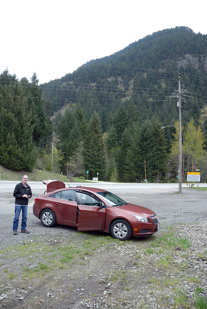
Ralph and I met the Thursday before our hike and planned out the last details. He arranged to borrow a KX3 transceiver from fellow club member Deme and planned to try a new simple antenna he recently purchased. So with the weather forecast looking good – warm but not overly hot – we felt that we were good to go. Early on Saturday I picked Ralph up in my back-country truck and we made for the parking area well up the slope of Hollyburn. It is convenient that this is a popular ski hill with road access well up the slope. The area was in fact part of the 2010 Winter Olympics. We made great time on the roads getting to the hill and the only challenge driving up the mountain road was avoiding all the cyclists that were heading up and then down the roadway. It really is quite surprising at how many there were. We arrived at the area near the access to the power line road where we could park and soon were finalizing our gear for the hike.

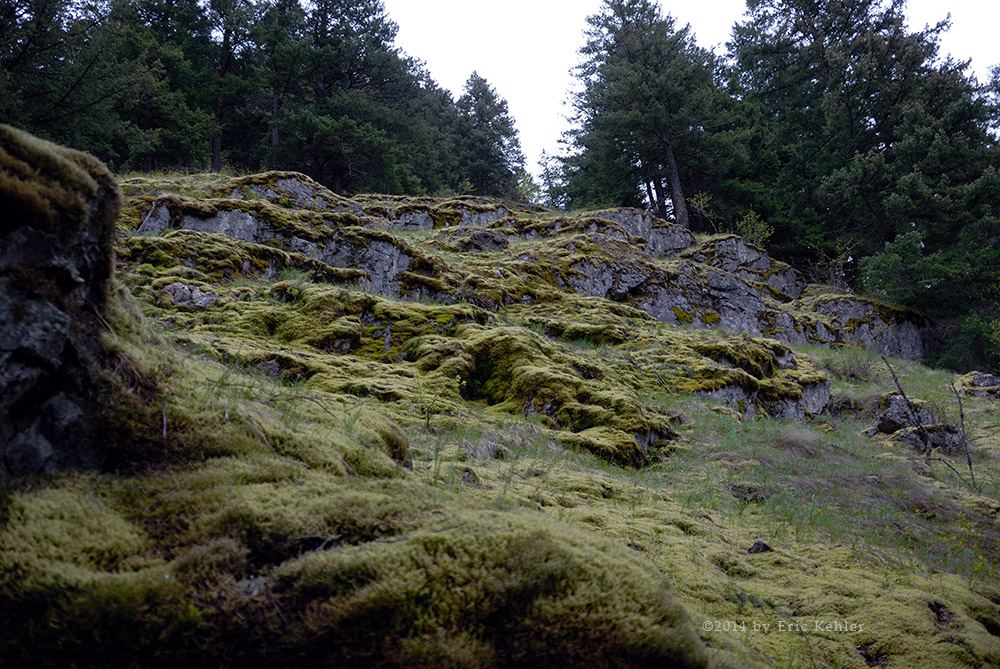
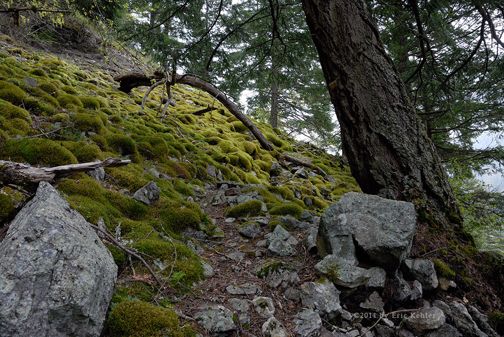
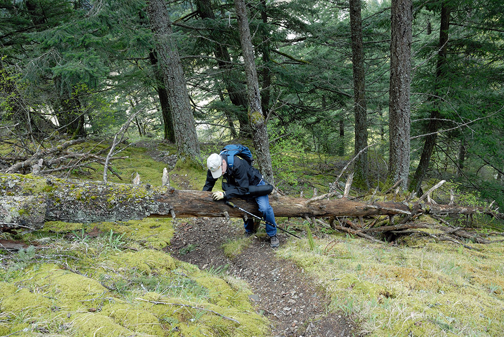
We set out at 9:20 and made good time up the first segment of the slope, looking back down at the truck I am always amazed at how quickly it shrinks to a toy size truck. Soon we rounded the first corner and came by a lovely lake where we took a few moments to enjoy the lily pads and the scene. I gathered a few photos as the place truly is quite beautiful. I could be content with just spending the day here and gathering photos from all sides of the pond but the summit was calling. Not much past the lake we left the power line clearing and started up the ski slope. Here the trail was well worn and very easy to follow. We were soon walking through a vast field of wild blueberries and they were ripe which added to our walking pleasure as they can be very sweet and refreshing. The early section of the trail doubles with a segment of the Baden Powell and as such is well maintained. Though the ground was dry there were numerous plank walkways placed to help hikers get over some muddy sections which even today made the trail easier. Once the trails parted, the Hollyburn was a bit less maintained but still in excellent shape and very easy to travel over.

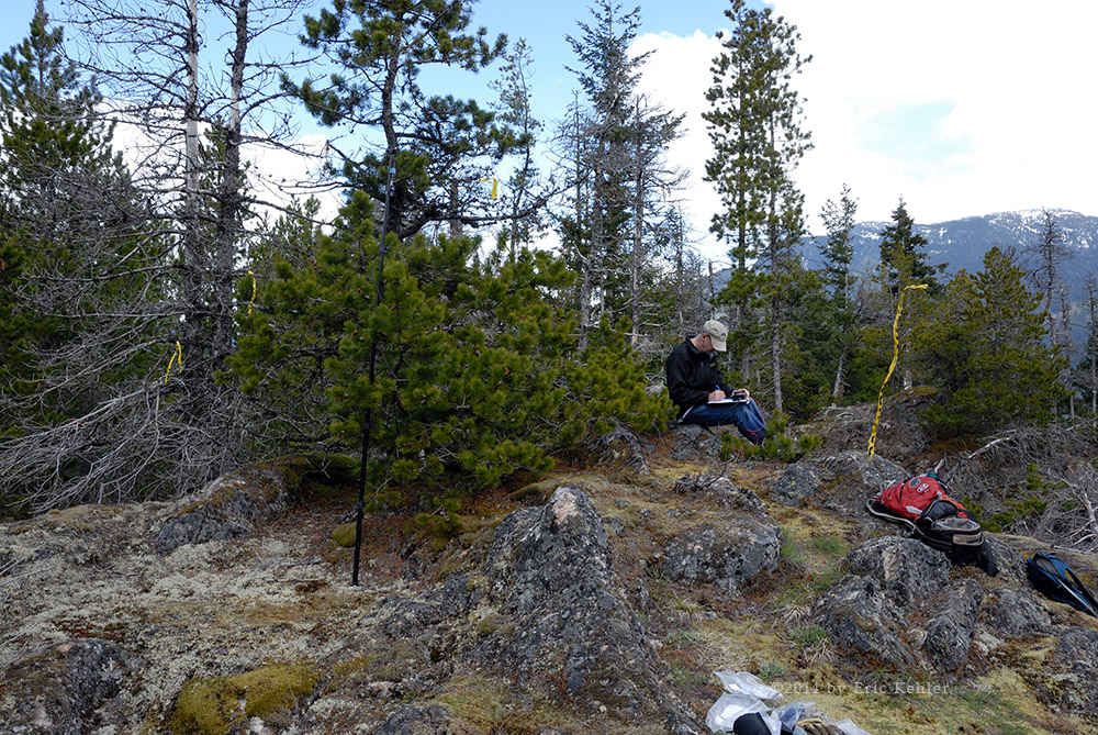
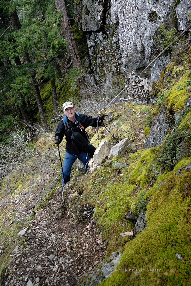
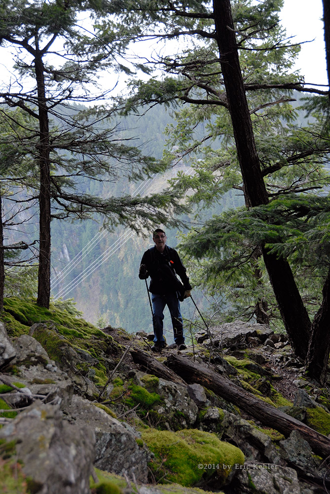
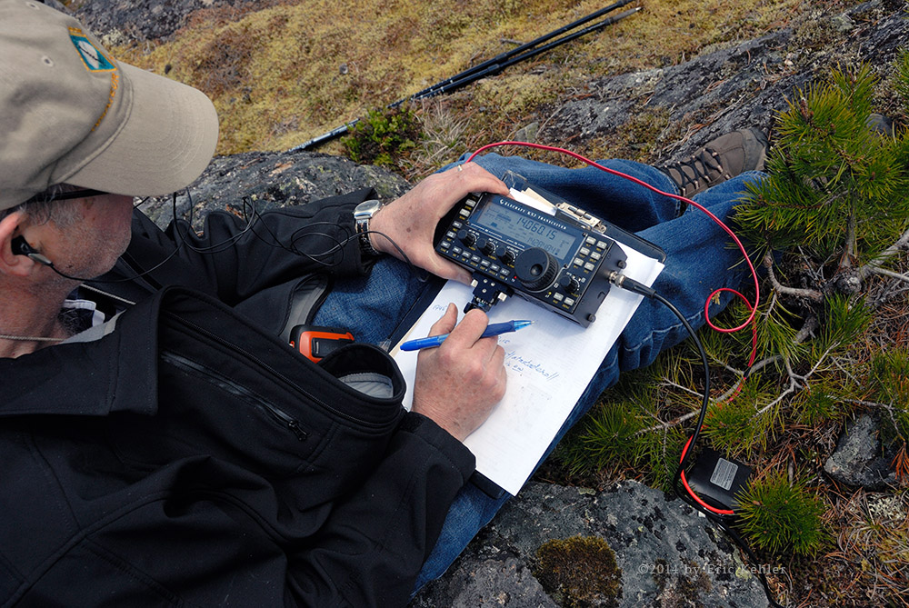
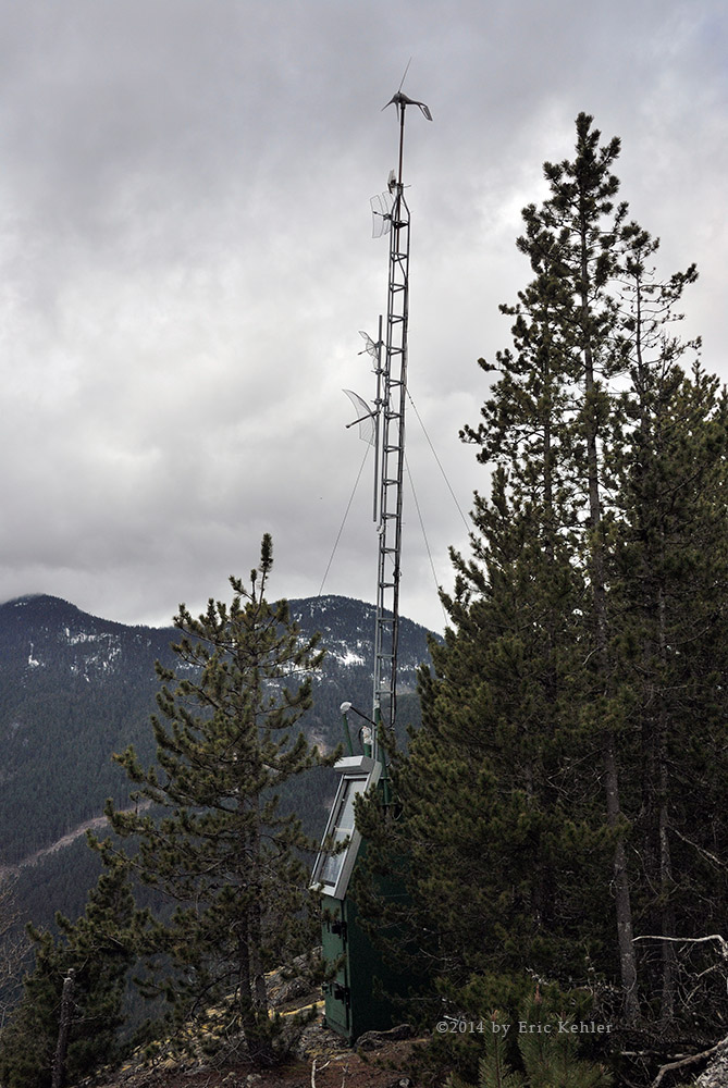
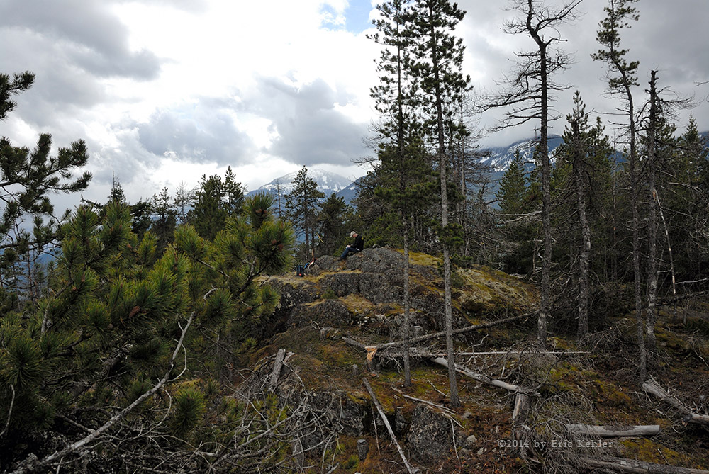
The ascent went well and as we were travelling through trees still early in the day the temperature was not bad and the sun controlled so our pace was fairly good and we made it to the summit in just over two hours. Perhaps not fast for a 20 year-old but then we weren’t really trying. The final couple hundred meters is the steepest section and a few short spots were a bit tricky for Ralph with all the gear he was packing. But soon we arrived at the rocky summit and peeled off our packs and rested and even ate a bit of lunch as we were up with 30 minutes to spare before the scheduled start time for our radio activity. There were several groups on the summit when we arrived and one was using the tree we wanted to commission for our antenna mast. They were quite willing to let us hoist up the wire antenna while asking about our plans. Though the antenna was new and well wrapped it still insisted on getting tangled. So Ralph had to spend time fighting the wires so they could be pulled into position. Fortunately they aren’t all that long and we had them in place in time for our planned start.

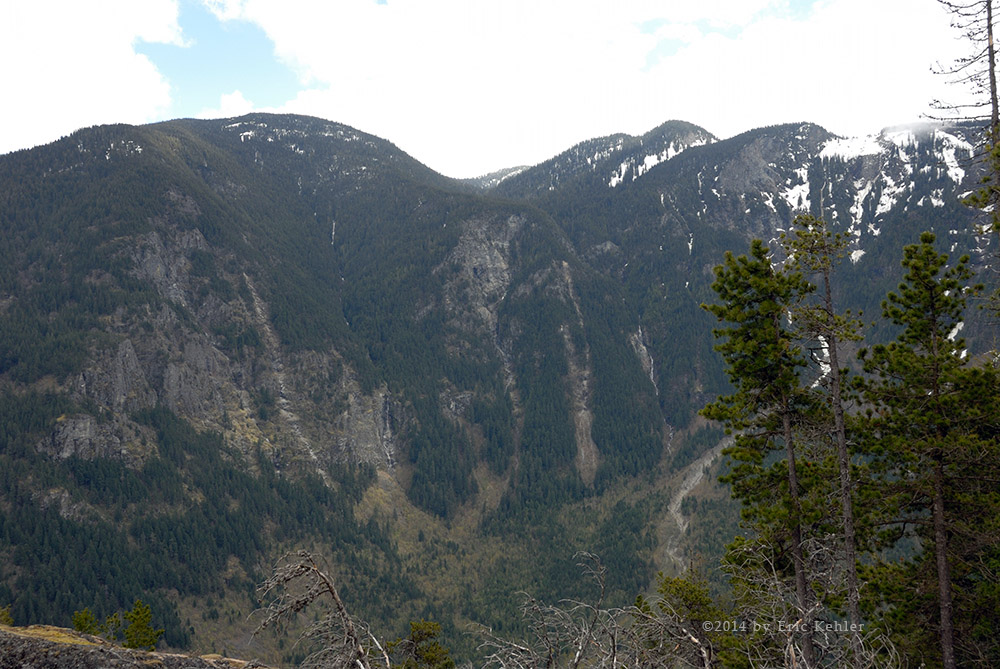
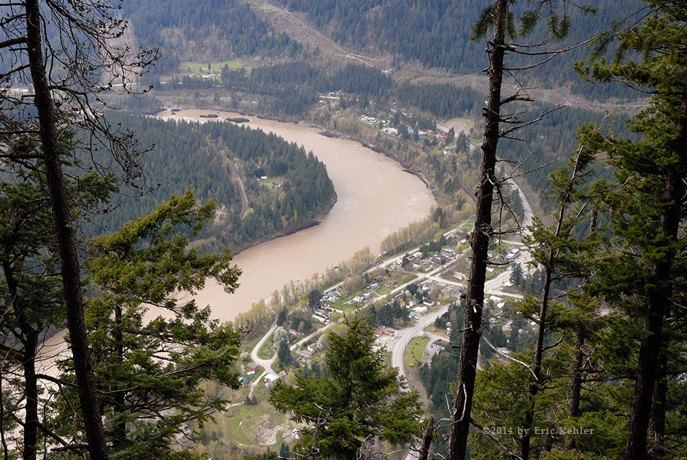
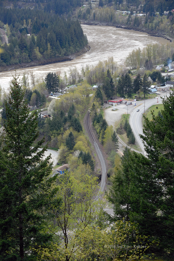
Ralph finished setting up the equipment and was immediately in contact with stations in the mid-west and California. Throughout the next two hours he worked stations across the continent – California to North Carolina. Meanwhile I was taking various photos from around the broad summit area and just enjoying the peaceful setting of the fresh air. The views of other peaks to the east and north are always spectacular but the view down into the Fraser Valley was obscured by smog and haze and left little to be seen. After I had finished lunch and feeding a few birds some nuts, Ralph set up his 2m Yagi antenna and I attached my small handheld to it. I put out a few calls and got responses form a chap down in Mt Vernon Washington and another just below us at UBC. I suspended the Yagi in a branch of a small tree and pointed it towards Puget Sound and called out for a contact in the Seattle region. Surprisingly I got a response from a mobile driver on the I-90 over 200kms distant. That’s the furthest I have done with my 2m handheld!

Well it was starting to get a lot hotter up here and we felt we had successfully activated this summit for the first time and so we packed up. We had a good opportunity to chat with numerous groups while on the summit and many were quite interested in what we were doing and quite surprised at the range we could achieve. The walk down went quite smoothly and we made good time. I was quite surprised at the number of groups still hiking up the slope in the mid-afternoon. I wouldn’t want to follow the trail in the dark and these people were cutting it pretty fine. But perhaps them being young they could do the trail in very little time if needed. Well, soon the truck was back in sight below us and we were on the final leg of the hike. It always feels good to get back to the truck and get those boots off. We rested and drank some cool liquid before setting off for the challenge of the high speed traffic. We made it safely home to where we could brag about our achievements. It was a good day not only for our radio success but just for enjoying the beauty of creation.

Uztilius Adventure

It had been two years since we last visited the Anderson and Uztilius region and being such an extensive road system we had seen very little of it back then. So it didn’t take too much convincing to head up there and see what we could find. The drive to the start is the biggest deterrent to exploring this road system as one needs to drive up to Boston Bar just to get started. In all we drove 500kms today most of which was on the highway coming and going. The drive to Boston Bar went quite quickly, the canyon segment of the drive had very little traffic and we made great time all the way from Hope to Boston Bar. After a quick top-up in town we back tracked a couple Km’s to the entrance to the FSR.

It was already hot by the time we started in but the air handling on the truck was working and we were able to enjoy a comfortable ride. The new tires gave us good traction on the gravel and we soared up the steep sections without any tire spinning or loss of grip. Previously we explored a few side spurs along the first section of road as it made its way south along the Anderson River but today we wanted to head straight for the narrow Uztilius Valley and start some serious looking once in it. That made for a quick drive south and then we started into the valley heading in a general north-easterly direction.

The lower section of this valley is much like those closer to the coast with firs and hemlocks though a bit drier. So far on the FSR, we came upon only a single truck on the road and we noticed one campsite along the Uztilius otherwise it was very empty and pleasant. In reviewing the map for the area we decided to try a major spur to the south but when we came to the fork it was washed out a few meters in where it crossed the creek that was quite disappointing. Continuing a bit further, Geoff spotted an interesting rock face across the creek so we pulled over to explore the creek. The short walk to the creek saw us pushing through some dead undergrowth and clambering down large rocks. It was obvious that no-one had been along here in many years. We soon noticed some interesting sedimentary rock along the bottom of the creek bed. The smaller rocks were embedded in the base rock and it had interesting patterns. The original cliff face that caught Geoff’s attention proved less interesting but it did get us down to the creek where we enjoyed some new sights.

Continuing on, we came by a piece of heavy equipment parked to the side and a very steep side road to the north. It was too challenging to ignore so Geoff turned up the spur and we made our way in. We soon came by a very steep section that had pure dust for a road surface. It was very slow going as we inched our way up the slope through the very low traction dust while creating a massive dust cloud in our wake. We did get up the road and after a few switch backs we came face-to-face with another track bearing piece of large road equipment. The operator was stopped chatting with a person in a safety vehicle. Once he spotted us trying to get past he started down the slope towards us. We backed up a few meters into a wide section of the switch-back to let him pass. Once cleared we continued up to the ridge and an extensive road network. Here they were busy adding in a new line of transmission towers. We drove up to the closest one, here they had completed pouring the cement base. It was interesting to see that they no longer tried for a level area, each cement pad was at a different level and all sloped inward. I gathered a few photos from the site then we drove up to a second tower pad, here the tower was in place but there were still buckets of bolts on site to finish the task. We decided to head back to the mainline as we wanted to finish exploring the narrow valley before I had my planned radio contact. The return down the steep soft slope went with little challenge and we were quickly back to solid level gravel.

Continuing along the valley we stopped a few km further along so I could get some photos of the slope to the north and below the transmission line. This slope is very steep with a talus surface and many dead trees along the upper section. It looks quite interesting, last trip we climbed up it a bit but today I was content to just gather some photos from the bottom. Meanwhile Geoff was trying out is semi-auto .22 rifle on an empty water bottle. We continued up the road and made our way along the headwaters of the Uztilius. It is a swampy area and we could only skirt alongside it on the mainline. Perhaps one day we can explore it on foot. Next we came by a major fork, the right branch continued east and down to the Murray Lake road area which we followed last time. Today we went left and soon came along a ridge with a view of a wide grassy swamp area with a winding creek through the middle. The road continued along it so we made our way down and were soon driving alongside the sweet grass. It was very pretty and here we looked for a pullout to setup our radio gear.

We found a wide circular area off the main road which was ringed with pine. It offered shade for the truck and some good places to string up the antenna. So we parked under some trees and pulled up the antenna into a nearby pine. Geoff tossed a hammer up and over the tree which we then used to hoist the antenna center. It was up in very little time and I was soon on the air. My first contact was with a station in Montana. He reported a solid clear signal. I tried for some time to reach the home base but there was no response from there, though one member reported hearing me. I then switched to 20m and soon heard a strong signal coming in from Barcelona Spain. I tried to reach it but there were too many others also trying and they were too strong for me to get through. I then heard a second station from Spain but the pile-up was again just too much for my setup. I eventually contacted a station in South Dakota before packing up for the day.

Well time had moved along quite quickly as it was now almost 4pm and we still had much to see. So back up the road we went to where we could best see the pond in the marsh grasses. Here Geoff spotted some geese on the water so we got out and I gathered a few photos of the big beaver pond. It was really quite a scenic spot and I would enjoy coming back with a canoe to explore the creek more fully. We decided to continue north and take a circle route back to Boston Bar. The map showed another major road heading back down to the mainline we had originally travelled and so we set off for the Spius Creek FSR. The drive to it went quickly but then we noticed that the Spius Creek FSR was much more over-grown and it raised a bit of concern. After driving about 8km west along the Spius Creek, the road became severely over-grown and we felt that it would not be worth the risk of continuing on only to be turned back in a few km’s. This was disappointing but not too surprising. At some point along the Spius our commercial antenna whip was dislodged from its holder. We did some searching but were unable to locate it. So I will need to add a new one.

We made decent time back along the Spius FSR and soon were back to the area near the big beaver pond. We turned back up to the ridge where we first spotted the marsh and then back to the original fork where we had turned right on our prior trip. We followed the road east and down off the plateau region. It was along this road that a snow hare bounded out of the bush onto the side of the road before stopping upon seeing us and quickly heading back into the scrub. Geoff decided it was worth pursuing as being just in season and he had his new .22 close at hand. So off he went and very quickly had his dinner meal in hand. Continuing along we were soon descending to the Murray Lake road.

Upon reaching the last road segment we turned right heading south. This was new ground for us as previously we turned north here and circled around the small range of hills separating us from the Coquihalla. The road south was in good shape and we made quick time. We stopped to take photos of a thick birch grove that we came upon. It has a very different look to the normal stands of evergreen or Alder that we normally see. The road soon reached the north end of Murray Lake with all sorts of campers tucked in along the lake. Here the road seemed to degrade from an active logging road quality to a well-used but poorly maintained road. It was narrow and squirmed its way between trees along the east shore of the lake. There were cabins and tents and trucks on both sides of the road which was now quite narrow and rough. I stopped at one point along the lake to gather a few photos before we passed by the lake. The road south of the lake was open but quite rough in a number of places. We were both surprised that cars actually drove to the lake along this route. After descending a steep rough section we spotted the highway just a short distance away. It took a couple kilometers more of road to reach it and once there we could relax a bit as we made our way along the smooth pavement. The new higher speed level was nice but we often weren’t even travelling that fast. Now that is something.

So on looking back over the trip I felt we had seen some nice new sights but that we still had seen only a tiny portion of what this region has to offer. We will need to return a few times just to get a handle on the many locations to enjoy.

Tricouni Peak

E
arlier this year I came across a story and video about some hikers watching a Sasquatch making its way across a snow field. They were on Tricouni Peak looking down into the slopes below. This caught my attention and I thought it may make for a good hike. There were a number of published hiking reports and the trail to the lakes is very popular in summer. So it became the goal for our first hike this season. Back in May we drove out here scouting the roads for the right choice of turns to reach the trailhead. We did quite well back then getting to within a few hundred meters of the trail-head before we were stopped by snow. That made today’s drive go quickly and we got to the trail with no distractions even with almost bald tires.

The one concern we had in starting out today was the forecasted high temperatures. A lovely sunny day but it was going to be a hot one and I don’t hike well in the heat. Well having arrived, we got our gear together and started for the trail. There were already two other vehicles along the road and so we knew we would be encountering others along the way. The first section of trail was cooled by trees and the ground was quite solid, I was hopeful the mud would be not as bad as described. But then we came to the first patch. It was slippery and not easy to get around. The edges were generally more solid and that is where I tried to walk.

We continued along the trail walking over solid ground alternating with thick deep mud patches. Early on Geoff took one step and sank in over a foot deep in the goo. He was more careful after that experience. Fortunately his gaiters kept the mud from flowing into the top of his boots. My boots weren’t as waterproof as Geoff’s so I had to be much more careful. Well we kept walking and the patches of mud kept coming some were thick mud others quite loose. At least the trail was easy to follow through the valley leading to the first lake. After an hour forty we came by the first of the alpine lakes. Here the area opened up and the ground was solid.

Our first views of the alpine lakes were quite amazing, it truly is a lovely sight and I can understand why so many come just to visit the lakes. But our goal was to reach the summit towering over us. So after gathering a few photos and just enjoying the scene, we continued along the trail leading up the slope to the next lake. It roughly followed the creek which it made its way between two lakes. It was very beautiful in its own right. After gaining some elevation we mounted a ridge and there we spotted the second lake along our route. At its shore was a small campsite with a few tents setup. The occupants were not around. I guess they were out gaining the summit.

Now the trail followed along the edge of this lake but it first crossed over the outflowing creek. This was our second challenge of the day. The water was flowing fast and the creek was much deeper than our boots high so we had to figure out how to cross it and stay dry. Geoff found a few rocks that were a couple inches below the surface that he used to cross but my boots would not stay dry if I used that spot. So I walked down stream a few yards and found another series of rocks and logs that were not so submerged. Here I started across. Geoff lent a hand to pull me up when I got near the far side. It worked and my feet remained dry enough.  We continued around the second lake and started up the slope at the far side which was where the stream flowed coming from the next higher lake. This area was heavily strewn with talus and the stream was flowing fast between the rocks. It made for a challenging climb up the slope and it was getting hotter out; I was starting to feel the heat and be slowed down. We made our way up a steep section of the trail and crested another ridge which brought us to the top of a lovely waterfall which we were enjoying from the distance. Now we had an easy walk to the close side of the upper lake.  Here we took a bit of time to rest before starting the slog to the peak.

By now we had been passed by a couple of other pairs of hikers and I could tell that frustrated Geoff who was being held back by my slow progress. We started around the lake following a well-worn trail. We made our way up the far slope but here the trail was not easily found and we climbed up faster than needed and ended up in steeper terrain then we should have been in. But by now it was near the hottest part of the day and I just couldn’t keep it going. We had another 400meters of elevation and perhaps 1100m of trail. Geoff was also having pain in his shins and so he felt it best to not push it as well. So we reluctantly started back down to the upper lake and once there we pulled out our portable chairs and ate our lunch. I had brought my new water filtration kit and siphoned off some of the cool lake water. It felt quite refreshing on a hot day. I was also able to reload our two water packs for the return trip.

After enjoying the spot for some time and taking with other pairs as they came and went, we packed up and started down the trail. It went much faster on the way down as we now knew where we had to go and I didn’t need as many rest breaks on the way down. The talus was still very challenging but soon I was staring at the fast flowing water crossing once again. Geoff zipped across with little thought but I had to find a spot I could cross without getting wet feet. I found the spot and Geoff waited on the other side with an arm for help. It was a good thing he had a good grip because my feet slipped on the wet rock as I reached the far side.

Done with the hard stuff we had only the mud to deal with once we got down to the lower lake. The trail through the mud seemed to take forever on the way back. Though downhill it was much hotter and I was getting quite worn out. I did get through the mud pools thanks to my two walking poles, without them I would have fallen in the mud more times than I could count. But they kept me quite mud free. Well we finally reached the truck and here we were too tired to move fast so it took longer than expected to pack up and get moving.

I called John on my ham radio to let him know we were on the road as he had promised us some cold lemonade when we reached his place. He had been monitoring the band for us during the hike lest we need some help. It is the power of ham radio out here as we had radio contact the whole time we were hiking, a great safety tool. Done with the hike the drive down the B200 to the mainline seemed to take forever, we were just too tied for patience. Just before we left the side road Geoff pulled into a short spur where others had done some target practice as he wanted to try out his new rifle. It is a semi-automatic .22 with large capacity magazines. It worked quite well for him and he was pleased with his new rifle. Well we were done with the back-country and we made for John’s place just past the start of the FSR. We enjoyed a large quantity of cold lemonade and then set out for home. A good day – tiring –and we didn’t reach the summit, but it is an awesome place and we had a good time.

Map

Silver – Skagit Valley

I wanted an easier drive in the hills today and as we hadn’t been up the Silver-Skagit for a while, it seemed like a good choice for the day. It would also give us a chance to find the granite quarry we came by a few years back. So we left the house with the newly repaired truck and made for the town of Hope. We arrived at the start of the mainline in good time and started up the initial paved section of the road. We passed a number of places selling firewood. This always seems so strange when there is so much lying all around ready to split and burn!

Once off the pavement we found the gravel freshly graded and it was so smooth it was like driving the asphalt! In fact the mainline was smooth all the way to the start of the Skagit Park where we stopped. It likely continued to Ross Lake! Not at all like it normally was. We made good time along it and with almost no traffic the dust was minimal as well.  We commented a number of times at how smooth the road was, it really didn’t feel like the back-country. I am sure that it will be a lot rougher by the end of the summer.

We made our way in not stopping until we reached the upper Klesilkwa. Here we turned in but soon were stopped by over-growth. A new logging road spur set off north along the edge of a slope and so we drove along it to its end where we spotted some lovely log sections that would have made a good replacement for the one in my front yard that finally rotted and was removed. Unfortunately the combined strength of Geoff and me was not enough to move the log into the truck. We grumbled a bit and decided to look for slightly smaller and less interesting choices, we never did find one. This area proved to be not the one with the quarry and so we continued further up the mainline and tried the Maselpanik branch.

The Maselpanik Creek proved to be interesting and we were able to get down to it in a couple of places to capture some lovely small waterfalls as the creek made its way down the steep valley and over fallen trees.  Through the road wasn’t overgrown we fairly soon encountered a steep washed out section that was just too rough for our truck to carry on. It was a disappointment as I have wanted to explore this road for some time. Another case where an ATV might have done it for us. We turned back and followed a lower branch north along the edge of the slope this was the road where we came by an excavator on our previous trip with a split open bucket. This ended with no quarry in sight though the terrain was similar to our memories.

We returned to the main line and back tracked to an exit we had passed just prior to the Maselpanik. It was labeled with a hand crafted sign saying ‘Mac’. We turned in here and followed the right fork not far from the mainline.  This road wended its way alongside a huge boulder field and made for the river but we encountered a campsite with people and tents setup right in the middle of the road! I don’t understand why people set up their tents blocking a road! We turned back and stopped beside the boulder field where we got out and hiked in to get a close look. One massive one was split with a carefully drilled set of holes. We now knew we were close to the quarry. Geoff and I climbed over a number of the huge rocks and I was able to find a number of interesting views to shoot. After climbing a number of the rocks we returned to the truck and made for the left fork. This one was quite short and led directly into the centre of the quarry with the huge granite slabs placed around the edge. Another older couple was camped at the far side of the clearing so we didn’t stay long. It seemed that the number of huge blocks was significantly lower than what I remembered. Perhaps they were still hauling them out. Well we found the quarry but it wasn’t as interesting as we had hoped. As there the place was occupied we decided to return to the mainline and find another spot for lunch and after all that I forgot to take any photos of the remaining slabs!

We made our way further south and entered into the park but decided it was not where we wanted to explore so we back-tracked and took the first side road on our right that led up the shallow slope. At the end of this spur we stopped for lunch and Geoff did a little target practice. It was from this spot that I got some nice winter shots while driving with Ethan a couple years back. Done with lunch we started the journey back up the mainline. We continued to look for a nice log for my yard and drove a few short spurs looking but we found nothing of interest. When we reached the Upper Silverhope FSR we turned onto it and drove in a ways but it was too narrow for us to continue in.

As we continued our way back we reached the Cantelon Creek FSR. Though the main road is washed out a few kilometers in the side road that leads up the northern slope – the eastern flank of Mt. Hansen - is one I have driven a number of times but never able to reach the end due to snow. I thought it would be worth a try. So we made our way in and up the road. It being mid-season the side growth was heavy and I almost didn’t recognize the place. We reached an area with some open wide spaces but today they were heavily overgrown with small alder and the once amazing views were gone. But we were able to continue further up and eventually we reached the end! At least the drivable end. Here we had some lovely views of the Silver-Skagit Valley and the peaks along the eastern side. Shortly after we reached the top, a pair of small ATV/dune buggies arrived behind us. They stopped a switch-back below us but where they could enjoy the same view.

Well we were now done in our minds for the day. The truck had done well and the tires held out one more trip, they really do need to be replaced before another romp in the hills. The drive out went with no issues and soon we were back on the pavement and the high-speed of the freeway home. It was a pleasant trip to the hills, one where we didn’t push it much but just took the time to relax and enjoy the scenery.

Squamish B200

Trips to the hills have been a bit scarce this year so far, so for us today it felt really good getting out and exploring some new areas. I have been on the B200 branch a couple times previously but there was still large areas we had not seen and so today we made it our plan to spend the day in this one area and look over as much of it as we could. It was still early enough in the season that we were stopped by snow short of the road ends but we did get up to 1150m elevation before the snow became a problem.

Our first goal for the day was to find the correct roads for our planned hike later this year. I had heard about Sasquatch viewing from the slopes of Tricouni and so I studied the route and felt it would be a challenge but achievable for me later this summer. I doubt we will see any Sasquatch but the views will be magnificent. So with that in mind, we set off for the valley and the B200 side road. It being a long week-end we encountered quite a few cars and SUV’s on the mainline. Fortunately they were likely all camping along the river and once up the side road we saw only two vehicles the entire day!

The one bad thing about campers in the hills is that they kick up a lot of dust on the road this time of year. So we were glad they stayed away from the side roads. Early during our drive in there was one truck hauling an ATV that came racing along the road towards us as we rounded a curve. It was taking the curve wide and got a bit close to us. Some of these guys really need to smarten up on these gravel roads, hopefully he got enough of a scare to slow down around the next bend.

Once away from the traffic jam, life in the hills resumed its sense of freedom and solitude. We made good time climbing the initial steep section of the road as it ascended the slope to the ridge bordering the High Falls valley. While on the mainline, we saw some hikers getting ready for the High Falls. Later as we were coming out we met three pairs of hikers walking down the B200 towards the mainline. They were making good time on the road but still looked quite tired out.

I had loaded the track of our previous trip to the B200 and studied it to see what would be new and where we should go for the Tricouni trail. The map made quick work of our planning and we soon were on the spur to the tail head, it was a new one to us and so we enjoyed seeing some new sights. A bridge across Belia Creek offered a lovely view of a small waterfall just above the bridge. The early part of this road was easy driving but as we gained elevation the brush was leaning in on the road and I am sure once covered in leaves, the road will seem quite narrow. We made our way almost to the end but snow finally blocked our way and rather than push it, we decided to just take a short walk up the slope and enjoy the view. The road-end was just a half km further.

Once done with this spur we tried a short second branch that dead-ended almost immediately but here I continued along what was once a road and made for the point where it crosses over a low ridge. Here I had some nice view of the High Falls valley and Cloudburst peak to the south. A nice spot but I was getting spat on by some rain so I opted head back to the truck in case it got harder. Once back to the truck we drove back down to the main branch road and continued in across High Falls Creek and then we drove a branch that traveled back along the creek but on its east side. Soon it started up the north slope of Cloudburst and we made our way up until snow blocked our path. We turned back to a level section of the road where we had a lovely view of the valley and the Tricouni side road we had been on earlier. Here we set up our gear for lunch and to just enjoy the view. While enjoying the site, we watched a shiny blue SUV slowly make its way along the road we were on, we wondered if they would drive as far as where we were eating but not long after we lost sight of them due to a ridge, they had turned back and were on their way out. So we had the place to ourselves. Done with lunch we started back down, as we started down my friend John, a local Ham who lives just before the start of the Squamish mainline called on the radio and we planned our visit once we were finished with the roads.

We tried another side road but this one ended with a large diversion where a fast flowing stream crossed the road. – annoying as there was still a lot of road beyond this point. Geoff tossed a few large stones in the fast flowing water to give him stepping stones to cross. He was determined to not be stopped by the creek, even if it was just for him. So it was back down to the main side road and back across High Falls Creek to another branch we had skipped past earlier. I had driven part of this one before but it provided some nice views of the Squamish valley so we drove it again to get to the views. One branch which was recently cleared blocked us with snow but the other gave us the views we were looking for. It was right along here that we snapped off our radio antenna on a prior trip, today we were more careful!

Done with this area we returned to the main access road and started down the very steep section leading to the Squamish valley. Here is where we met the first of the High Falls Trail hikers. They asked if we could give them a lift but on learning of the distance back to their cars, they felt they would just carry on.  Part way down the slope the road forks with the B220 heading north. Last time I tried it the road was blocked quite early by a small slide. Today we were able to pass the old slide area, I pointed out the huge tree that had been across the road, parts of it were now laying alongside of the road. We got some distance in but eventually got stopped by debris on the roadway. If it had been earlier in the day we would have cleared it but by now we felt it was time to turn back.

Soon we were back down and driving the mainline, here we met up with the couple we talked with earlier, they had almost reached their car. They were moving incredibly fast. The road was still crowded with cars and dust and so we were all too happy to reach the pavement. We drove a km and turned off into John’s yard where we met him out looking over his huge wood pile. We chatted about a number of his projects for the next hour before continuing on our way home. It was a lovely drive and we felt that we were now ready for the hike later this year.

Activating Mt. Lincoln

Earlier this year Ralph and I planned a radio outing to activate another mountain peak this spring. We wanted one that could be done early in the season and as there are limited peaks listed on the chart which are registered for the summits on the air program, Mt. Lincoln was the only local summit that fit the bill. So we planned to hike up on April 26th, late enough in the season to melt the snow and have a good chance for decent weather. We also were hopeful a few other members of our club would join us. Well, two others had planned to join us but in the end only Ralph and I set out.

We had a quick drive out to Yale and were ready to start our hike at 10:30. The weather didn’t look too bad – broken cloud – with only the odd slight drizzle, so we started out and made really quick time crossing the highway to the trail head. Then for the next two hours we slogged our way along the steep trail, over logs and loose rock. There were a few places with ropes to help one get up some steep sections and across one rock face. It was a good hike and we felt we did it in decent time. Once on the summit Ralph immediately unpacked his radio gear and we stretched out his wire antenna for our first contacts.

Soon Ralph had a number of contacts in his log including two other operators who had climbed peaks themselves in California! The weather continued to hold but with increased wind and the odd bit of drizzle and hail. I ate lunch and went for a walk around the broad summit. It looked a bit different than last time as the sun was blazing hot on my first visit. A short distance from us at the summit is a solar and wind powered radio repeater. I wasn’t sure all that it was doing but I noticed that I had a strong signal to a Wifi access point, though it wanted $5 to join. So I guess it provides some internet connectivity and likely a link to some rural communities further up the canyon.

Once Ralph had made a few contacts he broke for lunch and I tried a few calls, though I could easily hear several stations on the east coast, there were many trying to reach them and I wasn’t able to get through. After lunch Ralph tried again but now the band seemed more difficult and he wasn’t able to get through to any additional stations. The wind was also getting quite bitter and it looked like rain was on the way. So rather than get caught out in rain on a steep slippery slope we decided to head down.

The hike down always goes faster but it isn’t always easier. I found the section crossing the rock face a lot more challenging in the downward direction and it actually took me longer to cross it than on the way up. The balance of the hike went quite smoothly and though I almost twisted my ankle at one point I was able to avoid putting weight on the foot at the critical moment and so I escaped the ordeal no worse for wear. Ralph on the other hand managed to jar his ankle just 150 feet from then end! I guess he got too excited seeing the end of the workout just before him!

Looking back on the adventure, we felt it went well and we successfully activated another summit for its first time. Earlier this year we submitted a number of additional peaks to the list and so now we have a number to try that are all easily within our skill level. So I expect to do a few more this year.

Britannia Beach

It’s been far too long since my previous trip the hills. This year has gotten off to a very slow start thanks to the weather and various other tasks which have been in the way of the all-important drives through the hills. Well finally today we were able to get the weather to co-operate and so off we went to the Britannia Beach area and the logging roads over-looking the town of Britannia Beach. To access the roads above the town one turns off the highway at the logging road entrance just past Furry Creek. This access point actually provides the way in for both the Britannia Beach roads and those in behind Furry Creek.

The initial section of road starts with a steep rise to get up above the highway level and into some serious trees and rock faces. This whole area is traversing sheer cliffs and in many places the rock face has been shaved to make a wide enough section for the road to skirt across to reach some denser pockets of trees. Not far into the drive we started to enjoy some views of Howe Sound, but our first stop was beside a small pond that was just below the level of the road. Here we parked and made our way down to the pond. Now this little excursion proved more hazardous than it appeared. The recent rains made the water level high and the ground very soft. The route down involved walking over a bed of fallen trees which were rotten enough to give way under load. So one had to be very careful picking each foot step to ensure one didn’t step on a log that breaks and drops ones foot into soft ground that then buries the hiking boot. After a few close calls I was down to the pond and in a spot to gather a few photos.  I continued past the pond and made my way up a small moss covered slope to see if there was a view to enjoy. It was unfortunately quite full of trees. So back to the truck and on we went.

Next we stopped briefly at a widened spot along the road where I got out and wandered out across a mossy rock surface. Not far in, the rock ended in a steep drop to a fast flowing creek far below. It was in fact a very steep ravine formed by two creeks which merged directly below where I was standing. After looking down into the dark depths for a while, Geoff persuaded me to come back from the edge and return to the truck. Probably a wise thing to do as one never knows how long the moss surface on the rocks will hold up to being walked on!

We followed the road up past Mineral Creek then along the ravine dug out by Britannia Creek.  We rapidly gained elevation and as we passed 800m we encountered snow which soon blocked out way forward. Backtracking we turned toward the creek and found ourselves looking at an old silted in dam area. It was quite interesting but the creek level had filled up to the top of the concrete and it no longer held any water. I suppose this was a critical player back eighty years when the mine was in full operation but today it is an old relic of once prosperous past. We continued along and found a few more interesting concrete structures which we were at a loss to explain their purpose.

Soon we came by the remains of old mining buildings and their extensive steel equipment. The machinery seemed to be some type of turbine but we weren’t able to confirm its purpose. It could either be a steam powered pumping facility or a water powered electrical generator. The marking on the steel showed dates from 1904. After spending time looking over most of the heavy pieces we moved on and looked over the rest of the area and the various other structures. By this time other trucks had moved in and started to explore the ancient site and so we felt it was time to move on.

We followed the road back to a major fork where we first crossed over Britannia Creek. This other branch was well travelled and in current use by logging equipment; we followed it in but turned up slope at the next fork and made our way up the side of the Goat Ridge finding several lovely overlooks with great views of Howe Sound and its major islands to the south. We even found a makeshift bench to sit on! This spot was also along a mountain bike trail where some extreme bikers make their way down some very steep terrain. We explored a few more side roads being stopped by snow again on the highest fork. It being lunch time we found a overlook with a view of the Sounds and there we enjoyed our hot lunch.

After eating, we started down the slope and soon encountered a chap riding up the rough gravel road on his bicycle! He was tired but not overly so and he seemed to have little trouble cycling up the rough road! Likely heading for that spot with the bench before he started his way down. He told us that the area is full of bike trails, so it must be quite a popular adventure out here. We continued to explore the various branches as we dropped back down to the main line where we started. We did come by two logging operations in our driving. The first was a road builder clearing some more roadway for further logging. The second group were busy hauling cut trees up to the road for piling and eventual hauling. It was an interesting operation. By now the day was winding down and we were both tired, being out of practice! So we returned to the highway and started on the trip for home. It was a fun area with a number of different sights to enjoy, but it was also a popular area and the numbers of recreational drivers had increased significantly as the day wore on, it was definitely time to head-out.

Lost Creek

It had been over a month since I was last out in the hills, so it felt great being out here enjoying some fresh air and the bright sun. It was cold but not too bad as we started up the FSR. The road was so dry that we were kicking up a dust cloud just like in summer travel! Shortly after starting up the mainline we came by a group of vehicles unloading their ATV’s and getting ready for a day of adventure. They were preoccupied with their tasks and we continued past and soon were beyond Davis Lake Park. As we drove we noticed a number of frozen streams and rapids but we opted to continue past for the adventure beyond.

The mainline is littered with a number of short spurs, each was occupied by small groups shooting off various guns at targets, and it actually gets a bit monotonous. Not much beyond the park we came by an empty spur which led down from the mainline to a small isolated cove. It was an ideal spot for shooting but it also seemed to provide access to a view of Stave Lake just beyond the far wall. So we decided to drive in and see if we could find a few photos of the lake. I made my way along and up the far side into a clear-cut area where I had a limited view of Stave Lake below. It was a nice spot and I enjoyed taking a few photos. Meanwhile Geoff looked over the lower area where he found an old golf ball which he decided to shoot at. The ball seemed quite resistant to being injured by bullets.

Once done with photo taking we continued on to the main gravel pit where there are often several groups shooting but this morning it was still empty. So we continued on and turned onto the Twin Lakes side road. From here we turned onto a secondary spur and came to a washed out bridge where we stopped to look around the area. I gathered a few photos of ice along the stream while Geoff hiked into the bush to where he spotted something blue. It proved to be some old barrels. Done with this little area, we returned to the main side road and continued up finally coming by another fork, one goes to the lakes the other further up the slope. Geoff tried the branch to the lakes but the shape of the cross-cut was too much for the truck and so we decided to not push it at this time. The other branch didn’t go much further but we did see some interesting casings of a variety of bullets at the end of the road.

We then returned to the mainline and continued in, passing the fork to Salsbury Lake and rounding the lake on the east side. Here Geoff spotted a huge ice puddle alongside the road which caught his attention. He drove out on it and then proceeded to walk over it and sliding for the fun of it. A bit further up the road we came by a spur that led down to Salsbury Lake. I hadn’t seen the lake from this location so we parked the truck and hiked on down to the lake. It was a lovely view, the lake was frozen over for quite some distance – perhaps all the way across. But it wasn’t that thick so we didn’t venture out very far on the ice. We tried to pick out our favourite spot on the other side where there is a small island just off shore but without binoculars we weren’t sure we had found the correct spot.  After walking along the shore a bit and looking over the lake and camping area we returned to the truck and continued up the mainline.

We didn’t find any more access points to the lake so we just continued along aiming for Kenyon Lake. The road, though pothole filled, was actually a fairly easy drive through here and we made good time as we headed for the second lake. Soon we arrived at a fork with one branch continuing along level the other heading steeply upslope towards the lake. We started up this very rough stretch of road and soon encountered some ice and snow on the road. It was the first we came to but fortunately wasn’t deep here and it posed little obstacle to us. As we neared the lake we came by another fork. We chose the right side and this led towards the lake but never got to it. Instead it skimmed past the eastern edge and made for a ridge which looks down on the north end of Stave Lake. We realized this was the wrong branch and so we turned back and started up the left side. This immediately got very steep and covered in ice and we weren’t sure we could drive it, but it levelled off just a short way further up so Geoff decided to give it a go and we fortunately had no trouble getting over the worst of it. Here we found a narrow steep road leading down to the camp area on Kenyon Lake. We drove about half way and walked the final section to the lake.

The lake was completely frozen over and had a shallow layer of snow/ice over the near side of the surface. We walked out on the lake and it proved to be very solid. The high wind really drove the coldness into ones bones and we weren’t at all enjoying our cold adventure out on the lake. We had left the truck running so we decided to not go out too far until we locked up the truck but once back to it we decided we were already too cold to bother returning to the lake. So we backed out to the wide level area and there we turned around and started back down the really rough icy section. Though the truck slipped at one point, it didn’t go more than a few inches and we were safely below the worst section. As we continued down the rough road we came by a lone hiker who was walking up the road with a heavy pack and what appeared to be ice climbing equipment – out here alone in the winter seems a bit foolish. When we got back to the easy road section we spotted his SUV parked next to the fork.

We drove the other fork, pushing our way across some steep cross ditches and when we arrived at the end of the road we enjoyed a lovely view of Stave Lake. Here I gathered a few photos. As we made our way back to where the hiker was parked we were passed by a couple of trucks and cars making their way along the road. We chatted with the driver of one car. He was pushing it somewhat more than I would have done in that vehicle but he restrained himself from any really tough stuff. It was well past noon and we were hungry so we decided to head back to the area next to Salsbury Lake where we had parked earlier to set up for lunch. As we cooked lunch a number of SUV’s passed us on the road, one stopped and the occupants walked down to the lake like we did earlier.

After lunch we continued up another side road this one heading east away from the lake. I hadn’t been along this road before so it was interesting to find some new sights. One of the side spurs led into the second growth forest. Here the road was lined with young evergreens which made for softer branches rubbing along the side of the truck. We stopped at one point for Geoff to look over a huge stump he spotted just off the road. He measured it at a diameter of 8.5 feet! It would have been a massive tree back in its day. Another branch continued further in and up slope here we encountered a terraced beaver pond that drew us out of the truck to check it out. It was really quite a sight. It seems that a small stream travelled alongside of the road and every so often a beaver had dammed it so that the small pond was a couple feet deep and about a foot higher than the next pond. This continued for several iterations. The series of ponds was quite interesting but though we saw lots of Beaver projects, no animals were spotted.

The road continued on up the slope, here we encountered an ATV coming down towards us, fortunately they pulled off the road at a wide spot so we could pass. At the end of the road we enjoyed an amazing creek covered in various ice formations. Here I got out and captured a number of interesting photos of the ice. It was very pretty to both look at and to listen to the water flowing beneath the ice. Once done with this spot we decided to head on down, the sun was not as bright any more thanks to a thickening layer of cloud that was blocking it which meant it was starting to get colder. So rather than push it and get cold we decided to head home. It was a nice trip, not a huge amount of driving but enough for us to really enjoy getting out.

The Snowless Western Harrison

It had been over a month since I was last out in the back country and I was in desperate need of a fix of freshness from the hills and Geoff and I haven’t been out together since September and so it was well past time for us to get out together. Being January 1, I wasn’t sure where we would get the best chance of avoiding snow so we chose the West Harrison area. We needn’t have been concerned, the season has been so mild so far that we barely saw any snow the whole drive!

Our day began a bit slowly as we had to check our gear and load up the truck with the requisite equipment. Once ready we set out for coffee, gas and the start of the FSR. We even tried a new route on the way out, it worked quite well and likely saved us a few minutes of travel time. Traffic was light and we made good time to the back country and in fact we encountered very few people out there, I guess most were recovering from their parties the night before.

Though a dull day the road was inviting and we zipped up the initial segment and soon found ourselves looking down on the grey waters of Harrison Lake. It looked cold but still the layers of cloud against the peaks across the water were as scenic as ever and so we stopped to switch the truck to 4x4 mode and get our first breathes of clean air. Geoff was still looking for some ducks he could shoot as he had hoped to get one last week-end but thanks to a friend falling out of his boat into the cold water they had to abort their adventure. So today he was looking for a suitable spot, unfortunately we never did find any ducks until we were on our way home and they were not in a place he could shoot!

We continued up the mainline for some distance as we both had thought of the small lake we had explored earlier this year, it has access from two ends but only the northern one is easy access. Our prior attempt at the south side resulted in damaging our truck mirror. Still we took the side road the forms the start of the southern road but kept to the major route and headed up into the slopes away from the lake. Last time we were having engine issues and the truck had no power, today we had no loss of get-up –and-go. We decided to check out a bridge that was just being constructed back then, today we sailed across it and made our way along a couple of branches the first was following the old road into the hills. We tried to follow it a ways but it got too rough and narrow for us and so we reluctantly quit before the road end, so sad. A second branch brought us by a small waterfall and then to a tree which blocked the route. We cleared the tree and then continued up the gravel road. Unfortunately it ended not much further along but we did find a spot for a few lake photos.

We then back-tracked to the mainline and continued up to the other entrance to the small lake. The road was easy travel and we soon pulled up to the camp spot overlooking the small lake and near the old cabin that sits on the north tip of the little lake. The makeshift raft was still tied up and we both stepped onto it. The lake had a thin layer of ice and when the waves from our motion made their way along under the layer a lovely crackling sound was created. We tried a number of wave patterns and intensities until we got bored with our musical instrument. I continued to capture photos of the water and various trees while Geoff walked around the area and looked over the cabin. When we had our fill of this spot we continued up the mainline enjoying our potato chips yet feeling a growing hunger. So we decided to continue to 20 mile bay and eat lunch there.

The road continued to be completely free of snow and we made good time to the recreational site. We still hadn’t seen others on the road yet but we did hear some 4x4ers on their radio frequency. When we arrived at the camp ground we found all the gates open even though other campsites were gated off. This surprised us but we took advantage of the treat and parked in our favourite site – number 7. We took a few minutes to unwind after the drive and then we setup our burners and cooked our lunch. It is so nice having a warm meal after a long drive in the damp outdoors. I gathered a number of shots of the lake and surroundings. While here we did encounter the first of others out enjoying the day – pair of ATV’s driving the beach, a jeep touring the campground and later a couple walking the beach.

As it was now getting later, at least for winter, we decided to start back but slowly, taking our time to explore a few side roads. We took one short spur that led off towards the lake and offered a bit of a view of the lake.  It wasn’t as good as I was hoping it would be but still it gave us something to see. Continuing back we came to a side road that heads up slope to a lake above the road which we had never seen. The road was rough and had a sign saying it was maintained by a 4x4 club. Just past the sign the road got narrow and very rough but it still looked drivable so we continued to follow it up and across a stream. We rounded another bend but there we could see that the road was heavily eroded and too rough for our long wheel base and low clearance. We reluctantly decided to not push it. It will demand our attention when we get a better truck for this.

After turning around and finding our way back down the narrow road and across the stream we were soon traveling the mainline. The access to 10mile bay was just ahead but as we drove we only saw an overgrown side road with a heavily trenched entrance. This didn’t look right so we continued passed looking for the entrance but soon it was clear we had missed it and so we back tracked and came to realize that they had closed off the access to the bay. Now this is a travesty as it offers a number of excellent camping spots along Harrison Lake. I think they blocked it as the garbage that was being left behind down there was creating a huge volume of trash piled up in a big ugly mountain. So I guess forestry had had enough and just closed it off. I just wish people wouldn’t be so selfish and clean up after themselves.

We continued along to another wooded side road which we followed in a short distance, it didn’t go far but did come to a nice secluded spot surrounded by moss covered rocks which were covered in intricate displays of numerous types of mosses. I got out and walked across the various rock faces capturing a number of interesting images of the various textures of the mosses. Meanwhile Geoff had spotted a wrecked car down slope from where we were parked and he went down to look it over. It was well hidden from the drivable road and had been there enough time that there was no obvious route that it had taken to get down there. Well, the light was starting to fail and so we continued on our way south and soon were making our way out the final segment away from the lake. Here Geoff pulled off to get some air and I took a few last photos of some lovely trees which were covered in a dense layer of moss.

It was a short trip but it sure felt good to be out there. The dull days this time of year tend to limit the photos but I still was able to enjoy capturing a number of great scenes and some close-ups of various plants. I look forward to the next excursion to somewhere out there.

Subscribe to 2014