
Return to Elaho

T
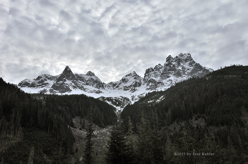
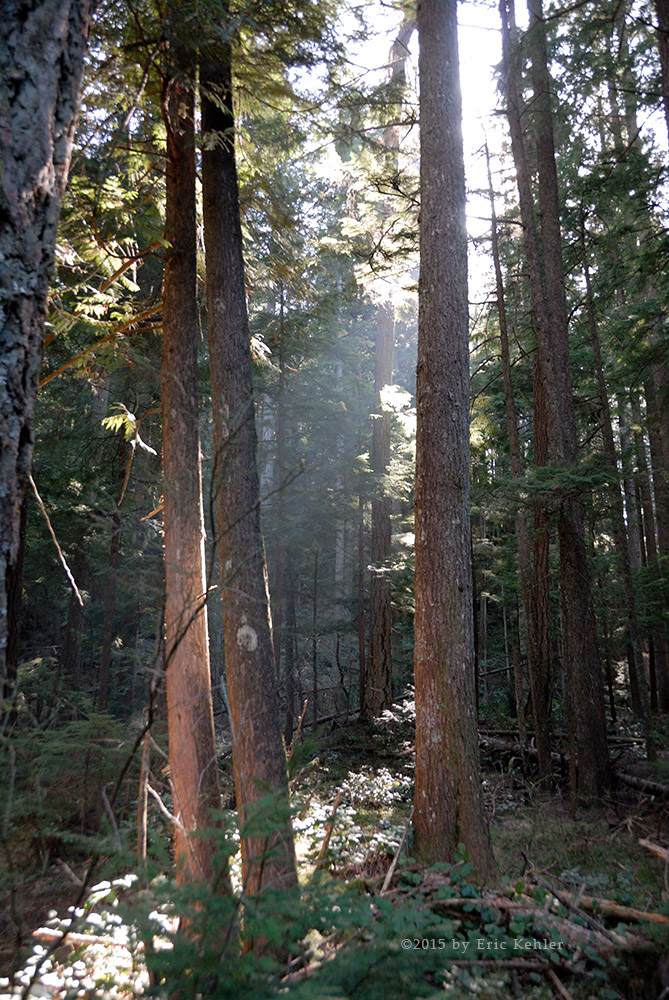
he Elaho valley is a diverse one with so many amazing sights and textures to enjoy. The area is also huge and we have seen only a fraction of it in all these years. I would like to visit much more often but it takes so long to get there that it really is on the edge of day-tripping. But that will have to do for the time being.

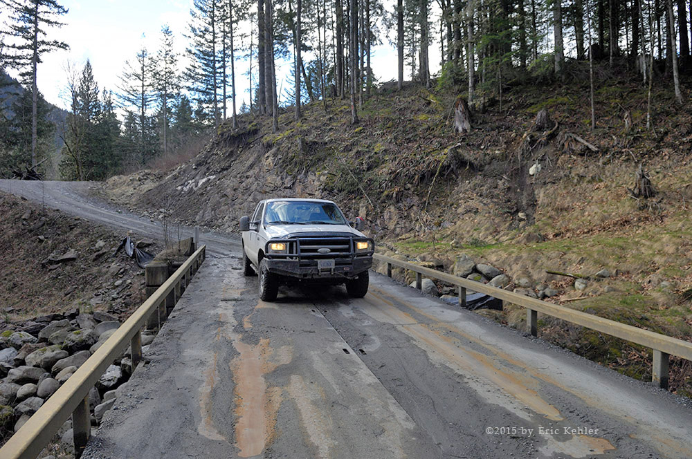
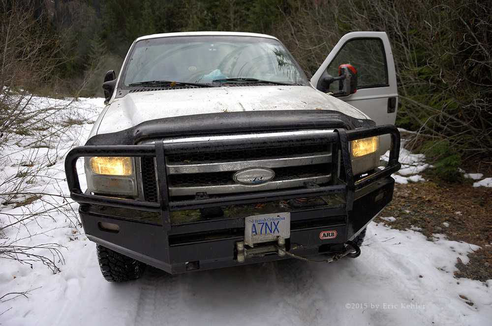
Our day began as usual with Geoff arriving with the boys and dropping them off with Carolyn while we go out to play. As a precautionary plan, I had put a charger on the truck battery so it shouldn’t cause us any grief on this trip. I do think we need to replace it as it doesn’t seem to be all that reliable. The drive to the start of the resource road though long, went without incident. We picked up fuel in Squamish to ensure we had a good reserve for the day. I called our friend John on the radio as we passed his place just a couple Km’s before the end of the pavement but there was no answer so we zipped in and entered the back-country.

Our first task was to dial in the road frequency on the radio, The Squamish region has switched to the new channel number method for specifying the frequency from the old one that spelled out the number. Fortunately we were ready for the new system and so dialing in the channel was a snap. We heard no activity on it for the first 10km but then a truck that was coming toward us was calling out and so we started reporting our position as well. We didn’t encounter any large logging trucks during the day but we did have to work our way past several busses hauling rafters to and from the river.

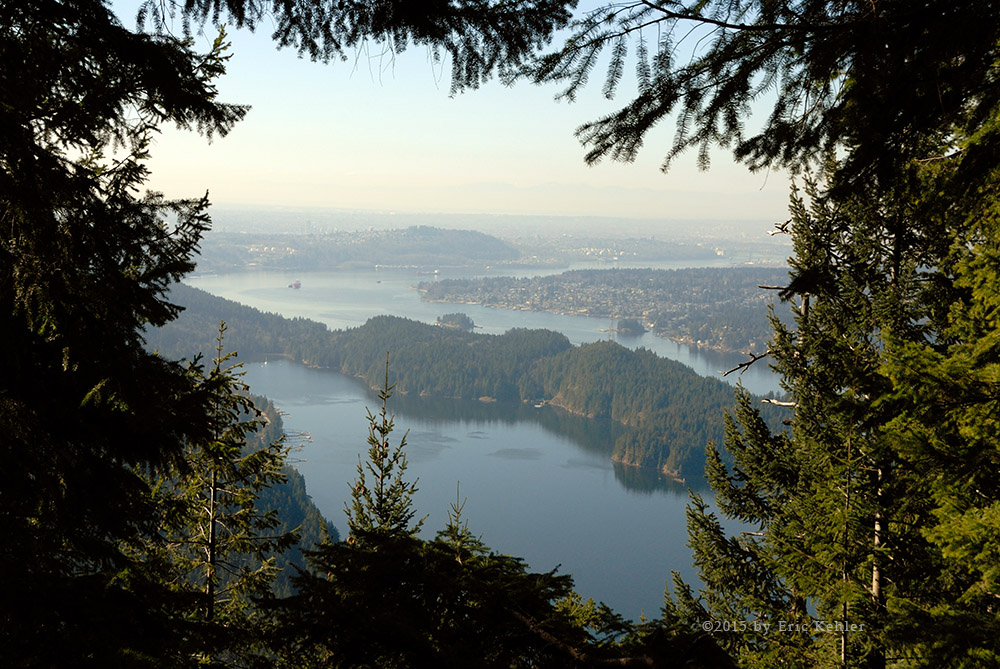
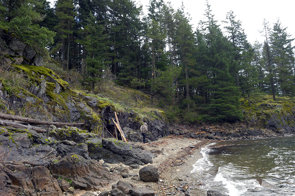
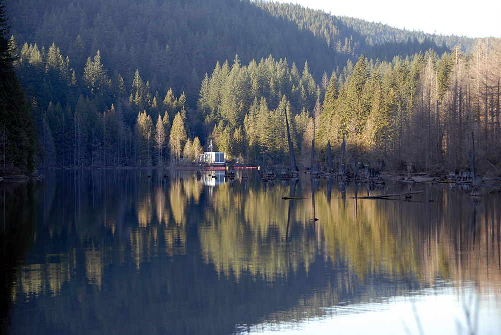
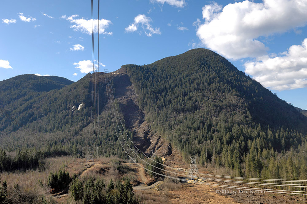
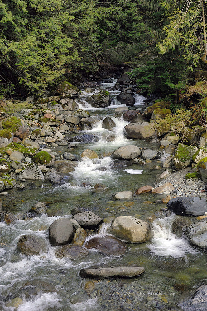
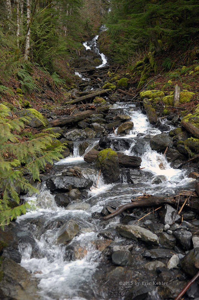
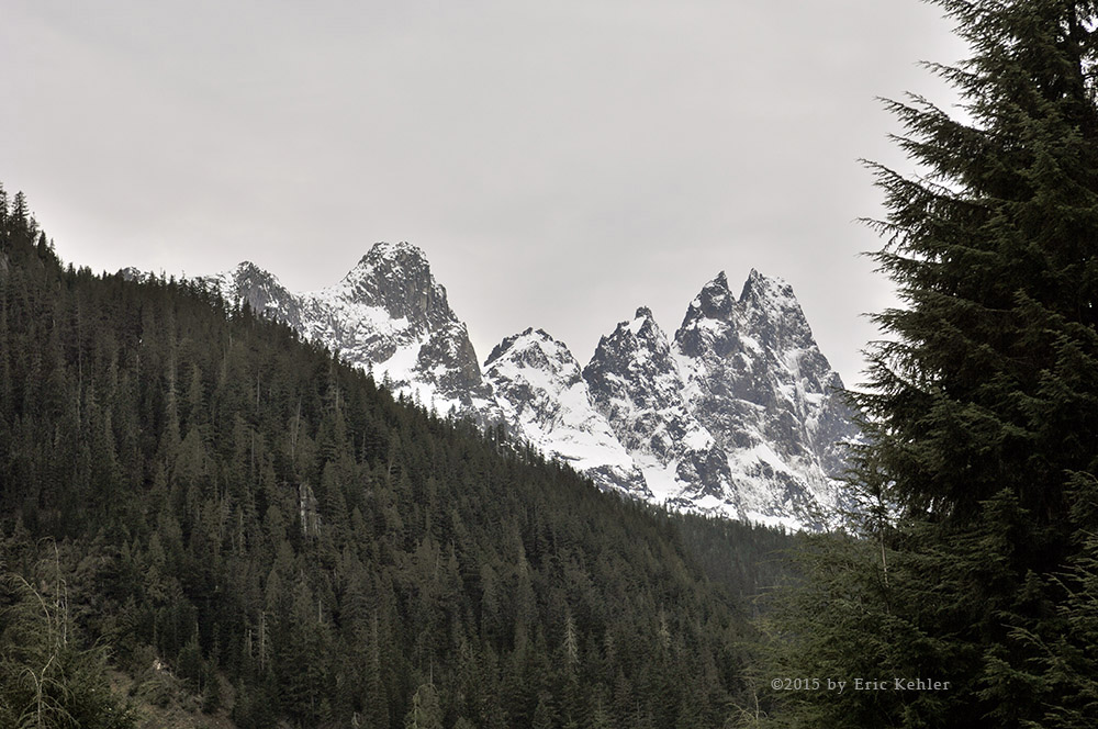
We made fast time along the Squamish and reached the bridge across it which forms the start of the Elaho. Here we stopped to gather a few photos. There were many groups camping along the river and a large number were up here is just their basic cars – not 4x4s. The road is so easy to travel that cars have no difficulty if they are just going camping along the river. We continued in along the Elaho and soon were wending our way up the steep section where the river goes through a deep gorge. I have gathered photos here on many occasions so today we opted to keep moving and head for the second bridge over the river and the start of the ‘G’ branches.

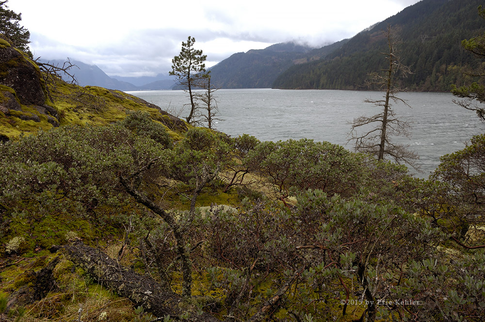
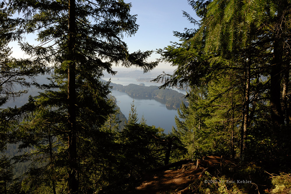
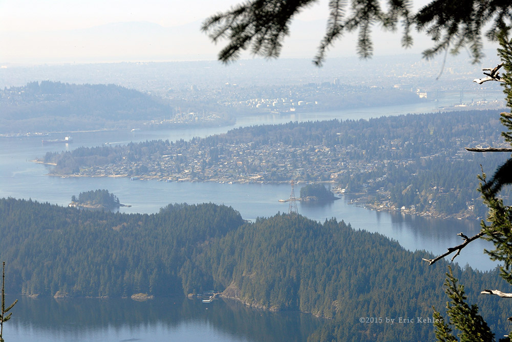
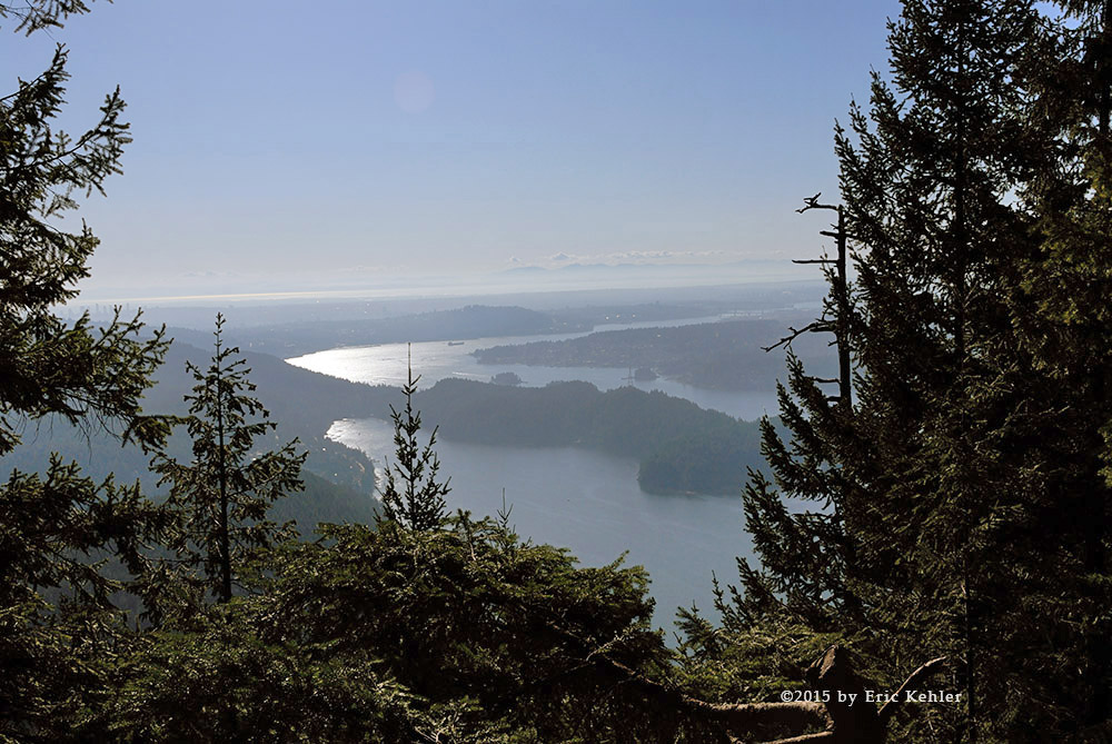
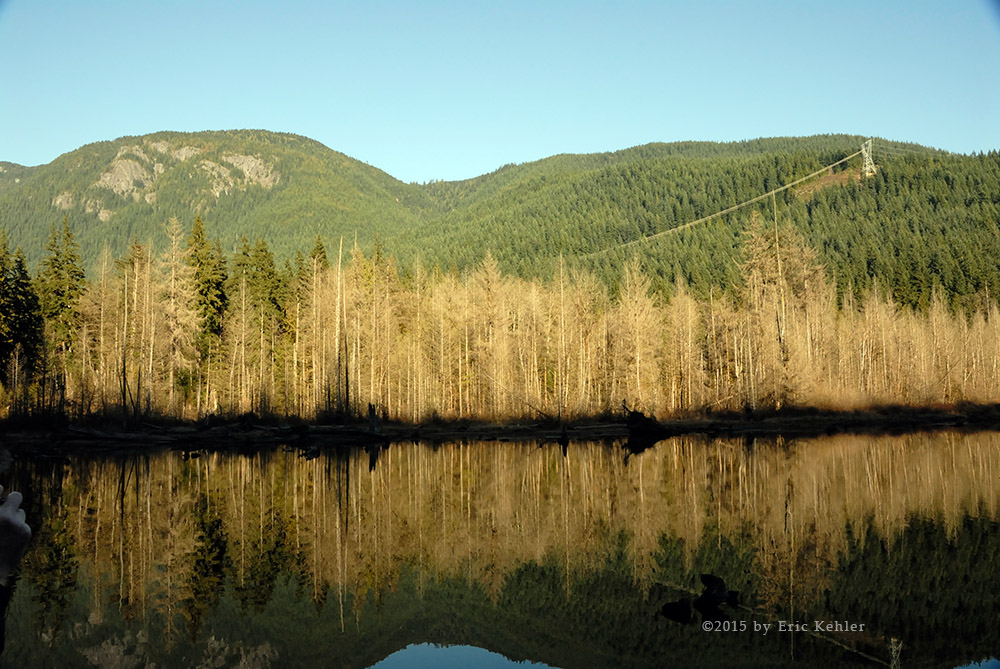
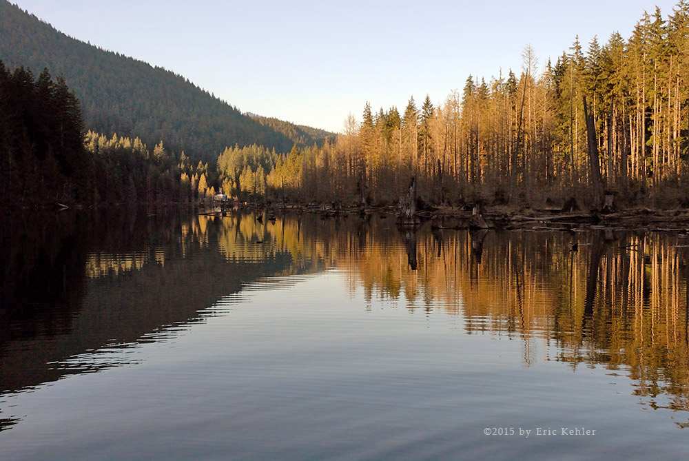
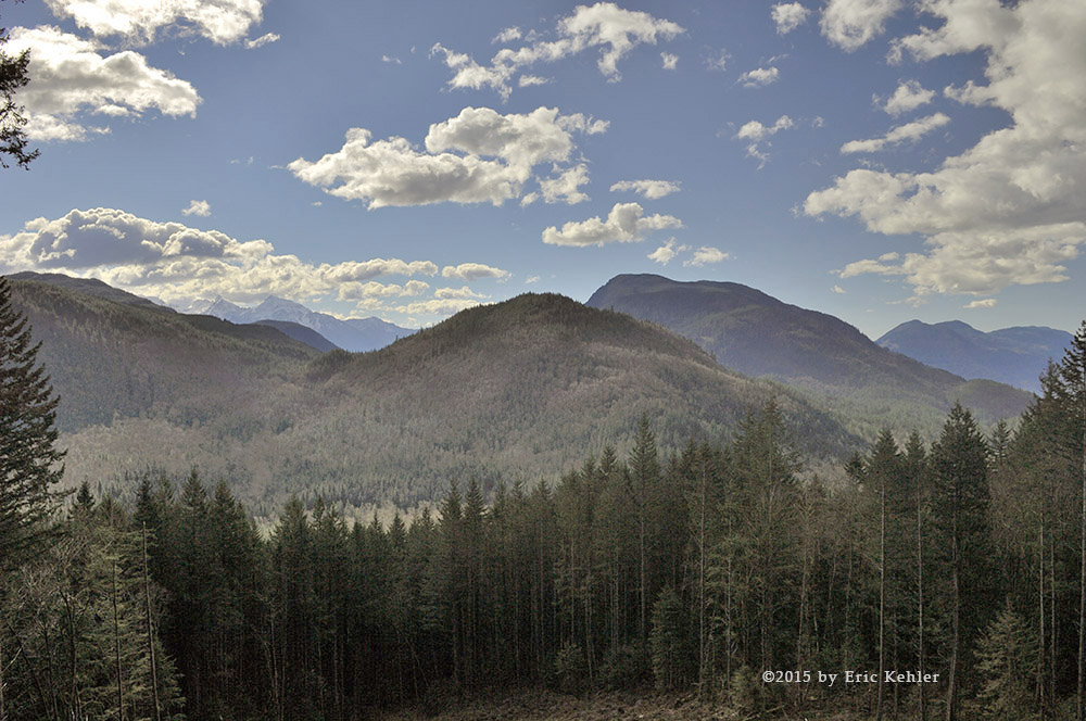
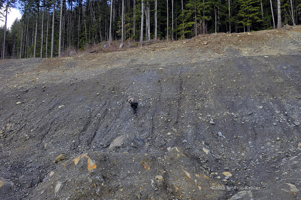
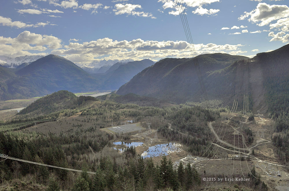
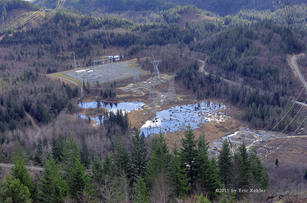
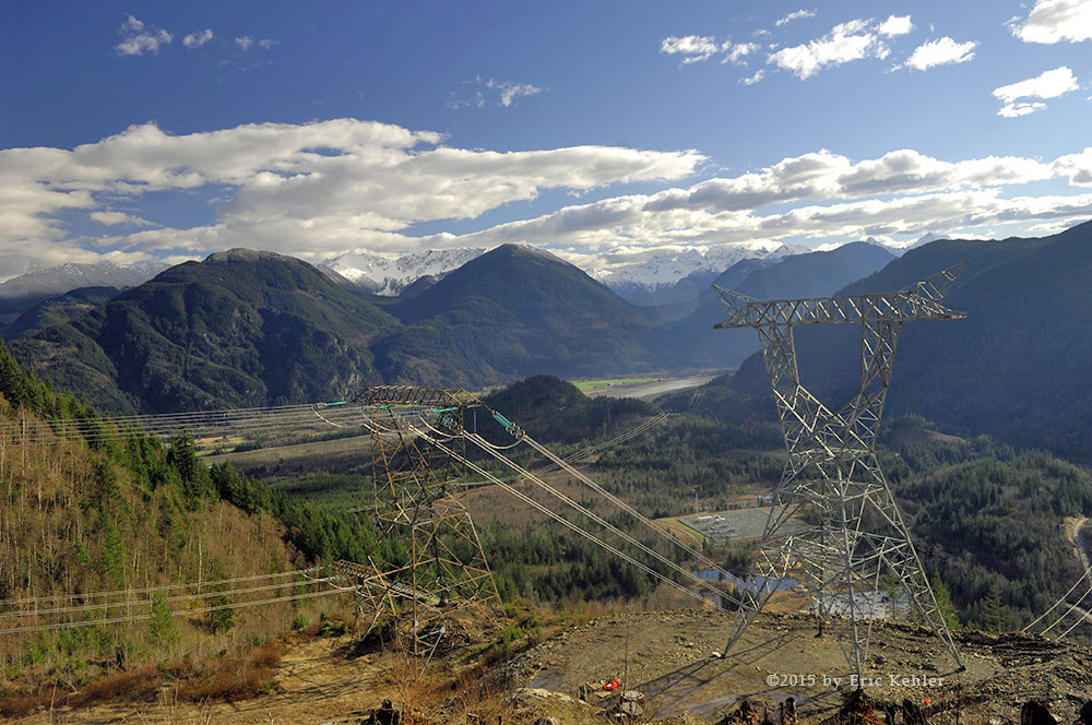
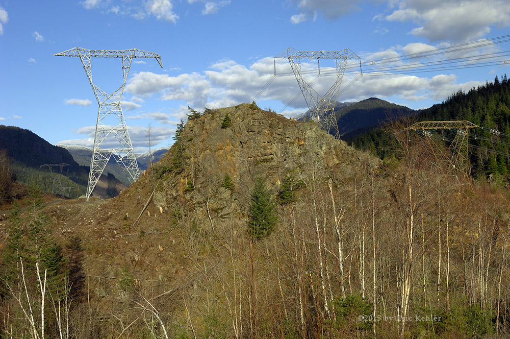
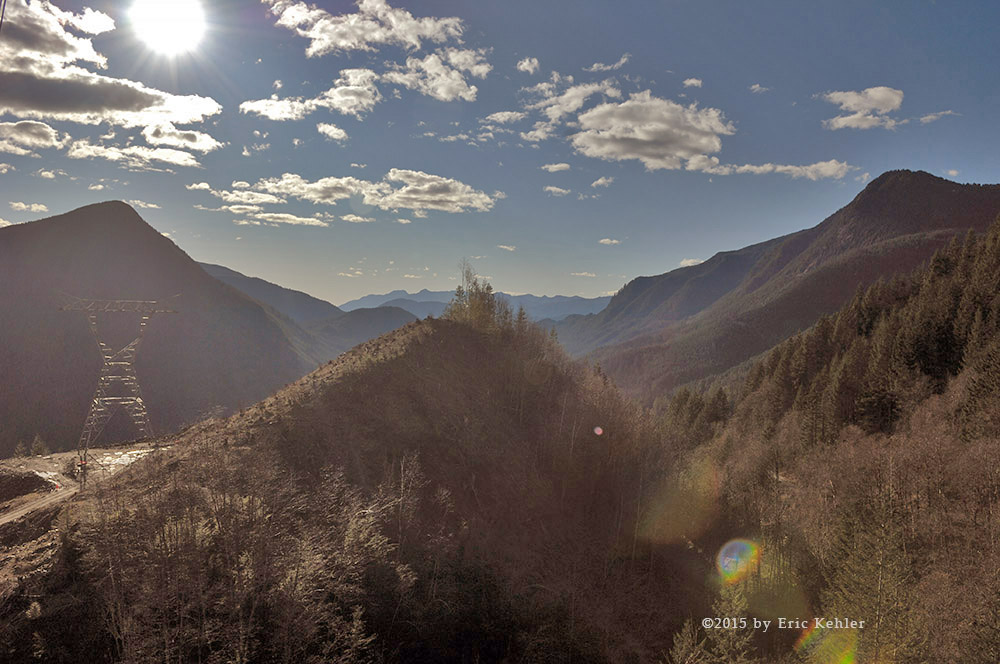
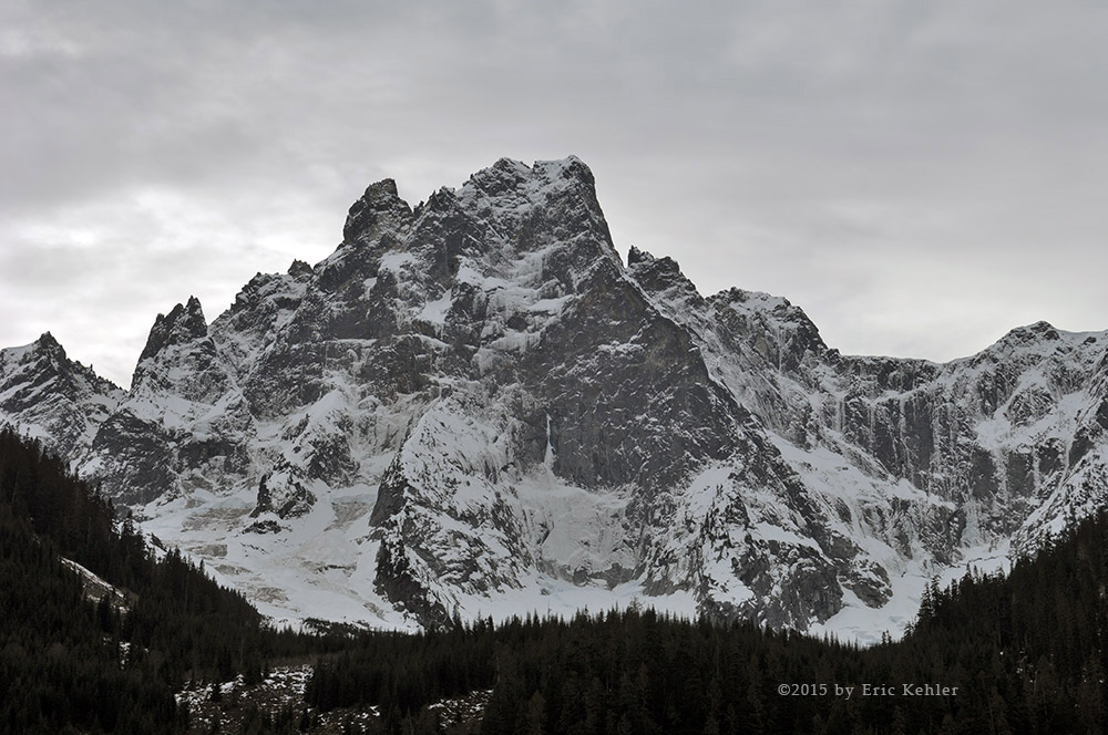
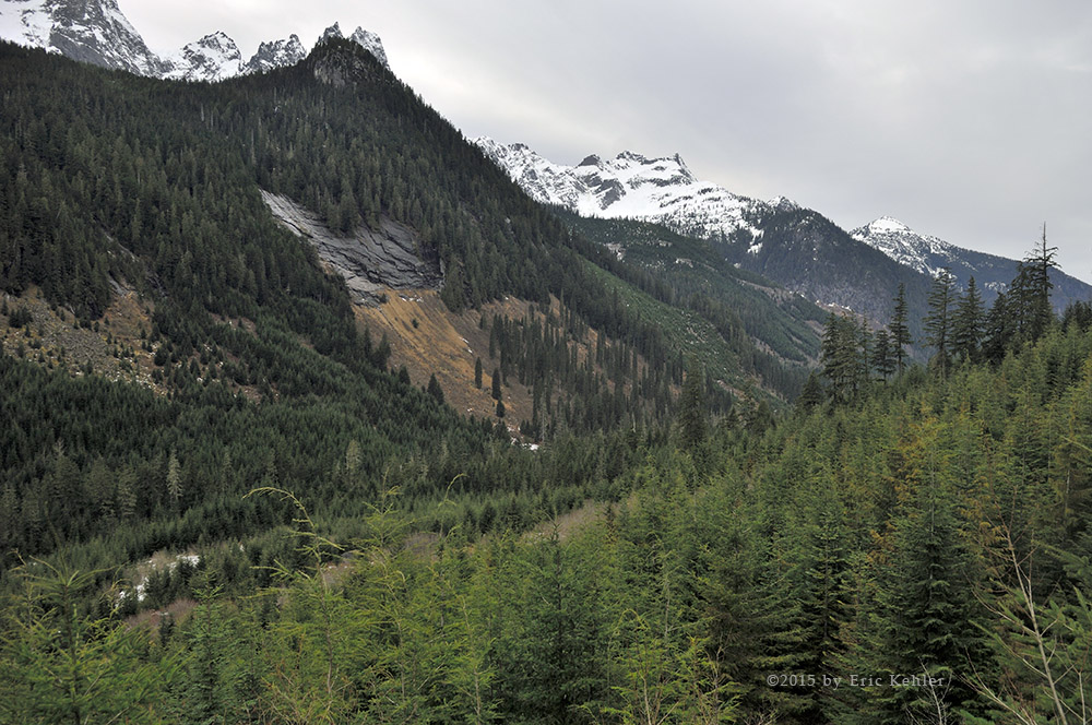
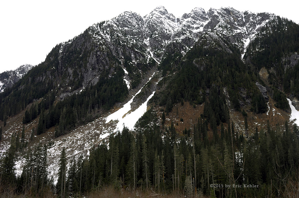
The ‘G’ area was one we had not visited before so we were hopeful we would spot some interesting sights. The initial portion of the G road continues along the river paralleling the main Elaho road on the other side of the river. Here we drove along enjoying views of the river as it meandered through the widening valley. We eventually arrived at another fork and the start of the G530. This one we decided to follow it as it climbed the slope to gain significant altitude above the valley. This gave us some memorable views of the river below. The road wasn’t too bad, there were a couple of very rough sections and one with just enough room to get past a small slide without falling off the road to the slopes below. The view at the end was worth the effort and we took time to just enjoy the spot and not rush on back.

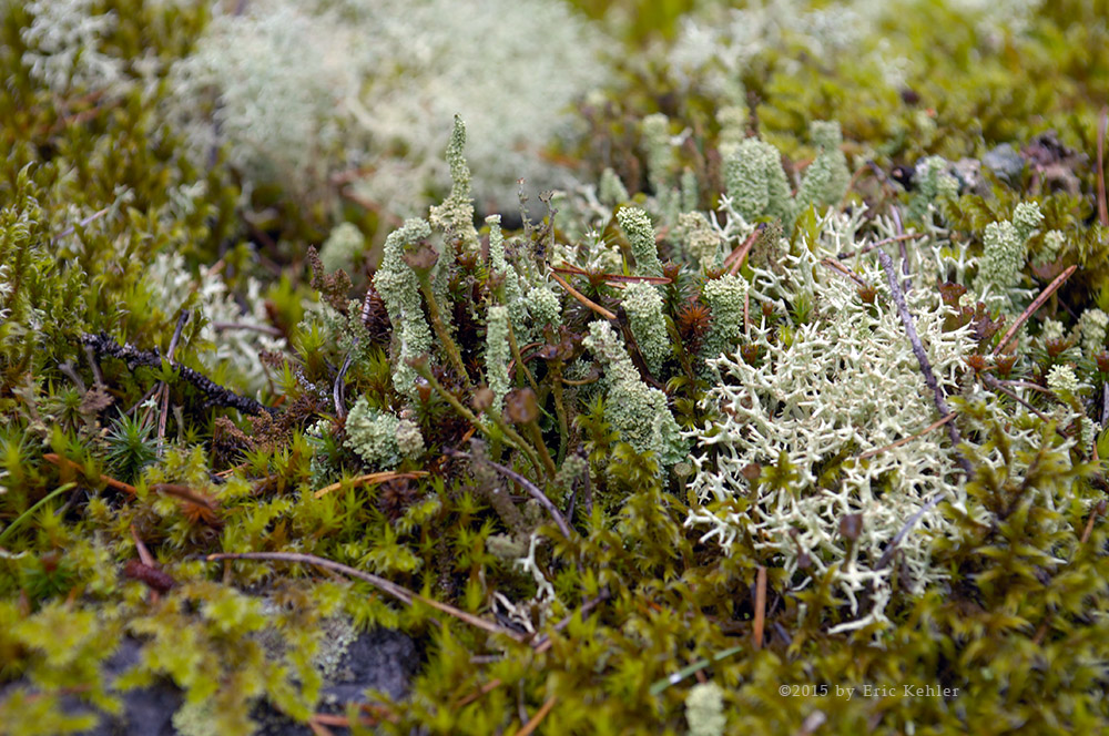
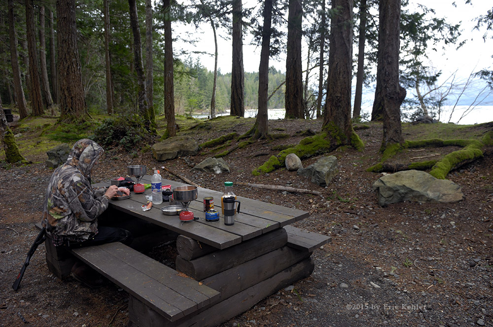
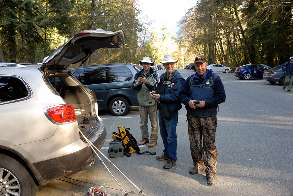
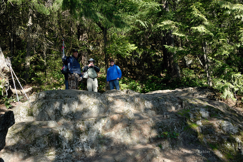
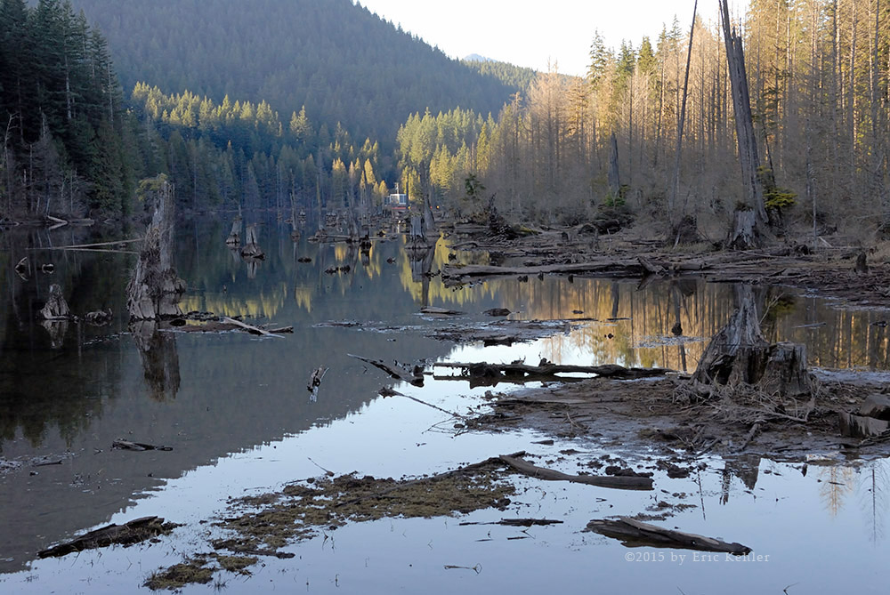
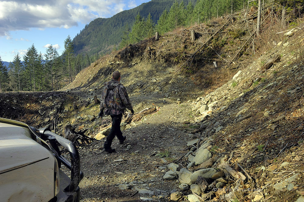
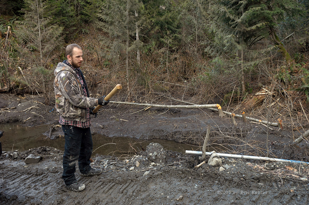
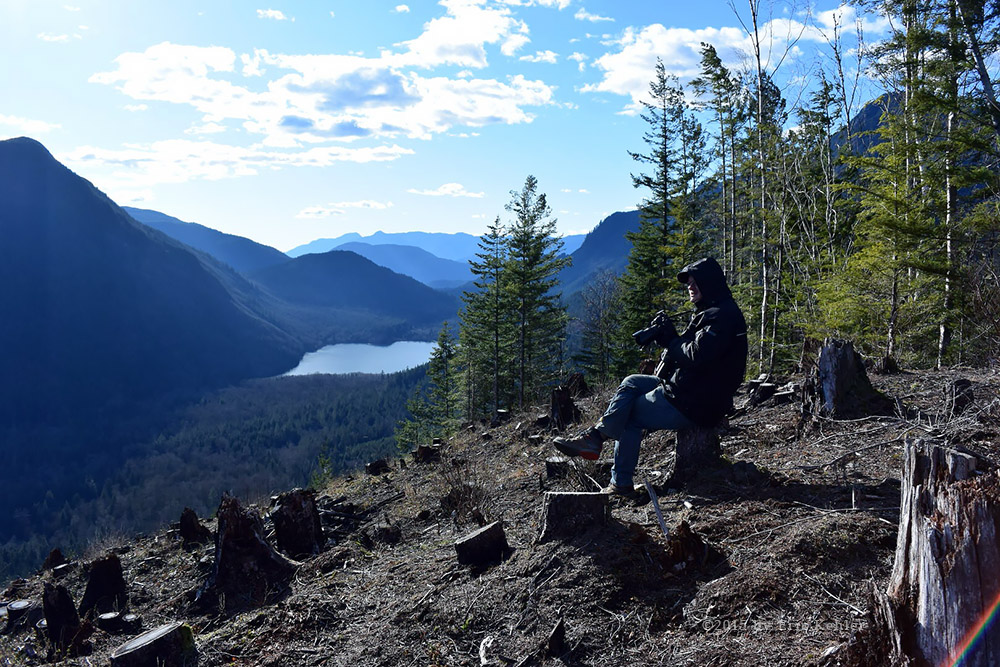
We returned back to just before the main road where another spur forked off heading in the opposite direction along the river. We had seen some great vantage points of the road from the G530 and we were looking forward to seeing the views from them. Unfortunately only a short way along we were stopped by a washout and unable to continue. It was a disappointment. We returned to the main G road and continued along the river, but when it reached the same creek below the other washout, we were stopped by the continuation of it. Here we did get out and enjoy the area as the valley was wide and there was a nice pond along the side of the road. Here we watched a group of butterflies sunning themselves, and in the water were thousands of fat tad poles and leeches. I wish we could have continued forward as the map of the area made it look so attractive. Time was running and we had a scheduled radio contact at 2:30 so we turned around and started back to the main Elaho road. We did find a couple of side roads to drive but none proved that interesting. Once back to the Elaho we continued in further and eventually found a side road where we could set up the antenna and try calling the guys back in White Rock. It took around 20 minutes to get things ready and as soon as I put out a call I had a response from Brett and Ralph. It was a successful contact. The distance was around 155kms directly over several mountain ranges. Radio really is quite amazing. After chatting with the guys we packed it up as it was so hot I really wasn’t in the mood to sit there calling others. We finished our lunch there and then continued in.

The time was getting on and we didn’t want to be all that late getting back so we just selected a main road forward and pushed it to the end. This gave us a few interesting views but we did skip over so many more. Once done with the fork we had followed we drove a few more short spurs as we headed back. At our furthest we were about 75km’s in from the start. About 10kms on our way back Geoff noticed that the front bumper seemed to be bouncing a bit and sure enough on checking it we discovered that the bolts holding it were loose and some were missing. We found a shaded spot to work on it and Geoff was able to tighten it up enough to keep it somewhat secure as we drove home.

The rest of the drive out was an easy drive with not much traffic. Once on the Squamish mainline I put out another call to John and this time I got an answer from him. He was home and looking forward to us dropping in as we passed his place. John had some cool drinks for us and we chatted for a while before continuing home. It was a lovely day and I enjoyed the visit to the area. I hope to get back here sooner than last time as our last trip was in April 2012! Way too long between visits.

Sowaqua

Back in June 2011 we first attempted to explore this valley but we were quickly blocked by a rock slide, so we weren’t expecting much as we started up the road this time. Well we had clear driving past the slide area and on but this gets ahead of our story for today. Our plans for the day were to revisit the Ladner Creek Trestle Bridge from the south side. This route had some washouts and was no longer travelled. We thought we would take a couple of hours and look over the path and see if it was possible to reach the bridge. But when morning came the weather report showed it as unsettled and we didn’t want to be hiking through vegetation in the rain. So we decided to explore the early roads along the Coquihalla that we just drive past.

Our first stop was at Peers Creek Road. This road is very easy to access, on the west side of the Coquihalla it is an access road to the town of Hope, on the east side it continues up the Peers valley as a resource road. The road was in good shape and we drove in a couple of kilometers to a fork where we chose the left side and continued in. The road went only a short ways further before it ended in a parking area where there were some improved facilities for hikers and signs explaining the historical significance of an old trail route through here. The trail dates back to 1849 as the Hudson’s Bay trading route to the interior. I stopped to talk with a couple who were preparing to hike the first segment of the trail, they were visiting Canada and doing many different hikes.

We returned to the fork and took the right branch, it went in a bit further but we were faced with a large corrugated pipe laying across the road. We could have moved it but we wouldn’t have been able to replace it and we felt it was there to keep the more casual drivers (which the easy access of this road would have in large numbers) off the road and out of danger. So we decided to head back and try the Sowaqua before heading to the Carolin Mines area. We quickly zipped up the highway and turned off at Sowaqua, the early bit was littered with campers and RV’s scattered along the Coquihalla River. The area has several roads running along the river that provide easy access to RV’s and they take advantage of the location in large numbers.

We drove on past the congestion and started up the actual resource road, very soon we were passing the site of the slide and on into the valley. The road was in very good shape and soon we passed the first of some logging equipment which explained why the road was so good. A few kilometers in we came by the creek emptying Serpentine Lake where a couple of ATV’s were parked and their occupants exploring the waterfall just in from the road. For the day we came upon only a couple more ATV’s and a pair of motor bikes, so it was virtually empty even with the crowds camped at the entrance. That suited us just fine.

At around 15km we heard a terrible squealing sound coming from outside, after a bit of listening we determined it was coming from our left rear tire. Now we had just had our brakes (rotors, pads, calipers … everything) replaced on all four tires, so this was not an encouraging sign. Had the mechanic not tightened it quite right and the jarring had jammed it up? We thought the day was done. Rather than just give up we decided to jack up the truck and pull off the tire to see if we could spot anything. Well after banging the parts a bit and realizing there was little we could actually do, we decided to put it back together, but just as we did Geoff knocked a guard and a small stone flipped out onto the road! We reseated the tire and took a photo of the stone as now the grating sound was gone and we were back to full operation. Quite a relief as we had just started getting to some interesting sights.

Next we came by the continuation of the Hudson Bay trail. Here they had built a lovely campsite for the hikers and erected a nice set of signs explaining the history and one of the best built outhouses I have seen. All built with Federal money set aside to help kick-start the lagging economy!  The trail is quite narrow and minor today but back then brigades with a hundred plus horses would cross it at a time!

We continued along the road noting several branches that would need driving as we made our way out later. As we continued in we were presented with amazing views of the Manson Ridge and the magnificent summits of Mt. Hatfield and Mt. Outram. The area is littered with alpine lakes all of which are likely worth a hike in to see. We managed to pick the main route quite well and soon found ourselves heading north-east along the creek as it made it way the final distance into a blind valley where the Sowaqua has its beginning. This final section was tucked in behind a shoulder of Mount Dewdney and it gave the valley a narrow isolated look. We managed to drive right to the end of it from where we could look back and down at the entrance. It was on this eastern slope that we stopped and ate lunch while we watched clouds move into the valley and drop rain on the slope below us. Just up slope from us a short way was the border of Manning Park and the Cascade Recreation area. It really was so close. One day I need to return and hike to the ridge line just to look down on the park.

We finished lunch and backtracked a ways, we had spotted a road high up the shoulder of Mt. Dewdney and we wanted to drive it as it looked like there would be some great views from up there. We did find it and the views were indeed there to be found. Driving the old road was an adventure as it was quite narrow and the slope very steep, looking out the passenger window gave me a bit of vertigo, I was happy that Geoff was driving. Eventually we got to a point where the road looked like it was getting too narrow and perhaps impassible so we parked and walked out a half kilometer. During the walk we determined that it was drivable and that the road widened out as it reached a broader plateau. We returned to the truck and continued along the narrow road. Here we found some nice views of the valley we had driven and even a few small waterfalls to enjoy. We continued up the road and eventually reached it terminus. On the way down we stopped at a few spots to enjoy the sights. At one small stream I watch a garter snake swim across the rapidly flowing water. I was surprised at its ability to fight the current and safely cross the stream.

Done with this spur we returned to the mainline and drove back along it to the next fork we has passed on the way in. This next one was a very long section that followed the eastern slope of the next valley. It continued along the wall gaining attitude as it looped across several ridges and more recently logged slopes. By the far end we had reached newly logged areas and ones likely to see renewed activity later this year. We finally reached the snow live at 1400m and were forced to stop while staring at the covered road ahead. As it was now starting to get on in time we decided to turn back and make our way out as we were close to 40km in at this point! We passed the forks that we didn’t have time to explore today and they were calling to us quite loudly, so we will need to return fairly soon. We encountered no one on the road as we left, a shame in a way as there are so many camping at the entrance, but then I really don’t want crowds back here.

So by the end of the day we never did get to the trestle bridge but we found an amazing valley with so many interesting sights and one that is fairly easy to get to. I want to return to see the other road sections but to also explore some of the lakes we see on the map. It seems that this area was popular in the mid 1800’s and now I am starting to understand why.

Hale Peak

hree members of the White Rock Amateur Radio Club (Brett, Ralph and Eric) hiked Hale Peak and activated it for the first time in the Summits-on-the-Air program on Saturday May 9th. The adventure began with everyone meeting at Eric’s and loading up the gear into his truck. We were on the road by 8:10AM and making good time to the nearest Starbucks where we filled up on essentials for the arduous adventure ahead. The drive through Mission, Harrison Mills and on to the start of the FSR went quickly and the truck was doing really well after its repairs in the garage the previous week. We now had 26km of rough driving along the Sts’ailes Service Road. Fortunately the road is well maintained and was not busy which was fortunate as the surface was dry and kicked up a lot of dust. For me the drive was easy but for my two companions who are not used to back-country driving the bouncing took its toll.

We arrived at the final road spur at 10:45, where we found a deep ditch across the road. The guys were a bit uncertain about the ability to continue on but on our second attempt we were across. We drove up the over-grown road and missed the trailhead on our way up. I soon realized that we had gone too far and turned around driving back down the spur very slowly while we looked for the cairn marking the start of the trail.

Once we found the marker we pulled to the side and parked the truck. We had reached the trailhead a bit before 11am which put us about a half hour behind our plans. We quickly got ourselves geared up for the hike and locked up the truck. The initial part of the trail follows an old road bed which looked good enough to drive with and ATV. The trail eventually veers off the road and begins a steep ascent of the slope to the peak. The trail wasn’t overly difficult and is well maintained, there were fresh piles of saw dust from trees that had fallen across the trail and were now split for easier hiking. The trail itself is well proportioned between steep sections and gentler patches with most of it shaded from the sun. After two hours the bedraggled team achieved the summit and we climbed into the abandoned forestry lookout. The building was in decent shape and offered a nice spot to rest and eat lunch. There were a lot of candles and some emergency supplies stowed in the room, the stove is usable for warmth and would be a good place to over-night.

Once we reached the lookout we rested and ate our lunch. It sure felt good getting the packs off and resting out of the sun but still enjoying a view of the mountains around us. Done with lunch, Ralph set up his portable vertical antenna and proceeded to make a few CW contacts across North America. Meanwhile Eric was enjoying a nice chat with club member Jim and then Eric’s wife Carolyn, who were both back home in White Rock, through the Cheam Repeater. Once Brett finished his lunch he strung is end-fed wire antenna between the lookout railing and a distant tree. It took a few attempts to get the rope high enough in the tree as the weight on its end wasn’t heavy enough to pull the line down.  It wasn’t long before he also had completed a few contacts. Ralph finished 4 contacts fairly early but Brett was stuck at three for quite some time. Then finally he made a contact with a local ham - Jan -  who is also a SOTA operator – a fitting end for the activation.

Now that both Ralph and Brett had achieved the minimum to qualify for the activation, we were ready to depart. The descent took only half the time of the climb but we were still quite worn out as we reached the truck. The return drive went without incident and we were soon recovering in our homes having enjoyed a great day in the outdoors. Plans for the next hike were already on our minds.

Kaiyama Petroglyphs

I have tried on a number of occasions to find the petroglyphs but was never able to locate them. The map shows the location being on the east slope of Doctors Point just north of Doctors Bay. This area is quite steep and the details are not exact enough to make the task easy.  Earlier this year I learned that the glyphs are only accessible by water and not from the road so I decided to try again from the water side. We had originally planned to canoe to the site in mid-March but the weather got in our way and it wasn’t until mid-April that things came together for us to attempt the adventure.Our day began much as usual with us heading out in the truck around 8:30 and making the requisite stops for coffee, fuel and some extra snacks.

Today however we had a canoe strapped to the top of the truck. I was a bit concerned how it would behave on the highway and then the long drive up the Sts’ailes Resource Road (West Harrison). I needn’t have worried, the many straps Geoff used to tie it down held well and we had no issues at all with the transport.

We planned to put in at the closest spot to the expected site of the glyphs as we weren’t sure how well we would handle canoeing in Harrison Lake. The best spot would have been in Doctors Bay itself but the road leading down to it is quite overgrown and one 10m section is washed out leaving a stretch of steep rock to get across. Knowing the state of the road from an earlier trip we decided to play it safe and drive past the point to put in at the small delta at Bremner Creek. This would give us a 2.7km paddle to the best known location for the glyphs. We felt that this was an acceptable distance if the weather was cooperating and the lake calm.

As we drove the mainline and reached the fork where the old road for Doctors Bay starts, we were seriously considering trying it anyways but reason prevailed and we continued along through the freshly logged area and down the steep drop to lake level and the Bremner Creek delta. The last two kilometers of the road were very rough and shook up the truck and us quite nicely, I was very happy to see the branch off the mainline to the small camping area at the mouth of the creek. We arrived to find the two best spots occupied. This surprised me but it really shouldn’t have, as they are both excellent camping locations. We pulled into a small section next to the largest camp site and parked the truck.

As we exited the truck we were immediately investigated by three friendly dogs from the neighbouring campsite.  While Geoff unloaded the canoe I chatted with our neighbor who became quite interested in our plans. He had been coming to the area as a kid 40+ years ago but had never seen the glyphs. After a few minutes of packing up the truck and moving needed supplies into the canoe, we were off on the water leg of our adventure. The water was almost a glassy surface so we were very happy to see that and it allowed us to make good progress towards the point to the south.

As we canoed along, the shoreline got more rugged and there were many vertical rock faces covered in various types of moss and lichens. They made for interesting patterns and one large rock appeared to have a large face on it. I had our target coordinates stored on my gps and as we approached the location we still could see nothing of interest.  Finally right at the spot the painted rock art was visible! There was also a fancy designer cairn placed on a rock outcrop in front of the petroglyph. We paddled past the glyph and looked for a place to tie up the canoe. The rock here presented us with a vertical wall but a bit past the cairn we found a narrow channel just wide and long enough to hold a canoe! It seemed like a planned moorage location, we pulled in and tied off the canoe and clambered over the rocks to get back to the petroglyph.

The glyph itself is not all that spectacular in that it seems to be just a painted rock and not carved but the shape does give it a rough body/head look. The white paint seems to have been recently redone as the glyph is still maintained by the local nation using traditional paints.  I have seen it called Dr. Rock but I am not sure if this was a misquote. According to the cultural history of the Sts’ailes Nation, a powerful shaman – the doctor - was defeated here and turned to stone with parts of his body scattered throughout the region which is how the area received its name. So this stone body would match the historical record. We also spotted a faint red hand print below the main figure and the rock to the right seemed to hold a barely visible figure obscured by lichens. Once we had looked over the main site we explored the rock face both north and south of the main figure to see if there were any more art works to be found.  About 40 meters south we did spot one other group of red figures painted on the front and underside of a rock. So that gave us 4 glyphs to consider as possible members of the Kaiyama Petroglyphs.

The site is actually very scenic and we enjoyed the beauty of the location before starting on the return paddle. The entrance to Doctors Bay was just around the bend from the glyph and would make a very short paddle if the bay was more accessible. Once we got back out into the lake we noticed that the glassy smooth surface was now a bit rolling and choppy. Fortunately the wind was still mild and at our backs so the return went fairly easily and we made decent time despite our stiff muscles. Once back to the truck we stopped to eat some lunch and then ended up chatting with the couple camping next to us for some time. They told us some of their interesting adventures enjoying the area over the years while we shared some of our pursuits.

Finally taking our leave, we made our way back up the rough section of the mainline and made for the easy miles of road ahead. We stopped at a few spots that caught our interest as we drove out but didn’t drive any long roads as the day was getting on. We did want to explore the road with the beaver dam that we have looked over our previous two trips. Today the road was repaired again with the creek flowing across it in a wide shallow section.  We crossed over it and explored a short section of the road on the far side of the creek just to prove we could. By now we were getting quite tired and decided to head straight out, I had to do the last 20km of the drive as Geoff was just not up to it. He resumed once back on pavement after a short rest. The rest of the trip went without incident.

Well we finally saw the petroglyphs. For those 4x4ers out there – get a canoe if you want to see them. I felt that the adventure was a fun one, we accomplished our goal and tried a few new things in our back-country adventures. I think we will do a bit more canoeing in the future.

Camp Cove

It had been over a month since Geoff and I were last out in the back country and we were feeling the urge to get out there. The weather has been our biggest problem but today looked like there might be a break in the clouds long enough to enjoy some scenery. I wanted to scout out the trail-head of my next planned Summits-on-the-air radio hike. So we packed up the gear and set off for the West Harrison area. We also hoped to see what happened to a beaver dam that Geoff had spent some time pulling apart.

So as usual we picked up a few essentials on our way out and made good time for the start of the forestry road. Our day’s excitement began just over a kilometer up the forestry road. As Geoff made his way along he glanced to the side, down the steep embankment, and noticed a recent addition to the scenery. There was a fairly new pickup on its side leaning against a large tree abandoned below us. This caught his interest and so we stopped to have a closer look. Geoff found a path down the slope to the truck and looked it over. It was recent enough to not have been picked over for parts yet! After a good look we continued on our way to our next adventure.

As we reached the spot where we could look down on Camp Cove we once again remarked on how we hated the locked gates placed in numerous spots along the road. Then just after we crossed a small bridge over the stream that’s empties into Camp Cove we glanced back and saw that the gate was open and the way down to the cove available. We quickly turned around and started down the road. Now back on April 13, 2013 we did manage to drive most of the way down to the cove but on the other side of the stream and we had to walk part of the way to the lake shore. On that occasion the truck was in a tight spot and we didn’t feel like we could leave it for long so we didn’t wander along the shore to the cove but we did get close. Today we drove right into the campsite with the buildings and facilities wide open for exploration.

We parked on the lake shore and walked over the area. We first explored the point of land separating the cove from the main lake. It was a fabulous treed and mossy area that was quite pleasant to walk over, the views back to the cove and out along the lake were quite amazing. At one point Geoff called me over pointing across the lake to a waterfall he spotted. I was amazed to finally see it. This was the whole of the Slollicum Falls. Normally we see only the magnificent lower section which is already a 200+ foot drop, but from here we could see the full 1200 foot falls. A truly amazing site one never suspects is there from the East Harrison road. We returned to the camp site and looked over the buildings, they were still in decent shape though one storage building had collapsed. It had been a scout camp until forestry succumbed to first nation pressure and turned it over to the local group who have let it fall into disrepair. While we explored the area a couple other ATV’s made their way down and looked around. It really is a beautiful spot and a great location for a camp but it won’t take long for it to be vandalized.

We returned to the mainline and made our way to find the trail head for my upcoming hike. We loaded up the GPS track I made from my hike back in 2008 and soon found what would have been the old start to the trail. Since then the area was logged and the slope was now bare. We drove up a side road and soon spotted some flagging and a rock cairn marking the new start of the trail. It still looked to be in decent shape so we considered this task accomplished and made for the beaver dam. Upon arrival at the dam site we saw that it had been cleared and the road re-graded and built up. So we could see that the access to the area in behind was needed but alas the culvert had again gotten blocked and the water a dug a deep trench across the road blocking our way forward. Perhaps next visit it will be open for us to drive. It was past noon and we were getting hungry so we decided to head down to 20 mile bay for lunch. There being no one in the campsite, we made straight for site 7 which has perhaps the best view of the bay and lake. When we got out of the truck the wind was so strong that we decided to find a spot on the far side of the spit where we would be more protected from the wind. We slowly drove along and stopped where we had a lake view and where we could use the truck as a wind break. Here we had lunch and enjoyed a bit of a break from driving.

As we were packing up Geoff noticed that one of his 25 round magazines for his 22 was missing so we scoured the area but didn’t find it. At least it wasn’t too expensive. It was only at our next stop that Geoff discovered an object in one of the many pockets of his extensively pocketed pants. It was the missing magazine! This afforded me ample opportunity to comment on his cognitive abilities.

We continued north up the mainline and explored some side roads along the Kirkland Creek. It is a nice area and offers some pleasant views of the lake. We next stopped at the Davison Creek Bridge to capture a few photos. It was only a short distance further up the road that Geoff noticed a bug on his lap and brushed it onto the armrest asking what it was. I looked over and confirmed that it was a tick. He killed it and brushed it aside. A few minutes later I scratched at something on my chest and asked Geoff to look at it – another tick and this one had chowed down on me! We pulled over and Geoff started looking for some tools to remove it with. We needed a thread and a straw but had neither. Eventually he found a pen cap and we pulled a seam thread out of a bandana he had with him. This allowed us to get the tick extracted whole. Just after that was done I started to look over my arms and found a second tick enjoying my right arm. We grabbed a second thread and this time used an empty SKS shell casing and tied onto the tick and pulled him out whole as well. We packed up both for testing later if needed, and in fact they were sent off to a lab. Geoff spotted a fourth one on his clothing but it was not biting yet. That was enough for us so we turned back and made for home. Spending a half hour extracting ticks was more adventure than we wanted for the day.

Over all the trip was a good one, we saw some new locations, confirmed my hike trailhead and updated the supplies requirements for our first aid kit. The drive home went without incident and we drove much of the way in silence contemplating the two caged passengers we had returning with us.

Farrer Peak

As a member of the local amateur radio club, I am always looking for ways to get the guys involved in some joint activity.The Summits on the Air program has caught the attention of several members and so I am regularly looking for ways to combine the club activity with my own desire to enjoy the outdoors. This winter we had almost no snow locally and so we are able to hike the lower peaks without concern for snow. It was for these reasons that we chose to hike the start of the Diez Vistas Trail to the summit of Farrer Peak.

Our adventure began with the guys meeting at my place at 8am for the drive to Buntzen Lake and the start of the trail. This started off smoothly but upon starting across the Port Mann Bridge we noticed that the right lane was separated from the left three with a temporary construction barrier. This continued the entire length of the bridge and it prevented us from exiting to the #7 highway. I guess there was a sign before the bridge that we missed telling us to get over if we needed to exit. So we had to continue past and take the next exit and return along the highway. With all the construction we next missed a sign directing us to the main Lougheed highway and ended up on the Mary Hill Bypass. Not a huge problem but it did add some extra driving to our route. Fortunately we had lots of time and soon we were back on track and driving into the Buntzen Lake parking area.

We quickly got organized, locked up the car and started off for the trail. There were already quite a number of cars parked with other hikers setting off in various directions. The lake has a large number of trails from easy to quite strenuous. Ours was a middling level trail though it does have a pretty steep section just below the summit. We made fast time along the level trail leading to the floating bridge over the south end of Buntzen Lake. I use the term ‘floating’ loosely because the old floating bridge has been replaced with a solid causeway with only a short segment that is actually a bridge and floating. I was definitely disappointed when they removed the old bridge as they also cleared out many sunken logs that offered some amazing micro-habitats to photograph.

Once across the bridge the Diez Vistas trail officially starts. The initial section is through a lovely forested area. It makes some elevation gain but generally isn’t too steep. It being a cool ideal morning for hiking, I made good time hiking this section of the trail. When we reached the power lines, we took a longer breather as the steep section was about to start. The day had continued to clear and it was looking very pleasant for radio operating which encouraged us as we approached the steep section of the trail. The next portion of the trail is shorter than what we had hiked but much steeper and we had to scramble up some rocky sections as we approached the first viewpoint.

Once we had reached the viewpoint, I stopped to gather some photos of Vancouver and Burrard Inlet. The view really was quite lovely for such a low elevation. The trail was busy with several groups passing us on the way up and we encountered a few more at the viewpoint. Fortunately it being early in the season the numbers of hikers was not through the roof. Done with the view we continued up the trail and another steep section to arrive at a small marker nailed in a tree stating 560m. It was quite close to the coordinates we had for the summit. It was however about 15m away from what looked to be the true summit of the ridge. As we were doing a SOTA activation we decided to setup near the official location and next to the trail. We did string the antenna out over the actual summit and so I guess you could say we had both covered. I made a couple of quick contacts with my hand-held to club members back in White Rock. We had good strong signals and so got our activation off to a fast start. While I was making those calls the guys were setting up the HF equipment and antennas and soon they were on the air as well. Over the next two hours we were there we made a total of 9 contacts. We likely could have done much better but our weak signal was being trampled on by others who were participating in a popular radio contest. Never-the-less it was fun and we had a good time.

While the team was busy making contacts, Ralph and I set off for the second viewpoint as it is the best one along the trail. I had remembered it being fairly close by but after walking some distance and descending a moderate amount we decided to turn back. It seemed to be much further than I remembered and we didn’t want to be away too long. I guess we’ll need to come back and do the actual hike. Once 2pm arrived we started to pack up and get ready for the hike down. We followed the same route and made another stop at the first viewpoint. Now that the sun and changed position the view was markedly different from the morning view and so I took a number of photos from the spot again.

The hike down was rough on the ankles and knees but we all made it in decent time and had no serious injuries along the way though one of the team did manage to slightly twist their ankle early on during the decent. So we arrived back at the car having activated the summit and enjoying the fresh air and closeness to nature. Our drive home went better than on the way out and we were soon back home recovering from the day.

Ruby Creek

It had been 4 years since our last visit to the Ruby Creek area and we felt it was about time for a return. Last time out we came across a brand new bridge over Mahood Creek that went to a dead end just yards past the bridge. We knew that it would have been the start of a new road and we wanted to see how far it went and even if it connected back to the Harrison. So with that as our goal we set off for the creek and a chance to enjoy some fresh air.

After all the requisite early stops we soon were driving past Agassiz and heading east rather than the normal north to the Harrison. It being a nice sunny morning we were also very hopeful for some livelier colour in our scenes. We made quick time across Sea Bird Island as traffic was non-existent and soon we were onto the start of the Ruby Creek FSR. Just in from the start we came past a number of vehicles parked alongside the road, this seemed a bit odd as it didn’t look like a hiking area. The road was in surprising good shape so we made fast time heading in. As we drove we noticed a power line was following the road and as this was new it sparked our interest as to what it went to.

Once over the initial hill we entered the wider swampy region and here we followed the power line into a new development. It was powering a new hydro switching station that was still be built. It seemed like quite an elaborate development as there had to be a lot of fill brought in to raise the footing above the surrounding lowlands. While we were looking at the station we noticed the new transmission line that was being built. We even saw a pair of workers high up a tower adding on the cross supports.  We continued our drive up to a low rise where there is an old tower and where there is a view of Deer Lake and the surrounding valley. Here we saw the various partially finished towers heading up a steep cliff to our south. There were workers all around us working on various aspects of the towers.  We soon realized that this was the continuation of the new line we came across last summer in the Uztilius! It does take some time to build it!

Once we were done gawking at the new power line – I guess it is coming for all the expected electric cars – we set off for the bridge. It took only a few minutes to get to it and sure enough the road continued on past. We crossed the bridge over Mahood Creek and up the steep slope, it had some serious cross ditches and they were bottoming us out as we made our way across. But the truck is solid as are our bumpers, so we just carefully picked our way. Soon we were beside Deer Lake and enjoying a nice view of it below us. The road was in good shape except for the ditches and we were soon past the lake but here we were stopped by a fallen tree. It took only a few minutes to clear it and get us moving again. Not much further we were stopped by a washout. This was disappointing as the road looked quite good on the far side. I guess we will need to try it from the Harrison side and see how far that road comes back this way.

A bit disappointed we couldn’t continue, we turned around and retraced our route. Part way back we came by a wide pit area. There was a steep sloping bank on the one side that gave access to another more solid overlook. The whole area was seeping with water and the slope looked very soggy. Geoff wanted to give it a drive and reach the overlook. Fortunately it wasn’t too soft and we were able to inch our way up and across to the solid ground. Geoff noticed something further up the steeper slope behind where we were and he started walking it but quickly slide down as the slope was wet clay! There was enough water seeping through the clay layer to form a stream as it descended the lower slope we had driven.  It was a challenge getting up here but now it was time to get back down and I was worried we would sink in to the soft slope. It went better than I thought as Geoff was able to drive the ruts he made on the way up. Done with the pit we returned to the main Ruby FSR and continued up slope along the main line.

We soon reached the shoulder where the power lines were being built and we followed those roads out to the furthest point overlooking Ruby Creek itself. The lines continued across the creek but we were stopped with a great view up the valley. We back tracked a bit and found an old road leading down towards the creek. As we followed along a sheer rock face, I reflected on the fact that it looked quite familiar. Soon we were stopped by a number of large boulders. I checked our map and the track of a prior visit and noticed that we had indeed been here before and got stopped at the same point! Geoff decided to hike down the road to where it reached the creek and there he found an old bridge but it was too rotted out to carry any weight. Meanwhile I was gathering a few photos of the mossy rock face beside me.

Once Geoff was back we backed up and returned to the mainline where we followed the road into some freshly logged areas. The trees were still laying across the slope waiting to be collected. We got in a few more Km’s and even a bit further than last time but we were stopped by a logging equipment parked on the road. It was such a shame as the road looked like it went some ways further. I guess it will need to wait till our next visit. It was getting well past noon and we were getting quite hungry so we started looking for a nice spot for lunch. We returned to the power project and there found a nice area with a view looking down on the valley and the switching station we saw earlier.

A hot lunch is always welcome out here in the cool air especially as the wind made things quite cold when the clouds hid the sun. Done with eating, we started back up the slope to the mainline but came by a small spur leading to another viewpoint. Here we got out and hiked a 150m up a small ridge to the summit of a small hill. It gave us a lovely view of the valley and Deer Lake in the distance. As we descended to the truck I noticed another small rise next to us, it was higher and had an older transmission tower on it, so it should have a road part way up. We found the road and drove to that tower, parking on quite a steep angle! We scrambled our way past the truck onto a narrow ridge, now this ridge had a sheer drop just past us but I found a reasonable path upwards to the summit. As I approached it I looked up and realized I was only 20 feet from the 500KV power line! A bit closer that I felt comfortable being. When I jabbed by walking pole into the damp soil I even felt a small tingle from the power. I decided to back down ASAP but just then Geoff called from above me – he had found a way up the other side! So I decided to keep low and finish the walk to the summit. All was well and we enjoyed a view of the ridge we had hiked earlier. The way down that Geoff had walked was definitely harder to do that my route, but it wasn’t hugging a vertical drop or power line.

Back in the truck we backed down the steep slope and soon were on the mainline heading for the valley. It was late enough that we decided to head on out. Once back on the highway we came by a spot with a great view of the Cheam Range so we stopped and hiked up and across the train tracks to where we could get an unobstructed view of the peaks. It was well worth the effort as we both got some nice photos of Mt. Cheam. Well our adventure was done and we drove the way home without incident or much to say. It was a successful visit to the hills, we found our target bridge and just generally had a relaxing time in nature. 

Slesse, Centre and Nesakwatch Valleys

It had been a few years since I last spent time exploring the valleys south of the Chilliwack River. Most are gated off thanks to the poor back country etiquette of the crowds that visit this area. This has left us with little interest in the area but lately I have felt a desire to see if anything was open and interesting. So off we went for our regular few stops before reaching the highway. We made good time through Sardis and onto the Chilliwack River Road.

As we made our way past the Borden Creek Bridge we spotted a large firearms sign which caught Geoff’s attention; so we pulled off to study it. It seems that with the heavy usage of the area by campers, hikers, fishers the setback area for shooting has been increased to 800 meters.  Not a huge amount but it was interesting to see how many were not following the rules. We continued on up the road and zipped past the DND training facility and the entrance to Slesse FSR. I glanced back and noticed that the gate was open and so we turned around and started up the FSR. I was glad to get in here as it is normally locked.  The road was in good shape and we quickly made our way along the high fenced training ground and into the deeper back.

The road had a few gated side roads and only one route was open, basically a direct line to the Sleese Mountain hiking trail. We continued up to it and found a pair of trucks parked alongside the main road blocking the way forward to a rougher section of the road, why people do this is beyond me. Fortunately there was a fork here and we were able to continue of the slope along the route of the trail. We made it to the end of the spur where we enjoyed a nice view of the valley. Here the trail continued over narrow ground suitable only for foot. Once done with photos and exploring the immediate area we drove back to the parked trucks and started on our way out. It was around here that my ham radio started squawking on the frequency used by 4x4 groups, we could hear no audio but it was picking up some strong signal that seemed very odd. The drive back was uneventful and we were soon back on pavement heading for the Nesakwatch.

When we drove in the Nesakwatch entrance we looked east and noticed that the gate which is normally locked was open. This road provides access along the river and on to Centre Creek. Being open, we b-lined for the opening and made our way along the river. Here we noticed some interesting structures in the creek and we stopped to explore them. It looked like some fisheries related items but didn’t seem to be functional anymore. Back to the truck and soon we were starting up the Centre Creek FSR. I had been here once before but got in only a short way due to a fallen tree, so I was hopeful today we would do better. We encountered a small amount of loose rock but nothing blocking the road. It felt great getting to finally explore this road. We made our way south but didn’t really get too far before the road narrowed to ATV only. But here at our end we had some amazing views of Mt. Rexford and the Illusion Peaks. We also took time to do a bit of shooting. I still want to get back further and explore some of the southern area as the map shows extensive road areas past where we got to.

We made our way out and switched over to the Nesakwatch valley and started up the road. Now this road I have done a few times including two hikes up the eastern slopes of Mt. Slesse to see the plane crash monument. My more recent drives encountered washouts which stopped me short of the drive I made on my first attempt back in 2002! But today the road seemed decent and we made our way in. We passed a number of rough washout areas but all were quite well driven and on we went. Soon we arrived at a fork where the lower one once formed the start of the Slesse hike. I hiked it from this spot but the bridge across the creek was lost a number of years back and this spur has since overgrown and is no longer drivable. Last time here the left fork was rutted with some deep trenches making it impassible but today the road was fine and so up we went and soon passed the new trail head for the hike. There were a couple of vehicles parked here as well. We continued south along the road and before long we were past the furthest spot I had driven 13 years ago. Back then we were stopped by a logging operation. Today the road simply was getting rough and we actually found a bit of snow!

We had no trouble continuing along the road as the snow was only a few inches deep and only in short patches. The views of the mountains became ever more interesting as the valley narrowed. Soon we were met by an approaching atv, a father and son were on their way out. We continued in a few Km more and eventually came by a fork, the branch up the slope looked better than the one the ATV took following the river. So we headed up slope and after a few turns and some elevation gain we reached a wide terminus area where we parked and ate our lunch. This spot offered a nice view north along the valley and I was able to gather a few photos.

Done with lunch we returned to the fork and continued up the road. It was getting quite overgrown and I doubt we would have continued if the trees were in leaf, but with them bare it makes seeing the way much easier and we were able to push our way through. We did have to clear one larger tree that was across the path. Eventually we came to the place where the ATV had turned back but we continued on. The road went for another 750 meters before stopping in a major washout. Here we stopped and I marveled at the southern view of the valley. By this point we were only 1km north of the US border. The valley continues south for a couple Km further and one day I would like to explore it on foot. Well we went as far as we could, saw new sections of road and enjoyed the feel of the steep slopes. Light was starting to fail as the cloud cover was thickening and with the sun below the western ridge, it was time to start back. As we made our way back we came by one side road that the map showed crossing the creek, so even though the road was being used by a stream and the trees were over growing it, we decided to drive it. We got a few hundred meters before the overgrowth got too much and we then noticed a serious steep drop a few dozen meters ahead. So we turned ourselves around, it is in spots like this that having strong steel bumpers on both ends makes life easy. We had to push our way over a few trees to make way to turn but it actually didn’t take too much work to get reversed even with the stream rushing wildly beneath the truck.

Well the climb up to the main line now went quickly and the drive out went without much to report. We did pass one slow moving SUV that was likely full of returning hikers. They at least pulled over to let us pass. They were very soon well back of us. All too soon we arrived back at pavement where we switched back to rear wheel mode and made our way along the road in the traffic! Well at least we had a decent day in the bush without much getting in our way except for nature. The slow drive west left us needing a caffeine fix in Sardis, so at the first Starbucks we pulled in and got the needed supplements for our drive home.

I enjoyed seeing some new areas but the day still left me feeling a bit down. I think the dullness contributed to the mood but perhaps the amount of area blocked off bothers me the most. I guess I will need to hurry up and pick up an ATV and visit some of these areas again with a vehicle that can get into tighter spots.

East Harrison and the Talc

We didn’t get out over the holidays so we felt quite desperate to get back into the hills and today seemed like a fair chance of seeing some nature. Though the weather wasn’t great, the forecast did indicate the day would improve as it progressed, so we felt we would take the chance and head out.As there has been some snowfall in the region we felt that the East Harrison would give us the best options as the power project would be keeping the road clear. The truck was a bit disorganized after the long gap of the holidays so reloading the truck and organizing things took a bit longer than normal, but we finally got under way.

Our second stop after coffee was for fuel. We were very pleased to find a station in Aldergrove selling gas at under 90 cents a litre! It sure felt great seeing the tank full and not even $100 spent. It felt like old times. Next we pulled into to Davis Meat shop to load up on some really good beef jerky. This stuff is so good it would be worth a drive to Abbotsford just for it.  Munching through the jerky, we quickly made our way to the start of the logging road.

We arrived in good time and set about configuring things for the off-road. The weather was still very dull and drizzly but the road was clear and on we went. It seemed to be smoother than normal likely thanks to the power project keeping it in shape. The dullness and low cloud blocked most sights and I was wondering if we would find much to shoot. At least the waterfalls were interesting and we stopped at a couple along the way. Slollicum Creek (Upper Rainbow) Falls is always a lovely sight even though the fog was obscuring the top portion of the fall. Continuing on it wasn’t long before we were stopped by a grader smoothing the road. He pulled over to let us pass and driving the area he had finished was certainly pleasant.

I had hoped to pull into the camp site at the point by the Bear Creek sort yard to gather some lake photos but it was occupied and so we just continued along and started up the Talc Creek FSR. It looked drivable as the snow was only a couple inches deep. We arrived at the bridge over the creek and noticed that the road deck timbers had rotted away in a number of places. The holes exposed the cross beams and the creek far below in the gaps. Geoff and I explored the situation and decided the bridge was solid enough, we would just need to bounce along over the support beams in the rotten gaps. It looked more threatening than it really was. We continued up the road for a few Km slowly gaining a bit of elevation and finally enjoyed some views of Harrison Lake. We were fortunate in that the snow wasn’t deep and didn’t stop us from driving.

 Soon we came by a fork and took the upper one, this allowed us to gain some elevation and follow along the Cogburn Creek side of the slope for a couple of kilometers before the road ended. Here we had a few interesting views but nothing amazing thanks to the low cloud level. On the way down we met another SUV heading up this branch. They seemed to have been following our trail. We returned to the fork and started down the lower branch. This made its way along the Talc Creek Valley, not too far in we came by a narrow section with a number of large boulders on the road. They had fallen from the slope above and were now blocking our way. Geoff moved a number of them, sending them crashing down the slope to our side. This was much hasrder than expected and really tired him out. We were left with the one biggest rock still in the middle of the road blocking our way. With only that one left we decided to try dragging it with the truck. After a few attempts we had it moved out of the way and with the way clear, we drove through the narrow section and continued up the road.

We had a few more tight corners and the snow was hiding a few holes but we made it in another km before we encountered another rock covered section. This one had just too many rocks that needed to be moved. Though not big they would have taken some time to clear.  We parked the beast and decided to walk on past to view a small waterfall just beyond the rock field. I gathered photos from a number of angles before returning to the truck. Done with this scene, we backed the truck down a bit to a wider section of road where Geoff turned the truck around. Not far past the first area we cleared, we met up with the same SUV we passed earlier. This time they stopped us to ask about the road. We mentioned the situation and left them to go on and explore it. By now we were hungry and wanted to find a decent site in which to eat.

Geoff had the camp sites along Cogburn Creek in mind and so that was where we headed. The main site was occupied with a number of tents and trucks but on the north side of the creek it was empty and we pulled in under some trees and cooked our lunch. It was a good decision as the drizzle picked up a bit while we ate. After feasting we continued up the road to the Silver Creek area. Here we heard on the road frequency the approach of a rock truck. It was hauling gravel for the grader we had passed earlier. When it came beside us we saw just how big a vehicle it was, it didn’t leave us much room even though the FSR is fairly wide. As the road was now occupied by large moving things we started calling our position as well.

At Silver Creek we turned off the road and made for the beach. The lake level was down and we were able to get out further onto the once covered lake bed. Here Geoff spotted two water puddles that he enjoyed driving through. It did help to wash the front of the truck and cleared some of the grime. I was able to gather a few interesting lake shots as I walked along the area towards the mouth of the Big Silver Creek. Some sandy sections were quite soft and I was a bit concerned as to how far one might sink in. Once I had reached the creek we returned to the FSR and started on our way back down.

We called out our travel positions as we made our way down as by this time we were hearing the calls from at least 3 rock trucks moving up the road. We pulled aside before we met each one. There were other pickups driving along but they didn’t seem to care and barely got out of the way as the big trucks came by. Eventually we passed the grader and the rest of the road was clear. We still had time to explore a bit more so we turned on to the Cascade Peninsula side road and made our way down to the Cooks Cove camp ground. It was gated but we parked and walked down to the lake.  I took the opportunity to get an updated photo of the tree that was growing through a large tire. It still had room to grow. As it was now getting darker my photography period was rapidly closing, we quickly explored a bit of the area and then returned to the truck for the drive home.

Though the day remained dull and damp, I felt it was well worth the effort to get out and see the sights. We did enjoy seeing a few new things and listening to the activity of some 4x4’s drivers on amateur radio who were busy making their way along on the west side of the lake. On our next trip we will need to go up and actually look at the power project as it should be showing some signs of interest by now.

Subscribe to 2015