
Dewdney Peak

Last week I had such a lovely day for hiking the hills but one of my companions was unable to come and he really wanted to get out this Saturday. He was determined to go regardless of the weather. So even though rain was forecasted and in fact this morning it was indeed raining, we still set out for the summit. We left at a leisurely 8am and made straight for the local Home Depot so I could purchase a small tarp. I had thought Brett had one big enough for two but it was not.  Done with shopping we made good time through Mission and on to the Lougheed Highway. As we came by Dewdney, the highway takes a right turn and crosses over the Nicomen Slough, today we would fortunately be going straight. We noticed that the highway was closed at the bridge over the slough, it was broken and being fixed. Numerous cars were having to be turned back.

We continued past the intersection and made our way along the flank of Dewdney Peak to reach its eastern side. Looking up we saw a cloud covered summit. It was going to be a damp one. We entered the forestry road and I announced our entry via radio, to which I immediately got a response back from a pickup coming towards us. They were the only traffic on the road frequency that we heard all day. When we arrived at the side road we were to take we were greeted with a closed gate and a sign warning to stay out due to blasting!  This was very disappointing for us. I drove past to see if there was a second road we could take, there wasn’t so we turned around thinking about an alternative.

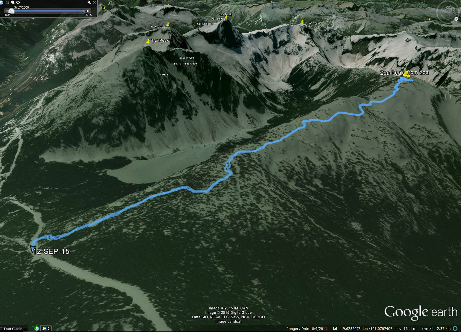
When we got back to the gate I stopped to look at it and thought the sign was a bit makeshift. So I checked the gate and found it unlocked and no lock in sight. So we decided to head on up and drive to the ridge as planned. The drive up the slope went fairly well, it was rough in a few spots but not difficult. We did follow one wrong branch a short ways before realizing it was the wrong one based upon my previous trip. So we backed up and turned onto the correct one to continue up to the ridge.

The drive along the ridge was easy except for the fog we were now encased in. We eventually got to where I was stopped back in 2010 but now a road continues past and we travelled it to where I had marked as our parking spot for the day. The road end was surrounded by steep slopes on 3 of the 4 sides. It looked quite isolated and remote here in the rain. Well we had arrived and now we had to get out and endure the rain first hand. We got our gear organized and my rain covers on and set out for the slope.

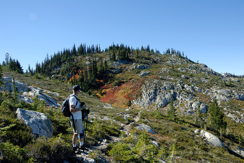
We had only around 400 meters to walk to the summit but we had 50 in elevation gain as well. Not a huge walk but we had no trail and a slippery wet mossy forest floor to make our way across. Even though it wasn’t much height to gain the slope looked steep and challenging in the dull foggy rain. We picked our way up and over fallen trees and around some rock outcrops and slowly made our way through the trees to our goal. The GPS units made the task fairly easy as we avoided any false turns. It was fun hiking through here but even though the understory was open the sheer number of trees limited ones view to a short distance. I can now better appreciate how easy it would be to get lost. One doesn’t have to get far apart to lose sight of each other.

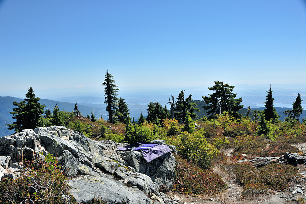
As we neared the map summit I stumbled upon the official Dewdney Summit trail. It was well worn and easy to follow. I continued along it for the short distance left to the summit where I turned off and walked to the actual point on the map. Now this point was a couple dozen meters from the SOTA coordinates so we set off to find that spot as well. It looked to be on another small knoll and was likely only a foot or two lower than the map summit. We decided to pick a rise between the two for our operating position.

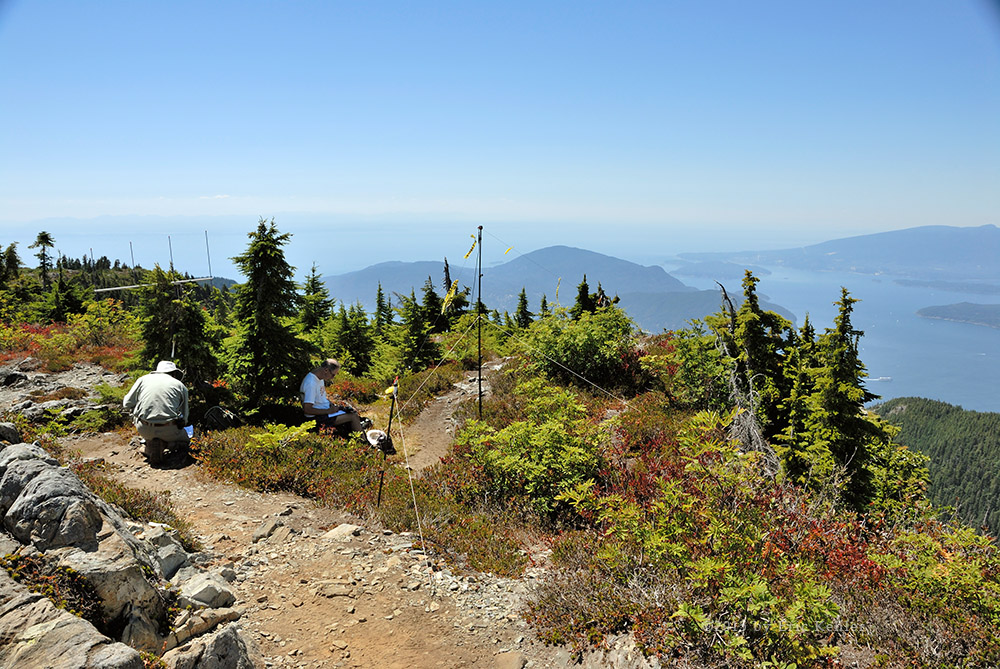
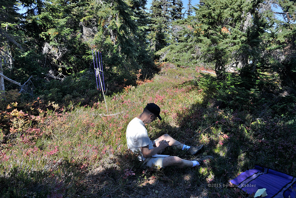
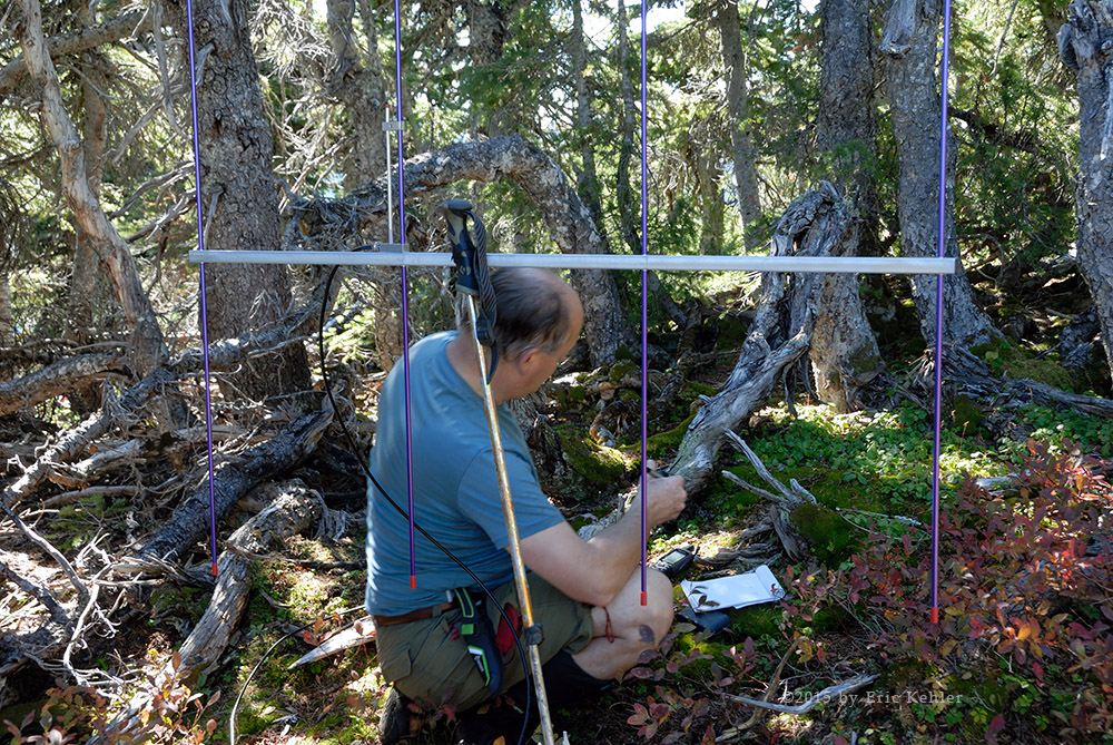
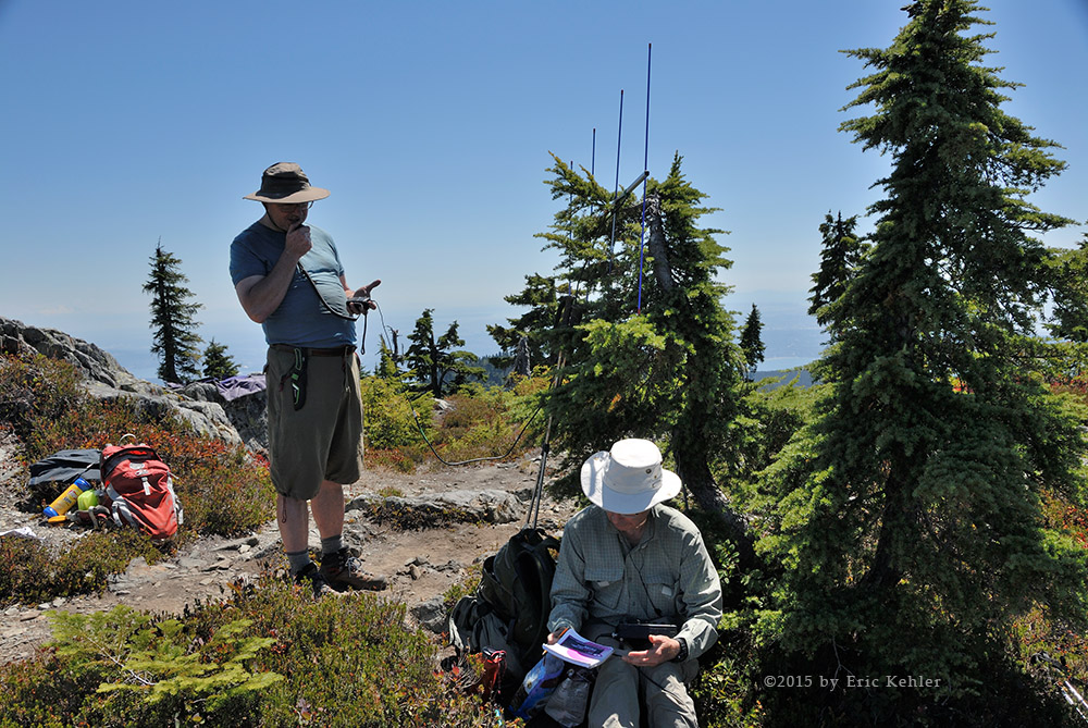
 As is common practice on the west coast for campers, the first order of business is to set up the tarps. So both Brett and I got busy tying them up and getting our gear stashed beneath them. I brought my portable chair and set it up next. Finally came my antenna. That took only a few minutes more and now I was on the air. Meanwhile Brett was still stretching out his HF antenna. I got two contacts in fairly quickly and then a final two 10 minutes later. Well I had achieved the minimum four needed to activate the summit so I took a break from it and helped Brett finish setting up. I then pulled out my cook stove and heated up a can of soup. It felt great having something hot in the damp rain. Hiding under the tarp was also very effective in keeping dry and warm.

Brett tried a few different bands and modes before he finally got a run of contacts including a pleasant surprise from a station in Spain. That contact really made our day as we had only 5 watts of power and a very limited antenna. Once Brett had exhausted his pileup he stopped for a bite as well. We had both achieved our goal and we felt the day was a great success. We were still wondering what happened to our fellow club members who had said they would be looking for us. I noticed that I did have minimal cell reception, so I called Ralph. He answered and said he was driving between stores. He did have his mobile radio and so he fired it up and I had immediate contact with him on my radio. So I logged one more contact before packing things up.

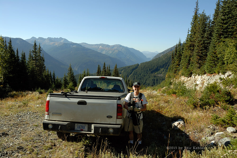
As we packed up, the rain picked up as did the cloud thickness. So we got things put away quickly so we could get back to the truck and get some heat. We followed the Dewdney trail for about half of the way back while it paralleled our upward leg. Where it veered off downslope we turned right, towards our truck. Following a track on the GPS sure makes backtracking easy. Soon we were on the steep initial slope with the truck peeking out between trees. It felt good getting back to it and starting up the heater.

Though somewhat wet, I was surprisingly still fairly dry for the most part. It felt good and I enjoyed the hike much more than I thought I would. I do think I will not avoid the rain as much as before. The drive back down the slope went without incident. I did notice that the road now had a lot more puddles in it and a small dip that had only a large puddle on the way up now had a reasonably size stream running across the road as well. So the rain was definitely being felt on the hillside and it was time to head home. We arrived at the gate and took a few photos of it for our collection. We were even more convinced that it was merely a sign left behind that someone had written the blasting notice to annoy other people. Done with the back-country we stopped for a warm coffee in Mission before heading the rest of the way home.

Map

SOTA on Zoa

Our adventure began a few weeks back when we were originally scheduled to do this hike. Unfortunately back then the weather turned foul after a summer of draught conditions. So we canceled the trip and waited a few weeks for a better day. Well it arrived and off we went. Unfortunately with the delay Brett wasn’t able to join us on this adventure.  Ralph arrived at my home just before 7am and we quickly loaded up the truck and started out for mountains.

As per the normal sequence of those drug addicted members of society our first stop was to the local drug dispensary for a fresh cup of the hot beverage that keeps society moving along in a generally functional state. Once loaded up we continued along to the next stop to feed the truck before getting onto the highway for a fast trip to Hope and then the Summit of the Coquihalla. It went smoothly except for a short slow patch near the end of our drive for road construction. The only excitement along the trip to this point was when Ralph was reviewing the computer to find our exit point off the highway – he tried to zoom in on the location but managed to terminate the mapping software while we were barreling down the road at 120km and rapidly approaching our exit. We now had to find the exit the hard way – with our memory and eyes. Fortunately we found the side road in time to exit and once off the highway we got the software restarted so we could follow the right backroads to the trail head.

We drove in to the Falls Lake parking area and there we spotted a narrow rough road heading north. It looked a bit over-grown but we stopped and engaged our 4x4 system and then set off onto the gravel road. It quickly began a steep climb up the slope which was good but it was also extremely rough with a stream having ripped out large chucks of the road bed. We managed to pick our way across and soon were past the worst and driving higher up on the slope looking for a fork. We found it and started up that road which was almost as rough but also very steep so progress was slow until we reached the top where the gas line right-of-way was. Here we parked and looked 30 meters down the clearing to see the trail-head.

Once parked we quickly got our gear organized and then set off for the trail. Though the road was very rough we still preferred it to having to walk the 300m elevation gain section of the slope to the start of the trail proper. The initial section of the trail is fairly steep as it winds its way through an alpine forest. Fortunately the trees offered shade and kept us cool in the growing heat. The trail was well trodden and ease to follow, it was also well marked with new reflectors placed on trees. Soon we were up to the ridge line and the climb got much more gradual. The fall colours were starting up here with the blueberry leaves coloured bright red. The ash was yellow and with the deep green of the spruce, and a small hint of white wild flowers the slopes quite spectacular to view.

We continued our way along the trail as it followed the ridge to the summit of Zoa. At one point we met two hikers come back from the summit. The one chap almost walked into me, he was so involved in his conversation with his buddy that he really wasn’t watching the trail! We stopped and chatted for a while he does rock climbing and several other more challenging adventures in the hills. This hike was an easy check out hike for him. After a rest we continued along the trail and eventually reached a view of the peak and the what appear to be steep trail to the summit. Though it looked quite challenging from the distance the final climb wasn’t too bad and we were soon following the trail as it led past the actual summit for a better viewpoint on the shoulder. We left the trail and made for the actual summit. It was in a lovely settling with trees scattered around it giving us a shaded spot to set up and operate from for our Summits on the Air activation of the summit. First we unloaded and ate lunch to regain our strength after the hike. I got my 2m antenna assembled and put out a call to the Sumas Mountain repeater. I was able to reach it in a spotty fashion with contacts fading in and out. I tried a number of locations to see which would reach it more reliably eventually settling on a spot a few meters to the SE of the summit. I heard Carolyn (VA7CDA) make a call to me but I wasn’t able to respond for her to hear me. A bit later Bill (VE7WNO) called and him I was able to talk with. Over the next hour I managed two more simplex conversations including with a hiker doing a SOTA activation on a peak in the U.S.

Meanwhile Ralph had strung up his 20m wire vertical antenna and was making contacts throughout the region. He found it hard to break in initially but once he got the first contact they piled up quickly. In the end we had 13 contacts logged. The summit was now officially activated for the first time. Eventually we had had enough sitting around playing radio and felt it was time to pack up and head home. The breeze had picked up a bit and with the heat of the early afternoon the day was proving to be ideal hiking weather. Before heading back we continued a bit further along the trail to view the western views of the next summits in our group – Guanaco and Vicuna. They are impressive to view but look a bit challenging to climb.

The return hike went smoothly with us making very good time even with numerous stops to gather up some photos and just enjoy the location.  Soon we were down through the steep section and walking along the right-of-way backup the short distance to the truck. It was great being back and getting the pack off my back. I changed in to some fresher clothes and then we started back down the washed out road. It took only a few minutes to get to the paved parking lot and then on to the highway. Our next stop was in Hope with my favourite Bistro in Hope – The Blue Moose. Loading up on coffee we were now ready for the final leg and drive home. Feeling good about the day’s achievement we had fond memories of the hike and were already planning our next adventure.

Map

Wells Peak on the Air

Today would be our third hike on the mountain and our second to reach the summit. Our previous attempt was in 2012. In July 2012 we were stopped by snow but made later in September. Today was almost 3 years later to the day.  I was looking forward to a tougher hike than what I had been doing earlier in the year with my friends from the Radio Club. Today’s hike with Geoff would be harder but still not too difficult, having done the trail before makes it easier to follow.

Our day began around 7:30 but seemed to progress in slow motion as we made our way through the regular activities of getting some coffee, fueling the truck and then buying some beef Jerky. Geoff added one extra stop to buy some lunch supplies as he had missed a major ingredient. The drive along the highway went smoothly but it was here that we discovered that the Sumas repeater was once again off the air. We had planned to use it to co-ordinate our activities. Too late to really find an alternative we continued on. We arrived at the start of the logging road in good order and started up the rough road to the far end of the deep valley.

The road was more over-grown than before as one could expect but it was still open enough to make reasonable time up the slope. Three years ago we had to clear some trees but this trip there were none in the way. Geoff spotted a Grouse on the road at one point and we stopped so he could hunt it with his bow. The season was open for Bow hunting. He shot twice but missed and he was only able to find one of the arrows. A bit later and just before the end of the road he tried again but shot between two birds! I finished the drive along the road and parked the truck. We were the only ones on the road and in the parking area.

After getting ourselves organized and our gear loaded onto our backs we started up the old roadway, it was 11:30, a good hour later than we had planned. The roadway had a decent trail carved into it, better than what I remembered from my earlier hikes. It looked like there had been a bit of trail work done. The first thing we noticed was that the plants were quite drenched and we were quickly becoming very wet ourselves. Pushing through the plants involved knocking off the leftover rain from the night before. It was going to be a soaker until we reached the thicker forested section. Eventually Geoff got tired of breaking trail and I took over.

Once through the wet section we started up through the steeper forested segment to the ridge line. This portion of the trail is reasonably easy to follow as it takes many switchbacks up the slope to the base of a granite wall. We then made our way along the base and crossed over a large fallen tree which was cut into a bridge for the hikers. We continued up slope past a ladder crafted from two trees. It looked safer to walk alongside it rather than use it. The trail continued up the slope fairly steeply until it finally reached the ridge line where it opened up into broader meadow sections. Here the sun had dried the plants and we were no longer in tall wet bush. In fact we were reasonably dried off already.

The hike along the ridge is quite pleasant, mostly in the shadow of trees but still in fairly open country. We continued up and over the ridge to start the traverse of the heather covered talus field below the summit. In some ways this can be the trickiest part of the hike. The slope is very steep and covered in heather. One has to pick their footing very carefully to not slide or get wedged between rocks. After gaining some elevation we came by a large boulder where I could rest and get my crampons put on. Now I was able to handle the heather much easier and we made better time crossing the slope to the far ridge. We zipped up the far side glad to be done with the talus field. The views were already very spectacular and I could see the summit now not overly far away though there was still some major slope to climb. We were able to find a faint trail again on this side of summit and we followed it up the steep ridge and then across to the south to where there is a treed section that one can use to pull oneself up to the summit ridge. I sure was happy to have my spikes on. Once over the lip we were on the top ridge with only a short walk along it to central peak and the summit of Wells. Once we had both arrived we stopped to eat lunch, it was a bit after 2pm. We took 2.5 hours of hiking to get here. Not really that bad.

Once rested, I set up my new 2m yagi antenna and started making calls for contacts on my hand-held radio. My secondary goal of the hike was to activate the summit in the ‘Summits on the Air’ radio program. That requires four contacts from the summit. After chatting with the first guy for a bit we tried turning the antenna and eventually found 3 more contacts. I had achieved the needed number and so I stopped to finish my lunch. After a good rest and some photography I got back to the radio and tried working into White Rock. I managed to reach the club repeater on my home roof and from there chatted with club member Ken but repeater contacts don’t count and we were unable to connect without the repeater. Ralph Webb put out a call a few minutes later on simplex and I was able to work him and get a fifth contact. After Ralph we packed up the antenna and we started down the trail.

It was tiring but much faster than on the way up. The crampons actually made the lower section of trail go smoother and we soon found ourselves past the talus field, down the slope and out of the forest, with only the earlier wet section remaining. Fortunately the sun had dried the plants by now and the trail was actually quite dry and we stayed dry all the way to the truck. As we were packing away the gear we looked up and spotted a pair of hikers emerge from the Hope Mountain trail a few meters from the truck. It came as a bit of a shock as we hadn’t seen anyone on the road going up. They had no vehicle in sight.

Once packed we started down the road keeping a watchful eye out for the pair. We caught up with them a fair ways down the road. I was quite surprised at how far they had gone. A short distance further we passed another couple and their dog who seemed to be out hunting. Continuing down the road we eventually came by both couples trucks. They had stopped at a wide area just below a small water crossing.  They sure added a lot of extra distance to their hike. I wonder if they did the whole Hope Mountain hike as they started quite late and were done when we were. That hike is much longer but not as steep.

Arriving at the bottom of the road and almost to the highway we stopped to turn off the 4x4 mode and here we noticed that the front cover of the passenger side mirror was missing! We had no idea where it might have fallen off and we weren’t going back to look for it. So it is another piece we will need to replace at some point. Tired and sore, we made a stop at the Blue Moose to gather up some legal drugs for the drive home. It was getting harder to move by the minute so we needed to get in there and back to the truck fast, fortunately there was no line-up at the till and we got our drinks and were back in the truck and driving with little delay. By the time we arrived home my legs had quite seized up and I was moving very slowly, a good thing for a hot tub – it helped a bit.

Victoria week-end

I enjoy a short trip to Victoria, though it really isn’t far away, the need to ride a ferry to get there definitely gives it a sense of remoteness. This year we went during the summer rather than our usual spring trip. This meant we were there in the busy tourist season but also in the better weather. Now this year we were in the midst of a dry spell, so things were dry and dusty at home and unfortunately not much better in Victoria. It also meant that our favourite hotel was booked full and we had to find an alternate location.

We left mid-morning on Thursday and caught the noon ferry, though we were almost an hour early we just made it onto the next scheduled trip, the crowds were definitely there. The ride across was uneventful, we ate lunch in the café and read in the lounge afterwards. We tried sitting outside but the announcements on the PA system were so loud it got very irritating very quickly. Once we had arrived in Swartz Bay we had a leisurely drive to Island View Park. I always seem to stop by here as the beach is interesting with driftwood and the views of the islands quite entertaining. This trip saw many more people laying around in the sun which was a new experience as it always seemed so empty on my prior visits.

Done with the park we drove to Victoria and our hotel – The Abigail Hotel – but not before grabbing a coffee at the standard purveyor of legal drugs, namely Starbucks. The hotel proved to be very lovely. It was all that the photos made it out to be. Our room was very enjoyable and offered a very comfortable bed – one of the best I have enjoyed while away from home. Now the place was great but the hot breakfast and early evening Hors d'oeuvres were incredible. They even operate scent free and looked after Carolyn’s wheat allergy. Needless to say that after 3 nights we were very happy with the place and plan to return on our next visit.

We ate dinner with two of Carolyn’s friends who live in Victoria at the Breakwater Café. It was a nice meal and we enjoyed the sunset and a short walk on the breakwater after dinner. Friday saw us lounging around our room and walking into down-town for a few purchases. It was a nice walk, though a bit longer than we would have had from the Magnolia, it was still quite reasonable and we enjoyed the exercise. We enjoyed dinner with my cousin Jim at the Canoe Brewpub. The meal was OK but nothing that special certainly not up to the level of our hotel. I suppose if I drank bear, they would have had some nice choices of their own production which may have made the meal better.

Saturday saw me out and about. I decided I wanted to visit the summit of Mt. Douglas. This is a low peak on the edge of town and offers a road to the summit with a great view of the city. I left mid-morning and arrived at a bit past 11am only to find that the road was gated shut until noon. So I back-tracked to the nearest Starbucks and enjoyed a fresh brew while I read until it would be open. I arrived back at the gate just after it was opened and I was third up the road that day. I parked and walked the short way to the actual summit where I set up my new portable 4 element yagi antenna. I wanted to try it out and see how the summit would do for a possible SOTA peak. It worked well, I was able to work into my local club repeater. A few asked about ham radio while I was up there and I shared some of the fun of the hobby.

Later that afternoon I drove over to my Cousin Jim’s home in Oak Bay and he showed me the major renovations done to his 70 year old home. The place looks great and I am sure it is a very enjoyable home to live in. We walked to the beach and made our way to the Oak Bay Marina for a cool refresher. It was a pleasant walk and we felt good for the exercise. The drive back to the hotel went quickly as the whole area really is quite small. For dinner Carolyn and I walked to a restaurant we enjoyed on our previous trip – the 10 Acres Bistro. It was a pleasant walk in the warm evening and we had another nice meal.

Sunday began well once again with a very good breakfast at the hotel. We then packed up and were on the road by 11am. As we had lots of time, I took Carolyn back to Mt. Douglas so she could enjoy the view from the summit. She quite enjoyed the place and was even able to get to the actual top. After a short stay we started on the drive to the ferry but took the scenic shoreline route where we discovered another good eatery – Adrienne’s at Mattick’s Farm.  Done with lunch we high-tailed it to the ferry and arrived just before 2pm, in time to line up for the 3pm sailing.

The trip was very enjoyable, though I didn’t really take many photos, I found the time relaxing and well worth the effort and expense to be there. We will definitely return to Abigail’s on our next visit. Did I mention it was our 36th anniversary and we both felt it was a great holiday celebrating our marriage?

Campbell Valley

I’ve been coming to the park since my kids were little, the place still oozes freshness and solitude. As a change from the regular path, Nick and I turned onto the Vine Maple Trail and enjoyed a less travelled section of the park. Only a few passed us on the trail so we had it to ourselves to stop and marvel at some of the huge trees through which the trail meanders.

The initial part of the trail was particularly treacherous for photographers as there were many dog mines along the edge of the path. If one is concentrating too hard on the subject, it would be far too easy to miss-step. Do these owners actually not notice or are they just not bothering to clean it up, it really does motivate one to ban dogs. Nick brought his camera and he borrowed my tripod so he could try out stationary photography. He found it very helpful for most of his photos but for the few that needed faster action the setup got in the way.

It was a great day to walk the trails and the hot sun was mostly avoided by being on the more secluded trails. We both took a number of interesting photos and felt that the time out was well worth it. I really need to come here more often as my last visit was three years ago. I noticed quite a few improvements to the trails which make it easy to walk. The only negative for today’s trip was the lack of water in the river! The southern bridge was completely dry. The northern bridge crossed over a small bit of stagnant water. This dry spell is sure having a strong effect on the small creeks.

American Creek Rock Hopping

A month ago we started exploring the upper Garnet Creek area but ran into serious truck trouble, so now with the truck repaired we returned to the region but not to the section of road that devoured us and spit us out a broken, limping mess. I guess we have a bit of a cowardly streak in us at times. Today we made good time to the start of the Garnet Creek FSR and there we immediately noticed that the construction signs at the start were missing. It looks like the work on the new transmission line was completed through here and the evidence of the work had been removed. We continued up the road and about a kilometer in we came by a group harvesting firewood. We continued on in and made for the small campsite on the Garnet we spotted last time.

As we approached the end of the spur and the campsite we noticed that it was occupied with a family spending the week-end. Geoff wanted to turn back but I insisted we continue with our plan to explore the small river gorge he had seen last trip. We parked and walked down to the creek where we saw the family and their noisy dog. They had recently purchased some sluicing equipment and were busy trying it out in the creek. I guess the TV shows where people are finding huge gold deposits is rather motivating. Their dog was a bit aggressive and did bite Geoff at one point but it wasn’t serious. After a short chat we continued up the creek to the gorge and there we started to take some photos of the rock formations.

I wasn’t able to follow Geoff over some of the rocks so we back tracked a short distance and found a path alongside the creek that got us past the section that was stopping me. Further up the creek we hopped across the rocks and found a good number of lovely views of the creek and the water running through very narrow chutes. I did manage to slip and scratch my leg up a bit at one point, fortunately the water stayed out of my boot. The flow was light which gave us opportunities to find lots of angles to shoot photos from. The smooth curved rocks were quite impressive and left no doubt as to the power of the water. This place would be a dangerous roaring maelstrom in a high flow period. Once we had explored the extent of the area we could walk without getting wet we started back for the truck. This time we stayed in the forest alongside the creek so as to avoid the dog. We chatted with one of the campers as we came past his camp spot, he told us how they had found a flake of gold on an earlier trip and this time wanted to see if they could find a more serious quantity.

We back-tracked to the fork with the American Creek FSR and started up the slope out of the Garnet Valley, the view from the road of the valley was worth a stop. The view was very lovely and the breeze up the valley was quite pleasant in the hot sun. After a few photos we continued up the mainline but soon took a side road that led up the far side of the American Creek valley. The road was recently used for building the new towers and so we were able to get to a nice overlook. While we were out of the truck taking photos we heard some radio activity which caught our attention and we set up our larger antenna to try and contact a person who we thought was a Summits-on-the-air activator on a summit. Unfortunately we were only able to hear one side of the conversation and it became clear that the two people were talking about a SOTA activator rather than it being one of them.

From the lookout we spotted a small lake to the east which was under the older transmission lines. This lake was the one I took photos of back in 2009 when I last did this loop. It looked inviting so we decided to forego lunch up here in the sun and drive down the slope and then along the main road to the lake. This didn’t take too long and soon we were driving a road which didn’t exist last time I was here. Back then we had to follow a very steep and rough power line service road up the slope to connect to the eastern part of the FSR. Along that stretch the view of the lake was quite nice. Today the new road stayed lower and connected to the eastern segment without providing a nice view of the lake. We eventually drove alongside the lake but without a clear view. A short distance past the lake Geoff turned the truck around as he really wanted to eat lunch next to it. As we drew nearer Geoff spotted an over-grown road beneath us and so we found the access and drove it. The road led across a stream bed which was a bit soft and I was a bit uncertain if we would get stuck but we made it across without issue. After climbing up over some large rocks we emerged at the base of a tower and a lovely view of the lake.

The lake was so inviting we decided to hike down the slope to it. We had one false start and on our second attempt we found a way through the wild blueberries to the lake shore. The ground was soggy and we had to pick our way carefully and not stand in one spot too long. The lake was very pretty from this level and we wandered along the edge for a distance. Here we spotted some fresh bear tracks in the mud. We now kept a watchful eye out for the bear as we continued along. I gathered some more photos and fortunately no bear made an appearance. For our return we decided to trek through the blueberries rather than back along the lakeshore. This proved a bit harder than expected as the bushes were stiff and thick. The heat was also starting to wear on us as well. We managed to make it back to the truck with only scratches.

We were now quite hungry and so we needed to break for lunch. Though the view was nice the heat was too much to bear so we decided to back down the side road to where there was some nice shade and there we stopped for lunch. Now we faced a bigger issue. We set up outside the truck and cooked our soups but as we ate the flies descended and started their meal on us. It got bad enough we moved inside the truck and finished our lunch inside.

Nourished and rested we returned to the main line and started driving east and towards the end of our day. I was looking forward to where the road crosses the main creek. It was here back in 2009 that we had to cross the creek at creek level with no bridge. It had been washed out and the only way across was through the creek bed. The path was level and easy on our first trip back then but on the second we came after some heavy rain and the creek was flowing fast and deep, had we not driven it two weeks prior we would have turned back! So today I was interested to see how things looked. Well we almost missed it as there is now a solid bridge across the creek about 100 feet downstream of the old crossing. After stopping on the bridge we spotted the old road and walked down to it.

Once at stream level the creek looked so interesting that we hiked up it finding all sorts of amazing sights. Like the Garnet, this tributary of the American had carved the rocks with incredibly smooth chutes where the small amount of water was running. Picking our way up the creek wasn’t too difficult and we could walk the side slope in a few spots to get past some larger rocks. The colours and smoothness of the rocks were very beautiful to look at. Geoff was quite amazed at the lushness of the forest alongside the creek. It reminded him that we are still in a rain forest even in the midst of a very dry summer. We finally reached a spot which would have required a longer portage along the bank to get to the next section so we decided to head back to the truck and make our way out as the day was getting later and the sun sinking behind the mountain we were exploring. Once back in the truck the road forward was quite easy. We came upon one more side road which led up the slope of Dog Mountain to the ridge line, I have wanted to drive it for some time so I thought we could take some time and try it. Unfortunately the road became quite overgrown a half kilometer in and we decided to not push it so we turned around and continued along the main line. We did stop at a few spots to enjoy the sights of the valley and at one spot we noticed a large solar panel across the valley at the top of the far ridgeline. It didn’t seem to be connected to anything we could see which raised our interest in what it was doing up there. The short distance further to the Fraser Canyon went quickly but was marred by us catching up to the one vehicle we met moving on the road. We spent the last few kilometers in the dust.

Once off the American Creek FSR we were just north of the town of Hope so we made a quick trek into town to our favourite coffee shop – the Blue Moose – for a bit of caffeine for the drive home. The place was packed and we had to wait a bit in the line-up to place our orders. Once loaded up with caffeine we started on the final drive home. We made good time except for a short stretch which was slow due to a minor accident. The day was a lot of fun and we saw some lovely sights of creeks and lakes not far from Hope. Perhaps we will need to try and explore the other side of the ridge and see what that solar panel was doing next.

Mount Strachan Adventure

My last visit to Strachan was back in September 2009 and I was long overdue for a return visit. Last time Ethan and I hiked the summit by following the long route which starts by following the Baden-Powel trail towards Hollyburn Mountain there the route to the summit splits off and backtracks at a higher elevation before starting to climb in earnest. It is a long hike through the woods and adds a couple of kilometers for little elevation gain. It is a pleasant hike and fairly well shaded but today I was joined by some friends from my radio club and our goal was to do some radio communications from the summit; we wanted a shorter hike so we could spend more time at the summit. So we decided we would hike up the service road which is a bit steeper and not as scenic but is the shortest route to the summit.

Saturday Morning came and my fellow club members Ralph and Brett arrived at my door ready to take on the task of activating the summit of Mt. Strachan. The day was clear and sunny which of course meant it would be a hot day on the slope. Sure enough the hike was a hot one made worse by the lack of shade along the road which served as our trail. Even the summit had very little shade due to the stunted trees that were growing there. So we were in the blazing sun for most of the day.

Upon arrival at the parking area we noticed that there were a large number of cars parked along the roadway. We were directed by a park worker to park alongside the roadway and start a new line of vehicles. He noticed my Ham license plate and asked what we were up to. We learned that he was also a radio operator but that he had not heard of Summits on the Air so it was quite interesting to him. He also explained that there was a major outdoor event taking place this morning and that was the reason for the number of cars, and loud music.

We geared up and began the hike up the service road. The first segment went smoothly but the sun was definitely beating us down and the heat was rapidly climbing as the day wore on to noon. There were few places with shade on the road but when we did come across a patch we stopped for a needed break from the heat. Even with the road being the short way, the heat slowed us down and it took almost 3 hours to reach the south summit. Once on the ridge we found a shaded rock and had a longer rest to regain some strength for the final assault of the northern summit.

 Once somewhat rested we began the final stretch. It took only 10 minutes more to cross the ridge and descend the gully between the two summits. The drop to the col looks quite challenging from the ridge but the actual descent wasn’t too difficult as there were a number of footholds dug into the ground at key spots. Once all three of us were on the col we looked at the climb back up the north peak. This was a bit longer than the southern side as the climb continues straight up to the summit. The trail is easy to follow and though there were a few spots where one had to scramble up some rock faces, it was again not overly hard to do.

It was a welcome relief to finally arrive and get a rest while we ate lunch. There were a few groups coming down the north slope to the col as we ascended and another group of four busy at the summit taking photos. While we were on the peak a few more groups came along but the numbers were much lower than on my previous visit.

Once ‘rested’ Ralph started to set up his Buddipole based wire dipole antenna while I assembled Brett’s portable 2m Yagi. It’s a very nice portable antenna in a very convenient canvas holder, I think it would do well for me in the back-country. It would stand up to the banging around much better than my current one.  As soon as the Yagi was assembled and hung on a branch, stations were lined up waiting to make a contact. I had 5 contacts completed before Ralph finished setting up his antenna! Brett followed with 4 more of his own.

Once the HF antenna was ready, Ralph made a few CW contacts on 20m then Brett did a number of voice contacts. Soon the two hour mark had come and we were all getting overly hot; it was time to pack up and head down. There had been a few more groups on the summit while we were operating but only one chap asked about the yagi and the contacts we were making. All of us were thoroughly impressed with the spectacular views from the summit, they were a good reward for the effort needed to get here.

Once the radio gear was packed we started the long hike back down. This went smoothly even the scrambling down and then up the rock face between the two summits. The walk down the service road was hot but this time, the sun having moved, we had a few lovely patches of shade to break the heat. The return took half the time of the ascent and we were back at the car by 4:30. Exhausted and hot but all happy for the adventure. We were already talking about our next one in August!

Garnet Creek Almost

Several years ago Ethan and I managed to drive the Garnet Creek FSR all the way from its start on the Lougheed highway, through some narrow roads and across to the Talc Creek FSR and finally ended up at Harrison Lake. It was a challenging drive but we saw some amazing scenery. I have tried to get back there a few times since but was always stopped short by wash outs. So today I thought we could try again.

Our adventure began much as usual with a stop for 1) coffee, 2) fuel, 3) dried meat then it was onto the highway and a quick drive to the start of the Garnet FSR. At the beginning were some notices about construction that we stopped to read and set the radio to the road frequency. Then we started up the bumpy start of the road. We quickly made our way up to the section which in winter presents a tall wall of ice and is usually very beautiful. Today we came across a notice warning of steel plates on the road! The road was disappearing and the gaps were covered by plates. That could be a bit disconcerting but we drove over them with little further thought. Before much further we came by a side road leading towards the creek. Here we stopped by the base of a transmission tower to gather some photos. Geoff noticed a smell of gasoline and so we checked our spare tank and noticed it on its side and leaking. So we secured it in an upright position and continued on. We found a partially obscured road leading down the slope which we followed to just short of the creek. We parked and walked along the broken remains of the road the rest of the way to Garnet Creek and there we enjoyed a very pleasant view of the almost dried up creek.

Once we had looked over this area we returned to the truck and carefully turned it around in the narrow road way for the climb back up the slope to the main line. The truck seemed a bit sluggish but we got up without a problem. We continued on and came to the main fork with one branch continuing up Garnet Creek and the other leading to American Creek. We came to see Garnet so that was our choice. I wasn’t sure how far we would get as last time it was only a short distance. Today the road was in better shape and we continued in past all the old washouts. We took the lower fork of the next split and followed it a short distance to its end which left us a short walk to Garnet Creek. Here we parked and got out to explore the creek. It is an amazingly beautiful location with a nice rocky beach alongside the creek, a waterfall on the left and a lovely gorge to enjoy to the right. A great place to camp and explore in detail. I grabbed a number of photos and then we returned to the truck and started up the other branch.

This one followed the old route on the map and gained some elevation as it made its way up the creek valley. Eventually we passed an old gate and now the road got quite rough in places with some challenging cross ditches to get past. We had a bit of clearing to do and even a tree to saw and move. We were getting past the really rough area and I could see the tone of the road changing to be the area I was hoping to get to. But then the truck flashed up a problem – low battery! Not at all what we needed. We checked for a blown fuse but found nothing and so we decided we had to turn back and not risk getting stranded out here. We had the spare battery but we didn’t want it to run out while we were not on pavement and it seemed like the alternator was not functioning.

We got turned around and started back. The cross ditches seemed to be a bit easier on the return but it may have been only because we felt desperate and needed to get back now. In Geoff’s concern for the battery he misjudged a large rock that he was sure he drove over on the way in, I was sure he drove around it. Well this time he drove over it and it hit the exhaust pipe in such a way that it cracked the exhaust manifold! Now we had the pleasure of scaring the bear’s two valleys over! As we were low on battery we had shut down as much power use as possible which included the A/C which meant we had the windows open.  This was fortunate because in the quitter moments Geoff heard a repetitive swishing sound as he drove along the road. We stopped to check and sure enough he found a gash in the sidewall of the front tire! So here we were still back in the bush with three issues to over-come. We decided to leave the tire as long as possible and deal with it when the battery finally gave out.

We made it through the rough road and then just as we started down a steeper section the truck shut off and Geoff had to maneuver the beast down the slope without power steering or power brakes. Fortunately it wasn’t too steep and it leveled off where we coasted to a stop and 150 feet from the gate. Here we worked on swapping in the spare tire and swapping the batteries. We got it done an under an hour and started the truck. Things looked fine again except for the noisy bear deterrent. We made our way along the road and down to the end at the highway all without further incident. Here we reviewed the battery level on our second battery and decided it was still in good shape so we turned on the A/C for the drive home hoping we could make it back before the level got too low.

Well the drive home went smoothly, we didn’t even get any noticeable looks from people we passed considering the racket we were making. The battery level dropped a fraction of a volt but nothing to be concerned about. Once home and unloaded I did some testing of the power systems and determined that it was the battery isolator that was the cause of our problems. The main battery side of it was not working correctly. It was currently faulted closed but I suspect it was an open circuit and flakey earlier which is why we were having changing issues. So I by-passed it for now and will replace the unit once the manifold is replaced. I do remember being concerned about the unit when it was installed as it was rated for less amperage than the alternator could supply and I think it was cooked over time. It just goes to show that sometimes one needs to go with one’s gut feel and not always the ‘expert’. I will replace it with a larger unit.

So in the end I got closer to the scenic location but still missed it by a kilometer or two. I guess there is always next time. Though I suspect this road is on Geoff’s avoid list now.


Field Day on Blackwall Peak

This year, Brett and I wanted to try something different for the annual international Field Day radio event. Rather than just join a club activity or set up in one’s yard, plans were made to travel to a mountain summit and try a low power operation from the high altitude.  We needed a summit that met a long list of requirements and found that Blackwall Peak in Manning Park fit the bill very nicely. So plans were made to operate from the area near the old BC Telephone microwave repeater station.

The nice thing about this location is that there is road access to the repeater site though the last 350m was closed to vehicles. The elevation was 2000m with a broad area to set up on. The Manning Park resort was at the base of the mountain which gave us a restful spot to spend the evenings. Brett went up to the location a week earlier to get a feel for the site and scout out a number of possible spots. He found the location very enjoyable and left looking forward to his return the following week-end.

On Friday morning June 26, we set out for the park. Our first goal was to re-scout the summit area and decide on the location for our operation. When we arrived at the resort we were able to check-in early and then eat lunch in the café. Done with lunch, we started up the road to the summit. Upon reaching the summit parking area we walked over the sites Brett had found the previous week and after some discussion settled on the area next to the old repeater facility. It had a wide road area we could setup on which not only gave us a good operating location but also allowed us to stay off the very pretty wild flowers that were in bloom. Having selected our site we returned to the car and then set up Brett’s new portable yagi antenna. We walked to a shaded picnic table just below the car and attempted to contact various repeaters in the region. We were unable to reach anything in the Fraser Valley so that was not good news for our planned 2m work during the contest. We did reach a Merritt repeater and the Apex Mountain system where we had a chat with a chap in Vernon. After trying a number of other ideas we packed up and returned to our cabin.

We only had a short time to rest before we had to set up the Brett’s portable Buddipole antenna so that Brett could copy the ARRL bulletin which gives extra points for the Field Day contest. We had a few challenges during reception including a momentary radio shutdown but between two attempts we had a complete bulletin in our log. Done with the bulletin we packed up the gear and signed off for the night.

We left for the summit around 7:30AM and arrived a bit before 8 which would give us lots of time to get ready. We parked close to the gate and started carrying items to the operating position. In total we made 3 trips; it was a lot heavier and harder to do then we had expected. Once everything was carted to the location we were able to start setting up the Buddipole. The assembly went quickly but then we had issues with tuning it. We were using both Eric’s new tiny VNA and Brett’s Comet analyzers. The VNA gave nice charts but we were just learning how to use it. Fortunately the results of the two generally agreed. We fiddled with the Buddipole far longer than planned and now we were actually running late as we still had to set up a second antenna. We had selected the location with two clumps of trees set the right distance apart and facing the correct orientation for the wire antenna so now we had to raise it. It took a number of tries to get the rope into the trees but soon it was in place and the wire suspended.

We quickly set up the KX3 radio and were on the air only a few minutes late. Brett began with some voice contacts and managed to break through the noise and make a few contacts. We were really struggling to be heard with our whole 5 watts of power. We could hear a lot of stations but they could not hear us. After trying for a couple of hours Brett switched to Morse code with keying and logging help from his K1EL keyer and notebook computer. Morse proved much better at being heard and we soon were making regular contacts. We began our day with the Buddipole but after we switched to the wire antenna we stayed on it for the rest of the contest. Though the wire only handled 20m and 40m bands it just seemed to do better than the pole. Over the next number of hours Eric did a number of sessions on voice but struggled with the pile-ups and was only able to make a few contacts. We had originally planned to operate until around 9pm but around 7 the notebook (which Brett was using for logging) decided to error out on us and didn’t want to boot. So we decided to pack it in a bit early as we were now both quite tired and we still had to pack out the equipment. At this point club member Jim called us on our handhelds saying he was at the resort and needed directions. We packed up a few items as we waited for him to arrive. It was a shame that the computer had shut us down early as he arrived only to help us carry stuff back to the car. We did take some time to enjoy the scenery and look over the technology of the old repeater.

Once back in the cabin we ate a quiet dinner and got to bed early as we wanted to get an early start in the morning. Sleep was a bit restless thanks to the heat as the cabin was not air conditioned and had gotten quite warm during the day. But we did get some rest. The next morning Eric was up second at 5:40AM! We had breakfast and got loaded up and soon we were packing our scaled back equipment list to the operating site. This time we packed in only a single load and left behind items which were not essential. We were on-site by 7 and operating around 7:30. The notebook having had its opportunity to express its displeasure yesterday, booted up fine today and seemed in good order but once bitten we decided to leave it in the car and finish logging with the trusty iPad for the rest of the contest. Our new challenge for today was to keep in the shade, we had left the tent behind in order to drop weight and now we had to keep moving to stay in the shade of the trees.

Soon 11am arrived and the event was over. We were actually quite happy to stop as the temperature had risen again and we were already quite tired out. But we still had to pack things up and carry them to the car! The trip back though downhill still seemed to drag on and take a great deal of energy and will-power to complete. Getting some air-conditioning blowing in the car was a welcome relief to the heat of the day. The drive down to the resort went smoothly though we encountered a good number of cars heading up and kicking up dust as we descended. We quickly packed up our stuff left in the cabin and checked out then stopped in the café for lunch before heading home.

It was a fun event and we enjoyed the time there, both doing the contest and just enjoying the area. It was exhausting but we learned a number of things about how much and what to pack and next time we will likely be able to do things a bit easier. In the end we made around 60 contacts mostly Morse. The phone contacts were very hard to achieve and took time that could have more effectively have been spent on Morse.

Lighthouse West

Lighthouse Park never fails to enthrall me. Every visit offers new sights and gorgeous scenery . Today Nick had a Saturday off and though I was still recovering from a bug, I felt I could handle a short walk along the western side of Lighthouse Park. We left mid-morning and picked up some gas in Cloverdale then made quick time to West Vancouver where we arrived a bit before noon. We stopped to buy a sandwich and a few items for lunch then sped down the slope to the park. It was busy but there were a number of parking spots open and so we were parked and ready to go soon after arrival.

Now as it was noon and we didn’t really want to carry sandwiches with us, we decided to eat first and then head out. So once done with eating we walked out the lower western trail and headed straight for Juniper Point. It had been close to 3 years since my last visit and I was surprised to see the number of trail improvements that were in place. The point was a bit less endowed with trees than when I was last here. Several of the Arbutus were dead and I am sure some were even missing. Fortunately my favourite evergreen was still hanging off the rock face looking much as before.

Done with the point we walked back to the main trail and turned south for Shore Pine Point. Somehow we missed the branch to the shore hugging trail and stayed on the now more major trail which continued higher up the slope and terminated near West Beach. We decided to follow the Shore Pine trail back north to the point stopping at various lookouts along the way. We scrambled over a number of rocks on the shoreline to get out to the far point of Shore Pine Point and there we enjoyed the fresh breeze and sights of the ocean. Done with the point we back tracked and then descended to West Beach where we rested for a while and took photos of the lighthouse.

Once done with views we returned to the main trail and made for the Lighthouse Lookout. As both of us had seen that many times we just continued in and then along the road to the parking lot. It was a very pleasant few hours in the park but we both had had enough for the day. So the walk back along the road went quietly and we were soon back to Nick’s car and the start of the drive home.

Subscribe to 2015