
Agassiz and Woodside

Qualms one may have had about doing multiple summits in one day were put to rest early on as we set off for our adventure. We had picked three summits that had short hikes with the last expected to be a drive up to the summit with a short walk. Mt. Agassiz was to be our first summit for the day. It was the longest of the hikes and one we had done before. Next would be Mt. Woodside followed by McKee Peak. From each we would operate our radios to active the summit in the Summits on the air (SOTA) program. We were looking forward to bagging all three and getting a first activation for McKee.

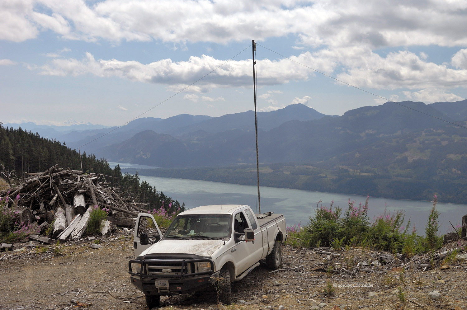
We left the house shortly after 8am and were soon racing along Lougheed Highway in the wake of a truck carrying a tractor. It was moving at a fair clip so we weren’t tempted to pass it. We did finally get past the truck as we started up the section on Mt. Woodside where the road gained a lane for the climb. No sooner had we passed him then we turned off onto the forestry road. A quick stop to lock in the 4x4 mode and we were off for the ridgeline. My next concern was whether the gate we encountered last time would be open or locked. So as each kilometer ticked by and the road continued to look heavily used by forestry vehicles I got more and more certain we may have an issue. But we soon reached a broad area on the far side of the gate and having not seen it I surmised that it had been removed! So nice for a change. We continued on, passing some active logging areas and soon we were parking in the old spot we used last time.

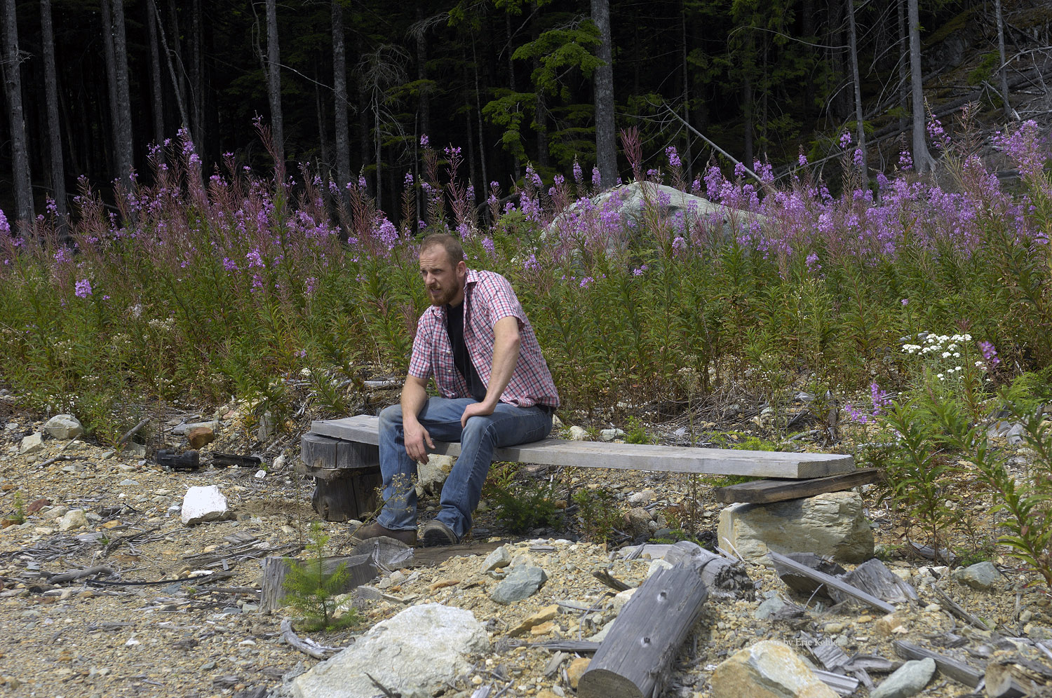
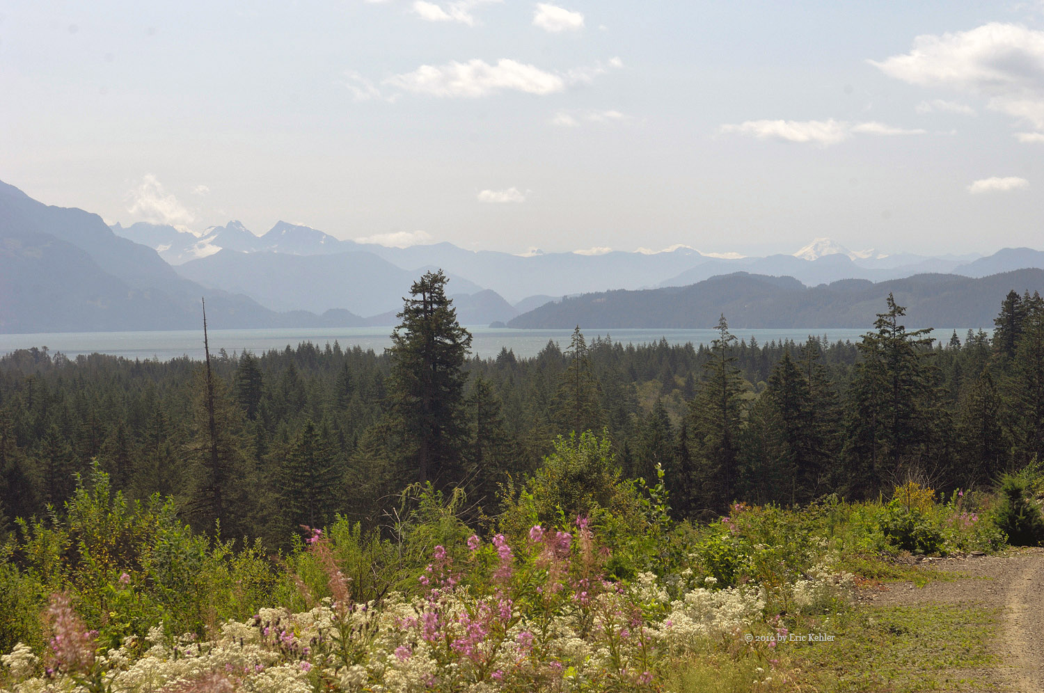
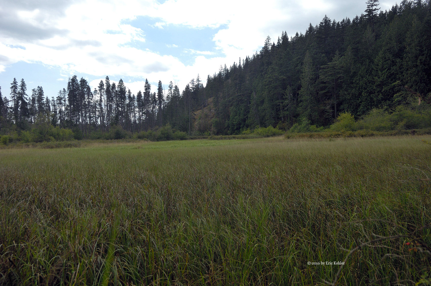
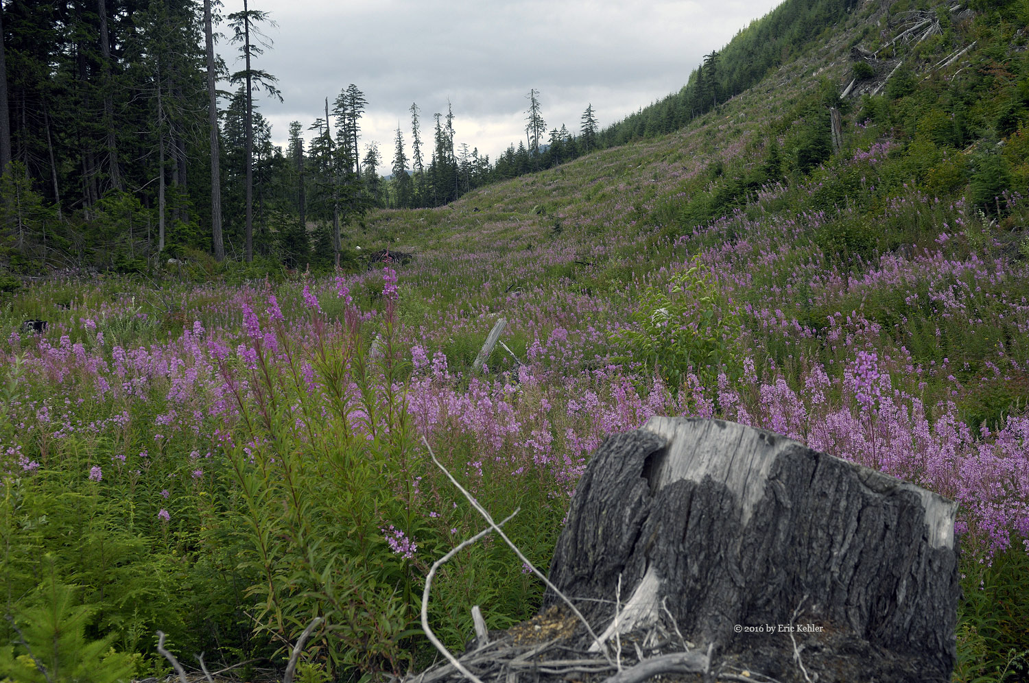
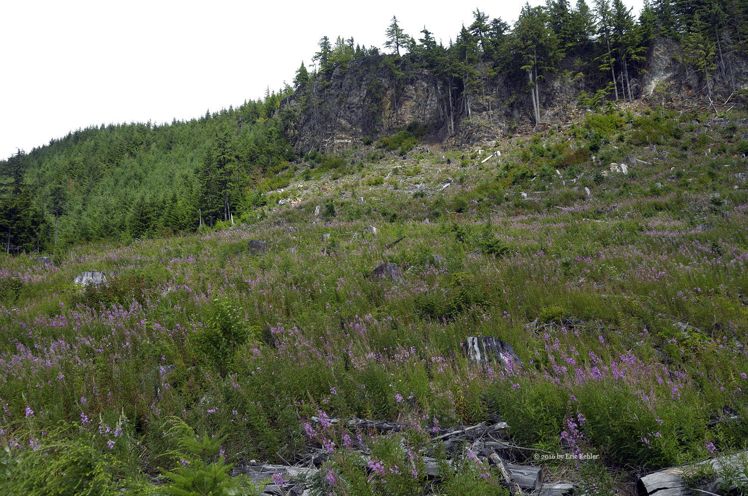
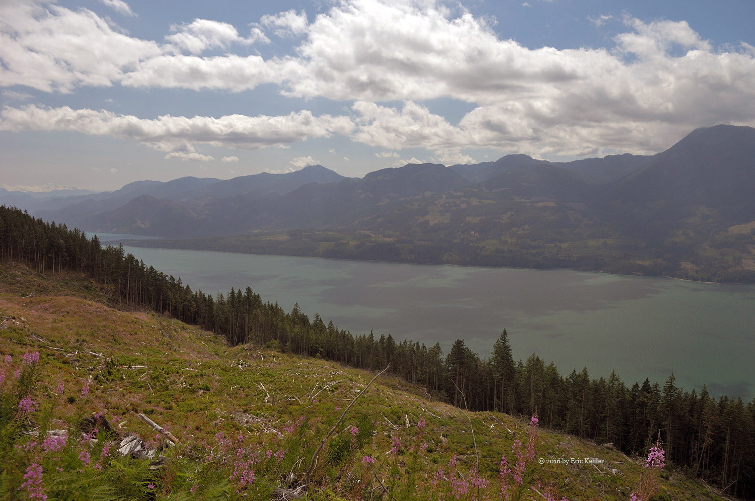
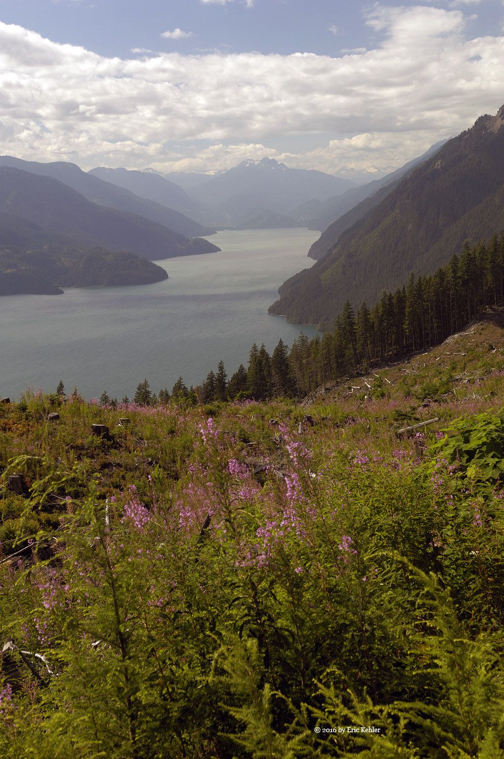
We soon had our gear on and picking our way along the forest floor following the track on the gps I made on our previous hike. It helped keep us heading in the right direction. As we got closer to the summit I noticed a faint trail with the occasional flag. It seems that the summit is starting to get a bit of interest though the path is very slight at this point. We followed it in a few places. I wasn’t sure where it comes out on the road as the flagging wasn’t heading to our starting point. We made the summit in decent time though we were a bit behind schedule. We had both forgotten just how steep this hike was in places, fortunately it was under a kilometer in length. We passed by the summit for the open viewpoint a short distance away. It is a bare spot above a steep cliff face and offers a lovely view of the Fraser Valley. After peeling off our packs, Ralph and I started setting up our antennas. I had my simple 2m yagi on the air soon and started calling out for contacts. Ralph soon was making CW (Morse code) contacts across the continent. I eventually managed 4 but it was a bit of a struggle. But 4 is all I needed and soon Ralph had more than enough in his log and we were packing up the gear for the slog back to the truck.

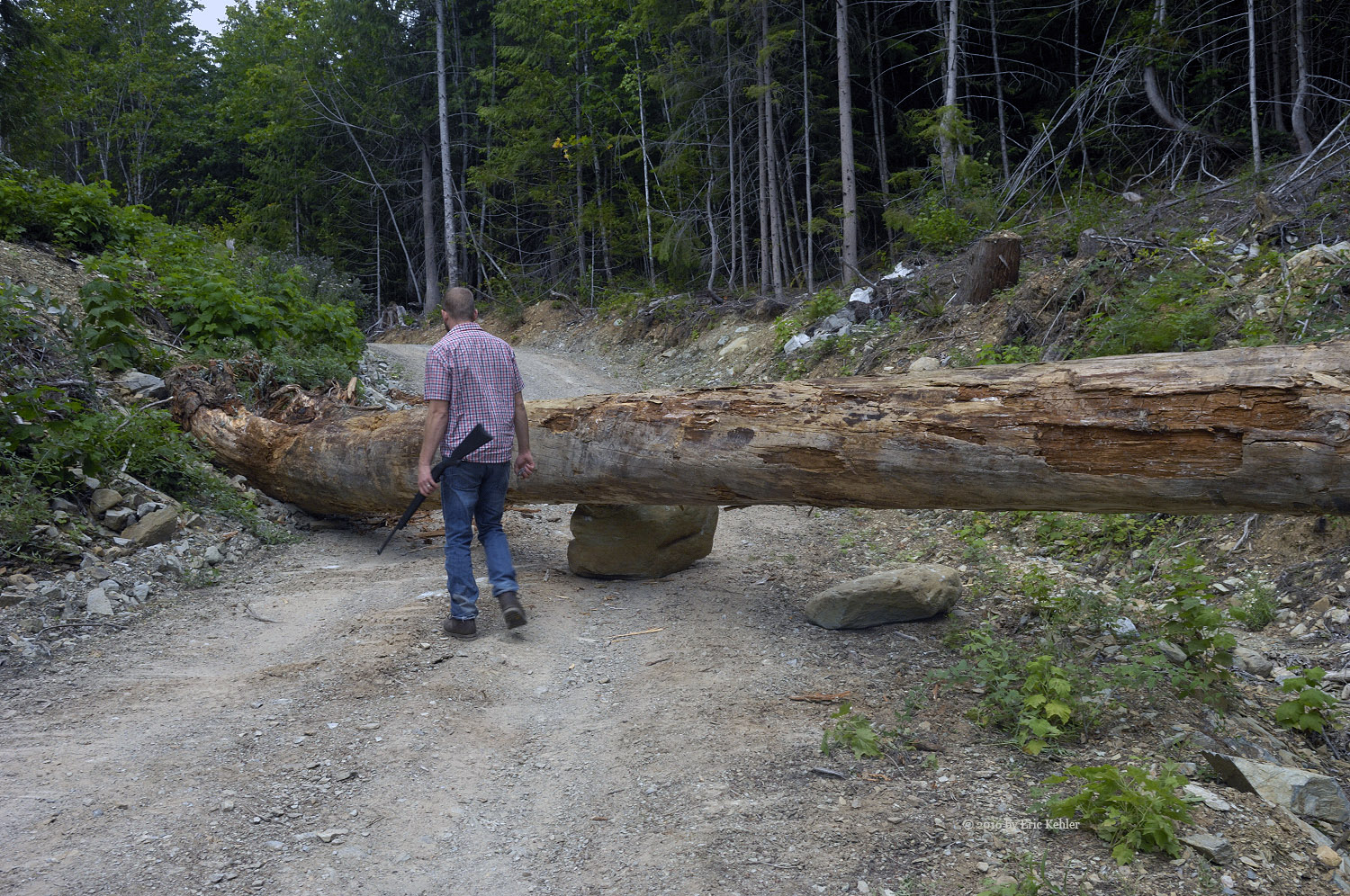
The return went without incident though we veered off trail in a few places but before too long we were back to the truck and taking a good rest while we ate some lunch and contemplated why we were doing this. Well, all is fine if we were done but now we had to set off for Woodside. We back tracked several kilometers along the road to the fork that leads to the decommissioned Telus repeater near the summit of Woodside. Now this spur was little travelled and quite rough and the trees were encroaching on the road. We had to pull in our mirrors and remove the truck antennas to get through. After pushing aside numerous trees we reached the old repeater building and there we found a spot to park. The old building was in poor shape as the roof was peeling away, the old tower was still standing tall but most of the equipment was missing. We got our gear on and looked at our GPS’s to determine the way to the summit and then pushed through some thick tree branches to start the journey to the summit.

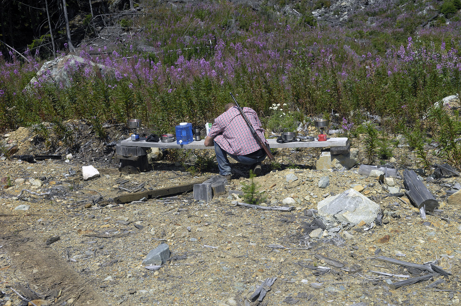
Our first direction soon was stopped by a steep drop over a rock face, we made our way along it and found a section with a gradual drop to the ravine below. There we were faced with another steep climb up the far side. After crawling under a fallen tree we picked a spot to climb the slope and soon were on the ridge above. Looking towards the summit we saw another rock face! We walked closer to it and found a way to get over it which didn’t tax our abilities too much. This left us on the summit ridge. It was a nice wide section occupied by a new small replacement repeater. This one was powered by a pair of solar panels.

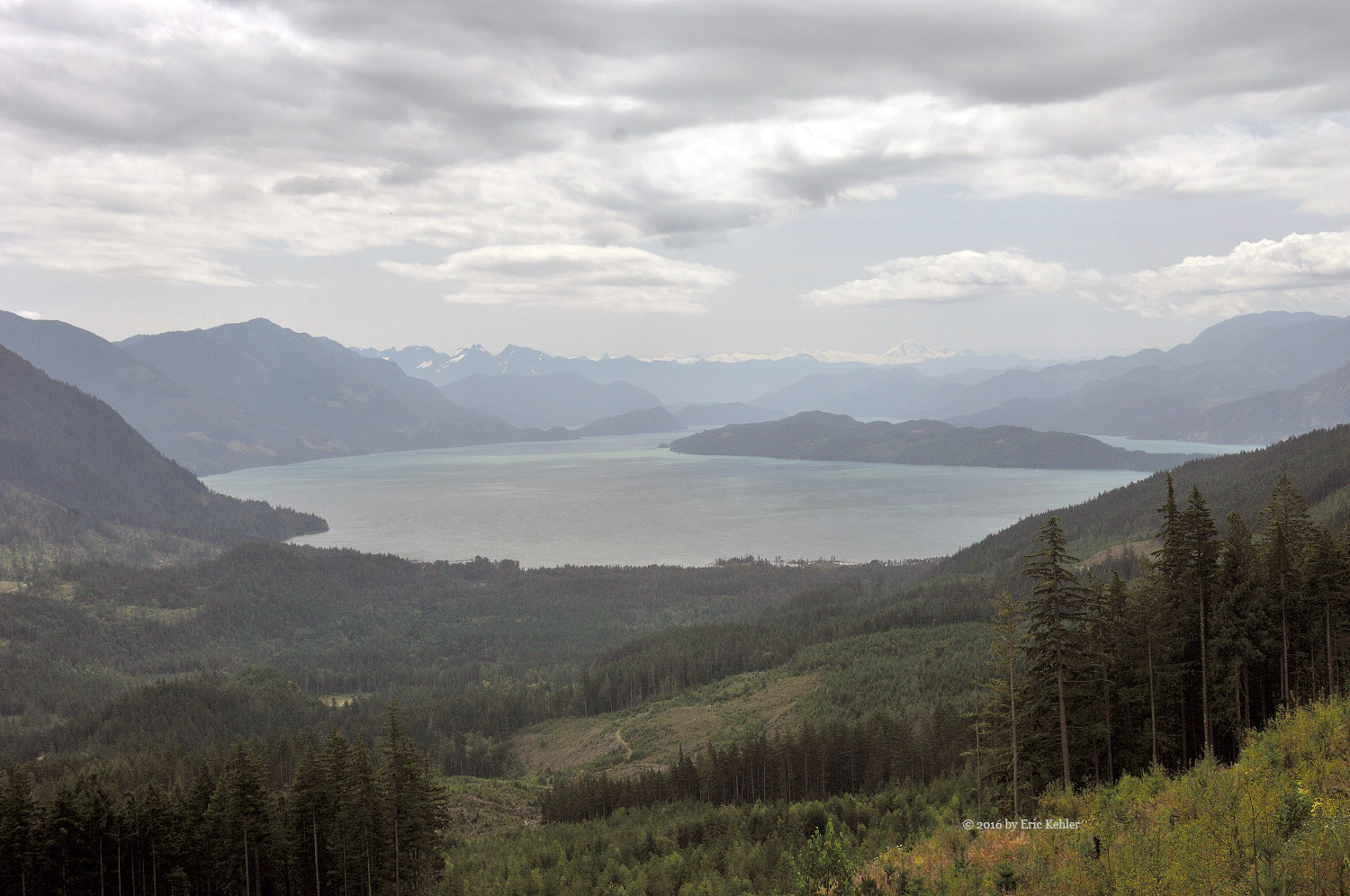
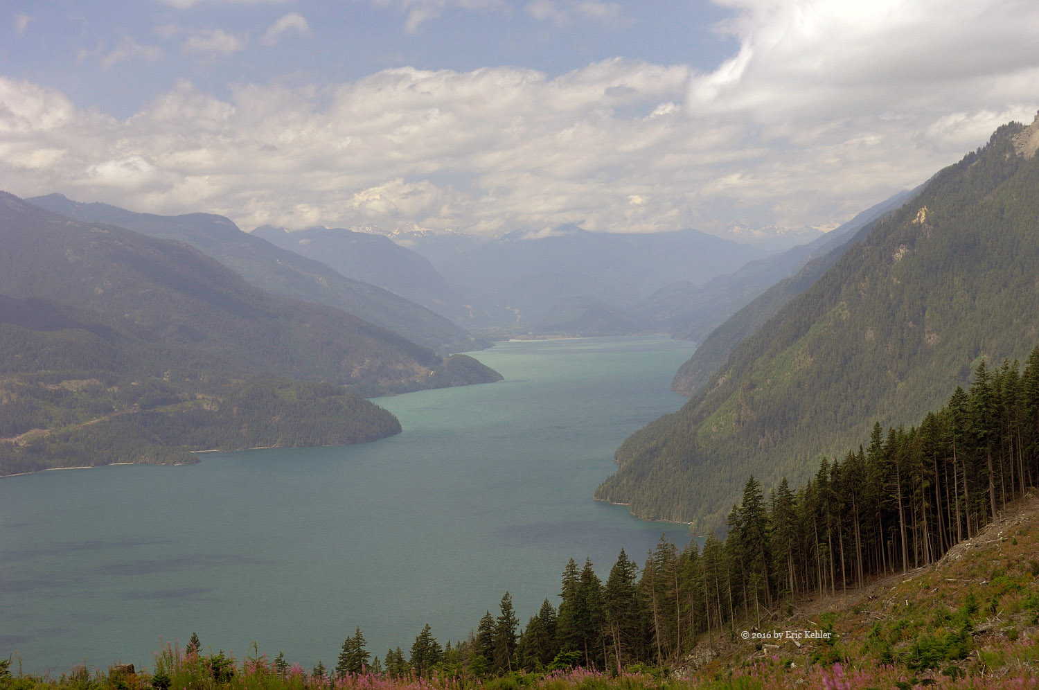
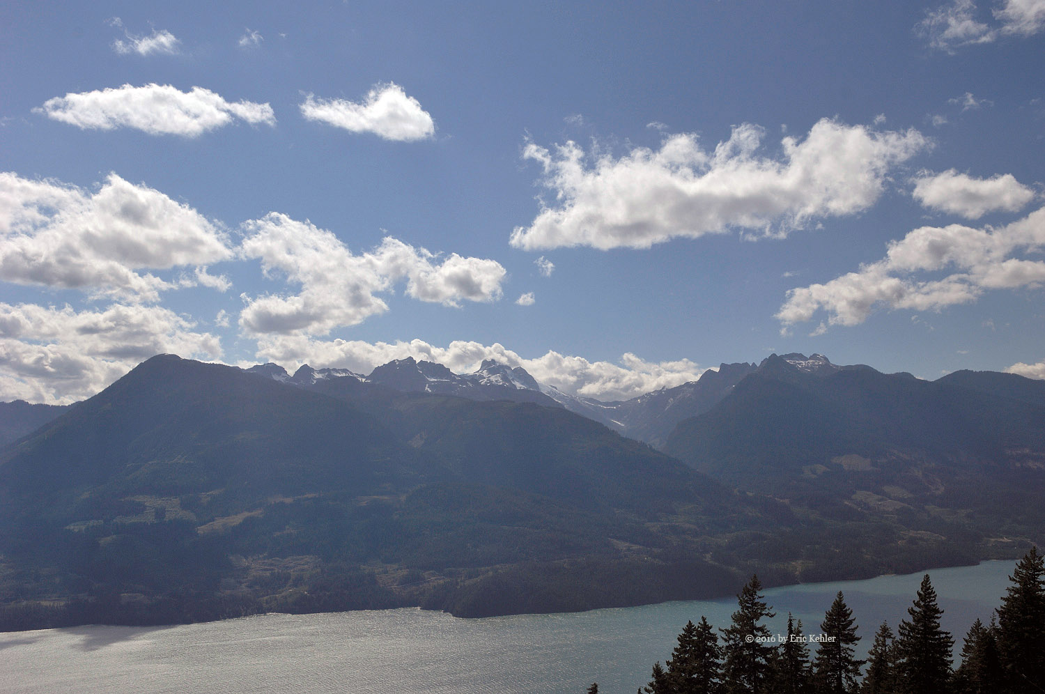
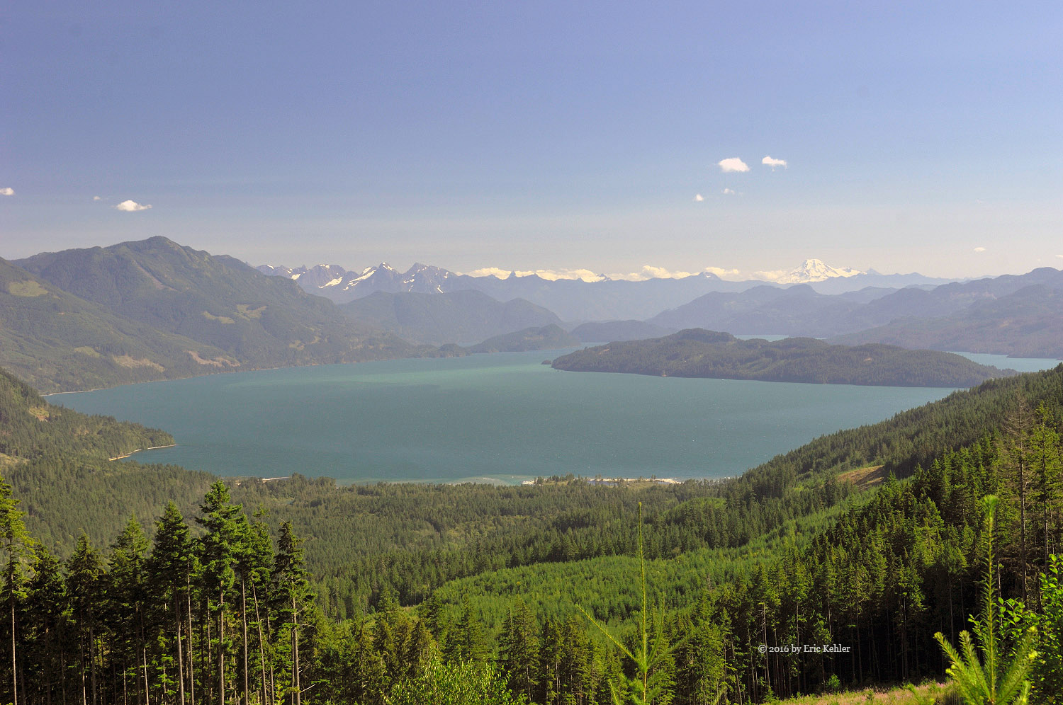
Walking past the repeater I found a nice spot with a view of the Harrison River and the Fraser valley. Here I set up my Yagi and put out a few calls. Ralph meanwhile was having a few more problems. There were no tall trees for him to use. Eventually the pole he carried up served as a center mast and the two wires stretched out from it, one to a tree the other to a shrub. He was now on the air. And by the end of our short stay he had logged 21 contacts. A new best for him on a summit. The furthest contacts were in Quebec and Florida.

Done with activating the second summit we packed up the gear and started down the first rock face, over the ridge and down the steep slope to the waiting tree which we crawled under a second time. Then it was up the slope and through thick branches to arrive at the truck. A second summit successfully activated. We took a few moments to rest and then we went and explored the old repeater building before starting back down the road. It was after 4pm and I had learned that the third peak wouldn’t be an easy drive-to as a gate blocked access. The gate was around 1.5km below the summit and we were tired and not at all interested in a long hike even if it was along a road. So we decided to call it a day and we set off for home. It was a fun adventure and we both enjoyed the chance to get two more summits activated this year. We will save the third one for later in the season

SunFlower

Earlier this year my youngest son brought over two small sunflower plants that needed a place to grow. He picked two planters on either side of my pool. Over the next while one grew into a huge plant, the other was short on sun and grew very slowly. Eventually we moved the small one to a better spot but it was too late for it to gain much size. Here are a few photos of the two of them.

Slollicum, Lookout and the far north

Previously on the east Harrison we zipped up the mainline to the Silver River area and started exploring the pine FSR where we spent the day. Today we took the very first side road – the Slollicum FSR – and did some hiking trail investigation. I hope to hike to that summit for a SOTA activation and wanted to see where the trailhead was and if there was any place one could drive to to shave off a few kilometers and elevation gain. So upon arriving at the branch of the mainline we started up the Slollicum FSR and took the first left fork. Here we made our way along a rough road for a short distance trying a couple of spurs. The road didn’t go far, though we did enjoy some lovely forest views. We backed down to the first fork and continued along it to the next one where we again set off up slope, this road led to the place we had been stopped by a huge cross-ditch years before. This time the road was drivable for more distance but we eventually came to a narrowing where we could have continued but decided to stop and explore a bit on foot. Here we found the hiking trail coming up slope to the road after which it followed for several kilometers. So we did find a parking spot that would save a whole 500m! but it does help.

Done with the trail we set off for the Silver River area and the second main side road on the west side. This one now boasts a new modern feature, it is the host access road for the new power line coming from the power station on the Big Silver River. We were hoping to follow it up and see how it connects up with the new road that was built lower down at lake level. So we drove up the main line past the mostly empty Cogburn Beach campsite on through the Silver River sort yard, and over the air strip at takeoff speed. Across the Hornet Creek bridge that will be being replaced in a week and finally to the side road for our journey up the south eastern flank of Mt. Breakenridge.

We crossed The Silver River and started up the slope following the transmission line. We tried a few spurs but they ended short of the ridge line. So back tracking we tried the next and finally we made it to the ridge and a view of Harrison Lake. So nice. The power line headed straight down the slope but no road followed, so we continued north along the one we were on and eventually came to its end. Here we had an amazing view of the lake covered in cloud and mists, you couldn’t tell where lake started and cloud continued! It was just a smooth transition from the whites of the clouds to the smooth white reflection on the lake. Truly a lovely sight. The wind was ever changing the look and we were graced with a number of incredible vistas. At one point the clouds lifted enough for a view south down the lake, really quite spectacular. Looking down we saw some amazing white sandy beaches just below us. It would be a great camping spot.

Well it was lunch time so we parked the truck near the cliff edge heading up slope from the road so we could tie off the tarp we had as the rain looked threatening. Sure enough just as we completed stretching out the tarp a shower hit us hard and we were very glad to be under cover while cooking a warm meal! By the time we were done with lunch the weather had improved and we were off to a brighter journey.  We returned along the route we ascended trying a few more short spurs but soon enough we were back to the bridge over the Silver River. Here there is a campsite just to the side of the bridge so we pulled into it and explored the area. It is nice enough but the summer week-end campers had really made a mess of the place.

It was still early so I decided we should try to explore some access routes for Lookout peak. So we returned along the mainline to the Bear Creek FSR and started up it only to find a solid locked gate. It was very annoying but nothing could be done at this point. So back to the mainline and on to the next side road up the west flank of lookout peak. This next one has a lovely small cliff one can climb to the edge of and enjoy an amazing view of a small lake with Harrison Lake in behind. Once we had gathered enough photos we continued up the road to its end which was at a stream crossing. Upon review at home with my maps I could see that the road had at one time continued up the slope right to the top ridge of the summit! It may well be a doable hiking route for us next year.

We back tracked and tried one more side road before heading home. The roads all offered some interesting possibilities for hiking to the summit of the two mountains. Not sure which I will try first but they both seem to have decent possibilities. Meanwhile I will concentrate on easier ones with marked trails.

Black Mountain

Occasions to explore a new to me trail is always a fun adventure. Today Carolyn and I hiked the trail to the summit of Black Mountain, one of the three peaks that form Cypress Bowl. I have hiked the other two several times but never seemed to get to Black. Well today was my chance to conquer this summit. It wasn’t going to be a long day so we set off at a leisurely time of 9:30 and headed straight for coffee and the highway to Cypress Bowl. All was proceeding to plan until we got to a kilometer before Cassiar tunnel where the traffic stopped moving. Traffic slowed us down for the next few kilometers and it wasn’t until we got up the cut in North Vancouver that we started moving at a decent speed again. The traffic delayed us a half hour! Well we weren’t in a hurry so on we went to the parking area.

We arrived amongst dozens of cyclists making their way up the Cypress causeway to find a well filled parking lot. There was still a lot of room but the numbers of vehicles was surprising. Once we carved out a parking spot we got our equipment loaded and set off for a quick bathroom break before the ascent. We made our way to the end of the lot and double checked the route on a big map and then made for the Baden Powell Trail. We were soon trailing along it enjoying the easy trail. Unfortunately we missed a small sign to turn off the easy trail and were now walking the Yew Lake interpretive one. It was nice but soon we realized we had missed our departure and back tracked to the fork and set off on the correct path.

The trail soon started gaining elevation and though it was a well-traveled and maintained one, it was still a challenge as the grade increased. The trail had a lot of loose gravel on it which made it harder to walk, but a well-trod path along the broader trail was clear of rocks and allowed us an easier time walking in many spots. It was quite steep in places but being short, we were soon arriving at the top ridge line where there is a nice lake to cool off in. We didn’t stop at this point as I was behind time for getting my Summit radio activation started and so we immediately set off for the north summit a short distance further. A few minutes later I arrived at the marked summit and dropped my pack for a rest.

Soon I had my 2m yagi antenna assembled and tied to a tree. I put out a few calls to the White Rock repeater but it seemed a bit sporadic. I then tried a simplex call and immediately got two club members and so the mountain was activated. Next was Ralph and a chap on the Olympic Peninsula. My next contact was with another SOTA hiker on a summit a bit east of Mt. Rainier, 310km away! We had a clear enough signal to exchange greetings and information. So that not only gave me a summit-to-summit contact but also set a personal record for hand-held to hand-held distance. It was lots of fun. I then took time to get some lunch, meanwhile Carolyn was enjoying her lunch and the nice breeze that had come up. She also took some time to enjoy the view of Howe Sound and the area.

Well after making a sixth contact I packed up the gear and we started down from the summit. I gathered a few photos of the lake on the ridge below us before we started up the south summit. This one had much better views of the ocean and city below. We decided to continue south down the far side of the summit to gather some photos of more of the alpine lakes. The trail dropped down to a later potion of the Baden Powell trail and there we were able to pass by several lakes which offered some nice scenery photos. This extra loop actually dropped us down further than I expected and we had a moderate amount of elevation to regain before we could start back down the trail we ascended.

The hike back down the trail went reasonably smoothly though Carolyn did slip at one spot and landed on her rear. Fortunately it was right where a series of boulders were placed for steps or supports and so her fall was reduced to a gentle sit-down! Once recovered we continued down shaking our heads at the number who were making their way up without water or proper equipment.- hiking on a steep gravel path in flip-flops is really not bright. Next we had to marvel at a senior and his dog jogging up the trail! Going down was hard enough for me. Well we finished the descent and soon were crossing the parking lot heading for the car. I felt good getting the hot boots off and resting in a seat! The drive home went without any traffic delays and an hour later we were parked at home. A lovely hike and enjoyable scenery. I will likely do it again next season.

Vedder Mountain

New on the Summits-on-the-air list of peaks is Vedder Mountain. It isn’t a very high mountain but being the southern flank of the Fraser valley it looms above us and offers some excellent outdoor activities. The mountain is easy access and as such has many trails for hikers, atv’s and mountain bikers. On an average summer week-end it is full of users. I knew that it would be an easy target for SOTA hikers so if I wanted to achieve the first activation I needed to hike it soon after its arrival on the official SOTA list. So to that end I selected the hike for today, it also was short enough and tree covered that the hike would work in the heat.

Our day began at 8am when Geoff arrived at my place. Joining us on this hike was Bruce Prior. He is a fellow SOTA hiker and I was looking forward to meeting him. He lives across the border in Blaine which from my house is actually very close by. He arrived around 7:40 only to discover he left his hiking poles at home and he always uses them. So he zipped back across the line and picked them up. As expected the line was delayed and he didn’t get back until around 8:30. We set off and gathered some coffee and fuel and then made for the mountain.

The forestry road was undergoing improvement and so there were a lot of cleared logs alongside the road and it had a much rougher and looser surface due to the work. It was no problem for our truck but poor Bruce was in the back seat getting some serious bounces. We followed the mainline to the designated fork and turned up it for a short distance and reached the marked spot for the start of the trail. The road was seriously dug out here, designed to stop all motorized vehicles. They did a very thorough job, even a motor bike would have second thoughts of continuing!

We got our gear on and started up the rest of the road carefully picking our way across the dugout. The trail continues along the road for a short ways to the official trailhead. Here there were steel cable covered logs and cables strung across the trail with signs stating it was a foot trail only. These guys are really serious up here. We made it past that barrier and started up the trail. It was a very pleasant hike as the trail was soft for the feet, well-marked and worn and the trees provided constant shade to keep the heat down.  The three of us followed the trail easily and found it a very pleasant one to hike. It added a number of rises and dips to the slow elevation gain we were making. About half way there is a short side trail to a lovely viewpoint to the north. Here we stopped to enjoy the valley view and eat a few morsels before continuing to the summit.

 The trail now started getting a bit more serious and we had some steeper climbs and descents as we continued to the summit. There was one long descent to a small lake near the summit. This of course meant there would be a long ascent on our way home. Geoff was in front of me as I started the descent along the south side of the small lake. I suddenly hear a loud splash below me and looked through the trees to see good sized waves in the lake. Geoff stopped and confirmed that something big had jumped in it. He got his defender shotgun unholstered as a precaution. Then we continued our descent to the edge of the lake. Bruce was a bit behind me at this point and when he came into view we warned him of the fun.

The trail made its way around the east side of the lake before heading back towards the summit. There was a lovely wooden causeway built here which made walking across the marshy ground a breeze. There were a number of such improvements to the trail which made it easy to walk. Now the trail reached some more challenging slopes as we neared the summit. The trail actually takes one across a rock face via a nice bridge followed by a short rope section. It looked intimidating from below but was actually fairly easy. The final steep section was endowed with a notched tree and rope so one could climb it very simply. Now we wer on the top ridge and in the sun and heat!

A short distance further and we were at the designated summit. I was able to put out a quick call to club member Ralph who had been waiting and calling me throughout the morning. We logged the first contact from the summit and the mountain became officially activated! It was 2:17! Much later than expected but the hike took longer than planned in the heat. I then set up my 2m yagi and proceeded to make 5 more contacts between mouthfuls of lunch. Bruce soon was also on the summit and getting his KX2 radio set up, he tossed a line in one of the convenient trees and pulled up his wire antenna. He soon was making a few Morse code contacts and getting his needed four contacts. The bands were not cooperating and it took some time to get them.

Well we were eventually done with radio and ready for the trek back down. The descent had a few challenges, Bruce had a bit of a stumble on the rope section but Geoff was able to guide his foot placement from beneath, so that didn’t hold us back too much. As we neared the lake Geoff spotted some fresh bear scat to the side of the trail, so we stayed extra aware of any sounds along the trail for the next section. We never did see any bears or other hikers for that matter. It struck us as odd that no one else was out here today. We made much better time on the way back and before long we were back to the north view point gathering a few more photos before the final walk along the trail.

It was a long hot day on the hike but the trees kept us from overheating and the trail improvements made for a good experience. I would like to do it again next year for a second activation. It was fun chatting with Bruce as we made our way along the route. I was a bit surprised at the length of the trail as it was significantly longer on my GPS than the posted length. But it was fun and we all had a good time completing the trek.

Mt. Cheam Re-activated

My first ascent of Cheam was way back in 2002 with two of my sons, today I hiked with two of my amateur radio buddies. The trail and views haven’t really changed across those years but the approach road is now much worse and the top section of the trail has been shifted away from a steep drop to a more gradual climb.  Our adventure today was to activate the summit again in the Summits-on-the-air (SOTA) program as was our previous hike  back in 2012. So Ralph, John and I set out from my place at the unhealthy time of 6:30AM so we could reach the summit before noon.

Our drive to the start of the Chipmunk FSR went smoothly and we made good time in the light traffic though I did comment that it seemed heavier than I thought it would be at this hour. Once on the FSR we made good speed along the section of road that parallels the Chilliwack River but when we turned off it to the longer section running up Chipmunk Creek the road was in a very rough state. The potholes were numerous and deep and the cross-ditches were deep, wide and rough! It was slow driving and extremely jarring. I really was amazed that so many drive this road and even some cars! They must leave a few pieces behind as they make their way along.

We arrived at the parking area a bit before 9am only to find it almost full! That was our first surprise of the day. But we did squeeze into a decent spot and then we started getting geared up for the hike. It was a cool morning and the sun was coming and going between clouds. So, a perfect day to be setting out for the summit 4.5km away. We made excellent time along the remains of the road and were soon descending into the bowl between Cheam and Lady Peaks. It was lush and brilliant green, no remains of mud slides and debris like I encountered on previous trips.  We made our way to the first bridge across a small stream, it was recently rebuilt and this time based on a pair of steel girders! It should last for a while. Passing Spoon Lake showed no snow piles this year, the snow levels were down everywhere though I could see a few patches high up the slopes.

The trail then starts a steep climb to gain some elevation before turning right into a small treed section before emerging on a wide slope which had a narrow trail cut through an immense field of wild flowers. Today we mostly enjoyed white with a sprinkling of blue. We took a short rest before starting up the slope to the next level area at its top. A couple of hikers passed us but soon we had made it past some others that were taking it easy. We were actually making very good time and I was finding my energy level staying decent. The cooler temperature I’m sure had a lot to do with it. We reached the main col between Cheam and Lady to find a number of tents set up with the occupants stirring between them. The small pond that is normally here was dried up so the area was a nice spot for the tents.

After a short rest we continued up the steep set of switchbacks as the trail made the final push for the summit. We found one spot about three quarters of the way up which was a lovely resting area and so we took some time to regain our strength before pushing the final stretch for the summit. As we got close to the top ridge I noticed that the trail had shifted away from a scramble over loose shale next to a steep drop to a more leisurely incline far back from the edge and which led to a lower section of the top ridge line of Cheam. We took the new route and soon reached the ridge and a lovely view of the Fraser Valley below – at least that which we could see through the clouds which were far below us. A brief rest and then we made a push for the summit not that much farther along. It was just before noon so our hike took a bit more than 2.5 hours, good time for us. Once John and I reached the summit we stopped to eat a few bites and wait for Ralph to finish the final section. Ralph immediately put out a call on the repeater and had club member Ken respond then he switched to simplex and Ralph had the first contact in the log. John started setting up his 20m inverted V antenna and I my 2m yagi. Ralph decided to setup a bit down the ridge to where there was some rocks he could use to support his mast. John quite successfully lashed his short pole to a boulder and had his antenna on the air in no time. He made three more contacts before the stations ran out. I was able to rustle up 10 on 2m, one on Bowen Island another on Camano Island down in the states. We had a lot of interest from the other hikers as they watched us make some contacts and chat with stations some distance away. John’s Kansas contact was particularly intriguing to them.

Having completed a good number of contacts we stopped to finish our lunch and then took down the antennas and started the climb down from the summit to where Ralph was and after a nice time talking about the adventure so far we started down the slope in earnest. We took a longer rest back at the nice location we rested at on the way up and then we made for the switchbacks to the col below. As we got down John and I left on a side trail for a view to the north through a gap on the ridge. Once there I went to snap a photo only to realize I had left my camera back at the resting spot! John quickly dropped his pack and made a fast dash back up the trail. I took his pack along to meet Ralph at the col where we waited for John to return. Meanwhile in chatting with another hiker we learned that the very next couple coming down had the camera with them and I soon had it back. Now to contact John so he didn’t keep going. I was able to call out to him and get him to stop. He got back down to us so quickly I was quite amazed! After some deserved ribbing we started down the next section of the trail and made good time needing only a few short breaks along the way. Soon we were passing Spoon Lake and then up and out of the bowl. The walk along the old road always seems to take longer than it should but we were soon back to the truck and getting our feet out of hot boots.

The drive back down the road was as rough as on the way up but being tired it felt much more jarring. We still made decent time, we passed one truck stopped on the side. They were heading up but the truck had over heated and they were letting it cool before continuing up. That sure beats burning it up like the car we saw on the highway last Monday. Once off the forestry road, the drive along the paved road felt so nice. The traffic was moving well which got us home in reasonable time. A great hike, lots of fun and scenery. Perhaps I’ll do Lady next year.

SOTA on Zoa with Cara

Looking back on my back-country travels by truck and foot has shown me just how much I miss sharing the experience with my wife Carolyn. She hasn’t been able to join me in the hills due to health reasons until lately. Today’s adventure saw the two of us driving to the Coquihalla summit and then up a very steep and severely eroded road to the start of the Mount Zoa summit trail. Our adventure starts a few weeks earlier as we contemplated what we could do together now that her health had been improving.

We had recently hiked a trail to Lindeman Lake to see how things went, our next challenge was to up the ante and try for an easy summit. The Zoa trail met the needs and it would also allow me to do my radio operating in the summits-on-the-air (SOTA) program. So after some planning and equipment purchases we were ready for the hike. The drive along the highway was easy but then we reached the parking area for Falls Lake! There is a narrow opening for a road to service the gas line and after switching into 4x4 mode I started for the gap. Carolyn was wondering what I was thinking but we edged through and started up the gravel road.

The next thing she saw was the very badly eroded and deeply rutted remains of a road. I continued along as though it was nothing serious, I did have to carefully plan my way along it but generally not too difficult. Then we turned up a steep side road that required shifting down to low gearing. Once up on the gas right-of-way I turned the truck around and parked. It was quite an eye-opener for her. We quickly got our gear on and started for the trailhead just a short distance down from where we were parked. The first bit of trail involves climbing some steep slope to get off the gas line right-of-way and into undamaged forest. It was quite a start for her. The trail itself is fairly easy to hike as it is well marked and not too steep. We made decent time along the trail and soon we were passing the actual summit for an area with some nice views. Here we stopped to rest and eat lunch.

After a short bite and rest I set up my 2m yagi antenna and pointed it to the SW and the Sumas Peak repeater. It came in clear and solid and I was able to chat with some club members as I prepared to get my HF antenna in the trees. I had a small net bag with me that I filled with a few rocks to act as a weight to get a line into a tree. It broke on my first throw! I tied a rock to the rope and tried again. After a few throws I had the rope over a good branch and I was able to pull the antenna up. I stretched out the wires and attached it to my KX2 radio. I could just barely make out a few stations. Chatting on the handheld through the yagi I coordinated my efforts to be heard by the home crowd and they started calling. I could just make them out but they couldn’t hear me at all. So frustrating. After trying various frequencies and bands I was finally able to make a contact with a station in SE Oregon! So I had succeeded in activating the summit but not the needed number for getting points.

There were a few other groups that came by while we were resting. Carolyn had a chance to explain what I was doing with the radio gear. Some seemed interested. Carolyn had her knitting with her so while I was operating she was knitting! Quite a set of photos! Well we had rested enough and fed the flies with our blood long enough so we packed up and started back. The trek back went faster than on the way in as is expected it being mostly down-hill. We didn’t push it as Carolyn was still developing her hiking legs and so was being very cautious picking her steps. Once back to the truck we were able to hide from the biting flies though we were both covered in bites. She then remembered that we had difficult road to traverse back to the parking area and wasn’t looking forward to it. Well that road section went without problem though one hole did jar her a bit. At the parking area a chap came by to ask about driving the roads. I said it was fine and he thought he would try the drive to the lake. We drove to the highway and were soon soaring along the highway for Hope. Not far past the summit pass we drove past a car and trailer engulfed in flames. It was on the other side heading up but now was well consumed by flame with huge amounts of black smoke billowing high into the air! A poignant reminder that these steep roads can be hard on a vehicle.

We made our way down the highway to the town of Hope and there we bought some refreshments at the Blue Moose Café. Next was the final drive home, but it was the end of a long week-end and the highway was running very slow in sections so we turned off it once past Chilliwack and drove the rest of the way home on the side roads. A lovely day and fun journey shared together.

Silver Pine Adventure

Keeping up to date with the Silver River power project has been an on-going interest for me. On our previous visit to the Silver River we explored some of the changes completed by the Power Project. I wanted to revisit the area and see how things have progressed and enjoy some of the sights that the improved roads offered. So we set off for Harrison and the east-side. The drive to the start of the logging road went smoothly. Soon we were starting up the gravel and listening to the road frequency for any activity. Now it being a long week-end we were expecting a lot of week-end campers on the road and campsites, we were not let down. Cars were inching their way along the road as they made their way to a campsite. Now one thing I have noticed about this crowd is that they really don’t understand the rules of engagement out here. Most seasoned back country drivers are all too ready to pull over and let faster vehicles pass but this crowd just hogs the road crawling along at what likely seems to them a good pace. We had to pass a few cars on the way up, I’m sure they were quite surprised at what a normal speed for out here really is.

The Bear Creek camping area was packed with campers, cars were parked alongside the road for a few kilometers, and it was even more packed when we returned. Talking with the campsite host on our way in told us that the some campers were causing issues and required some RCMP handling which was taking place when we returned. They also asked if we knew of any that could help one car owner who had shredded a tire and had no spare! Why anyone would drive up here without a spare is really beyond me. People just don’t seem to get that they are not in well supported area.

Once past the beach we encountered far fewer but still saw that most camp spots along the water were full. We made it through the Silver River log yard and past the air strip. Then we turned left off the main line and onto the Pine Service Road. This is Geoff’s favourite area for hunting. The road has been improved by the power project and we were planning on driving to the end of the new road to see what they had done for the project. We made it through all the old road and stopped to look over some of the grassy areas that Geoff really enjoys walking across during his hunting events. We then continued along the road but came to a stop where a huge log had been pulled across the road to stop travel. Now we were a bit miffed by it and considered how we would move it. Not too difficult but then we thought that it was keeping that rowdy group out and though we could winch it off we wouldn’t be able to put it back.  So since I wanted to see a fair amount of area to ay we decided to leave it for now.

We backtracked to an earlier fork which Geoff would take and we followed it to an upper area where there is an amazing view of the valley and river estuary. He really loves the spot and wanted me to see it. After gathering a few photos we turned up a second fork that he hadn’t driven before. This one continued up the slope and just kept going. The road reached the ridge of the mountain and there it opened up into a wide plain with purple wild flowers covering huge sections of the slopes. It was a very pretty spot. We drove a number of short spurs but finally found one that continued up the ridge and eventually crested it to give us the view I was hoping for, the northern end of Harrison Lake. The views were truly spectacular.

We continued north to the end of this road where we parked for lunch with a great view of the lake. Here we leveled the truck and set up my ham radio antenna on a mast supported by a new base built by Geoff that fits the trailer hitch. It worked really well at getting the antenna in the air. I then set up the radio and tried to contact the guys back home. I could hear them but unfortunately they couldn’t hear me. I will need to try again perhaps at a greater distance.

We enjoyed a nice lunch with the view and then we started back down driving a few more spurs as we descended. By now it was approaching 4pm and our time was running out. So we decided to make our way out rather than continue up the road to the next side road. I guess I will just need to get back here soon and finish the trip I had planned to do today. Though we only explored the one side road it was a great day and we both felt it was a full experience.

Mt. Hollyburn in Cloud

Jammed into my wife’s Buick with our gear was my good friend Ralph and a fellow club member Jim. Such was how we started our adventure to the summit of Hollyburn in order to make a few radio contacts in the Summits on the Air program. Our day began at 8am as we loaded up the car and started the first leg of our journey to the summit. We were soon ordering coffee at the first Starbucks we passed and then starting the real drive to the mountain. The day threatened rain but the percentage was low so we felt like taking a risk and heading up there. As we got closer our concerns got louder but being the optimistic type, we decided to continue to the trailhead and decide there if we would hike or not.

As we reached the parking area our eyes were presented with bumper to bumper cars parked solid along both sides of the road! Now this seemed very unusual and we sure hoped that they weren’t all on the hike to the summit. After driving a distance along the road and then back to the start we finally found a small gap we could slide into and park. Once outside the car we were able to ask what was going on. It was a foot race along the lower trails with hundreds of participants. This was one of five peaks that the group races each year.

Well, the cloud base was below us so we were already in the mist but it wasn’t raining just dull so we decided to start the hike. We geared up and checked over everything and then set out for the start of the path along the powerlines. Soon we met a race organizer who explained a bit about the race and showed us a map of the route. We were on it for only a short section of our hike. We said good bye and started up the steep section of the powerline portion of the route.  When we arrived at the small lakes that border the power lines I stopped to gather a few mist shrouded photos of them before continuing on. As we reached the fork where we turn off the powerline road and onto the narrow trail to the summit we were passed by the first of the racers. He was making fast time along the course and zipped past us with second place close behind.

The hike up the trail went without incident and though a bit muddy in a few places the trail was easy to travel. We met a few on the way down but the traffic was light. We weren’t able to see much nor very far as the cloud obscured most views beyond a few hundred feet. A shame as the sights are quite pleasant and Jim has never been here. The final portion of the trail traverses some smooth rock faces and hugs some cliff edges but generally it is easy to cross and soon we were dropping our packs at the summit and sitting down for a needed rest.  The cloud seemed thicker up here and the view was not to be had.

After resting for a short time and grabbing a few morsels of food we started to set up Ralph’s wire vertical antenna. Today he brought a collapsible pole to hold it up while it leant against a short tree. While he was finishing the setup I tried tuning it with my new KX2 radio. It seemed to have trouble with the antenna but it finally had a match once the setup was complete. Ralph’s Morse Code key didn’t fit the KX2 well so he brought out his smaller KX1 radio and started trying to make some contacts with it. Soon he had another chap also on a summit in California in his log.

While Ralph was gathering Morse contacts I set up my Yagi for my handheld and made some local contacts. I managed 8 including one chap on the Olympic Peninsula (150km distant). While making my calls the clouds decided to release some more serious water and it was soon raining on us. Jim had a small umbrella and he covered me while we were logging the calls. Once I had 8 in the log I stopped for a rest and to get my stuff covered up enough to stay dry. Ralph meanwhile got 10 contacts logged. We had enough so rather than stay too long we started packing up. Fortunately the rain stopped fairly soon after it started and we were able to stay dry though the thick mist did its best to penetrate.

Well we had completed the SOTA task and decided to start down as we were starting to get chilled and there was no sign that the clouds would soon part for a view. The trek down was a bit harder as the short rain had left the rocks slipperier than on our way up. Well, the descent proceeded carefully as we picked our footing through the roots and slick rocks. The trail was also much busier now. We were being passed in both directions as people came and went to the summit. This left us with a new problem as we reached the flatter section of the trail, the mud patches were now well worked over and more of a challenge to get around.

We made it back to the car with no further rain and we sure felt great getting a chance to sit and relax a bit. The drive home went smoothly but we noticed that the clouds were indeed parting and the day warming up as the sun had longer periods to heat up the place. I guess we could have gone in the afternoon and had a chance of a view but I was still glad to be done and almost home. It was a fun hike and I enjoyed the adventure but definitely prefer going when we get a view.

Return to Lindeman

I am always surprised at how long it is between visits, my last time to the lake was over 6 years ago! There is so much back country to explore that it seems to take a long time to get back to some old favourite sites. Well even though the lake itself was essentially the same as last trip except for the water level being a bit higher due to the spring melt, the new parking lot and swarms of visitors was very different. It seems that the lake has become well known and people by the dozens are now hiking in to enjoy a few minutes at the lake. The far end still gets fewer but even there it was busy with bodies.

Now today’s hike had special significance to me in that my wife Carolyn was able to go with me. This was the first time in over 20 years that she has been well enough to do a hike like this. This is the start of what I hope will be many more adventures in the hills. I am looking forward to her seeing some of the amazing sites I have enjoyed over the years.

As is typical of most trips, todays began with a first stop for coffee followed by one for fuel. Today we were able to drive Carolyn’s Buick as we were on pavement the entire way. That added some comfort to the trip but I did miss the truck, it just seems so much a part of the back country experience. We made good time to Chilliwack and then up the Chilliwack Lake road. On arriving at Post Creek we saw the large parking area and drove through it looking for a parking spot – none were open so back to the road and the traditional location alongside of the pavement. We got our gear ready and set off for the trail.

The parking are area now boasts an outhouse but the line-up for it was more than either of us wanted to wait for. So off we went along the old roadway that I remembered from previous trips. The trail was well worn and easily followed as it made its way along the creek gaining ground for the close end of the lake.  I had forgotten about the constant work needed to get across rocks and roots as one ascended the steep section to the lake. It really is more of a workout than one expects. As we made our way up, we were constantly being passed by groups of young people in the late teens through mid-thirties. They just kept coming and in both directions. The number of dogs was also quite large, it seemed that every second group had a dog with them. Some so small that I am sure the hike was harmful to them, virtually none had owners with water for them and many lacked any for themselves.

Once through the steepest section we enjoyed our first view of the lake. An amazing range of colour from aquamarine through cerulean as the angle of the sun varied in the distance. Carolyn was up for more so we continued past the main camping area and started along the western shore for the far end of the lake. Soon we reached the first talus field. This one is short but the boulders are quite large so it makes for a good scramble. Once past we continued up the lake and soon reached the far talus field. This one is much longer but somewhat easier to traverse. Here we caught up with a large group of youth who were here as a group from a church. They were having a good time clambering over the rocks with a few taking a dip in the cold lake. One of the leaders had a Phantom 3 drone that he was flying to gather some photos. I’d love to see how they turned out.

The wooden bridge at the far end of the lake was still in good shape and helped one cross the steepest area of the slope. We walked a log bridge across the upper Post creek and then settled down on a log for lunch while enjoying the north end of the lake. The sun was out but the wind provided a lovely cooling breeze making it an ideal setting for lunch. After eating and enjoying the sights we started back along the way we came. It always seems longer on the return but we continued forward finally reaching the difficult steep section. Carolyn found this particularly tiring as her short legs made the constant drop more challenging. Well we finally made back to the car and a well needed rest in a comfortable seat. It was a very successful adventure and we both enjoyed our time out on the lake.


Subscribe to 2016