
Elaho? A missing forest

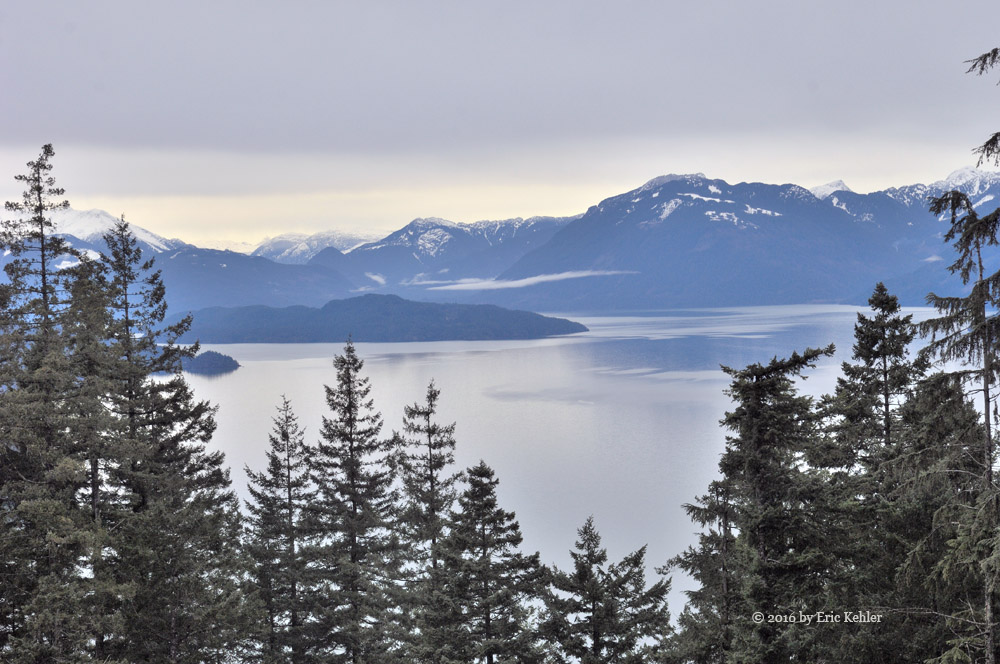
Horrendous is the best word to describe the sights of the upper Elaho valley.  It was exactly a year ago that I last visited this incredibly rich valley. It always inspired me with the lazy meandering river surrounded by high year-around snowcapped peaks. Only a week after that visit the forest caught fire and even with 100+ fire fighters working to control it, it became a massive fire and burned a huge area on both sides of the river.

I had been watching the forest notices since the fire and saw that the upper Elaho was opened up further at the end of May, so I felt it would be a good time to go explore the area and see what we could find. I also had a new GoPro camera to try out and so with the weather being sunny and hot, we set off for the Squamish valley and the far reaches of the Elaho. The drive to the valley went very smoothly as traffic was fairly light and we made good time. Once in Squamish I tried to contact my Ham radio friend who lives there but he didn’t answer so I guess he was out enjoying the countryside himself.

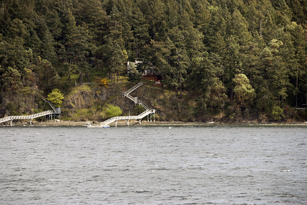
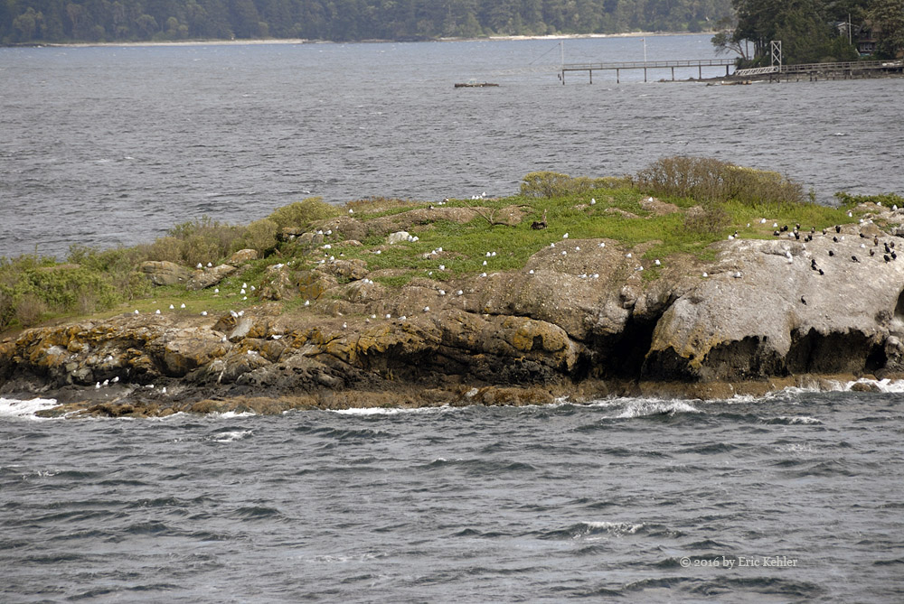
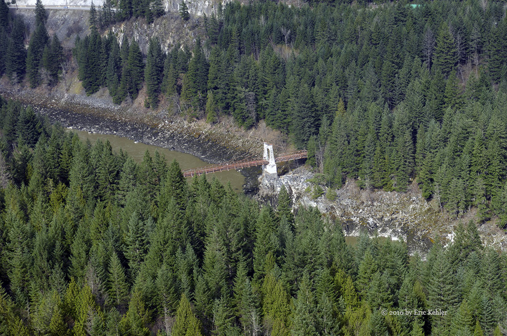
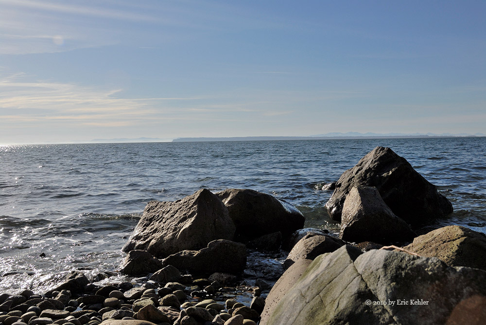
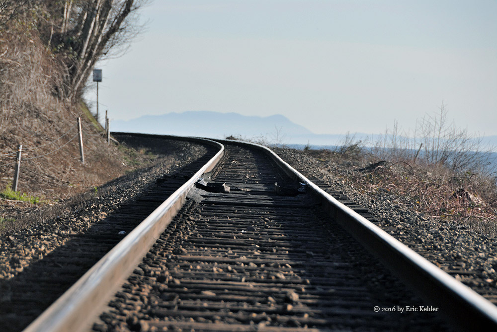
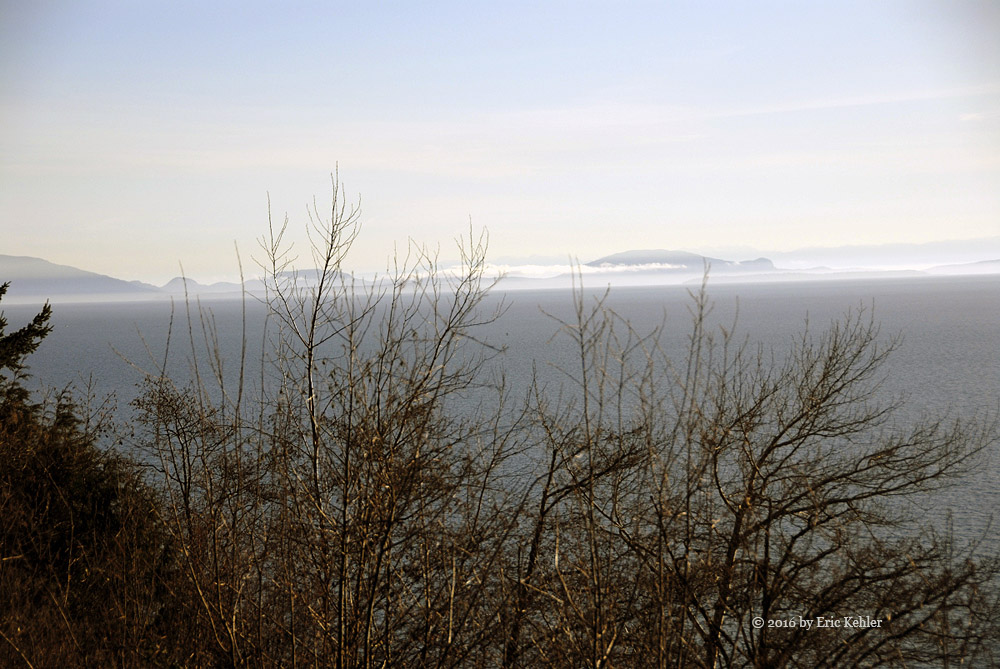
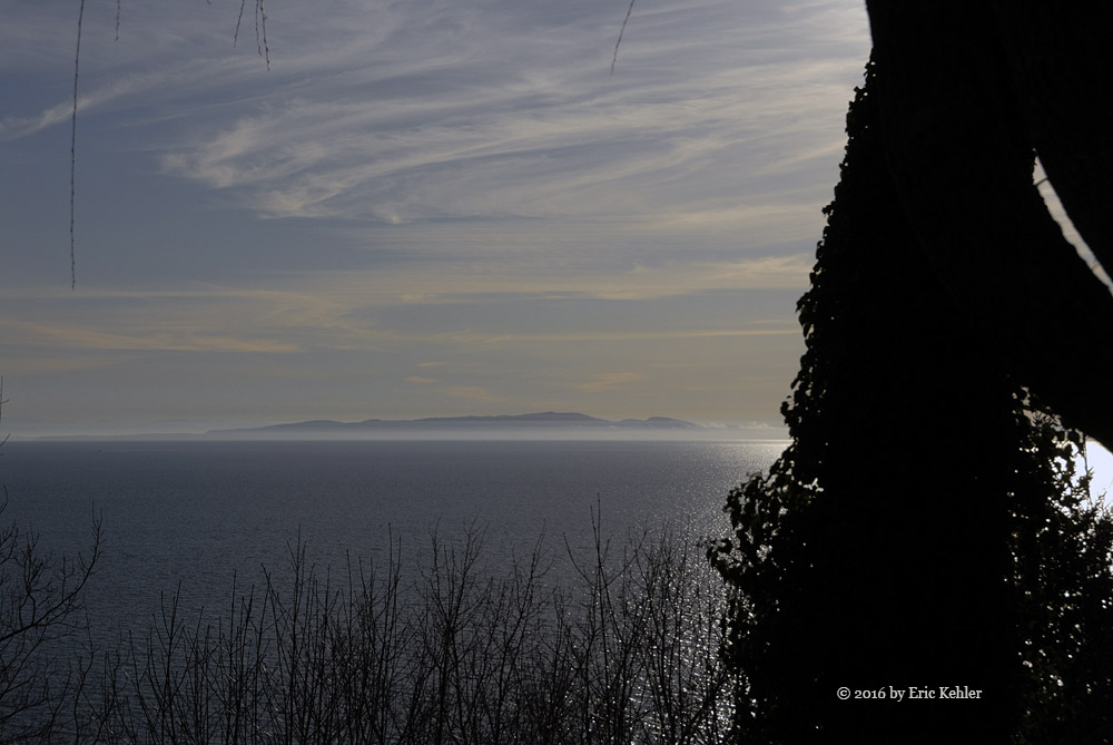
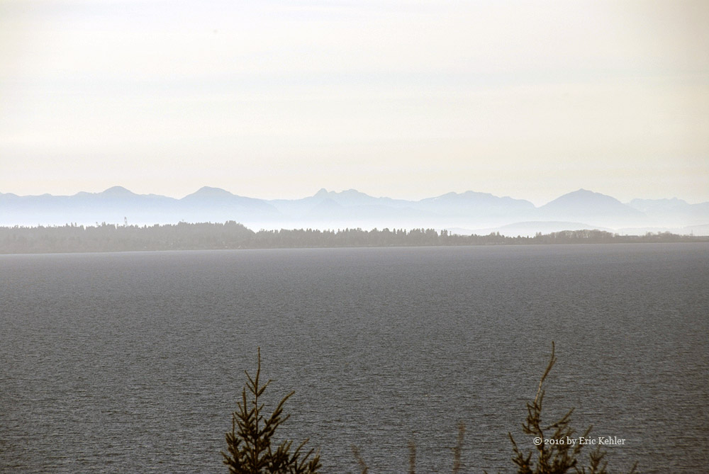
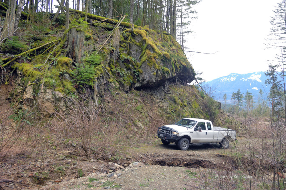
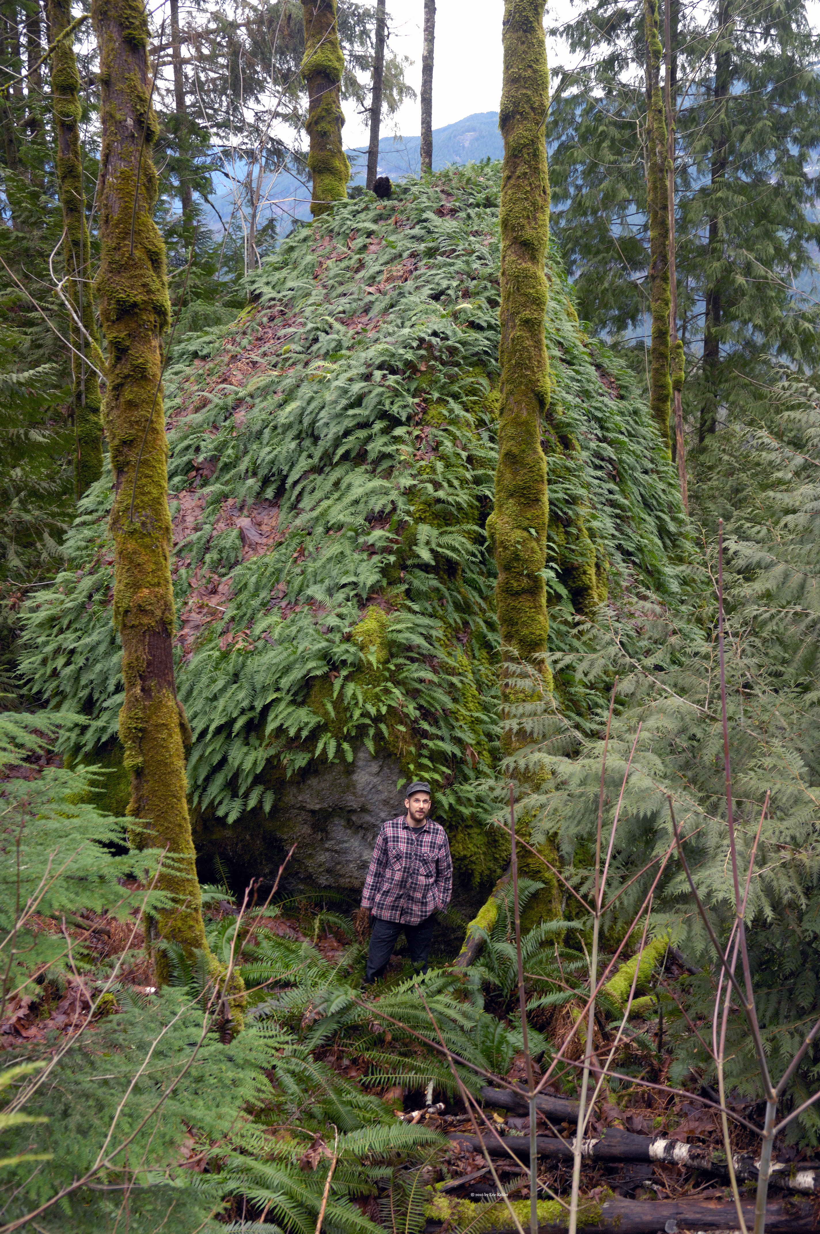
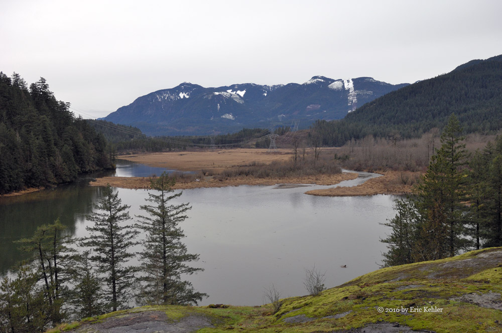
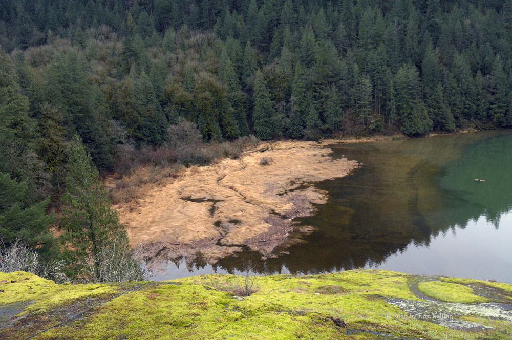
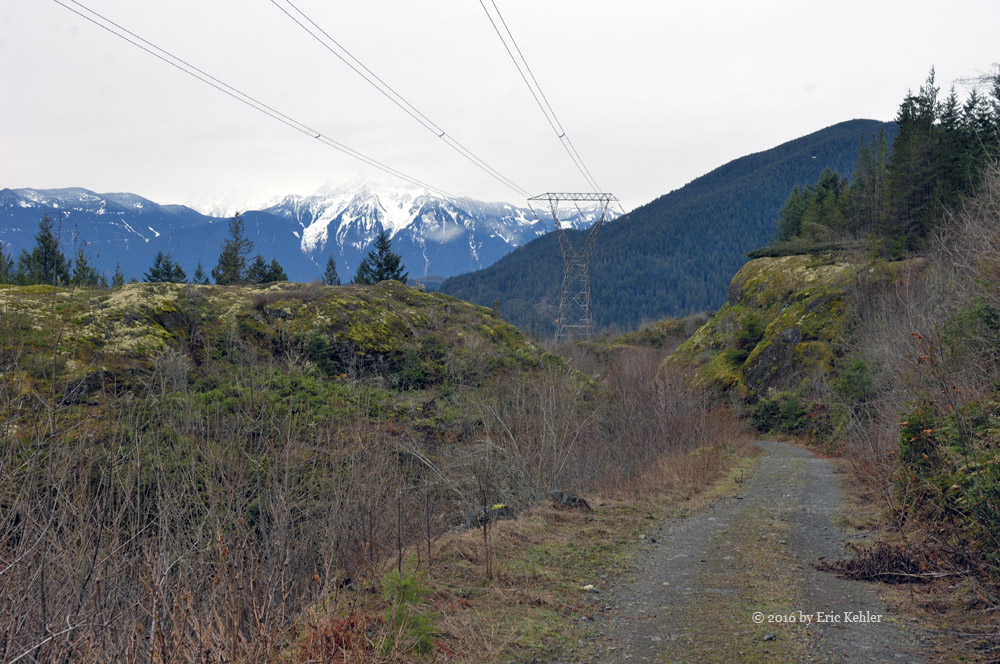
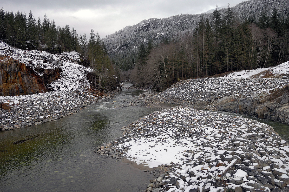
The initial drive up the Squamish mainline was busy with cars and SUVs so we had to be careful around curves as the other drivers were travelling a good clip across all sides of the road. Twice a jeep came close to driving right into us around a bend – far more dangerous than a logging truck! On the way up to the Elaho, we tried a few different things with the camera and got a bit of a forward view but it will need to be on the bumper to do it well. Our first longer stop was not until the bridge across the Squamish on the start of the Elaho mainline. The scenery was quite magnificent here and I enjoyed taking a sequence of photos. Then on up the narrow road and around the s-curve gorge. Too much traffic to stop so we just kept moving.

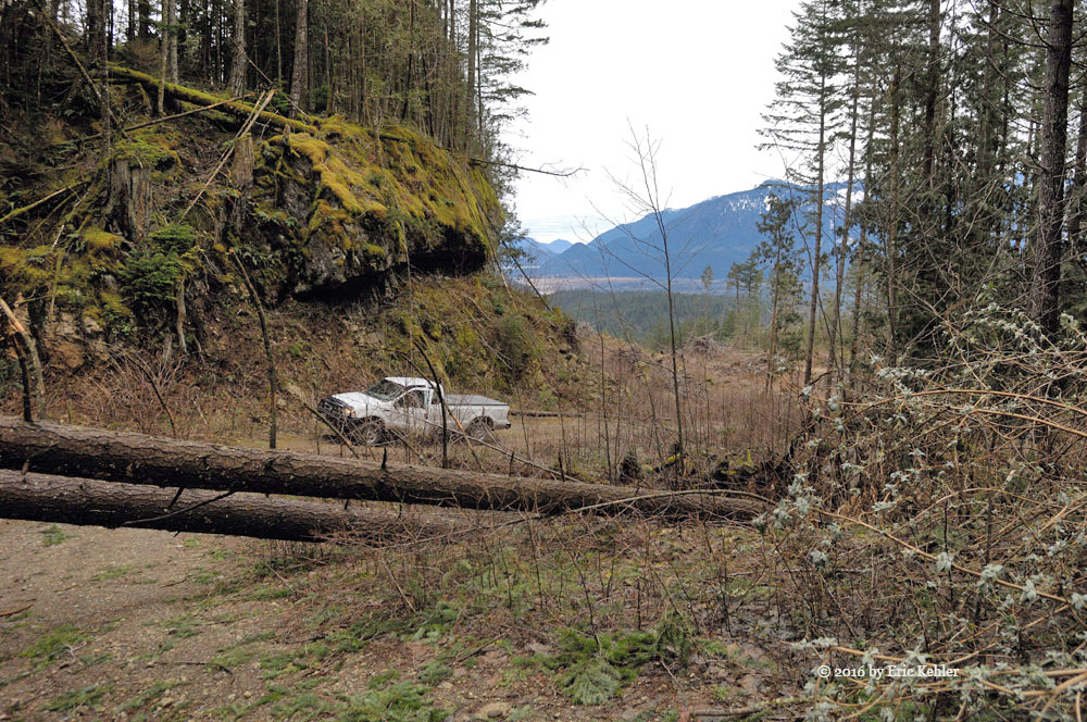
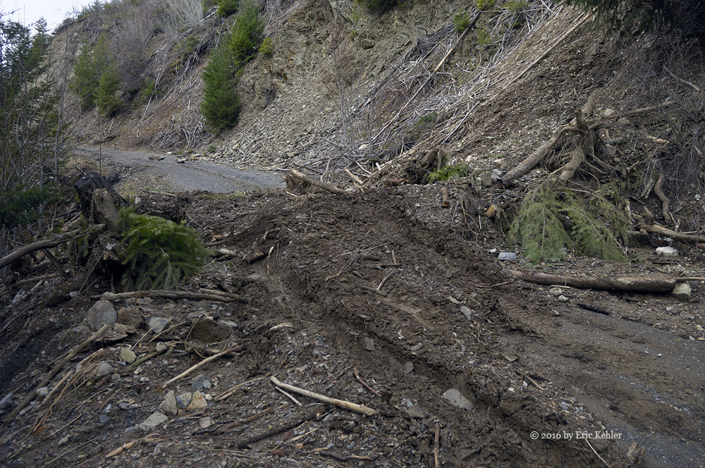
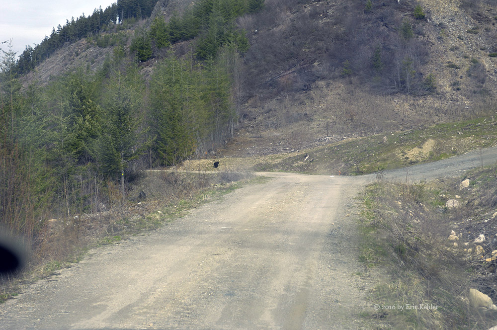
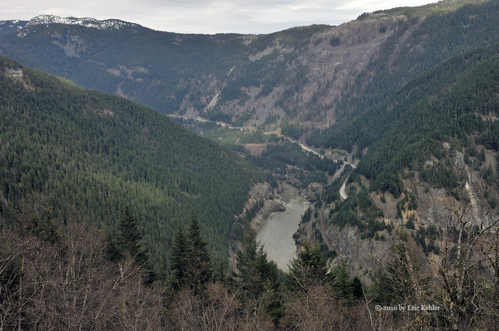
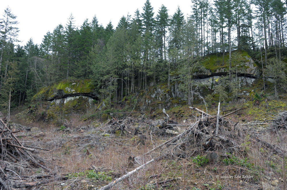
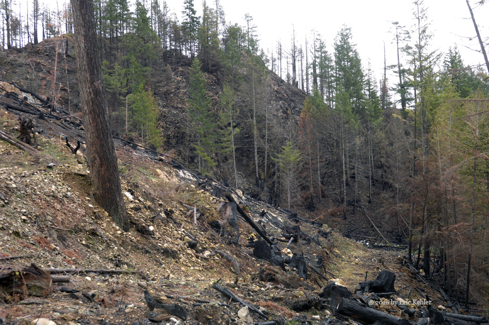
Eventually we came to a barricade across the road warning that the road was washed out at the 41.5km point. This was the previous closure point according to the forestry site. But it was open and so we continued on. The road seemed in reasonable shape though it was degraded from last time we were here. We did notice signs of other travelers but fewer than last year. Soon we arrived at the 41.5km point and found that the creek had been worked on to make it crossable and so across we went and kept going. We came upon a forestry sign warning of the hazards of the burnt forest. Soon we saw the first of the burnt area, it was quite overwhelming in scope. Then we encountered a very rough section of road as a creek was running down it digging huge ruts. We made it past and saw even more devastation from the fire. Every slope on every mountain around us was black and bare, covered only with black toothpick like trees. In some ways the grandeur of the rock slopes was exposed but I do like the green better.

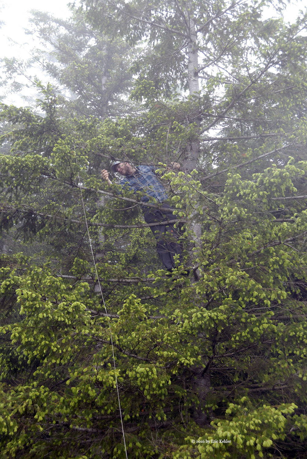
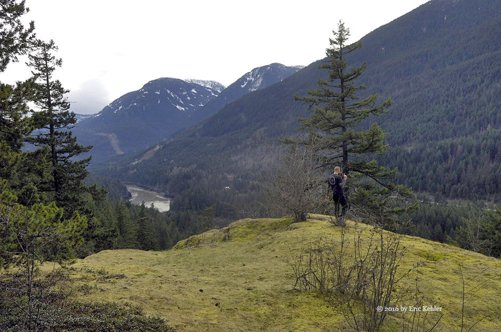
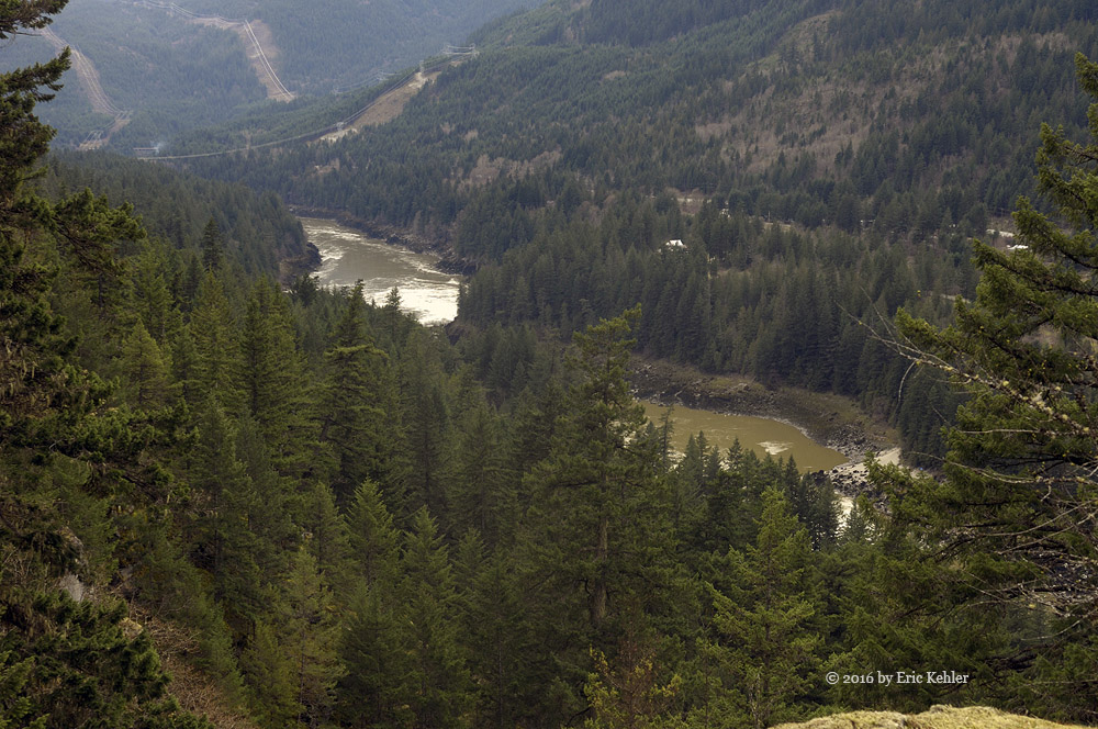
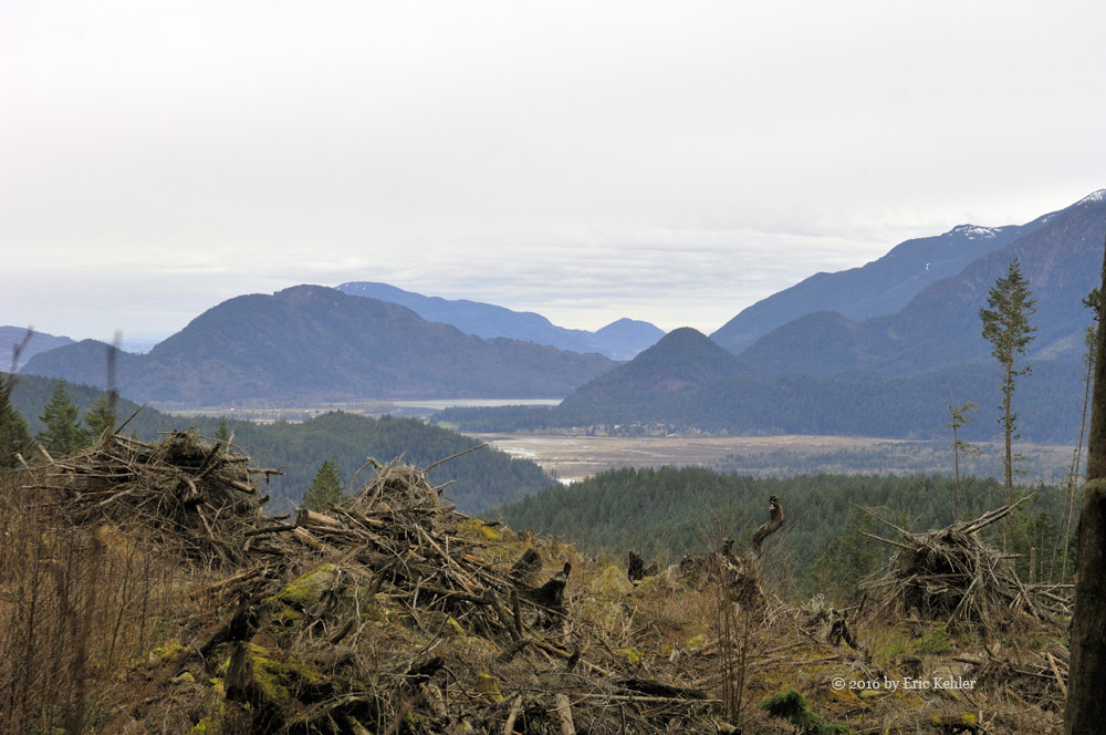
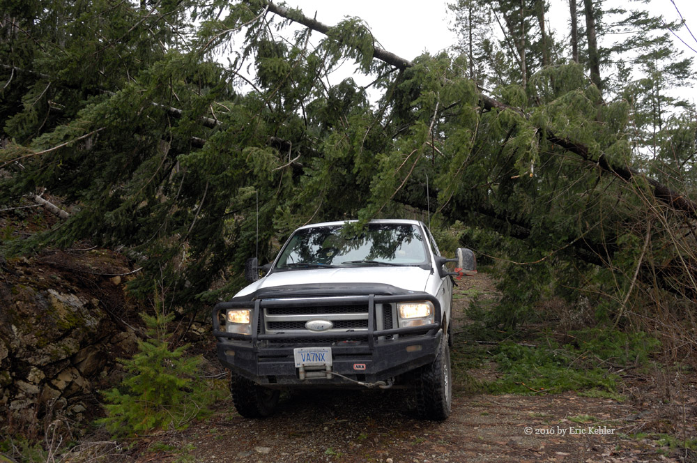
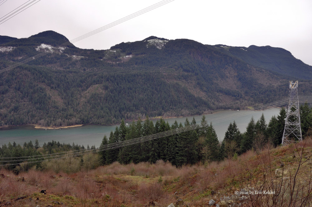
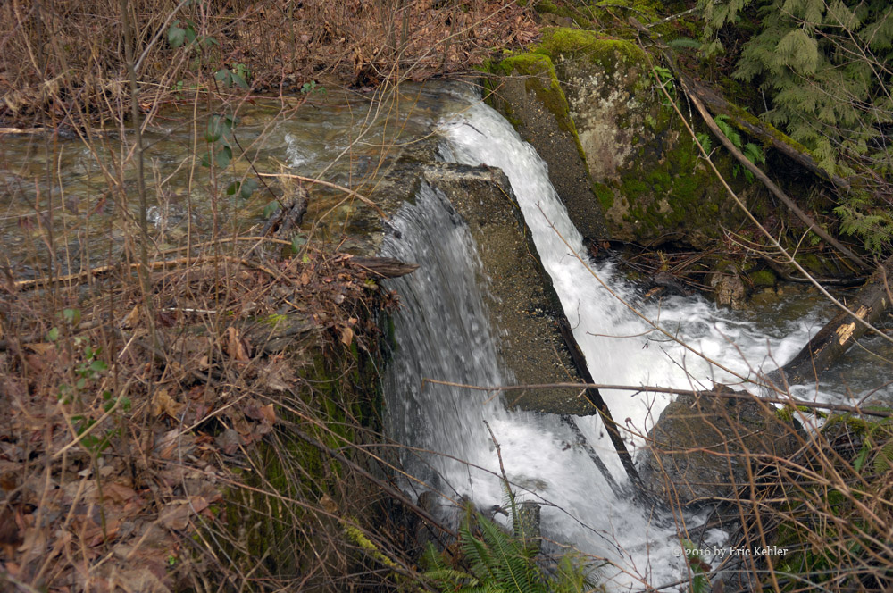
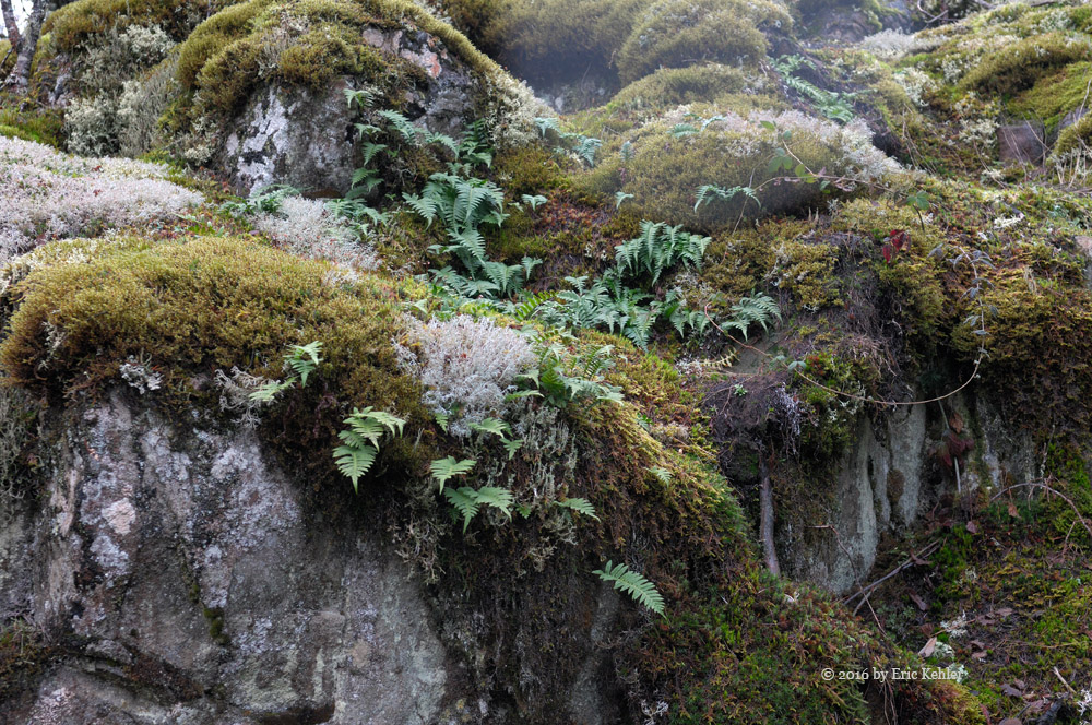
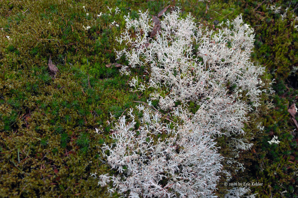
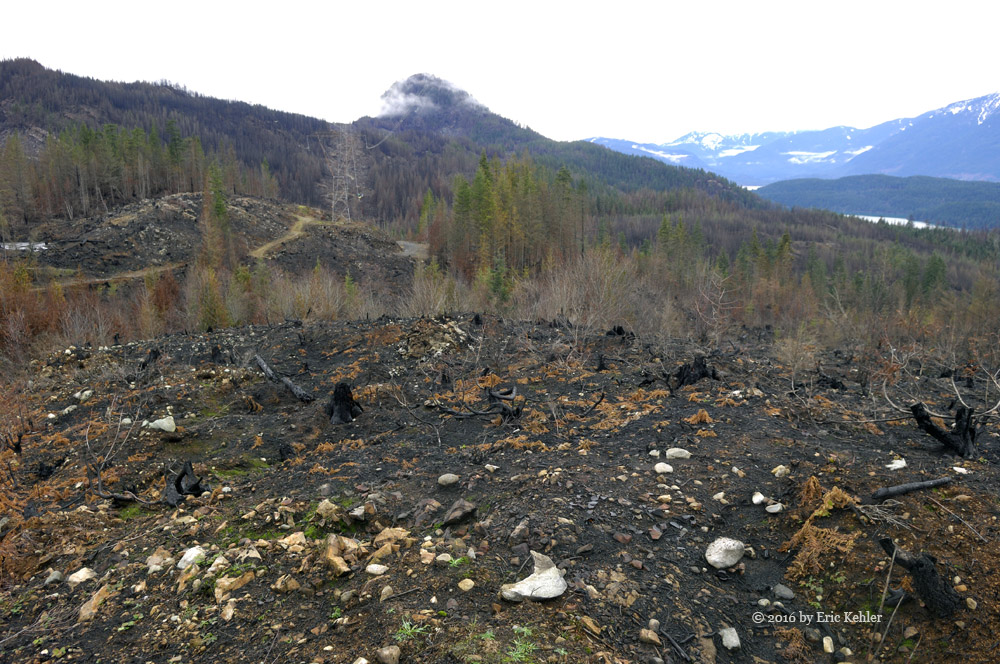
We were able to pick our way along the road to around the 60km point where another creek had ripped open the road. The gap was wide enough and the flow fast enough that we didn’t even seriously consider trying to cross. Well, we had come much further than expected so that was a treat. Now we could back-track and try the side roads to see where they went, something we had little time for on past trips. Taking the first we were stopped by fallen trees which we cleared with the chainsaw but only got a short distance further. Our second spur took us quite high up the slope and offered us some amazing views of the valley. Even burned it had a lovely grandeur to it. The blackness was already being muted by bright green weeds that were starting to cover the ground. We managed to travel a few spurs on the slope and found many interesting things to see in the burnt trees. A stump that was hollowed out a couple feet down into the ground. A standing truck with holes burned through it so it looked like swiss cheese. Once done with this spur we descended to the mainline and there we found some shade and ate our lunch. While munching a few Jeeps passed us heading in. It was still a popular spot.

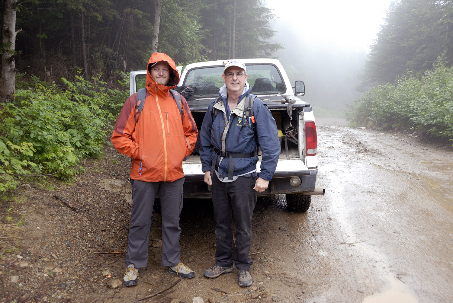
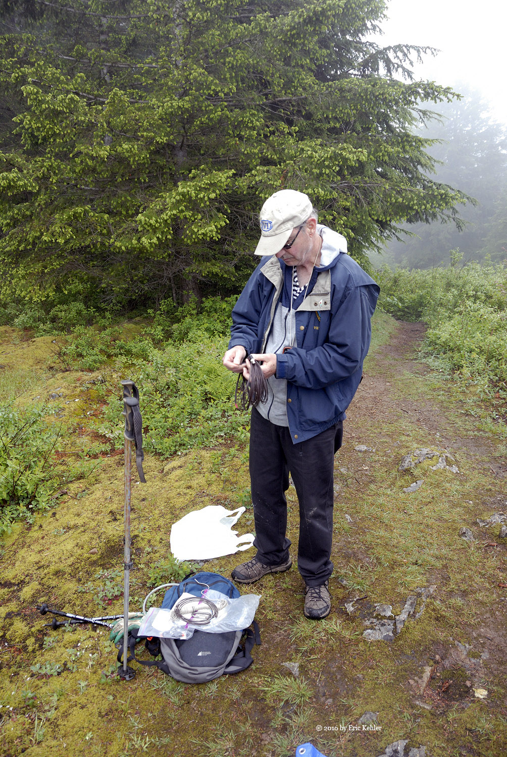
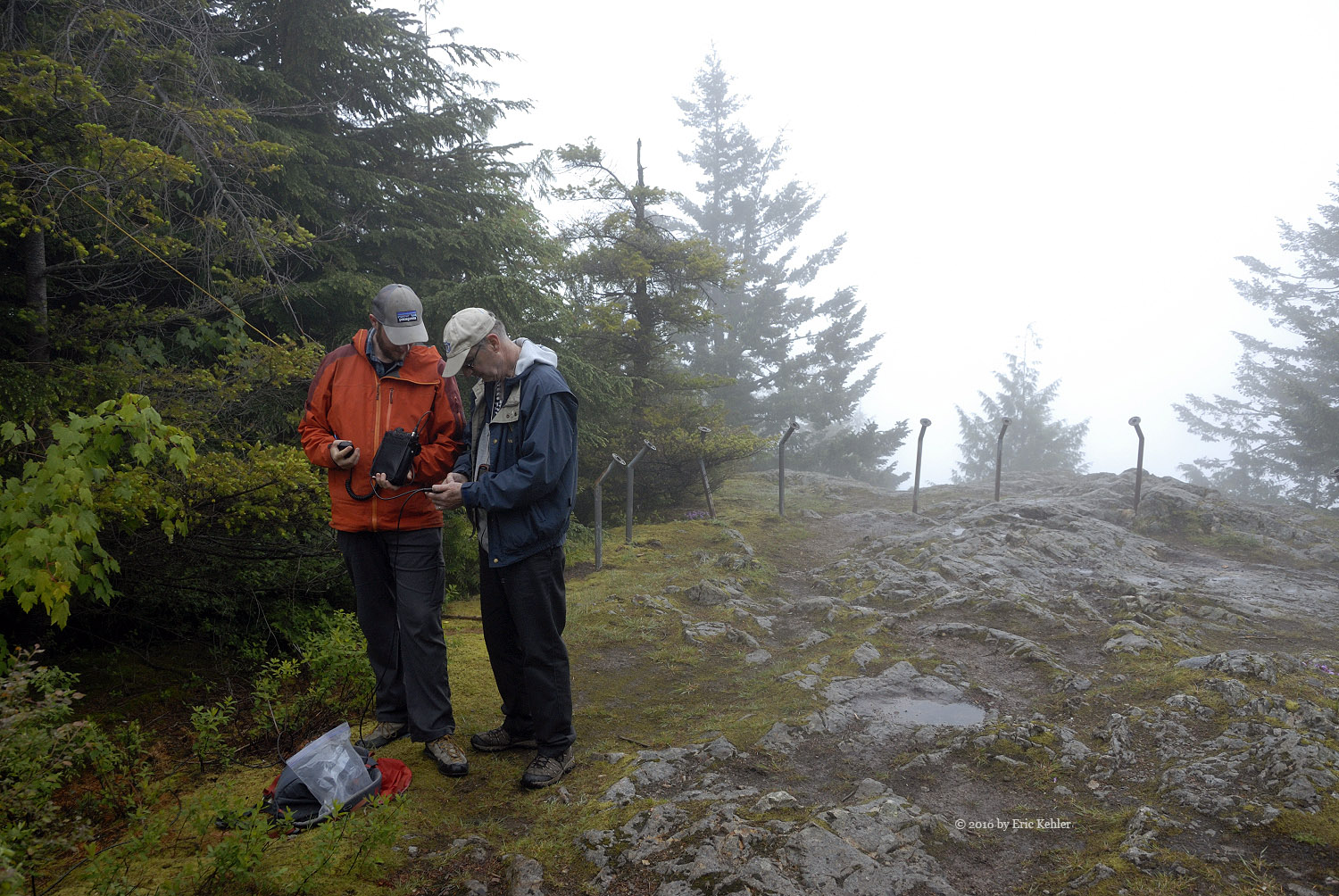
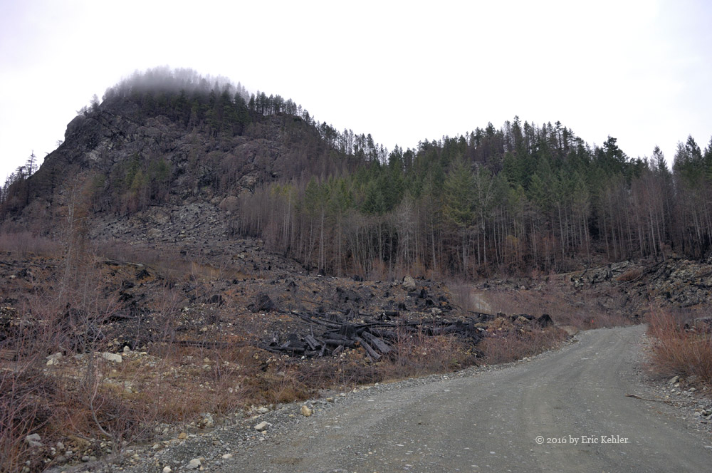
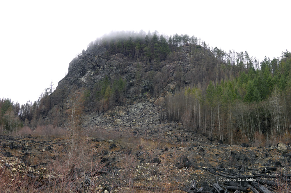
Done with lunch we continued on out and at the barricade we turned up another spur that lead high up the slope of Vulcan’s Thumb and the start of the Pemberton Icefield. This was an area I had been eyeing for some time as an area to visit as it forms the start of a trail climbing to the eastern edge of the icefield. We found an abandoned car that had its front wheels placed carefully on rocks with the tires missing! It seemed very odd. We continued past to the end of the road where Geoff did a bit of target practice. On the way down we stopped to chat with a first nation’s guy who was camped not too far from the car. He was a teacher and was supervising four kids who were out camping in the area doing a 24 hour survival outing for a course. He was quite interesting to chat with and we learned a few things of the area.

By now the day was getting on and we had a long drive home where my youngest son was waiting for Geoff to help him replace his brakes. So with little more to delay us wen made good time for the start of the resource road. Traffic on the highway was light so the drive actually went quite quickly. Now the real work began – replacing brakes that were long overdue and well rusted in place!

Sumas in the Fog

Good conversation and making new friends adds so much to a hike that is for the most part along a road and in the fog. Ralph and I had planned to do another summits-on-the-air (sota) activation but we were watching the weather as we really aren’t hard-core hikers that go out in any weather. The day looked like it would be clearing and so we planned to start a bit later to try and avoid the worst of the weather and at home in White Rock it wasn’t that bad as we packed up. Today we were being joined by a fellow ham and Sota hiker, John, he is a hard-core hiker and rock climber so our simple walk to Sumas Peak wasn’t even a walk in the park for him.

We had talked with John briefly two weeks earlier as we returned from our Mt. Lincoln hike. We knew him from the Sota organization but had never met until this morning. So this would be an added bonus for our adventure. John arrived a bit after our target departure time, he was coming from Vancouver and got a bit delayed en-route. But soon we were off to our coffee and fuel stops before the easy drive to Sumas Mountain and the logging road.  As we climbed the center area of the mountain the weather worsened and soon we were covered in cloud and a constant fine drizzle. This continued through our drive and while we geared up and started out.

The walk up the road went quite quickly as we were quite engaged in hearing about some of the exciting hikes John had recently completed. They were beyond Ralph and my abilities but at least we can dream and enjoy the thoughts of the hike. The coolness of the day made for a better time as we didn’t need to stop and rest as often. Soon we reached a small side trail that we skipped on the way up last trip. We confirmed back then on the way down that it would skip past the towers and so today we followed it and soon were at the east lookout enjoying a sheet of cloud and absolutely no view. There was a group of 10 already on the spot resting and chatting. They became very interested in our activities as we started setting up our radio gear.

Ralph was the first to start his deployment, he tossed his rope and weight into the tree which he used last time and after a few attempts got it over the desired branch. Unfortunately it got snagged and wouldn’t drop or come back. John quickly took advantage of the situation to put his climbing skills into action and he was up the tree in short order freeing the line and securing it over the branch. Ralph then finished setting up and started putting out a few calls. I started setting up my two meter yagi and soon Ralph was asking if I wanted his amplifier, I went to get it and realized I had forgotten the connecting wire, fortunately Ralph had his and all was good for a minute more before I realized I had also forgotten my radio! Now this was the first time that had happened. John to the rescue again as he did have his and so I hooked up his radio and I was making calls.

I eventually got my first couple in hand and started trying for the third. Ralph, who of course was sending Morse Code on the 20 meter band, reported that he had completed a contact with a New Mexico station and another in Quebec – show-off. He went on to complete 10 while I struggled to get two more. Meanwhile John set up his HF antenna and tried to make some phone contacts but it just wasn’t happening. Ralph tried his antenna later and it seemed fine but John’s radio didn’t want to be heard. Eventually he took back his handheld and my beam and made some two meter contacts. He was able to complete the requisite four after some time of trying to coax out some local hams. So all three of us completed an activation. While on the summit the first group departed and a second group of 8 came up. They also were curious about our activities and were quite amazed at Ralph reaching Quebec with his little set up.

Done with radio we started back down the slope, the fog had lifted a bit, still no view but the drizzle had abated so the walk back was a bit drier. Soon we were back to the truck and ready to settle in for a rest as I drove home. It was a successful day and I enjoyed being out on the slope in nature and meeting a new friend. Hopefully we can do some more activations in the months ahead.

Sowaqua Part Two

Finally a return visit to this broad valley, accessible only through a very narrow gap in the mountains along the Coquihalla. We explored this valley almost exactly a year previously and back then we saw only the mainline area and the far eastern end. Driving out on that trip revealed a large number of roads on the south side of the river that called out to us but we didn’t have the time to explore them. So we have wanted a return visit for some time. Today was our chance, the weather was great and so off we went for the Sowaqua.

Our morning began as most others, we soon had the truck loaded and on the road for Hope and the Coquihalla. There were no surprises on the drive up. Though we were so engrossed in our talking we missed our preferred gas station but realized it in time for our backup! Once we reached the exit off the Coquihalla we were soon enjoying the amazing lush greens of young spring leaves all around us. We noticed only a few trucks parked near the start of the Forestry Road, so we were sure we would have the valley mostly to ourselves. In coming out here one really doesn’t want to be bothered by others and their dust and noise. We started up into the narrow gap and the steep entrance section of the road. A sign said that there was a slide at the 12km point so this left us a bit wary and potentially disappointed.

As we made our way past the narrow entrance we were greeted by a lovely waterfall across the valley and high up the slope of Mt Jarvis. The valley continued east and opened up into a broad area with many smaller ridges running parallel to the main ranges on our north and south. The Sowaqua Creek was running fast and fresh with the snow melt and looked very pretty from high above its banks. After a few stops along the way gathering photos of the peaks and various waterfalls we arrived at the fork we were looking for. Last time we took the left one which continued up the valley. Today we chose the right side and drove down to creek level and a bridge to the south side. The smell of skunk cabbage was strong as the valley area was marshy and very soggy. An ideal location for spring bear to hang out.

Not far past the bridge over the creek we came by the first of many forks on the road. Well we decided to try them all so our method for today was to employ the right-hand rule – we would take the right branch at each fork and cover the left on our return. This led s along the south slope heading west and rapidly gaining elevation. Eventually after several switch backs we reached the end of the road. Here we enjoyed a lovely view of the valley to the east. We didn’t linger too long as there was so much still to explore.  We back tracked to the last fork and there we set off up the left side. This one had an incredibly steep incline that we didn’t really appreciate until we were making our way back down it. These roads look so much steeper on the way down in a truck as high as ours. This spur proved to be fairly short in length so we were soon back down to the major road and heading back towards the first fork we encountered this side of the creek.

Turning up it we made some elevation gain an d then reached the first of three more forks. Taking the right-side again each time we soon came to another small lazy stream in a high altitude valley. Just next to the bridge were signs announcing the Hudson’s Bay Wilderness Trail. It was across here that the supply route travelled back in the 1850’s. Today the trail has been revitalized for hikers but it is narrow and challenging. Continuing along, the road ran parallel to the trail but higher up the slope to avoid the marshy ground through which the trail meandered. Then we spotted a smaller SUV stopped in the middle of the road, it was one which passed us on the mainline while we were taking. I had commented back then that the couple in it looked a bit out of place back here. But here there were way into the road system and loading rocks into their vehicle. We stopped to chat and learned that the guy is a geologist and has spent many years working through these mountains. He had come to this spot to gather some green serpentine rock for landscaping his garden! Well I guess he did belong out here! And probably more than me! We continued past but only got another kilometer before a washout blocked the road. Here we did enjoy another lovely small waterfall just off the road. As we drove back to where the couple had been collecting rocks we stopped and spotted a nice green one. Well we thought, if they were good enough for a geologist then we could enjoy a nice green rock in our garden as well so we loaded in one mid-sized rock and continued on our way.

Back at the previous fork, we started up a lesser travelled road high into the slopes of Mt Hatfield. This road stopped in a lovely view point just below the ridge surrounding the Kippan Lakes. This was the exact spot I had studied on Google Earth last year as a pace I would love to reach and from there explore the lakes. Well we confirmed we could drive here, that leaves only a short hike to the lakes. We will return for them. Being well past noon, we decided this was the spot for lunch and we pulled out our stoves and cooked up a nice hot meal in the hot sun. Well at least it tastes good. Once done with lunch, Geoff did a bit of target shooting and then we packed up and continued back to the next fork.  That route and the next proved to be fairly short in length and we were soon back to the mainline on the north side of the creek.

Rather than head out we decided to drive in a ways further and explore a few short spurs along that road. We continued for some distance enjoying the sights and seeing many small roads that would need an ATV to explore, but we stopped before the road ended as the day was getting on and we had seen this area before. So turned around, we started on the way back. We checked out a couple more spurs but generally just made our way out passing a few ATV’s who were on their way in. That was until Geoff heard a loud rhythmic hissing sound. Concerned that he may have ripped another sidewall he quickly pulled over and got out to determine the source. Well the right rear tire had a good sized piece of shale rock jammed in it and it was leaking quite seriously.

We drove a bit further to a wider section where we could get out of the hot sun and there we swapped out the tire for one of our spares! Geoff seemed to make quick time of it and we were back on the road quite soon. We drove a bit more gently for the balance of the drive along the logging road. With no more incidents to report, we soon were making fast time down the Coquihalla headed for home. The return drive went without surprises and soon the drive to home was in sight only 350+ Km of driving for the day! Later in the week I had the tire in for repair, the rock was so big the tire was gone. That rock pushed a good 3 inches into the tire!

Lincoln and Ralph

Fortunate is a good word for describing our adventure up Mt. Lincoln today. We had planned to do the hike earlier in the month but Ralph hid in England and my other radio club partner moved to the interior! The weather was looking better each day as the week progressed and come Saturday morning it was expected to be sunny and warm. With the planning behind us, Ralph arrived at my place a bit before 8am and we were on the road in short order. Two quick stops for caffeine and fuel and we were making good time on the highway heading for the town of Hope.

Today we were driving in style, in my wife’s SUV as we didn’t need to leave the pavement to start at the trailhead. So the drive went smoothly and we were pulling off the road in Yale a bit before 10am. A few prep tasks and we locked up the car and started along the highway for the beginning of Lynky Trail. The day wasn’t too hot yet so it was a good time to get on to the slope and start up this very steep trail. It was dry and that made for an easy time picking our steps as we travelled the dozens of switchbacks up this trail, one book counts them at 47 but I think there are actually more.

Soon we reached the first very steep section where a long rope has been placed. It works well and is quite needed as the rock is slippery even when dry. Once over this section the trail meanders through trees and mosses for a while and then a second rope section is reached where the challenge is repeated. Not too much further a third rope segment is encountered. This one is quite different however. Here the ropes help you hang on to the rock face as you make your way across it. Going up isn’t too bad but I find this section to be quite challenging on the way down.

Once across the rock the rest of the trail passes quickly as one reaches the broad summit area marked by a cairn hiding a small geocache. Now that we had arrived on the summit Ralph and I stopped and ate our lunch it being 12:20 with almost two and a half hours of strenuous hiking behind us. My beef sandwich never tasted better, and the fruit salad delicious. Once rested we scouted for a tree to support Ralph’s vertical antenna. I found a spot that would also offer some shade and there Ralph tossed a line over a tree. He missed the intended one but snagged the one next to it which was actually a bit higher and so we decided to use that tree for the support. I helped haul up the line and soon we had the antenna deployed and Ralph put out his first call. He very quickly got a station in Alaska. Over the next hour he managed to complete calls with 4 more stations.

Meanwhile I assembled my 2m yagi and latched it to a tree behind Ralph. I then plugged the 2m amplifier I borrowed from Ralph into his lithium battery and I started calling. I kept that up for over a half hour but got no response. I tried a few frequencies and the only response I got was the automated one from the Hope repeater. Well, I guess I wasn’t making a contact, fortunately Ralph did and so the summit was activated again this year. I then grabbed my camera and gathered a few photos from the summit. The Fraser Canyon is very narrow here but affords a few lovely sights even if they are limited in direction.

Once done with pictures and Ralph’s attempts, we packed up the gear and said our goodbyes to the summit. The trail down though less tiring, is actually harder as one has to pick their steps more carefully than on the way up. This was particularly true as we neared the end section of the trail where a steep switchback had loose sides and here Ralph’s pole slipped sending him cartwheeling through the air. I was a bit ahead of him and heard a cry, when I turned around I saw Ralph midair doing a summersault before he splatted on the slope below where he should not have been. He was fortunately not seriously hurt, only a scraped knee and elbow. It was also fortunate that he came to a stop after only one flip as the slope kept going and I joked that he was trying to make a quick descent to the river below us for a swim in the hot sun. After resting where he landed and me looking over the situation, he picked himself up and continued on his way as if nothing ever happened. Now last time on this trail Ralph twisted his ankle just a few meters from the trail-end, so this time he did better, even if it could have been far worse.

The last section of the trail went quickly and we were back on the side of the highway in the growing heat of the afternoon. Getting across the road and over to the car couldn’t come fast enough. I really wanted to get out of these boots and backpack. Pulling it off and enjoying a long drink certainly helped improve one’s spirits. Once we had cleaned up a bit we set off for the Blue Moose Café in Hope and the cool air the A.C. system provides inside. The balance of the drive home went smoothly and as we made it past Chilliwack I heard a chap calling on the Sumas Repeater. It was a callsign I remembered as being another SOTA hiker. I responded and confirmed that he was indeed a fellow SOTA section manager. We had a nice chat as it was the first time we had spoken. Hopefully we can get together in the next few weeks.

Chehalis Peak

Encouraged and exhausted would be words I say well capture the way I felt at the end of my hike to the summit of Chehalis peak. I have been planning this hike for many months and did a scouting trip earlier this year. I had originally planned to approach it from the east but after a review of Google Earth the west side looked shorter and easier. So in January I drove the area and determined it would work but the road was washed out before my exit point so extra hiking along the road would be required. Well that still looked better than the east route so it was the planned route for the day.

Our day began with a lovely sunrise and prospects of a warm day ahead. We left the house a bit after 8:30 am and made for our regular stops en-route to our trailhead. The drive seemed to go slow as traffic and events just seemed to slow down the drive. We even got stuck behind a truck carrying an ATV who seemed to slow to a crawl over the smallest of bumps and curves. It seemed so out of character with a person riding an ATV.  Fortunately it was only for the last few kilometers of the paved road there he pulled off to park and we continued on up to the end of the logging road.

We drove right to the washout to confirm it was still blocking the road and then back-tracked to a wide spot where we parked and got our gear on and our minds ready for the onslaught ahead. The walk along the road was easy but it had a bad trait of doing a steep rise followed by a long descent! Going down when we should be going up was not encouraging as we had to reverse the route on the way back when we would be tired! But the road did gain the elevation eventually and we arrived at the planned point where we would leave the road for scrambling across the clear-cut area. We reviewed the slope before us and saw a wall of rock faces. There did seem to be a narrow gap to the south we felt would enable to get to the top of the face, so we started to pick our way across the slash avoiding the thorns and loose rock as we angled to the gap.

Climbing the gap was actually not too difficult and soon we were on top of the rock face looking down on the clearing. Before us was a nice moss carpeted understory that was fairly level. We marked a tree with tape and then studied our next move. We could see a second wall of rock before us on the left and a more gradual rise in front to the east, so we moved forward to the east and gained a bit more elevation. It looked like we could do this for some distance but the GPS was showing us moving away from the summit so we decided we would need to conquer the rock face somehow. After more study and planning we decided we had to cross a steep moss covered talus field and then carefully pull ourselves up a short steep slope to get to the top of the rock. It went fairly smoothly though the moss made each step a challenge and the steepness kept the rock loose and sliding down with each step. By hanging onto small trees and branches we managed to reach the top and there we had a nice rest before continuing up the slope to a ridge line ahead.

Well the next section was actually not too difficult just tiring as it was steep and the moss hid some holes that were waiting to swallow a foot and twist an ankle just for fun. I did step down into some deeper holes but fortunately by going carefully I managed to avoid twisting an ankle. Soon we reached the ridge and here we were able to walk on large rocks which formed some of the rock faces we saw from the road. Staying back from the edge we were still able to enjoy a nice view of the Harrison River valley to the west. From here we made good time the rest of the way to the summit. It was in a broad tree covered area with small ponds and multiple small rises all around. The actual summit coordinate we had was located in a depression rather than on a rise but I wandered across the highest point. After reviewing the area we decided to move a bit to the west to set up camp for lunch and operating my radio. The reason I had chosen this summit was because it was listed on our Summits-on-the-air list and no one had yet activated it. So here I was ready to make some radio calls and be the first to activate the peak. It was now 1:45 and we were late to start but it took only a few minutes to set up my small 2m yagi and I was calling out. I made a quick contact to a local ham in Abbottsford and then a second to a chap in Bellingham. Now things slowed down and switched to the 4x4 enthusiasts frequency and made a third contact. I ended up chatting with a few hams on the local repeaters but I wasn’t having success getting a fourth simplex contact. I needed four to successfully activate the summit so as 3pm came and went I was getting a bit discouraged. I switched back to the 4x4 frequency and tried calling for a while. Eventually a chap answered who was on his way to the Clear River Hot Spring. I had my fourth contact! Success! A short moment of relaxation and satisfaction and then Geoff reminded me it was time to get going!

Well packing up was fast and the way back well documented on my GPS track so we started back to the rock face where we took some time to enjoy the warm sun and the view before continuing down the harder part of the route. We decided to try what seemed a bit more gradual descent to the left (east) of our upward path and it got us down to the top of the second rock face we climbed, here we went back to the exact spot we ascended and there backtracked closely over our earlier route. We got down and off the talus without too many slips but I had managed to rip my jeans twice by this point!  They needed replacement any ways. Now we were into the shallower lower forested area and we had a pleasant stroll to the gap that got us started in the forest. Going back down this was fairly easy after what we had been doing and crossing the open cut went fairly quickly. Well back on the road in the hot sun and we had all those ups and downs to walk. It was tiring but the views we were able to enjoy made it a pleasant trip.

Well the truck was eventually in view and the hike almost done. It felt good to be rounding the last corner and then able to drop the pack and sit and rest for a while. A good adventure, much harder than I had expected and the long walk on the road made it longer than I wanted but we did achieve all our goals and now the summit is initiated. I don’t know how many will try this summit but with the few markers we left I think the next group will have an easier time, though it is still a class 3 adventure.


Victoria Again

Despite it being a city, I find short visits to Victoria quite relaxing and a nice change of pace for my ‘busy’ life style. Carolyn and I set off for a three night jaunt in the city of Victoria for our spring get-a-way. We had excellent weather for the time there and were able to get out and enjoy walks in the fresh warm air and just relax in more effective ways then we get at home in the routine.

Our adventure began Friday morning as we packed up and took the electric car off the charger and onto the highway. We grabbed a coffee en route and were soon pulled up to the ticket gate at the terminal. A short wait and we were loaded and waiting in the line for lunch. Though over-priced, I still enjoyed the burger which I don’t buy all that often anymore. The cruise went smoothly in the still air and with the ship being less than full there was lots of space to settle down in once we had finished eating. I went on deck and captured a few photos through active pass. I always seem to gather some photos here, generally the same ones but it is the only spot on the sailing that seems to capture my attention. So I gathered some traditional photos and then went back inside to read for the rest of the cruise.

Once docked the drive to town went quickly and soon we were parked in the Mayfair Mall to kill some time over a coffee. We even went for a stroll through the mall. Now what you may not know is that this was quite amazing for us as we both hate shopping, so walking through a mall is a rare event. We didn’t buy anything which really was not unexpected. Done killing time we continued on our way to Abigail’s Hotel where we quickly signed in and moved the car to where it could get a nice charge. We moved into the same room as last visit and so felt quite at home in no time.

Once settled, we walked up to the market on Yates and bought some snacks for the room, then at 5pm we came down to the lobby to partake in the appetizers. It was enough with the amazing mushroom soup to make it a meal, topped off with a few snacks in the room. The evening ended with a visit with my cousin who lives in Victoria.

The next day, we went for a walk to the downtown mall and there we did find some new tops for Carolyn, further down the road we came across a store where I was able to find some shirts. So it was a successful day. We enjoyed lunch at a Pho Restaurant and then after a rest we went for a second walk, this time it was through Beacon Hill Park where I gathered a few nature photos. The view from the lookout is quite enjoyable. While enjoying the spot we watched a guy flying some kites in the wind, he was doing well keeping them all going. Then for dinner walked to the home of a friend of Carolyn’s where we enjoyed a pleasant time chatting and eating.

Sunday was quieter but we did go for a longer walk along the roads in the downtown core of the city. We ate a simple lunch in the room and rested the afternoon. Dinner was Sushi in a restaurant not far from our old haunt – the Magnolia Hotel. It was a decent meal with Carolyn’s local friends and then it was good bye and we were back to our room for an early night. Monday came with a whimper as it was time to pack and head home. But first we enjoyed another hot breakfast courtesy of the hotel. They do put on a good meal and evening snack. As the ferry was only running even second hour we decided to just head out to it to ensure we didn’t miss the next sailing so we ended up waiting in the terminal parking lot for 80 minutes. But that was fine, we did make the 1pm sailing and enjoyed a quiet cruise back home. It also wasn’t overly crowded which was nice. I did get out to gather a few photos near the start of the trip as I hadn’t taken many over the years of this area. I even managed to forego taking more through the pass. Well we slid into port and the last drive to home was all that remained before being mauled by our dogs. I guess I could say it was a good time and I enjoyed the restful aspect of the adventure, need to return soon.

Anderson Valley and the Tsileuh

Constant rain has kept me out of the hills for two months! It has been a very frustrating time to be missing the sights, sounds and smells of the hills. Today was finally a sunny day on a Saturday and we were both able to pack up and head out for the gravel roads of the mountains. It has been a very long time since my last visit to the Anderson area next to Spuzzum – two and a half years. Time just shoots by so much faster than one can comprehend. But at least we were back. Our day began with Geoff’s arrival at the house, we then scrambled to load the truck trying to remember everything we would need. Once loaded we made our usual stops and were soon on the highway heading east.

As we approached the Alexandra Bridge I was getting anxious to actually get onto the roads, it felt good seeing the peaks from the highway but being on them in a few minutes would be so much better. Just past the bridge we came by the entrance to the FSR and turned onto it. A short way in at a wide area there was a truck parked with an empty trailer, so we knew there were some ATV’s ahead and to keep an eye out for them. We tuned in the logging road frequency on our radio and soon were off for our adventure. Our first stop was to enjoy a look down on the bridge we just crossed. It is quite impressive being so high above the river.

We decided to drive the larger section of the road system and set off for that area, passing many signs warning of homes below the road and not to shoot firearms in their direction. We soon were wending our way up the narrow gorge through the eastern range that forms the Fraser Canyon. At the far side the road splits and there we saw a locked gate. We checked it and though it looked locked the chain was actually not secured. But I really wanted to go the other way and so we started up that road but soon came to a small mudslide across the road. Though not really very big it was enough to stop us dead in our tracks. The truck just dug into the dirt and couldn’t get over the debris. We didn’t feel like digging it out so we turned back to the gated road but while we had been contemplating the slide we heard an excavator across the valley. It was obvious that they were the ones closing the gate and we didn’t want to take a chance that they would actually lock it while we were on the far side! So we returned to near the start of the road for another fork that climbs to the ridge of the range along the Fraser Canyon.

It is in this section that the hydro construction crews were busy two years ago building a new power line. We enjoyed the benefit of the improved roads and though we had a bit of snow on the road near the crest it wasn’t deep enough to block us.  If it had been the day would not have been very encouraging. But we had the whole valley before us and we followed the main line north down to the river and back up the far side to the end of this ridge and the final transmission tower before the line took a long dip to the far side of the East Anderson branch. It was a nice viewpoint so we set up our stoves and cooked a nice lunch. By now we now had come across the two ATV’s and a small bear cub but otherwise we were completely alone. So nice.

Done with lunch we started back and saw a red truck parked below us so we found the spur that led to it and discovered it was a truck we had seen before in the area collecting tree branches to ship east for Christmas ornaments. The driver was not near so we continued past and explored the road a ways further before turning back. We continued our backtracking down to the river where we stopped to gather some photos and then it was back up to the ridge and another spur. This side road is the one we were on the last time we were here. It brought us to an area with some nice small lakes that we found very pretty. Unfortunately not far along the road we encountered over grown trees which Geoff started clearing with the chainsaw but we also had deepening snow and decided we wouldn’t get much further so we packed up the saw and drove back to the mainline far below. Here we stopped on a large mossy rock that I enjoyed taking photos from years before. It is a very pretty spot with some nice views of the Fraser River below. Done with this road for today we crossed back over the Fraser and through Spuzzum and turned onto the Tsileuh Service Road. This one continues north along the west side of the canyon and soon we had some nice views of the old Alexandra Bridge and other portions of the Fraser. As we continued along the road we encountered a new challenge - freshly fallen rock with sharp edges which was threatening our sidewalls. Eventually we were blocked by a washout that seems to have been the same one that stopped me the previous time I was here.

Well it was still a nice spot to enjoy even if we didn’t get to any new section of the road.  As it was now getting on in time we decided to head down to the highway and return to the town of Hope for a coffee at the Blue Moose. It is always a refreshing spot to get a quick refresher before continuing the drive home.

Ocean Park

Beautiful is a good word to describe the day and scene. The sun was out with a touch of cloud and it was warm for February – 15C – so I felt it would be a great day to visit the beach and gather some photos while enjoying the sights and smells of the fresh sea air. I had mentioned my plans yesterday at coffee to my friend Ralph, and he thought it would be a great adventure and so he asked to come along.

Well lunch came and went and it was time to head to Crescent Beach, I swung by Ralph’s place and gathered him and his camera gear into the electric car rather than my big truck and we set off west along 20th Ave. Little did we know what was waiting for us around the next corner. We drove along 20th enjoying the sun and light traffic to 128th and turned right to head for Crescent Road and the descent to Crescent Beach. All was well until a block from Crescent Road, here we encountered a line up. I didn’t think much of until I got close to the corner. Here I saw a stream of cars coming up from the beach. Naively I turned towards the beach and soon joined a slow moving column of cars also heading down there. It was crowded, I took a short-cut to Blackie Spit but soon rejoined the line, they were all looking for parking. The place was over-full! By now I was quite convinced I didn’t want to stay even if I did find parking. So I turned around and started out.

I did find a few road-side spots along the side road but I didn’t want to fight with the crowds to get a photo. So we tried to leave the beach area but the line-up to get out was worse than the one we had coming in. We eventually got back onto Crescent Road and quietly turned off it to head for Ocean Park and the 1000 steps. I was hopeful the crowds weren’t clogging up that spot as well. We arrived and found a couple of decent parking spots and quickly slid into the closest one and got our gear ready for the walk to the beach.

The steps were a breeze to walk down and Ralph and I enjoyed the easy route down. We then walked the path along the tracks to where they end at a short tunnel under the tracks. Here we walked through it and onto the beach. There were a few people around but very few in comparison to Crescent Beach and likely White Rock. We soon found many enjoyable sights that caught our eye and enticed us to stop to make a permanent collection of light photons onto our camera sensor. Ralph soon spotted a collection of carefully placed rocks that were balancing upon others. They were quite remarkable in that they could even stay that way. I know when I try to stand up a rock it very quickly falls over. Perhaps they were glued, it sure seemed like they must be. But we did gather a good number of photos of them while they were upright.

We continued south along the rocky beach stopping at objects that caught our eye. I found some bull kelp that caught my eye and then a number of rocks jutting out into the water with a cloud draped San Juan Island as a back-drop. It was a very satisfying view. I stopped to gather various angles of the rocks and distant mountains before just sitting on the rocks resting and drinking in the beauty. The location brought back memories of my youth when I lived not far from this spot and I would come down here just to enjoy the scene. The smell of the salt air and sun glistening on the wave tips in the warm air is a very relaxing yet energizing combination, I really do need to get down here much more often considering I work just up the slope from here!

After gathering many photos along the rocks I heard a distant train and I thought it would be nice to gather a few close-ups of the train as it passed. So we climbed the rocks to track level and found a spot to capture the train. But it never came! So we wandered back to the trail along the tracks hoping for a train unfortunately we were soon back to the tunnel and so we dropped down to begin the more arduous task of ascending the stairs. But as I started along the path I noticed that Ralph was busy photographing the colourful graffiti covering the walls of the tunnel. I stopped to look at his subject and decided it was interesting and so I also took a few photos of the colourful art work. Done with that we started up the steps. I decided to capture a running sequence of the stairs as I climbed. By the top we were still in good shape and I remarked at how much easier that climb was than the last time I was here many years ago.

Once back to the car we looked around and decided to head to the park at the end of the road for an upper view of the sights we enjoyed below. Here there were more people gathered but it was still rather light in numbers. The view point at Kwomais Point Park really is quite spectacular. It was now getting on in time and I had a family dinner to get to so we set off for the car in seriousness this time. Just as I was reaching the car I met some old friends from my days living here and we chatted for a few minutes before Ralph and I left for home. It was indeed a lovely adventure out on the rocks, enjoying the sun, probably better than we would have had at Blackie Spit!

Morris Valley and the Sts'ailes

At Last! I finally got out in the hills, almost missed the first month of the year. It seems that the weather is better during the week than on the week-end, and exploring the hills in the rain is not my preferred time to go out. I did miss one good week-end as my son had a chance to take his wife and two boys up to the local ski-hills for a family day. I guess grandpa comes in last place but so it should be, it gave me the opportunity to do yard work; such fun. But here we are on another Saturday and starting out for the West Harrison area.

Today’s objective was to do a look-over of the road leading to Chehalis Peak. This road is on the west side of the summit and it looked like it would get quite close to the top making hiking it for a SOTA activation fairly easy compared to the eastern approach. So we set off for the Weaver Creek fish hatchery which is on the corner of the road we were turning onto. We arrived in good time after our stops for coffee, fuel and fresh beef-jerky the order of importance is open for debate. We arrived at the hatchery and the fork where we would normally continue on past and up the start of the logging road, today we turned right and continued south along the east side of the hatchery.

The road is well maintained as there are a number of homes built along it and at the far end along the Harrison River. Unfortunately as we drove south we encountered a gate with lots of warnings to get lost as it was private property. I think it was a bit over-stated as it is a public road. But we didn’t check the gate as we had passed the entrance to the logging road we needed to take to the summit. We turned on to it and started up the slope. The road was in reasonable shape and was cleared of some recent trees that had fallen across it. There were a couple of side spurs that led to the base of transmission towers but we ignored them and continued on the main line until we encountered a wide fresh washout. It was too deep for our truck to cross and just beyond it were two large trees laying across the road that we would need to clear. So we decided to call this road and start back down. Looking at the map later I could see that we were 2km from the spot we would have parked at for the hike so although not at the end, it would not be too bad a start for the hike.

On the downward drive we stopped at a spur overlooking the Harrison River where I gathered a few photos. Here I noticed the smell of stale oil and decided to move on fairly quickly. On our way down we came by another truck coming up, inside was a family of three out exploring the area. Back on the lower public road we stopped where we had a nice view of Morris Lake and the valley beyond. Here we again noticed the smell of old oil but now we were a bit concerned. So we checked out the truck and discovered that the rear right brake was leaking fluid. It was a slow leak so we decided to continue on but with a careful eye on it.

We returned to the hatchery and continued our drive up our regular road to the start of the FSR proper and then on to our first view of Harrison Lake. Here we took the first side road which heads south along the lake to an overlook above the Harrison River and on the east side of Chehalis peak which we had just been exploring. The drive along the transmission line service road went very smoothly until the last 250 feet. Here we encountered a large rock we had to drive up on but with it being wet it was too slippery for us and we were spinning out digging a hole. So we decided to not push it and started to back down but we had slid enough that the back end was now blocked by the slope - going forward was not happening but neither was reverse. It was time for the winch and a bit of help moving forward enough to get our rear freed. Now the trouble was that there were no large trees in front of us for quite some distance. I was able to find some old stumps but the first proved too rotten. The second held long enough for us to get ourselves repositioned and then we backed down to a place where we could park. We wanted to walk to the end of the road and gather some photos from the lookout.

The short walk along the last part of the road went easily enough until we reached the clearing around the last tower. Here I was walking ahead of Geoff and looking for an easy way down to the lookout when I heard a cry and turned to find Geoff laying on a large rock he had slipped on. He had his coffee cup in one hand and his shotgun in the other and so had little with which to break the fall. So he hit hard and I saw before a whimpering father of two sprawled across the rock with his gun and coffee safe but his knee and thigh in rough shape. In a couple minutes he was already sporting a huge deep bruise. But of course it was not a time to offer much sympathy just friendly teasing as to ones increasing age and diminishing agility. After a few minutes of recovery we continued to the lookout for our photos.

Done with the area, we returned to the truck and backed it down until we could turn around. Then we found a flat area with a view to the north along the lake where we stopped for lunch. We checked the brake fluid again and found it to be fine so after lunch we continued north along the mainline and explored a few more spots as we made our way to the area around Wood Lake which was burned last summer. The area actually looks starker than it did on our last trip as all the green ferns were brown in the winter season. It should start looking better soon. We continued on to the spot where the Lookout Peak trail starts so I could gather a few photos for my friends in the radio club who hiked the summit last year. It was a bleak sight with all the black and lack of green life.

By now the day was getting on and it was getting quite dull so we started back up the road having enjoyed a lovely day in the hills. When we reached the Weaver Lake side road we decided to head up to it to see the area as it had been years since we were last there, but as we got near the lake the road was gated stating that the campsite was closed. So we never did see the lake. We’ll just need to try again later in the year. Turning back, we were soon back to the mainline and out by the hatchery where we reset the truck for highway driving and then made for home. It was a good day and adventure and we both had a decent time for the most part and now I know how to prepare for the hike to Chehalis Peak.

Silver River

Time goes by far too quickly, I looked back on my back-country trips and saw that it was late September when I was last out with Geoff. I did one hike in early October with a friend and then my Ontario drives in mid-October, but since then nothing. I was well past the cold-turkey stage but the need to be out there was still strong and only got more pronounced as the morning prep took place and we were finally starting to roll on out. It didn’t take long to settle into the old routine and get a coffee and gas and then the highway. We decided to visit the East Harrison area and see what might be found. Geoff had been going back here near the mouth of the Big Silver for some hunting expeditions earlier this year and he wanted to show me the sites. So that became our first target for the morning.

The drive up the first section of the FSR was in fresh snow but it soon cleared off as we drove north. By the time we reached the Big Silver the ground was clear though we could see the snow on the trees part way up the slope. We zipped up the old landing strip and took a turn at the Pine side branch. This was our first trip since the Forest Service switched the radio frequencies of the road to the new channelized system. The main line was channel RR-19 and the pine was RR-28. It is easier to use than the old frequency based method and fortunately I had programmed my radio some time ago with the new system. But being Christmas week-end we heard no activity on the radio.

We drove in on the Pine branch and followed the newly improved road south towards the lake. It was really quite nice and improved courtesy of the power project as they needed to build a road to the lake and along it north to where they will be anchoring a submerged power line across the lake. We drove the road to where there was a security trailer warning to stay out, but it being Christmas there were no workers or contractors so we just carried on and drove through to the end of the road. It still has a few Kilometers more to go but it was a fun adventure already. I will want to revisit it once completed and it reaches the lake shore in an area not previously reachable.

We back-tracked along this route carefully avoiding a big hole in the road that almost swallowed us whole on the way up. For the most part the road is quite good but there were a few challenges. Done with that road we drove a couple more older spurs and stopped to eat lunch with a view of the lake to the south. It was quite cold out so having a hot lunch was definitely a nice benefit of driving rather than hiking. It felt like old times being out here enjoying nature first hand.

Done with lunch I thought that it would be a good day to go visit the power project as it was unlikely that there would be anyone more than a security type up there. So we headed north and soon arrived at the site of the work camp and generation station. I was right we didn’t see a single person in the camp area and so we continued on through and soon were driving the road which was now on top of the buried penstock of the new power house. We stopped on the high bridge that crosses the river and gathered a few photos, the placed looked like before except that the road was in better shape and a bit wider below the bridge.

We continued a short way further up to where there had been a river crossing years ago but was now a spot with a very scenic bit of the river. Well the crossing was back with a solid bridge and on the far side a huge concrete dam structure for the new power project. I had thought it was to be built a bit further up the river not right on top of the most scenic bit of river! Parts of the old section were still there but a new channel had been blasted through the rock and the bulk of the river was flowing through it rather than over the old route. It was quite a shock to see especially in light of the fact that the brochures of the power project depicted the beauty of the river with this same section of river. It is a bit ironic that they then go a damage it. Generally I am in favour of the river run power projects so I guess I will just wait to see how it pans out once the project is in operation. I did get a chance to walk across to the dam and look over its various structures. It is a lot bigger than other sites I have visited.

After a good look over the project we decided to continue up the road to Shovel Creek to see if that portion was started yet. The road past the bridge was back to the former quality and fairly rough and soon we were driving on snow. We continued driving a few kilometers further with the snow getting deeper and the ruts we were following more pronounced. Soon the road was really getting too deep in snow to continue, the ruts were less pronounced as many drivers had already turned back. Neither of us really wanted to put on the chains so we opted to turn around. We had a bit of a challenge turning as the snow was deep enough to ride high but it was still early season and fairly light. A short stint in low drive mode and we were turned and headed back south.

We continued on past the empty work camp and came by the next major side road – which had a bridge across the river. This branch caught our attention as the new power transmission line was being built from the powerhouse to this point and then up the side of the mountain to our west. So we turned on to the side road and explored the area. We were able to follow the old logging road a ways up the slope as it switched back and forth beneath the new line. Eventually we were stopped by snow but until then it was a pleasant drive. In looking at the map it was clear that the line was headed up over the ridge and down to the lake where the new road was being built to. At some time in the next couple of months they would join up and the work crossing the lake would begin.

Done with the side road we started back south on the main line. As it was still not late I decided to visit the Clear River Hot Spring. From past talks with back-country goers we had learned that the old wooden tanks had been vandalized and burnt by drunk idiots. Earlier this year others had hauled in two commercial hot tub shells and fixed up the area to once again be useable. So I thought it would be interesting to go see the work.

We started up the Clear River spur and soon we were driving on snow. It was getting deeper but there had been enough traffic that the ruts were quite established and so we continued on. At about the 3km point we encountered a group of 4x4s coming back. One of them stopped to chat with us, it was a couple my age and they said that the place was crowded with drinkers and they didn’t bother to stay. They said the road was passible if we took it easy, he then went on to recall how one driver had slid off the road and needed help getting back on. He also said that another group of 8 was heading up about a half Km ahead of us. He wished us well and we continued on. The road was indeed getting more challenging and soon we had reached the other group heading in.

We all continued along the road and eventually reached the area next to the spring. There were indeed a number of vehicles there and several people standing around arguing about something. Geoff found a spot to turn the truck around while I walked past the crowd and made for the tubs. They were empty so I got a few photos of the repaired site. Another pair of girls and a guy came up and started getting changed for the soak. The first girl had on such a small bikini I wonder why she even bothered. I made my way back to the agitated crowd and quickly got past them and back into the truck. This drinking really messes people up. We started back along the road with another 4x4 following us. We had a few short slides but generally it went easily and soon we were back to the mainline as the clouds began snowing. I just wonder how beered-up drivers were going to do on that road with fresh snow. It was now getting dark so we started the drive home. That went without incident and before much time passed we were back on pavement and ready for the easier but longer part of the drive home.

So after too long a separation, it felt great to be back in the hills enjoying the sights, smells and sounds of nature, I just wish that the others would leave their alcohol at home.

Subscribe to 2016