
The boys visit the West Harrison

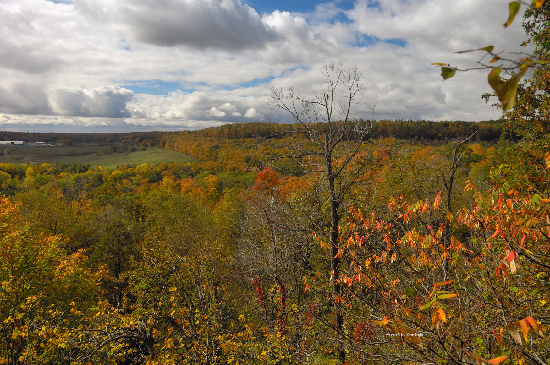
It felt long overdue for us to be getting out into the hills, the wet fall has kept us behind closed doors, so when a decent day came along we immediately set out for an adventure. This was also the first trip since the truck was fixed up and given a lift. So a good check out for that expensive bit of work. It was a dull morning when we set out but the day slowly improved as we drove east. After the first few stops including buying some lunch, we were soon driving to Mission on our way to the start of the FSR. Traffic was light and we made good time.

When we first started on the gravel and approached the first bridge the road turned to a field of potholes. As we weren’t expecting that road had deteriorated so much,  we were a bit fast and shook ourselves quite seriously, Ben was wearing his hot chocolate by the end of the rough patch. The truck did far better than before so the new suspension was working well. We stopped at the side of the road not much past the first lake campsites to show the boys a van that was on its side below the road. They seemed quite amazed to see a vehicle abandoned down there. It has been there for years, but to them it looked very current. We continued in not sure where we would end up so we just took our time, the truck was handling well and we were enjoying the sights.

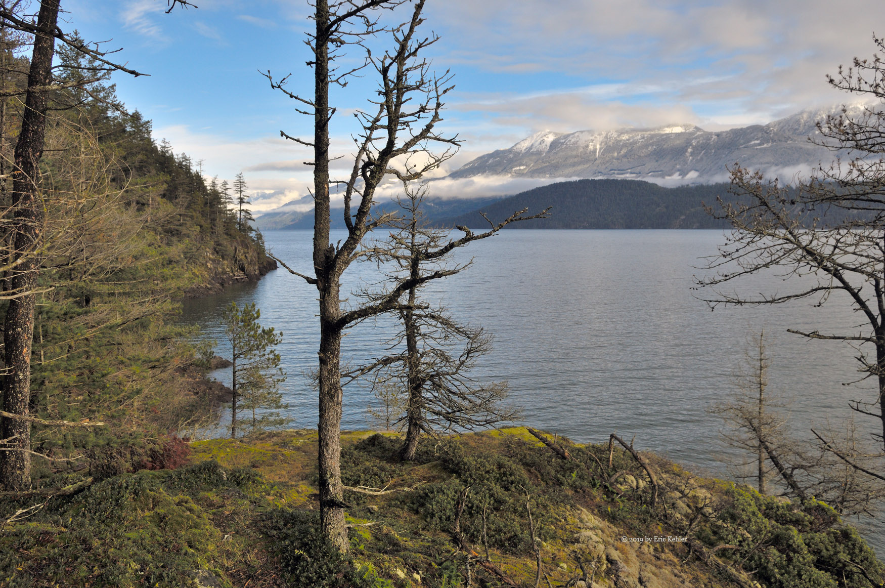
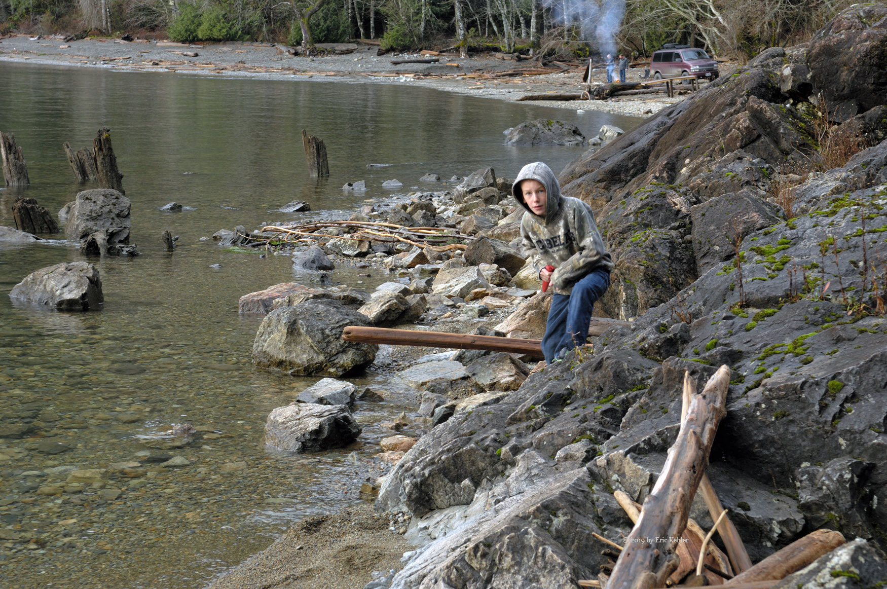
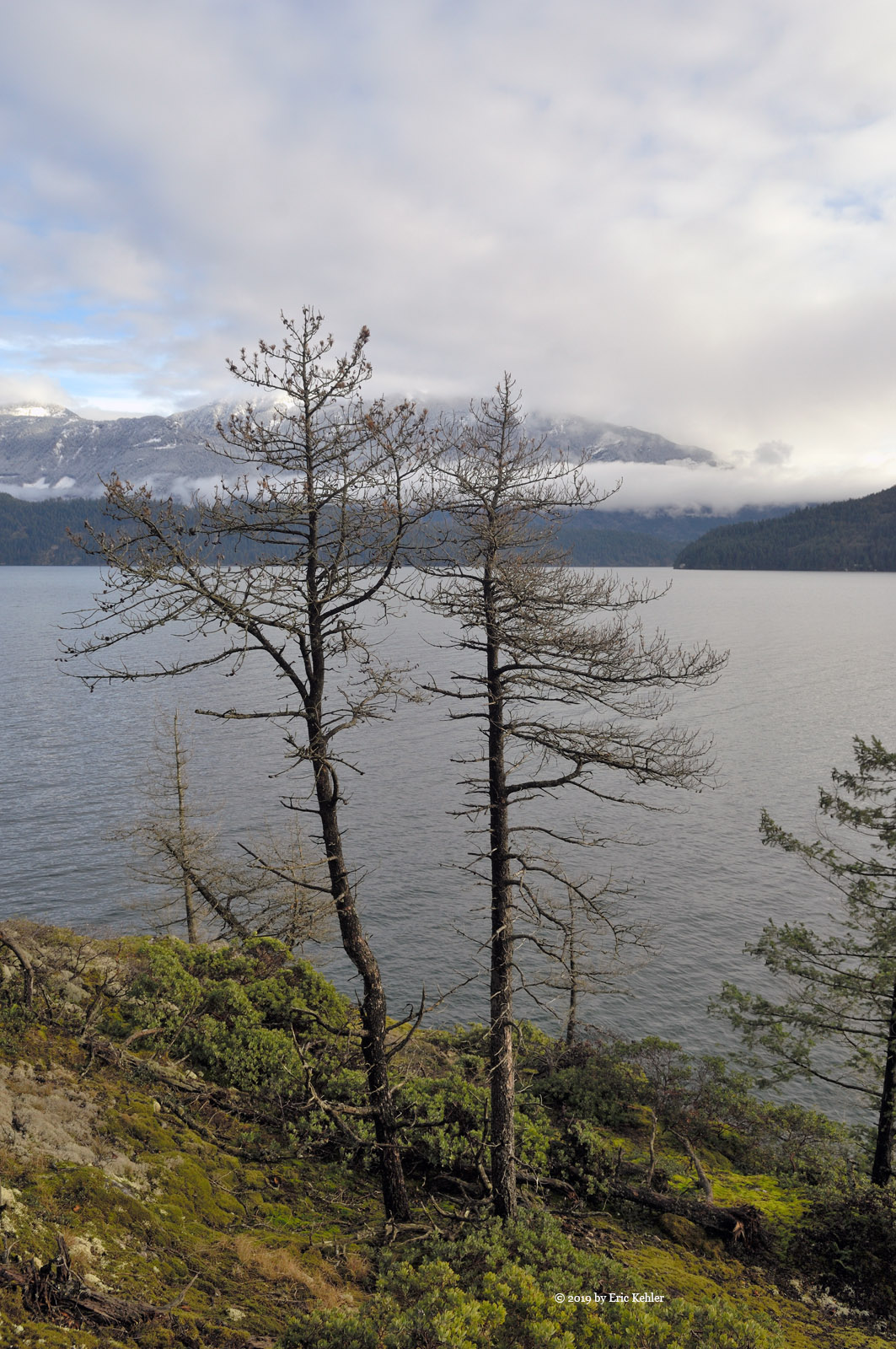
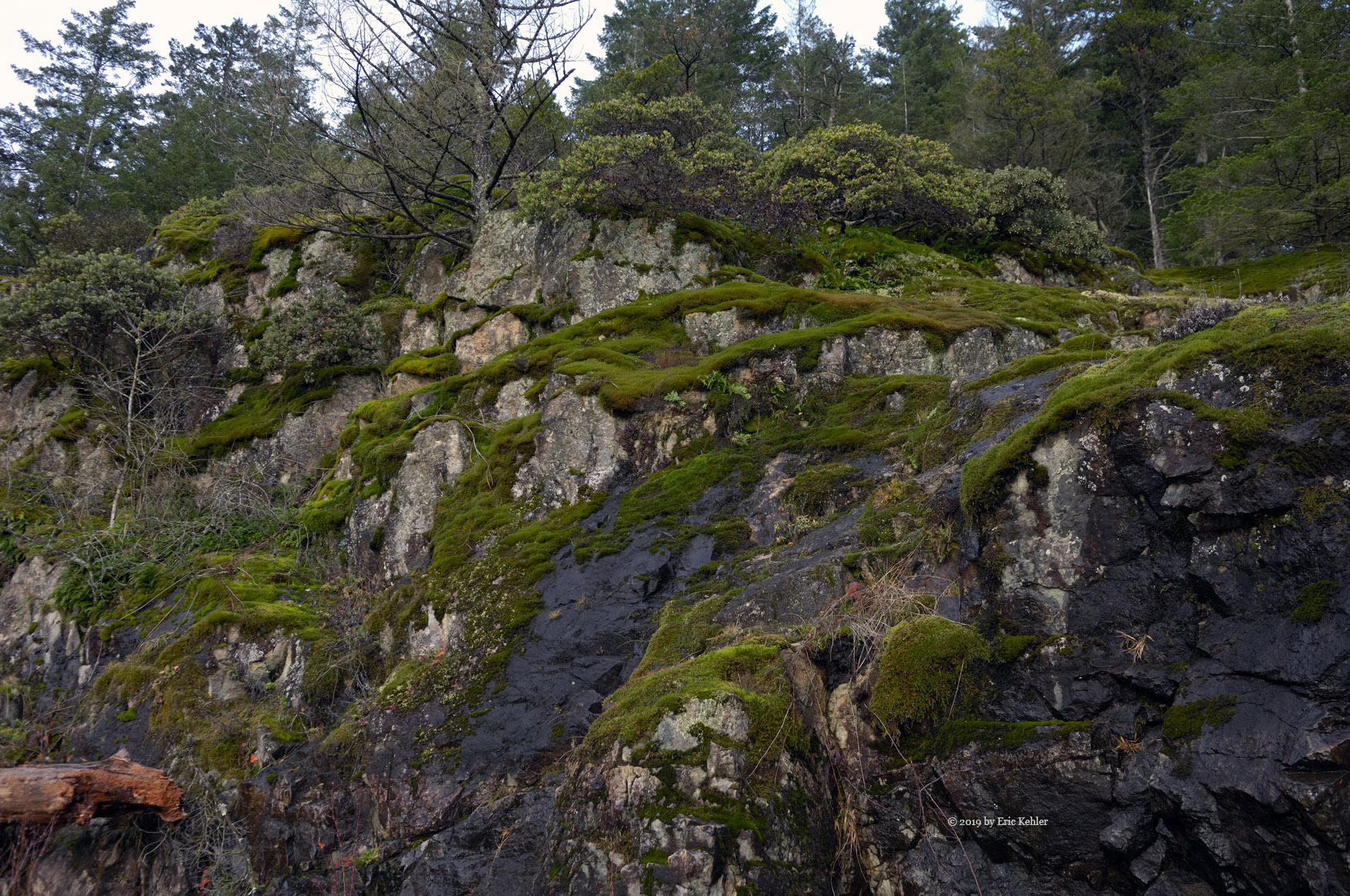
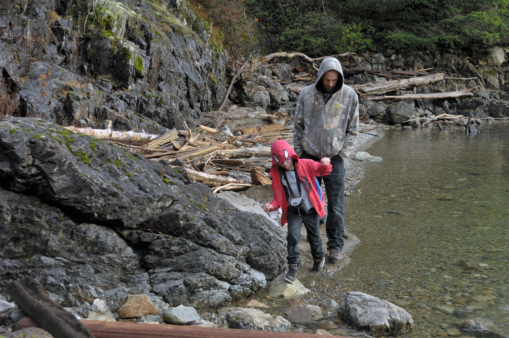
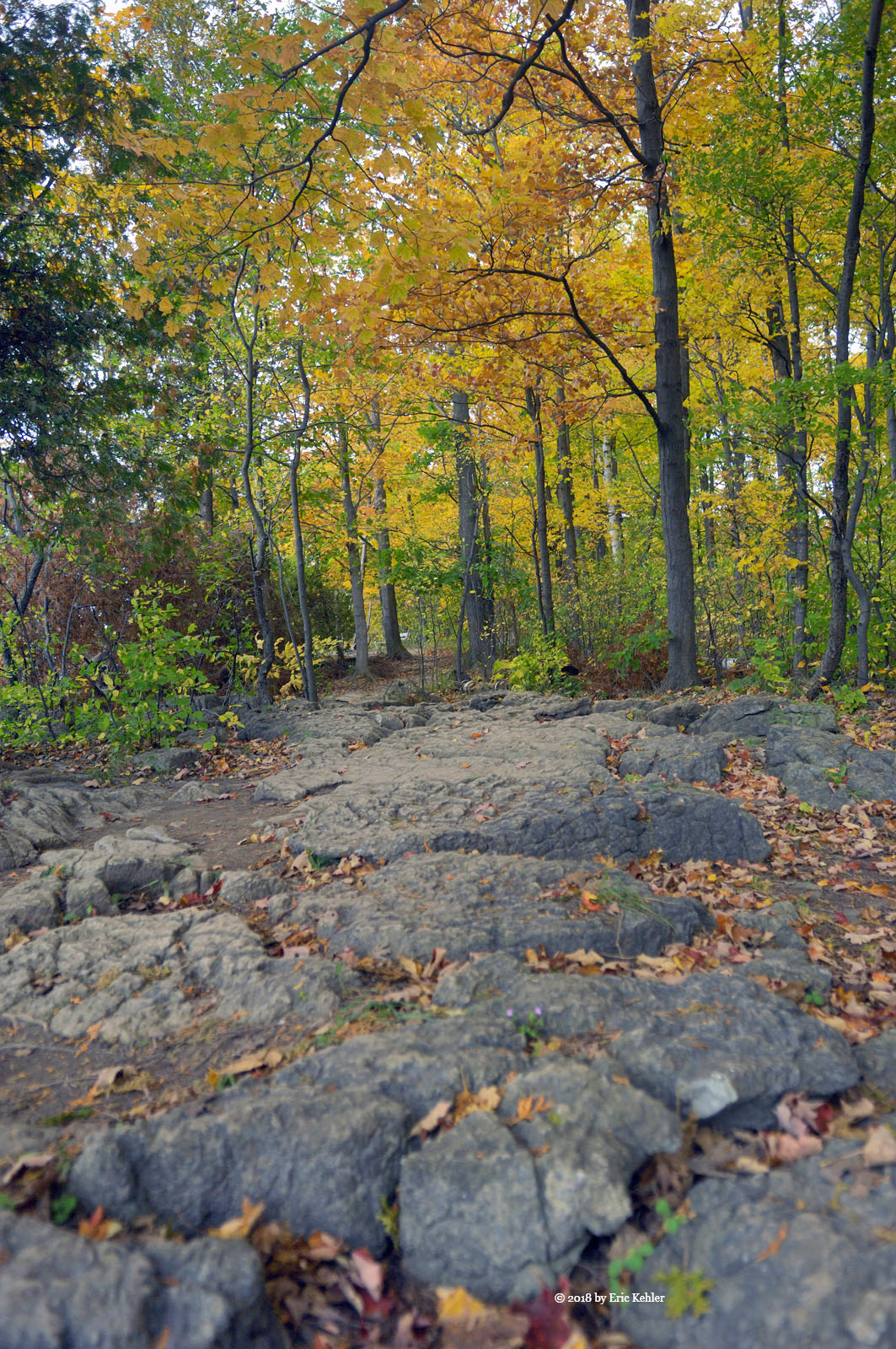
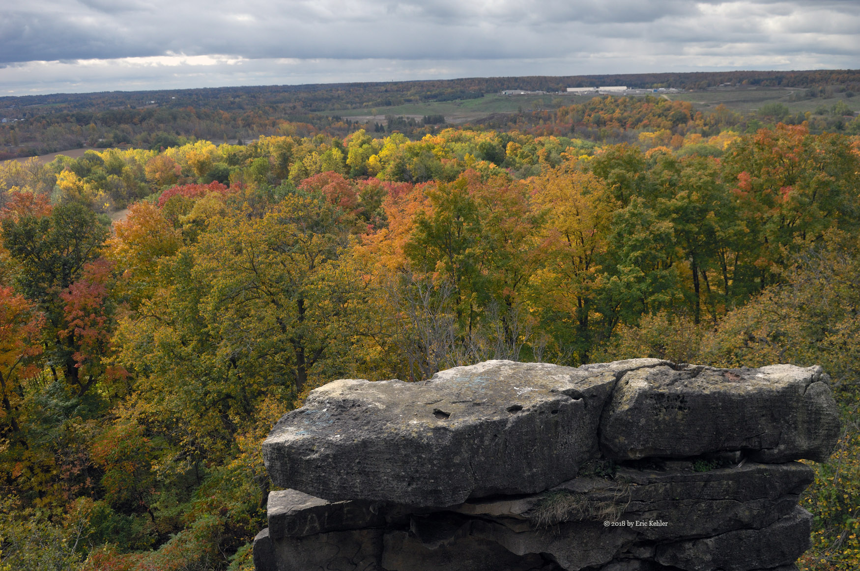
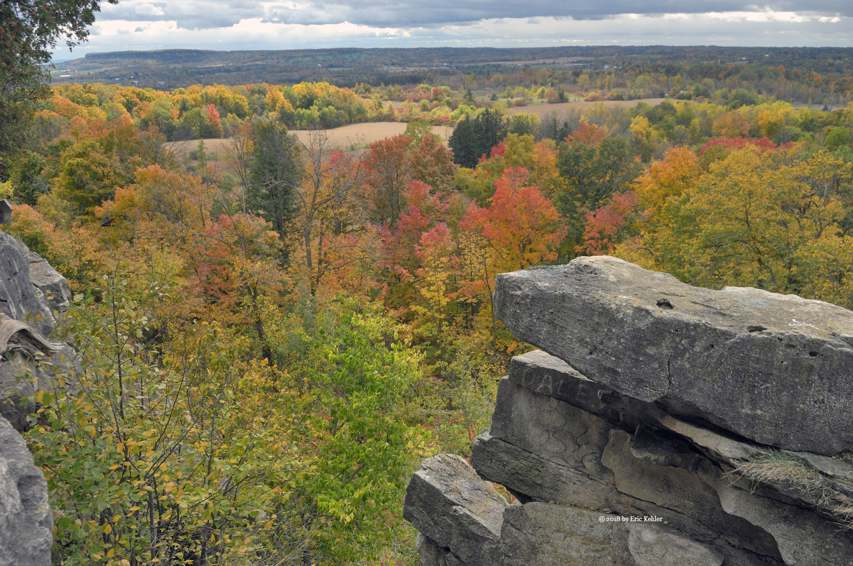
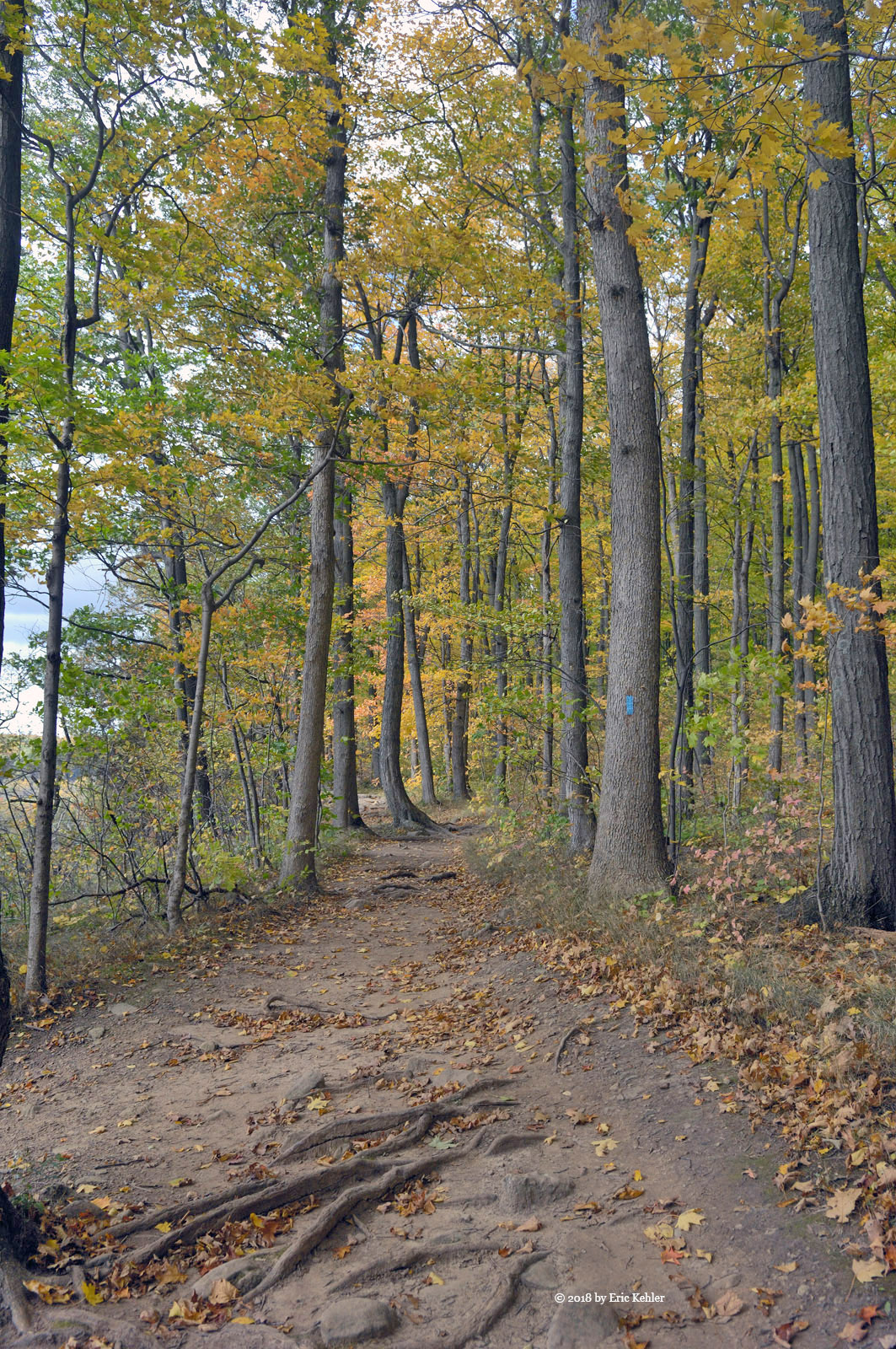
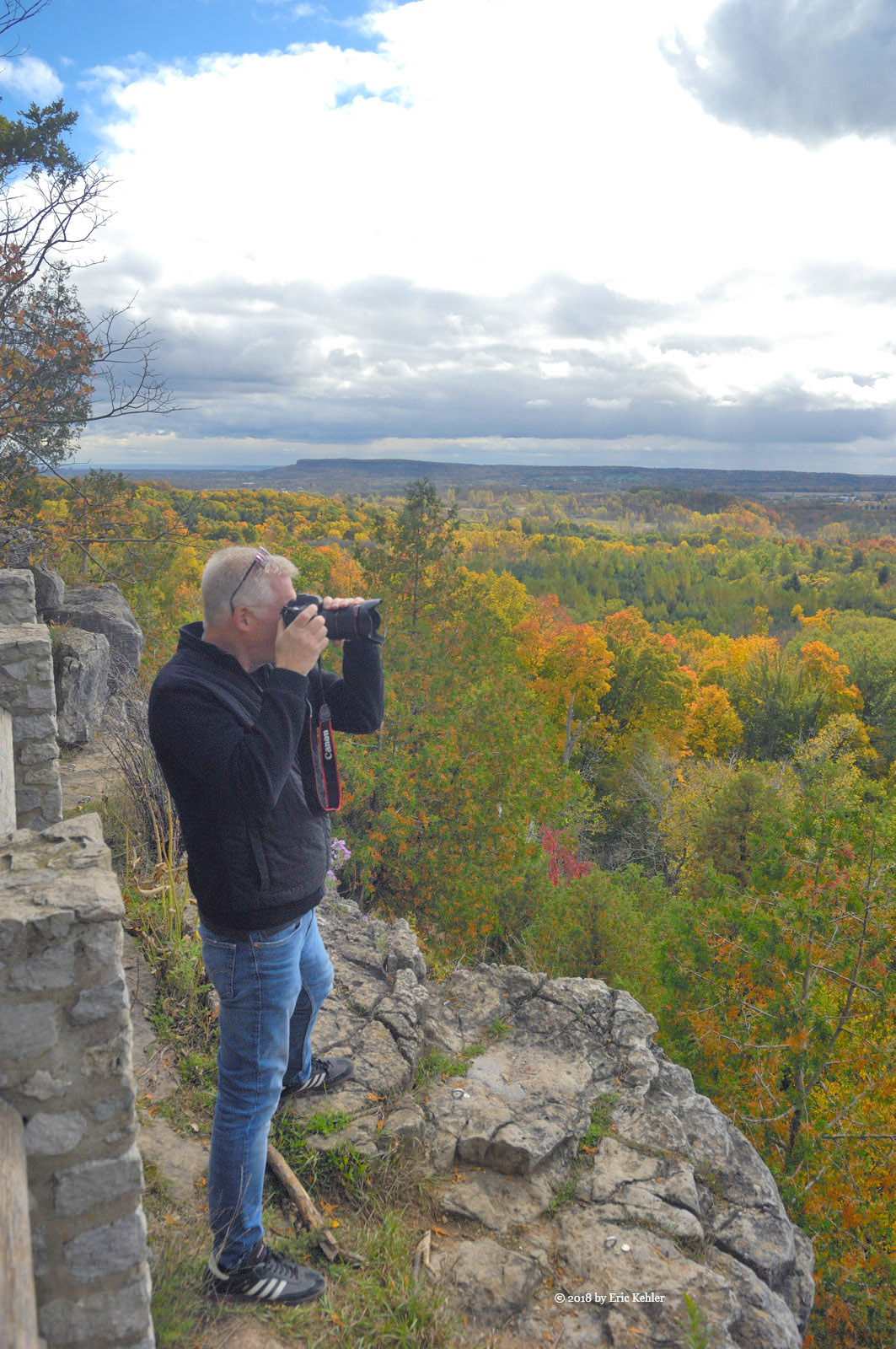
As we came by the side road to Camp Cove we noticed that the gate was open, so we decided to head down to the lake and enjoy one of the nicest beaches. When we arrived, a pair of guys were  on the beach flying a small drone. We parked and took a walk along the beach and I headed for the mossy rise that forms the outer point of the cove. It was a lovely romp through the mossy trees. Liam was with me and he exclaimed that it was his favourite spot! Soon Geoff and Ben followed and we enjoyed the views for a few minutes before heading back. On the return Geoff spotted some Buck scat on the ground that would have been from a huge buck. It had survived the hunt season and Geoff figures he was a big one. We made our way back to the truck and started up the road, Geoff needed to turn around and in doing so managed to back right into a large tree – bang and we stopped moving. Now I know the canopy blocks ones view but to miss a huge tree really is funny. He hit it square in the middle of the rear bumper which now sports a serious curve.

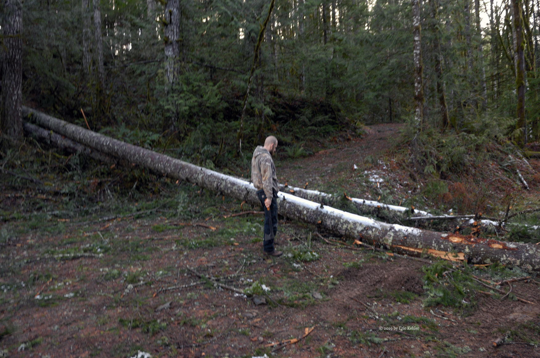
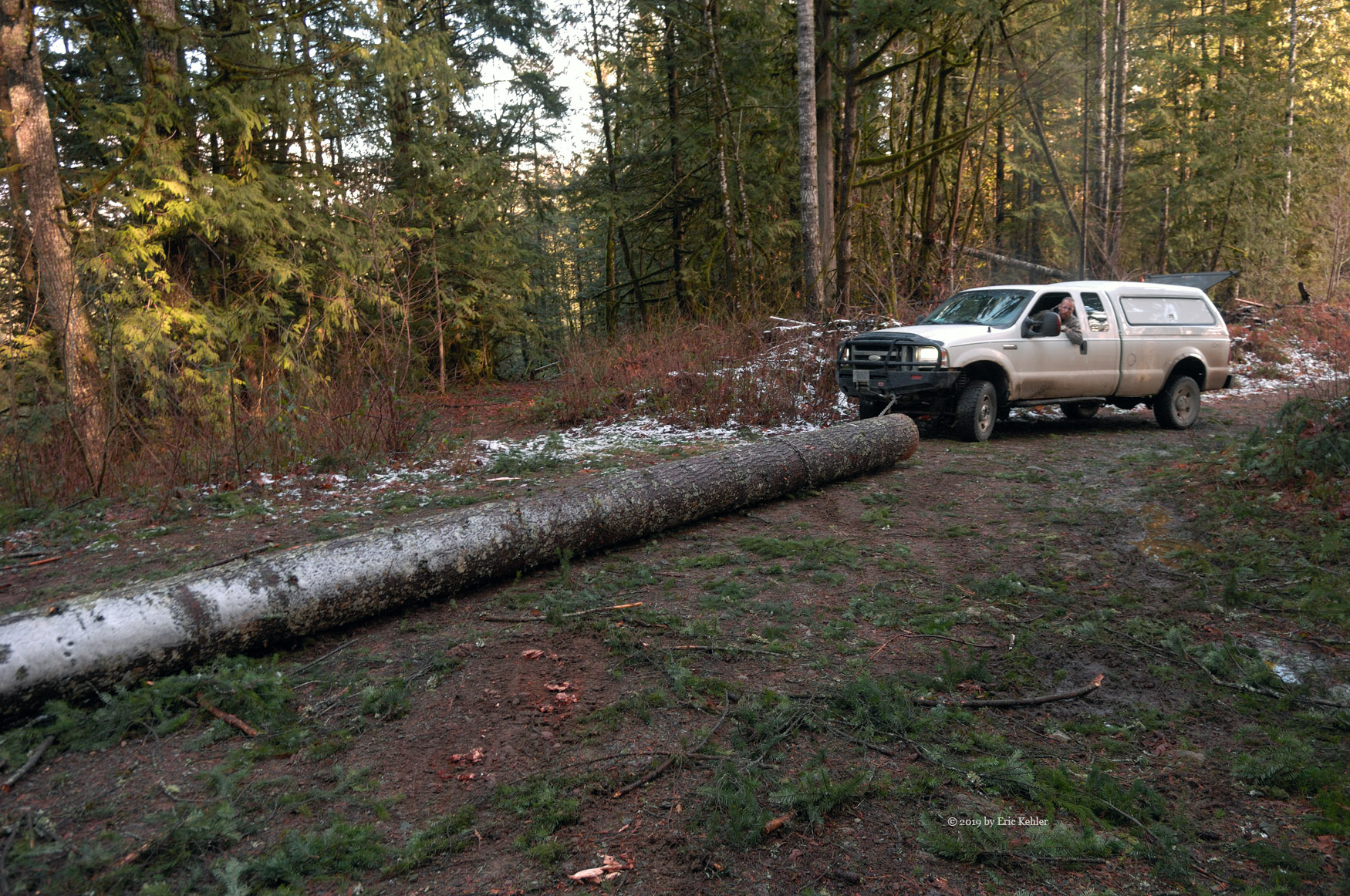
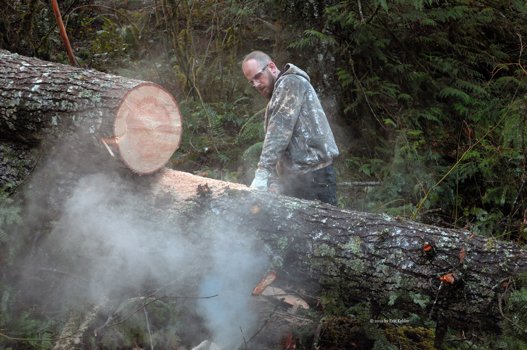
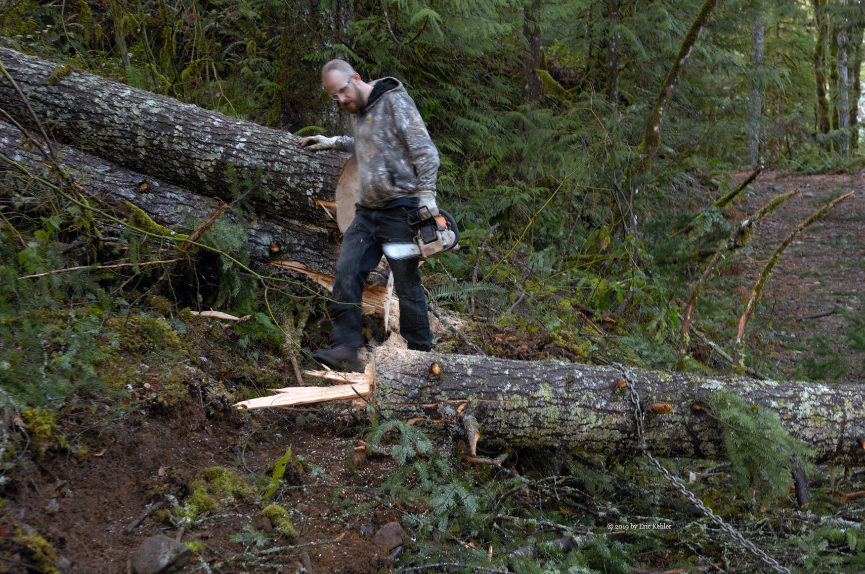
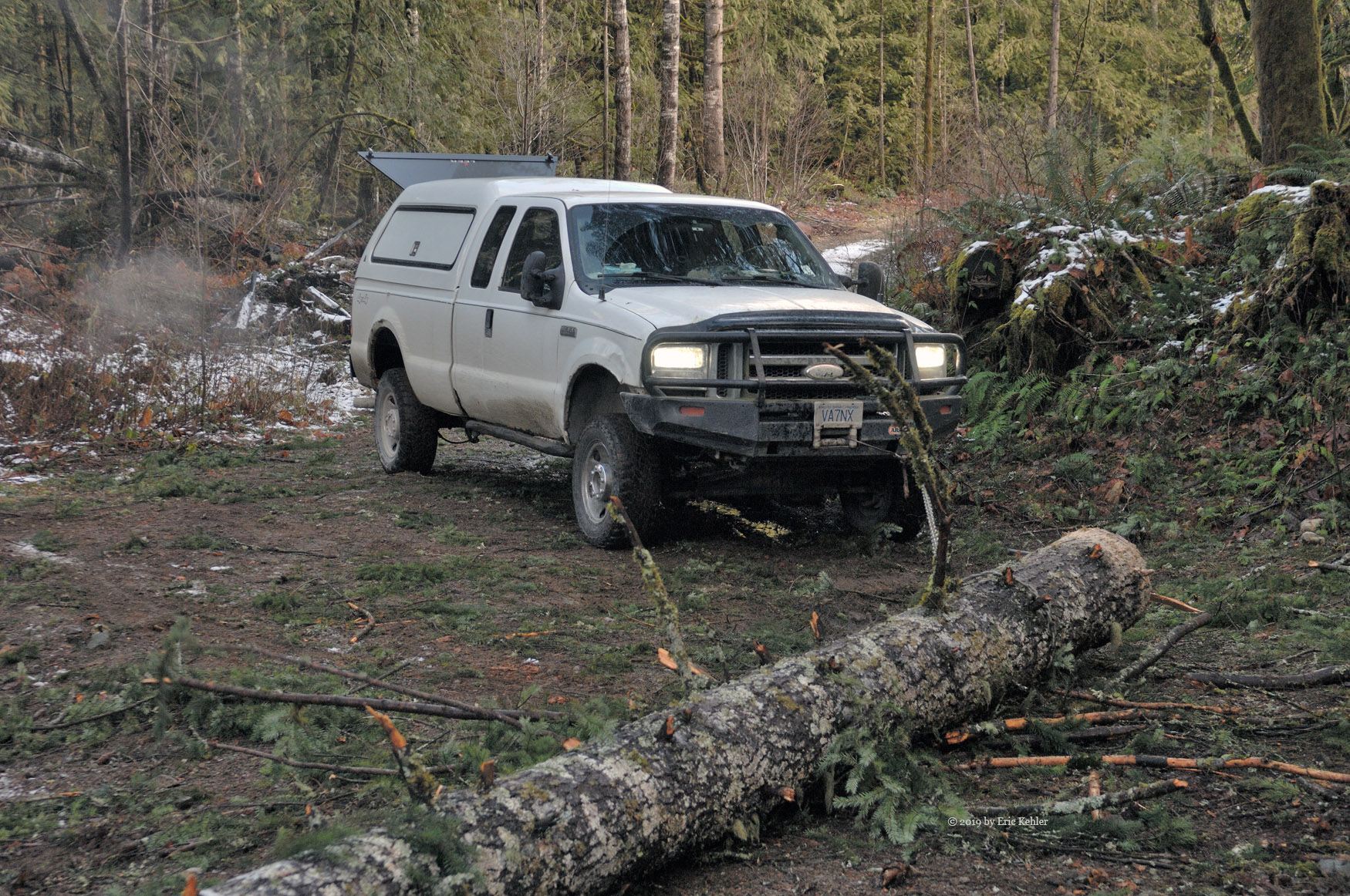
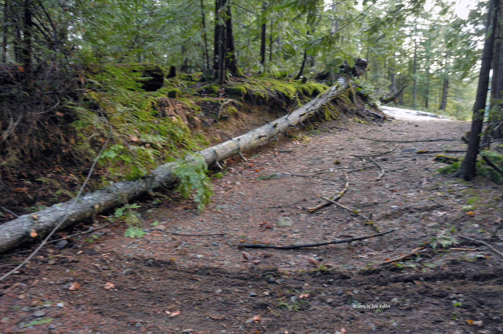
We got back on to the mainline and continued north. Geoff thought about heading to the small lake with the cabin near the Wood Lake campground. So we set off for that spot. We finally came by the side road leading to the camp spot and about two thirds the way in we were stopped by two huge trees that had fallen across the road. We decided to cut them and haul them out of the way. It took a bit of time as the trees were a bit wider than out saw blade. But with some planning and perseverance we made the cut. Then we pulled the first tree aside and repeated the task for the second. With the road open we started up the incline and there we met another large tree blocking the way only about 150m from the end. This time we cut the top off and used the snatch block to pull the tree to the side of the road. The way was clear and we parked the truck in the campsite.

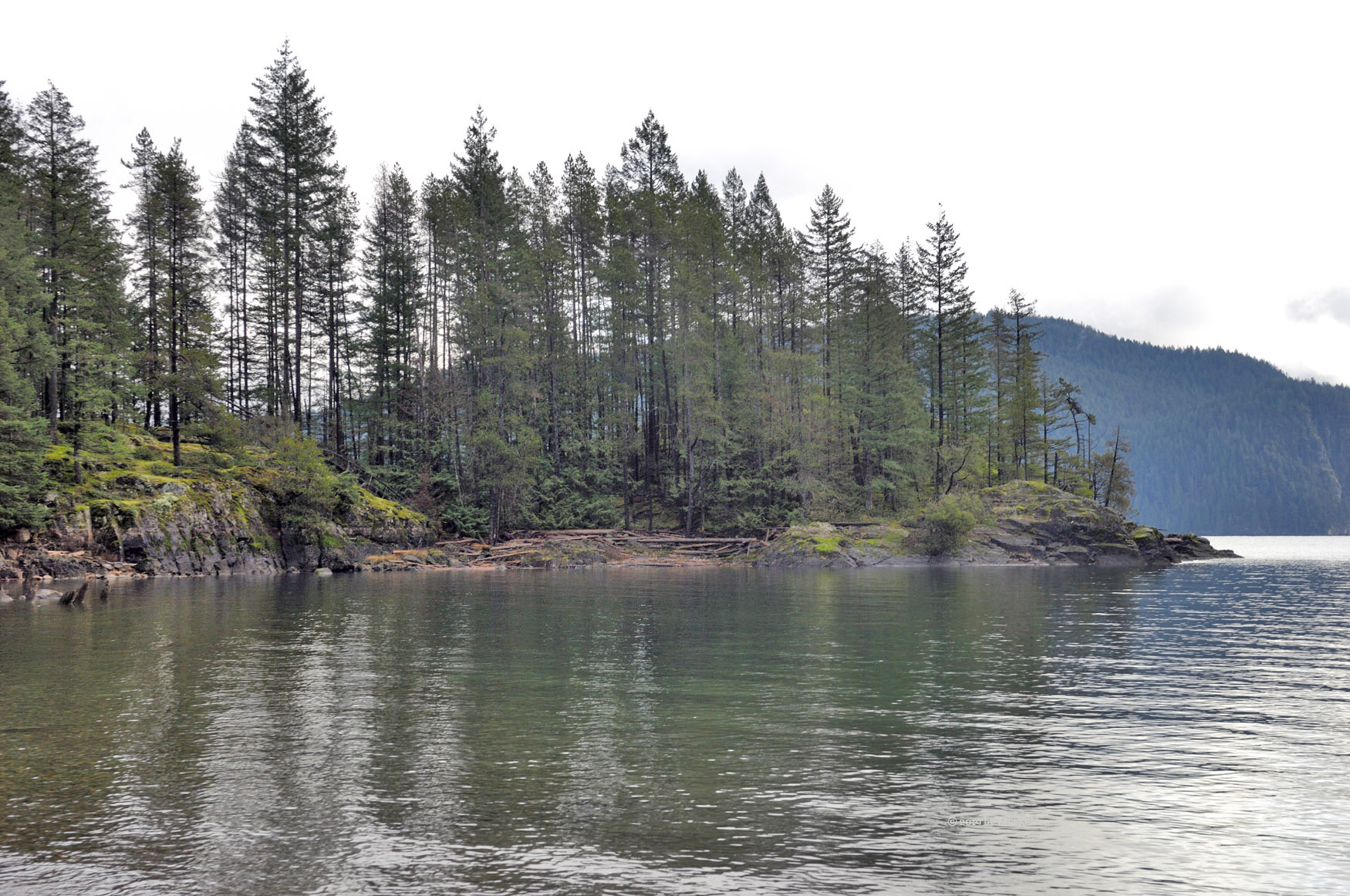
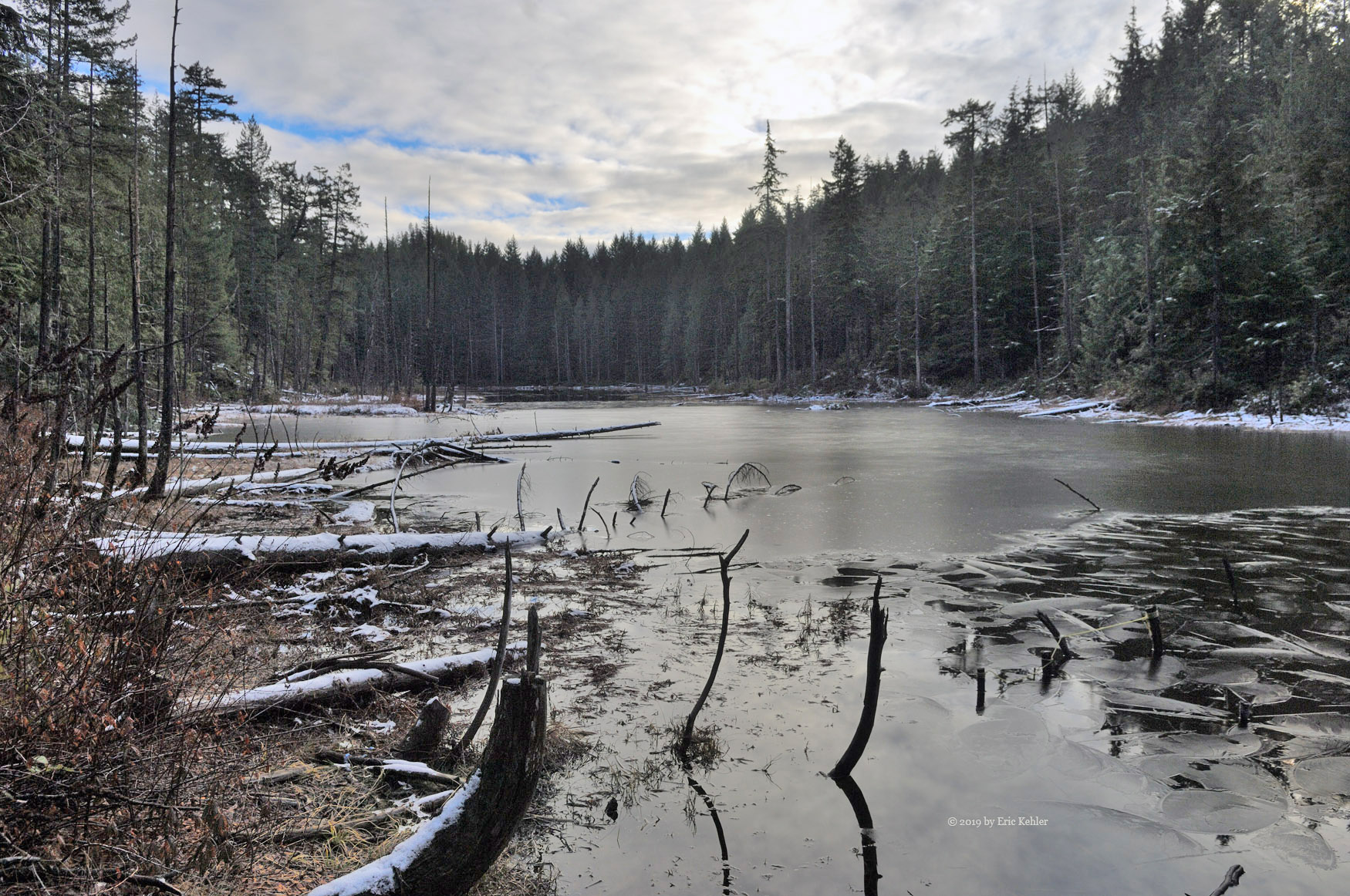
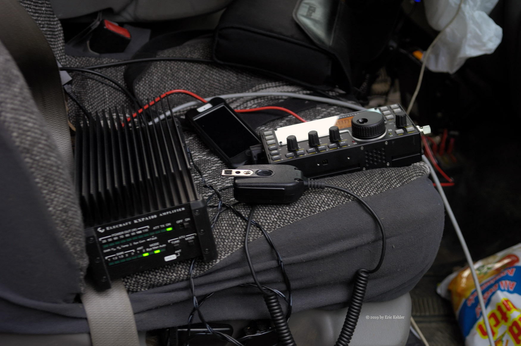
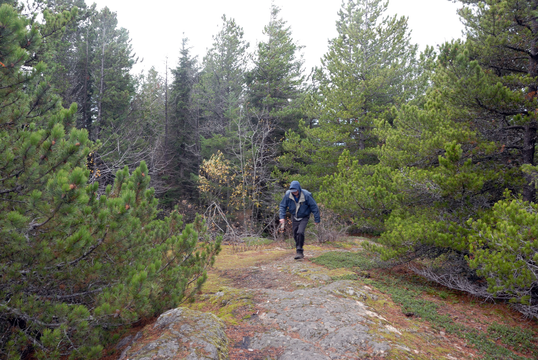
It is a very nice spot, Geoff started a campfire and the boys and I went down to the lake to look at its slightly frozen surface. It was mushy and the rocks the boys tossed in made small holes as they pushed through the soft ice. As Geoff prepared some lunch I set up my antenna and new KX3 radio. The antenna was stretched between two trees and not all that high but soon after turning it on I heard a station in White Horse calling and I chatted with him for a bit. I then heard another in Fairbanks. This chap was busy with a pileup of people calling him and though it took a good number of attempts I did finally contact him. So the radio set up works and is fairly fast to get going.

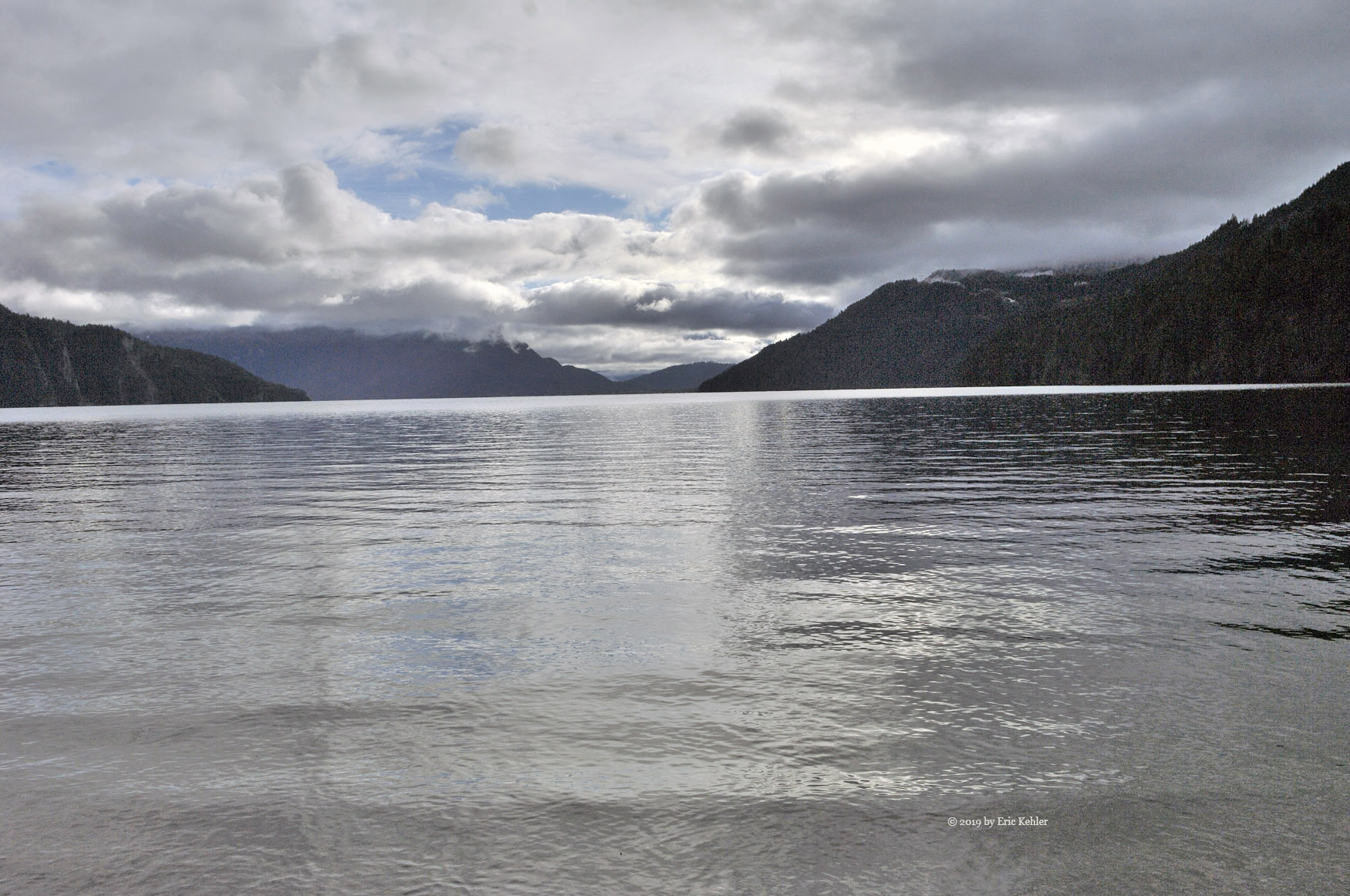
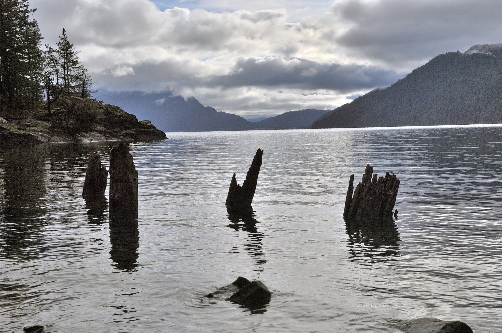
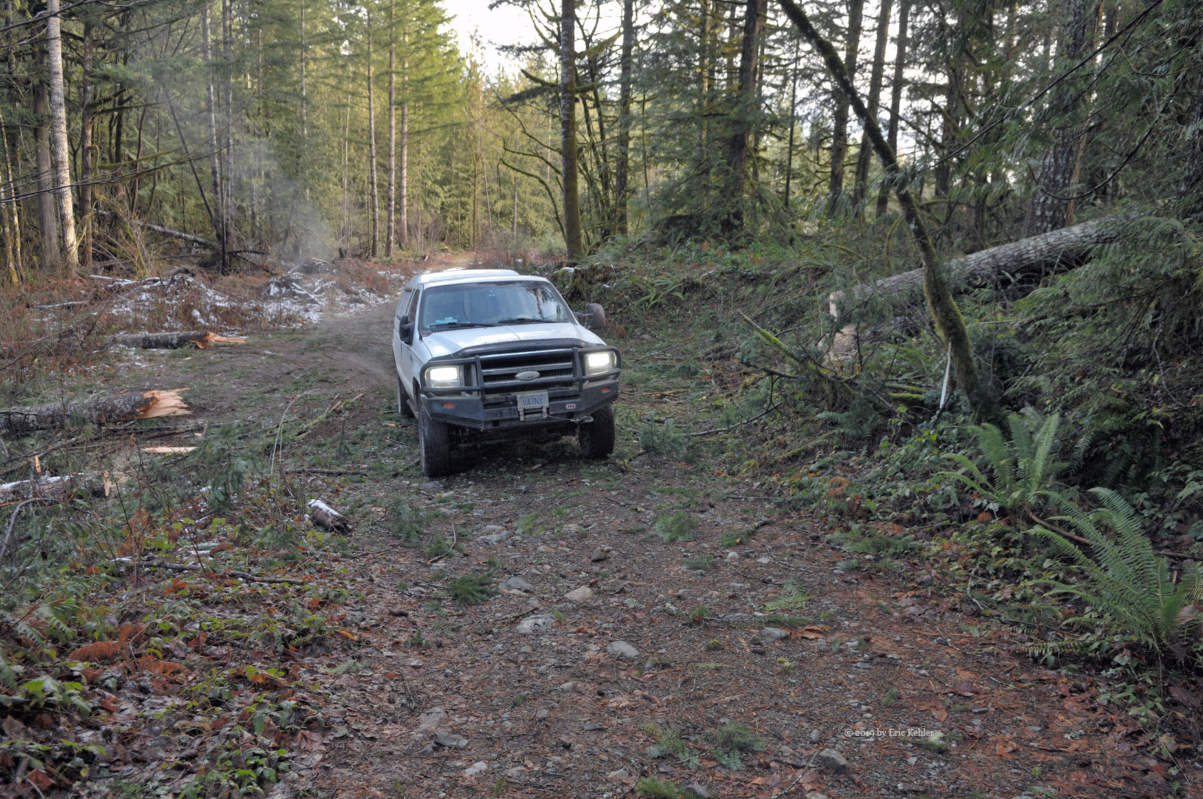
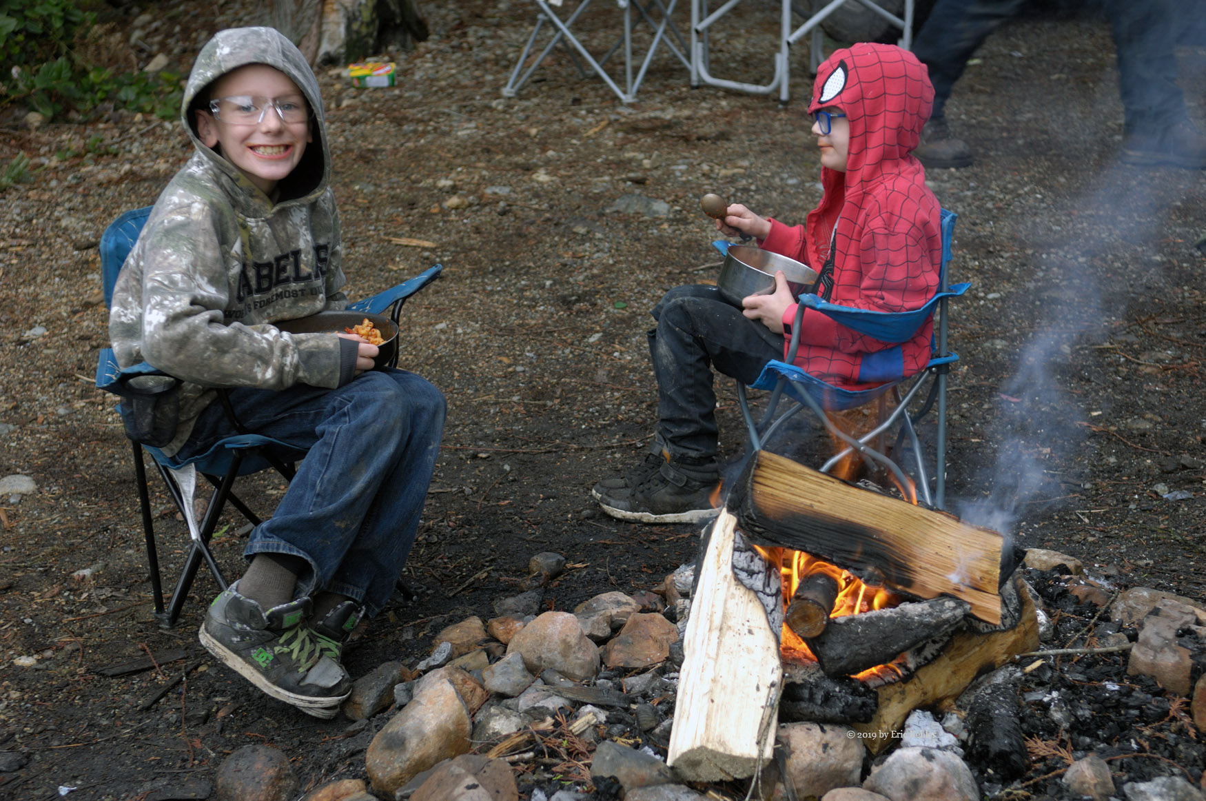
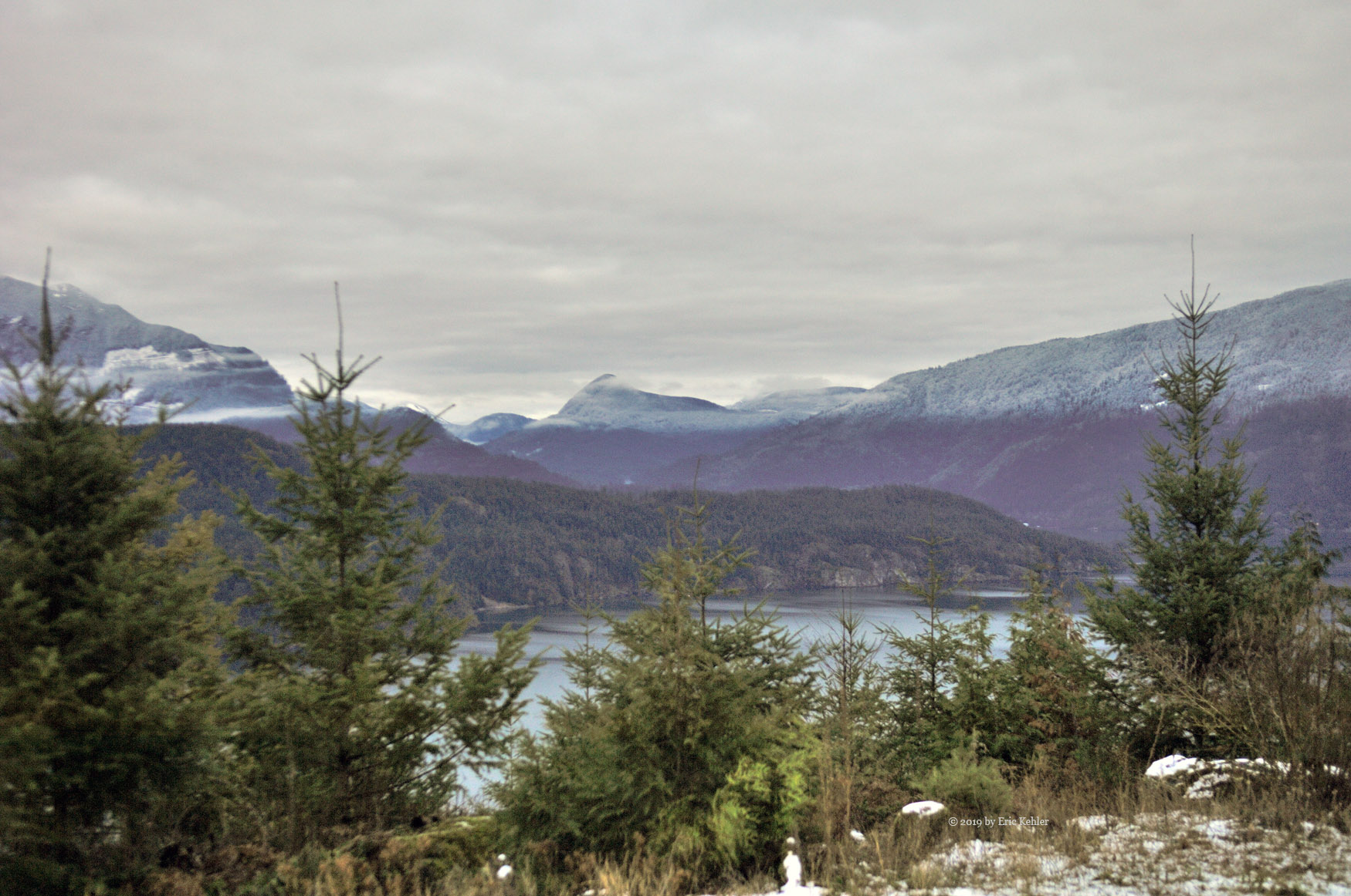
We ate lunch and lounged around for a bit, a couple of guys on ATVs came by and we chatted with them a bit and then it was time to pack up. The day was ending and temperature was now falling so it was definitely time to start back. The new headlights were a definite improvement over the normal ones; we could see much better but a big light bar would still be nice. We made one more stop in the failing light to gather a photo of the lake and then it was back to pavement and the drive home. A lovely visit to the hills, not a lot of driving but it was nice seeing the cove again and enjoying some fresh mountain air.

Hollyburn with Nick

It had been a few weeks since my last hike and as the season was getting late I really wanted to get in another summit before the snow arrived. My son Nick was off this week so it was a good time to head up with him. Checking the forecast showed that Friday would likely be a decent day and so I booked the day off and hoped for the best. The ski weather reports were still showing only rain on the hills so I was hopeful we would still be early enough to avoid the white stuff. Though with all the rain the trail may be quite muddy.

Friday morning soon arrived, it was a dull cool morning with low cloud hanging around. It looked like the hike might be a bit cold and damp with no view at the top. Despite the poor start we loaded up the car and set off for the first stop – Starbucks. Then it was back to the highway and north to highway 1. As we made our way north the clouds in the distance seemed to be clearing and we saw some blue sky in the distance.  We made good time on the drive and soon we were ascending the road into Cypress Bowl and the spot we would be parking at.

We were still under dim skies as we geared up and got ourselves ready for the hike. It was here that I realized I had left my hiking boots at home! I had gotten them out and ready to load but somehow they had been missed during the final loading. So I was hiking in my runners. On this trail that wouldn’t be a problem as the trail is well maintained, it may even have been easier. We started up the powerline road and were making good progress. To the top of the first stretch. Once there I stopped to admire the view, the sun was starting to make its way out from the clouds and the day was getting much brighter.

We continued along the road to the turn off to the main trail. Not far into it we came across the first people we saw. They were making their way along the Baden Powell, heading for Capilano. We continued up the trail encountering a couple more doing the same trip. So far none were on the trail to the summit. So far, the trail was wet and there were some streamlets running along it but the mud was quite manageable and we were able to pick a path around it fairly easily. We made decent time in the cool air despite the work to avoid the mud and soon we were nearing the high ponds. It was here where we encountered the first people on the trail, a pair of women coming down. They cautioned us about some slippery rocks with frost on them.

When we arrived at the ponds, the Lake District, we stopped to gather a bit of a rest before finishing the final segment. The sun was out and the ponds were showing a bit of ice and lovely reflections. I gathered a number of photos while Nick regained his wind. Soon we were making our way up the rock gauntlet and then the final cliff face. We arrived at the summit which we had to ourselves. The small pond there had a layer of ice on it and the ground was frozen but no snow. We enjoyed a few moments on the highest rock observing the views and then we settled on the rock next to the gnarly single tree which Ralph uses for his antenna. We stretched out the tarp for some damp protection and then Nick ate his lunch.

I got my yagi set up and started making some radio calls I soon had 8 contacts in the log and then I finished my own lunch. After eating I set up my KX2 and stretched out the 20m antenna. I did some calling but wasn’t making any progress until a local ham contacted me and we were able to make a 20m contact. So that got one HF contact in the log in addition to the 2m FM ones. Well, sitting on the tarp had its challenges and by now our rears were getting quite chilled. While we were on the top a few groups joined us and departed. In the end there were six others up there at various times. Not the numbers you see on a week-end which was nice. We packed up and started back down in the sun.

On our way down we did come across two more groups on their way up, one had a very energetic hound with them. The second group was three mothers with infants, they had taken quite a while to get there and still had a ways to go, we were sure they would be returning in the dark but they said they had lights so I guess they would be fine. We descended fairly quickly and soon were back at the car where we chatted with the guys who had been on the summit while we were there.  We made good time driving off the mountain and along the highway to North Vancouver where we finally ran into rush hour traffic. It took us two hours to get home! Quite an irritating end to the day. Nick felt great at conquering another summit and I gained another 4 points in the SOTA program. The views were nice and the trail a pleasant walk, so it was a good day all around.

Vedder Peak

Both Ralph and I were feeling the need to activate another summit. As the season was progressing, finding a Saturday with decent weather was becoming more of a challenge. When we first planned for this hike, the weather looked like it would be dry but as each day passed the outlooks kept changing from rainy to chance of showers to cloudy and back. It wasn’t until the morning we were leaving that we made the final call.

Ralph arrived at 8:30 and we left in the truck for the start of the trail. The drive along the forestry road could be done in a car until the last kilometer. But as both Ralph and I feel, the further you can drive the better, so we needed the truck for that last bit of road. When we arrived at the end of the road we found two other trucks parked there. We found a spot a bit further from the end and there were geared up and started off for the trail. It was cool and no rain in sight so we started over the big diversion across the road placed there to keep all non-foot users away.

The hike along the road and then the trail was very pleasant and the cool air allowed us old guys to make good time. We encountered a few others on the path but for the most part we had it to ourselves. We took a brief stop at the north viewpoint where I gathered a few photos of the clouds hugging the top of Sumas Peak. We didn’t feel tired out yet so our stay was short and we were off to the next viewpoint. On the south looking viewpoint, we stopped to get a rest for a few minutes, here we noticed just how much the wind had picked up.

Once rested, we continued to the summit making reasonable time as we descended to the small lake and then back up the steep final climb to the summit. On the top we were faced with a constant wind which in the cool air was chilling us quite quickly. We ate a quick lunch and then started making calls to complete the radio activation. Ralph got his simple wire antenna strung up in the tree and I went to set up my Yagi only to discover a connecting cable was missing, I hadn’t loaded it after my vacation to Ontario! So, I was forced to make calls with the simple antenna on the hand-held. My first contact was with another chap activating Hollyburn Mountain in West Vancouver. I managed to get 3 more but it was quite tough. Meanwhile Ralph was making Morse contacts with people on the east coast! Once he had made enough I tried calling on my KX2 on the 20m band. I ran into a crowded band due to a contest, but I was able to work one more station. By now I was getting way too chilled to be able to write well so I decided to pack it in.

We were both getting too chilled to want to try any more antenna configurations so rather than set up more gear we packed up and started back down. The sky was definitely looking more ominous than when we arrived so heading down was likely a good plan if we wanted to stay dry. On the return we encountered a few more groups making their way along the trail. A few with young kids, one only 2 months old. I’m sure that these groups were only going to the viewpoints not the summit so it being later in the day wasn’t a concern.

Once back in the truck we got some heat going and were soon warmed up. I wanted to check out another logging road that I used to travel years back but on which the military had placed a gate. The gate blocked access to the Liumchen area behind it which was very annoying. I have meant to see if the gate was still locked for a couple of years now, so today I made my way there. I drove in and past where I thought the gate was but saw nothing. I drove in a moderate distance further and saw no sign of it. So, the gate is quite literally gone and the way clear for a return visit to the higher locations. Done with the road for today, I turned around and re-crossed some very rough sets of potholes. Now for some warm coffee and the drive home. It was a lovely hike in the cool air and though the wind was strong at the summit it wasn’t bad in the trees. It wasn’t until a few miles from home that we first found some drops on the windshield, so we had managed to time our adventure perfectly for the day.

Radio Play and Sites West (Day 8)

Today was the best day weather wise of the whole trip. Yet there still is very little colour down here. So I decided to head to John Pearce Park and play with my KX2 HF radio. I recently built a wire antenna for it with a reflector component and wanted to try it out. It is a triangle and requires 3 trees spaced about a triangle and the park offered many to pick from. So a bit before noon I set out, first to refuel and then to drive straight to the park.

I arrived at the park, and there being no one else there, I walked to the grassy area. There I started laying out the pieces of the antenna, it got quite knotted up while unravelling it so that caused some irritation as did its propensity to snag twigs and leaves from the ground. Eventually I had it stretched out and I was listening to a strong station out of Italy! I worked the band up and down listening to various stations looking for opening but they were far between. I tried calling the Italy station but didn’t really expect anything, especially sense my antenna was not oriented right for that direction. I did manage to be barely heard by one station but they couldn’t make out my words. 8 watts just doesn’t seem to do it. I may just need to settle for a commercial antenna. A station from California was particularly strong as well, but they had a pile-up and I couldn’t get in a call before they closed down.

I packed up and started for the car realizing I was running late for my call with Ralph. I quickly set up the mag-mount antenna and checked my path the repeater, no activity. I needed to move to a higher spot so I quickly drove back out the way I came and when I reached a high spot I tried again, here the signal strength was reasonable. I parked and connected to the Vancouver node and called Ralph. He answered and we had a good chat. Done with radio for the day, I started driving back along the coastal roads again. This time I stopped at a few creek crossing to gather some photos.  Though the colour was not as nice as prior years there was still a bit to enjoy and I tried to capture a few bits of it.

So, a day more for radio than photography but I managed to get both in before returning to the room. Later we went for a walk to the spice store to pick up a few spices to bring home. Our outing ended with a coffee at the local café. They do make some nice drinks and desserts there.

St. Thomas Elevated Park and Port Bruce (Day 7)

Today the sun was mostly hiding behind clouds though it peeked out for brief periods teasing me with its brightness. Unfortunately the colours just aren’t out yet and with dull light they are even worse. So today I started with a visit to the new elevated park that is being developed in St. Thomas. An old railway bridge has been repurposed into a park. The current state is only about a third done but it is looking promising and even this small bit that is open was a pleasant walk. The place is designed more for summer use with lots of colourful flowers which this time of year are dead and brown. Still, I enjoyed the saunter across the bridge and back while imagining what it will be like when done.

Next I drove into the eastern side of the region visiting many of my old favourite spots. I just couldn’t pull out much to photograph. At 2:30 I set up my radio to chat with Ralph, this time I assembled my yagi but the wind knocked it over mid-conversation which caused me to lose the contact with Ralph. It was helping prior to that tumble. I continued driving to Port Bruce only to get blocked by a missing bridge. A temporary single lane bridge has been set up not far from the main spot but it has a slow turn-a-round time. I drove to the beach in Port Bruce and stopped to gather a few photos but here the wind was high and the light poor, not much to excite me. Continuing on to an inland grassy area, there are some trees that are often very pretty, they weren’t in full colour yet, but one of the best over the years didn’t let me down and it provided some vivid colour.

I continued driving, slowing making my way back to St. Thomas to pick up Carolyn at the wool shop where I had left her earlier. There really wasn’t anything that caught my eye on the return drive.  This evening I took a walk on the harbour walkway around the time of sunset and managed to gather some decent sunset photos from the end of the walk near the lighthouse. It was a pleasant end for the day even in the cool wind.

Lakeview Road and West (Day 6)

It was a lovely sunny morning though quite windy. I set out with Carolyn for a drive on the west side, hoping to take in John Pearce Park and Duttona Beach. Once on the back roads I found a small bit of colour, some individual trees looked quite nice but they were far between and the groves of trees were pretty much solid tones of green. I did find a few spots to stop and grab a few photos but mostly it was just driving in the sun enjoying the day.

I arrived at the John Pearce Park and we set off to walk to the grassy area. I noticed that they had fenced off most of the park, claiming it was unsafe. By the grass area they had cut almost half of it off with a new fence that it seems most just pushed down and went over. I think the bureaucracy that put it up for some misguided sense of safety quite over did it. There needs to be a balance between real safety concerns and just trying to cover ones ass. The fence really damages the splendid value this park has to offer. They really just need to shore up the actual dangerous areas not take the easy way out. By over doing it people will be more inclined to ignore the whole fencing effort rather than take it seriously and if they think that will absolve them of anything, well think again.

We next pushed on to the Duttona Beach area, here we met a similar sign on the lower property which has communal access to the beach. It seems that some estate left the property to the province who now want to keep people off of it. Still, they have garbage cans on it to accept trash should people want to be there! Talk about a confused message, again I suspect they put up the signs simply to protect themselves rather than provide useful services to the community. The beach area was quite beat up with trees fallen and the high wind was pushing the waves high-up on the shore. The place seemed quite run-down from two years ago, though the foot path remained well-worn and in obvious use.

Done with the beach, I back tracked to a small cemetery we had passed and there I explored, looking for the oldest stone I could read. There were many quite recent additions so this area is obviously still being used. I found one stone dating back to 1848 and there were many I couldn’t read that may be older. The one sad thing about looking over the stones is finding those of children, one was only 2 days old when they died. We have much to be thankful for.

It was now around 1:30 and I had a radio call at 2:30 but we felt like some lunch so we decided to head back to find a café. I remembered one we ate at in Wallacetown that wasn’t bad so we set off for there. We arrived at around 1:50 and settled in once Carolyn had found something she could eat. The food was decent, nothing in the gourmet fashion but still decent enough. It does seem to be the centre attraction of the town. Done with lunch we set out to find a spot to work the radio. In the end we ended up on Erin Road, this road has had some amazing scenes where it dips down into a small creek but today it was dull and lacking any excitement for me.

Shortly past the creek, I pulled over and set up the antenna and radio. I tried the mag-mount whip again and it successfully pulled in the repeater signal with full bars, much better than yesterday. I called the node in Vancouver and Ralph was not there, it was a minute early. I waited a tried again and soon I was chatting with him. Weather was great back home and should continue after we arrive back there. So we have something nice to look forward to. Done with the chat I continued a slow drive back to the port while looking for some more colour but I found nothing worth stopping for.

Once in the room we watched to wind play out on the harbour, it was actually quite rippled in the protected area whereas yesterday it was smooth, so I guess the wind is much higher today. I could see large waves crashing over the distant breakwater and then watch the water pour off the walkway. If I thought it was risky walking that yesterday, today one would have no chance of avoiding getting soaked. The day ended with a nice sunset picked up with the distant western clouds. A full day and one I enjoyed being out there driving in.

Port Stanley (Day 5)

The morning began in a lazy way as one is want to do on a holiday with the wind blowing and the rain falling. It was a dull morning and not one to inspire me to leave a nice warm bed. But my back can take only so much of a good thing and I was on my feet getting ready for the day. With the rain outside I didn’t have much planned for the day, only a radio chat with Ralph at 2:30.  After breakfast, Carolyn wanted me to drive her to the wool store in St. Thomas so she could pick up some wool for Christmas presents. We set out in some light rain and made good time to the store where she was able to find the wool for the task. Done with shopping, we returned to the room to make ourselves some lunch.

As time approached 2:10 I got my gear in order to head out for my radio contact with ralph, the sky was still overcast but the rain had stopped. It did look a bit brighter so I took my camera along. I set out for a decent spot to set up and found myself on the side of Roberts Line. Here I tried two repeaters with the second working for me. It was located in London. I was able to have a good chat with Ralph back in Richmond. In trying to bring down the link I was unable to get a clear enough tone, a local ham joined in and offered to close the link for me. We then had a short chat, he was surprised I got into the repeater from the Port Stanley area. He said I had been the only one on the repeater so far today. Like so many they seem to be getting less used.

Done with radio, I got out my camera and started looking for some photos. The trees were still quite green down here but there were a few small pockets of colour that I found, the problem was still with the weather as the overcast clouds mutes the colours. I continued along the line for a few side roads but turned off at Quaker Line. I then started back to the hotel as my sinuses were giving me a bad headache. I did find a few spots of red sumac to enjoy which required a brief stop to capture but generally there was little colour to inspire me.

After resting back in the room for a bit the sky finally cleared and the sun was out, there was still a brisk wind but the walk around the harbour looked inviting and so Carolyn and I set off along the newly paved walkway. I managed to pick up a few more shots as we strolled along. At the far end, the waves were breaking over the breakwater, so we decided to not walk that final section of the walkway to the light. I did take a few photos of the waves breaking over some rocks. The return to the room was interrupted by a group of determined geese. They had decided to bed down on the walkway and hissed as I walked past, even though I was only a few feet away, they never moved.

After dinner I noticed the lovely sunset from the room, so I gathered some last photos of the sunset before calling the day’s photography complete. The clouds provided some lovely shapes and textures to the setting sun.

Travelling to Port Stanley (Day 4)

Today we finished our stay in Grimsby and visits with the family by attending the church that Mike pastor’s. It was nice to see the other family members and report on our on family’s situation. Mike gave a good message on faith and after the service we were able to spend some last moments chatting with various family members. Soon we were on our way to the west.

As we had planned to stay a bit longer to visit and since the sky was overcast we decided to travel the fast way to Post Stanley, via the main highways. So in some ways it was unfortunate that the sun came out and it was a nice warm sunny day. Normally that would be great news but I was committed to driving the fast roads and so I missed a good day to be gathering some photos along the slower back roads route. I noticed that the colours were mostly greens as we closed in on the port, so perhaps I didn’t miss much.

While taking photos earlier I noticed that the clock in the camera was not working, I figured the small clock battery had died and so one of my first tasks was to find a replacement battery. Upon arriving in St. Thomas we made for a mall and dropped into the Source store and was able to find the small source of power.  Once I got to our room I installed it and the clock is now working well. Leaving the mall we made quick time to the port and the hotel.

The place looked very much the same despite being operated by a new owner. On the outside however, we noticed that a new tall building was going up right next to the hotel. It blocked some of the views to the north which is most unfortunate. Our room was like the day we left it two years ago. One positive change was that the stove was now connected and we could cook with it – if we had any pots! So I guess we will be limited to heating a frozen pizza. Once we had carried in our bags we set off for the food store and loaded up for our stay.

Back in the room we unpacked and got ourselves settled in. I had a scheduled facetime meeting with my radio club back home as today was the monthly meeting. The facetime conference seemed to work reasonably well. Once the meeting ended it was dark here so I wasn’t interested in going out to get any photos of the harbour. Not to be completely left out, I set up my tripod and gathered some long exposure shots of the dark harbour. I think a few turned out ok. I hope the weather will hold and I can get out exploring tomorrow.

Mount Nemo and Kelso (Day 3)

My day began at little past 10am when my cousin-in-law Mike arrived and we set out for our day of photo taking. Today we planned to visit the part of the escarpment on the far side of the valley from Rattlesnake point where we were yesterday. So we got some coffee and set off for Mount Nemo. Our drive went quickly and we were soon arriving at the parking area and paying for our admission. We asked about which spots were covered by the day pass and then drove in to find a parking spot.

Once parked we checked the map and made for the main viewpoint at the far end of the main trail. The day was mostly overcast with a few bright spots appearing occasionally. The main trail was busy with people, kids and dogs but it was a wide route and had room for all even when we stopped to take photos. It was a pleasant easy walk to the viewpoint; there we encountered a group chatting quite lively about something. The overcast sky muted the colours but we still found enough colour to keep things interesting. After checking out a few spots along the cliff edge we had collected a number of photos and so we decided to follow the trail towards Rattlesnake point. It was a pleasant walk through the trees and it turned to the cliff in a number of places offering varying views of the valley below.

We finally reached the end of the section of trail that followed the cliff, here we had a nice broad viewpoint where we could spread out to enjoy the scenery. It would make a lovely spot to relax in the summer sun while soaking in nature, today we stopped only long enough to gather a few photos. The trail now turned away from the cliff and towards the parking area. We still had a ways to go and we were able to enjoy the colours of the trees as we wandered through them. We eventually circled back to the main trail and then along it to the car. The trails were quite lovely and the scenes from the cliff were still very enjoyable despite the muted colours. Well it was a bit before 1pm so we decided to go find a spot for lunch.

As we drove into Lowville, we spotted a bistro that had its parking area packed with cars. We thought it must be good to have so many there. So we found a spot to park and headed into the restaurant. The place was packed full and we got the last open table. It stayed full with people coming and going as we sat there. The food was really quit good and the decor of the place quite lovely. We both were quite pleased with our find and hope to return at some point. It was now 2:30, we had stayed quite long enough and so we set off for our next adventure.

Included in our paid locations was the Kelso conservation area. It had a few viewpoints on the map so we decided to head there. It had two parking areas the closest being the summit lot and so that became our destination. After a stop to take some photos of rattlesnake point we arrived at the Kelso lot, passed through the checkpoint and parked. The lot was only half full so parking was quick and easy. Once out we noticed that all the visitors seemed to be riding mountain bikes. There were many trails throughout the area set up for the bikes and I thought that we may be at the wrong place for walking but we decided to take the shortest trail to the marked viewpoint and we set off.

The trail was an easy walk and we eventually found other walkers on the route besides us. The trail was along the top of a cliff looking down on an old flooded quarry. It was being remade into a fish and bird habitat. The views were interesting but not overly scenic. Once at the viewpoint we decided to walk further along the trails to a second viewpoint. This trail was quite pleasant, the trees were a bit ticker as we made our way along and eventually we came to the far end where we reached the far edge of the cliff. Here we were surprised to encounter the top of a ski chairlift. It was operating carrying people up and down. We had arrived at the top of the local ‘ski-hill’, one I had seen many times in passing from the 401 highway. Here we were at the top of it. The sun was now starting to peer out from the clouds and we had some nice views across a broad valley that had lots of colour to enjoy, the number of people here was quite high as many had taken the easy way up the slope.

After gathering some photos we continued along the cliff edge to the next viewpoint and back to where we started. We took our time wandering along the trail stopping to marvel at the huge gaps in the rocks near the edge. Some of the gaps were only a few feet wide but dropped down 50 to 100 feet! They were an interesting sight. As we continued along further form the chair lift the number of people diminished and soon we were mostly on our own. The trail looped back to where we started and then we walked the first trail back to the car. In the end it was a lovely walk and we found many scenes of colour to enjoy. This area was great for walking and biking and well worth our time being here. Should I come again next year it would be a good spot to revisit.

Well it was now approaching 5:30 and we felt it was time to head home so we packed up and set off along the main roads for home. We passed by the Rattlesnake point parking area and then down the escarpment and through Lowville, passing the bistro, its lot had finally emptied out. The rest of the drive went quickly as Mike made his way to the highway and our exit at the hotel. This trip saw us do much less driving but we found some amazing sights and colours, I sort of missed the drive of previous years but the sights we did find were a good reward for this trip.

Rattlesnake (Day 2)

After what to me was an early start, Carolyn and I made our way to the restaurant for breakfast, we had a pleasant meal, and then back in the room I got my gear ready to set out with Mike. It was 10:15 when we left for the hills. Our first stop was to be an electronics store to buy a 12 volt connector for my ham radio as I forgot to bring one. Mike suggested the Source so we drove to Burlington and parked at the major mall to visit the store. They were no longer stocking that sort of item but had some clearance items. Mike spotted something that would work and after a quick purchase and some adjustments to the item it was ready to use. It actually worked out quite well.

Done with the shopping, we started north along Appleby Line. We came by Bronte Creek where we sought out some access to the creek and tried a few roads but all seemed to be private with no access to the public. We then spotted Rattlesnake Point Conservation area on the map and decided to head there. It was a short drive and we soon arrived, paid our entrance fee and made our way to the lower parking area. From there we wandered over to the first viewpoint and started gathering some photos. The sun was peeking out from the clouds on and off so we had some time as we waited for the best light. The colours were quite lovely in this area and it was well worth the few dollars to be here. We walked along the cliff edge to each viewpoint in turn, gathering more photos at each stop.

At the one furthest to the north-west we stopped to reflect on all the rock climbing hooks secured to the rocks. They were all along the cliff, every few feet! Several hundred in fact. Well we were here for the colour not to reminisce about a lost youth where we could have been rock climbing. We circled back taking the more secluded trail a bit back from the cliff edge. It was a pretty walk in its own right. We then continued past where we were parked to the south-eastern most view point. Here we encountered a stairway down to the base of the cliff and we decided to head down to gather a few photos looking up the cliff face. It was a fun spot and we found the ledge where people were sitting half way up the cliff when we last gathered distant photos of the cliffs two years ago.

It was now starting to get cool so we headed back to the car and then to find a place for lunch. We settled on a Thai place and used google to lead us there. Soon we were walking in to a deserted restaurant, it being between the prime lunch and dinner hours. We ordered some food which when it came was very good and we both quite enjoyed our meals. We stayed to chat for quite a while afterwards, I had already missed my scheduled radio chat with Ralph so it was no longer a priority to get going.

Once we did leave we slowly made our way back to Grimsby but stopped at a few spots along the way, most notably was a spring with an interesting history in the area, and a cemetery. The oldest stone we found dated back to 1837 and the number of Eaton stores was quite a surprise. We continued to slowly make our way home but the clouds had thickened and the colours no longer caught our eye. It now being Friday rush hour we decided to travel the side roads home and miss the stalled traffic on the highways. It was a fun outing and we successfully gathered some nice fall colour shots.

Subscribe to 2018