
Lost Creek FSR & Twin Lakes

It had been two years since I last visited the eastern Stave region and the prior trip was on Boxing day 2006! so I thought it would be a decent day to explore the area and note the changes that had occurred. It being a holiday, Nicholas my third son was available to join Geoff and me. So the three of us prepped the truck and set off for Mission and the roads beyond. Near Mission we encountered our first of many problems, I managed to blow a fuse on my power distribution unit, somehow the notebook was drawing excess power today. We found some for sale in a small general store just outside of town. The little store seemed to have a bit of everything and would be worth a return visit.
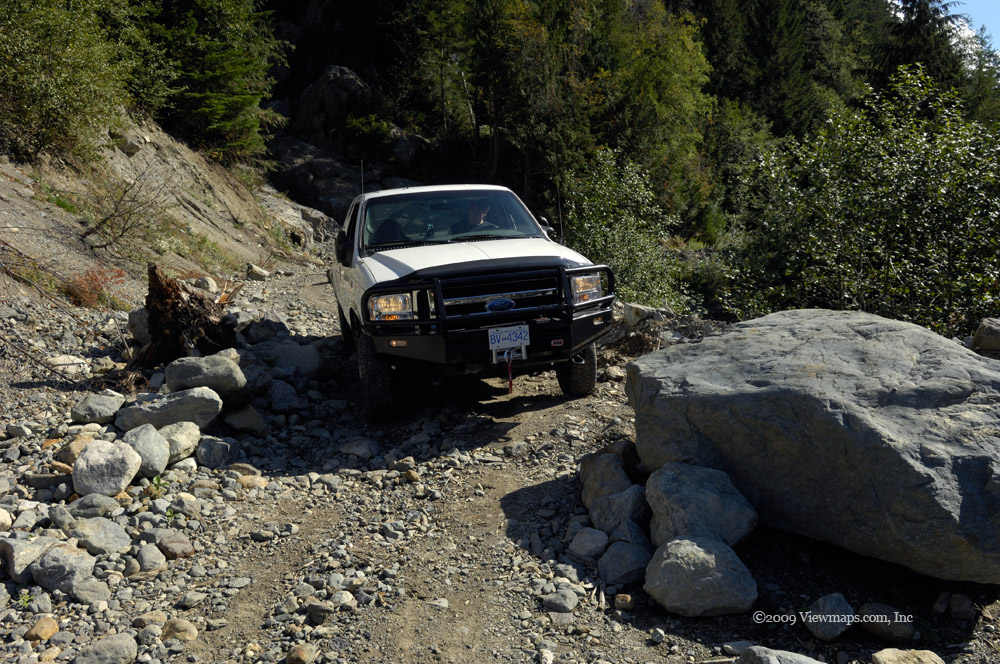
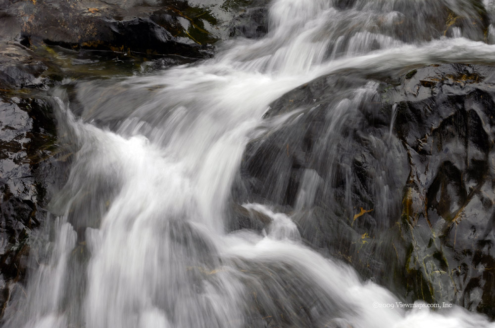
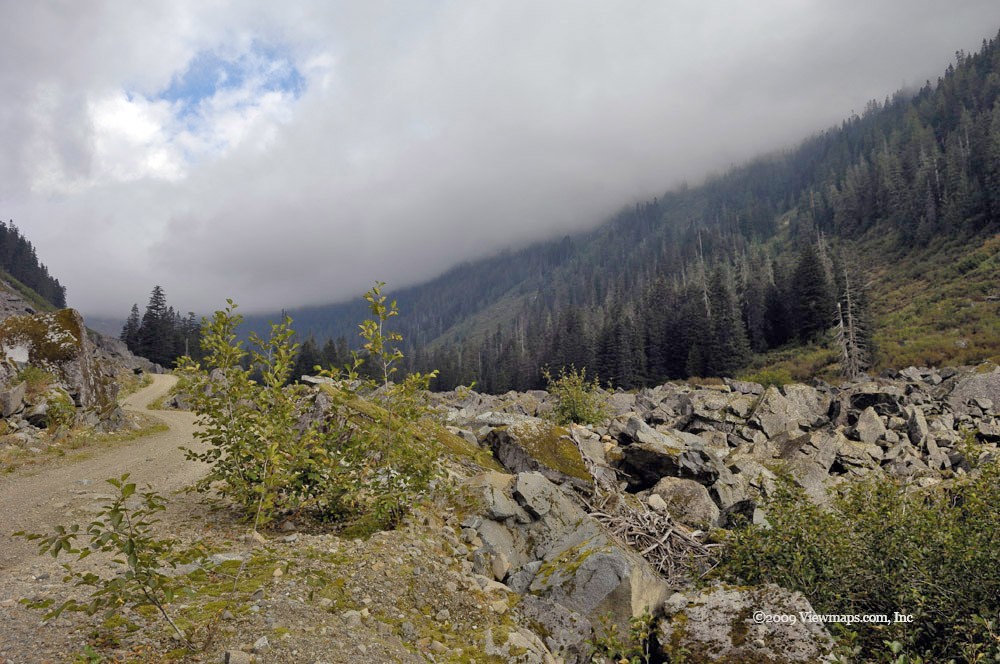
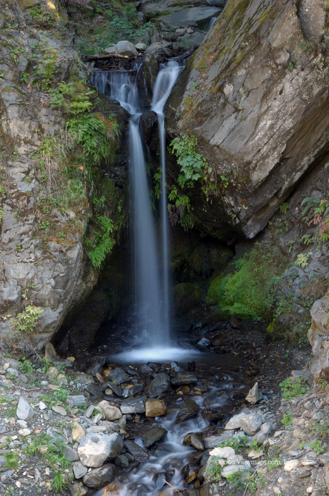
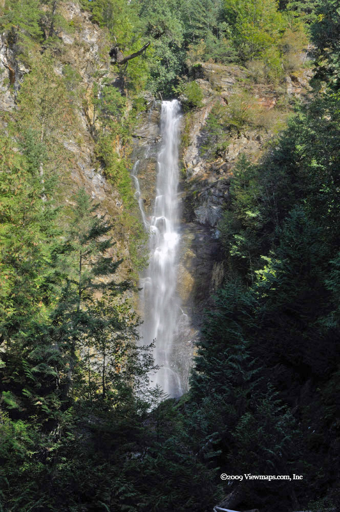
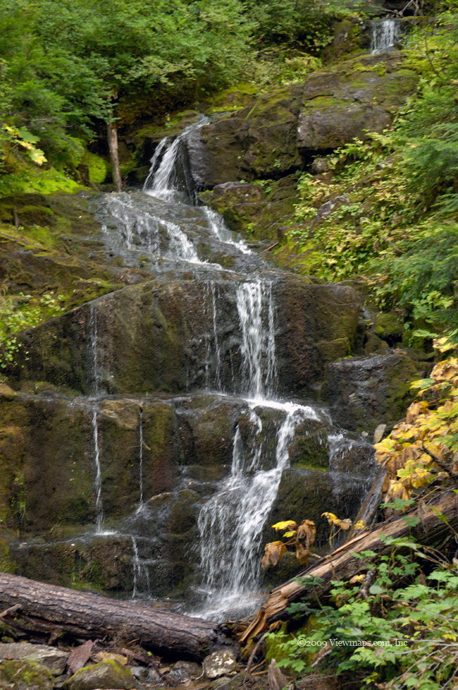
Back on the road the fuse blew a gain before it settled down, still not sure what was causing it but I was glad it stopped. Soon we arrived at the start of the Lost Creek FSR, we edged our way through a number of abandoned trucks having launched their ATV's. We were surprised that there was no snow anywhere to be seen! The last time I was here in the winter there was snow starting from before the FSR. Today we barely encountered any all day. We made our way to Davis Lake Park and stopped to grab a few images of McDonald Falls. It was here that I discovered I had forgotten my tripod at home. So I would have limited opportunities at the Falls today. We decided to explore the upper section despite not having the tripod. The flow was decent and I got a few shots but not of the caliber I was seeking, so after a short visit we returned to the truck and set off further up the road.

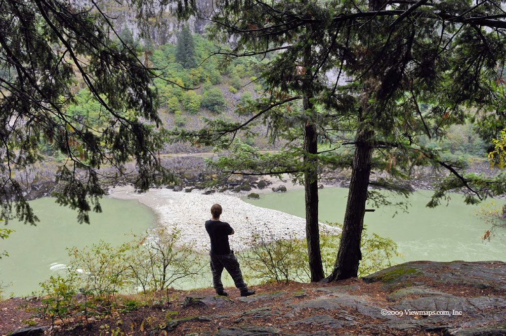
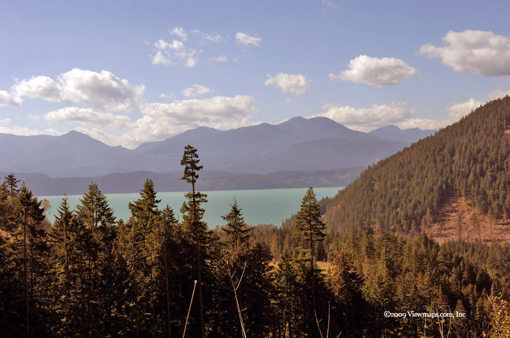
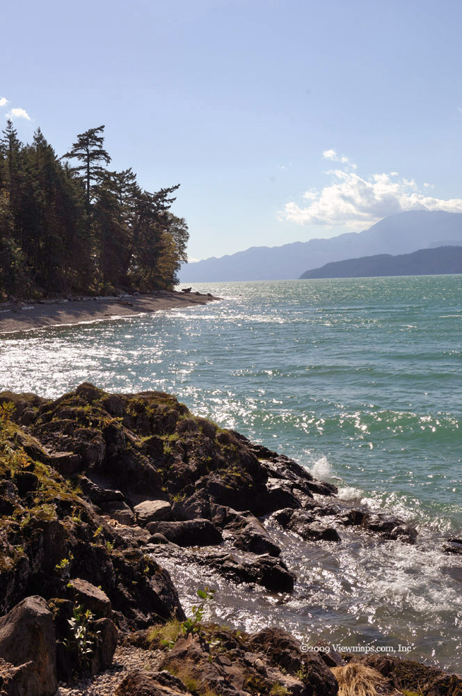
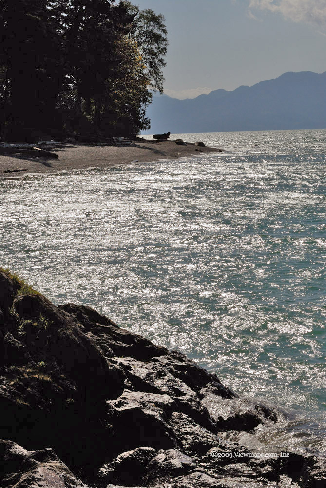
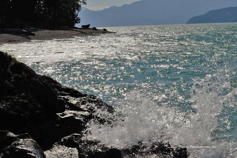
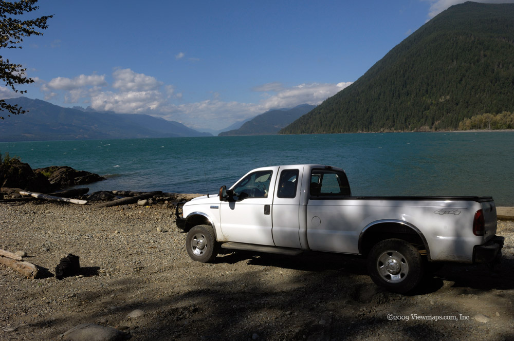
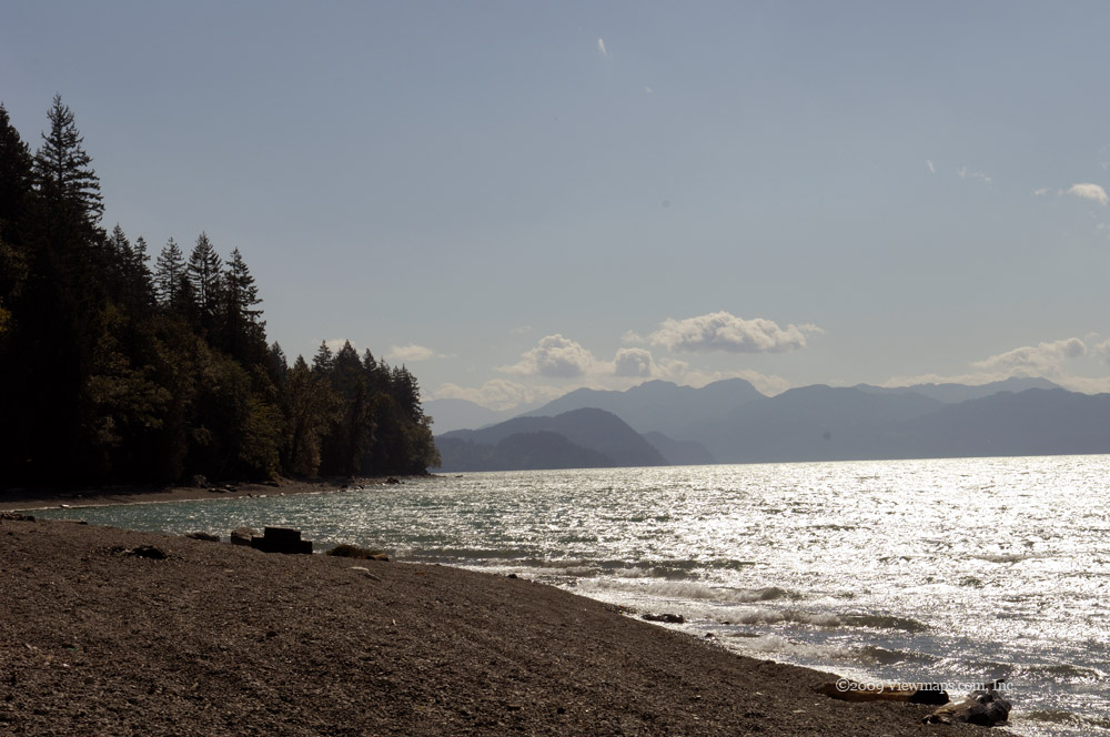
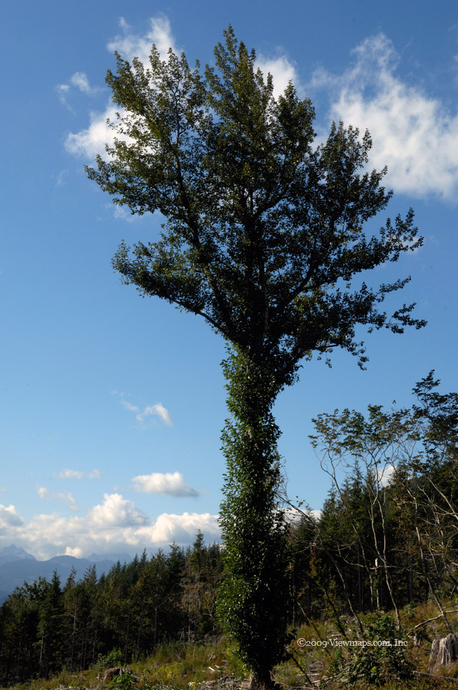
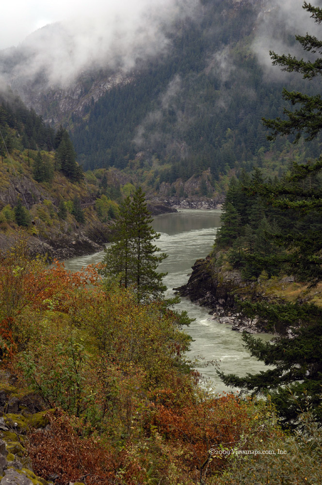
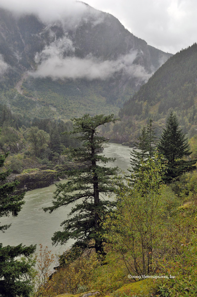
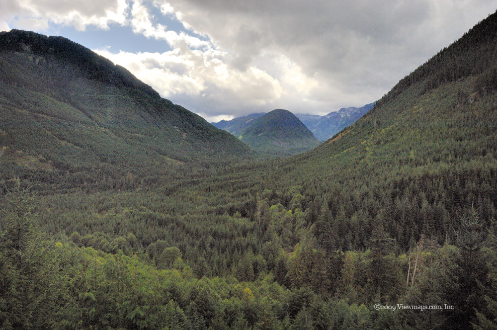
Once past the park we had our first view of Stave Lake, it was mist covered and offered some lovely mood photos. There was a branch of the road leading down toward the lake but as there were several groups of shooters doing target practice, we decided to leave this spot and continue on up and try the Twin Lakes branch and see if we could get some better views of the lake. Soon we arrived at the fork leading to the twin lakes and started up a steep rough section of road. It seemed a lot rougher than I remembered but it may have been memory or the stiffer suspension that the truck has. Once we got past the steep section the road was quite easy to drive and we quickly arrived at the larger of the two lakes. We parked in a small campsite and I started taking photos. 

The lakes were frozen over though it wasn't a thick layer and I wouldn't trust it enough to walk on it. While I was shooting photos, Geoff set up a target for some practice with his riffle. He showed Nick how to shoot with it and Nick managed to hit the target a few times which pleased him considerably. I find it far too noisy for my liking and prefer to stay away when Geoff is shooting. Just as I was leaving the sun had heated up the surface enough to send up clouds of mist, so I was able to gather a few more photos with a different character.

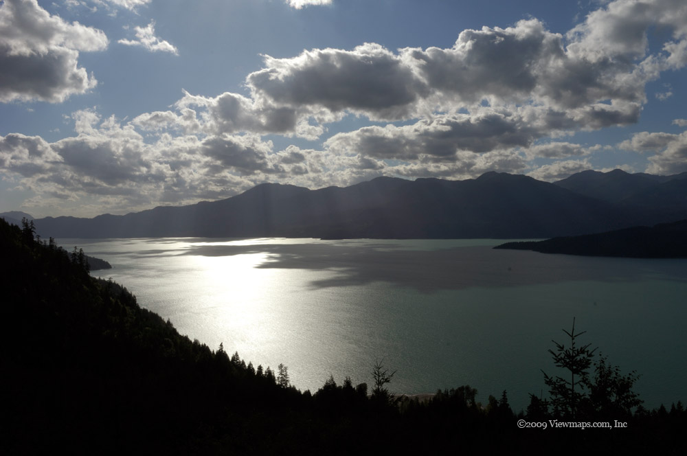
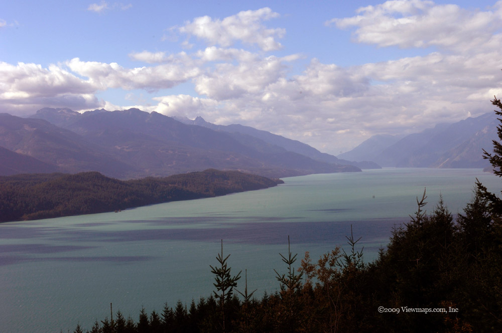
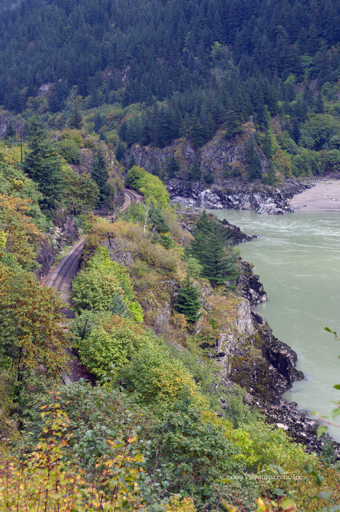
We were back on the road heading to an overlook of Stave and we were soon stopped by a downed tree. Just the excuse Geoff needed to whip out his chain saw and clear the way for us. After a few minutes and a few cuts we were back on our way . I knew the viewpoint I wanted to get to and I wanted to get there while the light was good and the mist was still on the lake, so we moved along stopping as little as possible. But the road was to make travel a challenge. Soon the side brush was over-hanging the road making driving slow and difficult and we still had over a kilometer to the viewpoint. As we inched forward, we bent our ham antenna and when we got to the viewpoint we realized that we had lost the truck radio's antenna. We looked for it on our way out but didn't find it.

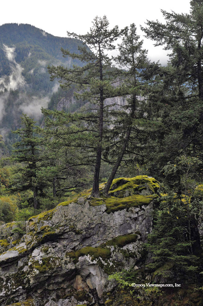
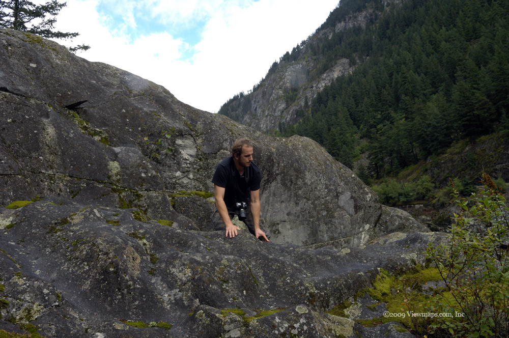
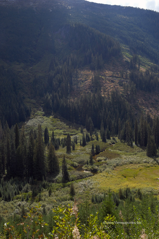
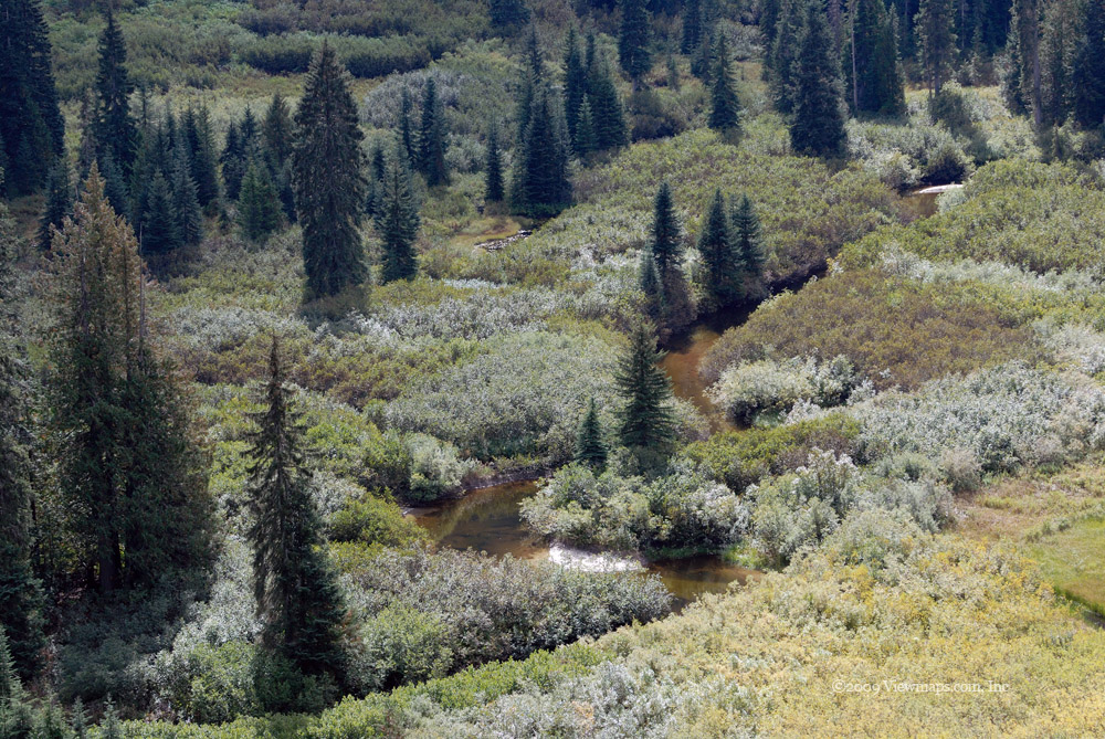
Now that we had arrived at the viewpoint I wanted to grab a few shots before lunch lest we lose the mist on the lake. I made my way out to the ledge I had hoped to take some photos from but time had given the trees additional height and bulk and much of the view was now obscured. Talk about a disappointment. I did get a few images but not as many as I had hoped for. The guys also came out and grabbed a number of shots. After a quick bite for lunch I made my way up a cliff face to see if that got above the over-growth, it did and I was able to get some clear views in the northerly direction.

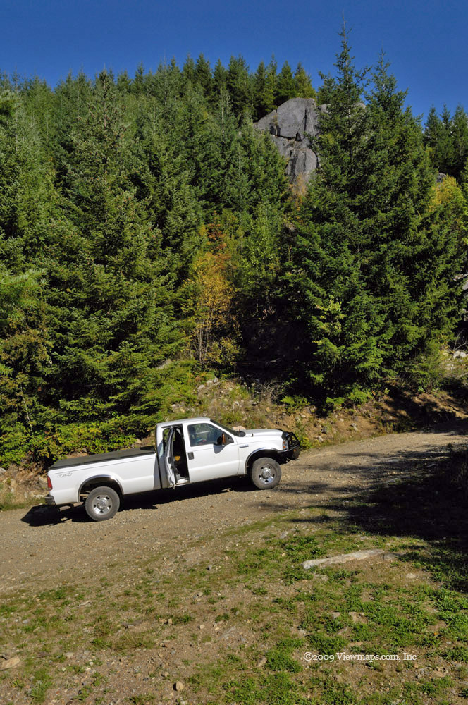
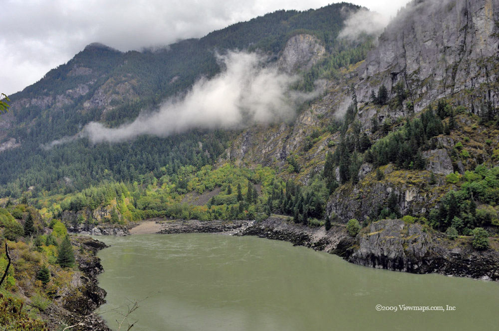
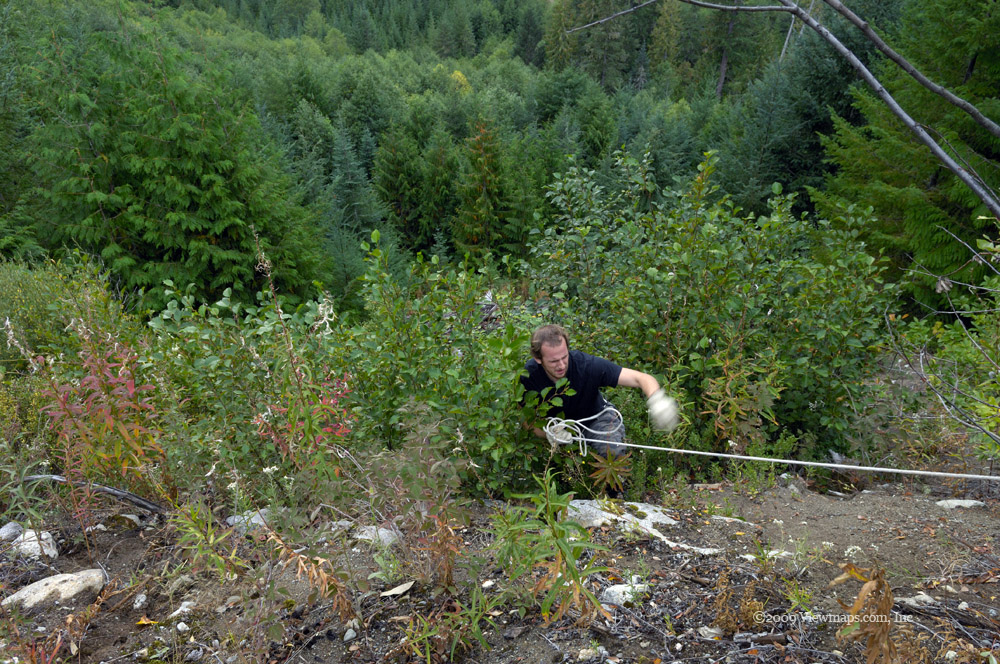
On our way out the guys decided to do some brush clearing while I drove the truck. In the process, Geoff managed to snag a small tree trunk on his down swing and smacked it onto his head. It almost knocked him out and he was feeling a bit unsteady for a few minutes. Not to mention his new headache. After clearing the worse of the over-hang we had made our way past it and now we were able to quickly make our way back to the main FSR. Once there we decided to continue in and see what Salsbury Lake would offer us. We made good time getting to the lake, it also was frozen over but the ice was thin and definitely not able to support walking on. I grabbed a few more shots in the dimming light. 

We decided to continue further down the road to see if the washout was passable and the way to Cypress Point open . Unfortunately the road was blocked and signs indicated that the way was still impassible in a vehicle like ours. So the Point will need to wait until I have an ATV to reach it. We took one more short detour on our way back to see if another view of the lake was possible but this spot didn't offer one and as the light was now marginal for my photography we decided to head on out.

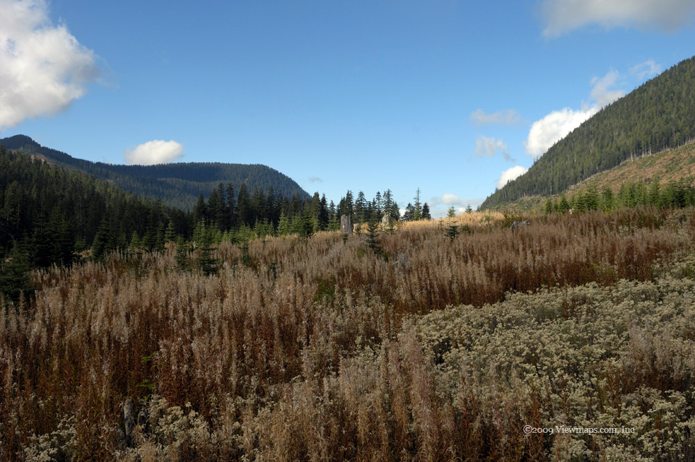
The day was a success and I got a number of decent photos of the lakes. I was surprised by the lack of snow on the ground, this mild winter can sure be seen when you come up here. Nick had a good time, it's a shame he is working most week-ends and not able to join me on my trips. We'll need to plan some hikes this summer when he can take a day off.

Chehalis River FSR

The last few times to the area were curtailed by a washout which blocked access to the lake and the Statlu Creek area. So I was glad that the bridge was repaired and we could now venture to the lake. Unfortunately the mountain slide that happened a few years back blocked the road and one can no longer continue the drive to Mystery Creek and on to the West Harrison, so we would be returning this way. Despite It being a dull day with cool temperatures, I was looking forward to the drive - at least it wasn't raining.

On reaching the FSR we found ourselves alone, it seems that the area was not an attractive one this morning. That suited me just fine as I find crowded roads to be a nuisance never mind a hazard. We did our regular stop at the campsite at the start of Elbow lake. I'm not sure what it is about this little lake that always catches my eye but it has become the norm to stop here and grab a few shots. The area is pretty and all but there is something else about this spot that keeps me stopping to check it out. Maybe I just feel there is something there that I haven't been able to find yet.

Once past the lake we set off down the main road and soon came to a newly logged area that we turned off to explore. It wasn't a large area but we did get a bit of elevation and a few shots. The area was split into two segments and crossing to the second put us over a narrow bridge where a large logging vehicle was parked. Geoff looked it over for a few minutes while I grabbed a few photos of the creek. We noticed another group in a truck on the far side of the main road so once we were done here we set off to see that area. They were blocking the road but after chatting with them a bit they said that it didn't go far, so we returned to the main. They seemed a bit surprised to see us and at first took us for someone official.

As we got further up we discovered a frozen wall of ice that looked very pretty and worth a number of photos. Next we came to another actively logged branch and turned up it to explore, signs were warning us of video surveillance . We discovered some icicles hanging from the roots of trees. These caught Geoff's attention and he climbed up the slope to view them from a closer point. After checking out the area we returned to the main and crossed the repaired bridge on our way to Chehalis lake. Just before the lake we came to a lovely frozen waterfall that was just visible from the road. We decided we needed a better view and since the creek bed was too slippery we decided to climb a small ridge beside the sunken valley to a point overlooking the waterfall. After stumbling through the undergrowth and steep mossy slope we arrived at the ridge top, the view was great and I got a good series of images including a pano.

Then it back to the main and on to the lake. We stopped for lunch on the rock overlook midway up the lake. This was a spot we discovered our first time here and I have made a habit of walking out on it every trip. The view was good but the dull weather did tend to compromise the quality of shots available. As we were finishing our lunch I heard some voices but we couldn't see anyone. we returned to the truck and continued along the main. Just past the first turn we found the source of the voices - there were a couple of foresters burning some trash at the site of their heliport. We chatted a bit and then left them to their task. We continued to where the road was closed due to the slide. They were very serious about blocking the road as they had dug two huge cross-ditches that nothing would get over though we really had hoped to try. As it was obvious we wouldn't get past them, we turned back a bit and took a side road to see how far we could get. This was the Skwellepil Creek road. We explored this road in the Pathfinder some years back and it was one where we almost got stuck when crossing a stream bed. Today we were to be stopped by snow. 

As we drove along we eventually came to snow, it had two deep ruts in it. The snow crust around the ruts was hard we ended up tracking the ruts. before long it was getting deeper than we liked and we decided to turn around, that was a mistake as when we left the ruts our frontend immediately sank into the deep soft snow on the side of the road and now we weren't moving. We pulled out the winch and pulled ourselves back to the centre of the road. But when we backed up we ended up back in the spot where we got stuck. Rather than try it again we put chains on our rear tires. Those dug us out in no time, we got back into the ruts and backed our way down till we found a better place to turn around with shallower snow. In the process we broken several links in one of the chains.

Once back on the main we soon were passing the entrance to the closed campsite. We decided to drive down to the lake to see if we could see the slide. We were not disappointed. The whole face of a mountain had slid off down into the lake. The debris was vast and looking across the lake to the other-side one could see how the slide created a huge enough wave that the beach and trees for 10 's of meters up were stripped bare! The wave must have been incredibly big and powerful. Driving along the campsite we discovered more damaged areas where the water had stripped the shoreline bare.

The day was getting dimmer and no longer good for photography so we decided to head out. The pair that was burning had already departed as we came past their work - it was still smoldering. We saw only two other vehicles on our way out, one we passed the other was heading in. So it was a very quiet day out there which suited me just fine. We collected a few images on the repaired bridge and then drove out and soon were back home. The truck performed very well for us, the winch also proved helpful and a wise investment already. It does look like it will serve our needs quite well for the years ahead.

Chiilwack, Folley & Chipmunk FSR's

The rains in November set quite a number of records this year. Their most irritating effect was that they kept me cooped up and out of the hills. So today's trip was long anticipated and I hoped that my choice of location would live up to the urgent need of seeing some real back-country. I have been in the Chilliwack river area so many times that I have lost count but even so, there are new areas opened up and some areas blocked off with washouts. Today we actually had a mix of new and old. It was a fun day out there though I didn't actually get to do what I had planned - no surprise, I often don't.

We started off exploring an area just south of the Chilliwack River Road that exits just before the road crosses over the river for the second time. It was a new area for me though I believe that this is the place that Geoff and his friends often come to go camping in the winter. I don't think I found the spot he uses but I am sure I was close by it. The area has some new logging taking place so the roads were in decent condition and as such we were able to get up to some viewpoints quite quickly. The road had some icy spots but was generally clear and easy to drive. I found a couple of decent scenes but nothing was really calling out to me so far. The day just felt cold and dull despite the clear skies at this point. As we made our way down I did spot an interestingly shaped tree that I was able to position into a reasonable shot. We started up another branch of the road but soon came to a log that was pulled across the road. We contemplated pulling it aside but I really wanted to get to the main area of my drive so we turned back and set out for the Folley Creek FSR. 

Folley Creek was bare of snow this trip and we were able to make some good time driving it. At one point we took a break to watch an eagle hunting in the river. As we reached the lake we tried a branch road I had not traveled before. It seemed to go a good distance up the north side of Ford Mountain and I enjoyed the drive though I didn't find much to shoot. We then continued past the lake and set out further up the valley. The road had some serious washouts and with the ground frozen, it was hard on the undercarriage as we scraped our way across some of them. They were getting deeper and being frozen and this still not my main target we decided to return and try it again after the thaw. As we came back to the lake I glimpsed the main waterfall mid-way up the far side of the lake and stopped to get a few shots.

So soon we were on the Chipmunk FSR. I was hoping to make a loop from the Chipmunk, to the saddle point on the ridge - upper section of the Bridal Falls FSR - overlooking the Fraser Valley and then on to Mount Thurston before returning to the Bench road and on out. The first section of the road was clear and I was hopeful we would be able to do the loop. But soon we were traveling in hard snow. The snow had melted and frozen a number of times leaving the ruts almost impossible to climb out of. Ethan was taking the road slowly at this point as he was still getting a feel of the situation and trying not to get stuck should he climb out of the ruts and end up in some deep stuff. So the slow descent into a cross-ditch with water flow didn't look too unusual until one studied the far side and realized it was a frozen slope of ice! Once the truck got the rear wheels into the water and the front ones on the icy slope we stopped moving. The ice on the front gave them no traction and the soft stream bed robbed the rears from any as well. So we were stopped! I figured we had two possible methods by which we could get out of here. One was to use the winch the other to put some chains on the front tires.

As we were contemplating the situation and pair of ATV's came back down the road toward us and realized they would have to wait for us to get out. They indicated that they got stuck themselves not much further up the road. So it looked like going on would be pointless - the loop was not going to happen today. That being the case I decided to use the winch as the easiest way to get out. So I dragged out the line while Ethan hauled the 20 foot chain out to a tree and soon we were joined and ready to pull. The winch made short work of the problem and soon the ATV's were on their way. We returned the cable to the spool and chain to the back and turned the truck around. We kept up a bit more speed on the way out and had no trouble getting off the road.

I decided to follow the bench road west and to drive the upper area of the Chilliwack region to see what tales it might tell. We made our way up through Ryder Lake and the Promontory before returning to the highway through Sardis. It was a pretty area of farms and views. So though we couldn't do the loop as I had hoped, we did explore some new roads and even used the winch for a legitimate recovery! Over all it was a very successful day. The number of photos taken was a bit down but then not every trip has the same level of quality. The trip did wonders for my sense of missing the back-country. Hopefully the roads will stay open a bit longer so I can get out a few more times before the snow shuts it all down.

Garnet and American Creeks Again

I had planned to connect through to the Emory Creek FSR on the two previous trips to the Garnet Creek area, but both times I got diverted to other adventures as we went along. The first trip saw us heading west up to the Garnet Creek head-waters and then over to Talc Creek and Harrison Lake. It was a lovely drive with many great sights that I really need to repeat. Our second attempt saw us head up the Transmission line road to American Creek where we connected to the Trans Canada Highway in the Fraser Canyon after crossing over the repaired washout on American creek.

So here we were, trying to find the elusive connector to Emory for the third time. We set out on Garnet Creek as before and stopped to enjoy the faster water flows that the recent rains had produced. The small trickle down the cliff face that forms a wall along a section of the road was flowing quite heavily today and offered a new feel to the fall. I setup my equipment and started taking some slow shutter photos but had to fight with the wind which was whipping up the stream and spraying water long distances from the actual channel. It tried several times to soak me a few dozen yards away!

Our next stop was on the bridge crossing a major tributary to Garnet Creek. The water was fast and furious today, generating a loud roar that clearly warned of the power in the water. It was amazing to see just how different the creek could look as the water level changed. From a friendly little quiet stream in which one could cool their feet, to this fast and dangerous rapid that would easily knock you over and carry you along for miles. Once past the creek we made our way to the spot where Geoff and I were originally blocked by snow back in mid May. Today, we continued up the road but as we did we were getting more and more concerned as it seemed to be leading away from the valley where the power lines ran. I was hopeful it would turn back but that hope was rapidly failing.

We continued to climb in elevation and came across a few nice viewpoints looking down into the American Creek valley. The road was quite passable though the cross-ditches were a bit annoying in a few places. Eventually we came to a shallow ditch that had a large rock blocking part of the road. We decided that as the road looked like it was passable for some distance still, we would drag the rock out of the way. So we hauled out some gear and hooked a strap to the rock and pulled it over. While working on it we were attacked by some freezing rain and hail that made life a bit cold for a time until the cloud passed. The hail seemed to add to the feel of the place and though cool, I enjoyed the setting. We got back in the truck and crossed through the now wider opening we had created and made our way up the road. Soon we encountered a crossing of a small stream. The water flow was up and the path across seemed a bit uncertain for a large size vehicle, So since the road only went a short ways further we decided to not bother trying this crossing. We set off back down the road stopping for a few shots along the way. A small lake on the map just up from the road looking appealing but the wet slippery ground that we would have had to cross to get to it convinced me to try it again on a drier day.

We continued back down to where the power lines were and tried a few spur roads that lead to some of the towers. We finally found the one traveling along the line leading to Emory Creek. But after a couple of towers the road ended. Not a very encouraging development. I studied the path forward and saw to my dismay a steep slope under the lines just before the next tower. It would seem that the roads do not actually connect! This was a major disappointment after all these tries. Those next towers must be serviced from the other side leaving only a few hundred feet between the two road segments. It would be passable on foot with some effort but not even an ATV would be able to do it. Well at least we confirmed the situation and now know we didn't miss out on the loop road before.

So, now that our intended route was no longer possible we needed to decide which way to head out. I decided to go out American Creek, this way I could revisit a few locations I thought particularly nice and then end the trip at the Blue Moose Bistro in Hope. We made our way to the steep section of road that was a serious challenge for Ethan last time here. Today it seemed to go so much easier as he knew what to expect - practice does make things so much easier. We got to the small lake that forms the headwaters of American Creek and then tried a few spurs to the transmission towers. One crossing was through some fast running water that was a bit of a challenge. The ground soon became quite muddy and soft in places so we had to be careful not to get stuck. Once back on the main road we followed our route from last time and soon came to the level water crossing of American Creek. 

On our first crossing, the water flow was light and the way across easy to find, it presented no concerns. I had hoped to stop here for some additional shots of the creek. But today the creek was wide and fast flowing. If we hadn't been here before I would not of thought the crossing would have been recommended. After a few moments of planning we set out across the creek, the water seemed ominous when we were in the middle of the flow. Looking upstream I could see the rocks that I had hoped to shoot but today they were completely covered in fast flowing water. The nature of the river was so different from last time, not nearly as interesting in this setting. So we made our way across and kept on going. 

We stopped at a few more side streams that with the extra water were producing some lovely waterfalls to enjoy. I also took some shots across the valley of a waterfall sliding down a large rock face but the wind and rain made for some difficult shooting and I didn't get the quality of photo I wanted. We made for the highway and stopped at Schkam Lake (Lake of the Woods). I had driven past this small lake several times lately and thought it might be a good time to visit, The trees offered some colour but the weather made most things dull and cold. So our stop was short, a few others stopped by for brief visits while we were there. We continued on to the Bistro and enjoyed a hot drink before heading back home. Over-all a great day for back-country exploration and photos even though we failed to find a way through to Emory Creek.

Bridal Falls, Garnet & American Creek FSR's

I had tried twice earlier this year to explore the Bridal Falls FSR, both times stopped by snow, and I still needed to find the Garnet/Emory Creek loop which was missed last trip. So today's adventure was to comprise two separate explorations. As the Bridal Falls area was first along the way, that was where we began our back country driving.
We came to the start of the FSR and noticed that an area just west of the road had been cleared and developed into a trailer park. There were only a few camping there today as it was now out of season. The Bridal Falls area seems to be pushing tourism quite effectively. We were soon past that and into the forest where we rapidly made our way upward. The truck bounced a lot along the road and it seemed a lot rougher than last time in the Pathfinder - I need to get used to the stiffer suspension. Before long we were passing the place we were stopped on our first trip and then on the second, followed immediately by the spot we stopped on our hike from the first trip. We were soon at a fork and took the right branch which went to the launch site for the paragliders. 

We arrived at the site, parked and got out our equipment to photograph the area. The view was spectacular. I could see far down the Fraser Valley and far up Harrison Lake! Though it was quite cold with a breeze the site was amazing and I didn't really want to leave, but we had just started our adventure so it was back to the truck and then off to explore the left fork. We made our way up till the road was blocked off, at one point it had continued on and joined the Chipmunk FSR with access to Cheam and the Chilliwack River. Today you can only walk across the washed out area and join the Chipmunk at a ridge overlooking the valley. I had previously been on the top side of the washout and had planned to try this lower section for years, so being here completed another of my goals. As we made our way down we came upon another truck making its way up. We chatted for awhile, they were new to the region and didn't realized you couldn't drive much further and that you had to reach the upper launch site from the back.

We returned to the highway and made our way to Agassiz to pick up a lunch for the next leg of our trip. Soon we were entering Garnet Creek FSR again and this time we were determined to find the connector to Emory Creek. As we made our way along we tried a few side roads that we had skipped previously They brought us to some lovely areas where the leaves were starting to change colour. As we approached the area that stopped Geoff and I earlier this year we found a side road that looked interesting so we thought we would try that before continuing. This road provided access to the transmissions towers so it tended to be much more rugged than your normal FSR. The road soon came upon a very steep and wet section which we thought we would avoid but then we said - well why not try it. So we carefully made our way up. This was a much more challenging section of road and definitely a push for Ethan but as we made our way up his adrenaline kicked in and soon we successfully reached the next tower. That resulted in a scream of exhilaration from Ethan, quite catching me off guard. I reminded him that we may have to go back down this stretch.

We continued up past a few more towers and came to a lovely small lake where I got a few shots. The road was obviously improved recently in this area as the tread marks of a grader were evident. We decided to keep going and see how far the service road went and if it might be the continuation of the American Creek FSR. Before long we realized we had transitioned to the FSR, not sure when but we were beginning to think that the path we travelled was the only open route. We continued along heading towards the Fraser Canyon, my new concern was the washout that blocked Geoff and me this past May. I really didn't want to get almost out only to have to return the way we came.

We came to a small creek crossing where I took a number of lovely slow water shots of the rapids just up from the road. We decided we were overdue for lunch and took an extended rest here where we could enjoy the phenomenal setting. After lunch we continued along, the road had by now improved considerably and driving was easy. Before long we crossed another arm of American Creek, this one with a bridge. After crossing we came upon a few side roads that were quite overgrown - perhaps we could explore them with an ATV.

I noticed that the road looked somewhat traveled so I was getting less concerned about the washout. Finally we did come to where the washout was and saw that it had been well repaired, one would never have known it had been impassible not that long ago. So we were soon off the FSR and onto the Highway headed for the Blue Moose Bistro in Hope. It was a great trip but we still didn't get to find the connector to Emory Creek, so I guess I will need to try one more time!

Garnet, Talc, Harrison FSR

Since Geoff and I tried to connect back into Garnet Creek from Emory Creek FSR in the Spring and were stopped by snow, I have wanted to return to try it again to see if the pathway is drivable. So today Ethan and I set out to further explore the Garnet Creek region and see if the path to Emory Creek exists. First we planned to explore a new area – the headwaters of the actual Garnet Creek and once done to head back to where we believed we could follow the transmission line service road to Emory. It was a bit of a blustery day so once again I was cautiously hopeful that the weather would hold long enough for us to complete the trip. We set out for our regular coffee in Abbotsford and then on to Agassiz to pick up a lunch. Soon we were on the FSR and immediately came upon a forestry notice saying that a bridge at 10km on the Talc Creek FSR was washed out. I wasn’t sure why it mentioned Talc Creek so I ignored it.

We quickly drove through the first section of Garnet. I was hoping to get some nice waterfall shots at the rock face that borders the road but the water flow was so low there wasn’t much to see. Driving on, we soon were at the fork between American and the upper section of Garnet FSR’s. As we hadn’t seen the Garnet section before, we had planned to explore that area and return here to continue on up to where the connector to Emory Creek would be. 

The first section of road was a bit overgrown with a couple of less travelled bridges but soon it opened up into a lovely valley with interesting rock formations and great views of the ridge line that was paralleling us along the valley. The road was continually climbing through the valley and provided a number of views to the creek at the base of the valley. We had a few drops of rain here which was a frustrating sign but we were fortunate in that this was the only rain we had while in the back country. While we were stopped for some photo taking I received a radio call from a club member and though deep in a twisted valley we were able to have a clear chat all the way to White Rock. The Ham bands were working well for us.

We continued westward up the valley and soon were into some rough road with several side roads. We decided to forego the side roads at this time and perhaps take them in on our return. As we drove I started to wonder just how far this valley went as it seemed to go on forever and was now past the marked road on the map. Suddenly it dawned on me that we were heading straight to Talc Creek! Now I was excited as we might be able to loop through to the East Harrison FSR and enjoy a view of the lake. So we kept driving forward over some steep sections and soon we were descending into a new open valley. It was looking very promising. But then I started thinking about that sign we passed at the start of the Garnet Creek FSR, would we get all this way and be stopped by that washout we were warned about?

We kept driving the lovely valley and the map was showing us getting close to the Talc FSR so we were very hopeful we would connect. Finally we were on the Talc and now we needed to know if we were above or below the 10km washout. It was not long until we noticed a 6km marker! that was a huge relief. I was now wondering if the two roads had a second connection which was above the 10km point. It does look like it will need another visit. As we made our way towards the lake we came to a landslide with some huge boulders across the road. There was a clear quad trail through it but we were in a long F250 and so the path may not be passable. Ethan & I both felt a bit let down – we hadn’t come this far to be blocked by a few rocks on the final stretch. So we analyzed the opening and planned our approach. After a few tries we made it past the narrowest point and then past the slide area. We were very excited at that. But another washout by a small creek soon came into view! This also took some planning and reties but we got past that as well. We certainly hoped there wouldn’t be any more as having to return through those sections was not a pleasant thought. But now a new thought came to me. I recalled that a couple of years back I had wanted to explore this FSR from the Harrison but we were stopped by a gate! So I was now worried that we may encounter a gate and not be able to get past it!

Alas we finally made our way to the gate and it was blocked open, there was the East Harrison FSR before us! We had succeeded in finding a loop trail even if it wasn’t the one we had intended. We quickly made our way to the lake where we stopped for lunch and a few photos – the wind was really blowing on the lake which added to the photos. As we ate a group of ATV’s came by and stopped to check directions. I chatted with them a bit – they were on their way to the Clear Creek Hot Springs for a soak.
After a rest and almost getting stuck in the sand on the lake shore we set off down the road – there were few campers this week-end coolness and wind seems to have chanced off most. We tried a number of side roads as we traveled south, one of these looked like it would give us a view of the Talc Creek area that we had just been on but the road was blocked by a rock fall before we got to a view point. I guess I could have hiked a ways but that wasn’t interesting me today. We stopped along the main FSR at a number of the regular scenic features and before long we were at the end of the FSR on our way to the town of Harrison Hot Springs.

It was a very fun drive with some significant driving challenges. We pushed ourselves to new limits with our new truck and were happy with how it performed. Ethan was excited to have made it through some challenging road hazards, I enjoyed some great scenery. But we didn’t get back to the connector to Emory Creek so I guess we will need to return to Garnet Creek very soon.

Fraser Canyon & Spuzzum FSR

I have been slowly working my way up the Fraser River as we explored the back country. The next logging area is located just outside of the metropolis of Spuzzum. So Geoff & I set off to discover the sights of this region and to see if there was a possible connecting route through the hills to the East Harrison area. The day was partly cloudy which should be ideal for photography. I was hopeful it would stay bright for the duration of the drive and not turn to rain.

After we picked up some food for lunch at Peter’s Deli in Hope we started up the canyon but soon got dribbled on by some clouds. So I was starting to be a bit apprehensive about the day. Soon we came to a viewpoint along the side of the highway and we pulled off to explore its sights. The view directly from the road wasn’t very good, but a short walk along a well used trail brought us to some unobstructed views of the Fraser River. I grabbed a few shots while fighting the drizzle and then we made our way further up the canyon, this time stopping at a widening of the shoulder. Here we found a few more lovely sights but they all had some obstruction in the way. Geoff noticed that we were walking over a short train tunnel for the tracks that were hugging the river. He briefly considered going down to track level but everything was wet and the slope quite slippery.

We returned to the truck and made our way further up the canyon, we soon discovered a side road leading towards the river which we took. This road paralleled the highway for a couple of kilometers. Not far along it we found a pair of grave markers proclaiming the existence of a native burial ground throughout the area. A short distance further we had access to the river bank where we found a fascinating collection of smoothed rocks. Geoff went exploring across the various rocks to find some interesting angles for his photos. Returning to the truck we soon came to the end of the road where we managed to capture some more decent images of the river. We then carefully turned the truck around on the narrow lane and returned to the highway.

As we proceeded north, the highway made its way through a few tunnels and slowly widened the gap between us and the river, so our views of the river were getting scarcer. So we were fortunate that we were soon in the Spuzzum Indian Reserve with the town just around the bend. As we left the reserve the entrance to the Spuzzum FSR opened before us and we turned into it. Now we could concentrate on the back country and see where this road would go.

The map showed a number of side roads that looked interesting but when we came upon them we found them to be very over-grown. After passing by a few we decided to drive one for a distance to see if it opened up. After driving a ways and pushing back the undergrowth that was hanging over the road, we took some video footage of us driving through the tunnel of small trees. A bit further along we decided that the road would be best travelled on an ATV and so we turned around in a small widening. It was fun driving through it but the branches were snagging on our mirrors and antennas so we thought it best to stop before we broke something.

We came to a lovely viewpoint of a valley to our south; unfortunately it was obscured by a tall alder. Geoff got the urge to fix the problem and he got out a rope and made his way down the slope to the tree and cut it down for me. With the tree gone, the view of the valley was truly amazing and I was able to take a number of images. Now I had a new problem – too much contrast between the bright clouds and the green forest. I guess I will need to start using the High Dynamic Range techniques for these scenes. After our fill of the valley we made our way further west along the FSR. 

After crossing a few streams and switch backs we came to a blocked section of the road. We decided to first explore the road that crossed the river here and see where it might lead. This side turned back east along the south side of the river but was much darker as the mountain was now blocking the sun. The ground cover and forest reflected the lower level of sunlight by growing heavier moss everywhere one could see. The road soon ended and we had to turn back. When we got back to the north side of the river and the obstruction that blocked our way further west, we decided this would be a good test of our new winch’s abilities. 

We moved the truck into position, pulled out some line and tied it to the end of a large log. Then we started backing up. Once the line was taught, we couldn’t move the truck any further it simply spun out on the road – not great for our tires. So we decided to lock down the truck and pull using the winch. This was quite successful. Using the truck as an anchor we pulled that log right out of the way though it got hung up on a few small trees that we had to get past before we could complete the relocation. Using the winch for this was quite easy and went fairly quickly. Now I just need to complete our winch outfitting with a good snatch block and some chain for it. Once the log was moved we considered moving some rocks but it was getting late and the road past the blockage was overgrown and didn’t look like it would connect to the east Harrison so we decided to leave it for some ATV’s to cross. 

We set off back to the highway. On our return we came across a couple of groups on the FSR – they were the first people we saw since we had entered the logging road. One was a pair of hunters; they appeared to be set for spending the night out here. We had had a decent day with the rain holding off while we made our way along the FSR but now that we were almost back to the highway the rain came and reminded us of how fortunate our timing on the road had been.

Once back on the highway we were soon in the town of Hope pulling into a parking spot so we could warm up in the Blue Moose Bistro. After a warm drink we set off for home having had a lovely day exploring the canyon and one mid-sized FSR region.

Mount Strachan

I started this year's climbing season with a hike on Hollyburn Mountain which is directly next to Strachan. So it seemed fitting to end the season with Strachan. This was a new hike for me so I wasn’t sure what to expect nor how long it would take me to complete. The day was starting off really well weather wise – mostly sunny and not overly hot. Unfortunately the cloud burned off fairly early and the temperature rose higher than I would have preferred.

We drove up to the main parking area for Cypress bowl but due to construction for the 2010 Olympics we had to park alongside the entry road. This suited me fine as the parking ticket dispenser was broken, so we got a free day trip. There are two common hikes to the peak, the short quick way is along the service road basically to the top, the second, a longer trail through the forest that hugs the slopes. We chose the forest route as it would likely offer more to see. After reviewing our maps we set off up the eastern slope past a number of construction workers who were busy improving the ski runs. A sign pointed us into the forest and we were soon putting some trees between us and the construction noise. This first section of trail was typical second growth west coast forest an we made quick time as the trail was quite level for some distance. At this point we were actually heading away from Mount Strachan and toward Hollyburn. 

About two thirds the way along this first leg, before the trail turns back toward Strachan, we met a hiker with a child in back-carrier coming toward us. He reported that he had seen a bear to the side of the trail about 10 minutes ahead and as he had his kid in tow he decided to not risk continuing past. We decided to carry on as it would be over 20 minutes between when he had seen the bear and when we would get there. We never did see the bear though he may well have seen us. We finally reached the end of the first leg where one can choose to continue forward along the Baden-Powel Trail and on to Hollyburn. The return leg to Strachan started to have greater elevation gains and was not as well marked or travelled, but we did pass a few hikers travelling in the reverse direction. On route we heard a radio call on my hand-held from a Ham on the east-coast who was demonstrating ham radio to guests at a state fair. I ended up chatting with a few east-coast families and some pre-teens as we walked along. Eventually we made it back to the main ski slopes and took a bit longer of a rest. Now the trail got much steeper as it made its way to the top of the south peak of Strachan. 

Along this section of the trail we came to an old plane crash site where a military training flight had crashed into the side of the mountain in 1963. The wreckage remains as a memorial to the pilots and has mostly been left un-pilfered. It does seem to be a popular site as at the summit we later heard a number of other groups of hikers talking about the crash site. After a longer rest at the crash site we set off for the final slog to the south summit, but we soon lost the trail. We made our way over some steep brush for a few hundred feet until we relocated the trail and continued on. Soon we were at the south summit and took time to eat a snack and get some photos and some rest. I chatted with some of my radio club buddies from the summit with my hand-held.

After we regained our breath we had to decide if we would try for the higher north summit or be satisfied with the south. It didn't take much persuasion to give the north summit a try. We set off north and soon came to the cliff face that drops to a saddle between the two peaks. The cliff looks a bit challenging from the top but there is a good path down the 150 feet to the saddle which wasn't difficult to traverse. As we were heading down, a couple of groups were coming up including one with a very tired dog. I'm sure that poor animal had travelled 3 times the distance of the people as it was running back and forth along the trail between the various group members.

Once down to the saddle we found the trail up the north peak and made our way to the true summit of Strachan. A couple of hikers were coming down as we made our way up the final rise and once at the top we joined a solitary hiker who was enjoying the view, he apparently does the hike numerous times a year! We rested and enjoyed our lunch, then I started gathering a number of photos of the various sights. I grabbed a number of the Lions to the north and later when I reviewed the images I found people on the summit! Soon we were rested and ready to head back. We chose to follow a route that descends from the saddle through a steep gully. It was wet and slippery and at one point Ethan slipped and strained one of his fingers, we kept it chilled in the cold stream water to reduce swelling.

The drop through the gully was slower than expected as it was fairly slippery. Eventually we were at the bottom of the ravine and onto the main trail that goes from the Cypress parking lot to the Lions and on through to Deeks Lake. There were quite a few hikers on this trail walking in both directions. Before long we came upon a couple of workers in narrow trail machinery grooming the trail and repairing washouts. Places where they had partially completed their work ended up being very muddy and slowed us down yet again. Finally we were back to the parking lot and almost to our car when we came across the hiker we met at the summit! He had taken the fast route down and was back before us even though he had left much after! 

It was a great view from the top and I do think I will return and redo the hike. I we leave out the gully section and track back along the ski runs on the south summit. A fitting final hike of my 5 summits for the season, especially in light of the upcoming winter Olympics which will be holding some of the events on these ski slopes.

Hope Mountain

The hike to the peak of Hope Mountain is a moderately travelled one. Though not nearly as well known as Cheam, this trail is fairly well maintained and marked. Earlier this year when I was trying to determine what my 5th peak of the season would be , I came upon this hike in a new hikers book I picked up. As I was spending a fair amount of time near Hope while exploring the logging roads, it seemed like a natural extension to the exploration of the region. In preparation, I took a drive up the logging road early in the season to scope out the trailhead so that the day of the actual hike would start smoothly and get us on the way sooner.

When we left home we were concerned about the weather again as it was overcast with some chance of rain in the area. What we hadn't expected however was the low cloud layer which fogged in the whole mountain! When we arrived at the parking area next to the trailhead we were completely enshrouded with fog. Though that was fun to be in, it caused us two serious problems. The first was the lack of a view of anything, the second was the complete drenching of all the foliage along the trail. Despite these issues we decided to do the hike as planned.

We first setup the cross-band repeater radio as is our custom on hikes. This took a bit longer than normal as we were having trouble finding an orientation for the antenna that could reliably reach the Sumas Mountain repeater. We eventually found a partial solution to the issue and then set off. The first leg of the hike is down through the head-waters of a small stream, here the foliage was thick and being wet with dew the plants were hugging the path soaking everything that came past. We were quite drenched before we had gone half a kilometer. Trying to shake the water off the plants slowed us down quite a bit and so we were making very poor time on the hike.

As we made our way to the first ridge, we lost the trail for a short distance. We kept heading in the original direction and found it as the trail took a steep climb to the ridge line. At the top of the ridge there was a pleasant log seat to rest on. Since we had lost so much time getting this far it was now lunch time,so we took a break to eat. As we rested we watched the cloud come and go on the next segment of the trail, at no time did it clear enough to see the peak that was right before us. We decided that the slow going would delay us enough that going on would not be worth it since we were unlikely to reach the peak and even if we did we would see nothing. So we decided to walk along the ridge a distance to see why the waypoint I down loaded as the location where one crosses the ridge was some distance from where we were. After bush-whacking a ways we realized that it would take too long to find the old trail, if it even existed, especially since we were wet and getting cold. So we returned to the trail we came up on and started our return trip to the truck.

The hike back went quite quickly as it was down-hill almost the entire way. The plants were already very wet again and so we had to shake the water off a second time. It was certainly nice getting back to the truck and turning on the heater for some drying action. Though we didn't achieve the peak we did have a good time. I have re-scheduled the hike for next year and hopefully we will have a clear day to try it on.

Sumallo River FSR

I have driven the Hope-Princeton highway past Sunshine Valley countless times over the years on my way to Manning Park or the Okanogan, so it was long past time to stop and see what the little community was all about. On the way we tried a few logging roads that started on the highway but none were passable for more than a short distance. So we rapidly worked our way up to the valley. We first tried the road across the highway from the main section but quickly discovered it was a 'private' residential area and people like us were not welcome. So we turned around and set off into the main area and quickly found our way heading out the FSR into the hills.

The road was well maintained and travelled and we made a number of crossings over the Sumallo River . The river itself was a reasonable size and near the start of the valley many homes were built right along the side of it to take maximum advantage of the pleasant sound of the flowing water. We noticed kids toys scattered along the bank waiting for their owners return as the day warmed up. As we travelled further into the hills we came across a washed out bridge with an inviting road beyond it. There was a clear path down to and across the river and it was very tempting to follow the path across but we didn't have a winch on the truck yet and so I was reluctant to try it. I do think it is mainly ATV's that make the journey here.

Heading further along we came to a major fork in the road with the one heading up the slope calling itself the route to a Winter Play land. Apparently there is a good ski mountain here that has a site that had been operated as a small ski area in prior years. It is currently closed as they were not able to secure better support to develop it. We did eventually drive our way up to a locked gate that blocked 4x4 access to the actual base of the ski area. I will need to come back with an ATV to explore it further. After checking out another short spur we stopped along the side of the road for lunch at a spot with a nice view to the south looking up the Sumallo river valley. A couple of other vehicles came by while we were eating but generally it was quite quiet, probably due to the questionable weather.

After lunch we started to work our way back to the main fork, we did come across one more spur that went some distance to the north which we were able to follow till blocked by a wash out. At the end of it we had some good views of the river valley and the mountains on the other side of the river. It was a pleasant spot but quite exposed to the weather. After returning to the fork we continued along the main FSR and tried a number of side branches some with nice views of the valley but nothing exceptional in this weather. There were a couple more roads we didn't have time to explore.

Eventually our road became quite over-grown and we weren't able to keep going. At the furthest point we had to back out a few hundred meters to get back to a wide stream bed where we could turn around. It was a quieter trip with not overly difficult road conditions to traverse. This was a good first serious workout for the new truck. It allowed us to test out some of its abilities in a less challenging area though I'm sure some would not consider the area easy. So it was a great test drive for us on the truck while we wait for the winch and steel bush guard to arrive. Once they are in place it should free us to try a few harder roads and not feel too vulnerable.

It being a dull overcast day, I felt we missed a number of potential images of the various peaks in the region which is unfortunate but it does leave us open to a return visit. I do feel we could explore a number of areas more thoroughly if we come back with an ATV. Our way back out went without incident and we were able to capture a few photos of the river. I would like to check out the closed ski area to see what paths may exist in that region. So a return trip with an ATV is definitely in order.

Subscribe to 2009