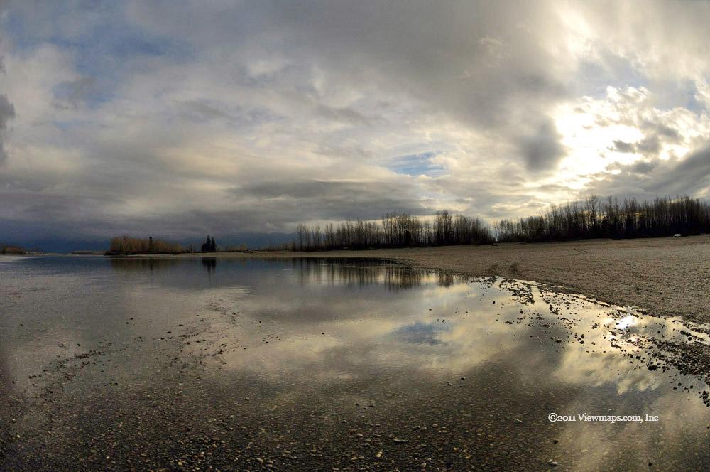
John E. Pearce Park and area (Day 10)

Today being our last full day in Ontario and the weather being fair, I decided to take one last run out into the farms. Carolyn came along for the ride today though she was very tired and stayed in the car when I jumped out to gather a few last minute images. I decided to head west one more time as it seems to offer the quickest way to get submerged in the back-country.

I took the familiar roads along the lake shore and stopped to get some closer-in shots of the various clumps of trees. The overcast skies muted the colours but this also prevented some of the subtler tones from being washed out. So the net effect was that the grand vistas were dull but the tight-in photos had some real depth of colour to them. We came by the local maple syrup farms and one looked like it might be open but when we drove in the store area was quite deserted and empty. I guess they are only selling off the farm in the late winter when the syrup is flowing. We continued along to Pearce Park where I got out to wander the leaf covered roadway.

The park was offering up some lovely micro spots of colour that I was able to tease out with my telephoto. I was quite enjoying the search and capture but before I got very far into the park a shower came up and trapped me in a small area the was protected by the trees. I waited a while for it to stop gathering a few more shots from that area but it seemed to be dragging on so I returned to the car and started to head home. 

There were still a number of smaller roads that I had skipped past on my previous drives so today I decided to drive a few different roads on the way back. They proved quite interesting and I was able to find a few more shots to take. Thought it was a short time out I quite enjoyed the drive and the colours were findable but they took a bit more searching out. About half way back the skies got much heavier and the light wasn’t much good any more so the last part of the drive went faster as I wasn’t stopping to gather photos.

It was still a nice drive and I am glad I decided to try it despite the heavy clouds. The drives out here this year were rewarding in that the variety of images I was able to locate was quite high and though the broad swathes of colour may not have been as full as I was expecting, the overall effect was still amazing. I look forward to a return visit and what I will discover next year.

Ports Bruce & Burwell Region (Day 9)

I had traveled to the west along the lake for most of my excursions out of Port Stanley so today for something a bit different I decided to head for Port Burwell and the wind farm that surrounds it. My first stop was Port Bruce and its beach area. I drove the highway to Port Bruce seeing only a few clumps of coloured trees but nothing that grabbed me enough to stop and shoot it. So I arrived at the beach with minimal delay. The wind was up and the beach deserted so it looked like there might be some decent opportunities to photograph. 

I wandered across the wide sand section towards the lake and started gathering a few shots of the waves breaking against the shore. There I spotted a log not far away that would make an interesting prop with the breaking waves behind so I walked over and took a number of photos from various angles. I then saw another log and repeated the process. After capturing a number of photos I returned to the car where I spotted a few images of some trees. I made my way to the eastern edge of the port and looked east along the coast to Port Burwelll and saw some of the wind turbines in the distance. They were enticing but I wanted to explore some back roads around Port Bruce before I set off for them.

I drove inland a bit and found the street – Rush Creek Lane – which looked like it might offer some views. I soon found some decent colours to photograph including a single lane bridge. The bridge wasn’t all that spectacular but it did get me out of the car and started on some non-lake shooting. Soon I was stopping at various spots along the road capturing the nuances of the coloured trees. I drove a few of the roads through here – crossing back over the one-lane bridge a second time as I started for Burwell. There were some remarkable combinations of trees along this stretch of road.

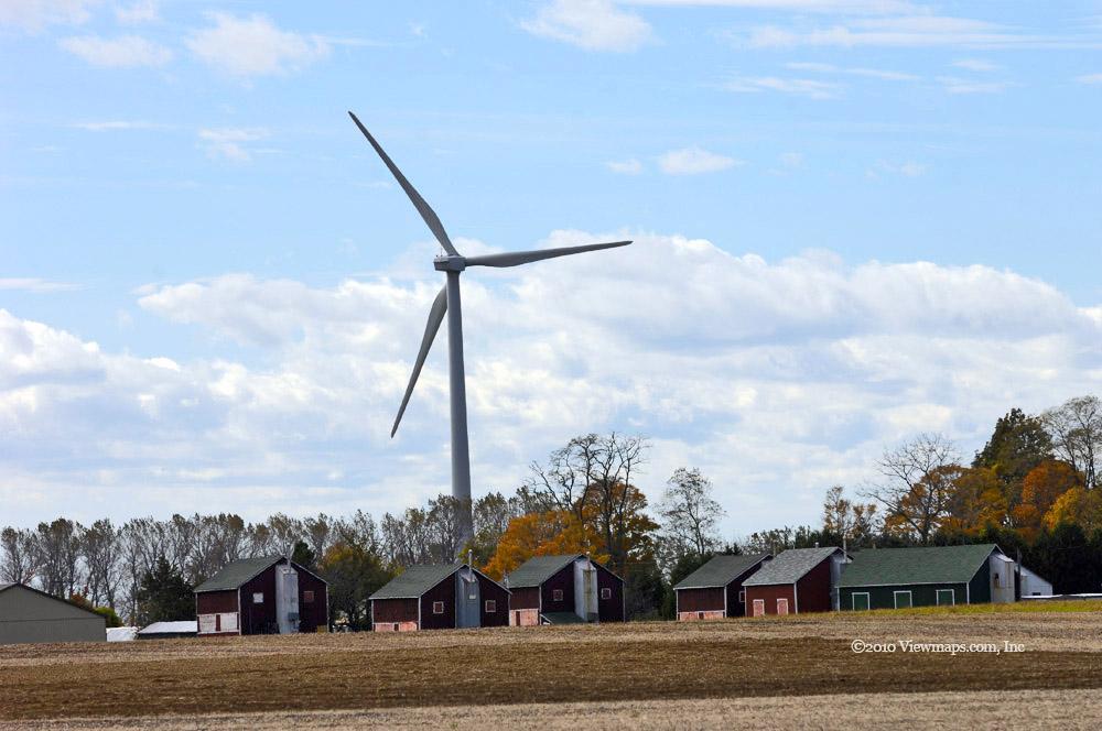
Soon I was on the highway heading for Burwell and approaching the first of the wind turbines. They really are huge and stand out from miles back as they dwarf the buildings that surround them. I finally arrived at Burwell but decided to skip the port and just keep heading east along the wind farm. I passed the main control centre for it and soon was in the thickest section of the turbines. When you got out of the car near one you could hear the wind swishing around the blades as they rotated; it was surprisingly loud. I was trying to find some shots that captured the size of these towers but nothing was really doing what I wanted. Eventually I got back on the lakeshore road and reached a closed section of the road but there I noticed a cemetery and decided to gather a few photos in it.

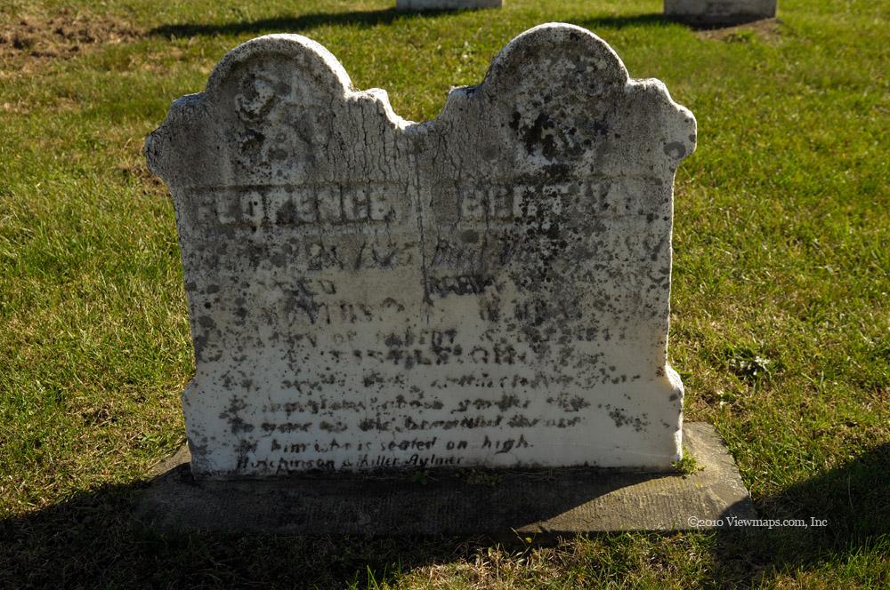
The cemetery had some stones dating to the first decade of the 1800’s which were still legible. So I had a number of interesting photos. It was while I was taking one of those shots that I had a distant turbine in the frame. I thought it gave a new perspective of ancient on modern and so I gathered a number of additional shots combining the old and new. The cemetery was in a nice location – just back from the ridge over-looking the lake and beside a huge orchard.

Once done with e cemetery I decided to look for a turbine close to the road where I could take a photo with me next to the tower. I soon found a convenient tower and set up the camera to capture me next to the base, It really showed the immensity of the structure. At this point I decided to start my way home and so turned back along a street parallel to the Lakeshore road. Here I was able to capture more shots of trees with the turbines and other autumn colour images. It was an interesting section to drive along. I even spotted a building that was well on its way to collapsing that offered an interesting image. Once I had made my way back to Burwell I spotted another cemetery that looked like it might have some older stones and so I stopped to gather a few more images of headstones.

I then got back on the highway and made for Port Burwell. I continued past the town proper and turned on a side street that ran parallel to the harbor where I was able to gather a few shots of the harbor and some of the distant wind farm. I next stopped at the interpretive centre for the wind farm which I found interesting. As it was getting later and I was getting tired I decided at this point to head straight back to Port Stanley.

At the harbour I decided to take one more short drive out to the end of the road where I could gather some images looking down the coast and of the breakwater protecting the harbor. The wind was still strong and so the water had a lovely character to it for some last photos. Once done here I returned to the main road and drove the short distance back to the Inn. So though the drive started out a bit slow I eventually gathered a good number of photos of a wide variety of subjects – another good day for photography.

Driving west of the port along the shore of Lake Erie (Day 7)

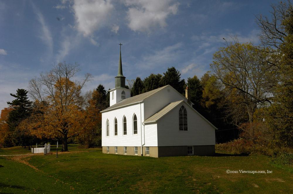
Today was very windy, though the sun was out it made for less than ideal conditions for picture taking. I decided to head west again and visit a couple spots along the lake past the furthest point I had travelled. I started out by heading for the Pearce Park as I wanted to see the old church that was next to it. St. Peters was very old and had an historical significance to it. I then explored the associated cemetery where I found a head stone dating back to 1822. That is the oldest one I have seen so far. Once done with the cemetery, I continued along the lakeside road to Duttona Beach.

Duttona proved to be a small community of cabin like homes, most were seasonally used and at this time of year only a few seemed to be occupied. I found a place to park next to an access point to the beach. I loaded up my bag and walked out to the lake. The wind was up and the waves were crashing against the beach but it wasn’t until I rounded the point that I really felt the full strength of the wind. It was really howling out here. It was quite refreshing actually but the wind was strong enough to make walking difficult and so I didn’t travel too far along the beach. Once I had gathered a few shots I returned to the car and set off for the next place I had planned to visit - E.M. Warwick Park.

The drive to the park was enjoyable, the back roads here had a bit of hill to them and so the drive was more interesting thanks to the variations in the road. The colours were not all that good along here so I didn’t find all that much to photograph. Once I got to the park I noticed another car parked. It seems that these places close early in the year but people still drop by. I saw a path leading towards the lake so I got out and started along it. As I came to a larger clearing I was greeted by a woman with a large white poodle. They had just come up from the lake and were heading out having exercised the dog. I noticed an elevated viewing platform and made my way to it.

The platform was listed as 28 feet above ground and should have some great views over the brush of the lake. But once I got to the top I was disappointed as much of the view was blocked by trees. This problem is so common, great viewpoints are made but no one keeps them clear and soon the view is gone. I returned to ground level and set out in the direction I saw the woman coming from and there I found a set of stairs leading down towards the lake. So I started down and soon was standing on the beach once again. The wind was strong here as well and I gathered a few shots but then returned to the stairs and made my way back to the car. It was a nice park but the leaves were well past their prime and so I wasn’t all that motivated to gather many photos here. I’m sure I could have looked a bit harder but I was getting a bit worn out and decided to head back to the Inn. After reviewing the maps I picked the shortest way back and set off for the room. Generally a good day, but it was not as productive as I would have liked.

Port Stanley Area (Day 6)

After e leisurely breakfast chatting with another guest couple I set off for the roads and plans to find some of the colour that the trees were offering. My first destination was the one I seem to always visit – Hawks Cliff Road. As I made my way along the road I saw a few people parked part way along the road, sitting on the edge of a field. They were busy spying on a group of hawks across the field. I continued on to the end where I parked and walked the final distance to the cliff edge. Here I spotted some interesting close-up items that I began to capture. The distant shots were not very spectacular today so I took very few of them. After gathering a number of macros I returned to the car and the main highway. 

I tried the next side road along the lake, there were a few spots with some colour but nothing that caught my eye enough to stop. The most interesting thing along this road was a tractor being serviced. It was missing one side of its rear dualies which looked quite funny standing on the far side of the road! I then made my way to the village of Sparta where I noticed a cemetery on our way in yesterday. I spent a few minutes walking around the site snapping a few shots of some more interesting stones. Then I continued on to Sparta proper and continued west back towards Union and the port. I passed a golf course that seemed to have a lovely setting but I doubt they would have allowed a photographer in just to take a few photos.

I then returned to the main road of Port Stanley and filled up the gas tank as it was down to a quarter and I didn’t feel comfortable heading out with that little fuel. Once the tank was full I retraced my path along the side roads towards Pearce Park that I found last year. I found a number of spots to stop along the way which offered some lovely rich colours to enjoy. At the park I made my way along the path which was heavily covered in dry leaves. This area was definitely past its prime but I still enjoyed the walk with the crunching leaves. The view of the lake was worth the walk. I made my way along the edge and eventually found a path down the cliff to the beach. The view from the beach was quite stunning. The beach was fairly narrow being squeezed between the cliff face and the lake – no place to run in a storm! The sand was very soft and I sank in over an inch with each step. Though the cliff wasn’t all that high by BC standards, it was still an impressive sight to stand at the bottom of and look along the wall that went on for miles in both directions broken only by a few eroded gaps from small seeps.

Once I had enough of the beach I returned to the car and as it was getting late I headed for the Inn. It was a lovely first drive for this year in the Port Stanley area. As the sun sank into the horizon, I set out for the west beach of the port and set up to capture the sunset. It was partially blocked on the east side but for the greater part offered a lovely colourful evening. The sky presented some lovely maroons as the sun dropped below the horizon. Perhaps a bit more obscured than ideal, it was still a very nice scene that I enjoyed with a few others who had come out for the final moments.

Beamer Conservation Area (Day 4)

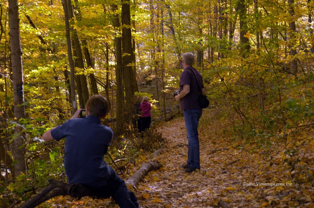
Today, we only had time for a short walk through the local escarpment before dinner. Joining Mike and I were his three teen-age kids. We trekked along the Bruce trail as it makes it way along Beamer Creek and on up to the viewpoint overlooking the town of Grimsby. We had fun taking photos of the vibrant leaves that filled the valley leading into the escarpment. We also made a number of small diversions from the trail down to the creek. The light played nicely on the leaves for our enjoyment as we slowly made our way up the trail. We were having so much fun finding items to photograph along the lower creek that we finally needed to start rushing a bit so that we could get to the viewpoint before we lost the light. Not far into the trail Mike stopped to take a photo and when he put his glasses back on he couldn’t see – he was missing one of the lenses on his glasses! We then all stopped to look through the leaf litter to try and find it. Fortunately Lucas with his eagle eye spotted it before we lost much time and we were back taking photos.

The creek was full of small rapids as it made its way down the escarpment and each set offered us lovely vignettes to capture. They were very pretty and we spend so much time exploring them that we were in danger of missing the light on the grand vistas visible from above. So after only covering about half the distance in from the road we started a more rapid pace to reach the ridge and the viewpoint. It didn’t take long and soon we joined the crowds up there enjoying the colours along the escarpment. The light was still quite good on the ridge –filling the trees with much colour so we took some time to capture the trees up there for a while between our glimpses of the valley below. 

Once done with the ridge we started our return. I noticed a squirrel in the distance that interested Mike and he was able to get a decent shot of it just before we started down the stairs from the ridge. It was now getting late and we needed to get back to the house for dinner, and I still had to return to the hotel to pickup Carolyn. Once back to the car we noticed that the light was playing nicely on a huge tree over-hanging the car filling it full of rich colour. One last scene to enjoy before we returned home!

Albion Falls & Haldimand County (Day 3)

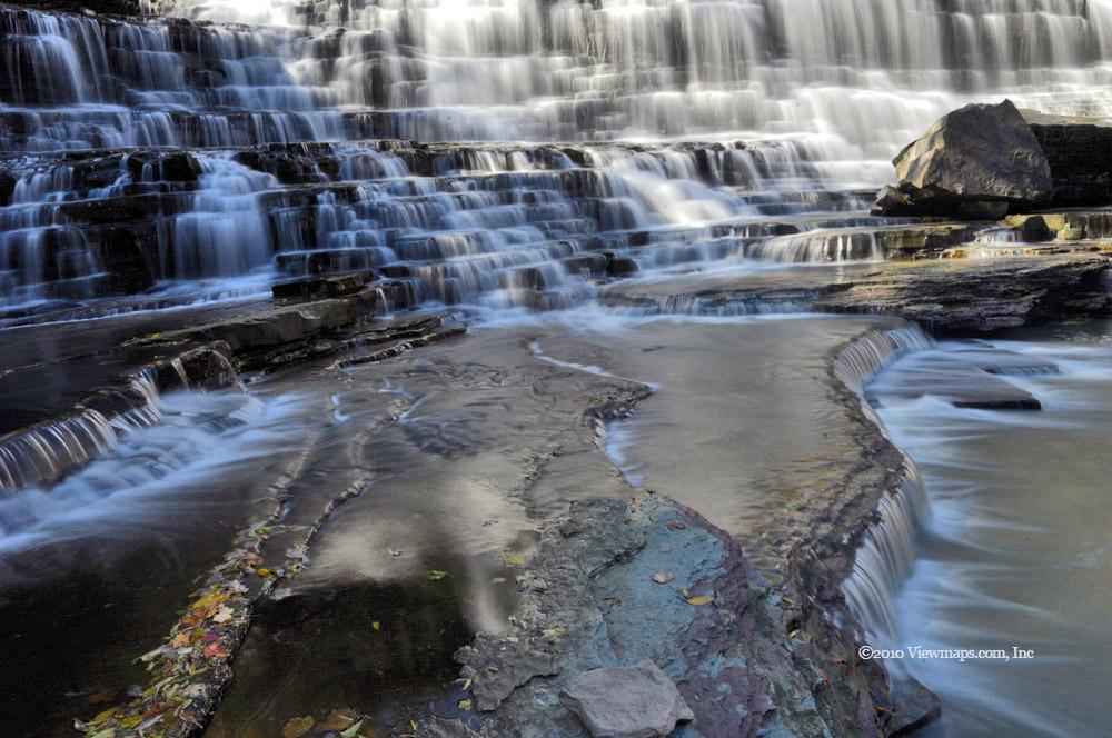
Today Mike and I resumed our nature photography with a visit to the Albion Falls. This waterfall is quite a large one compared to most of the local waterfalls. It is also very easy to access and so draws a continuous stream of admirers. While we were there, there was a constant flow of visitors, including a number of serious photographers taking shots from multiple angles much like I was doing. It was easy to climb down to the base of the drop and gather shots; the falls was a wide one with several ledges and protrusions which made for hundreds of items of interest in the curtain of water. I felt it would be worth a whole day here gathering shots of the many portions of the scene under lighting conditions that changed as the day progressed. In the end we did spend well over an hour on this one subject. Once done with the traditional view, we found a path to the top of the drop and gathered a few more while hanging over the edge!

After the Albion Falls we decided it was late enough to get lunch so we trekked along to a nice deli at Fortinos and then we set off along highway 6 to the deep south. Our first destination was the Grand River. Where we found the colours muted as we shot across the river into the sun. We took a few minutes to explore a small park on the eastern shore of the river but found only a few trees of interest. We decided to head further south and cross over to the west side. Here we found a bit more colour. Mike was unfamiliar with this side of the river. It seems that he only traveled the main road on the east and had never explored the lesser roads on the west side. 

Soon we came by McKenzie Creek which flowed into the Grand, there we found some interesting trees and water shots. Once done we rounded a bend and noticed an old cemetery. I have had a growing interest in viewing these old sites and so we stopped to explore the tombstones. Some were placed in the mid 1800’s and were now barely readable. It seems that even stone will wear away and leave nothing to remind one of the person buried below. After trying to read all the older panels, we returned to the car and continued south along the back-road. We came by a few fields of interest where we gathered more photos but soon passed another cemetery on a hill that we decided to explore.

This cemetery was almost as old as the first one but was much bigger. We saw quite a few older stones as well as some very recent ones in a modern style. I was dismayed to see quite a number of plaques to young children – some less than a year old – most dating to the later 1800’s. We certainly don’t see that level of mortality anymore and I am glad for it. When we were done walking a loop around the area, time had reached 3pm and I remembered I had a scheduled radio call to my radio club friends who were participating in a Scouting radio event. 

As the cemetery was on a hill I felt it was the best place around to try to reach a distant IRLP node. So we set up the mobile antenna on the roof of the car and I dialed in the frequency for the node around 40km to the east of us in Pelham, we were still on the west side of the Grand River in Cayuga. We had full scale to the repeater and the call to UBC and node 1000 went through without delay. Jay from the club responded immediately and I was able to chat with the guys for a few minutes with excellent clarity. Once done with club members I brought down the link and dialed in the Hamilton repeater Carolyn was monitoring. Again I had full scale signals, Carolyn answered immediately but after her first transmission we had mostly garbled audio from her. Not sure the cause but it would clear up for only a few words at a time. So we relayed our status to her and took off for more driving. We stopped for a coffee in Cayuga before trying some side roads.

As we were close to where Mike grew up we decided to drive past his old home and he recounted some of his adventures as a youth in the area. Some of his stories proved very interesting as he pointed out the various features of the countryside where they took place. As time was marching on we decided to start making our way back to Grimsby via the side streets. The sun was lower now and the drab colours were even more muted so we didn’t find as much to shoot as we had thought we would. We did discover an old brick silo that had some very interesting textures for us to capture.

Soon we were back in Grimsby making our way down the escarpment, and here we noticed brilliant colours in the trees along the escarpment. Though they were now shaded, they still offered some brilliant reads and oranges. It was too late to photograph them today but now that we know where the colour is, we plan to make a short trip to them tomorrow afternoon.

Though a bit disappointing in the lack of colour, they trip was a success in the area of relaxation and just plain sight-seeing. We both felt that the drive was worth every moment of it. There really is so much to see out there and we only touched a tiny portion of it.

Tiffany’s, Sherman’s & Shaver Falls (Day 2)

I look forward for months to our annual trek to Ontario where we take in family visits and exploration of nature shrouded in the rich fall colours common to Ontario. Today was a great day for trekking through the leaves and trails. After a leisurely breakfast, my wife’s cousin Mike picked me up at the hotel and we set off for Tiffany’s falls – the first of the three waterfalls we will be exploring today. We met his brother-in-law – Steve – at the parking area and from there we trekked in along the creek towards the main waterfall. 

Tiffany Falls was a lovely walk; we started capturing shots from the start. The colours were mostly yellows and oranges but the odd speck of red could be teased out of the trees from time-to-time. The weather was perfect for the activity with broken clouds offering us a variety of lighting conditions throughout our visit. When we finally made our way to the falls we met another photographer who was busy capturing the scene. He was having a great time trying out different lenses and angles, he even had a 3D lens adapter which caught my eye and will be worth further exploration. The mist coming off the water was heavy enough to cover my lens after a few minutes so we had limited time to get our photos. A number of other groups were also trekking up to the viewpoint to enjoy a few minutes with the roar of the water.

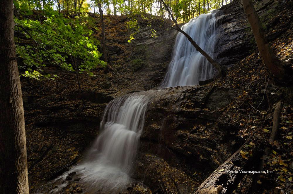
We returned to the car and set off for Sherman’s falls this was only a short distance further along the Escarpment. This waterfall had a good flow with a ledge that turned the drop into two shorter drops. From the bottom it looked like a single drop but if you climbed up the slope a few yards you could capture it in a way to show the split nature of the drop. The scene was surprising quite different from the two angles. Here the wind was blowing towards the waterfall so we didn’t have the mist problem like at the first location. This spot was also not as popular and we were the only ones enjoying the view though we did meet a group leaving as we arrived.

Once done with the second location, we drove back past our first spot and took a few side roads to find the recommended parking spot to hike to the third waterfall – Shaver Falls. None of us had been here before so we were truly exploring the trails and did in fact turn the wrong way at one point. But soon we were heading the right way and approaching the creek with the falls. Steve was out of time by this point and so had to turn back before he saw the twin falls. Mike and I continued on and were getting a bit concerned that it was a dud until we finally rounded a further ridge and there up a side trail was a lovely twin fall. We walked up the side valley towards the drop and captured a series of water shots but also a number of close-ups of various scenes along the side of the creek. We even spotted a larger frog that was resting at the side of the water. It was a lovely place and we gathered a good number of photos. Once done, the walk back to the car went faster than our way in as it was mostly down-hill and we didn’t make any wrong turns.

As we drove back to the main road we spotted a tree on the side of the road which was heavily covered in large red berries. They were quite large and were thick over the whole tree, it was quite a sight and so we stopped to get a few photos of it. Our next stop was for lunch and we drove back to the top of the Escarpment and further south to a place recommended by Steve. The sandwiches were great and once fed we returned to our exploring, we decided to travel the farm country and see what it would reveal.

Our first stop was to enjoy the wide-open panorama of a cornfield ready for harvest. The play between the beige corn socks and the vibrant sky with patchy clouds was amazing. We continued driving and came to a soy field with a very different tone to it. A tree out in the middle of the field had some lovely textures to capture. We made our way south and came by a marshy patch with some wild flowers between the road and fields, which offered some varying mixture of nature and farm. We also captured some close-ups of some wild plants. As we drove we stopped from time-to-time to gather some interesting colours.

Eventually we came by a small pond that offered us a marshy area to photograph. Here we did a number of macro shots of waterweeds and leaves floating on the water. We spent a significant amount of time here enjoying the warm sunshine as the light played off the water surfaces and the floating debris. Soon both Mike and I had captured everything from telephoto shots across the pond to macro shots of leaves on the roadway! It was a fun area and we were both glad we stopped, backed-up and parked to take a few moments to see it. We then started a slow return to home and soon found ourselves crossing another stream. Just off the bridge was an older single lane bridge that looked like it had some secrets to tease out. We parked along the road and started exploring the area. Here we started with some more macro shots of the plants and then moved on to wider views from the old bridge. It was a lovely scene to enjoy. A leaf covered trail led away from the road along the side of a field that looked very inviting. We followed it for a short distance as it made its way through a grove of large coloured maples. Once back at the car we decided it was time to head home so I could get ready for dinner with my wife’s aunt. We decided we would start in the farm country with tomorrow’s travels.

Mt Woodside

I was hoping to find a second easy access location to test out the new tire chains. So when the thought of Mt. Woodside came to mind I quickly made plans to head for it. And if we run out of road before daylight we were close to the west Harrison for continued driving. We may even get a bonus of having a Paraglider taking off. So Ethan and I got things ready for a quick drive to the mountain and once there we started up the FSR with little delay.

Soon we were driving through patches of the new snowfall while enjoying the clear skies, warm sun and slowly expanding views of the Fraser Valley below. We came past another vehicle where two chaps were busy hunting. They had been roaming a side road but were now parked and were out of the truck chatting. We continued past and on to the side road leading to the launch site. On the access road we saw many tracks of people walking in but no actual vehicle tracks. Despite that ominous sign we started up the side road as it didn’t look all that difficult. As a safety precaution, we decided to put on the chains at a level area before the snow got deep. It took us only a few minutes to get the four chains in place and then we continued up the spur. There was a steep section of the road dropping down to a parking area for the launch site. The chains gave us great traction on the way down – no sliding at all.

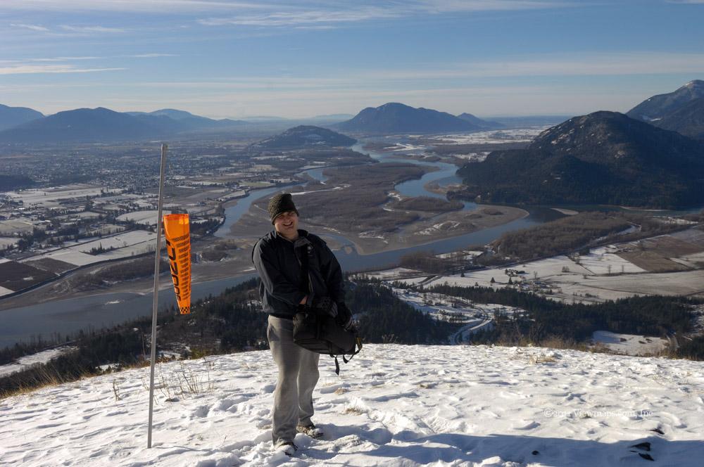
The sky was clear on today’s visit and we had a phenomenal view of the Fraser valley and the Harrison River. The haze was low and we could see most of the way down the valley towards home. The mountains were all beautifully capped in fresh snow and gave us a sharp image against the blue sky behind. The sun was out with a bit of warmth to finish off the scene. It was a great place to spend a few minutes and to drink in the beauty of the place. But it was still cold out and before too much time had passed, I was getting a bit chilled in the fingers. So we decided to head back to the truck and start exploring some of the upper sections of the road.

We easily drove up the steep slope out of the launch area without even spinning the tires, the chains gripped that well. Once back on the main line we continued up the mountain. The snow here was broken by a single vehicle track that we followed as the snow depth increased. As we neared the peak the road split, the left continued up to the peak and a radio relay station but had a locked gate. The right continued along the flank of the mountain and so we started down that branch. The tracks we were following ended here and so we were now driving virgin snow! It was lovely and the truck had great traction pushing through the deepening snow drift. We continued for some distance but as the snow depth slowly increased we started to have a few places where we were spinning a bit before the chains dug through and grabbed the road.

Soon we reached an area that started downhill and though we were still able to move we decided to park the truck and do a bit of snowshoeing. We packed up the equipment that we were not taking; I put the truck radio in cross-band mode and made a call to Carolyn at home to fill her in on the plans. We then started down the road on our snowshoes. It was a lovely hike through the virgin powder! Once around the first curve we were greeted with a cliff face covered in icicles. They were a very pretty sight and we stopped to admire the ice for a few minutes. We then continued down the road for a small lake that was off on a side road not far ahead. Soon we came to the side road which led towards Stacey Lake and we started up that path. It was only a short time before we spotted the frozen lake on our left 30 meters through the trees. We descended the short treed section and stood on the edge of the lake.

We noticed that the snow was resting on top of a thin sheet of ice which had water beneath and then a second more substantial ice sheet. It seemed solid enough so we decided to walk around the edge of the lake. Little did we know that after a short distance around, with the top layer being weakened enough by our weight, we would be breaking through it. That was a bit unnerving but It still seemed strong enough so we continued around though Ethan was now walking beside my path rather than in it. About a third the way around I spotted a new issue for us.

When I stopped to take a few photos I noticed that a rubber guard on my camera was missing. Looking back along the path I couldn’t see it, so it was lost and I would need to have Nikon Service put on a new one. We continued around the lake with little trouble except for the occasional crack as we broke the ice in a few places. Once back to where we started, I continued around a little distance to look for the rubber piece but didn’t spot it so I turned back and started to leave the lake and noticed the black rubber at the edge of the lake where we first entered! So I got the piece back, now it needs to be glued on.

Our walk back to the truck went quickly and we got back inside where we could get a bit of warmth. The heat was well appreciated as we were started to get a bit chilled in the feet. The lake surface was a bit wetter than we thought at first glance. The truck had no trouble backing out of its spot and soon we were turned around and making our way back, at least while I wasn’t stopped to take photos. We followed a few more side branches and tried a few steeper cross-ditches that grabbed at our rear bumper but the chains gave great traction and we weren’t slipping anywhere even when moving up slope on a sheet of ice!

Once done with a number of side roads we decided it was getting late enough to call it a day and so we drove down to where the chains weren’t needed and we removed them. Only one had a bit of ice on the catch which needed a bit of tapping to free. On looking them over we found no damage to them, they easily handled anything we threw at them today. We then left the road and started for home along the highway. The rest of the trip was quite uneventful except for me needing to take over driving as we had worn out the youngster.

East Harrison and Clear River FSR’s

On our previous trip we ripped apart the tire chains we were using as they were just too light for the type of driving we were doing. So I picked up two pairs of heavy chains before Christmas for our travels and today we planned to find some roads to test them on. When I woke up this morning it was snowing hard outside and the ground had a couple inches of snow! A bit of an ominous start to the day, but we continued to get ready and planned for a full day out. By the time we had driven a few miles east the snow was gone and we had clear driving to the logging road. 

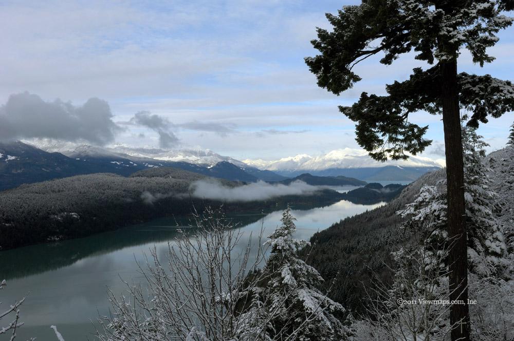
Geoff and I settled on the East Harrison area for our chain tests – it has been quite some time since Geoff was there and I knew we would have multiple side roads to pick between for our chain tests. The drive to the start of the East Harrison went quickly but the FSR itself was deep in a few inches of fresh snow. That certainly made for a pretty start to the drive. There were a few vehicles already in and their ruts made life a bit easier for us. As we made our way north, we stopped at a few early spots to capture the grandeur of the fresh snow on the trees. After 7km the road drops back to lake level and the snow cleared and we had bare road for the rest of the drive on the East Harrison.

We stopped at the viewpoint by the Bear Creek log sort area to gather some winter shots of the mountains. There we chatted with a guy who had spent the night. He suggested we try the Clear River road and try for the Hot Springs. I have wanted to return to the site for some time so the idea seemed good and we set off for it. The drive between Bear Creek and Silver River has always been very rough and we were expecting that, so it came as a welcome surprise to find the road much upgraded and the drive went quite quickly as a result. Soon we arrived at the entrance to the Clear Creek FSR and we started up.

Well we were soon compensating for the easy smooth drive to this point. The Clear Creek FSR was very rough and it slowed down our drive significantly. We stopped not far into the road for a look around and there we hear a radio call from Carolyn, so I updated her with our plans and then continued in. I was actually quite surprised to have contact way back here on that repeater as moving the truck a foot killed reception. It was quite a coincidence to have stopped in the one spot with reception when the open space was only a foot or so wide!

Soon we were gaining elevation at a rapid pace and saw the first snow on the road. Once it was a few inches deep we decided to put on the chains. The process went quite quickly and for our first time we did really well. They are quite heavy and solid but they fit well and go on with little trouble, though it was definitely helpful that we had practiced with a spare tire at home earlier. Shortly after putting on the chains the snow cleared and we were driving gravel for a few hundred meters! Go figure. But we continued to climb and the snow did get deeper. There was a rut we could follow but we were generally making our own path. The chains gave us great traction and they dug in very well when we spun for a few moments. We reached the hot Springs to find one other truck and an ATV parked just below the tubs. 

I got out and walked over to the tubs to chat with the ATV driver who was enjoying a warm soak. His name was Kevin and he comes by there in the winter when there are no crowds there, summers are a real zoo. The tubs are fed via black PVC pipes and I decided to follow them to where the actual spring is. The spot was only 15 meters up slope from the top tub so I was able to get a bit of a look at it though not much could be seen. I returned to Geoff and the two guys from the truck who had gone for a soak earlier. They related how they had come out a few years back and rebuilt some of the walkways and structure around the tubs and later found some idiot burning a campfire on top of one of the wooden paths! It seems this spot attracts some pretty foolish individuals.

After chatting and taking some photos we started back up the road to the East Harrison. We followed the other truck – they had to take a second run at one hill to get over but we could get over it without even spinning the tires thanks to the chains. On our way out we were met by two trucks and an ATV heading in, now that we had cleared the way, driving was much easier for the less equipped.
When we arrived back at the spot Carolyn contacted me earlier I tried h

r and was able to get through though we had to relocate the truck by a foot as Geoff let the truck drift mid conversation. Propagation was that spotty back here. Once back on the East Harrison we followed the two chaps we met and they stopped a ways down and flagged us down. They pointed to a cave they had mentioned to Geoff earlier and so we all decided to get out and explore it a bit. It was an old mine shaft that went straight into the side of the mountain for around 150m with a small bend 2/3 of the way in. The ground was fairly flat but was covered with water from seepage. Through the water we noticed narrow gauge tracks along portions of the floor that were still in place. We didn’t have great light with us but we did make it to the end od the shaft and there we turned off all lights to experience the total blackness the cave environment affords. It really is an amazing darkness.

Once done with the mine, Geoff and I continued on to the Silver River sort area where we stopped to gather a few early sunset photos of the peaks across the lake. We then continued along to the Bear Creek area where I took a few more photos of the approaching sunset. I had hoped to talk to the guy we had met there earlier to let him know that we had made it to the Spring but the campsite was packed away and he was gone. The Forest Service had added a number of improvements to this stretch of road to accommodate the campers that flock to the beach in the summer. There were widened areas for parking all along the lake; I guess they were getting in the way of logging trucks!

We continued on out and made really great time thanks to the much improved road surface. We did chase a young Bobcat at one point as it tried to get off the road and into the bush. Later we waited for a doe to saunter across the road. So we saw some wildlife to top off an already interesting drive. Once off the FSR the drive home went quite quickly and without incident. In reflecting on the trip, we decided that the chains are easy to use and do provide much improved traction. They seem to dig in to the ice and ground when needed and are much stronger - not breaking any links on the trip. I’ll give them another try this Friday with Ethan driving and see how they hold up on that trip.

Sumas and Fraser Rivers

I was looking forward to getting out a few times after Christmas as I took the week off with that expectation in mind. Today I had Nicholas available to drive for me and as he is my least experienced driver we needed to travel easier locations. I decided to try Sumas mountain and then along the Fraser for some water views followed by a run up Mt Woodside. Our first stop after fueling up was Starbucks for a warm coffee but when we drove through the parking lot it was over full and not a spot to park, so we just kept driving and skipped the coffee. Our first destination was Sumas Peak so we set out for it. 

The road on the south side of Sumas Mountain was reasonably good, the first section presented the rapid growth Abbotsford is experiencing - a lot of it on the slopes of the mountain for the million dollar views. It was a bit convoluted to get to the Sumas Mountain road from the south but we made decent time and were soon climbing the south flank for the saddle point along the spine of the range. We took a few side roads along the way to seek out some views but didn’t find any good spots. We soon were on the actual road that went to the peak only to be stopped by a locked gate. The peak was closed for the winter! Very disappointing, so we returned the way we came exploring a couple more side roads on the way down. At one point Nick needed a stretch and pulled over onto the shoulder. On departing he found he was stuck! I had him get out and lock the hubs and with that in place the return to the road was no issue – a good learning experience for him.

Once off the slope we drove towards Chilliwack and found a park along side of the Sumas River. It was a dark skies designated park for the local astronomy club. I found some pleasant views of the river with Sumas Mountain as a back drop. Nick got quite excited as he spotted a new duck for his bird watching program. After gathering a number of images as I walked along the river bank we returned to the truck and set off for lunch in Chilliwack. It actually being lunch time and being near a restaurant, we decided to eat at one rather than buy a lousy sandwich, though more time consuming, it was a nice pizza. Our next stop was the Fraser River north of Chilliwack. As we approached the river we spotted a sign inviting us to a regional park that borders the river, so we accepted the offer and made our way to it. We pulled in to the boat launch area and took a walk along the bank; I was able to locate a number of decent views. Once done with the park we continued along the river and stopped at a sand bar where we were able to get down to and walk the river bed. There were some interesting exposed items of interest to shoot.

Once back at the truck, we continued east along the river and soon came upon an access point where we could get the truck onto the river bed. We had a short water crossing to get across and then we had a huge area to drive shared with other 4x4’s and numerous ATV’s. It was a big area with all sorts of users. We drove upstream to where we had a phenomenal view of the river further upstream. The location was incredible and offered some spectacular sights with the silvery colour to the day and the sun peeking out sporadically to give a glimmer to the river. I will need to come back here regularly under different lighting conditions as it was so lovely.

We then returned to the road system and continued our way east through the sloughs. They are quite numerous and extensive through here and offered many possible spots for great photos but I wanted to get to Mt Woodside so we skipped past some lovely areas. This area definitely needs a visit in the Spring when the new growth is fresh but still small. – So much to do and see in this region, it is quite over-whelming.

Soon we were crossing over the Fraser to Agassiz and then on to Mt Woodside. Just after turning onto the FSR we stopped to lock our hubs. There we met a chap named Gary. He is a paraglider and was hoping for a lift up the mountain to the launch point. So we re-arranged a few items and loaded him into the truck. This being Nick’s first drive up a steep road, I was concerned how he would fair. He did quite well on the steep slope up the mountain and was enjoying the drive. Soon we reached the branch to the launch site and made our way along it, at the end the road is quite steep and the high front of the truck made the road invisible for a few yards, It gave Nick a bit of a scare descending that segment but he did it and without any incidents. 

Once at the site we parked and Gary set out for the launch site. The view was amazing but we were soon engulfed by cloud. There were brief openings that gave us glimpses of the valley below but the cloud was getting thicker with some freezing rain hitting us sporadically. After waiting about 20 minutes and sunset coming, we decided to head back down. Gary returned to his truck with us somewhat disappointed he didn’t get a chance to fly today. Part way down we broke through the clouds and I had some great views of the valley to capture. So I did manage to get some photos from the hillside.

At the bottom we said good-bye to our guest and set off for home. We did take a brief detour at DeRoche where I noticed a logging road on the map. It was being actively logged and so should be a viable road to try another day. As we made our way to Mission, we came upon a detour off the highway due to an accident. The detour ran parallel to the highway and we had a view of the accident scene from across the fields, it looked like a car had driven into a gas station. We were soon back on the highway and approaching Mission. After re-crossing the Fraser Nick needed a break from driving so I took over and finished the final leg of the journey for us. A great day with several nice locations scouted out for future visits.

Subscribe to 2010