
Chilliwack Lake Beach

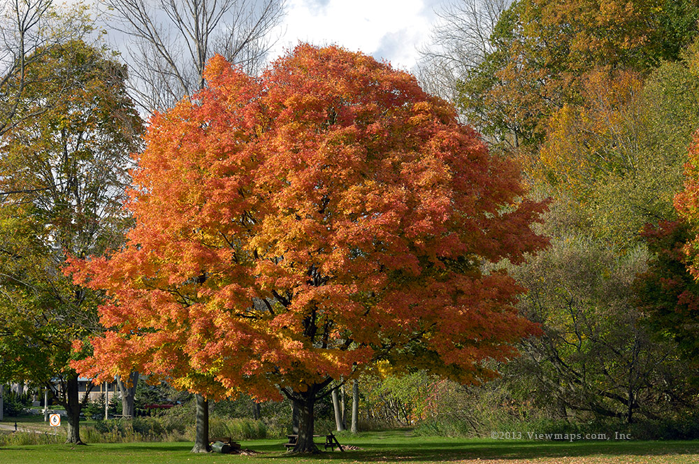
I haven’t been out in the back-country since mid-September, except for my drives in Ontario, so I was definitely feeling a need to get out and enjoy some fresh air, sunshine and scenery. I didn’t want to do serious driving on this trip just to get out and enjoy some quiet time in nature. As it had been sometime since I was down the road along Chilliwack Lake I felt it would be the perfect place to spend a few hours.

Ethan arrived around 8:30am and we loaded our gear into the truck and set off for the coffee shop. Done acquiring the coffee mixture of choice we set off for Chilliwack and soon we were starting down the Chilliwack river road. It was not busy and we made good time along the road. As we made our way along the valley we passed numerous pockets of heavy frost interspersed with dry patches. The sun has only a short time working over any single spot along the road this time of year so places can continue to build up frost for long periods and it often starts to look like fallen snow. I was glad it was only frost as the last time we came to visit the lake we were stopped by deep snow at the start of the forestry road.

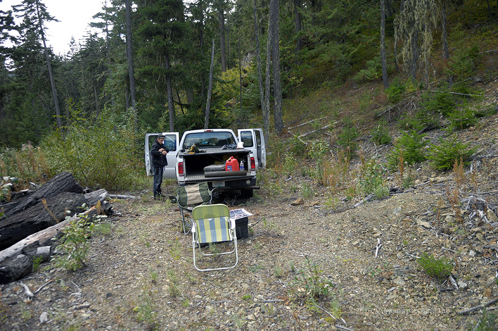
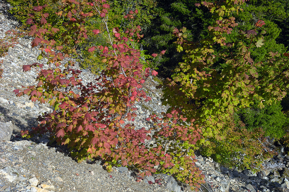
This morning the sun was out and the forestry road was clear. In fact it was nicely levelled off and the horrendous pot-holes filled in. The drive along the lake was actually quite pleasant this time. It seems that there is a small logging area being worked and as part of their operation the road was improved. As we made our way down the lake we stopped at a number of spots to enjoy walls of icicles of various shapes and lengths. There were some very impressive cliff faces full of icicles! Eventually we had worked our way down to the beach area and there we found a vehicle parked next to the access path. We pulled in next to them and got our gear organized so we could get everything we needed to the beach in one trip.

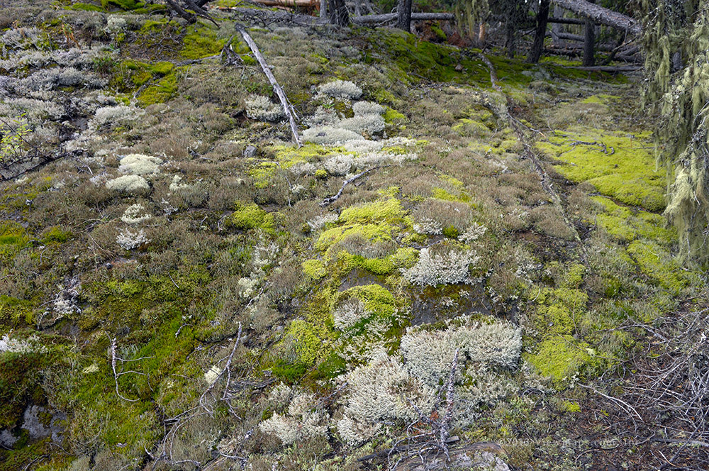
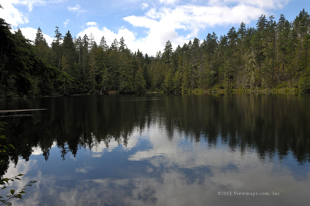
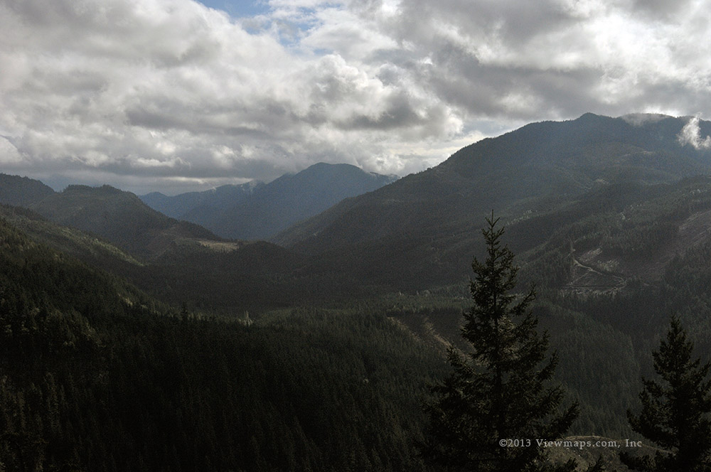
The first section of the short trail was steep and slippery so we had to go slow and pick our steps carefully lest we go for a bad tumble. Once down to lake level we followed along the side of a small stream and then walked across the broad sandy beach to a spot a few meters from the lake. Here we set up our chairs and relaxed. I took a few initial photos but then just relaxed in a chair for a few minutes, soaking in the freshness of the place. Though the air was cool the warmth of the sun was pleasant and we just felt great sitting out there looking across the lake at the peaks on the far side.  After a few moments of reflection I got up and started to walk south along the lake shore.

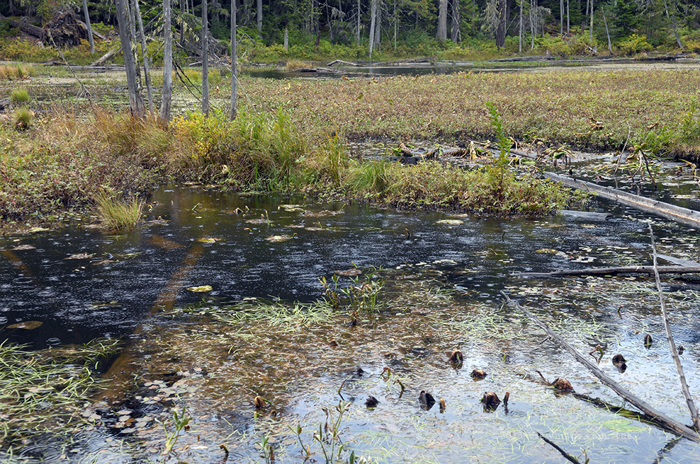
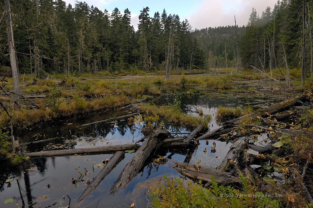
I had never visited the area to the south of the big tree log that was lying across the beach. This delta area was created by the sediment from Paleface Creek and is fairly broad with a few streams running through it. I stopped to take photos of the log positioning Williams Peak in behind to give a variety of interesting views. Finishing with the log, I continued down the beach trying to avoid soft spots and sinking in too deep in the soft sand. There were some interesting photos along here and at the furthest point I could safely walk to I saw a A-frame a little ways further down the shoreline. The A-frame has road access but there is a locked gate keeping people out. I then turned around and made my way back to Ethan and then continued past to the rock causeway where I gathered a few more photos. Ethan had started cooking lunch by the time I got back to him so I didn’t want to go much further.

After lunch I replaced my small zoom lens with my telephoto and then set off to retrace my path from earlier. This time I was looking for new sights with the longer lens. It was fun seeing just how different the place looks with the longer lens. I found some shiny sections of the beach to be particularly interesting with the longer lens. I also go a better shot of the A-frame this time. Eventually I had worked my way back to Ethan who was reading while sitting next to the lake. I packed up the camera and sat down for a bit more peace and quiet. By now the clouds had thickened and the sun was not as bright and warm so we were starting to feel the chill. Before we got any colder we packed up and returned to the truck.

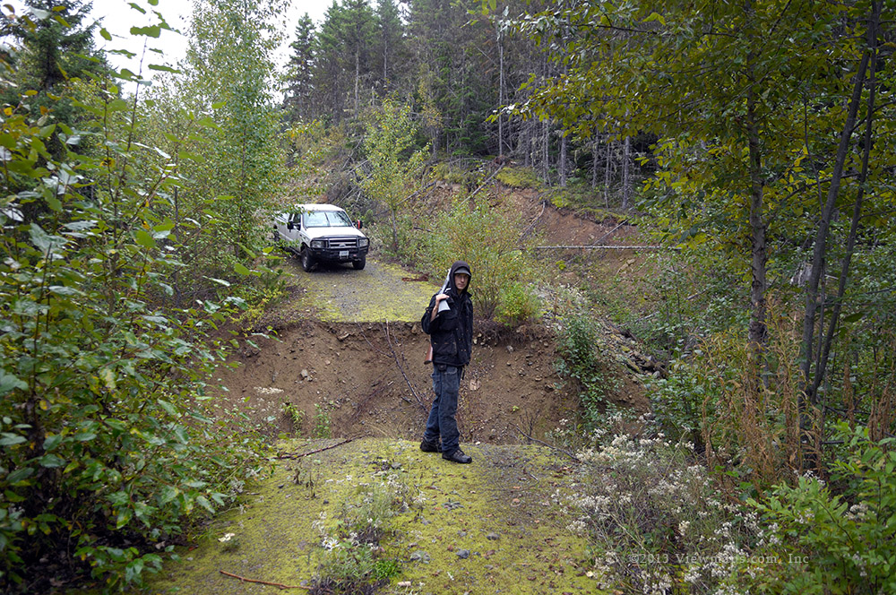
Rather than just head back we continued down the road to the furthest point we could drive which is the bridge over Depot Creek. The road was closed here to protect the south end of the lake. Rather than find the cement blocks we found a forestry gate and a watchman who was spending his time in his trailer. I had chatted with him before on the West Harrison so we spent some time talking about his time here and how dark and cold it must be at night. He explained that they were doing a last bit of logging on a stand on the north slope just across the creek. Once done hauling it out they plan to remove the bridge to permanently protect the area to the south. They will be replacing it with a smaller foot bridge.

After chatting for a while we started back up the road and made our way out in good time with the improved road. We continued along the Chilliwack River Road and soon were in Sardis where we picked up a second coffee for the trip home. It was a lovely afternoon and just the perfect outing for my mood and need to regain some back-country sights.

John Pearce Park & Duttona Beach (day 8)

Today was a short day for driving. Carolyn joined me and I wanted to share a couple of spots with her that I quite enjoy. So we set off for the John Pearce Park stopping only a couple of times for some colour photos. The day was mostly bright sunshine so it was a good one for her to come along.

We arrived at the park in good time and we walked the short loop road from the locked gate to the picnic area. From there we walked along the fenced cliff face to a spot where we had a nice view of the lake. The cliff is quite undercut in places so the fence is probably a good idea. After enjoying the view we back tracked to the picnic area and then returned to the car following the loop road around the far side. The leaves were quite deep in places and gave us a strong crunching sound to enjoy with each step.

Our next stop was Duttona beach where there is easy access to the shore of Lake Erie. We walked a short distance along the sandy beach enjoying the wind and fresh air. Then we sat in some lounging cars for a chance to soak in the beauty. Before returning to the car, I walked the beach and gathered a few photos. As it was now lunch hour we decided to find a place to eat as our next order of business.

We drove up to the Talbot Trail and headed for Wallacetown where we found a small cafe that had a gas bar and doubled as the post office. It was quite busy and we had a decent meal and some very nice homemade pie. We chatted with the owner who told us he had lived in Burnaby for a few years and was familiar with white Rock. It was a pleasant friendly place and we will return again. Done with lunch we took a direct path back to the port and there we enjoyed the afternoon. I went for a short walk to the end of the road and the harbour but didn't take any photos.

Central Elgin (day 7)

The forecast for the day was for it to be wet and so I had expected to stay indoors and just rest. So this morning I did just that but Carolyn wanted to go out for lunch then go to the wool shop to their weekly drop-in. So we found a spot for lunch and I then dropped her off. The weather was quite cloudy but there were clear breaks so I started looking for sights to capture as I made my way back to the inn.

It was going fairly well and the weather was holding up well enough that I thought of continuing to Hawks Cliff for my annual visit. Along the way I was just keeping ahead of a wide thick rain cloud. When I stopped to gather a photo it would sneak up on me and block the sun. I would then drive off and find another scene and have just enough time to gather a photo before the cloud caught me again.

I finally got to the cliff and parked. There were a few people watching the birds but it seemed that they were heading out as the weather darkened. I grabbed my camera bag and walked to the cliff edge and there I looked out over the lake and watched the play of the light, clouds and rain on the surface. I took a number of photos while I enjoyed the scene. Looking towards Port Stanley I could only see the trees darkly in the gloom but I saw bright sun off in the distance slowly coming closer so I decided to wait for it to arrive at the port and take some more photos with the trees lit up. As I waited the main storm cloud passed over dropping a bit of rain but not really very much so I just stayed out there waiting for the right light. It brightened a few times but it never really got full sun before I had to move on.

It was now 3pm and time to try Ralph on the radio. The irlp wouldn't connect again so I wasn't able to talk to him. I then drove some of the back roads towards Port Bruce finding a few spots of nice colour. With the main rain cloud now out over the lake, I was able to get much longer periods with the trees in the sun.  I slowly worked my way to the smaller port and then back up through Sparta and on to St. Thomas to pick-up Carolyn. We then drove back to Port Stanley where we bought a few groceries and returned to the inn for e night. So in the end I had a decent drive through the back roads after all.

Sunnyside Mushroom Farm

The Sunnyside Urban Forest grows a wide variety of colourful mushrooms in the early fall. The western side of the lower portion of the park has the densest area for mushrooms and they are easily seen from the trail. I suppose there would be even more if one were to wander off the path. The variety along the walkway is surprisingly varied and numerous and a quick walk along the trail is more the sufficient to capture a number of nice shots. Every year the arrangement and location of the various fungi change and offer a whole new look to enjoy. It really is a shame that most visitors just zip right by the sights or worse just knock them over in their travels.

This year I only had one opportunity to get out before I left for our Ontario adventure. So I packed up some minimal gear and set out for the parking area and the start of the trail along mushroom corridor. It didn’t take long to find my first clump and then they just kept showing up as I continued along. The only downside of shooting mushrooms in a park is the funny looks one gets from those walking by. They don’t seem to get a picture of the actual beauty of these poor little wonders.

After I made my way down the main section of trail with the densest collections I decided to wander back up through a side trail in the middle of the park. Though this is a pleasant walk, I find it to be quite sparse in mushrooms and today was no exception. I probably should just backtrack along the main section next time. It was a quick visit but I did manage to find a nice selection to share here. I hope you enjoy the photos and perhaps even develop a bit of an appreciation for these little guys.

Southwold and Dutton (day 6)

Yesterday was a dull windy day and I didn't feel much like driving and looking for photos. The Tuesday forecast looked to be better and so I spend the day resting and reading a good novel. So here I am on Tuesday, the sun was peeking out from the clouds and after a decent breakfast I set out for a trip to the west.

I got my camera gear loaded and set out across Warren Street and over Kettle Creek for the open country. On climbing out of the harbour valley I had the open fields before me criss-crossed by patches of trees used for windbreaks and general wood stores from a past era. It felt good to be driving out here again, but I wasn't seeing much colour yet. I soon was reminded that I needed to wait for the cloud to pass and for the direct sun on a forest patch for the strong colour to emerge. So for the next few hours I was driving looking for muted patches of colour and then waiting for an opening in the clouds when the sun shone on the patches and I could quickly grab a few photos.

This pounce and wait game continued along the road as I made my way to the small church on Fingal Line where I stopped to roam the yard and look over a few of the monuments in the adjoining graveyard. The clouds were getting thicker and I ran out of patience here before a good clearing shone through. I continued my drive west to the St. Peter's Anglican Church cemetery. Here I parked and got out to look over some of the stones. The largest monument was for John E. Pearce for whom the bordering park is named. I also looked over the memorial for John Talbot who was the pioneer who built up the region 200 years ago and who's name appears all over the region.

Next I parked at the adjoining park and waited for noon when I was to make an irlp contact with Ralph in Vancouver. Though I had a good signal from the repeater I didn't seem to have a strong enough one to signal the irlp node and so I was unable to bring up the link. After a number of tries I packed up the radio and set out on foot to view the park. I headed to the lookout over Lake Erie first but didn't find the view much to shoot this year. So I wandered the forested area of the park and gathered a few photos before returning to the car for the return trip home.

Rather than head straight back I travelled a few more side roads. As the afternoon progressed I enjoyed more breaks in the cloud layer and I was able to resume my pounce and wait game, gathering some more colour shots of the local forest patches. By the time I had travelled back to Port Stanley I was ready to call it a day even though the sun was now out more than hidden. Hopefully I will get a few more days with sun before I return home.

Rockway & Decew Falls (Day 2)

Our flight to Toronto went without any troubles, only some turbulence to add a bit of character to the flight. The drive to the B&B last night went smoothly as well. It seems that the drive around the lake to the Grimsby area gets shorter and faster each year. That's good I guess as we waste less time en-route. This year we are staying at the Crown Ridge B&B for a change. It is very nice and though our access code didn't let us in, an onsite family member heard our difficulty and let us in.  So this morning we arose to a nice breakfast and please conversation with the hostess.

Done with the gourmet meal, Mike arrived and after a few minutes chatting we set off for our journey. His SUV was broken and so we had to drive the short distance back to his place to drop off his car and then we could head out using my rented BMW.  This year Mike hadn't planned any destinations so we had a few moments of thinking and we decided to head to the Balls Falls area to take photos of the waterfall. It took a bit to get out of Mike's yard and on to the road but once moving we quickly climbed the Escarpment and left the city behind.

We drove straight to the conservation area and soon we were driving down into the ravine but we discovered a serious problem. They wanted money for the visit! And for a short stay it was not a reasonable amount so we decided to skip it and drive some backcountry. While driving Mike looked up his map and found another waterfall – Rockway Falls - just a bit further east. We had just driven past the road to it but the next one allowed us to backtrack to the correct road.  On the side street we drove past a vineyard with wines that had huge clumps of brown grapes, they were quite different from the normal black ones we see. Soon we arrived at the small community hall next to the falls and we set out for the west side of the ravine where there is a nice view of the waterfall from above.

Rockway falls is very pretty and we gathered a number of photos from the top of the rock face. It's quite a drop should one step too far. Done with the above photos we returned to the car and the east side of the creek where there is a trail that leads away from the fall but allows one to descend to the creek and then one can backtrack to the waterfall. We were taking our time along the creek as there were so many amazing scenes that demanded our time. Eventually we arrived at a good viewpoint of the waterfall and we were able to capture some shots from the bottom. Our only problem was that the sun was now directly behind the waterfall and made shooting quite challenging. When we had finished collecting photos we returned along our path in and soon we were resting back at the car.

We decided to continue east to St. Catherine's and look for a place to eat lunch. After a few false turns we found a small restaurant that served Shawarmas. We each ordered one and found it to be a lovely meal. A nice side adventure for the day. Once we were done eating, we continued back along Pelham road and took a turn to Decew falls. Here we parked in the small lot and made our way past the old mill buildings and looked for a good view of the fall. Unfortunately the views were all blocked by trees so we continued along the gorge trail to a place where there is an access to the creek below. This short drop requires the use of a rope to get over one steep section but once down, this part the walk along 12 mile creek was pleasant and we were soon at a great place to take photos of Decew Falls. After taking a quantity of photos we packed up the gear and set off for the car. I found climbing back up the rock face easier than the down trip. A few minutes more we were back to the car and ready to head home, it had been a lovely drive and we had two amazing waterfalls to enjoy.

October 2013

Submitted by admin on 31 October 2013

Another pleasant visit to the Fall Colours in Ontario. This year  the weather was not very co-operative. I went driving six days but on two of them I took no photos thanks to the rain and overcast skies. 

Anderson River Heights

Today was the day that I had scheduled for a hike to the summit of My Seymour with my radio club pals. Unfortunately the weather had turned wet and so that hike was postponed a few weeks. So faced with an open schedule and with Geoff wanting to get to the hills, I decided to return to the Anderson River Area. We both wanted to find the road we missed previously and I also wanted to drop-in on a rocky cliff area where the fall colours are bright reds and oranges. So the Anderson was a good choice and not overly distant to get to.

Our morning began with Geoff’s arrival and him taking a few moments to play with our 15 week old Dane puppy Equus. She is hard to resist at this stage. Next we started reloading the truck, it had been unloaded for Geoff’s camping trip and we hadn’t put back most of the equipment. That took a few moments and some decision making as we decided to strip out a few items we weren’t using. Soon we were on our way to the coffee shop for a fix of the main drug needed for these adventures. Done with Starbucks it was off to Abbotsford to fuel up on the cheaper gas. Then we had clear sailing all the way to Spuzzum and the start of the Anderson FSR.

Upon arrival at the road we noticed immediately that the road was looking good but also well-traveled which raised a bit of concern. We prepared the truck for FSR travel and off we went to find our missing road. We soon came by the fork where the left branch heads up the ridge to the transmissions lines while the right continues south until it reaches a narrow gap in the ridge paralleling the Fraser before heading in.  We went left and just past the fork we came by a staging area for construction workers and a whole lot of safety information along with a new road frequency. The place looked busy but deserted. We didn’t have that frequency in our radio so I just dialed it in on my Ham radio. Immediately we picked up some activity – the guys were busy working the road and lines just over the ridge. Though muddy, the road was in very good shape and we quickly ascended to the ridge being passed by one truck coming down.

In listening to the radio we learned that the team was having trouble with one of their robotic tools which we found a bit amusing. Once on the ridge we followed the road north and after a couple kilometers we came by a branch, the main road continued right and down but we went left to regain elevation to the ridge. This far we had gotten last time but soon we would reach another fork and on that trip we chose the lower right-hand branch which dead-ended very quickly – we never did try the left fork. So left it was for today and we continued along on a decent road but with some taller growth down the centre line. By now we were encountered some showers and the road was wet along with the trees, it also made it darker and feel a bit foreboding.

As we came around one darker corner with trees overhanging the road, Geoff made a quick stop and jumped out of the truck calling me to follow. I grabbed the camera and followed him out, he pointed out a large clump of mushrooms in the centre of the road. I went back to get my flash and took a number of images. Geoff meanwhile had wandered off the road and found a number of reddish mushrooms and clumps growing from a log.  We spent a number of minutes gathering photos of the fungus with all the varied colours that they were showing. The wet rained-on-look made them shiny and added an interesting additional texture to the natural look. After gathering many photos of various clumps we returned to the truck and continued up the road. We stopped a few more times when we came by some additional specimens.  We were quickly making our way north along the ridge to Gate Mountain when we had to quickly brake thanks to a wide wash-out in front of us. This gap could swallow the truck whole and make for quite an extraction issue. On examining the gap on foot we noticed a small path to the upper side of the gap. Here was a small footpath built up a bit to enable walkers and possible bikers a way across the washout. Much too narrow for our truck.

Geoff crossed over and noticed a small lake just off the road and so I came over with camera gear and took some photos from a few spots along the edge. As we made our way along we found some interesting small plants to take photos of. The rain was on and off and we were getting wet so we returned to the truck and started backing back done the road. This continued for a distance before we found a wide spot to turn around at. A short way further back was another fork with a more overgrown road leading off further up the slope. We turned onto it and drove to a wider clearing and the effective end of the road. Here we parked.

We looked around and saw a short but beautifully moss covered cliff to our west. It was so interesting that we decided to get out and climb up to the top of it. This took only a few minutes and soon we were at the top of this small cliff enjoying the amazing colours of the many varieties of moss. When seen as a whole field, the varieties, colours and textures of moss can be very pretty. Looking down the far side of the cliff we could see a lovely moss blanketed open forest which was so inviting the two of us just had to get down there to explore it, we could hear frogs in the distance and that was calling us along to find the pond. We had my GPS in hand so we felt we could safely get down there and enjoy the open forest floor and see what was there.

As we made our way along the forest, we came by a trail which lead roughly in the direction of a small lake marked on my gps map. We decided to follow it and see where it went. The trail was actually quite well trodden and easy to follow and there were a few branches going many different directions. We followed what seemed the main path up the next rise and then down to the lake. We walked it that far and found a very lovely lake area which would be an amazing camping spot. So secluded and stunningly beautiful. As we hadn’t really come geared for hiking we decided to go no further and to return to our truck. The way back seemed to go so much faster than the way out and soon we were resting back at the truck. The sun was popping out from between clouds and the clearing was quite warm. Geoff was thoroughly enjoying the spot and marvelling at a dragonfly that was busy hunting the clearing around us. It was now around 1:20 and so we decided to eat lunch before moving on.

The rest and quiet felt good and we really weren’t in a hurry to leave. Geoff decided to set up a target and took a few shots getting near bulls-eyes with each attempt. He found his one riffle had lost a screw and so he didn’t shoot it lest it get damaged. Then we packed up and started back down the road. I wanted to drive over to the main road where there has been some amazing fall colour in past years and so we drove back down from the ridge to the very first fork - almost at the beginning of the main FSR. It didn’t really take all that long to get back to the cliff wall section with the red maples but it was a bit early and the leaves were just starting to turn. Another week or two are needed to get good colour here. Geoff did a bit more driving hoping to see a Grouse but they were all well hidden and so we called it a day and started the drive out. With Geoff’s work and school he was now quite wiped so I took over driving for the next segment and continued along the highway to the town of Hope.

After picking up a coffee at the Blue Moose Café we got back onto the highway heading home. About 20km out of Hope we learnt that the highway is closed not much further ahead due to three accidents! We quickly exited at the next road and returned to Hope to take highway 7 to bypass the stoppage. Apparently some people ended up being stopped for two hours! We were soon in Agassiz in a long line of cars which were now pouring down this route. We headed back to the highway and once on it the road was empty, it seems we were amongst the first to get around the stoppage and the road was wide open before us. We made very quick time all the way to our exit. Then Geoff took over driving the final bit home – even 16th was lighter than normal.  It is quite amazing how the traffic stoppage affects so much downstream traffic. It was a pleasant trip and we both felt relaxed from it.

Pitt Lake Loop

Today Ethan was joining me for an adventure in the hills and he wanted an easy hike to enjoy. I also had an obligation to attend a special birthday party for my Uncle this afternoon in Pitt Meadows so I thought I would look for a hike in the general area. On reviewing the various books I have, I found one called the Pitt Lake Loop. This hike was listed as being 12km in length with most of the distance along level dykes at the south end of Pitt Lake. I had seen this write-up before and thought it interesting. With the rated time and location it was a perfect fit for the needs of the day.

Ethan arrived at the house a bit before 8 and we got things loaded into the truck but it took a bit longer than usual as Geoff had borrowed it earlier in the week to take his family camping and though he unpacked his stuff, my items never made it back. So that took a bit more time than planned. Once everything we wanted was reloaded and hopefully nothing critical left behind we were able to head out around 8:30. Our first stop was of course - the closest Starbucks along the route.

Enjoying our coffee, we continued north along the highway and took the turn for the Golden Ears Bridge and up the roads leading to the south end of the lake. This area is very flat as would be expected for an area affected by tides even though it is fresh water. The parking area was already mostly full of trucks and boat trailers. It seems to be a very busy place for boaters who want to enjoy a leisurely time on the lake. Why some take huge loud speakers up there and blast the whole area with their noise is beyond me. We found a spot at the far end of the lot and once parked we were met by a woman who was warning us that a movie crew would be moving in on Monday and that we would need to be gone by then. I assured her we were only there for the day.

Well, the drive was done and now we had to load up the packs and put them on! So after a few minutes of checking and stowing stuff in the lock box we set off for the far end of the lot and the start of the dyke. As we passed the boat launch we could hear a few groups talking about who should launch next and how another was going to turn around so he could get his boat trailer in the needed position. It was a busy spot! We quickly wormed our way through the crowd and started out on the almost desolate dyke just across a locked vehicle gate from the crowds. Not far into the walk there is a 30 foot high observation tower available which we decided to walk up and look around the area. It sure is flat out here but we enjoyed the view and after a few moments of checking our gear we continued along the dyke.

At the far end of the dyke is a private property area and we were a bit uncertain as to the start of the trail but upon careful rereading of the guide book we found the indicated clues and soon we were crossing the initial over-grown area and into the forested area where the trail wasn’t hard to spot. It was not heavily used but still quite noticeable in the flatter sections. We also found sufficient spots flagged with tape that we could make our way along fairly confidently. Soon the trail started up slope and here it became much harder to follow, there were many places where trees had fallen across the trail and not just singly but often in groups. This really slowed us down as we had to find a way over or under each tree. The trail was also much harder to spot on the slope and we ended up spending much time looking for the next flag rather than just moving. The trail was now heavily overgrown in places which slowed us even further. We finally came by a small waterfall which was just dribbling a small trickle of water but it was worth the short side jaunt to get to a spot with a nice view of it. I was able to gather a few photos and enjoy the sound of the falling water. We then continued up slope along the trail and were beginning to wonder if we had missed some fork as the book seemed to indicate we should have come by a pavilion but none was in sight and with the trail ahead wending its way along a steep slope with fallen trees in the way, we were getting a bit uncertain about this adventure.

Continuing further we eventually came to a narrow spot with about 5 trees laying across the path, we had to work our way under and over the trees while descending the steep slope. It wasn’t easy but we got to the far side without incident, we were thankful though that the trail was a loop and that we wouldn’t have to do this again in reverse! Continuing down a bit further we finally spotted the pavilion! It was a nice solid structure with a view of the mud flats below, there was a bench to site on and even some bottled water for emergencies. The big keg looked a bit sketchy but there were some regular store bottled water stashed in the rafters. We found a map of the trail but it didn’t show the current position and we were a bit confused as to where we were on it as the book seemed to say we were in a different spot. But we enjoyed a nice break and then continued the trail.

The next segment of trail went steeply downhill to the marsh level and then continues out along the edge of the marsh to where a small side dyke juts out to join the main dyke. We got to the side dyke and made our way along it enduring stinging nettles and prickly vines as we pushed through tall grass. Then it was over a barbed wire fence as we could see the cleared dyke trail only a few hundred feet ahead, we were feeling not too bad and so we just pushed on as the hard stuff would soon be behind us. And then it happened, we spotted a wide gap of water between us and easy walking! This was not at all a happy moment! The mud flats were just too deep and thick with mud to make it safe to wade across here. If we had a rope it may have been doable but not with our current gear. So we turned back not at all excited about the now much longer path further south and with growing uncertainty of what it would reveal.

Having pushed our way back around the fence and tall grass and nettles, we arrived at a sign post showing the trail, though going south was longer it looked like it stayed at marsh level where we were making faster time than on the slope so we decided to continue south. Things were fine for the first couple hundred meters but then the trail disappeared and there were no markers. It’s possible we missed a turn and it went up the slope a bit but where we were there was no way forward. By now we were already tired and really in need of some rest and an easy return trail. So reluctantly we made the decision to turn back and follow the route we had come. We were currently at 8km and the way back would be up the slope and over those obstacles that were a challenge before.

Not much into the steepest section just below the pavilion, Ethan’s legs cramped up and he was suddenly in severe pain as we now inched our way forward. There were many points where he had to stop and I massage his legs to get the cramping under control. Then just before we got back to the pavilion, we disturbed some wasps and Ethan got stung on his sore legs a number of times! Now he was in even more distress and could barely make it to the pavilion. There we stretched out and rested for some time and finally ate some lunch.

Once finished eating we were feeling better and started out on the trail. But with the continued uphill climb, it was only a short distance further where Ethan’s legs cramped up again. We had to stop and wait several minutes for them to settle down before moving again. This pattern continued for the next 2 km’s. As we reached the last part of the descent to the level section at the start of the wooded trail, his legs seemed to settle down and he had much less trouble though it remained just on the edge of tightening up. Finally we came by the small gap just before the main dyke and we struggled across. Now we were safely back on the main dyke and we felt great at having made it through the challenging section. Just as we started along the dyke we came by a couple out walking who asked about the trail. He had done it years ago and stated how lovely a hike it had been. He was saddened to hear how it had deteriorated but was thankful for the information as it was a hike he was hoping to redo.

The walk back along the dyke went without further incident though it was still some distance, being level and graded the distance clicked by quickly. It sure felt good getting to the truck and being able to finally rest. We got our hiking gear stowed and the driving equipment set up again for the drive home. Ethan was in no shape to drive so I ended up driving at this point. Though late for the birthday party we still dropped in and had some time to relax and enjoy some family and food before continuing home.

So our 12km hike turned to 16km and went from moderate to difficult. The overgrowth really made the trail difficult though it wouldn’t have been too bad had Ethan’s legs not cramped. But considering the challenges we faced I figure we did quite well. At this point I don’t recommend this hike to anyone inexperienced.

Mt Mulligan and Anif Peak

We had originally planned this hike for the week prior but that day was forecast for rain and so we delayed it a week. Today was also forecast for 40% chance of showers so we were quite concerned about starting out. Fortunately, by the time we were parking our truck way up the slope, the weather seemed stable enough to set out. The first section of the hike was over clear-cut with minimal vegetation and we made good time but soon we were into the first of many large fields of ripe blueberries. Now the berries were huge and ripe and tasted great but they were close packed and dripping wet from the cloud mists we were walking through.  It didn’t take long for us to be quite soaked.

The route up to the summit of Mulligan was quite steep in places and we had to work around walls of rock. We were clambering up steep sections grabbing branches and small plants to pull ourselves up the damp slope. It was actually quite arduous work as we couldn’t see the ground most of the time and we had to avoid steeping into an unseen hole. Slowly we gained elevation and came upon a wide cleft just below the top ridge. Here Geoff spotted some interesting rocks and formations that led to much speculation as to the source of the rocks. After walking along the cleft we found a path up the final slope to the ridge, we had to push through a few thick clumps of trees to break through but we were soon looking down on the trail we had made enjoying the satisfaction of reaching the first summit. Unfortunately the views were not that good thanks to the clouds that were engulfing us.

After regaining our breath we continued along the ridge heading for Anif Peak. Our GPS track was not that detailed and showed the general direction so we started down the slope to the saddle point between the two peaks. Unfortunately we were trying to find a path that wasn’t too steep but we ended up heading too far from the ridge and got into some very steep and slippery terrain. It slowed us down as were continuously slipping and a bad fall could see one slide for quite some distance. After descending what seemed a long ways we felt we had drifted too far from the ridge and so we decided to head a bit back up slope to our left and regain the ridge. Here we found the slope less steep and we were soon at the saddle point between the two peaks. We hadn’t actually gone that far but the steepness sure made it seem like a long ways.

At the saddle we found a small pond with a spongy moss covered section that required a bit of time to explore. It was quite pretty and I gathered a few photos of the pond with the various trees in the background. After a bit of a rest we started up the slope to Anif. This time we tried to stay closer to the ridge line hoping it would be less steep. We made some gains but then encountered a bit of a wall and so we drifted right, we went further than needed as on our return we were able to stay closer to the ridge. But after scrambling up the steep wet slope grabbing roots and shrubs we were able to make it to a flat section here we stopped to eat lunch. We had gotten quite wet, cold and tired by this point and the clouds were thick around us and we weren’t sure we could continue the hike to the second summit.

We took our time to eat lunch and enjoy the warmth of the stove and heated soup. Soon we felt more energized and a bit warmer even though we had forgotten to load part of our lunch into our packs from the cooler. The clouds had also parted a bit more and so we felt less intimidated by the slope before us, I was actually able to get glimpses of our truck far below on the slope of Mulligan. We looked over the route on our GPS and determined that we had only around 180m elevation to gain and were only 750m from the summit, so we packed up and pushed on over the next section.

The way forward came in chucks of very steep sections followed by wide gaps where we could regain our breath and plan the assault on the next wall. After around 4 of these small ridges we reached a wider one with a higher wall just below the final sub-peak and the start of the top ridge line. Geoff wanted to go up the right side of the wall I the left. But after more study we went left and soon we had reached the top ridge and a gap between the main peak to the south and the sub-peak before us. We walked between the two rises as the one between us and the summit was a sheer cliff face and we had to find a way around it. Fortunately the far side of the ridge had a gentle slope up to the top and we had a short walk along the ridge to the summit of Anif.

We stayed for 20 minutes or so on the summit hoping for the clouds to clear enough so that we could enjoy a nice view of Sky Pilot but we never did get a glimpse of it. We did get brief views of Mt. Habrich to our South West and could even make out the top of the Chief far below to the north-west. Done with waiting we started back down the path we came up looking for a few simpler spots down the steep sections. We followed a bit straighter path on the way down to the saddle point, generally closer to the ridge line but even here I went for a bit of a slide at one steep area. Fortunately it was in a heather field and I was able to grab a few plants before gaining any speed on the way to the next flat section.

Back to the saddle we stopped to look over the small pond a bit more and walked around the far side of it. Here we found some deep foot prints from a bear, and the print wasn’t all that old. We then started on down the slope from the saddle to the end of the old road. This slope was much like the upper part that we were descending earlier but this was more open and we had to wade through 2 to 3 foot high mountains plants as we very slowly picked our way down to a pile of logs I saw below which I assumed would be at the end of the old road. The ground was very uneven and had many logs strewn across it all of which were hidden from view thanks to the deep vegetation. Geoff stepped into a hole several times on our decent.

It was very slow going over this section of the hike and it seemed to be a long distance but it was actually quite short just somewhat treacherous due to the hidden ground. Once we reached the pile of logs we indeed did find a clear path along the old road. This proven easily walkable and we made fast time along the old road back to the truck. This hike was quite a challenge for us. Being wet, we got quite cold when we stopped but generally I wasn’t uncomfortable, Geoff’s boots were full of water from early on which made for walking a bit less enjoyable but he managed to continue. We also encountered some equipment problems en-route. It was only about a kilometer along that the zipper on my fly broke and I enjoyed extra ventilation for the balance of the hike. I also broke the chain on my spikes which connected the spike plate to the rubber support on top of my boot. After this broke the front spike plate was constantly slipping to the side of my boot making it useless for gripping and I had to watch it and adjust constantly. It had gotten so bad that I could no longer trust it to function and it was likely worse than not having anything. After a bit of thought, I was able to tie it in place with my shoelace and once that was done the plate was more stable than it normally would be, so that problem was solved. At the end of the hike Geoff discovered that he had also snapped a support on one of his spikes but it was a back plate and hadn’t caused him any problems on the hike. My camera also got a bit wet in the brush and made for a bit softer set of images but at least they turned out fairly well.

So we accomplished both peaks and pushed ourselves to attain some steep slopes both climbing and descending. Likely we would have picked a different hike had we expected the steepness but in the end we mastered some new skills I guess. Though the weather gave us less view than we could have enjoyed we still had a good day and felt it was worth the effort.

Subscribe to 2013