
Big Silver Creek

I t had been a few weeks since our drive along the West Harrison so today we felt like heading up the east side to the Silver River area where Geoff did some buck hunting earlier this year and felt like scouting the area one last time this season. We planned to set off at a leisurely hour and enjoy the day up near the Silver Creek log sort yard.  Last night we watched the first snow fall for the season and we were a bit concerned as to what the roads would be like today. Well, it was no issue at all. The roads near home were all clear and dry and as we drove up the valley the snow completely disappeared and there was none along the forestry roads. Though the wind made driving a bit of a challenge.

As we made our way along the paved road just past Harrison Hot Springs we came by a wall of icicles formed from a small waterfall just off the road. It was an incredible sight with so many icicles of all sizes and shapes, it truly was something to marvel at. Many who were driving by thought so as well and they stopped to enjoy the view. I took a number of interesting shots of the ‘ice sculpture’. After I spent only a few minutes taking photos I was compelled to get back in the truck due to wind chill from the high wind coming off the lake at our backs. This is one of those spots that everyone can get to but almost no one does – such a shame.

We continued up the road and soon started up the actual forestry road. At the start we noticed some new signs warning members of the power project to be sure they had radios operational in their vehicles. That was interesting and we wondered what it all meant for our wanderings. Continuing up we soon caught up to a small blue truck that was heading in. It was going quite slowly up the road and showed no courtesy of letting us pass. I really don’t know why some of these guys are so miserable. Eventually Geoff found a spot he could pass them and quickly left them behind as we made for Silver Creek.

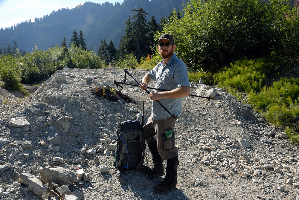
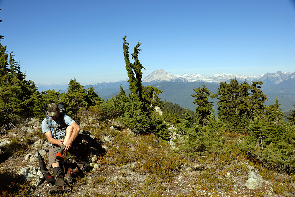
The road is in very good shape thanks to the power project and we made quick time to the log yard. There we continued a bit past and took the side road up the slope to the area where we found three bears on a prior trip. This was also the area that Geoff had gone camping while hunting earlier this year. We met one chap coming down in his truck, he was complaining about the rough roads in here. It really didn’t seem bad to us at all. We stopped at the end of a few spurs and got out to walk the area looking for anything of interest. I’m sure Geoff was looking for one thing only but I was enjoying the freshness and the scenery. After spending some time driving and wandering around the roads in this small section we drove back down to the log yard and returned to the mainline.

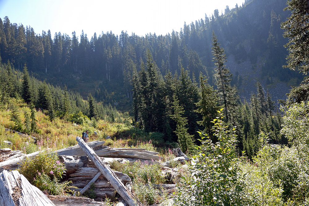
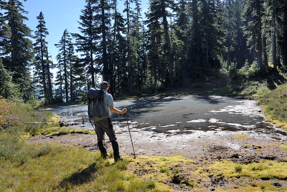
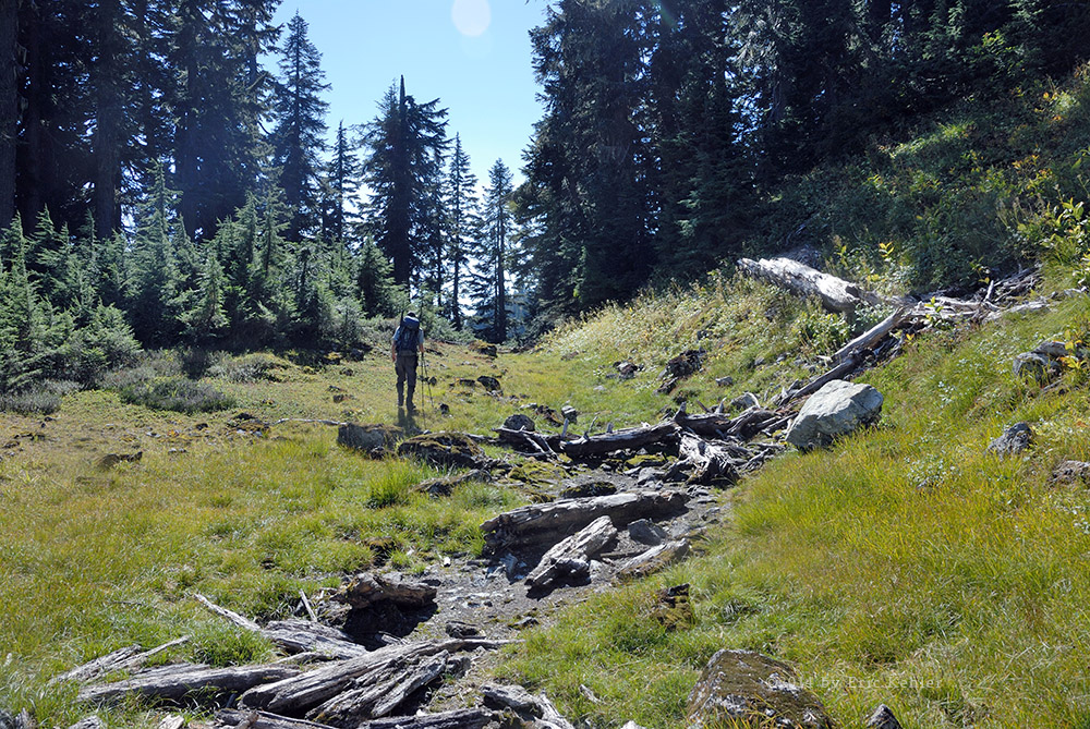
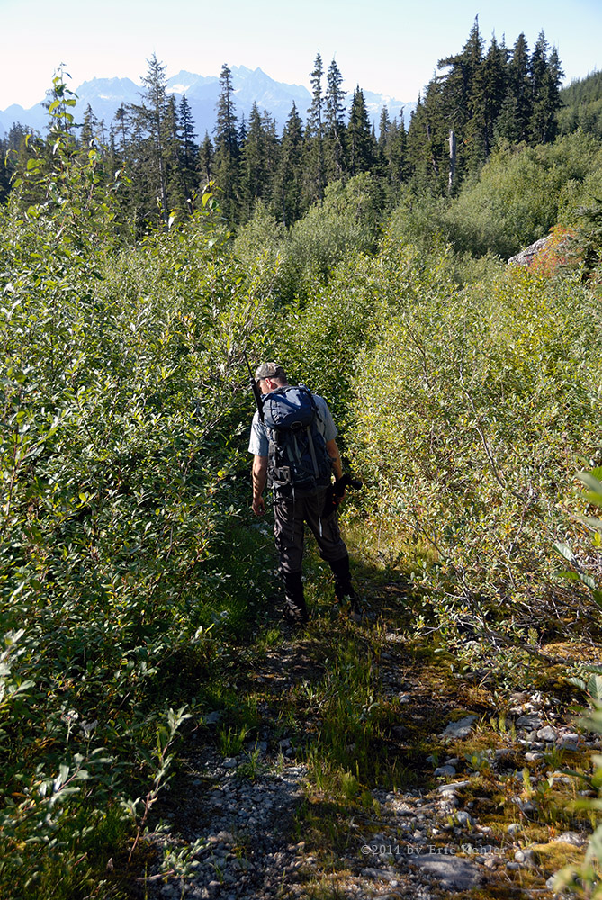
We started up the mainline but very quickly we took a short spur leading to the lake where we hoped to reach the beach and set up for lunch . The spur was in low ground near the river and so was covered in ponds covering the road way. They were iced over and we weren’t sure how deep they were. The first large pond seem to have a shallower side along the right side so we slowly made our way across, breaking up the ice as we moved. The next pond was even bigger and as we drove in the truck kept dropping lower in the water. We felt a bit uncomfortable so we backed out. We tried the far side but there we were stopped by a branch. So Geoff studied the water a bit and decided to try the first route again. He drove in and down but just passed the spot we had stopped at last time the ground leveled off and we were able to cross without sinking any further. There was one more water hazard to cross and then we were clear for the beach. Here we drove north a short ways and found a spot for lunch. While there another couple on two ATV’s came by. They also stopped for lunch as we cooked ours. This was another incredibly scenic spot and I gathered a number of photos before we retraced our path to the mainline.

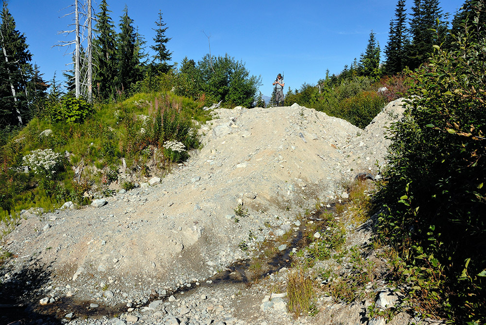
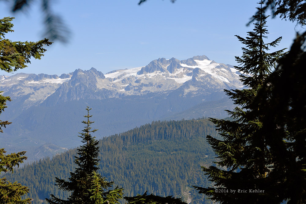
All the while we were exploring this area we were hearing chatter on the road frequency coming from some activity 15km up the road. I guessed it was the run-of-the-river power project so we decided to head further up and find out. Indeed we did get to the old spot for a logging camp but today we found 15 meter high mounds of sand and gravel on the river side of the road and many mobile units of worker barracks on the other side. It was a busy operation with activity all around us. The heavy road work started just past the camp area and we were about to start up it but looked at the watch and with the sun below the western mountains we decided to leave it for today. So we started on our way back down the road.

The amount of work being done is really quite incredible and I am sure we will enjoy looking it over during some warmer weather next spring. As we had a radio we decided to continue calling out the road markers on our way out, we had only started just before the busy section but this time we kept it up until we were well past the area. It had one benefit as an excavator that was carrying a number of long planks had pulled over for us to pass and was out of our way by the time we had reached him. The radios really can be quite useful.

Closer to the log yard we decided to head up another side road that leads to a ridge line overlooking the confluence of the Big Silver River. But just in from the start there were logging crews active and they had some equipment across the road. As it was getting on we decided to not bother and just start the drive home. The local group did call us on the radio to ask if we needed to pass but we let them know it was OK and we continued back to the mainline.

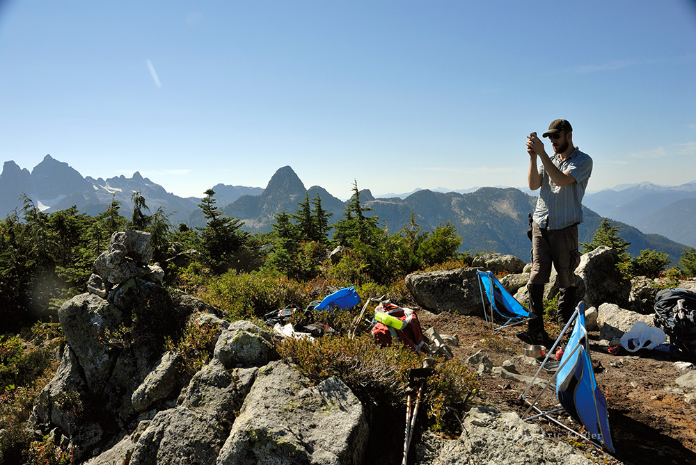
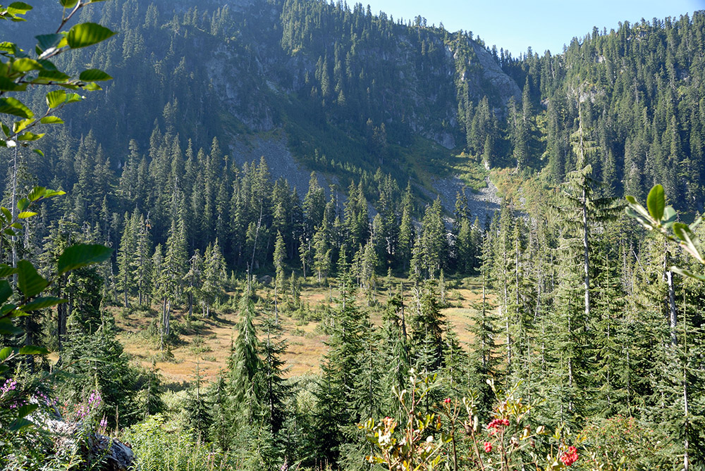
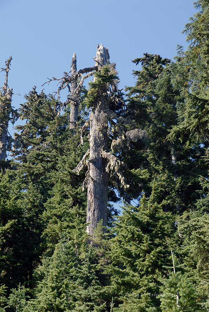
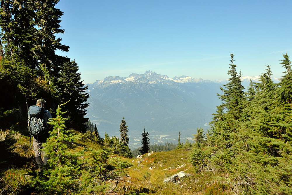
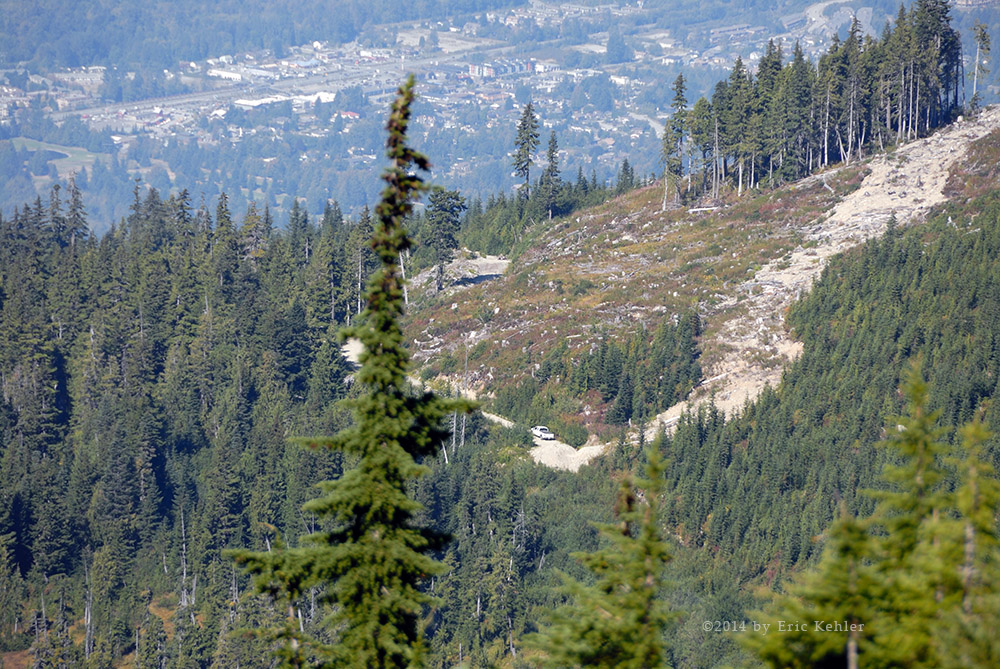
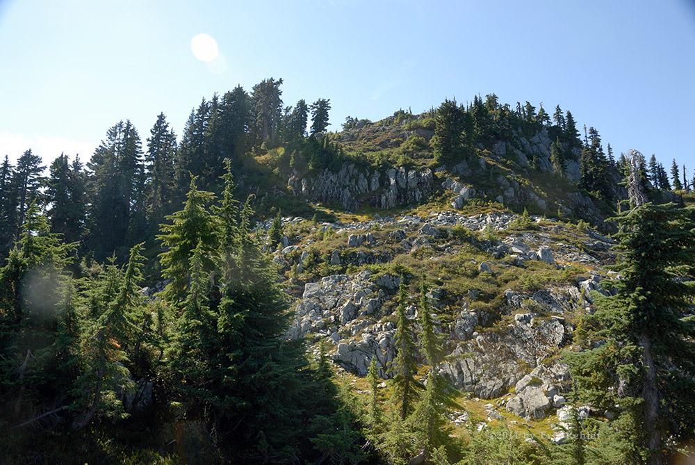
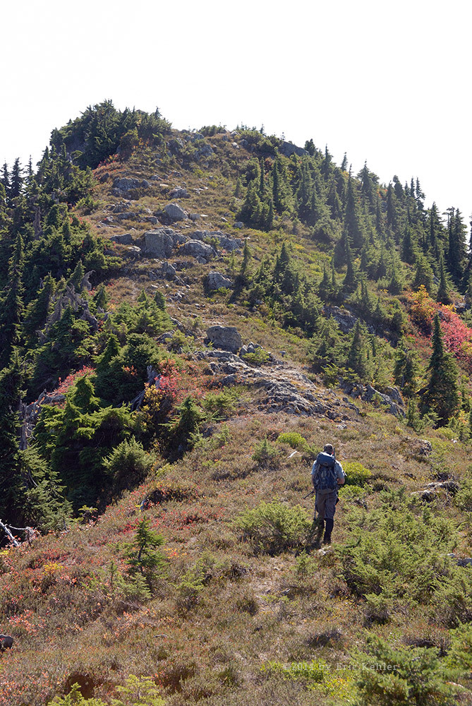
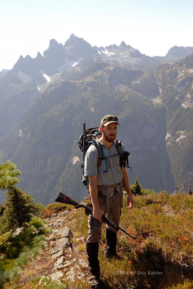
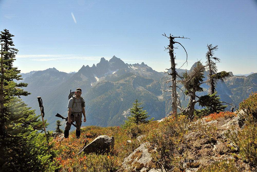
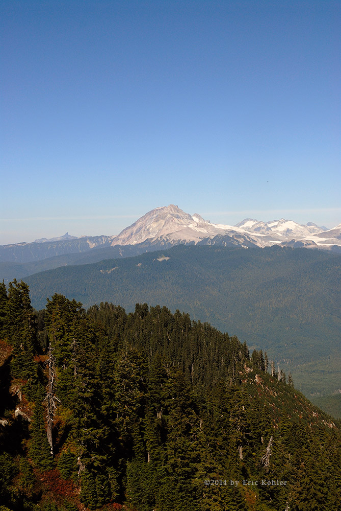
As we drove out we found one more side road a bit south of the log yard that gained some elevation quickly and near its end we had some lovely views to enjoy. It was a nice little side journey on which to end our explorations for the day. The rest of the drive back to pavement went easily and we took a couple of stops along the way for a few photos.  As the sun was now down, the wind had picked up and the temperature was quickly dropping, so it was a good time to get on out. In fact we did get to pavement before it was too dark to see anything. So despite it being quite cold and windy, the sun made for a pleasant day. We tried a few new things and we confirmed that the power project was well under way. It will be a spot to look over next year.

Western Harrison – Midway

It had been some time since our last visit to the west Harrison area, so we planned to visit the region in early October but weather got in our way. Then I was off to Ontario for a couple of weeks. So here we are in November and finally able to get back out into the hills.  I have explored the southern area many times and even driven the length of the lake on several occasions but very few of the side roads around 20 mile bay and north have been explored by me. So those roads were our goal for the day.

Geoff arrived at my house as planned and we finished loading up the truck and then went to start it. But the battery was dead! Not at all a good start to the drive. It seems that the battery is no longer holding a decent charge and we needed to jump it from an old battery Geoff had on my charger, that worked fine and off we went. We kept the truck running when we stopped for coffee but then when we filled it up we didn’t have a choice, but it should have charged enough by then. It hadn’t! We jumped in our second battery and cranked it, but even that battery barely made it! While driving we decided to just keep the engine running for the day.

We made good time to the start of the roads and then up to the first viewpoint overlooking Harrison Lake. Here we stopped and I gathered a few images. While stopped there we were passed by one of the few vehicles we met during the day.  After a few more minutes we continued up the mainline. From the Mystery Creek area we didn’t encounter any more people on the roads until we were well on our way back home. The area seemed completely deserted which suited us quite well. The one thing we did decide was to not push the driving so far that we would need a winch to get us out.  With weak batteries winching may not have been possible.

As we started our way north, we drove past the gated entrance to the Woods Lake campsite, here we spotted a jeep that was bottomed out trying to get up and over a steep berm next to the gate. He was stuck teeter-tottering but he had his own winch and was busy getting it set up to pull himself over the barrier, so we just had a good chuckle and kept driving. I’m not sure why he was so determined as there really isn’t much to see through there. We made good time up through the Mystery Creek branch and then started looking for a side road to drive. It didn’t take long before we came by one on our left – the upside of the slope.

This short spur gathered a bit of elevation and took us through some cleared areas. The views and colours were not all that impressive but we d id spot some interesting fungus growing on the road and then some constructed wood objects discarded along the shoulder. Towards the end of the spur the view looking down on 20 mile bay was actually quite amazing and I gathered a number of shots. We returned to the main line and continued north. We came by a major side road and turned up it but soon we were blocked by a beaver pond that had formed across the road. The culvert had gotten blocked and the water backed up to overflowing across the road. Meanwhile a beaver had added a number of branches to build the level up even higher. We possibly could have crossed but we weren’t sure how deep it got so we decided to pull out some of the debris and see if the level would drop. It started to drain but it was going to take quite some time so we decided to continue up the mainline.

The next branch took us to the right side of the road and a bit below it. Here we discovered a broad plain of clearings with numerous forks. We tried a number of them, some giving great views of Harrison Lake and which would be a lovely camp spot. Being past lunch, we opted to stop and cook ours and enjoy the warm sunshine for a bit. Geoff did some target shooting while I did some photo shooting a reasonable combination. Once filled up with nutrients, we explored a few more branches and then continued north along the mainline. We turned up the Kirkland Creek road and found an area with some good fall colour and even signs of a large buck deer.  This got Geoff’s interest up and he kept a watchful eye out for it. This side road had a number of longer spurs which we enjoyed driving as they made their way up some steep cliff areas. This area really was quite pretty.

Our next stop was a spur that led down to the Shore of Harrison Lake. It was down here that we spotted the first signs of people this far up.  They were camped along the lake at the far end of the small cove. We continued further north and came by another spur heading down towards the lake. We tried it but came by a steep section which we decided to not cross as it was getting late and we didn’t want to depend upon our winch for getting back up it later. Geoff took a quick hike further down the road and thought it looked very promising. But as the sun was now down below the mountains to our west which reduced the light levels quite significantly, we decided to head home.

As we made our way back Geoff wanted to drop in on the beaver pond again and see how far the level had dropped. Well it had gone down an inch but not near enough to try crossing. This just got Geoff irritated enough that he started pulling out more and more chunks of the debris dam. This got the water flowing a lot faster but it was now getting quite dark and we had to start home in earnest. Too bad as the map shows an extensive road system in behind the pond. Perhaps next summer!

The drive south went quite well, during this part of our journey we did encounter a few drivers heading north, that seemed a bit odd considering the lateness of the day, but perhaps they were camping up there somewhere. Thinking back, we felt it was a pleasant day in the backcountry and we quite enjoyed ourselves.

Central Elgin (Day 9)

I woke to a clear blue sky that beckoned to me to come and play amongst the trees. So after some breakfast and a bit of organizing, I set off for the lands to the east. Yesterday I travelled west and though I didn’t see all the areas, I wanted, I only had today left to explore the Sparta area. This area has offered some amazing colour in years past so I was really looking forward to finding some this year.

My first stop was down along the harbour where I could look back towards the lake front homes of Port Stanley. They were nestled in amongst some lovely trees with shades of orange and gold. I also saw where they were building up the embankment with concrete taken from the dismantling of the large grain elevators next to the harbor.  I only took a few photos here and then set off for my traditional shots at Hawk’s Cliff. As I drove up Hawk’s Cliff road I passed a dozen or so cars of people watching the raptors from a field beside the road but I didn’t stop as my goal was the cliff edge. Alas, the cliff has gotten so unstable that there was a strong fence put up blocking access to the cliff. It was most annoying but I accepted the implied wisdom and turned back to look for trees.

I next made for Roberts road and slowly drove east stopping at various sites to capture some images. Though much had already be lost, there were still some lovely patches to enjoy. One day I will need to walk through some of these forested areas as there are so many micro scenes to enjoy. I continued along and eventually found myself at the beach in Port Bruce.

I parked alongside the beach area and walked out capture some lake photos and a sailboat that was not far from shore. The beach has some tall grassy like bushes scattered across it which makes for some interesting textures. Done with the beach I drove inland to Sparta Line where I turned west and drove through the Rush Creek depressions until I reached Sparta. The creek areas were quite bare of leaves and I didn’t take the time to search out micro sights. In Sparta I came past an old Quaker cemetery and there I parked to wander the stones. Most of the old ones were too eroded to read but the oldest I could read dated back to the early 1800’s. As I was pondering the ancientness, the elementary school across the street let out and the thrills of the kids carried across the road to me – such a contrast.

Done with the cemetery I set out to find a spot to run my radio to talk with Ralph in Vancouver. After a bit of driving, I found a spot back along Roberts Road and setup the radio. Once again I was able to access the repeater but I was unable to bring up the link. I’m beginning to think the node is down. But at least I tried.

I then continued west and crossed over Kettle Creek to drive along its western side to where I had spotted some colour a few days earlier. It really was quite lovely and I got a few final photos before heading back to my room. It was a nice outing and I found some pleasant scenes. But mostly it just felt great being out in the warm sun and fresh air.

Dutton (Day 8)

Today was the first day I felt like getting out there and driving the roads looking for colour. The weather had been wet, dark and dreary so far while we were in the Port and the colours looked so dull. But today the sun was out and I was looking forward to seeing what the trees were offering. I had to settle for a late start as Carolyn needed a ride into St. Thomas where she was going to spend the afternoon at the wool shop. So I didn’t get started on my adventure until after lunch and then I had to be back to pick her up at 5pm!

So I set out along the Fingal Line heading west out of St. Thomas and made for the St. Stephen’s church. This small church has been one I have visited most years that I have come out. It felt like a good spot to get inspired for the day. I arrived and read a historical plaque that talked about the war of 1812 and Col. Burwell for whom the area was named. I gathered a few colour shots as the sun poked out from the clouds and started to enjoy being out here. I noticed the old grave marker for Burwell but it was so eroded that I couldn’t make out the words. I snapped a photo of it so I could try some Photoshop restoration to see of it could be read.

After a few more photos I continued along Fingal and Iona Roads and turned down the back road called Erin Line. This gravel road offered some great sights in previous years so I was hopeful I would find some this year. But many of the trees along it were already bare and I didn’t find anything to shoot.  The road ends further down on Fingal where I then backtracked a bit to Lakeshore and drove this short section to the John E. Pearce Park. Here I found a few colour shots which caught my eye and I was able to time them with the sun.  I was now at the park but it was getting close to time for my radio call to Ralph in Vancouver. So I set up my radio and tried the repeater but it wasn’t making it in. I drove up the road to a rise and there I got into the repeater and now I waited for the right time. Unfortunately I wasn’t getting a clear enough signal across to open the link to Vancouver and missed the call.

I returned to the park and started a walk, there was another chap already on the road walking his tiny dog through the leaves. I enjoyed the walk and found a number of close-up shots and lake views as I made my way around the paths. As I was leaving another visitor came by to enjoy the scenery. I next drove out to Duttona Beach where I enjoy getting down to the lake. This year I met a couple who were walking out to the beach just ahead of me. They were in the area looking at a house to purchase. They were tired of the city life and wanted a quieter friendlier community to settle in. They really enjoyed the beach and its easy access.  I gathered a few lake photos and just marveled in the fresh air and wonderful views.

I returned to the car and climbed up out of the valley, as it was well after 4pm, I needed to start back to get Carolyn so I tried a few back roads that went in the direction to St. Thomas but I didn’t find much along the way to shoot. There finally came a few spots with nice colour but the sun was on and off due to the clouds and I wasn’t going to be able to wait for a clearing to get the right lighting so I had to skip a few opportunities during my drive back. It was a short day but it did feel good getting out there. Hopefully tomorrow will yield some better photos.

Spencer Gorge (Day 4)

It looked to be another dull day with limited prospects for finding decent colour. So we really didn’t know what we should do to make the day effective for photography. We also had Mike’s son Luke with us and he wanted to do some hiking rather than just a lot of driving. Thinking of these constraints, I thought that Spencer’s Gorge would give us a nice hike and as the colours were strong, it may just be rich enough to enjoy in the dull overcast conditions. We all agreed to give it a try and so we first stopped for some coffee and a bit to eat for Mike who had not been able to get breakfast due to an early start on a project.

We made good time to the gorge and after paying for parking we started along the trail leading to Tews Falls. The colour was really very full and lovely and at the moment the light was quite bright for overcast. We enjoyed a nice walk through the trees along the edge of the gorge. We quickly noticed that they had improved the trail with a solid steel stairway that provided access over the steepest section of the trail. I’m sure it is well appreciated as the old path had some steep slippery sections to navigate.

The gorge was well used today with many groups making their way along the various paths and taking lots of photos. Camera gear ranged from the ubiquitous smart phone camera to very advanced DSLR gear like our own. People seemed very happy to be here and enjoying the lovely views of the lush colour in the valley below us. Our first photo stop was at the viewing platform for Tews Falls. It was crowded with people so we made our way down beside the platform where we could get a better view of the waterfall. Here I set up my tripod and gathered a few slow shutter photos of the falling water. The actual stream was quite light but still enough to give some nice photos.

After a good number of photos we moved on to the next higher platform and gathered a few more. This spot doesn’t give as good a view of the fall but one can get some shots of the far cliff wall. We continued on our way along the trail that ends at Dundas Point. There are many side spurs leading to small viewpoints of the gorge and we followed a few to gather photos of the different sections of the colour below. About midway one can get down to a ridge of rock that juts out into the gorge and offers one a chance for some wide angle close-up views of the gorge. It was worth the effort to climb over the sketchy path to get to the ridge.

We made our way back up to the main trail and continued to an area near the final platform. Here you can get right down to the edge of the rock face where there is an serious overhang; one can gather a great number of interesting shots from this open spot. People were continually coming to stand or even sit on the edge and have their photos taken. We met one young couple who were recent immigrants from Iran. They climbed out to the edge and sat over it and asked Mike to take their photo. Mike moved along the cliff a bit to get to a spot that would show off the overhang they were sitting on. When they saw the gap that had been below them they were quite shocked! It was fun seeing them take in the grandeur of the gorge. Well, we all spent some time here gathering photos before moving on to the final platform. It really doesn’t offer a good a view of the gorge but does open up a great scene of Hamilton below. The dull day left the colours of the city very muted and it was not something I was interested in shooting. After a brief stay at the point and helping a few people with some group shots we set off back to the car. It went quickly as we didn’t stop for any serious photo taking – we were hungry and so that was mostly on our minds.

We packed up and set off for civilization below where we found a nice Thai Food restaurant; we were very impressed with the quality and taste of the food. We had ordered three dishes and shared them between us. The food was very good and we plan to return again. So, done we lunch we returned home having had a much better day of photo taking then we had expected.

Winona and Binbrook (Day 3)

Today was promised to be sunnier than yesterday and so we set out with the hope of finding some brilliant colours along the Escarpment. Unfortunately, someone forgot to tell the clouds. So when we first set out we drove along the Escarpment to the west and looking for some good vantage points of the slope. We found a few but the sun was still in hiding. We eventually had a few short periods of sun and were able to gather some nice photos of a few spots. But the sun was soon covered so we decided to head back up the ridge and into the back roads.

Mike wanted to return to a small pond we had shot at back in 2010 so I looked up the GPS coordinates from an old photo and we drove south to find the road side pond. It didn’t take us very long to reach the spot though we almost stumbled past it before realizing we were there. Checking the co-ordinates, they matched our records, and sure enough the pond was here – sort of. During intervening four years the grasses and marsh plants had swallowed up most of the open water and we weren’t able to find the interesting objects that so enamoured us last time. The clouds had also thickened given a dull look to everything. And we even were splattered with a bit of rain. Mike and I did gather a few close-up photos but not the numbers we were hoping for.

After a short while at the pond we decided to head back to Binbrook for some fuel and lunch. As we drove through the centre of the town we spotted a small café – The Countryside Grill – it was in a new mall that was still mostly unoccupied. The whole town was undergoing a rapid growth period with many new subdivisions being built. The food was quite good though the hamburger Mike ordered was so big he couldn’t eat all of it. We were in no hurry to leave as the day continued dull, but as the day passed we eventually felt it time to move on. We left just after 2pm and made for a gas station. Once fueled up we started looking for a good spot to do my radio call to Ralph in Vancouver. We picked a spot on a small rise and set up the antenna and radio. I checked the access to the repeater in Mississauga and found it solid. So I dialed in the UBC repeater and put out a call for Ralph. He immediately responded and we had a nice chat for 10 minutes. After which he went back to work and us to play.

It was approaching 3pm and as the day was still so dull we decided to pack it up for the day and try again tomorrow. So Mike dropped me off at my B&B and I settled in for a rest. Though not as pleasant a day as we wanted we still saw some nice locations and had a relaxing time enjoying some nature.

Lincoln and Region (Day 2)

Today was the first of my travels for this year’s adventure in Ontario. My wife’s cousin Mike joined me at 9:30am and together we set off for the fields of colour that the fall season had brought us. The weather today was a bit damp and overcast so we were concerned that we may not get the colours popping out like they would in  the sun, but we accepted what we were given and so off we went.

Initially we dropped down to the bottom of the Escarpment and drove east towards St. Catharines but here we saw only muted colours and nothing all that inspiring. So we decided to head back up to the top of the Escarpment. As we made our way up we passed by a nice vineyard and noticed that the forest in behind had some lovely coloured leaves but the dull sky made them look so insipid that we didn’t even stop to study them. Once on top of the rise we drove a few side roads before we settled on one heading back towards the edge of the drop. Here we found some colour alongside the road and so we parked and began the first of our photo sessions.

Our first location was full of bright red sumac, the strength of the reds was quite spectacular. We spent some time wandering around this spot while avoiding the big farm equipment making its way along the road. We drove a short distance further along this side road and again gathered some photos of the trees just off the road. Soon we were driving along the ridge passing a few beautifully situated vineyards. The sun popped out for a few brief periods teasing us with a glimpse of the colours we were missing.

We continued along for a while a eventually came by a small pull out in a valley with a stream through it. Here we found some nice patches of colour and even had a bit of co-operation with the sun. We decided to descend a short stone stairway to the creek level and there we were soon intrigued by some splashing we saw in the water. We made our way over to get a closer look and discovered dozens of Brown Trout making their way up the creek to spawn. These were big fish and they were amazing to watch as they fought their way up over rapids and rocks to gain elevation. The effort and determination they exhibited was incredible and caught the eye of several others who had come to watch the migration. We wandered back up to the top and found another access point to the creek a bit further upstream. Here there were even more trout working their way up the creek. We stayed to watch for some time.

It now being lunch time Mike pulled out his iPhone and yelped for a good local restaurant, it suggested the ‘Bleu Turtle’ and so we decided to give it a go. Initially we zipped right past it but after stopping and checking our phones for directions we were soon heading back and parked and walking into the converted house restaurant. It was a small spot but the lunch special – Duck Tacos with a cream soup – were very enjoyable. We left feeling like we made a great choice and planning to return some day.

We continued driving a while and soon came by an historic mill and waterfall we spent time at last year. Today we decided to not climb down the cliff to the creek below the falls, so we concentrated on getting some photos of the upper pond and mill area. We had a brief period of bright sunlight which really opened up the colours of the trees along the creek below us and I was able to gather some intense colour shots before we continued along.

It was now 2:30 and time for us to set up my Ham radio and call my friend Ralph back in Vancouver. Where we stopped was too distant from the radio repeaters I had planned on using and after trying a second spot along the road, we tried a more distant repeater in Simcoe. This one we could partially access. Mike looked up another repeater on the web and this one was across the lake in Mississauga. It worked well and I dialed into Vancouver but we had missed our time window and Ralph had quit waiting for our call. We’ll try again tomorrow.

-  We continued to drive through the back roads but the clouds had thickened up and the tree colours were very muted and so we didn’t find any more spots we wanted to stop at though we did see many places that looked like they would have great colour if the sun was out. We did come by a field of Llamas and a donkey where we stopped to capture a few images. It was now approaching 4:30 and we were getting tired, so we decided to call it for the night and head back to the B&B. We will continue the adventure tomorrow.

Ontario 2014

Submitted by admin on 15 November 2014

Another restfull adventure in Ontario. This year the weather was much more challenging for photography with rain and overcast skys. I did get out on a few of the days but was fighting with the clouds for some light. Still, lovely pictures can be found if one searches for them.

Anif Peak Exposed

We found the hike up Mulligan and Anif last year quite challenging in the clouds as the plants were wet which got us soaked and cold. The steep slopes were slippery which facilitated a few slips and when we did achieve the summit the views were very limited thanks to the cloud layer. So we both felt we needed to revisit the mountain on a sunny day. Today was that day. I got myself ready and picked Geoff up at 7am and we set off for the closest Starbucks. Once the essentials were handled our next stop was some fuel and then the logging roads.

We arrived in good time at the start of the Mamquam FSR and stopped to read the road frequency on the road sign but we were greeted with a new channelized number and no frequency! The province is switching over to 40 specific radio channels and the Squamish area is one of the first. So we weren’t able to dial in the road. Fortunately our drive along it was short and the traffic light. We soon reached and zipped up the side road encountering only a single vehicle coming down. So we were very likely to be on our own up here today.

Upon reaching the end of the road, Geoff carefully turned the truck around in the narrow space and proceeded to park on the edge of the road. This left me no way to exit as there was a large mud puddle along my side of the road, after a few shared words he moved the truck back to the middle of the road until we were ready to set off. The initial segment of our hike was along the remainder of the logging road. This section started at a major washout and was now quite over-grown and the road was getting crowded out with Alder.  At the end of the road is a large pile of rotting logs which we climbed up on to survey the next section of our journey.

Upon leaving the log pile we had to make our way up a densely covered valley slope. The route went straight up the slope to the start of a forested section where the path was easy to travel. This slope however was thickly covered in wild flower plants, dried ferns and wild blueberry bushes. One was not able to see the ground so picking each step on the uneven ground was time consuming and tiring. Stepping into a hole or between two logs was all too common. Throughout the slope one could see trails where animals (bears) had made their way between berry bushes. Once we finally got past the open area and into the bush, we stopped to put on our cramp-ons so we could scale the slope easier as it was steep and we were slipping more than desired. The spikes made the trek up to the ridge very easy. I had my new more aggressive set with me today and this was their first use. They looked ominous but they sure do work.

Soon we were past the trees on the slope and in the open meadow where the slopes of Mulligan and Anif meet. Here there is a small stagnant pond where we could see several places an animal had dug into the mud to free up some water. After a short rest we continued up the slope to Anif. Last trip we ventured too far to the right of the ridge line which put us into steep terrain so today we kept to the left as we followed the slope upwards. Not much past the pond one is faced with the first of several vertical walls which would need to be circumnavigated. The easiest route on this first wall was to curve to the right side and then as one gains the elevation above the wall to circle back towards it. Once above this wall we were able to follow a trough up the slope just to the left of the ridge line. This allowed us to get past a number of steep sections we fought over last time. After gaining a few hundred meters the trough leveled off and we needed to get onto the ridge itself and cross over to the other side. Here we had a short steep section to get over but with spikes and grabbing onto many plants I was able to gain the ridge without incident.

After crossing to the right side we soon came to the first of a series of walls and cross ridges to scramble over. Each took some study to determine if it would be easier to try the right or left side. We were fortunate that our guess worked each time and we made decent time over these obstacles. The final wall on the east ridge we were climbing was now before us. It was a bit taller than the previous ones and the side slopes didn’t seem that much easier. Eventually we tried the right side and scrambled up some large boulders with just inches of ground for grip above the drop. It was a bit of a challenge and I wasn’t looking forward to making my way back down.

Having gained the final wall we were now in a more gently sloping knoll that led to a gap between the two sections of the upper ridge line between the peak and the sub-peak. We made our way through the gap and up the far side to the ridge leading to the summit. The walk along the top ridge is actually quite easy and we were soon at the summit enjoying the view. From the summit I called my friend John a local Ham from Squamish and we had a nice chat. He said we should look across the valley at Sky Pilot as a Search & Rescue operation was on-going for a climber who had fallen. Sure enough we spotted the helicopter passing just behind the peak of Sky Pilot (the climber unfortunately didn’t survive).

I gathered a number of photos from the summit and then we stopped to enjoy lunch and the warm sun with a lovely 360 degree view – so much nicer than last time. After enjoying an extended time at the summit we geared up and started the journey back down. It went quite quickly as we made our way down the ridge and over the various cross walls. Even the big one near the top proved easier than on the way up as we found a steep but more easily walked path a bit further to the side than where we ascended. It looked overly steep on the way up but likely would have been easier than the path we chose.

Once we were back to the pond we took a breather and stopped to recheck our gear before the final slog through the densely covered slope below us. Going down the uneven hidden ground proved even more challenging, I stepped in holes several times almost losing my balance. I really think this is the hardest part of the climb! Well soon we were clambering over the logs at the start of the road and ready for the easy section of the hike. It was by now much hotter than on the way out this morning so even though the path was relatively flat, the heat made for a tiring final 700m. As always, one is sure happy to see the truck again and get the pack off and sit down for a few minutes. Getting a cool drink out of the cooler sure helps a great deal as well. It was still early so we took our time unpacking and relaxing before we started down the road in the truck. After a couple bends Geoff spotted a Grouse in the distance and he felt it was a good chance to bag a bird for dinner. He didn’t want to get too close and spook it so he fired his .22 from a greater distance which went low and that spooked the bird. So no dinner for him tonight.

Further down the road we finally spotted a suitable log round that we could lift into the truck for an ornament in my yard. My previous one had finally rotted and was gone. We had been searching for a replacement over that past few trips so we were happy to finally locate a good candidate. The balance of the drive went quite smoothly and before long we were back home where I could relax and get into my hot tub to work out the kinks from the hike.

Trestle Bridges and the Dewdney

Earlier this year we learned about the old Kettle Valley Rail Trestle Bridge over Ladner Creek. The bridge is a relic of the old railway and is not much of a hike off of the Coquihalla highway. The rail bed passes through a short tunnel just before the bridge but it is unfortunately collapsed and so one must hike around it. Though walking on the bridge is strongly discouraged due to the rotten state of the cross timbers, it is still an interesting sight to see. So we felt it a good day to go see it and then spend the day on the surrounding logging roads.

Our drive to the trail head started off slow as our truck battery wouldn’t start the truck, we had to jump ourselves from our second battery – handy! Then after a short drive to get coffee, it once again was still not strong enough. Now on the road, we soon learned that the highway was stopped due to a truck fire at the Mt. Lehman crossing – our crossing. So we took a detour south to skip that area and join the highway on the next overpass. Then just as we were getting close to the highway we were passed by a burned garbage truck being towed! The vehicle on fire was reported to be a garbage truck! Well, excitement behind us, we made good time the rest of the drive to where we would be starting the hike.

The initial segment of the trail is quite steep as one climbs the slope to the level grade of the track bed. Fortunately it was also a short distance. The walk along the track bed was easy being completely level, and we made great time to the tunnel. It was indeed completely filled with rock, Geoff climbed the loose rock to the ceiling to see what was there. He noticed that by looking through some of the gaps in the ceiling cement, he could see a series of rotten beams! Did they line both sides of the cement with wood? Done with the tunnel, we made our way to the path that leads to the far side and the bridge. The path crosses some very sketchy spots with a vertical drop of 100+ feet.  It was not really the safest place to be. There are some ropes and cables in place but none of them are well secured. Descending the far side there is a steep path with a bit of network cable strung out for balance (it sure won’t hold one’s weight). This section has had some major erosion and there are a few spots with only a few inches of path width remaining before the slope takes a near vertical drop for quite a distance. We did make it past this area but then came to a swath of loose gravel on a steep incline. A rope had been tied here but it wasn’t all that safe looking and wet gravel tends to offer little support should one start to slide towards the drop only 30 feet down slope! Neither of us thought it safe enough to cross. So we took photos from the path about 40 feet from the bridge. Heading back up the eroded trail was not much fun either.

Well we safely got back to the level track bed and took a few moments to relax after the unwanted adrenaline rush. Watching for bears as we hiked back now seemed quite anticlimactic! We felt a bit disappointed we didn’t reach the bridge but also felt good that we didn’t push past our level of comfort and experience (at least not too much past). Geoff suggested we try approaching the bridge from the other side of the valley, it might be possible but I found no online guides for that side.

Done with the hike, now we had the rest of the day to explore some roads. The side road we parked on for the hike continued down the valley and crossed under the highway. Just prior to our hike we initially drove down here as we thought it would be a short drive but we discovered that the road connected to the service road for the gas/oil pipeline that travelled through here and it was quite well maintained and crowded with campers! We were quite surprised by the number of people holed up in every spot they could find along the river. So now that we were done hiking and ready to drive the roads we skipped down the highway to the next exit – the Dewdney FSR - and started to drive its branches. We came across dozens of campsites and groups all over the early section of the road as it tracked the river. I was even more surprised by the number of motorhomes in here. As we drove in and away from the river, the crowds quickly tinned out and we had the road to ourselves. We spent several hours driving through the area enjoying the mossy slopes and dense forested areas. As we continued along, we discovered a number of nice viewpoints looking down on the Highway.

We stopped for lunch at the end of one road which had followed the ridge line of a series of hills. Here we had a nice view of the Coquihalla valley. It was a very lovely spot and we had it to ourselves. Though up in the hills and seemingly in the wilderness, we were still so close to the highway that our cell phones had full digital coverage! After eating, we drove a few more side roads but ended up skipping a number of them due to time, a few look like they could be quite interesting.  We made our way down to the crowded motorhome city and continued north parallel to the highway. We eventually came by one stream with a nice waterfall where I took some time to photograph. While busy shooting, Geoff managed to slip on a rock and scratch himself up. Now he was in some pain and not all that happy. We continued along the road and it eventually merged via an on-ramp to the highway. We drove north on the highway to the next exit which was also a U-turn spot. This exit is also where a road along the pipeline continued north around the far side of a short mountain range to join back up with the Coquihalla Highway. When we had set out we had planned to drive this road as it looked very interesting, but we were stopped by a locked gate. Now that was very annoying. The excuse given was that they were doing road work!

Well it was getting on in time and Geoff was starting to feel some pain from his scrapes so we decided it was time to head back and get a coffee at the Blue Moose in the town of Hope before driving the rest of the way home. We enjoyed both parts of the day’s adventure and plan to retry the bridge from the other side.

Subscribe to 2014