
Middlesex, Thames River and Dutton (Day 10)

Weather wise today has been our best day here this vacation. The morning opened with blue skies and the sun shining from the eastern edge of the sky. It was cool but not too cold and the sun was rapidly warming things up. I was looking forward to the day and getting out though I hadn't picked a spot to head to. We had a simple breakfast and then lunch after which I left in the car.

I decided to try the western side, north of the port heading across the 401 and into the Thames River area. It was another location where I had never ventured before. The trees were looking their best today in the bright sun and I was seeing a lot more of the colour. This area had been a bit behind but now the bright colours were coming out, I suspect that next week will be even better.  I made for a quick drive north and soon was in the area around the river. Like yesterday this region didn't seem to have the colour or texture of the regions closer to the lake but I drove around the river and found some nice patches of colour to capture.

By 2:30 I was parked at a bridge over the Thames River and waiting for Ralph to respond to my call. He came back quickly and we had a nice chat for 15 minutes. I then walked the bridge and gathered some river shots before continuing along. It was now time to start a backward sweep to the port and so I started back and found better colour as I got closer to the lake. There were some stands of amazing contrasts that I was able to enjoy. I decided to follow some of my old paths and noticed that the colour was richer since my first pass through here on Monday. The bright sun brought out the colours even more and I was able to re-capture some nice spots as I neared the port.

A lovely day and one I really enjoyed. The weather was perfect for taking fall photos. 

Dexter, Sparta and Middlesex (Day 9)

The day looked quite overcast as I dragged myself out of my warm bed. The alarm said it was time but my body had quite a differing opinion. I got myself cleaned up and ready for breakfast. I checked the forecast and it showed improving skies as the day progressed, so I was hopeful for the day. I took it easy through lunch but once finished eating, I packed up the gear and set out for the roads. I have been doing the old areas for the past trips so today I decided to drive further out and see what there was.

I decided to head out to the area on the east side of the City of London. So my first stop was to reload the fuel and then set out east on Dexter Line. I had spotted a nice area yesterday along the lake that had a lot of colour but the sky made it dull. Today the trees were brilliant and very pretty. I grabbed a good number of photos and then started north but not before a short drive along a section of Roberts Line. This road has always had many great spots of colour and the blazing sun today really brought out some great sights. I stopped at one spot along the road and got covered in ladybugs. Now normally I quite like these beetles but when they got this dense and were crawling all over me I had had enough and batted many off as I got back in the car. They followed me in and I was flicking them out for next half hour.

When I got to Yarmouth Centre Road I turned north and started along the side road watching to see what I could find. The road continued a long ways north crossing highway 3 changing its name to Old Victoria Road and then continuing on over highway 401. All during this part of the drive I kept a watchful eye out for colour but actually found very little I wanted to shoot. There were a number of patches off in the distance but nothing close by. The landscape seemed much flatter and duller as I headed north. The main point of interest was a large combine that I passed on the road, it kept following me a long ways and I had to keep moving to ensure it didn't catch me.

Once across the 401 I decided I had gone north enough for today and so I turned east on Bradley Road and then south again on highway 74 back across the 401. Here I took the first side road east and drove along looking for some colour. I found a few patches but again it was quite sparse. I then turned south and west and then repeated the back and forth looking for colour as I slowly made my way back to the lake. As I approached the town of Belmont it was time to call Ralph in Vancouver on my Ham radio. He was waiting and we had a nice chat, Jim joined in for a short period and then I brought the link down. I was then called by a local ham who shared some interesting information about the repeater I was using. Done with the radio I drove through Belmont and did a few more back and forths as I got closer to the lake. The tone of the landscape was improving as I made my way to the lake. Funny that is, I still need to quantify what it is. 

I spotted a small cemetery off Springwater Road which caught my eye so I stopped and wandered the stones for a bit. They do come in so many shapes and sizes but all decay and the oldest ones could no longer be read. Someone needs to photograph them with better equipment to preserve the messages and dates. Perhaps one day I will research that as it seems a shame that they fade away to dust. Once done with the tomb field I zipped along to Quaker Line and drove the short way back home. I was getting tired having been out here for almost four hours of driving. I wanted to sit in the comfy chair and rest.

I was a good drive with lots of colour, creation was truly showing its best today. I just wish I could find it faster. I should have another good day tomorrow, but I still need to decide where to go. Regardless, it will be a nice feel being out on the road in the colour.

Central Elgin (Day 7)

Today was a short day. I set out a bit after noon and drove east. I wanted to revisit my old haunts along Roberts Line and the Port Bruce. The sky had a growing number of clouds and I wasn't sure how long I would enjoy bright sun. The trees were somewhat dull in this direction as well but at least there were some patches of colour. The day was already quite warm and the breeze made everything seem so fresh. I was really just enjoying being out here. I found a few spots along Roberts Line to stop at and grab some photos but nothing was really popping much. Even the bright sun still had a thin cloud layer across it. I continued along and eventually reached the Jamestown side road. Here I found a few trees of interest.

I continued along to Port Bruce. Down in the valley the trees were quite colourful and I was able to gather some lovely photos. The only challenge down here is that the trees are surrounded by homes and other artificial items. But one does their best and hopes for a pleasing result. I didn't stay too long but I probably should have worked the area much longer. I continued along the highway and on towards Almyra. Before getting there I turned onto Sparta Line and set sail for the west again. The clouds were making a fairly solid screen by now and my photos were all muted but there were a few patches of colour to be seen.

As I reached Sparta I set up my radio gear again for my 2:30 call to Ralph. I still had time so I continued driving a few more roads until the scheduled moment arrived. I connected the repeaters and Ralph responded. We had a good chat, eventually Ken joined in while he was driving home. It was harder to hear him as he was more distant from the UBC repeater than Ralph and wasn't as clear. Conversation done I brought down the link and then chatted with a local Ham who was driving the 402 into London. He told me that this repeater was mounted on a tower 400 feet high, so that is why it has such good coverage.

Done with the radio I grabbed a few more quick photos before heading home. I had noticed a few drops of rain on my windshield so I didn't plan on staying out much longer. In the end I did get a decent number of photos but mostly I just felt good being out there in the fresh air.

John Pearce Park (Day 6)

It was a brilliant bright morning outside but the wind was high so I wasn't sure what to expect. Well first things first - I need to get breakfast and then contemplate what the adventure would be for the day. Sure enough not long after eating the call of creation got to me and I was getting my gear ready for a short trip out. As the day was lovely and dry, and the next expecting rain, I decided to head for John E Pearce Park and climb down the cliff to the beach along the lake. I had planned for this activity by packing some rope so I could get down the trail a bit safer. So with rope, camera and radio ready I started off for the farms.

The trees were not very brilliant today. It seems that they were either bare or mostly green. I think they will liven up over the next couple of weeks but I may have left already. So I continued along the side roads looking for some trees in full colour. I did find a few clumps but nothing like in earlier years. After taking my time driving towards the park, I finally reached it. Here I switched my runners for hiking boots and packed up the camera bag for transport. I meandered along the roadway in the park gathering a few photos but really my heart was set on the climb down. So I headed for the cliff and made my way along to the viewpoint. The scene was actually not all that good - no colour.

I walked back along the ravine looking for a good spot to descend. Eventually I spotted the place that others use to get down. There was a nice rope tied in place for me already. So I didn't end up needing the one I brought. I organized my approach and dropped down over the lip for the trail a few feet down. Once steady I grabbed my gear and used the rope to help me across the next 20 or so feet of slope. It went quickly as the clay ground was dry and not slippery. The lower section of trail was easy to traverse and soon I was at the beach. The waves were licking the shore right up to the base of the cliff so I wouldn't be able to walk along the cliff this year. Well at least I was here and now I set about grabbing a few photos of the cliffs and water from the beach. I tried a number of long shutter shots to see how they would turn out. I almost got wet feet a number of times but managed to run back to the path just in time. It was then that I noticed my cap was missing, I looked around for it but the wind must have grabbed it and taken up the ravine. Well, I could get another easy enough. Even here the wind and poor colour made for poorer shooting than I was hoping but I gathered the photos and started back up the trail. It went easily and soon I was at the rope and as I reached level with the top I saw my cap laying there half over the edge. I quickly grabbed it and stowed it until I had finished getting up. Happy again, I walked back to the car and drove off for my second favourite location.

I have visited Duttona Beach each year I have come here and so that was my next goal. I didn't find anything along the roads to shoot before I reached the beach so the drive went quickly. I parked the car in the normal spot and noted that a truck was also parked here. When I reached the beach I saw a chap walking along the waterline staring at his feet. He said he was looking for water smoothed glass amongst the rocks. He collects it for his wife who makes jewelry with it. The water was right up to the top of the beach so again I wasn’t able to walk much of it. I did manage to gather a few photos before heading back to the car.

I turned inland this time and wandered along a few more roads as I slowly headed back to the inn. It was now only an hour until I needed to call Ralph on the radio so I decided to just stay out here until after the call. I found a few more sights of interest and grabbed some photos. I tested the radio link and it seemed good, so I just kept driving up until the time of the call. I connected the repeaters and called Ralph in Vancouver who responded quickly. We had a good chat and even Jim and another person joined in for a short time. It was a fun day and hopefully I can get out tomorrow and see more colour around the Sparta and Port Bruce areas.

Beamer Falls (Day 4)

The day began cold, there were even some snow squalls in a few locations across the southern section of Ontario. The locals seemed to be in strong denial, after last year snow was not a welcome topic.  Mike arrived around 9:30 again today and we set off for the local hills in short order. Today we wanted to go south and do some exploring around the escarpment. We got up on top and Mike thought of Beamer Falls, it was still quite close by and so we drove over to the parking lot and strolled over to the cliff edge and stared down in to the creek. There were some great colours but the ravine was quite narrow and the sun not high enough to reach many of the trees yet. So we wandered along the side towards the upper falls and there we decided to get some more gear and climb down to the base of the falls for some photos. It was a lovely place to spend the morning and we both gathered a wide range of photos from many angles. It was the highlight of our day.

Once we had gathered our fill of water we climbed back up the ravine and set out again in the car along a few roads just back from the escarpment. We drove for some time but didn't find much that caught our attention, the clouds were not cooperating fully and we had muted colours when we did find something that could be of interest. Before too long it was time to head back to Grimsby to pick up Carolyn for lunch as we were all getting together to enjoy a nice meal. Once lunch was done Luke (Mike's son) joined us and we resumed our exploration of the roads south of the escarpment.

After lunch the clouds were much thicker and we had very few gaps with sun shining on the trees around us. We did stop at a few spots that were rich in colour but without the sun they were still quite muted and nowhere near what they could have been. We were getting quite disappointed with our lack of success. Luke suggested going back to the Beamer Falls area and the small forest alongside the creek. This sounded good and so we headed back to the falls and parked in the upper lot. It was full but we found a grassy spot that we could use.

We gathered some gear and set out along the main trail through the trees. As we made our way in the sun came out and lit up the canopy for us and we enjoyed some bright colours as we walked through the park. It was quite pleasant though the wind made it quite cool. We even enjoyed some great views of the creek below, the colours were very deep and rich. But we had only a few minutes of grandeur before the clouds moved in and we were reduced to subdued colour again. The coldness was starting to get to us and as the sun was gone we decided to return to the car and call it a day. So the day had its challenges but the morning at the waterfall gave us a very successful one despite the lack of cooperation by the clouds.

Powerline Road (Day 3)

The day got off to a good start with a nice breakfast in the main café in the hotel. The skies looked good and I was feeling good about the day and our chances of finding some colour to shoot. Mike arrived around 9:30 and we were off for our adventure. Yesterday we found colour along powerline road north of Brantford but it had gotten too dull to see much so we decided to return the next day.  So it being the next day, we made for powerline road in as direct a route as we could find and soon we were leaving the highways and turning on to the eastern end of the road. Just a short distance along it we spotted the first of the lovely colour off to the north and we stopped to capture it.

Well, as can be expected on a mixed weather day, just as we got ready the clouds obscured the sun and our brilliantly coloured trees turned dull and boring. We studied the clouds and could see a clearing coming so we sat there and endured a short shower as the clouds moved to open a hole for the sun. After a 10 minute wait we got our hole and the trees were once again glowing in full colour. They were really very lovely. Finishing our fill of the spot we continued along the road a short ways and found some more trees to shoot. Again we had to wait for openings in the clouds but it was always worth the wait as the trees were quite spectacular when bathed in the bright sunshine.

We enjoyed some close-up views of the trees and others where we were shooting across fields. Both situations offered some amazing sights of the colours and tree textures and we were enjoying the time so much that when I pointed out that it was after 12 Mike was quite surprised.  We had worked our way west and were now on the outskirts of Brantford. Mike's relative Steve lives in Brantford and Mike called him up to join us for lunch. He suggested a nice restaurant called Gus & Guidos. The food was very good and we all enjoyed a nice chat over an extended lunch.

Leaving the restaurant we were faced with some rain and angry skies but we could see a bit of blue off to the north so we back-tracked along powerline a bit and headed for Harrisburg. As we got near the town the time reached 2:30 and I had a scheduled radio call to Ralph in Vancouver. We stopped next to a harvested field and there I set up my ham radio gear and called through a repeater in Hamilton to Vancouver. Unlike yesterday, today Ralph was quick to answer and we had a nice chat for 15 minutes before we both had to move on.

As we drove through Harrisburg we had short breaks in the clouds where we could capture small vignettes of colour before the gaps closed up. This continued as we drove east and north over the next hour. Eventually we reached highway 6 and turned south towards Hamilton and the route home. The gaps had progressively gotten shorter and farther between and we were out of time waiting for them. We will try again tomorrow. But for today we now needed to get back as we had dinner plans and needed a bit of time to get ready. It was another good day enjoying the roads and trees of the area. We have one more day to find some nice spots before I need to say my goodbyes and head out for Port Stanley.

Buttermilk Falls (Day 2 )

Up early and still running on Pacific time so it was real early but one had to get started on the time zone change and get off to a good start taking photos. The morning opened with some clear sky and nice sun though it was a bit windy. Mike arrived shortly after 9:30 and we were off to the sights. Looking south at the escarpment gave us some concern as the wall of trees looked very brownish and lacking in colour. With that as our first view into the day's adventure we decided to take in a waterfall first and then explore some roads. Mike had read about a waterfall next to Albion called Buttermilk Falls. It was one we tried to locate a few years back without success but today Mike had a better understanding of where to look. So we made for the highway and zipped into the Albion area past the main falls and further west along the escarpment. Eventually we crossed over another stream and this we believed was our target. So we parked and got out to check.

The spot was indeed Buttermilk and so we returned to the car to get some camera gear and then walked to the top of the cliff to start taking some photos. The water was just a trickle and the view from the cliff edge quite limited so we decided to climb down the rock face to the stream bed and then walk to the base of the waterfall. The decent wasn't too difficult but we took our time picking our way across the loose gravel and rocks and fortunately made it to the bottom without incident. The short distance to the fall was an easy walk and now we could start taking photos. The low flow was a bit disappointing but we kept looking for new angles and found quite a few. I spotted a ledge behind the falls where one could walk and stay dry and Mike and I headed there for a different look to the water. It offered some very interesting effects and showed that there really was more water flowing than what one first believes. We spent some time looking over the angles and then set off downstream for more.

We found a number of interesting sites along the stream and quite enjoyed the location which we had to ourselves. We came by a small pool with fallen leaves on its surface between the leaves was a lovely reflection of the colourful trees above. We tried many different angles of the pool to capture the reflection and the leaves in the best way possible. It was a fun challenge and we both quite enjoyed the opportunity. We continued further along the stream and finally came by a spot fixed up with a big fire pit and some ropes for hanging curtain walls. The trail continued down but we decided we had travelled far enough and so we looked for a way to climb back up to the cliff top. The slope didn't look too hard at the place beside the camp area so we started to climb the loose rock. It proved to be a bit harder than expected as there were limited hand holds in a few spots. After a careful ascent we reached the top of the ravine and there we caught our breath before walking back to the car. Though at first we were not too impressed with the location, after trying different perspectives, the place came alive and we both felt the effort was well rewarded.

Well it was now lunch and so we left the area for a restaurant where we enjoyed some good Indian cuisine. Done with food we continued driving SW looking for clumps of coloured trees. This proved harder than we liked as trees were either bare or still quite green. We did come by a few nice settings where we were able to take some time to capture the colours. After driving for an hour we found a nice row of trees near the Grand River. This took a little coaxing but I soon had a number more photos in the camera. It was now approaching 2:30 and I had a scheduled radio call to Ralph in Vancouver, so we hauled out the radio gear and tried to find a reliable connection. We tried a number of repeaters but finally settled on a Hamilton repeater and connected the link to Vancouver. I put out a call to Ralph but he wasn't there, so we put that aside and continued our drive.

It was however getting quite grey and dull out and the colours were not popping. We finally did locate some great colour spots north of Bantford but without the sun they looked quite dull and now the rain had started. We decided it would be better here tomorrow morning when we could explore the area for colour with a fresh start. So we drove to my hotel and called it a day. Overall it really was quite successful and we both enjoyed our time amongst nature.

Sumas Mountain

I have driven past Sumas Mountain more times than any other summit yet I have never been to its summit. I tried once a few years back but it was a winter when we actually had some snow and the road was gated near the start so I didn’t get in. Though not a challenging adventure, the hike is still around 3km along the upper section of a service road. Last year we added the summit to the list for the Summits-on-the-air (SOTA) program so we now had more motivation to hike the peak.

Over the last few years I have developed a pattern of hiking the tougher summits with Geoff and the easier trail or short off-trail hikes with my friends from the radio club. Today’s hike was one of the latter as Ralph and I wanted to do another SOTA hike in October before I left for Ontario and Sumas fit the bill nicely. The weather looked good and we were hopeful it would last until Saturday so we scheduled our lives to fit the adventure in and were looking forward to it for a couple of weeks.

The morning of our trek arrived with fog but a promise of sunshine before too much of the day slipped by so we set out for coffee, gas and the mountain. We found the drive to the start of the service road went very quickly and trouble free. The initial section of the service road was quite a washboard and we got a good shake to start the backcountry section of the travel. Fortunately it cleared up and we were left with scattered potholes for the balance of the drive. There were a few vehicles on the road and lots of cyclists making their way up the road. It looks to be a very popular destination for those wanting a moderate backcountry cycling experience. There are a number of trails throughout which also make for good hiking and cycling.

We eventually arrived at the upper parking lot which already had a number of cars in it. The view from here looked good but we kept going and made our way another kilometer along the road to the upper gate which was as expected, locked. Here we parked the truck alongside the road and got our gear ready for the strenuous part of the day – the uphill hike. Now the annoying thing with starting out on one’s uphill hike is when the trail starts going down rather than up. Not only are we losing ground we drove up to avoid doing by foot but on the way back when we are tired out it will be uphill. Unfortunately the road did indeed drop down for a short ways before rounding a corner and resuming a uphill direction.

The hike up the road was actually fairly easy though it still needed effort and the views though limited to the immediate forest were still interesting. We both enjoyed this section of the hike. Soon we had reached the large repeater station just back from the summit and we stopped to look it over. The towers were not overly tall but were extremely broad and stable. The main tower had a large number of antennas on it. We checked our GPS to find the direction of the summit and set off into the bush to find it. Soon I spotted a well-trod trail leading in the general direction so I started along it and we were soon greeted with a viewpoint and the actual summit.

It felt good arriving ahead of schedule and now we could set up. The one problem we encountered was the high winds. The forecast had warned of a windy afternoon and up here on the summit nature took it to heart and it was very windy which made it somewhat colder than it should have been. At the summit I noticed a number of pipes protruding from the rock and they looked ideal to lash my walking stick to for a mast for my yagi antenna. So I got it tied on and soon had my antenna assembled and attached to a post. A few minutes later I was putting out my first calls, meanwhile Ralph was busy stringing his wire antenna into one of the trees and getting his HF operation in order. I soon had my first call, it was from a chap in Washington State, two more followed in quick succession but then I had a gap. I was having trouble keeping the wind from turning my antenna every which direction.

I next tried our White Rock repeater and was able to get into it reasonably well. There I had a return call from Geoff who just happened to be monitoring it at the time. He switched over to simplex and I soon had my fourth contact in the bag. That made it a successful activation of the summit. We chatted for a few minutes and then I stopped to eat some lunch. After a bite I worked a couple more stations. Ralph was able to work 15 on HF, one was on the east coast. He had a good run and felt it went very smoothly. We had both gotten more than the needed number and the wind was chilling us so we decided to pack up and head down.

Despite all the traffic we met on the road we had only one pair come to the summit while we were there. They enjoyed the view, took a photo and left in short order. The hike back down went easily and we chatted with a few of the cyclists making their way up. We never saw any coming down so I wonder where they go for the downward portion. Finally back to the truck, we could take a nice long breather before setting out. We stopped at the upper parking spot to gather a few photos of the valley below. It was quite lovely even though the haze hid all the details from sight. Ralph was able to pick out the White Rock land mass fairly quickly and I was able to snap a photo of that direction. Done with the view we continued down the service road and were soon back to pavement.

We decided to get a coffee before heading home and so we needed to find a route to Abbotsford rather than just head back to the highway. So I took a different route from the one we drove up along and this brought us to some nice fall colours before opening up in the historic town of Clayburn. We had an extra view into the village as the main road was closed to construction and we had to detour through the inner section of it. We got through the town and onto the highway for our final drive to the Starbucks where a parking space opened up for us just as we arrived. All the others were taken. After a quick stop to gather our drugs we set off for home having enjoyed a shorter but lovely day in the hills and sun.

Map

Wood Lake Fire

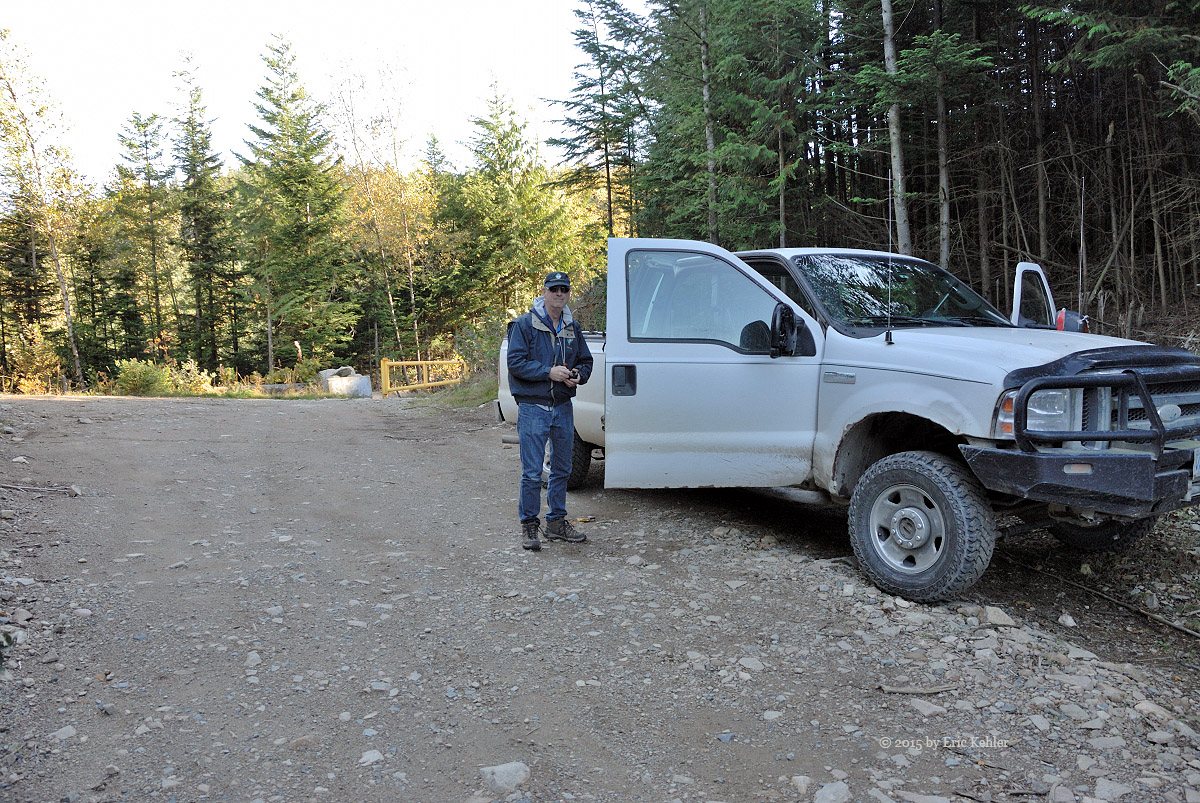
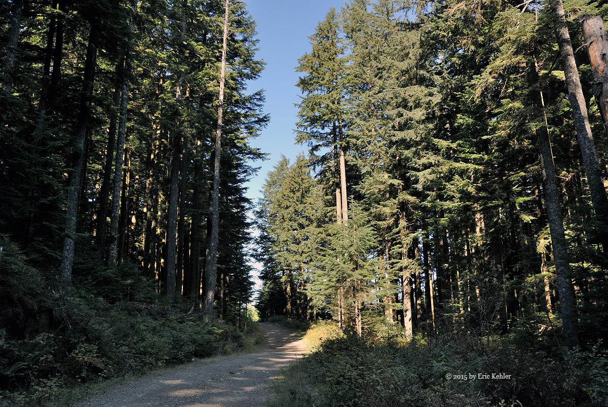
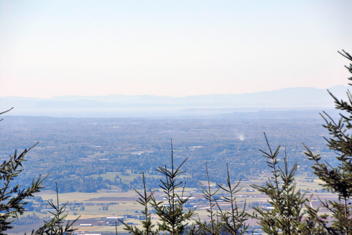
Our morning began with us getting our packs ready for a hike up Sasin Peak. We had been watching the weather reports all week and they showed a decent day for Saturday. That was of course until Saturday morning when suddenly a 40% chance of rain showed up. So annoying but we were still hopeful. Well as we drove along and got closer to the mountain the rains hit hard, so hard it was hard to see the road while driving! Not at all encouraging. We hoped it would be short lived and pass quickly while hiking and that the tree cover would keep us reasonably dry, so we drove on.

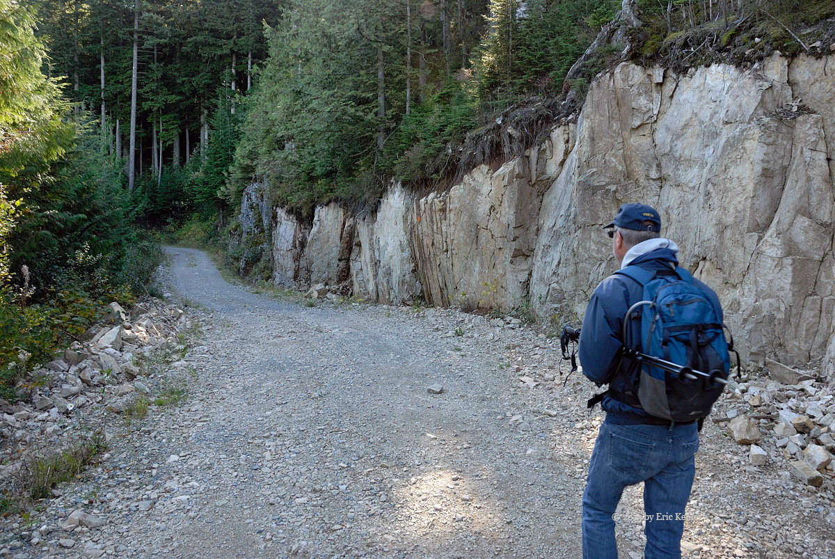
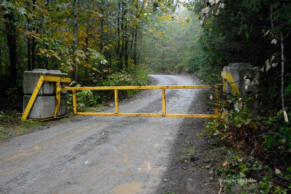
We started up the Chehalis FSR and noticed a new water bottling plant being constructed just in from the start of the road. Further on we caught up with a truck hauling in a heavy excavator. Finally we reached our side road up the Pretty Creek area and there we spotted a new locked gate! It wasn’t on my road report but still, it was in our way. If the rain was annoying, this was very irritating. The light rain falling as we approached the gate added to our mood and so we had to cancel our hike and plan something else.

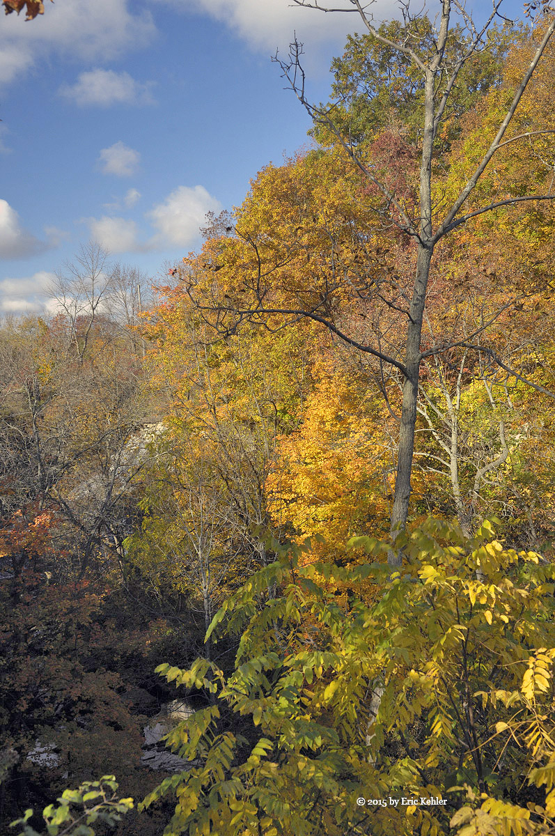
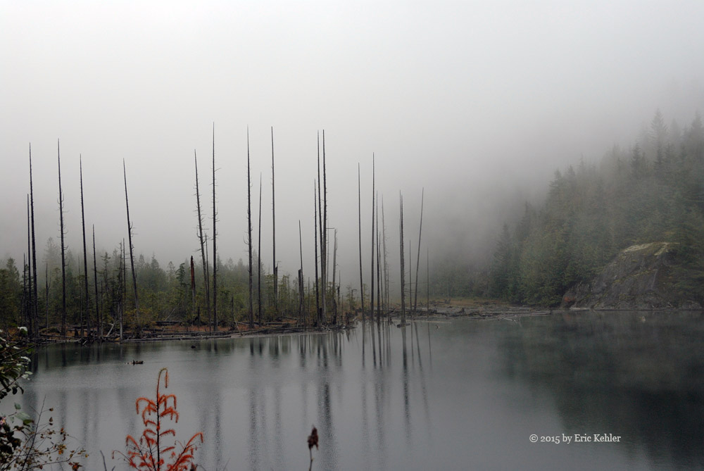
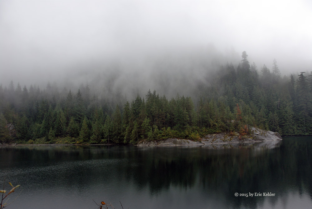
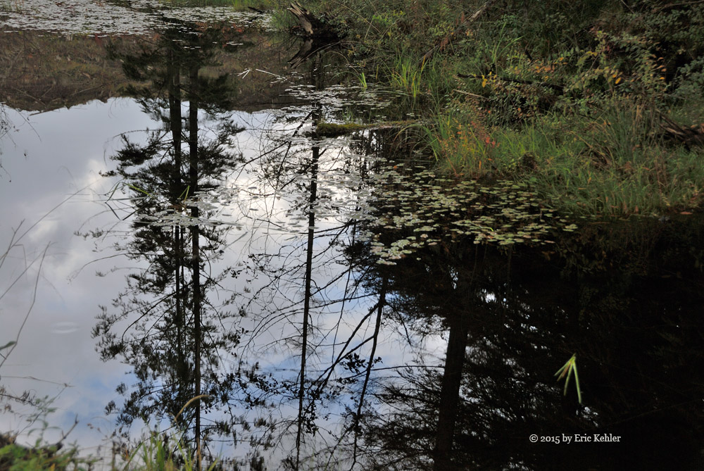
After a brief discussion we decided to backtrack and leave the Chehalis and drive to the Sts’ailes for the day. I had wanted to explore the area burned in the Wood Lake fire and today was convenient with our hike canceled. So after a brief stop at Elbow Lake for a few photos of the mist on the lake we set off for the Harrison area. We made good time and soon were driving along the first section of the FSR. There is a small lake quite close to Wood Lake which has a small cabin on it and we were wondering if it was still there.  The area looked much as always as we drove north and it wasn’t until just before Wood Lake that signs of the forest fire could be seen.

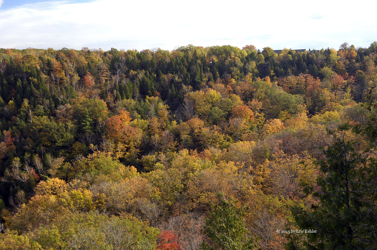
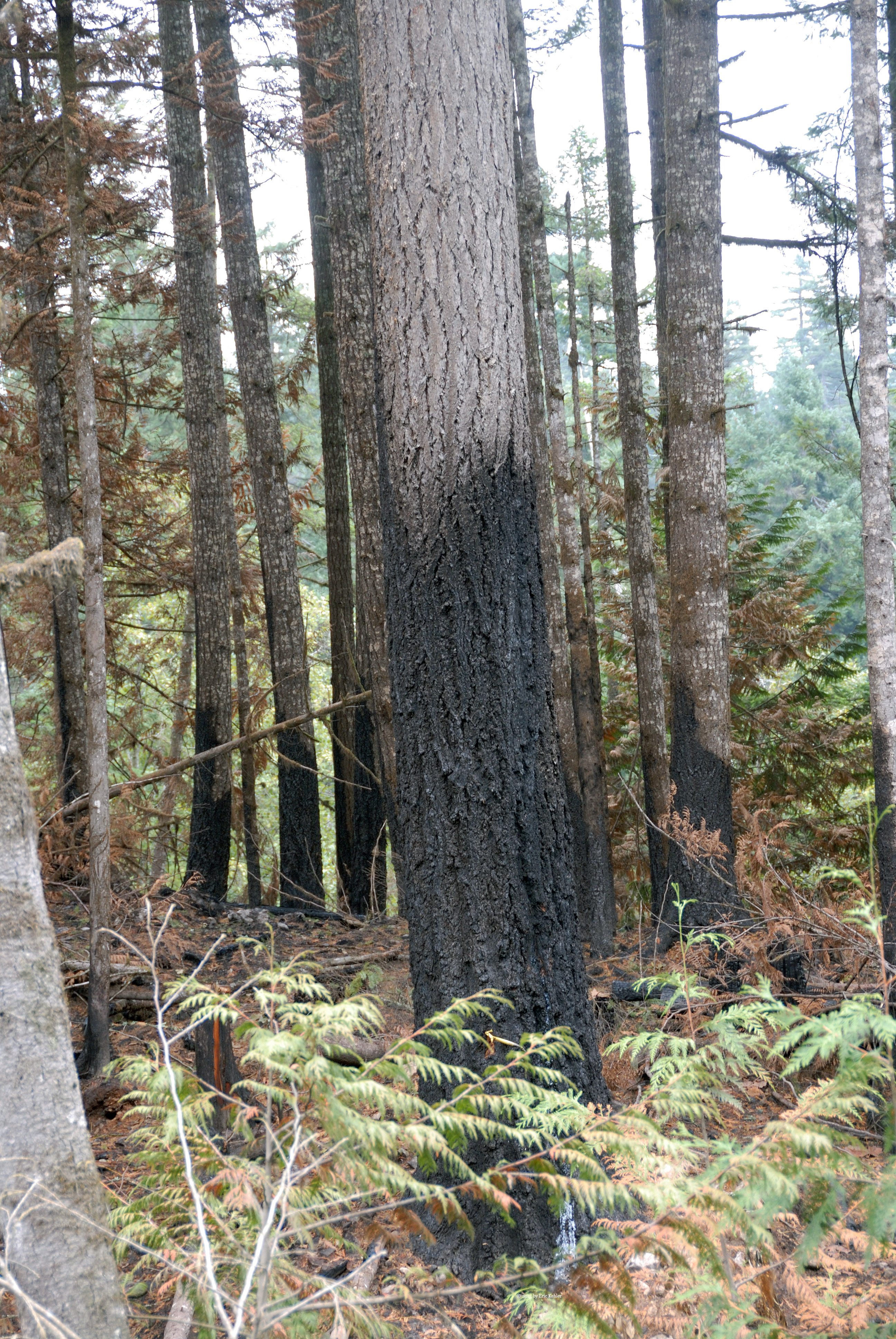
We found the side road to the cabin and drove up it, the area looked green and burn free so we were feeling fairly comfortable that all would be well at the small lake. When we arrived at the wide camping spot looking down on the water we could see the cabin through the trees, it was in fine shape and was not touched by the fire.  After short visit we returned to the mainline and continued up to Wood Lake where we finally saw the start of the badly burnt area. Fortunately the area around the lake and the camp ground had only the underbrush burned, the trees were still standing and green. It looks like in a year or two it will look fairly reasonable for a camping spot.

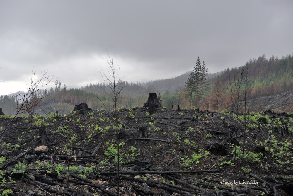
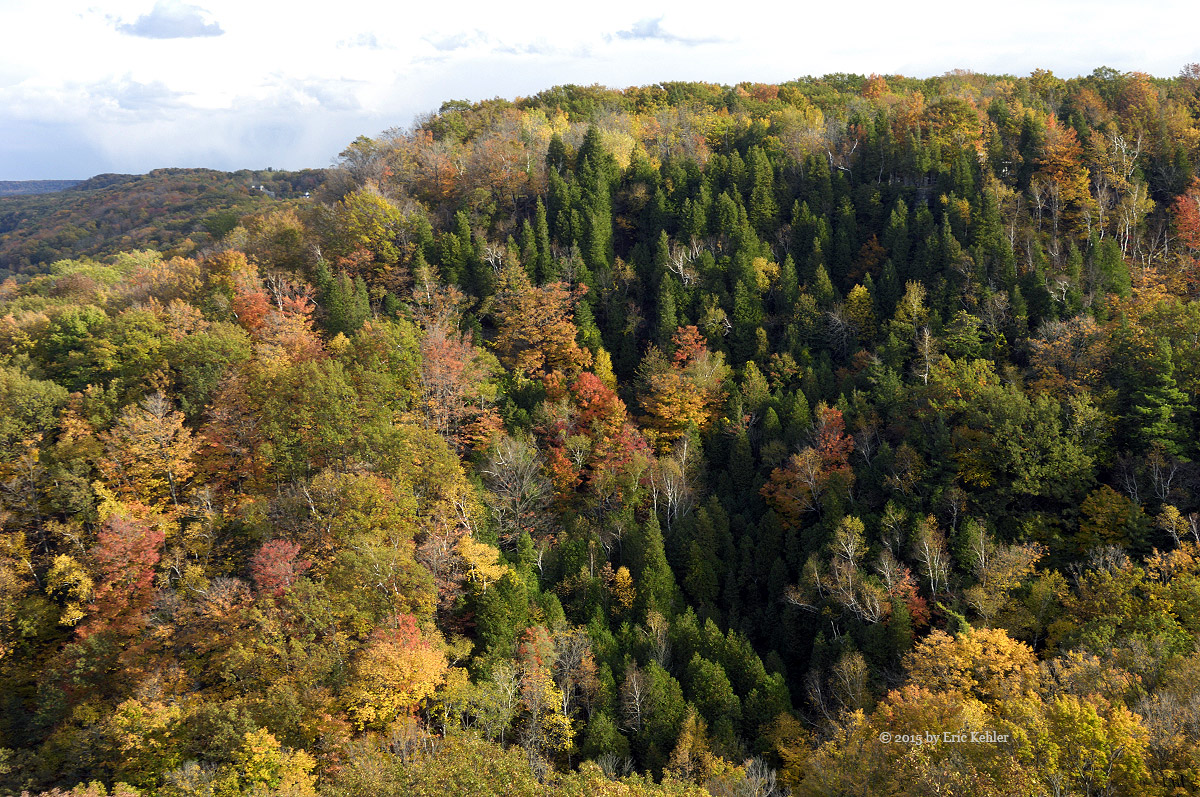
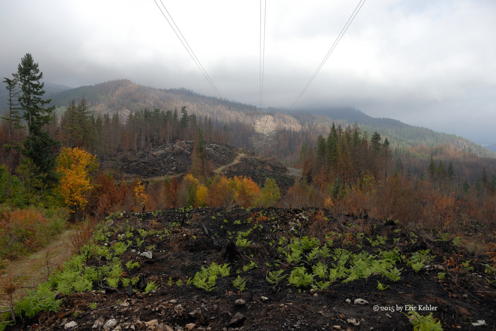
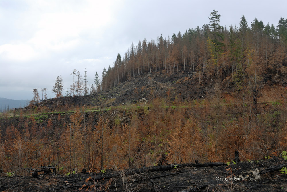
Continuing past the lake we encountered the first area that was burned to the ground. The trees were gone, all green was missing, just charred ground. The rock face of the cliffs were very odd to look at. Previously they were mostly hidden but what could been seen was covered in moss, today the rocks were fully exposed and crisscrossed by black soot from the moss. They rocks looked so stark without the moss giving it life. This starkness continued for miles. We stopped at one spot where we had a view across the valleys, we saw that the fire had burned one spot to the ground , another the trees were dead and brown but still standing, and a third area had the ground cover burned and the trunks blackened but the trees were still green. Amazingly across the open charred expanse ferns were popping up all over bringing back the greenness of life to the dead valley.

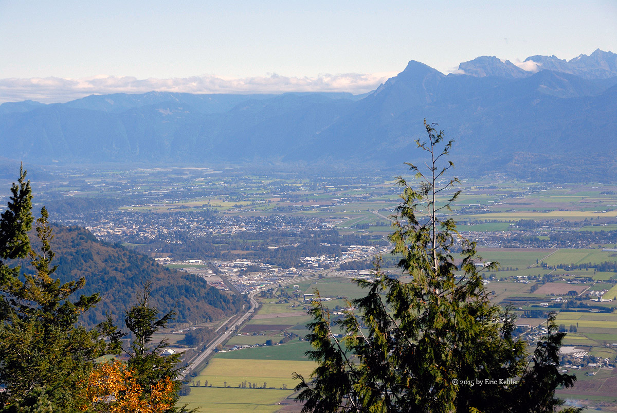
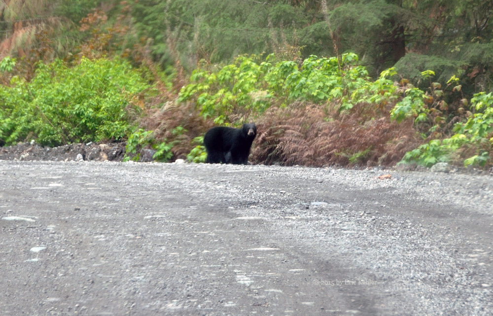
We continued along the road a bit further only to spot two bear cubs playing on the side of the road. They quickly descended into the bush as we approached. We never did see their mother. Our next stop was to look over the start of the Hale Peak hiking trail which goes to the fire lookout on its summit. I had hiked this trail earlier this year and I wanted to see how it survived the fire. I hope the fire lookout building on the summit was saved, I understood that it was a priority but one never knows. As we neared the start of the trail we were struck by how open the area was now. The side of the mountain was exposed burnt rock and the first section of the trail was now fully open and not hidden by trees. I could see that though trees were standing along the trail further in, the ground was burnt, hopefully the trees were not too damaged and will survive. It was a sad view.

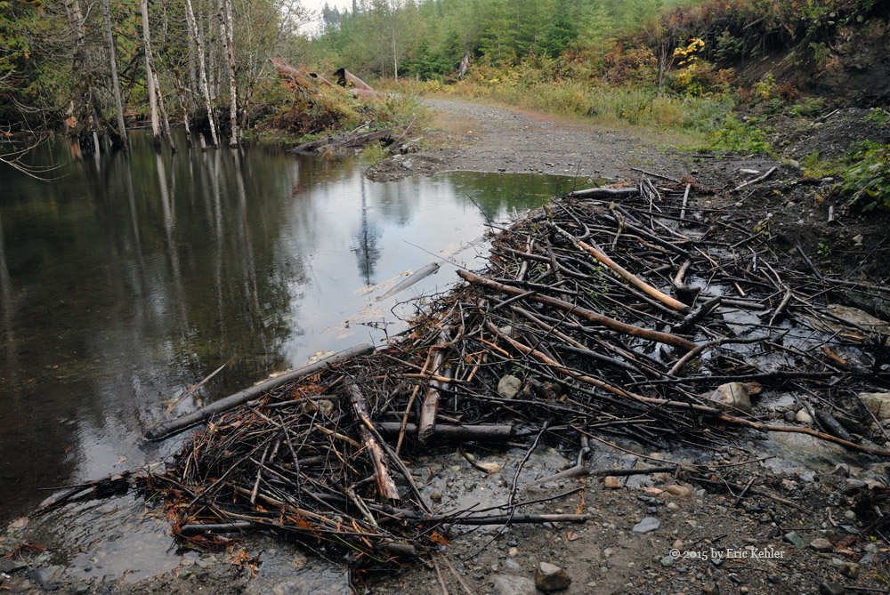
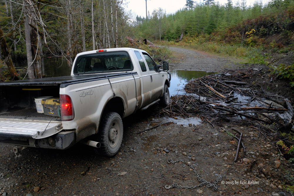
We continued further north and descended to the Mystery Creek fork, by here the area was back to normal as the fire hadn’t reached this far north. We decided to explore the road where we had been stopped due to a beaver dam earlier this year. On our last trip the road had been opened but we didn’t have time to explore the area. When we arrived at the spot of the beaver dam we were greeted with, well I am sure you can guess – a new beaver dam. The dam had backed up the water deep enough that we ddidn’t feel comfortable crossing. We decided enough is enough and we set about to clear enough of the dam that we could lower the water level enough to cross. We pulled out a section and after around 45 minutes the water had dropped 8+ inches and we were willing to try a crossing. It went OK and now we could explore the road.

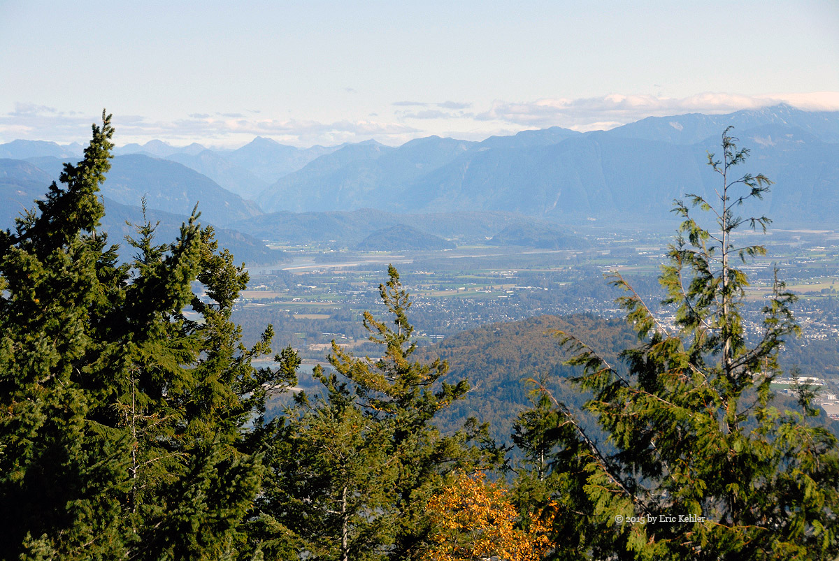
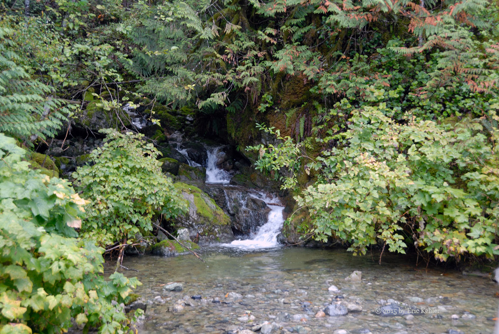
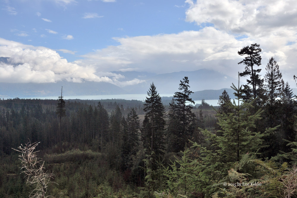
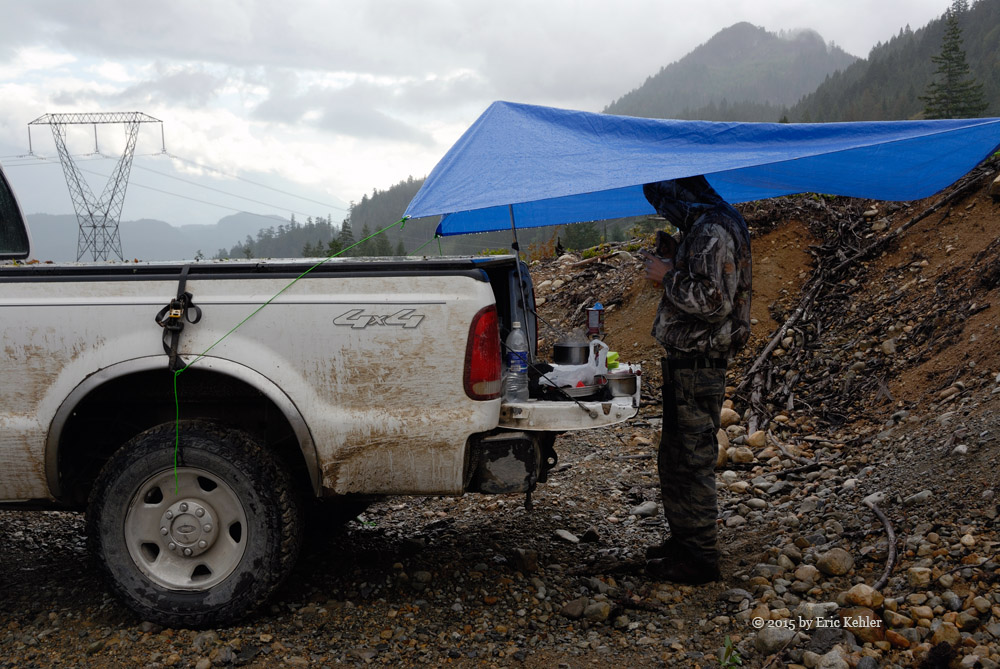
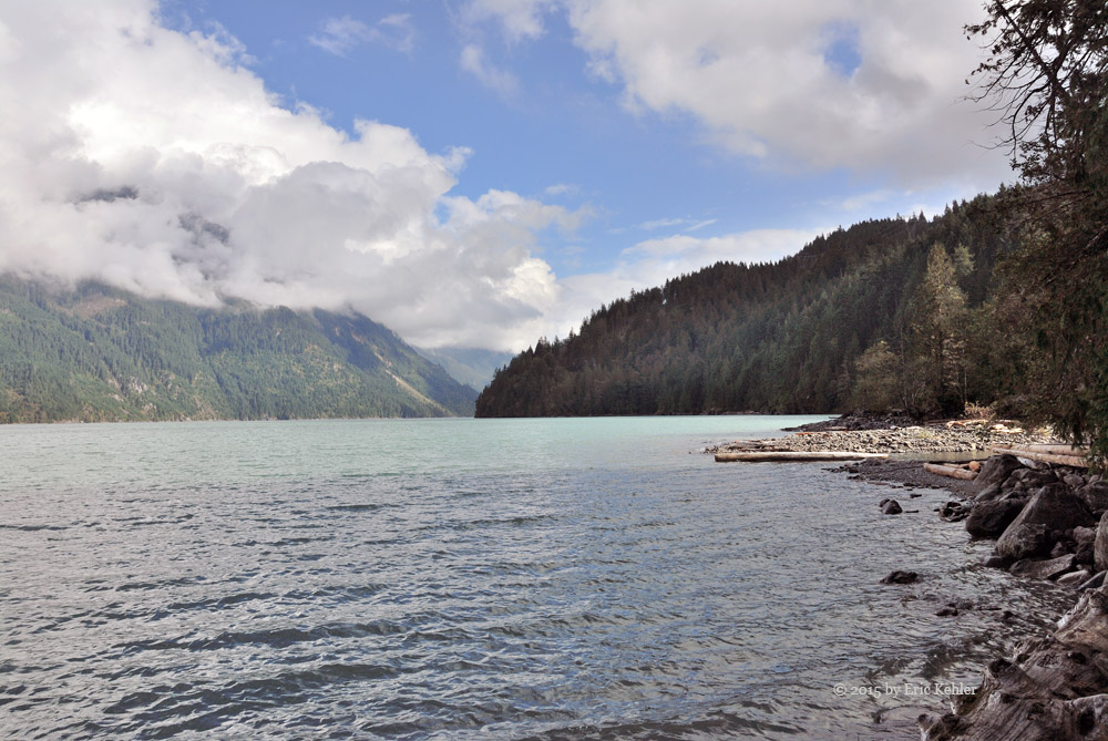
The road led up the slope for some distance and we had a few good view of Harrison Lake before the road led into the upper valley and trees. We eventually had to stop as the road was over-grown and we didn’t want to push on. It took some serious maneuvering to turn around but soon we were heading down and looking for a spot to eat some lunch. We took the only fork we came by this side of the beaver dam and stopped where we had a nice lake view. The rain had started up again and as Geoff had to cook his meal, we needed a shelter to hide under while he heated his food. Fortunately I had my small tarp for hiking and we set it up and cooked under it. By the time we were done eating the rain had passed and the skies were clearing.

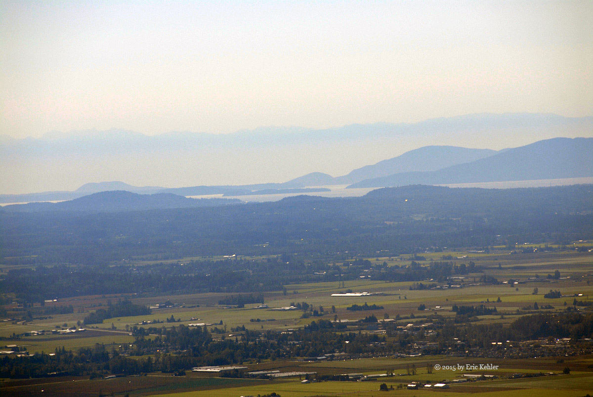
We continued north and eventually came to rest at the Bremner Creek camp site that we enjoy visiting. This is the spot we launched our canoe from earlier this year when we were looking for the Petroglyphs. The place was empty and we had a nice opportunity to look around and take a few photos. It was now  getting later in the day so we decided to turn around and start for home. As we drove the road north earlier we spotted a construction campsite just below the road near Westwood Bay, so on our way back we decided to see what it is about. We think that this camp will be for workers building the power line under the lake for the Big Silver Creek power project on the east side. It was empty while we were there but I’m sure it will be filled soon.

We left Westwood Bay and set off for home as we were both feeling tired from a day of bouncing around gravel roads. So even without the planned hike, we saw some interesting sights around the Fire and just enjoyed a day in the fresh air.

Subscribe to 2015