
2019

Rock Point Park ( Day 2)

Up early for me due to the time change but just a leisurely start for the indigenous population. I enjoyed a pleasant breakfast with Carolyn and then it was back to the room to get ready to head out with cousin Mike. Mike arrived around 10:30 and after a short visit we set off to find an adventure. We had spent some time late last night getting the basic stories in sync so today was mostly business out on the road looking for colour.

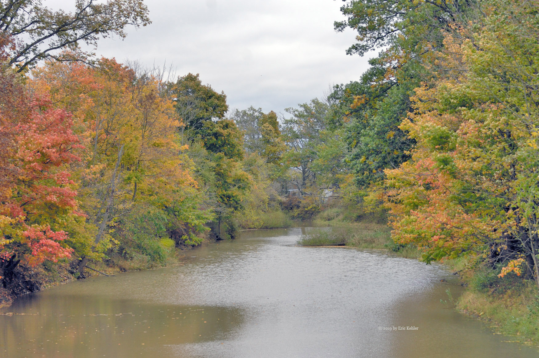
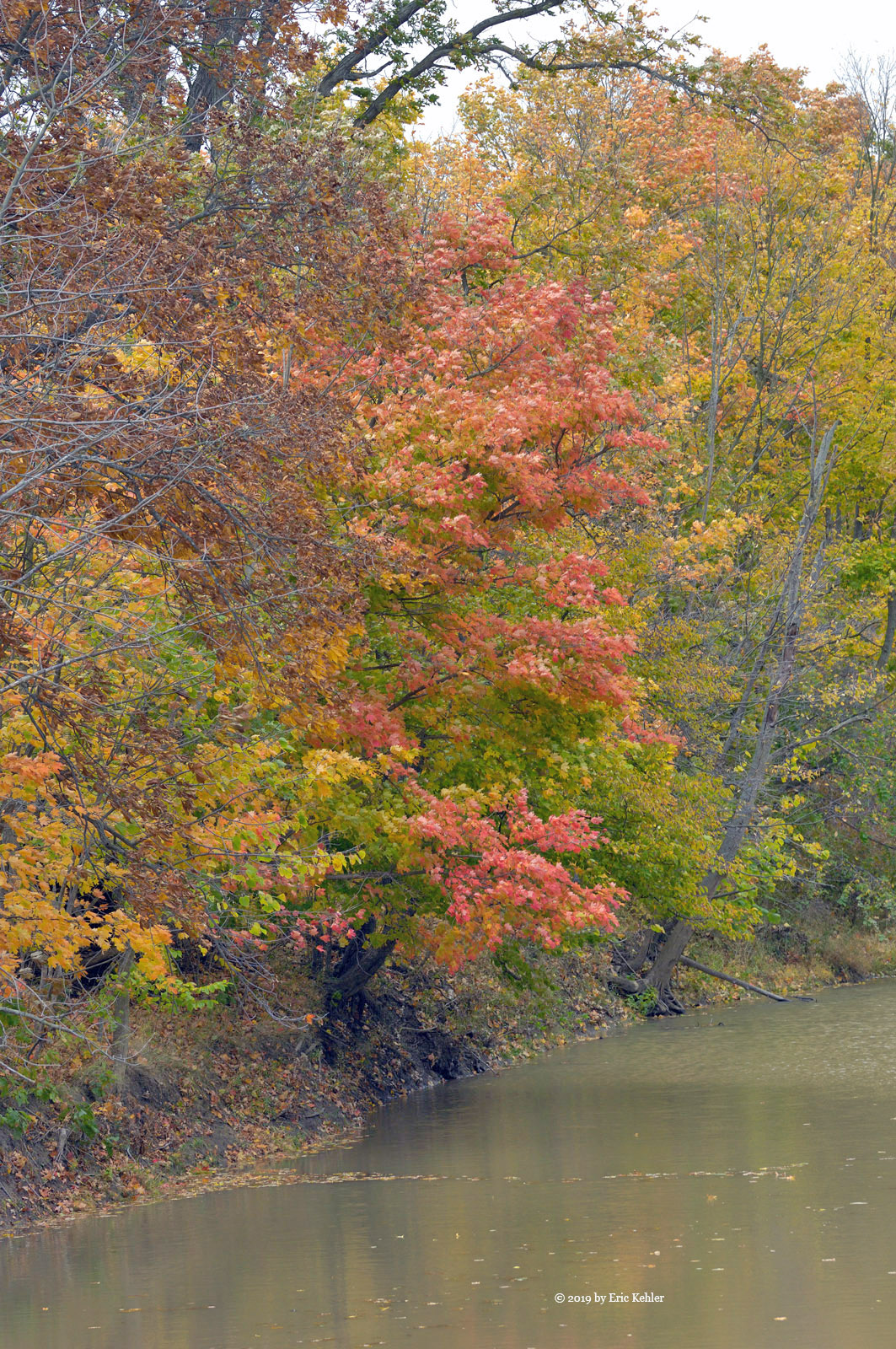
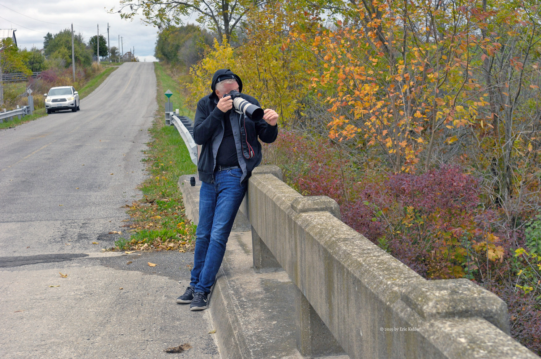
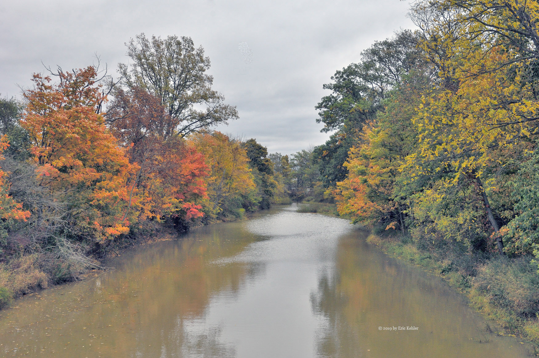
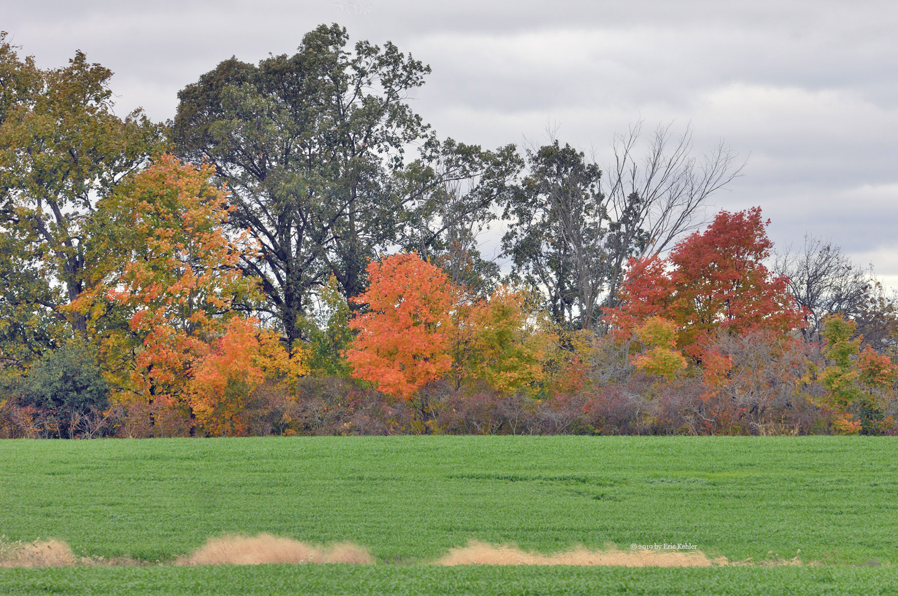
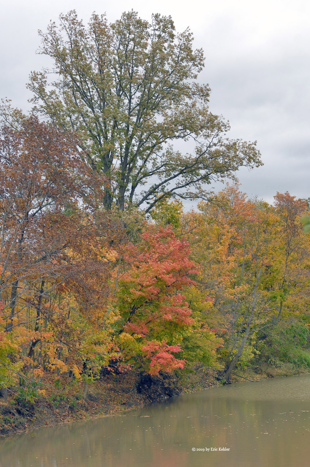
We decided to head south for the day and possibly even spend a few moments on the shore of Lake Erie. So, Mike quickly loaded up with some gas and we zipped up the escarpment for the farmland behind. We slowly made our way south and had driven for some time without stopping as the colours weren’t out yet and the overcast clouds made what was, dull. We continued south and eventually came by a small bridge over the Welland River and there we finally found a bit of colour that was worth stopping for. We parked and wandered over to the bridge and captured some scenes. We had taken photos here in prior years, but it was worth another visit. Done with the river we continued south to the lake and Lowbanks. Along this final stretch we did find one more spot where we stopped to take a few photos but mostly we just talked and drove for the lake.

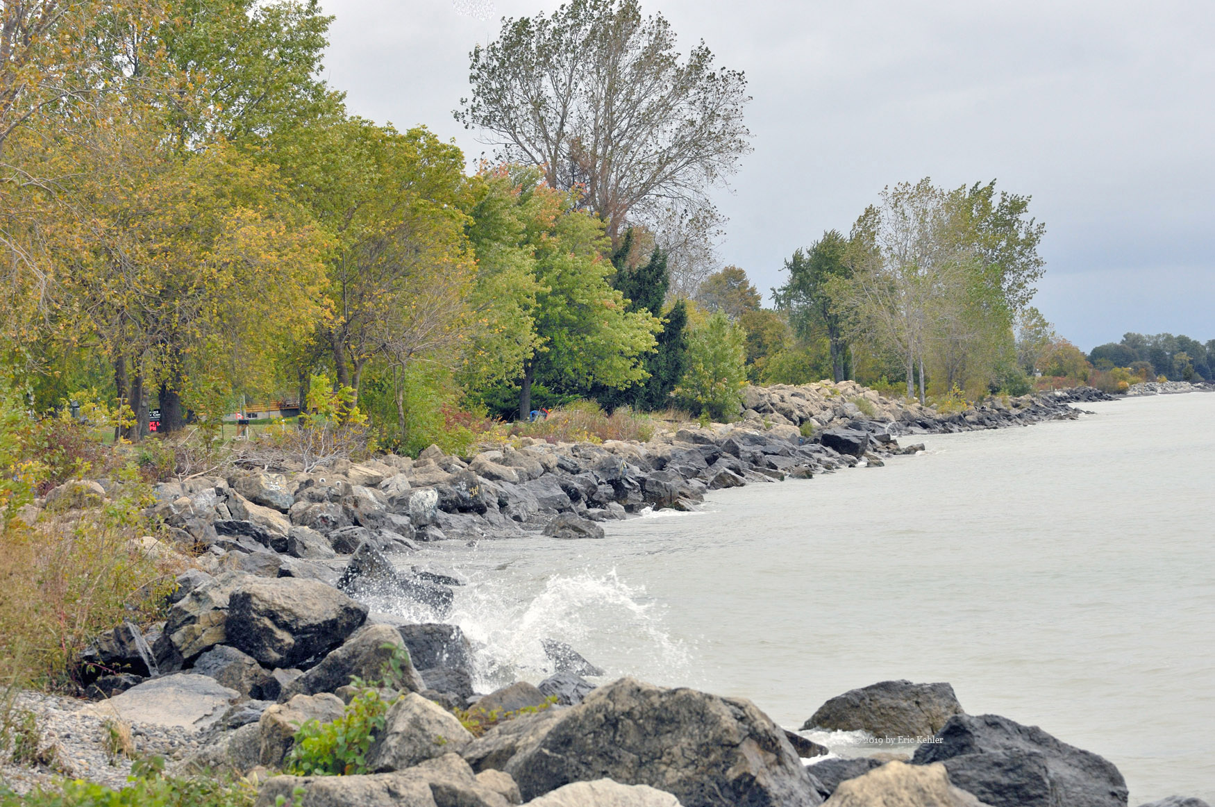
When we arrived at the lake, we were looking for some splashing waves but though it was windy the wind was from the north-west and not causing much wave action. So, the location didn’t work out for us. We drove further east to the Long Beach Conservation area. Unfortunately, it was closed for the season and the wind made wandering the open area less than inviting. Mike suggested we try for Rock Point Provincial Park and so we turned around and drove for the park.

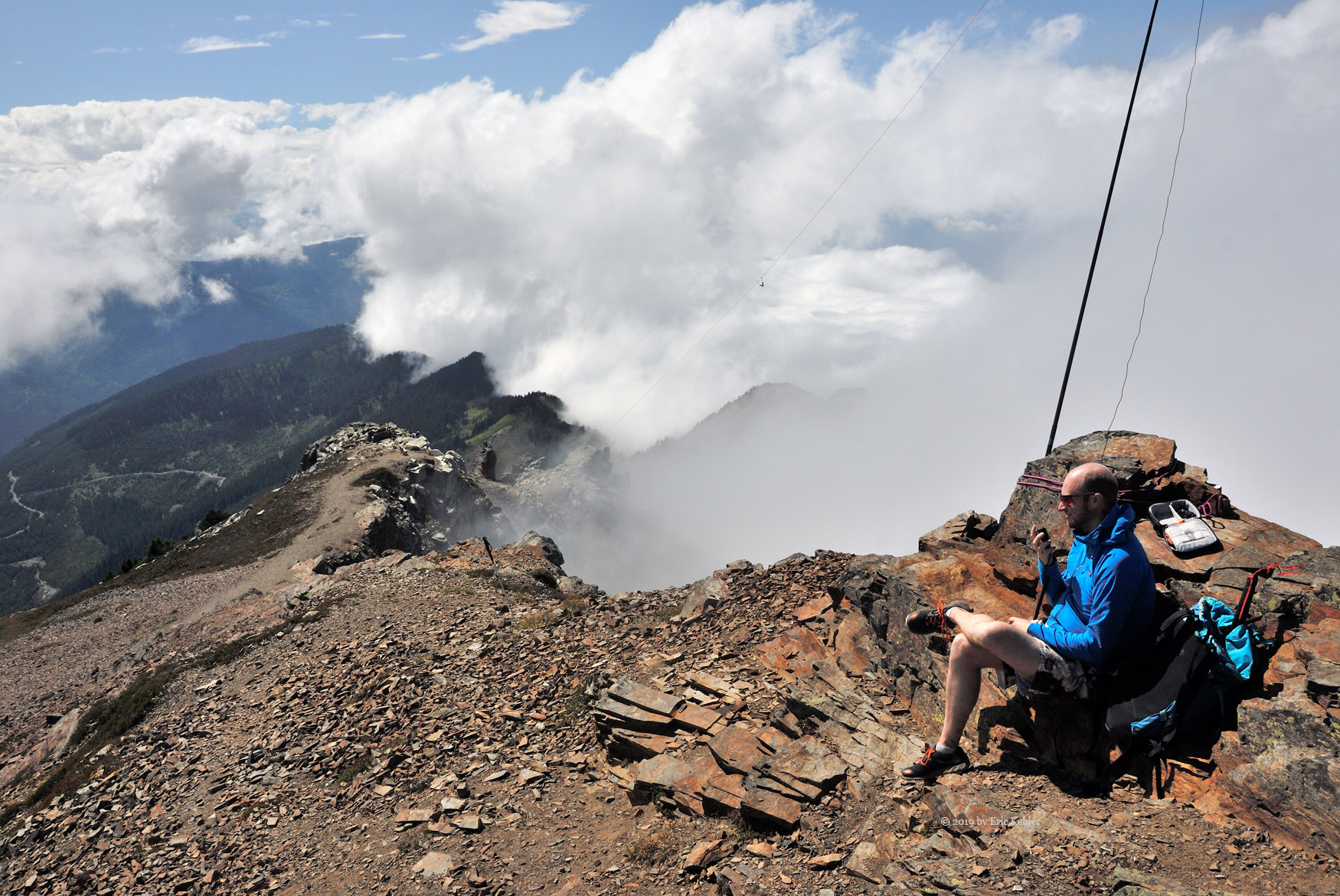
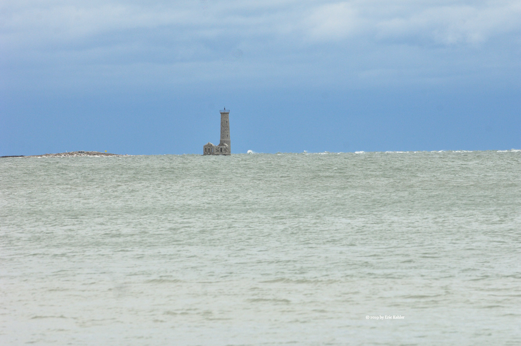
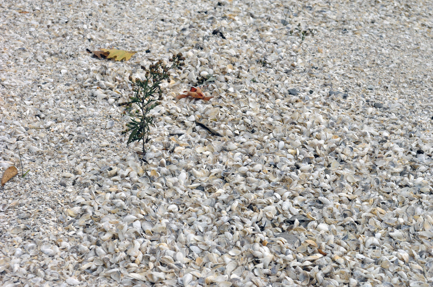
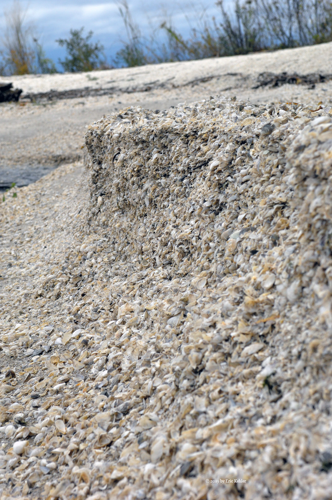
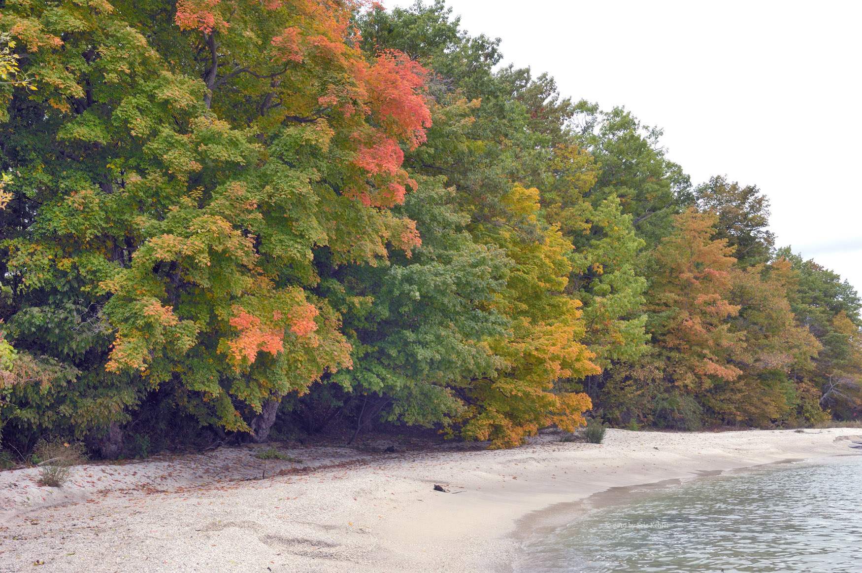
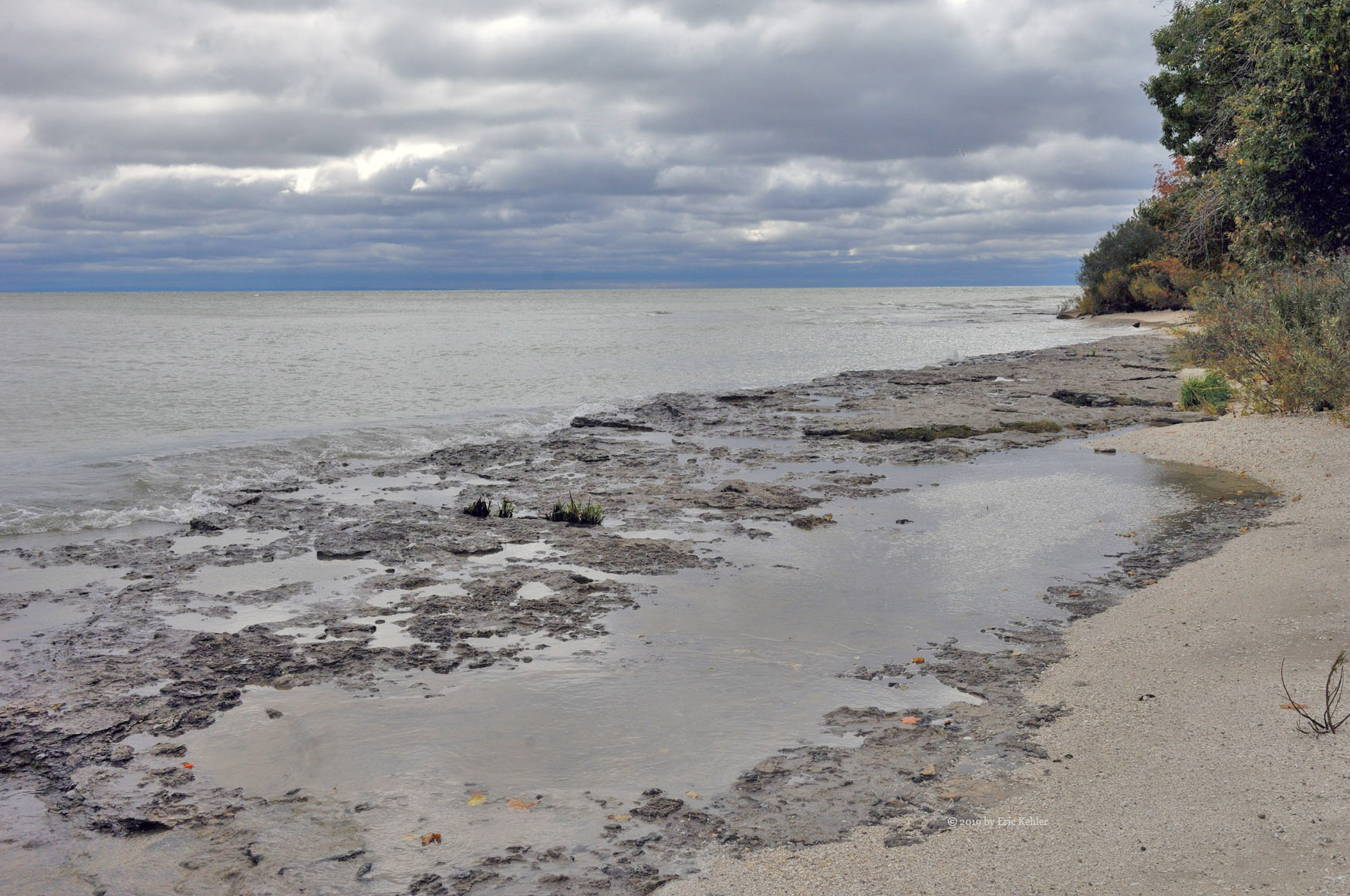
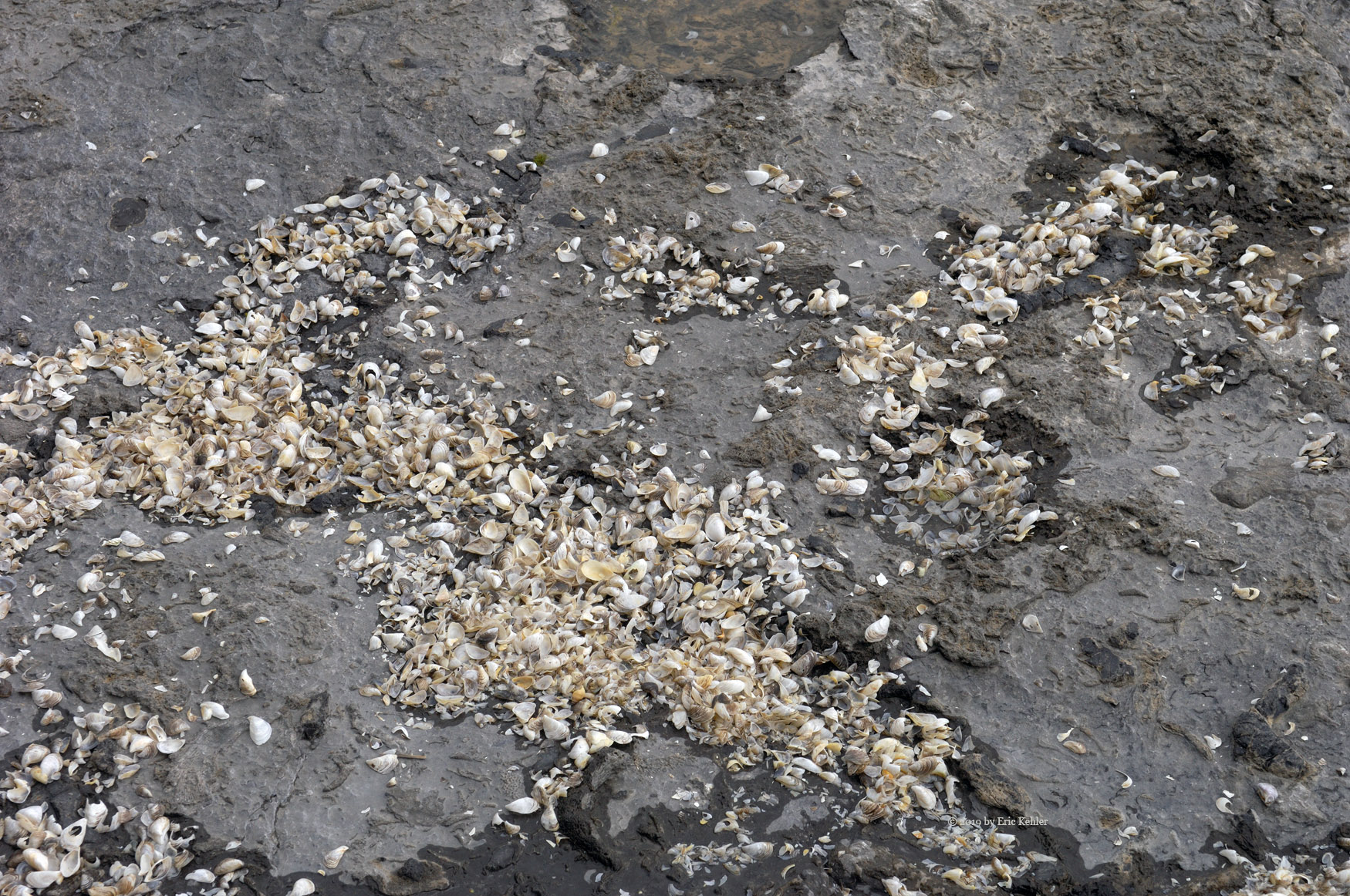
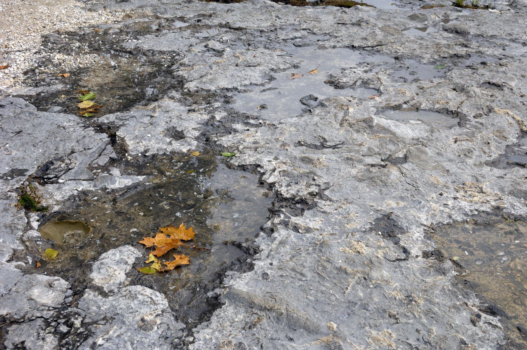
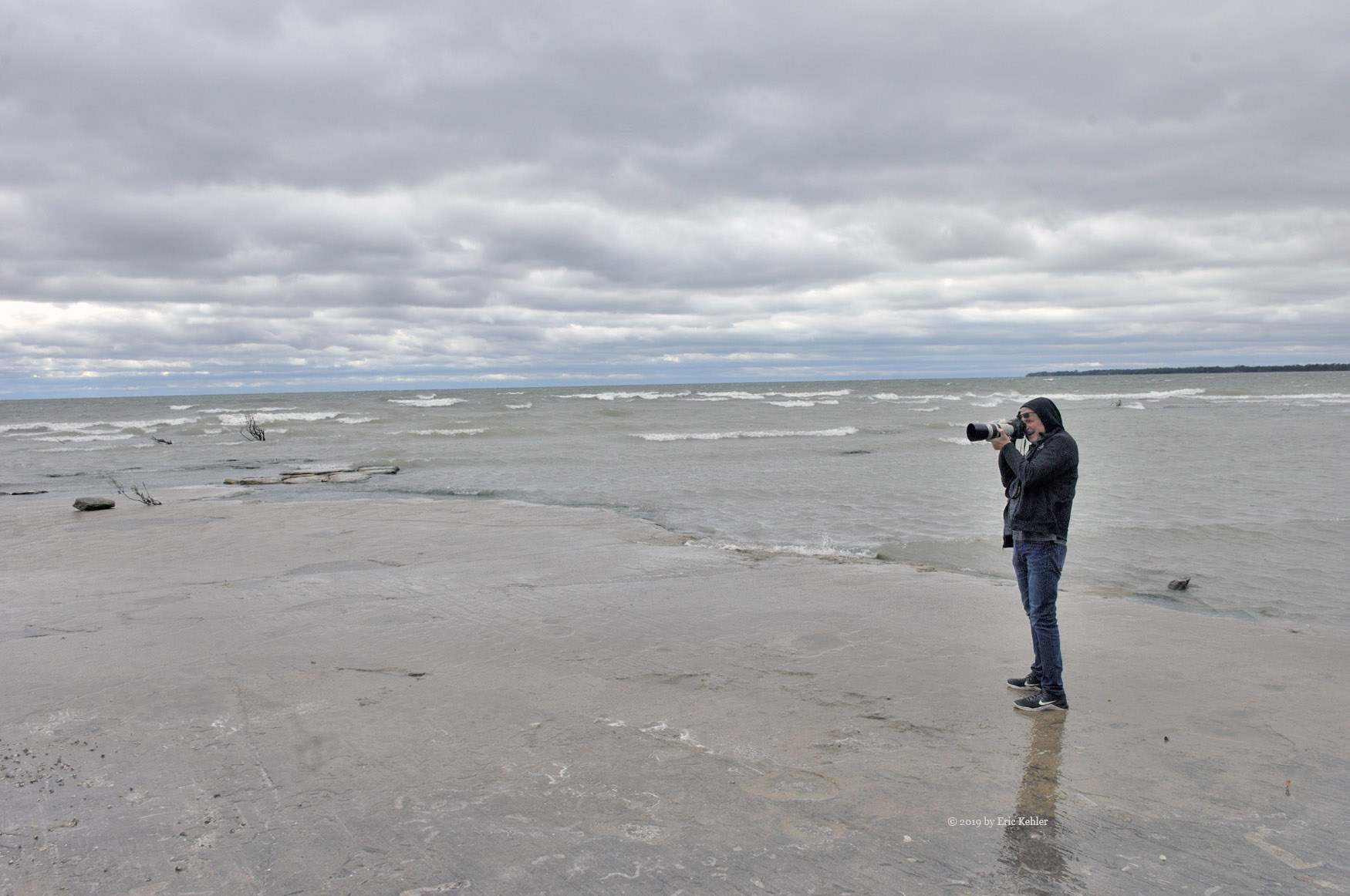
The park was also closed for the season, but a public road made its way along the east side of the park heading for the lake. It looked promising as we drove it to the end where we parked. After looking about and wondering about the parking spots labeled with shooting site numbers we wandered along the trail into the park and slowly made our way on to the far end. We met a chap coming out and he encouraged us to find a platform that offered some nice views of the lake. We continued in and followed the road east to where it approached the beach. There, we found a short trail to the water where we found some lovely scenes to photograph. The shells on the beach were amazingly deep and soft. There were a few trees in vivid colour and the various textures of shells, sand and rock along the beach made for some very pretty spots to capture. Once we had our fill of this area which was labeled with ‘site 4’  we followed a stairway back to a trail that followed the coast and starting looking for the platform. We soon found it and were enjoying what remained of the view from its top. It looks like it would be a very pretty view, but they really need to cut some tree tops.

We continued along the trail and found another trail down to the water; this site wasn’t as pretty as the first and was less protected, so the wind based us off the beach family quickly it was shooting site 1. We were getting hungry by now as it was well past noon, so we decided to return to the car and head to Dunnville for lunch. We found a nice fish and chip place; the meal was quite good, and the fish cooked very nicely. While eating we had a pleasant chat with the owner and then a local homeless chap who came in as we were finishing our food.

Done with lunch we decided it was time to head for home so we could get ready for dinner. The drive back went quickly as we didn’t find anything to stop for. I’m sure there were plenty of sights to enjoy but were had had enough for the day and were hoping that we would have some sun tomorrow. The day worked out fairly well even though the clouds made it quite dull.

Defeated by Mount Archibald

For a few years now Mount Archibald has been on my list for an activation. I have looked over various approaches to the summit as there are no published trails for it. There are references to an old ridge walk trail starting down at Bridal Falls and ending on Mount Cheam but those were dated and not of much use. So, when John and I completed our hike of Mount Cheam earlier this year we did a bit of scouting. Well, the day finally arrived for us to activate Archibald. John arrived at my place at a more leisurely hour as we were not expecting to use the crowded parking lot.  We set off for a fun day of adventure.

The drive to the forestry road proceeded as usual and we were now at the start switching the truck to 4x4 mode and dialing in the resource road channel on the radio. We noticed another chap in a jeep getting his tires ready for the road so we guessed he would be following us to Cheam. We set off and soon reached the fork for the Chipmunk. Here we saw some construction equipment and warnings of construction on the road. We continued in and saw that the trees along the side of the road were cleared, and eventually we came by some parked excavators. Though the road was not improved, it looks like they will be doing so soon. I surmised it is all in relation to a site survey being done to bring a gondola up to the Archibald Ridge.

We continued along to the fork I reviewed on the map as a possible route up. Here, we turned off the main road, but this fork soon narrowed, and we decided not to continue but to drive further up the mainline. We passed the next fork which we had explored last time here and just a bit before the parking area we pulled into another fork to park, we couldn’t go in far due to a big berm across the road. This road made its way in the direction we wanted so we parked and got our gear on. By the way, it was snowing!

Now I hadn’t expected snow on this trip, I really should have but the summer just didn’t seem over at home yet and I really didn’t think about it enough. John did of course. So, when ready, we started up the old road, but I was soon running back for gloves. Then we continued up the road and were making good time to its end. Now John had to carefully pick a path to the ridge line above us while avoiding the steepest sections. We had some soft areas to navigate and by this point the ground had an inch of snow cover. Soon we reached the treed area and found it reasonably passable though the snow cover did make it a bit slippery in places.

After finding our way up the slope we finally reached the ridge. Wouldn’t you know it, we spotted some fresh trail flagging and the old trail along the ridge! The flagging was very recent and made following the trail easy. Now we could pick up time as the trail made it much easier. That said we soon came by the next rise and the trail made for a steep rocky section. John, in the lead, started up the slope but soon decided that it was too slippery, and we would need to find an alternate route for the next bit. He continued a bit further but was looking down slope for a way forward. I was still a bit above him on the slope and trying to find a stable footing. Unfortunately, as I was planning my way down to John my foot slipped, and I fell forward upslope onto a flat rock with my right shoulder. My shoulder did not appreciate the gesture.

Laying on the snow I started to get up only to notice my right arm was not cooperating. Lifting it caused serious pain, I left it dangling. Next thing was to call John back to provide some advice and help. He quickly looked over my shoulder and though it didn’t seem like it was dislocated it was definitely needing attention. He helped me find a spot to sit down and then he looked over my arm. It wouldn’t bend into a sling, so he secured it along my side. By now we had concluded that my shoulder must be dislocated or worse. John helped me back down to a level section of the trail and then we continued along a short way to a sheltered area. He then had me sit down while he dropped his pack and zipped along the trail to see where it went.  We were in the situation that if he didn’t find an easier way out than which we came in on, we would need to call for help.

After about 15 minutes John came back saying that the trail looked good and there was a fork ahead with the one branch heading down to the road. So, we got our gear on – John with both packs. And we carefully made our way along the trail to the fork.  I was doing fairly well with my arm hanging straight down. Soon we reached the fork and started down the trail that made for the road. This was steep in places and I did manage to slip a bit and fall again but this time it was quite gentle. After about another 1.25km we reached the parking area! Here was the trail we could have taken up, if only it was marked on a map, well we know for next time.

We walked the road to the truck and I carefully got myself into the passenger seat, John would have to drive us out. It took a bit of maneuvering to get comfortable, but I eventually found a tolerable position. The only challenge left was to figure out how to reduce the jarring of my arm on this very rough road. John did a decent job and we soon were back to the smoother bench road and then the pavement. It was quite a job getting off the slope and onto pavement, but I was now there thanks to John’s skill and training as an outdoor guide. – handy to have knowledgeable friends.

As my arm was doing OK and I wasn’t in much pain we opted to head straight home and have my wife take me to the emergency for treatment. Decision made, John made straight for home, fortunately traffic wasn’t bad, and we had only a few short slow-downs. I called Carolyn once on the highway to warn her of my upcoming needs. Once at home we quickly unloaded me and John’s gear from the truck and I got loaded into a car for the final drive to emergency which is only around 5km away. Fortunately, emergency was not busy, and I soon was having an x-ray to confirm the dislocation and then some sedatives to relax the muscles so my arm could be repositioned. Another x-ray and I was off for home.

So now I have my right arm in a sling, no real pain, a mountain that is still waiting for me to activate and a period of convalescence. Unfortunate, but it could have been much worse. I am thankful to have a professional guide as a friend to go SOTAing with. He really has taught me a lot and has now proven to be a good safety resource.

Return to Grant Hill

Grant Hill is a minor summit with a road to the peak. It isn’t overly hard to walk and is covered with bike trails. Even so, it is still a nice place to get away from the bustle of normal life and just enjoy a few moments of nature. Normally I would only do a summit once a year as points are only available once per year. So it was a bit odd to be returning to Grant so soon, as we were here in February. But we had a particular reason to return, or at least Ralph did. 

On our visit in February Ralph used his throwing rope to pull his antenna over a tall patch of brush. It worked well unfortunately on our next adventure he discovered he was missing the rope. Thinking back he felt he had left it on Grant so for the next several months as we did other summits he repeatedly reminded me how he missed that rope. I’m not sure if it was particularly designed for the task but it certainly had some sentimental value. It had become an ongoing recital and it was time to find it before desperation set in - mine that is. 

So we planned to activate the summit the week prior to today, when other SOTA members were activating summits for a big summit-to-summit party. Unfortunately, Ralph had forgotten about a trip to the states he had planned with his daughter. So, the activation was delayed a week.  At least this week-end there was a SOTA chap activating Sumas Mountain in Washington and who had never worked a Canadian station before, so I planned to be there for him. 

Ralph came by my house and we left at 9:30, a quick stop for coffee and we were off for the summit, no need for gas as we were using my wife’s electric car. The drive to the summit took around 50 minutes and we quickly closed in on the locked gate. We slid into a parking spot and loaded up with our packs. The gate is around 900m from the road end and about 100m below the top elevation, not overly hard but still a steep walk. We started up the road and soon reached the end with the Telus buildings and towers. We turned west along the trail to the high point where we operated last and there we stopped our packs and planned our setup. 

First things though, Ralph was determined to look for the long-lost rope. He was wandering all over the area where he had used it to no avail. I decided to help, and I wandered over to the big log where we had set up the radios. I peered over it to the ground between the log and all the brush. I immediately spotted a partially coiled up greening rope laying on the ground. I called Ralph over and he quickly picked up and cradled his long-lost throwing rope. Looking over every inch for any damage. Even the combo lock weight he used with it was in decent shape. It was back home and though a bit green, after a wash it should be in good shape. Ralph immediately put it to work in pulling up the antenna for today’s activation.

I set up my 2m yagi and made a few calls, it was very quiet for a while but then I worked a fellow sota member activating Mount Jeffrey on Vancouver Island. Soon I had a few more in my log. Meanwhile Ralph was using his KX1 making some CW contacts. He was having a harder time being heard today. One of the other tests were planned was to use my KX2 with the 100watt amp to see how it did. We set up the KX2 and amp with Ralph’s battery initially and set the power to 30 watts. He did much better at being heard. I was still waiting for the chap to reach the summit on Sumas so my battery was in use. Once I had KJ7EHA in the log I shutdown my 2m radio and added my battery to the power amp, we raised the power to 75w and I made some 20m SSB contacts on the east coast, it sure works better than at 12 watts.  

The higher power made a considerable improvement for both of us and makes 20m SSB possible out here. Now to find a way to get it to higher summits with longer steeper trails! Once I had completed my 20m SSB contacts we packed up the gear and set off for home. The nice thing about that location is the number of mountain bikers coming by. The area we were in is a rest point for them as they get organized for the ride down. That gave them time to ask about what we were doing, several were quite interested. So even though I got no points for the day, I did get some S2S points and we proved out the value higher power for our SOTA situation. But even more importantly, we found Ralph’s throw rope. Now I can hike with him in peace again. 

Vedder Mountain for Three

The trail along the Vedder Mountain ridge is a very pleasant well maintained route which would be usable year-round. It is a lovely walk, not overly hard but it is almost 5km each way, so a bit long. It is a summit and hike I plan to do annually and this year I was saving it for an outing with my son Nick. The day finally came and we got things organized for the day. We were fortunate to have Ralph join us, so the three of us made a day of it.

Ralph came by my place for 8:30am and we quickly loaded our three sets of gear into the truck and started off for the trailhead. The drive went quickly with the two standard stops and low traffic on the highway. Soon we were starting up the logging road and then the final rougher spur to the trailhead. Once parked we quickly donned our gear and started off. The first thing we noticed were steps built into the deep cross ditches that blocked the start of the trail. The ditches were there to keep atv’s out but they made crossing a bit hard. Now with the steps in place it was a very easy crossing of the ditches.

The trail continued along the old road for a couple hundred meters before it turned off into the forest. We soon were walking the trail proper enjoying the cool air in the trees with the start of the fall smell in the wind. It was really a lovely experience walking through the trees. The trail does go through a series of ascents and descents as it follows the ridge but none are overly long or steep. As we neared the first lookout to the north we met a couple coming back. They had enjoyed the hike to a point a bit beyond the lookout but they hadn’t made it to the summit. We continued by and soon we were enjoying the view of the Fraser Valley.

After a rest we continued the trail. There had been a number of improvements along the way including a number of new steps dug in at the steepest points. After a bit more walking we came to the stone outlook to the south. There is still a small bit of view left here but most of it is over-grown. A shame as it would be a lovely view of Cultus Lake from there. Once re-energized we continued along to the sub-peak and then down the long descent to the lake. The boardwalk was partly covered in fern growth but prior hikers had worn a path of ground up fern along the walk. It looked kind-of cool amongst the tall growth and plank walkway

The next section of trail worked its way along another pond and then started upwards to the steepest part of the hike. We needed a breather at this point as the steepest section was next.  Nick was not impressed with the next bit of trail but he was determined and so he started up and soon he had passed this hard section of trail. Next came the ‘fun’ bit with a short bridge crossing a vertical cliff and then a rope for help climbing a rock face. All was passed with little ado and then it was the final rope climb to the top ridge. Here we noticed that the rope was still there but a notch log was gone. In climbing it without the log I actually found it easier then with, so I guess others felt the same.

Once on the top we followed the trail to the small summit area and there we flaked out and after we regained our breath we ate some lunch. Now it was time for our radio work. Ralph went off to set up his vertical antenna with my KX2, I set up my 2m yagi and as soon as it was on I heard John Bell calling from a summit up Howe Sound!  He was really strong considering he was only using a handheld with small antenna! We made a Summit-to-Summit call and then we worked a few more stations in tandem before he finished and I continued for a few more. Meanwhile Ralph was raking in 20m CW contacts. Once Ralph had enough in his log, I managed a single 20m Phone contact. We both had enough contacts in the log and so we called it quits and packed up. We made fast time down the steepest section and then along the trail. We encountered a few groups coming towards us as we were walking out but there weren’t many on the trail today. So it was a nice experience with the place mostly to ourselves. Once back at the truck we were able to relax in the comfort of a soft truck seat and the cool A/C. As it was Labour Day and the crowds were packing the highway we drove the backroads to home, that went quickly and we were home by 6pm! Another great day out in the hills and getting exercise and fresh air all at once.


No Room Left on Mount Cheam

I have hiked Cheam many times over the last couple of decades. It is always a very pleasant hike and the views are so worth the effort. Unfortunately, lots of others have also learned of the beauty and the accessibility that the numbers coming has grown rapidly, but the mountain is not without its own form of crowd control. My last hike up Cheam was in 2016 so it was time for another adventure. Last year I did Lady Peak beside Cheam so I had been here fairly recently but it is an easy 6 point summit so regular visits are in order.

In my planning for this season, Cheam was on the list from the start, I had asked John if he was interested and he said he would like to go. So I just needed to find a time when we were both available and hope for good weather. Well the day finally arrived. John arrived at my place around 7:45 and we quickly loaded up and set off for the trailhead. We hoped we left early enough as the crowds quickly over fill the small parking area on a week-end. Last year we came mid-week and shared the place with one other. Today it would be different. We made quick time to the start of the FSR and there we switched to 4x4 mode and dialed in the road frequency on the radio.

The drive along the bench road was fast, we had a jeep tailing us and we assumed it may be following us the whole way – it did. Now the Chipmunk FSR is the main road going from the bench road to the trailhead. It is a very rough road with some large steep cross-ditches and many deep pot-holes. Not a road for street vehicles. The road is really not a safe one to drive for people not experienced with 4x4 driving and so the mountain does crowd control by keeping out the less equipped drivers. Despite the extreme road, there are many vehicles driving it at a snail’s pace, bottoming out and still continuing on. Right at the start of the road there is a huge cross ditch that should warn people off but today I even saw a small car starting out on the road! All I can say is that it was a foolish decision.

We finally arrived at the parking area having left the jeep behind. It was already mostly full but we found a spot to park and then we got our gear loaded and we set off for the trail. After a 150m I noticed I had dropped a glove and so I returned to the truck to find it. The glove was on the ground near a log we had to cross. Glove in-hand I returned to John and my pack and we continued along the road to its end. Next was the descent into the bowl formed by the flank of Cheam and Lady Peak. It really is a wonderful spot and a lovely place to camp except I noticed that there was now a no camping sign posted!

Continuing on to Spoon Lake and then the initial steep section we made good time to the upper shoulder and the alpine meadow. Here I noticed that many of the side routes had been roped off with warnings to stay on the main trail so that the area can heal itself. This was new since last year, I guess the crowds were eroding too many spots along the fragile meadow. It was good to see the attempt to improve the slope and I hope people stay to the designated trail. It may be a bit longer but it is the easiest route. We continued along to the point where the Cheam and Lady trails split and there we took a longer rest.

While resting another group came by with plans for Lady Peak, they asked about the route and John gave them some detailed directions, they seemed quite surprised that he said it would take them between 2 and 3 hours more to reach the summit. They thought it over and then continued on their way. We watched them a bit as we continued up Cheam. We continued to make good time along the trail to the summit. The weather was warming up a bit as the sun was peeking out from the clouds more often but it was still a great day for hiking and not overly hot. Soon we arrived at the top ridge line that continues right to the summit. Continuing up to the summit, there we and took a few moments to enjoy the view. Unfortunately clouds were blocking most of the valley view and with the numbers up there we decided it would be safer to set up our antennas a short distance down the ridge where the crowds were less.

So we dropped down a short way to where there were some good rocks to use for supports and we set up for the radio work. I soon was on the air with Ralph talking to me as my first contact. Next was Mike from the southern Island and then Ken from home in White Rock. So contacts were going well for me on 2m. John was having much less luck on HF even though he was using my KX2. With the number of people up there, I had several groups come by to ask me about what we were doing. In places like this one can share so much about the hobby which is why I pack an info card that people can take way with them. After John and I had enough contacts in the log we packed up the gear and started the trek down. A bit below the summit we stopped to view Mount Archibald to the west as we hoped to try it before long. There aren’t the trails available to it so we need to plan a route and looking down on the summit area helps with the planning.

Once down to the upper col we took a short diversion to the north cliff edge to enjoy a view of Waleach Lake far below. It truly is an amazing view from there. The clouds had parted enough to give one a great view of the area. The rest of the trip down went smoothly though the final leg along the road always seems to take interminably long. Even as we reached the truck more groups were just setting out for the trail. It really is far too late to be starting out for the summit but even a hike to the bowl is worth the effort.

On our drive out we took a short detour to explore a road spur that may be a route to hiking Archibald. It was pretty narrow in places but we managed to drive it to a wide section where we could turn around. Done with exploring it was time to head home. We were making good time back as there were no vehicles in front of us but then we came to a pair trucks inching their way along. Once would think that they would have noticed our quick approach from behind and that we may be just a bit faster than them and that they could let us pass. But no, they just kept hogging the road holding us up as they slowly worked across each obstacle. Perhaps they thought that no one would be any faster than them but after putting up with their slow pace for too long we finally reached a wide water filled section where they hugged the right side, I quickly zipped past on the left.  A jeep also followed me past and now we could make much faster time. The rest of the Chipmunk road went much nicer now that I could cross the ditches at a decent rate. The jeep soon was left behind as well.

Well we finally finished the Chipmunk road and the bench and pavement was before us. We reverted the truck to city driving and started out for the last bit to home. Being the first day of the long-week-end the traffic was not that heavy so we made good time until we left the highway. Here we encountered a traffic jam as the next over pass had a traffic accident and people had diverted here. At least we were able to get away from it fairly soon and the final drive was fairly light. A great hike and activation. The vehicles on the Chipmunk road amaze me, I really don’t know why people are pushing their luck but that is why there are so many car parts littering the road. I guess it adds to the adventure. And did I mention that as we left the parking area the number of vehicles lined up along the road went on for quite some distance. It really is popular but people really need to plan for a very difficult road. So, that was an easy 6 points for SOTA and I look forward to my return visit.

Hunter Creek for Lunch

I last visited the Hunter Creek area 2 years ago, back then the small power project was being constructed and I wasn’t able to drive the area I most wanted to see. So, it was time to try it again and see what was happening in this alpine valley hanging high above the Fraser valley. The boys arrived around 8:30am and we reloaded the truck with our gear and then set off for coffee, fuel and the back-country. We made good time along the roads, which allowed us to take a few minutes to visit Davis meats to pick up some of their amazing beef jerky. Then it was on to the highway for the Hunter Creek area.

We arrived at the start of the FSR to discover a few trucks parked with their ATVs unloaded and likely somewhere up in the hills, so we would need to keep a watch for them. After switching the truck to 4x4 mode we started up the initial section of road. Prior to the power project this was a very sketchy road with a steep drop-off, but the power project tamed the road and added barriers making it quite safe and boring.   Once past the initial climb the road leaves the cliff face and heads into the valley. We followed the road into the valley and saw the power plant below us at creek level. The power project was in full operation and the roads were fortunately empty of construction equipment. We continued in and eventually crossed over the creek and continued along to the next bridge but here we spotted a water intake dam and so we took time to explore it.

The intake was just below the bridge over the eastern branch of the creek. It had a dam component but that was open and no water was being diverted here. This was an odd situation because the project had two intakes. The main one was up the western fork and this one gathered water from the eastern. After looking over the intake we packed up and crossed the bridge having decided to check out the other intake.

We soon arrived at the second. This one was smaller and simpler in design, there was no dam component and the water was diverted to a pipe with some spillage left for the creek itself. While there a chap and his son drove up in an ATV. We chatted for a bit and I showed him my map of the area. Meanwhile the three boys were down at the creek exploring where Liam managed to get a soaked foot and Ben a wet backside. Lots of fun for the start of the day. Once we had our fill of the river we set off for the road to the top ridge where I had planned to spend the bulk of our time. We back-tracked to where that fork was and started up the slope to the top.

The road was in good shape considering it had been 8 years since my last visit. We quickly ascended the steep road and soon arrived at the end where a tree blocked our path. The road past the tree was quite short and not that interesting so we backed up a bit to a wider spot where we settled in for a few hours. Once parked, Geoff set about setting up a campfire pit, the two boys were helping gather rocks for the barrier. Meanwhile I was busy scouting out supports for my wire antenna. I decided on tying it to a stump on the top of a slash pile and the other end up the slope to a tree. It worked very nicely and the centre was almost directly over the truck! Very good placement. I then set up my KX3 and amp and started calling stations in the Ohio QSO contest. I made a few contacts while the boys were busy getting the campfire going and lunch started.

The two boys were having fun exploring the area and the various steep slopes above the clearing we were parked at. I gave them each a UHF radio and they had some fun with that during their explorations. Soon lunch was ready and we settled in for a nice hot meal around the campfire. We all had enough to eat and then it was back to exploring, and radio contacting. After another hour the wind was picking up and we could see the clouds moving in with some rain, so we starting packing up and were back in the truck as the first drops hit us. I was surprising to not see any of the other ATV drivers while we were up there but as we came down we did spot the original chap heading up the fork that continues far up the main valley.

Once back down to the first road we stopped to gather a bit of wood for Geoff to use at home. He had spotted what looked to be some nice dry wood piled up next to the road and after cutting it,  he loaded it into the truck. While working on the wood we finally saw the other ATVs, they passed us heading out to avoid the rain. Once the wood was loaded we continued back to the entrance, by now the rain was coming much harder. We made good time to the start and there we saw the others loading their ATVs back onto the trucks for transport home.

All was going well until a bit before Bridal Falls where Ben cries out that he needed a washroom now! Well we had a bit to go but we turned off at the Agassiz exit and drove in to the first service station and made Ben much happier. We then resumed the drive home stopping once more in Sardis to pick up some coffee for the final bit of the drive. A nice day with some interesting sights and a pleasant spot to hangout and eat lunch.

Return to Mount Strachan

Early this year I planned some of the summits I wanted to activate this year and Mount Strachan was on this list. I thought it would be a good one to do with my friend Ralph and so I kept it open through the early part of the season for when we could go. I planned for August 10thwith him but as the days got closer I learned that Ralph would be out of town for the day. Not wanting to lose the opportunity I decided I would go solo, but then I remembered that a chap was coming up from Arizona on the following week-end who was looking for a partner. So I contacted Keith (VA3RRK, KR7RK) who said he would be delighted to hike Strachan with me.

Looking a week ahead the weather looked a bit questionable but that really is too early to make decisions off of so I kept watching the forecasts and as the day approached the weather was improving. So come Saturday morning I set out for the Cypress parking lot and then started looking for Keith. We had planned to meet at 9:30 and shortly before the time I noticed a solitary chap in the distance standing in the middle of the lot looking for something. I walked towards him and we found each other. A quick walk back to the car to load up my pack and we were off.               

Keith asked about the trail up. I said that there were three basic approaches. A long gradual one which I did my first time but really didn’t want to take the time on today. Up the service road which I did on my second hike but it is rather boring and lacking in scenery. That left the short cut trail which bypasses a large bit of the long route but is much steeper. So we started out on the trail and where the short cut branched off we took it up the steeper slope. It wasn’t nearly as well marked or used but the trail was still reasonably easy to find – a few short miss-steps but we quickly gained the elevation to where it rejoined the longer trail and then we had a clearer path and a less steep one for a while.

By this point we were about an hour into the trek and had come across no others on the trail. Soon we passed the fork to Hollyburn and now we started to encounter others on the trail and some walking the road not that distant from us. The trail passed some lovely ponds and open meadow areas before starting up a steep section to the southern summit. We met up with some groups coming down and a few continuing up, it was getting a bit crowded on this segment. As we climbed some rocky bits Keith mentioned how his 10k run earlier this morning was starting to make itself felt. I could only wonder as I was long past feeling all that energetic and I didn’t do a warm up run before this hike! We stopped to view the crashed aircraft from 1963. It remarkable that people have left it intact all these years

After a bit more grunt work and pushing ourselves we finally reached the ridge line of the southern summit. It was easy hiking for a while now until we reached the drop to the col between the summits. Up here is where most people were gathered and only a few were continuing on to the next. But SOTA requires the true summit so we found the path down the side to the col and then started up the trail on the far side. Another 15 minutes and we (I) were dragging ourselves on to the summit area. We had arrived, but there was a serious problem. After all the effort, the clouds were hiding all the view. Keith had seen my earlier photos of the area and was looking forward to the sights – nothing.

We decided to get going with the radios and so we each set up our stations. I had my 2m rig up and going fairly quickly but Keith had quite a bit to do – a full size OCF HF antenna, a KX2, a 100 watt power amplifier, a heavy key and a thick board to bolt it all to! A fair amount of weight for packing but he seemed no worse for wear. Soon I had more than enough contacts in the log and decided to take a break to eat some lunch. The Whiskey Jacks were circling and demanding some of it so I decided to share a small amount of the crust with them. They really are quite brazen (friendly) about picking up treats right off your hand. Meanwhile Keith was busy chasing other SOTA activators on summits across the continent. He had several already in his incredibly neat log book. I had made 2 S2S on 2m but he was racking them in one after the other.

A bit later I did some 20m SSB contacts on his radio and with the 100 watts it sure made it easy compared to my usual QRP mode. Then Keith was able to finish the log off with a contact to a station in Australia, just to prove that carrying a bit of weight is worth it! So we both had a good session of contacts and now it was time to pack up and head on back. We made some decent time getting down to the col and then back up to the south summit. We decided we were both a bit tired and not really wanting to tackle the steep trail so we opted to take the road back down. One would think that would be easy but the loose gravel on the steep sections was harder than one would think and it did take a fair concentration to ensure ones feet stayed under them.

Soon we came by the place where the road and the main trail basically connect which is just up from the Hollyburn fork. Originally Keith was thinking of doing two summits but as we reached the point of decision he decided it was getting late and that it would be best just to continue down the road and save Hollyburn for another trip. So we continued down together and before long we had reached the cars in the lot. I was definitely ready to just sit and relax for a long time. We said our good byes with plans to try some others at a future date. A very successful adventure on Strachan though we had only a brief view of Howe Sound when at the summit.

A Romp up Black

It was a holiday Monday, a day when both Nick and I are free so we planned for another hike this month. After the challenge of our last hike I opted for an easier one this time. Black Mountain in Cypress Park was the best fit for the day and so we planned for it come Monday.

As the summer has finally been delivering some hot days, we decided to head out early and do the climb before the day got too hot. This meant we had to get up at an early hour – well not for some – and we were loaded and on the road by 8:30am. We were making good time to the coffee shop but as we neared the overpass on 176th just south of Cloverdale I noticed a few support vehicles arriving and parking at the start of the bridge. As I passed them, I spotted a SUV suspended in a tree just past the bridge! Later I learned that there were two in the car and it took until 3:30 to reopen the road, we had made it past just in time!

The rest of the drive went without excitement and we soon were in the parking area of Cypress Bowl. After some freshening up, we started on the trail at 10:45, it was getting hotter in the sun but the shaded areas were still pleasant. The trail is well maintained and quite wide but it is steep in several places and these really slowed Nick down. Fortunately, it being quite a short hike he was able to make reasonable time to the top ridge line. We took a short rest at Cabin Lake amongst the growing number of others who were also enjoying the scene. Then it was on to the north summit. This took only a few more minutes and we were finally at the summit. Nick immediately flaked out for a rest. It was well deserved as he had completed the ascent in about an hour and twenty minutes.

I took a few minutes to catch my breath and eat a few morsels before setting up for SOTA. I also took time to gather a few more photos of the views from the summit. It isn’t as open as the southern summit but the scenes are still quite rewarding. Done resting, I found a spot to anchor my antenna and then I assembled the yagi and put out my first call. I soon had several in the log. Previously I set my distance record on this summit with a Summit-to-summit contact with a chap east of Mt Rainier, 312km distant. I wasn’t expecting to beat that but I thought I could try for a new high in the number of contacts made on an activation. So, I took a bit more time working stations which continued coming in until I had 22 in the log. I took a rest to finish lunch and then called some more but only landed one additional contact. So I had 23 which was a new record for me.

I now have both the longest 2m distance set on Black along with the highest number of contacts, it is a good mountain for me. Not sure what to aim for next but perhaps trying for it on Black would be wise, mind you Sumas Peak has my longest distance HF contact at 8600km.  I was done with contacts and Nick was now rested and restless. So, after quickly packing up the gear I asked if he wanted to visit the south summit for the view but he wasn’t interested. We set out for Cabin Lake, by now the crowds were forming and many were swimming in the lake, so we quickly started down the main trail to the car. This went very quickly as Nick had taken an energy and amino acid packet and was anxious to get moving. We were actually passing others on the descent! Our return time was around 45 minutes!

Once in the car with the A/C running we were finally able to get a good rest and reflect on the hike. It was a success and Nick is interested in planning for the next one. Shortly after leaving the parking area we were passed by an ambulance and three support vehicles making their way up. I guess someone was having difficulty in the heat. I had the map guidance on for the return and as we got to Cloverdale I noticed that it was directing me off of 176th which seemed very odd. But as I got to Hwy 10, I saw that 176th was closed due to that accident we passed earlier! It was still being worked on and the map software was taking the closure into its planning, that was impressive. So after the short detour we arrived home at 2:30 having had a nice morning of hiking and now we had the afternoon at home to enjoy the heat.

A Quick Jaunt up Bear Hill

Today was out last one in Victoria and I had planned to do an easy summit on my way to the ferry. Originally I planned to drive up Observatory Hill and operate near the dome. This would have allowed my wife to join me on the grass while I made a few contacts. So since we had lots of time, we finished breakfast at the hotel and got our room packed up in a leisurely fashion. Then I drove out to the West Saanich road and turned off at the Observatory entrance. Alas the gate was locked shut.  This was not what I had planned for. I guess it is open week-days like the last time I was here but not on the week-ends. It was very disappointing. So what to substitute for this one. Bear Hill was closest and I knew the trail so that became my new target.

We left Observatory and took the shortest back road route to the parking area at the base of Bear Hill. We got there quite quickly as we were so close already. As I pulled in, the owner of the car beside us was just returning from their hike. The woman had a large dog that she stopped to provide a drink for before loading him in the car. This caught my wife’s attention and the two of them started chatting. Meanwhile I quickly transferred my gear from the tool box to the backpack as I would now need to pack it some distance. Once loaded I started up the trail.

I made very quick time ascending the slope as I didn’t want to leave Carolyn at the car too long. Soon I was at the summit where I took a few moments to catch my breath and take some photos of the lovely views. Once rested I picked a spot to setup at and got my yagi assembled and ready to go. Soon I was making contacts. The first were across the water in Washington State but then I worked a mobile station all the way in Chilliwack followed by fellow club member Ken VE7HI. This time he was quite readable and we worked each other for the first time this trip. I now had 4 contacts but there were still others calling so I worked a few more and then when things slowed down I turned off the radio and packed up. Normally I would have stayed longer but Carolyn was waiting so I quickly packed and started back down the trail.

I made fast time back and in the end spent less than an hour on the mountain. It was a fast activation but it worked and I gained the single point it is worth. Once back to the car I stored my gear and we set off for lunch at the place we often go to on our way to the ferry. So a quick replacement summit but I enjoy the views from the summit immensely.

Mount Maguire

I had wanted to do Maguire for a couple years now, originally I was hoping to be the first to activate it but weather intervened on my first attempt and I had to cancel. By my next time in Victoria the summit had been activated so I skipped it for a few visits doing a few closer to Victoria but its time finally came.  After reviewing the maps to find the closest place to park I selected a point on the end of Copper Mine Road.  The park map showed an access but another SOTA hiker had reported that there was no access from there. So it was with a bit of uncertainty that I set out for the place I had planned. After a pleasant drive from Victoria I approached the end of Copper Mine Road a reached the fork with Valentine Road and sure enough there was a big sign posted saying no access. But it looked to be more on the Valentine side of the fork so I went the other way and quickly arrived at another fork, this time I went right and after a few hundred meters the road led right past a sign marking the park boundary. I continued into the park and found a nice wide area ready to hold several cars.

The trail was before me and I set out for the summit. The initial stretch of trail was the continuation of the road so it was broad and easy to walk. The next section was not a wide but well maintained and I made quick time to the final trail up the flank of Maguire. The sign posted at the start of this section said the summit was 400m further and according to the gps I still needed 80m elevation gain, so I knew it would have some steep sections. It did have a few but nothing difficult and soon I reached the summit area.

At the summit I started scouting for a place to operate from and noticed a chap off to the side. I mentioned that I hadn’t expected anyone up here and he briefly replied much to the same. I looked over a few spots and selected one a bit to the east of the summit with nothing blocking the way eastward. Here I set up my 2m yagi and started calling, nothing. After many minutes of silence I tried the Victoria repeater and that came in and I talked to two chaps the second of which was willing to give me a call on simplex in a few minutes. Unfortunately I never did hear him. Feeling a bit frustrated I decided to set up my 20m antenna and try 20 phone. I could hear a few stations so I started calling a bit.

After a while with no results I decided to post my activation in the SOTAWatch site. Being on my iPhone entering the details was a bit tricky and I had to restart twice before the entry got entered and then when I reviewed it, I noticed that the call sign had been changed by the auto corrector. Annoyed, but it had the other details so I just left it and made some more calls, now I got some action and soon had 4 contacts in the log. I tried a few more 2m calls but that was still dead. I had been here a while so it was about time to pack up. The next thing I noticed was the chap I had seen on the summit earlier coming my way, I supposed to find out what I was doing. He introduced himself as VE7EA! Not only was his the call sign I thought my phone had autocorrected but he had just completed his SOTA activation! Fortunately he was doing CW so we didn’t interfere with each other. It was a pleasant surprise to be way out here near Sooke in the middle of the week and find two people activating the same summit! So I took a few minutes to chat with Larry and we had a good laugh over the situation. At least now a few more activators had met each other and encouraged the other in the fun of SOTA. Larry continued on his way and I started to pack up my gear.

On the way back I stopped by the view point near the summit. It was a lovely view of the Strait of Juan de Fuca. The water was actually fogged over and looking down on it was like looking at the clouds. It was really quite beautiful. The provided bench was perfect place to enjoy the beauty. I started down the slope and met a pair coming up. Then on the lower trail I met a few more groups doing the loop trails. Soon I was back to the car and ready to rest and drive back to the hotel. It was a good hike and activation and the scenery was quite amazing. This whole region really is incredibly full of wonder and sights to enjoy.

Subscribe to 2019