
2019

Exploring Partridge Hills

On my recent vacations to Victoria I added the challenge of doing a radio activation of various local mountains. I was trying to do some that are new to me and so this trip I had selected Partridge Hills as a candidate. I planned the route prior to leaving for Victoria and had decided that this summit would be a good fit for a morning adventure. There were many trails off of various roads that surround the hill and I selected one which seemed to provide the least amount of elevation gain. The drive was easy and only 30 minutes from my hotel, so the summit was a good choice.

After a good breakfast I got organized and left the hotel around 9:50 and with the help of Siri directing my every turn, I soon arrived on the road where I would be parking. Unfortunately there was a pipeline being installed under the road and I had to wait at three separate spots to continue through the various construction zones. But I eventually got through the last and found myself approaching the sought after trailhead. The road was climbing through a curvy section in this area and I missed seeing the trail on my first pass. I turned around and this time I saw a small narrow trail heading up the slope, so the trail was located but there was nowhere to park by it. Fortunately not much further along there was a pullout area where a few cars could park, so I pulled in and parked the car. 

Once parked I got my gear on, it being such a pleasant morning, I set out in my shorts and tee shirt. Traffic was minimal on the road as I made my way back up the short distance to the trail I had spotted, I crossed the road and started along it. The first 50 meters of trail was quite narrow and a bit rough but then it broadened out into a very nice passage way and I continued up the trail slowly making my way to the summit. The trail intersected several others along the path I had picked and the Gaia map seemed a bit off in places but generally it gave good guidance. I encountered a few steeper sections but nothing difficult and soon I was in the summit area. Partridge Hills has many smaller peaks near the top and I chose one that had a broad flat area to operate from.

Once I had selected a spot to set up, I tried a number of spots to drive my walking stick in but the ground cover was very shallow on top of the rocks. Eventually I found a spot that would support the antenna with help of my backpack. I finished assembling the antenna and radio and put out my first calls. In short order I had a reply from a chap near Arlington who was flying in an older plane. A few more contacts in the log including with fellow SOTA member Mike, got me fully activated and now I could relax. I tried my wife back at the hotel but neither of us could hear the other. I talked via a repeater with a club member back home and though I could hear him on simplex he couldn’t hear me, so that contact didn’t work out. Having gotten the minimum number of contacts needed, I decided to stop and take time to eat a few bites. After a short break I made a few more calls before packing up the radio gear.

Done with SOTA, I decided to explore the summit area of the mountain and noticed a viewpoint to the west of me. The area was actually quite small and the distances short so I decided to head for the view. It was worth the effort and I enjoyed a nice view of Saanich inlet. I then continued along the trail as it curved down from the summit along a different trail then the one I ascended. Soon I was back on the original trail that ends at the road. I made my way down and before long I was walking the road to the car. A very pleasant little summit and the trees and open spaces at the summit area made it a very nice place to visit. I saw no one else on the trails while I was there though the trails themselves looked well used. A very nice open space to enjoy and worth a return trip one day.

Crown Mountain

I was originally expecting to be on my own this week-end and so I thought I would hike Goat Mountain. It was one I had hiked previously with my son and there were enough other hikers around that it would be reasonably safe to do solo. So with those plans in place I learned that my friend John was in town and interested in going with me. He thought we could try for Crown and add in Goat on the way home. I wasn’t so sure I could do Crown never mind both but doing Crown would only be possible if I did go with someone like John so I decided to give it a go. The day before our hike indicated that the weather would be sunny and increasing in temperature. So all looked good for the day.

I left the house at 7:30am and made for Starbucks and then the drive to the base of the gondola at Grouse Mountain. I arrived shortly after 8:30 and as I already had my ticket I got my gear on and made straight for the ride. It was busy but not yet crowded, so I had a nice view of the city as the gondola  made its way up. Meanwhile John was walking the Grouse Grind as a warm up for the main hike. We were to meet at 9:15 at the top but that time came and went and no John. Soon I had a text stating he was delayed on the trail due to crowding. He finally made it around 9:30. Without further delay we started up the roadway to the alpine trails.

Our initial trekking went fair smoothly and we were making reasonable time along the roadways and up the first section of the Alpine trail. In around an hour we reached the decision point Crown or Goat. I was feeling not too bad and the trail to Crown looked inviting so we decided to go for it. It was ariound 10:45 and we started the decent to Crown pass. Most of this trail isn’t difficult but there are two sections with chains in place to help with the steep section over some smooth rocks. The rocks were a bit muddy so one had to pick their path carefully to safely navigate this section. Done with the chains we continued the descent and soon reached the pass. That short section had unfortunately taken another hour it now being 11:45.

After a rest by the rescue camera we started up the flank of Crown. Lots of steep bits and roots to get over. Many large rock sections and a bit of moisture to make things a bit slippery, but generally it was not too difficult just slow work for me. The scenery was increasingly lovely as small gaps offered various views of the valleys, Hanes to the North and Vancouver to the south. We crossed over a lot more rocks and roots and soon came to a large talus slope we had to cross. These big rocks made things interesting, a slip here could result in a serious fall but the rocks were dry and one had a good grip on them. By a bit after 1pm we reached a nice broad flat area where we could have a longer rest and take a few photos. Then it was on to the final leg and the summit. We finally reached the summit around 2pm only a couple hours past what John had planned for. But we were here. After a quick lunch and some exploration of the steep summit area we descend a few meters to a less crowded spot and set up our radio gear.

I was on 2m and immediately made a number of contacts. John meanwhile was setting up his 20m end-fed antenna with my KX2. He made one contact on 20m after some serious calling. The band was just not cooperating. Eventually he borrowed my 2m handheld and completed 3 more contacts to qualify for the points. We had the contacts done, so we packed up and started down the slope. By now the day had gotten much hotter and what should have been much faster for me proved to be a slow grind down the slope. I just wasn’t finding my footing very well on between the roots and the gaps in the rocks. My left ankle was acting up a bit  which didn’t help. It was most unfortunate as it made the decent almost as slow as the climb. We did finally get down to Crown Pass and there we had a rest before the ascent to the Goat Ridge. We finally reached the ridge but I was far too exhausted to try for Goat, John didn’t even ask. So we continued along the Alpine trail back to the chalet. I was making better time along this section as the trail was easier with fewer obstacles. Once we reached the chalet John said his goodbyes as he would be taking the trail back down to the base. I meanwhile continued to the chalet and bought some cool drinks where I could rest for a bit. The line-up for the ride down was 45 minutes long!  So rather than wait in line I just stayed in the cool room for a while. When I was rested enough I joined the line and slowly inched my way to the gondola for the ride down. I reached my car at around 9pm! Then an hour home and my day was done.

It was definitely a challenging hike for me. I was glad to have John along as he gave me a number of tips as we made our way along. Hopefully they made the trip go a bit faster and definitely safer. I am glad I attempted the hike, the view from the summit truly is spectacular. I would love to return but I am not sure I could handle the trail any time soon. I still have Goat to get in my log but it will need to wait until next year.

Hiking Old Baldy

There are many summits in the region that I have never hiked, many should be fairly easy and so I wanted to try a new one that would also allow me to be the first to activate it in the Summits on the Air program. I had hiked the Liumchen Lake trail twice before back in 2003 and 2005 and the Old Baldy trail follows that one most of its way. So, I thought it would be a good choice to try. I spent time reviewing the maps and posted reports about the hike and learned that the roads had gotten quite bad in the intervening years, this was a major concern for me as it could stop us well short of the trailhead. I figured that my truck could give it good try and so we planned to hike on July 1 a day Nick and I both had off.

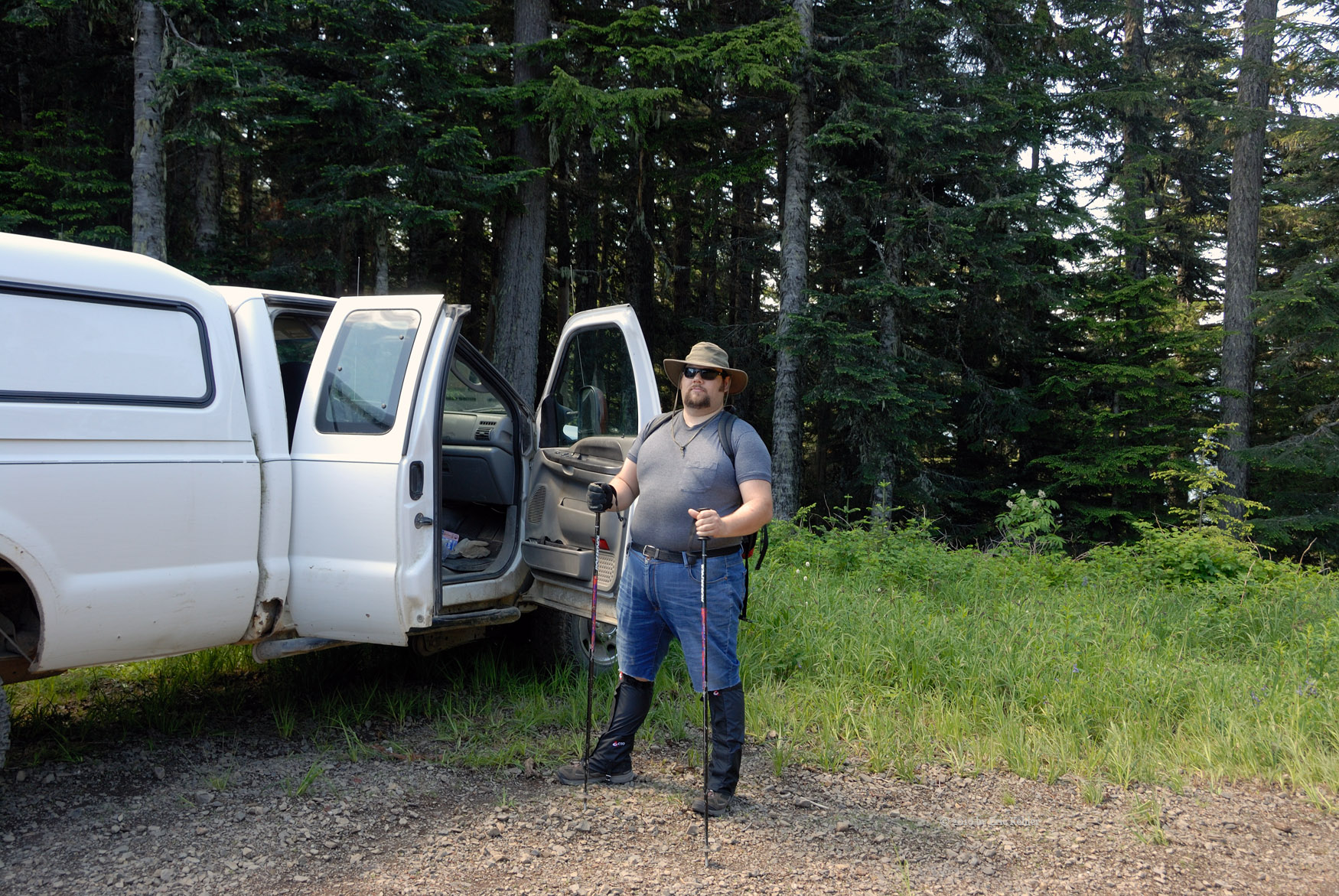
Up slightly earlier than most week-end days, we got the gear loaded into the truck and were off shortly after 8:30. The drive to Starbucks went quickly, we also picked up some bug spray at the local drug store. Then a bit of fuel for the truck and on to the highway. Nick was driving this early part of the trip, I would take over on the forestry road. Unlike two days ago the highway was fast moving and we made good time to Chilliwack. In short order we were onto the Liumchen Forestry road. Nick pulled over for us to switch to 4x4 mode and I took over driving.

We quickly passed the military base and started down the slope to Liumchen Creek. There we were flagged down by a chap pushing his broken dirt bike up the hill. He asked if we could give him a pull to the top of the hill. I turned the truck around and tied a rope to his bike and pulled him back up the steep section of road.  Once at the top we sent him on his way and we returned back down the same road again. We crossed Liumchen Creek and drove until the fork with the Liumchen East road.

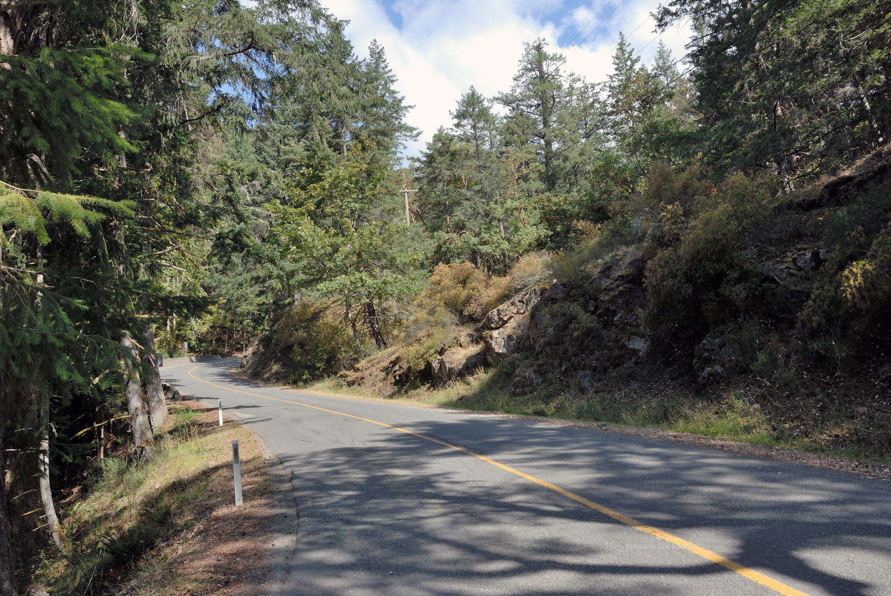
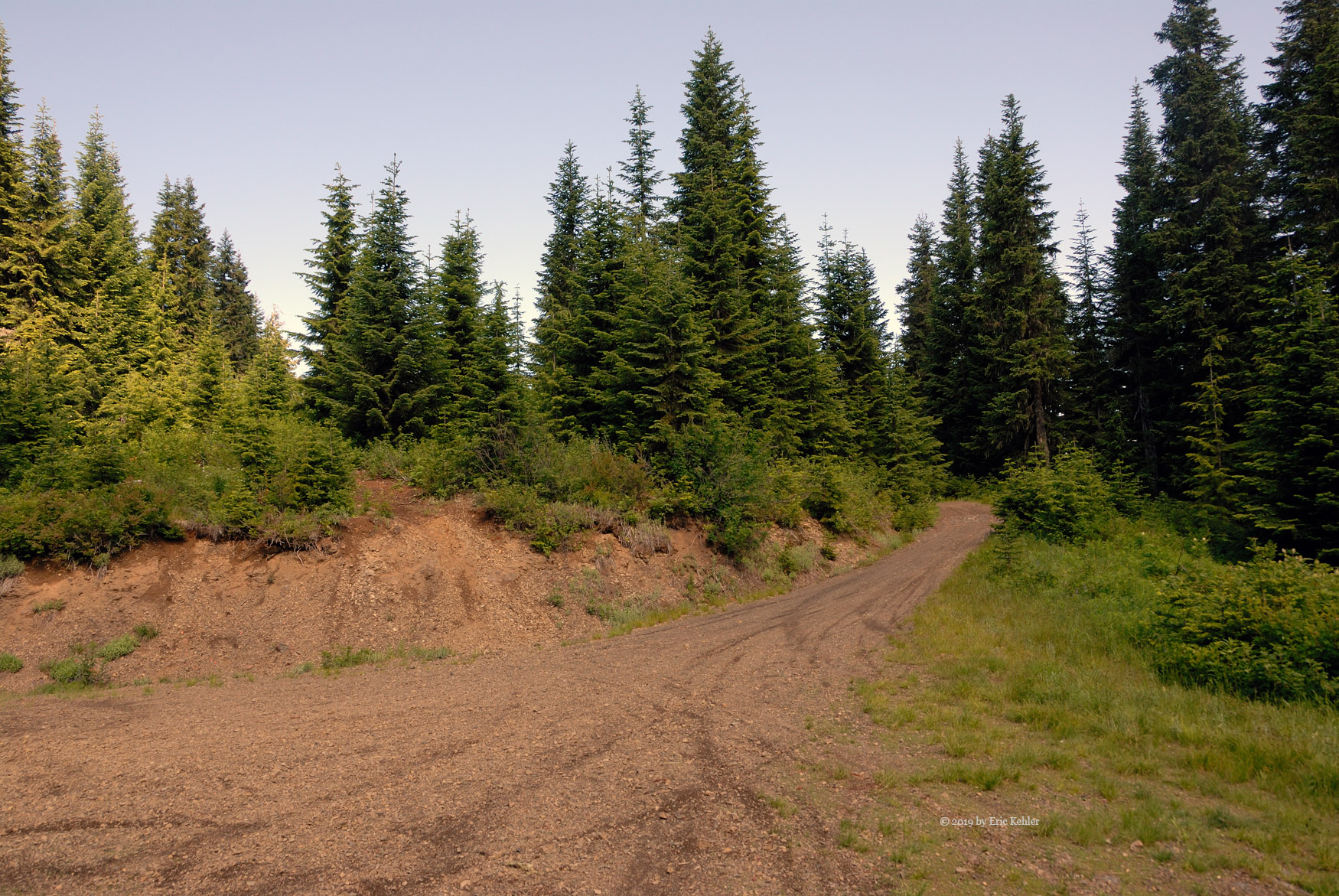
We turned up the branch and quickly started ascending the steep slope of the Church, Baldy flank. The initial section of road was in reasonable shape and we made good time up the flank despite the steepness and rough surface. Soon we came to a newly graded area where active logging was occurring. Here was the reason for the decent road, it was also one of my main concerns – did they block access with a gate? We continued through the active zone and soon pushed out the far upper end having avoided any gates. Now however the road was in its pre-logging upgrade state and the road quality quickly dove to poor.

The road was now much narrower and full of deeper holes and many deep-water channels cut into the road. It was no longer a road passable by a car, even many 4x4 drivers would think twice about this area. We slowly made our way up across the various obstacles and found ourselves at the next fork, the right-hand branch was the one we needed. It also was the steep rutted one. We drove up the road and fought some even worse ruts and large washouts on the road. Fortunately, we were able to keep going and soon we attained the ridge line where the road was in decent shape, this continued to the parking area at the trailhead. We arrived and parked the truck being the only one there and likely would remain so.

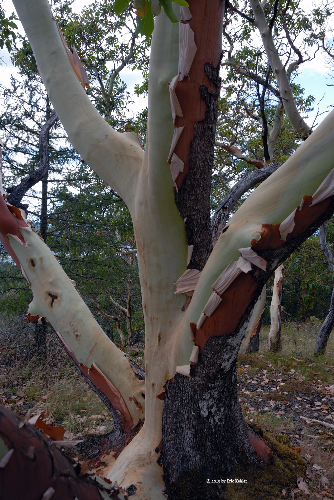
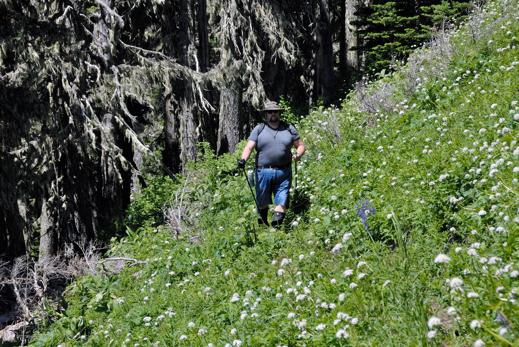
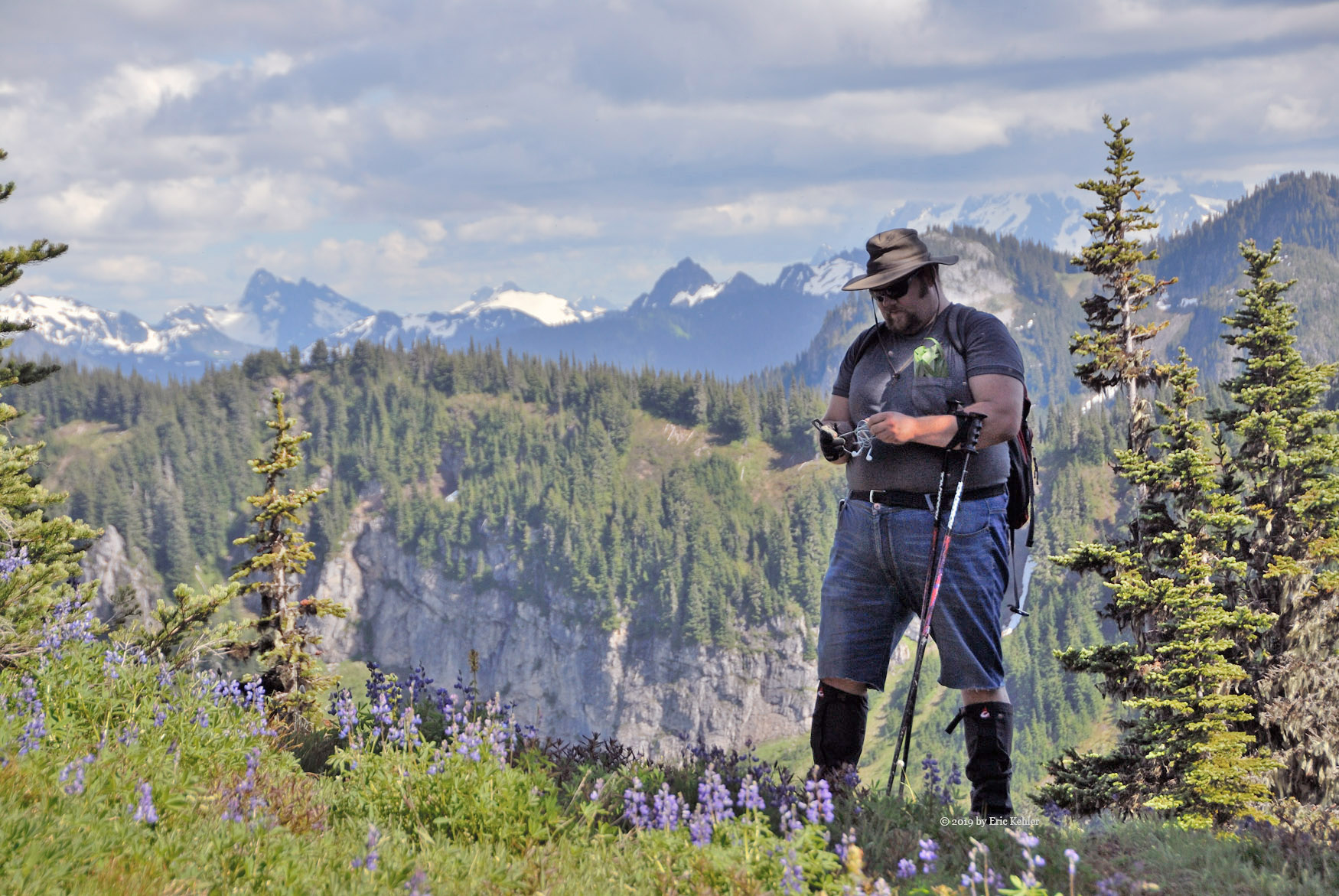
Nick and I donned our gear and started for the trail. This first section of the trail continues up the ridge to Windy Knoll. It was a very steep section and gains over half of the trail’s elevation gain in one short initial stretch. Not much past the start the trail levels out to a small plateau where the Church Mountain Forestry Radio Repeater is situated. We took a few moments to look it over while we caught our breath. Then back to the steep trail and our destination. Soon we reached the point where the trail leaves the open ridge clearing and enters the forest, here the trail levels off for a bit and allows one a bit of a rest. The trail switchbacks a few times as it ascends Windy knoll, fortunately we don’t need to go the whole way up, soon it continues south to the ridge line between it and Old Baldy. When it breaks out of the forest cover, we are at the top end of a grass clearing. It was along this section that I was in contact with some of my radio friends who were asking how we were doing and when to expect us to be on the summit. We still had a fair way to go!

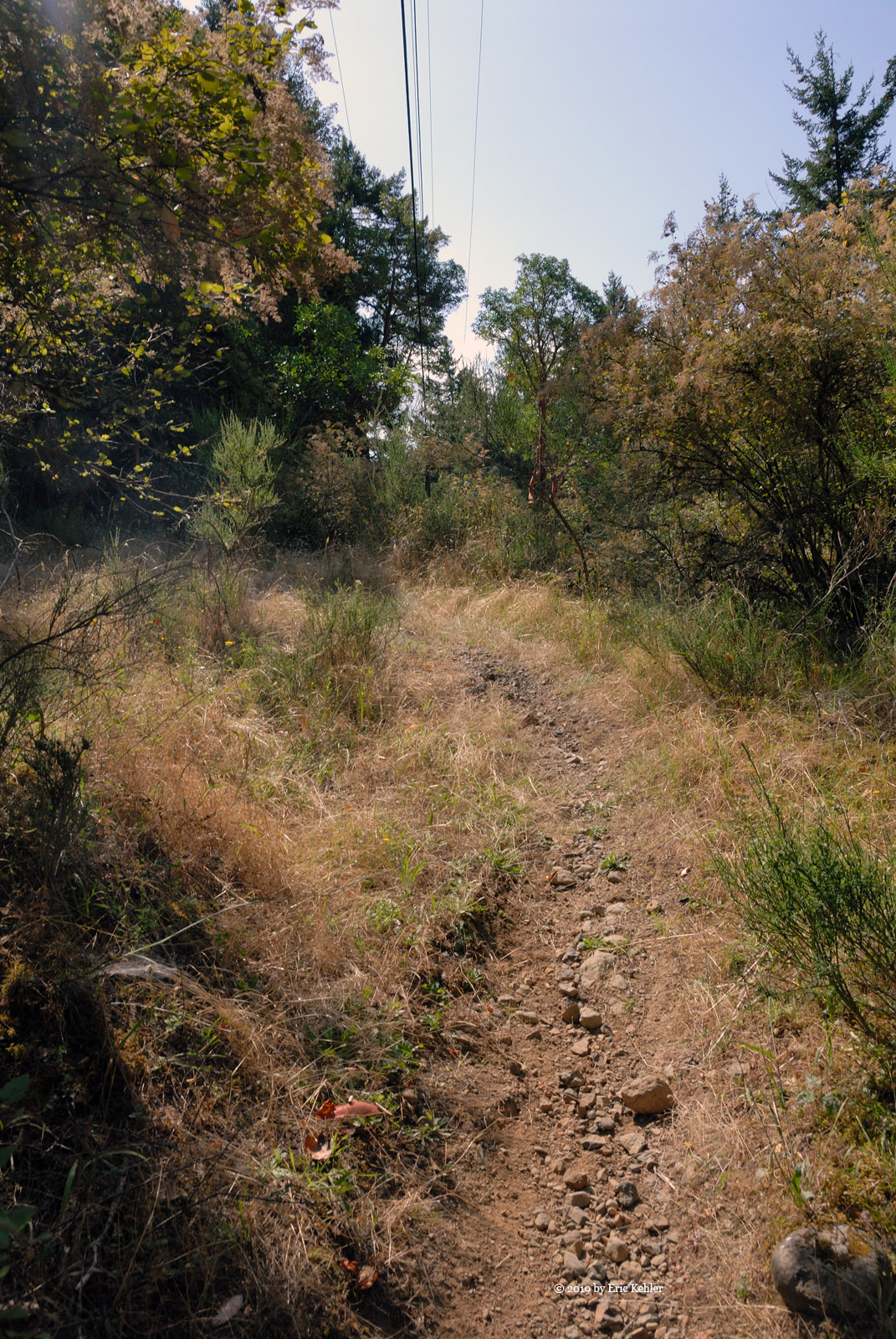
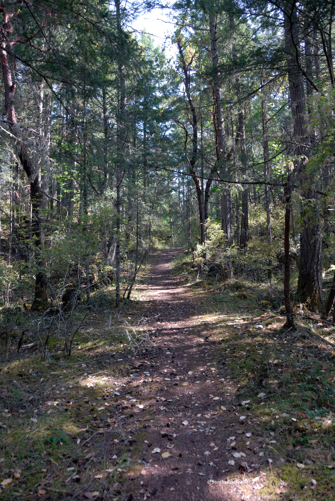
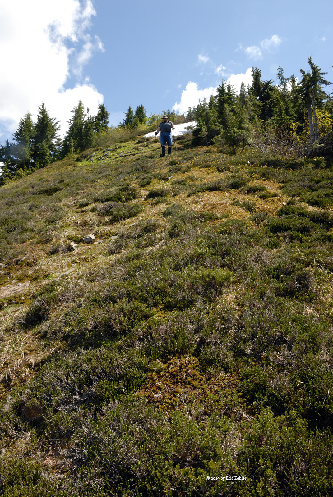
Shortly after I arrived at the grass ahead of Nick, I heard a strange sound coming from just below which startled me. Searching for the source I soon spotted a buck crossing the low point of the grass, relieved it wasn’t something worse I sat down to rest. After a decent rest on the grass we descended the ridge to the first of two small rises between us and Old Baldy. The first we sailed right up and down the second we skirted maintaining a mostly level route. Then past the second knoll we needed to plan for a fork and our leaving the trail. Initially I thought we would be bush whacking at this point but I learned that there was a trail to the summit. It was marked by a very small sign on a tree. As we were starting to get close to where I had marked my map for the likely place the fork would be I turned back to Nick and mentioned that we needed to watch for a small sign.  When he reached me he looked on the upslope side and said – like that one? Go figure, I would have missed it but he saw it, amazing that I stopped right in front of it to say we needed to start watching for it.

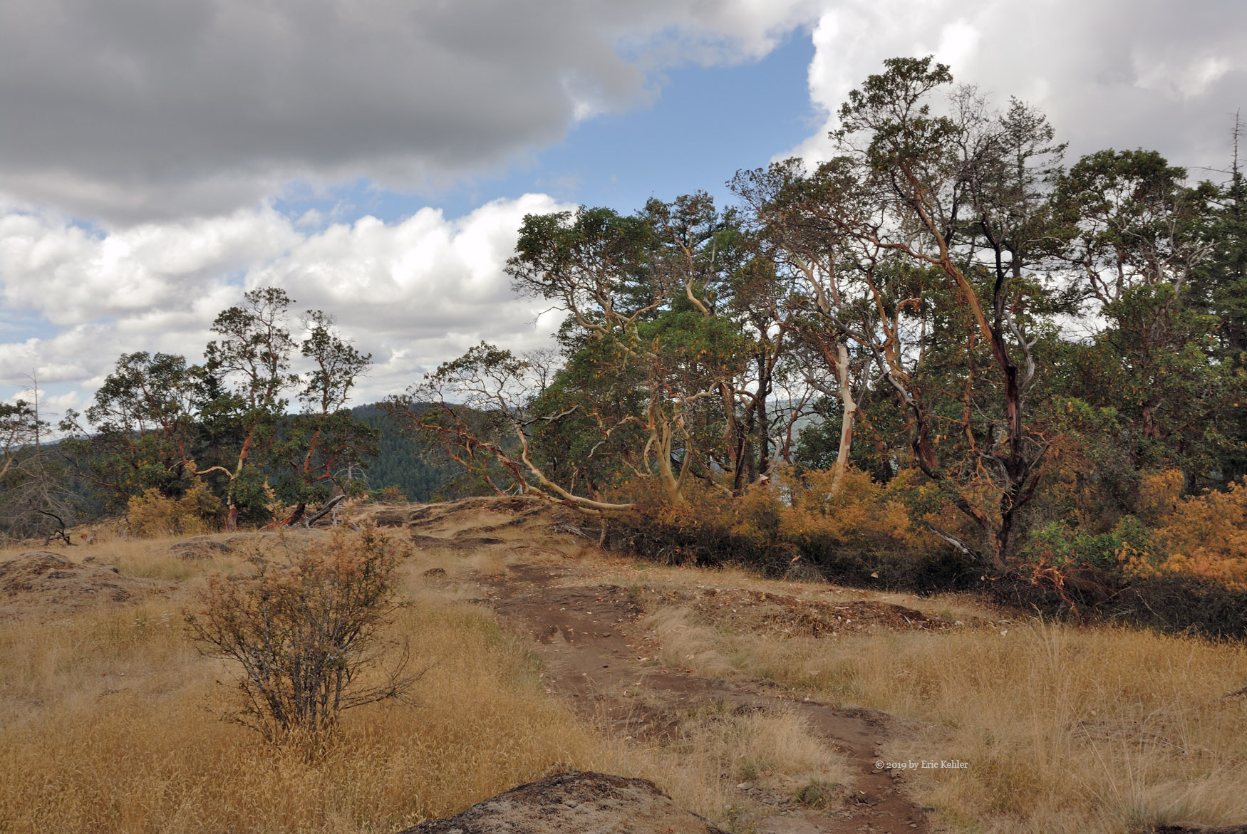
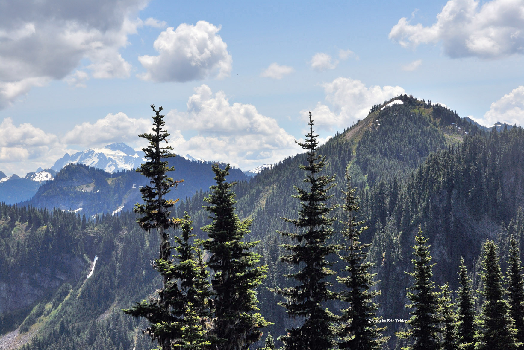
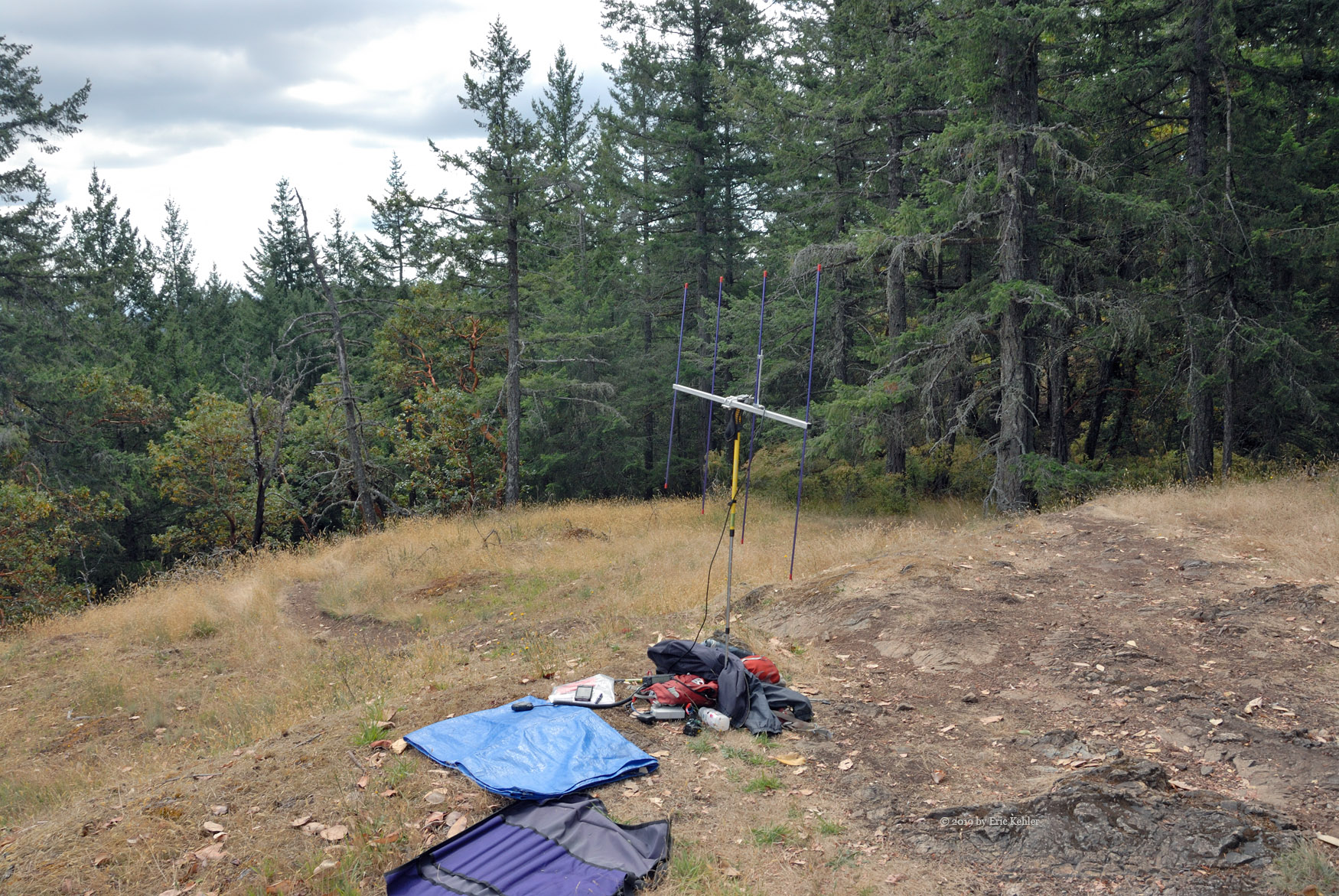
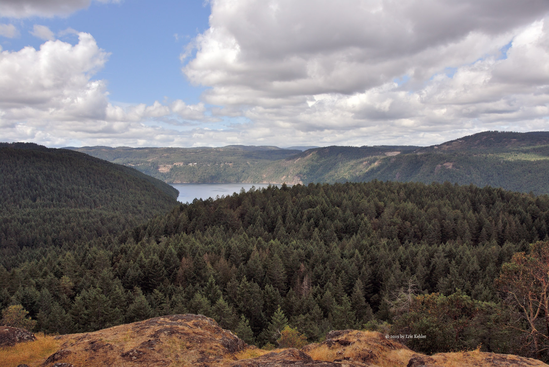
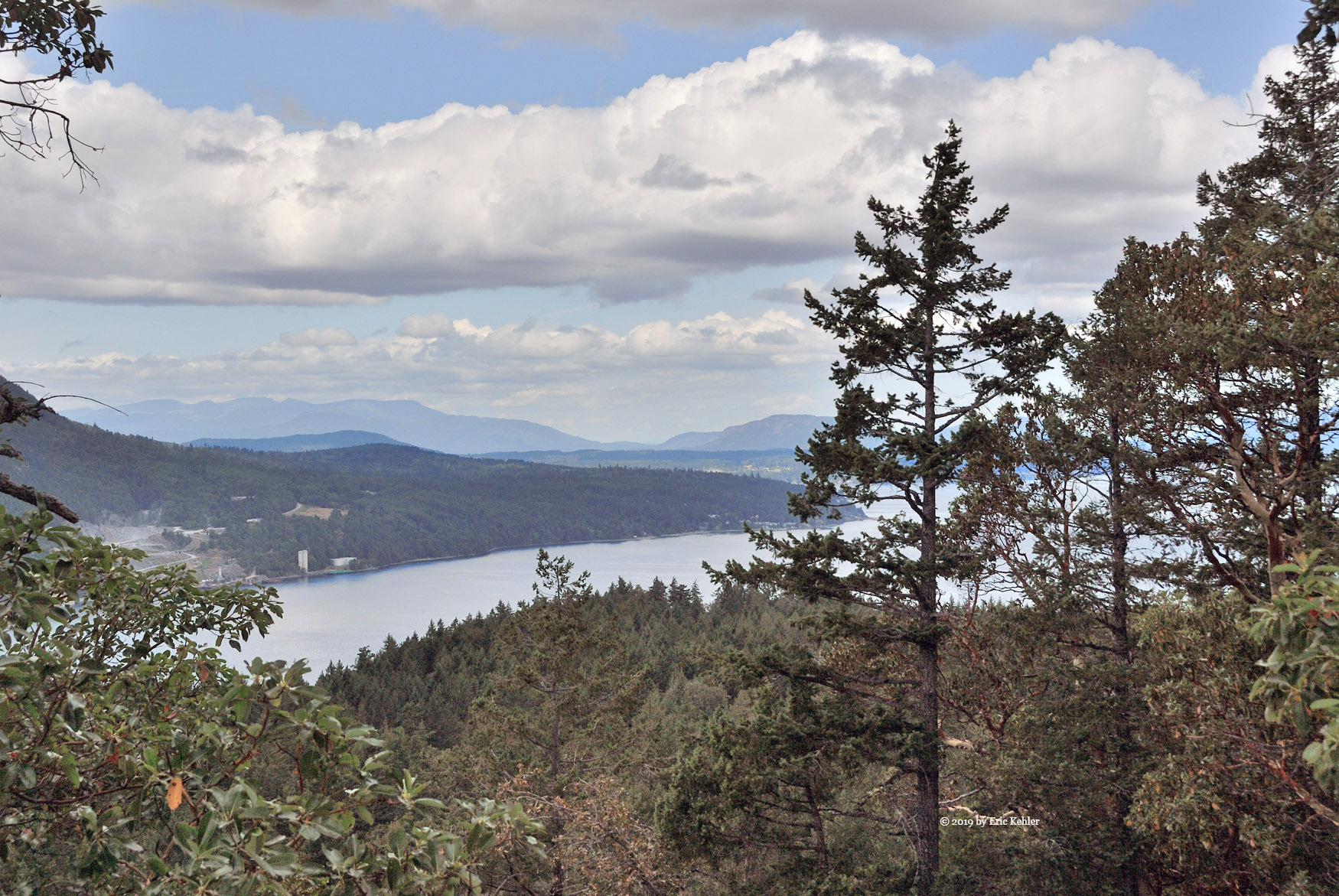
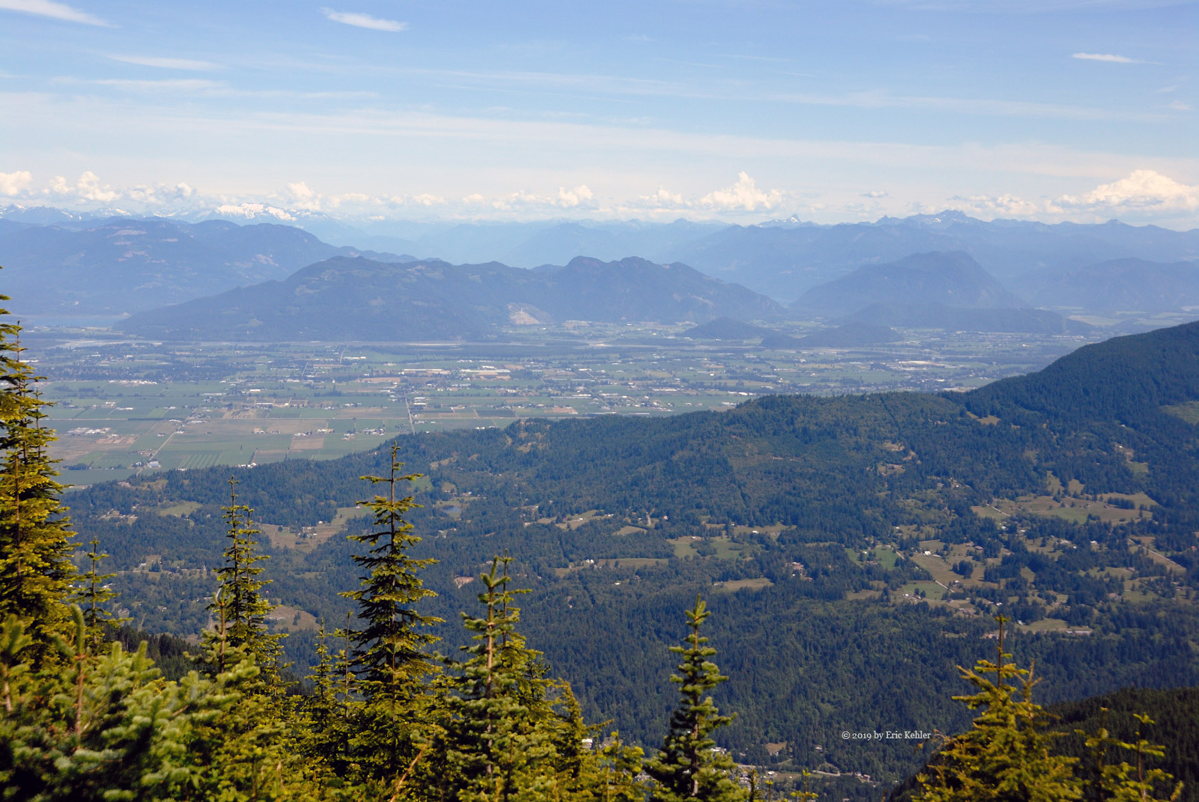
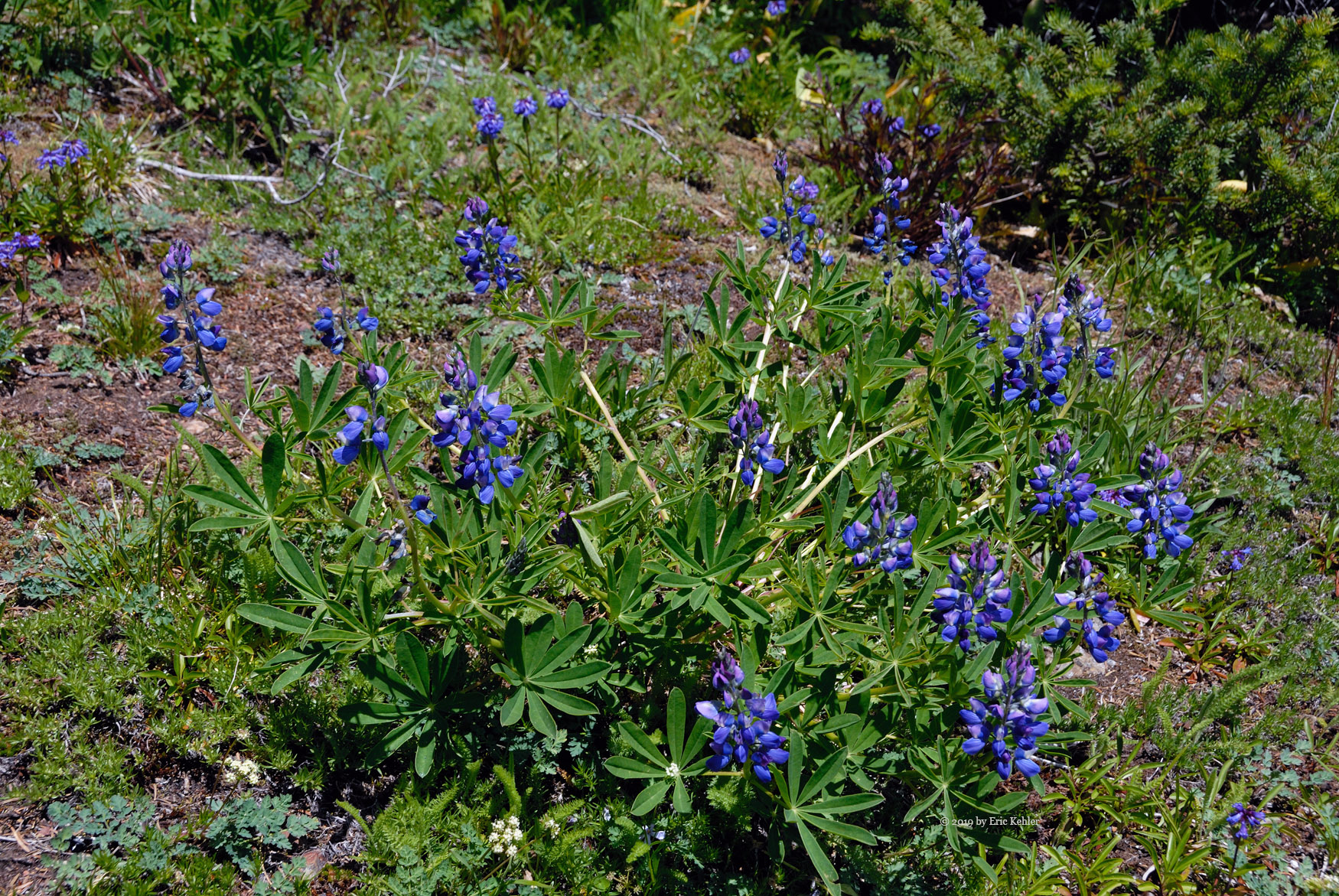
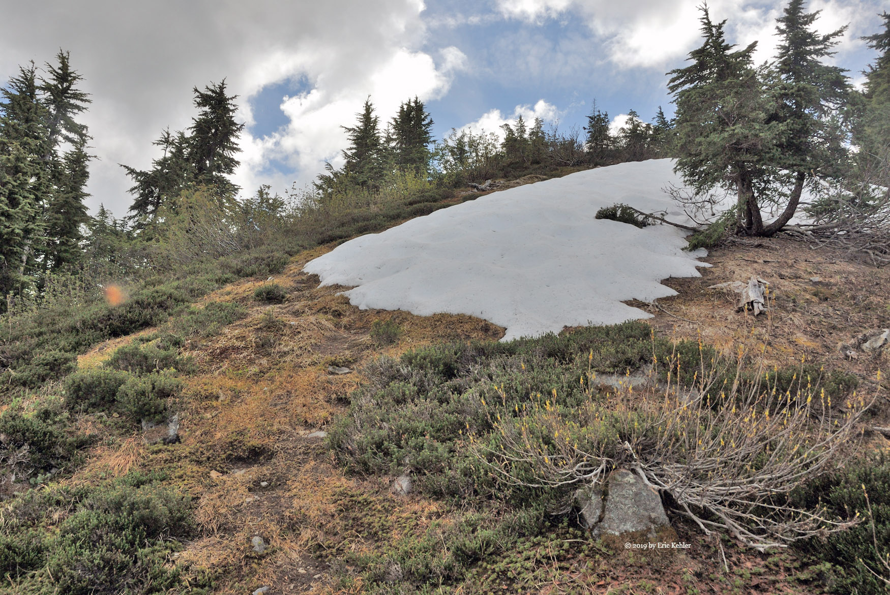
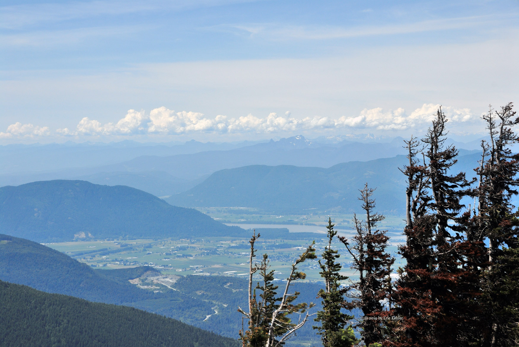
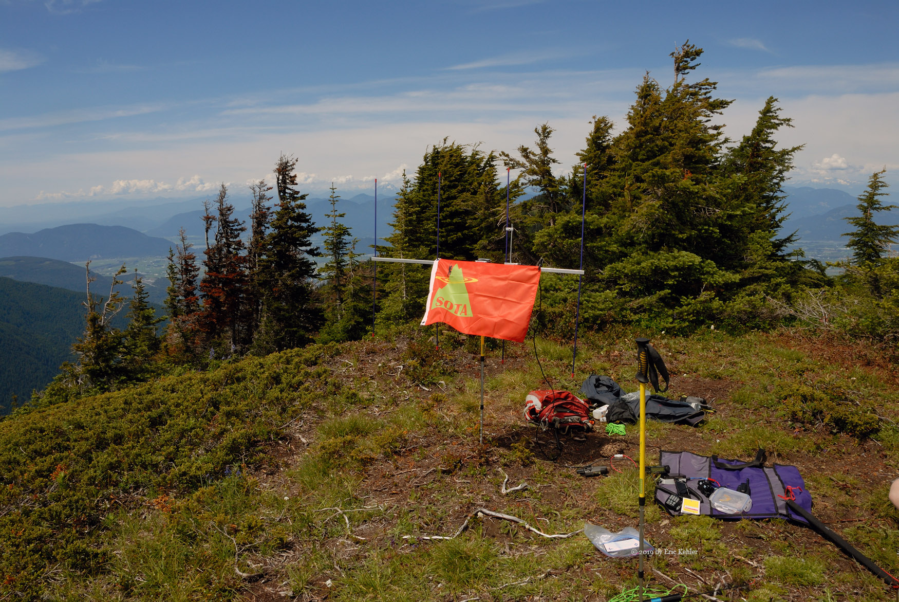
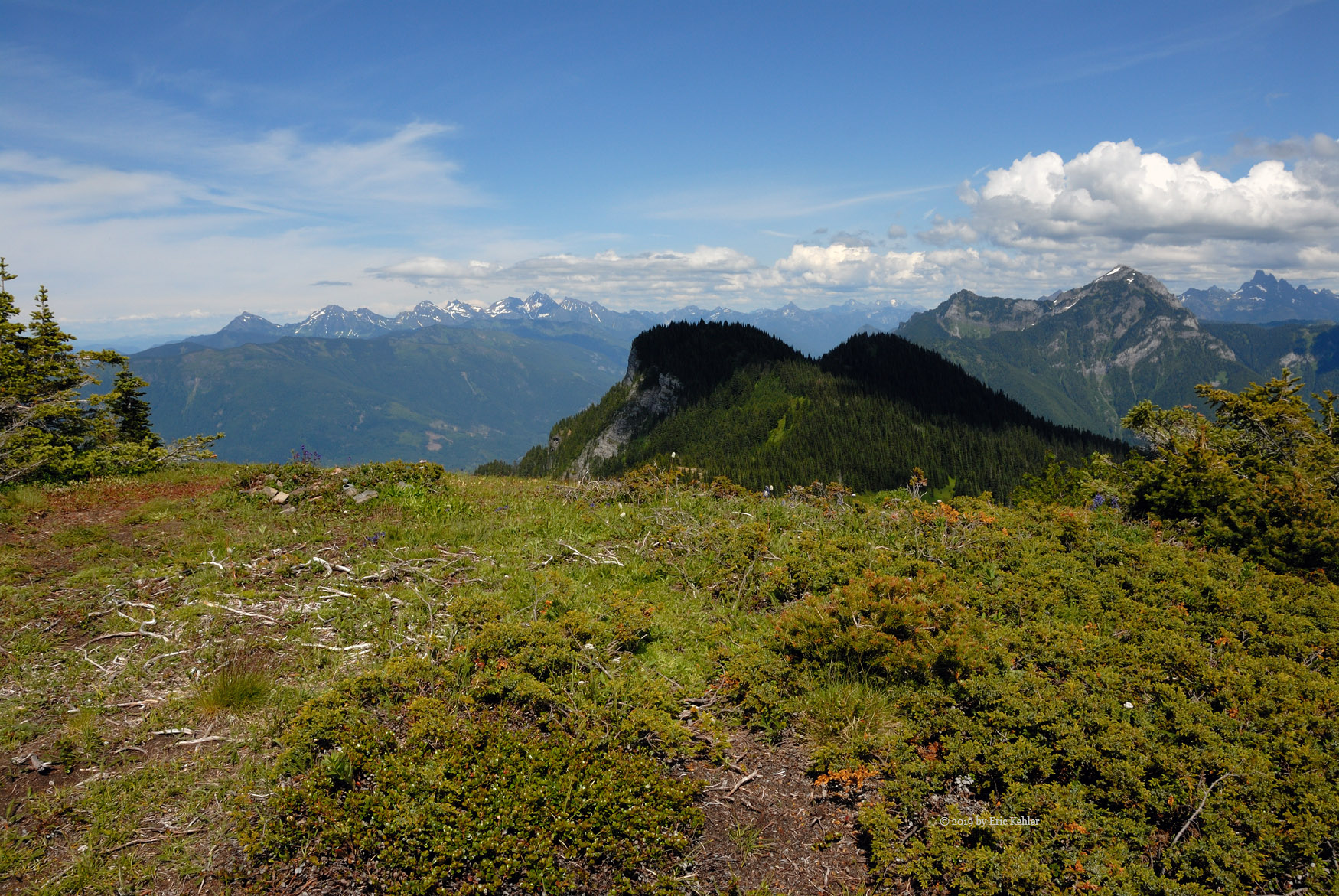
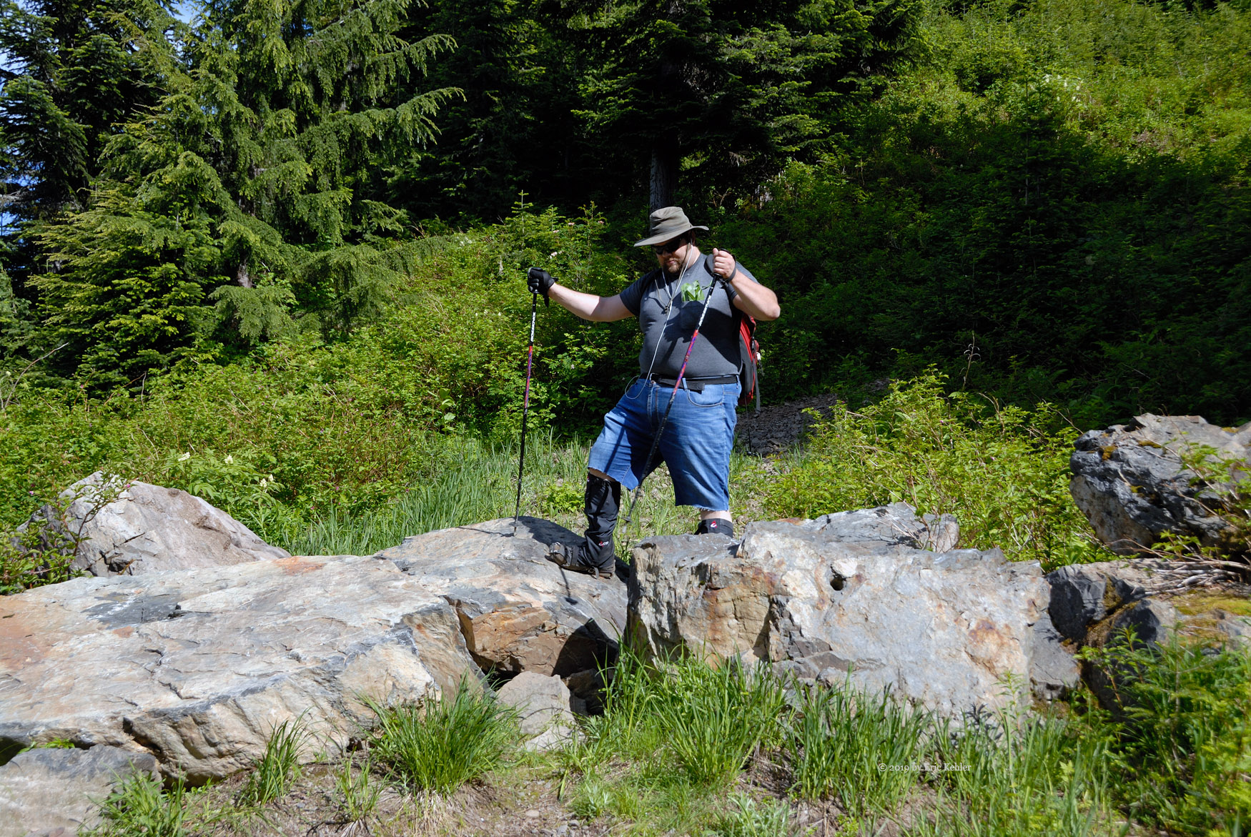
This trail was still easy to follow but definitely less travelled and there were deadfalls in a few places that we had to work around. The trail initially ascended the short distance form the main one to the top of the ridge and then continued along it towards our goal. After a few hundred meters we broke out into the open northern flank of the summit, it being only around 80m further along. The final bit was quite steep but being so close to the end we took heart and pushed on to the summit. The summit area is actually fairly broad and as per it’s name mostly barren.

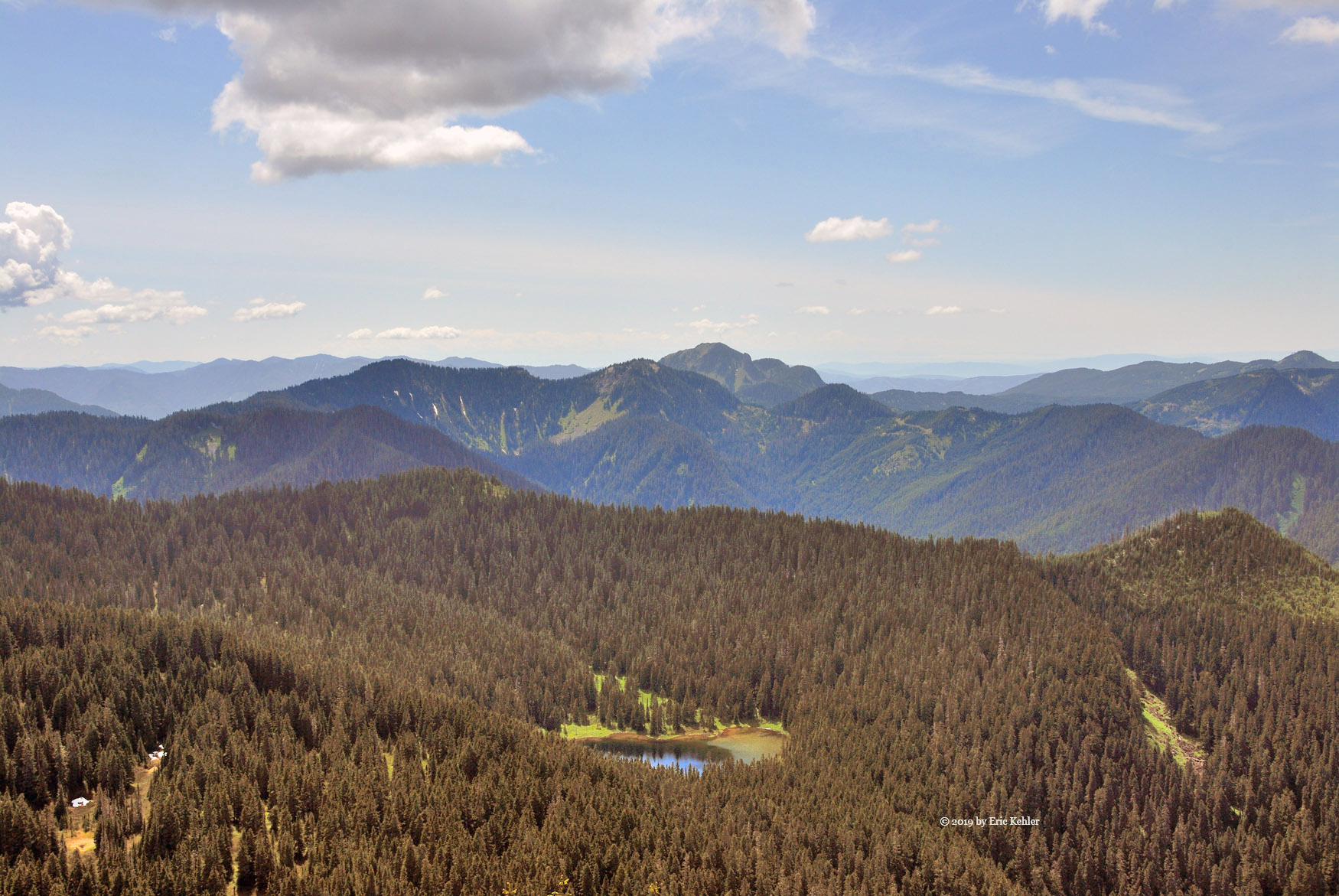
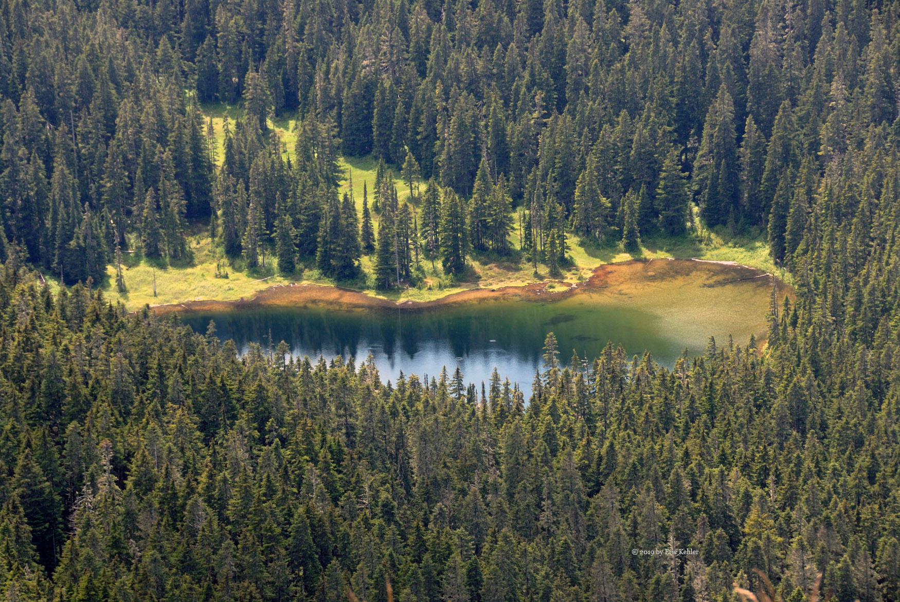
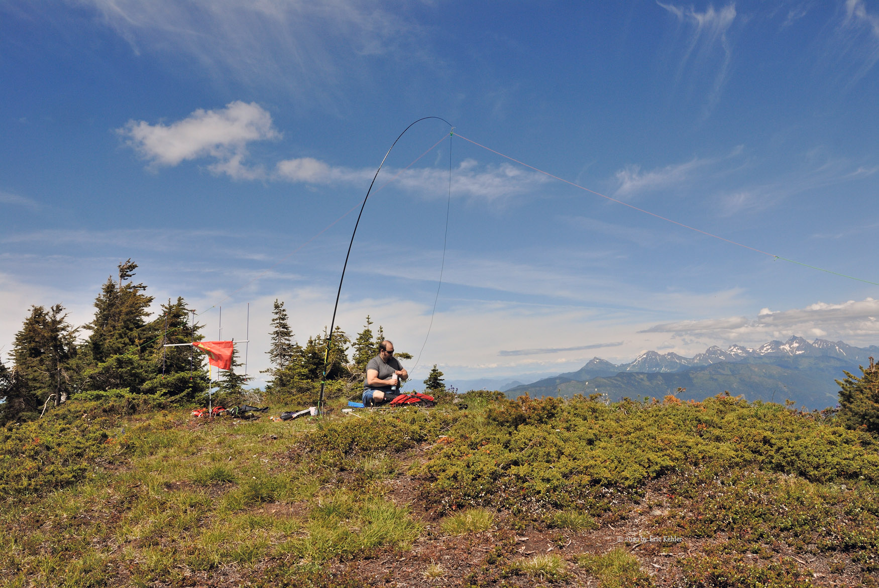
I took a short breather and then set up my two-meter yagi and soon was on the air logging contacts. After I had the first few in the log Nick finally arrived on site and flaked out for a rest. I continued to log a few more and then I slowed down to eat some lunch. About then another couple appeared on the summit! That was quite a surprise for us. We chatted a bit, they had parked beside us and told us that they were surprised to find a truck up there! They had hiked the trail before but never the one to the lake which looked quite lovely below us. I shared what I was up to, they were quite interested and glad it wasn’t ‘another drone’. It seems they encounter people with drones all over the place in their hiking. I next set up my 20m wire antenna and listened around for some stronger stations, it being the annual Canada Day Contest there were a decent number. I was able to work 7 stations on HF before Nick said he was wanted to start back, so I got the gear packed and loaded.

We then started the descent, it goes so much faster, with spikes on the shoes we zipped down the initial exposed flanks in no time and then through the forest to the main trail. We made fair time following the trail up the two knolls and then inched up the final grassy one before heading into the trees. We had gotten this far in an hour, much faster than the other way. Once rested, we couldn’t take too long as the mosquitoes were now out and targeting any slow-moving objects, we headed into the trees. This next steep section seemed to pass quickly and we soon found ourselves descending the open area along the far flank of Windy Knoll. The truck was soon in view and we were done. Even though the other couple had left the summit before us their truck was still there. I guess they decided to visit the lake before returning.

It felt good sitting in the truck and having some cool air blow on one’s face. Once we were rested and had everything stowed, we started out. The road went faster than on the way in thanks to gravity and being more confident with the obstacles as we had passed them once before. We made fast time down and soon were in Cultus Lake. Here the place had become crowded with people. When we had come by earlier it was quite empty. I checked my iPhone to view the road traffic and sure enough the main highway was bogged down and the radio on the LADD frequency full of truckers complaining about badly behaved motorists. We decided to follow the back-route home and though a bit longer it had no traffic issues to slow us. So we were back home just before 7pm a moderately long day but lots a great scenery at the summit and a first activation to brag about.

Sumas Peak 2019

The hike to the Sumas Peak summit is a pleasant walk along the top end of a service road. The road is well maintained as it is used to service three large repeater towers at the summit. For this reason I save the hike for someone whose hiking ability I am not sure about as it should be doable by most. So for this year’s adventure I enticed fellow club member Jim (VE7ADH) to join me and do his first SOTA activation.

Jim came by my house around 9am and we were off on the road, our first challenge was in squeezing the truck between cars parked either side of the road in my subdivision, they were all here for a garage sale. Once past the fortune hunters we made quick time to the traditional stops and then on to the highway. It was moving slowly for a few kilometers but then resumed normal speeds. It was a concern at first. Soon we were off the highway and making our way along Whatcom Road climbing the west flank of McKee Peak. Then onto McKee road and finally Sumas Mountain road.

The drive went quickly as we marveled at the growth of homes all the way up here. New subdivisions were appearing as we rounded each bend, it was really quite amazing. Soon we were starting up the forestry road and out of the reach of the developers. The road was in much better shape than when I drove it last year. This of course simply meant that there were now cars crowding the way not just a few trucks. We made good time to the locked gate and there I parked in what has become my standard location. There was one other car parked when we arrived.

Once geared up we started up the road and as the day was cool and quite ideal for hiking we make fast time to the top where the trail marker directs one to the final trail to the viewpoint. As we started along the trail another couple came by and passed us also on their way to the viewpoint. We continued past the repeater towers, Jim was explaining some of the challenges aligning the dishes as we went. Soon we rounded the final curve before the viewpoint and then we stretched out to rest and eat some lunch before starting the radio work.

Initially I set up my 2m yagi and started making some calls. They were coming in at a regular pace and soon I had the 4 needed for the activation. Jim also did some calling but once the calls slowed down we set up the 20m dipole and KX2 that I pack with me and we put out some calls. We could hear some stations but few heard us. I did manage one summit to summit with a chap in California. We switched back to 2m and logged a few more stations. Jim started up on 20m HF again and this time he was able hear a station which was in a plane off the coast of Florida. He heard part of our callsign but was unable to get all of it, so it was a partial contact.

After more 2m work, Jim tried 20 once more and picked up a station in Slovenia. He was a popular destination and there were many trying to reach him. Jim tried many calls and eventually was heard. So he logged a call with the station in Europe, 8650km distant with the KX2 at 12 watts with a small dipole antenna only a few feet off the ground. That was a good finish, so we packed up the gear and had a leisurely walk back down to the truck. It was a very successful activation and we both quite enjoyed the day.

Field Day on Woodside

For this year’s annual Field Day event Ralph and I decided we would operate from the upper flank of Mount Woodside. We had scoped out a location earlier in the year and had planned our adventure for spending much of a day on the slope operating. So as the day arrived we carefully watched the weather and it looked reasonable so once Ralph arrived at my home the morning of the event,  we loaded a few last items into the truck and set off. First for coffee and then fuel. We were making good time on the road until the last kilometer! Just shy of where we would turn off the highway for the forestry road we were stopped in a line of vehicles waiting our turn to use a single lane past a paving operation on the highway. We had so little to go and the delay seems interminable. After around a 10 minute delay it was finally our turn to move.

A short distance along the new pavement we made our turn off onto the forestry road. We switched the truck over to 4x4 mode and continued up the road. It was a dull morning and though not raining it did seem dreary. We quickly ascended the early section of road and soon we encountered the one vehicle we met on the way in it was a pickup towing a boat! It seemed odd to see a boat up here on the top of a mountain but I guess Stacey Lake is just big enough that floating in its middle would help with fishing. At the 500m level we entered the first wisps of cloud. As we climbed the cloud got thicker and more solid.

Continuing to the side road we would be taking to the final site, we encountered no other persons on the road. Once on the short spur we descended to the spot we had planned and then drove past to drop off the generator we would be using.  We quickly reached the spot to drop it off and now we had to turn-a-round, we had a very narrow area in which to turn the truck. It took quite a few reverses to complete but the truck stayed on the road and was eventually facing the right direction. We then unloaded the generator – a 4KVA unit so it took two of us. After driving back to our operating location, we parked and began set up.

First item up was our day tent, with the cloud we were in it was less needed than in the hot sun but we got it set up and a table. Next came the antenna. For today’s adventure we opted to start with my 40m OCF antenna strung between some trees on the slope above us. This took us around 20 minutes to get in the air. Though the wire wasn’t that high off the ground being on a long slope would make the effective height much higher. Next came setting up the KX3 and amp. We hauled out Ralph’s big battery and powered the radio and were immediately hearing stations. I put out a call, as it was now around 11:30 and the contest portion was underway, and quickly got a response. So we knew the setup was working.

Next I set up my 2m radio with my arrow yagi on a 16 foot mast. Shortly after getting it operating I had a 2m contact in log. We continued operating for about an hour and a bit and decided it was tie for a break and to get the generator going. Ralph and I walked out to the generator and tried to fire it up but it wouldn’t start after numerous pulls and words we decided to leave it for now and we returned to the tent. I heated some water with my portable stove and we had some coffee to warm up in the damp cloud. The cloud was staying with us, we had hoped it would burn off quickly but so far it was staying.

After operating a bit longer we broke for a light lunch. Ralph had tried some CW contacts but the damp air had him chilled and he was adding too many extra dots and dashes to be readable, so he stayed on voice for the rest of the day.

Once done eating, Ralph continued to work 20m while I made a number of 2m and even one 220MHz contact. We continued on this way for a couple hours with me taking some turns on the KX3 to spell off Ralph for a break. As the afternoon worn on, I decided to retry the generator and I walked back out there and tried a few more attempts on it. Eventually it gave a short puff and I knew it was almost cooperating. A few more pulls and it was finally running. So we had our power after all. I returned to the tent and heated some water in the kettle, Ralph meanwhile turned on the battery charger to ensure we didn’t run out of power for the radios. The generator did cause dome audio noise in the headphones so we had to work around that when operating.

Once the battery was recharged we shut off the generator until we needed it later to cook dinner. By now we were seeing a bit of clearing in the cloud but still no view of the valley below us. At least there was no rain and though cool and damp it was not wet enough to cover the surfaces in water so we were doing fine over all. At dinner time we restarted the generator with a single pull and then cooked some chili on the hot plate. It was satisfying to bite down on some warm food up in the mountains. After dinner we did a bit more operating but we soon decided it was time to pack up. By this time we had some longer cloud openings and had a view of the valley below. So the cloud was finally breaking! It took around a half hour to get things packed up and then we were back on the road heading for the highway. This time we encountered two vehicles on the road and one had a canoe!  Mount Woodside seems to be a popular place for boats.

At the bottom we saw that the paving operation was still going and so we waited on the side for the current group of cars filing past to end before we joined them. They were going our way so our wait this time was short. Past the paving area we made good time the rest of the drive home. In the end we had completed 50 contacts the furthest being from Kentucky. I tried working a Vermont station but the pile-ups he was dealing with prevented our being heard. Lots of California as one would expect. We tried to work the club members who were set up at Blackie Spit in Crescent Beach, but that failed though we were able to chat through the club repeater. So it was a fun adventure even though the expected hot sunshine was missing. Next year we will likely do something similar.

Taming an Alligator

Early in the week I looked at the forecast for Saturday and saw that it would be a good day for hiking so I contacted Ralph and invited him to an adventure. I offered him a repeat summit or the opportunity to try something new. He opted for new. I wanted a summit that would not be overly difficult and where the hike would be relatively short. Alligator NE2 fit the criteria and so it became our target. I told Ralph that it would include some bushwhacking and trail finding with no guarantee of reaching the summit. So with that in mind I did some prep work planning a route and loading it into my gps.

Come Saturday morning Ralph arrived for an 8:30am departure, and we were off for the backcountry. After our normal stops we were soon driving along Sylvester road looking for the start of the forestry road. As we approached the end of pavement Ralph noticed a sign about Cascade Falls and wondered if I knew anything about it. I said we could visit if we felt so inclined after the hike. The drive along the mainline went quickly, there were only a few vehicles on the road this early so we made good time.

Once we arrived at the Twin Lakes side road we encountered some rougher sections but still not too bad.  We came by one very deep diversion that took some careful planning to get across. Low gear worked well but I was a bit leery about the return. We managed to follow the wrong fork for a short distance and had to back-track a bit but soon we arrived at the marked fork where we would take the way less travelled, though I did notice that this side road had some recent activity.  Soon we came to another deep cross ditch, this one took a few tries to get up the far side but eventually I was out of the gap and ready to drive on. A couple km more and we arrived at the spot I had marked to park and start the foot work.

Once our gear was on we walked the road looking for the over-grown side road but didn’t spot it. So I decided it must be too overgrown and that we should just head into the trees and aim in the general direction I had marked. We were soon carefully picking our way through soggy swamp! I found a way up the far side and we were back on solid ground heading for the track I had planned. After some minutes we spotted the old road I had planned on walking and we started following it to where my route left it. This sped up our travels but we still needed to push through fallen trees.

When we came by the spot to leave the road the ground was fairly open and sloping upwards at a gentle pace. However, not much beyond the road I noticed some rock faces we would need to find a way around. Fortunately the slope continued upward at a steep rate between two faces. It allowed us to gain some elevation and get past the first of the cliffs. At another plateau area I surveyed the way ahead and noticed what looked like a small gap in the one face and so I made for that and pulled myself up by roots and trunks to a small ledge that worked its way across the face. It seemed to reach a vegetated area on the far side so I opted to try it. Sure enough the ledge offered some convenient handholds and we were able to start crossing the face, at the far end a tree had fallen across the way. It presented some challenges as the drop down would be serious, so going over the tree would be risky. There was a small awkward gap under the tree that seemed safer, so we squeezed under it and finally made it to the green area on the far side.

Once past the tree we were able to ascend to the next plateau area only about 4 meters above us by grabbing trees again. Once up here we took a breather and then continued towards the summit direction. We soon had another face to deal with but this was much shorter and offered some paths through it. Next came a wall of fallen trees which I worked along to reach the next level area thinking I was now at the summit. But once again another wall stared back at me. This one was also fairly easy to get over as was the next one which proved to be the last. I was finally on the broad summit area. There were a number of small humps scattered sound the area and I picked one to settle down on. Ralph had run out of steam a couple of faces ago and so I was on the actual summit by myself. I took a rest and then set up my 2m radio. I soon had my first contact in the log. I managed 3 more while eating lunch though the numbers were few. Turning the yagi a few degrees would change the strength of the signal from static to useable and I found I had to point it to the east rather than south to make some contacts, - reflecting the signal off another summit.

Once done with the radio work I packed up and started back down, I would have liked to try a different route but with Ralph left down below a bit I had to return the way I came. I ended up dropping right past him before releasing I had gone too far. So back up the slope to where I recognized the spot and there he was packing up his gear! He had completed 7 contacts. We then started for the face and ledge.

I made it across fairly quickly but Ralph got hung up on the tree, I re-crossed the ledge and helped guide him to a handhold as he tucked under the tree. Then we were both across the face and starting down the narrow gap to the lower plateau area. For our return travels we had put on spikes and they were helping immensely with the traction, we made fast time down the slope to the road. We followed the road back to where we entered it and continued on. Sure enough it came out exactly where I had thought it would be and only about 15m from where we entered the bush initially! I guess I will just need to trust my plans better and look harder next time.

Well we were back to the truck and getting rested. Once ready we started off for the mainline. This time crossing that narrow cross-ditch became a problem and soon I was not moving forward, just digging holes. So rather than fight it, I hauled out the winch line, hooked it to a convenient tree and with a short pull the truck was past the ditch and out of the grip of the alligator and we were moving again. The other ditch almost got us but with a bit of momentum I made it down and up the second ditch without stopping.

The rest of the drive along the mainline went without issue though I noticed a lot more traffic on it at this hour. We reached the pavement and stopped to reflect on the adventure. In the end the alligator gave my arm a good nip and almost swallowed the truck whole. It claimed my two walking sticks as a sacrifice and Ralph was covered in fly bites. But we were not that bad off. Still with energy to spare, Ralph said lets go see the falls. So we turned off the main road to Cascade Falls Park and found a parking spot. I hadn’t been here since my kids were small and so I noticed that the place is now a well-developed park, not at all like it was before. We found the trail to the falls, it was well maintained with a smooth route and stairs for the steep section. There was a nice suspension bridge across the creek just below the falls to provide a better view and access to the best viewpoint on the far side of the creek. So we had a nice view of the water fall.

Well, done with the falls we made our way back to the truck and soon were on our way to the highway. The day was a great success, we activated the summit for the first time and got our two points for it. So now we need to plan another first activation just to keep the excitement going.

Activating Burnaby Mountain

Burnaby Mountain was added to the summit list for Summits on the Air as an easy starter summit for people new to the activity. When members from our club went to activate the summit years back, I was unavailable to go and so I never did operate from the mountain. Burnaby Mountain being a single pointer, it never got on my priority list until recently. The summit is an easy activation, one I can do solo, and it will give me a new unique so I felt it was about time I got it in my log.

The day was a lovely one for outdoor activity and I set off at a leisurely time of 9:50AM to get a coffee and drive to the summit. The traffic was light and I made good time to the SFU campus. Upon arrival I drove up the wrong entrance but saw a campus security vehicle so I parked and went over to ask some directions. He wasn’t sure what park I was referring to as I had remembered the wrong name. After pulling out my iPhone with a map I had the right name and he outlined a route forward.

I travelled the streets to my hoped-for entrance but it was blocked by construction activity so I back-tracked to a street that came up on the other side of the summit. This street made its way through the residential area and I soon found the point where the road was closest to the summit. There was parking along the road and I found a spot next to the Childcare building. This location was only about 200m from the summit and already well within the activation zone, but I wanted to be as close as possible.

So with the car parked I loaded up my back pack and started for the summit. Very soon I was there and found myself in a nice park area. A short distance to the south-east was an empty picnic table so I walked over to it and decided it would be a great operating location. It was here that I decided I could well afford walking back to the car to get a taller mast to set up. So after a quick return to the car and walk back with 3 lengths of mast and a tripod, I set up the 2m yagi at around 12 feet. I was soon ready to start calling.

My first contact was with club member Ken – VE7HI who also happens to be the highest scoring chaser in the association. I worked a number more stations before taking a breather. When I started up again I noticed that the Push-to-talk seemed to get stuck transmitting and I needed to cycle the power to break it. So now I needed to perform some high-speed finger gymnastics to talk, cycle the power and listen for a response. It was quite annoying and I missed chucks of conversations. By now I had completed 18 contacts and I felt the number was high enough considering the radio issue. So I decided to pack things away.

I lowered the mast and started to loosen the nuts holding the yagi to the mast but they had jammed solid for some reason. I tried turning the wing nuts but they just wouldn’t budge. After some effort I was able to loosen them enough to slip the bracket off the mast but that was all. After trying further one of the nuts snapped off the end of the bolt! It was really odd as the nuts have not been off the bolt for months so cross-threading was not the issue. Even later at home the remaining nut was still tight and unbudging. Needing the antenna in good order, I ordered some replacement bolts and nuts so it would be ready for my next activation.

Once all was packed up I walked everything back to the car and loaded up. The drive home went quickly as traffic though heavier than on the way out, it was still quite light. It was a very pleasant location to do SOTA from, easy to reach and the area was reasonably isolated that one could set up equipment with little interference. Stringing a 20m dipole wouldn’t be too difficult as there were a few trees close by that could hold the antenna though one may want to supply a centre mast so they could work from the table.  In the end is was a fun activation and I would come again  when I need to get out and the bigger summits are closed with snow.

Dewdney Peak as a Stand-in

Back on the 27th of April we had set out to hike Agassiz but part way along the route we turned back due to white-out conditions. So here we are on a lovely sunny morning and we were ready to tackle the slope once again.  All was going to plan as we left the house and arrived at the start of the logging road. As I started up the road I noticed a new ‘No Shooting’ sign. I guess too many were causing some close encounters of the wrong kind. We made fast time up the road, the traffic since our last trip had cleared some of the rock off the road which had accumulated over the winter season. So it was a bit smoother and we were soon up to the turn-off for the para-gliders.

Continuing past, we drove up the road, past the fork to the Woodside summit, next came the viewpoint of our coming ‘Field Day’ site in late June. Then it was along the ridge to Mount Aggasiz. The road is a bit less travelled here but still in good form. Finally at the 10km point we encountered the backcountry driver’s worse fear, a locked gate! It hadn’t been there three weeks ago but it was sure there today. After looking it over a bit we reluctantly cancelled our planned adventure on Mount Agassiz. Ralph suggested we try another close-by summit, I offered Dewdney or Sumas Peak. As he had never been on Dewdney, that became our new destination.

So with a locked gate before us, we backed down a bit to a wide section of road and there I reluctantly turned the truck around. Back down the 10km of road we went with few spoken words. Back along Lougheed Highway and then a turn to head for the Norrish Creek FSR. Soon we were driving up the logging road past a number of cars parked along the side near where the Dewdney Grind trail begins. As we neared the 3km point the fork for Dewdney came into view and the gate was open. I got the truck ready for 4x4 mode and we started up the steep initial section of this road.

The road was very rough in places with deep trenches dug into the road by water. Fortunately the gouges weren’t severe enough to block us on this trip, but if they continue getting worse we may be stopped next time. The road to the ridge is quite steep in a number of spots and we had to take it slow but soon we were on the top where the road is quite easy to travel. I turned onto the south fork and made for the spur that crosses the top part of the Dewdney Grind Trail. This part of the drive went quite nicely and soon I was turning on to the final short stub of road where we would park at the end. As we made our way up and almost to the end we met a couple wandering along the road.

I stopped to talk with them and learned that they had hiked the whole trail but were wondering if there was a viewpoint anywhere. I said that I understood that the trail continues a short way past the road and at the end there was indeed a view. So they located the continuation of the trail and continued the short distance down the south slope to the view. Meanwhile Ralph and I parked the truck and got our gear organized. Then we walked back along the road to where the trail crosses and we started up. This first bit of trail is a bit steep and one needs to place ones foot carefully. We only had about 500m to go so we soon were past the initial steep section and enjoying a nice walk amongst the trees. This section of trail passed a pond as it makes its way to the summit.

Once on the peak, we found a soft spot to spread out on and Ralph began setting up his Buddipole for 20m work. I tied my walking pole to a small stump and assembled my Yagi on it. Soon I was putting out calls.

My first call was with Mike on Empress Mountain, a sought-after summit-to-summit. It was scratchy and he was just pulling out, so we just made it. I continued calling and managed 6 contacts but they were spread-out and a bit of a challenge. Meanwhile Ralph had started with a rush of three Morse contacts but then nothing. He never did make a fourth CW contact. It seems that the bands were very quiet that afternoon. Ralph did make a fourth contact on my radio while I tried some low power 20m SSB calls, I heard a few stations but none heard me.

We had successfully activated the summit so it was time to head back. Tear-down went quickly and the walk back to the truck went without incident. We quickly loaded into the truck and began the bumpy ride back down. About a half way we came across a group of three hikers. They were doing the grind, or so they thought. I stopped to help them with directions, showing them on my maps that they had left the trail quite a ways back. They gave up on reaching the summit but still wanted to find some view. I encouraged them to get a copy of the Gaia map app so that they could track their trails better. Then we were off and on our way to home The final section of road was easy and before long we were on pavement headed for home.

So not the summit we wanted but we still got some points to log. Agassiz will need another try if we are to get it in the log this year.

Mount Matheson

I was still recovering from my hike up Mount Finlayson, so a simple drive up activation was what best fit my agenda for the day. I wanted to activate another new to me summit but really didn’t want a long hike as I was still stiff from the steep climb up Finlayson. So I selected Matheson as my destination for the day. As it was a drive-up, Carolyn decided to join me for the drive. We left a bit before 10am and made for the highway and the way towards Sooke. The day was overcast but still bright and fairly warm so it was a nice day for driving.

We made good time to the Sooke area and then started along some minor roads, these also went smoothly. Finally we were onto the Mt. Matheson road that made its way up the western side of the mountain towards the summit. It didn’t take long to gain the upper ridge line where the houses all had lovely views of Victoria off in the distance. We arrived at the end of the top road as planned through Google Maps and Street view. I parked the car along the side of the road and looked to find the way to the actual summit. A worn path led in the direction desired so I followed it.

The path lead to a rock covered summit area that required a tiny amount of scrambling between some big rocks. In all the trail was about 75m long and gained about 10m elevation. Just enough to make the summit distinct from the road-end. The top had some dirt and plant filled crevices which worked well for supporting my walking pole and antenna. I quickly got my gear set up and sent a text to Ralph. He was immediately heard on the radio and I had my first contact. Over the next 45 minutes I completed 6 more, some in Vancouver others across the strait in Port Angeles. So it was a successful activation.

Carolyn was enjoying the time on the top in the warm air knitting so I felt I had time to try some HF. I got out my KX2 and setup my 20m antenna and started working the band. I think I needed to get the antenna a bit higher next time but I did listen to a station in Minnesota and tried to reach him but he didn’t hear me. I heard a few more stations but unfortunately none could hear my tiny signal. Well I had enough contacts so I packed up the gear and made my way back to the car. It was still a pleasant morning, fairly warm and the sun though mostly covered did seem to provide a bit of warmth through the thin cloud cover. The view from the summit was quite pleasant even though it was a small summit.

The drive home went well, google took us through side streets on the way back which gave us many new sights to see. I ended up driving on the far side of the Victoria harbour for the first time and saw a few of the new developments over there. I really have seen very little of the area despite having had numerous vacations there. I guess I need to get out and explore more of the region.

Mount Finlayson

Finlayson may be less then 500m in stature but the trail starts from around 50 and climbs to the top in 2km. So the route is short and steep. I made good time along the roads to reach the start of the trail but found the parking area almost completely filled with cars. I managed to pull into an overflow spot along the side of the road and then started getting my gear on for the hike. I was soon starting along the road looking for the actual trailhead.

Once I found the start of the trail and made my way in a short way I came by a fork, the left trail was broad and led through mud as it made its was upward. The right fork started up a huge wall of stairs. A chap was coming down the stairs and as he got close I asked which way lead to the summit. He said they both did but that the left hand trail was the better one. So left I went and worked through the mud patch and up the trail that was slowly getting steeper.

I eventually came by the fork where the two routes merged and there I took a short rest as the next section was quite steep. Rested, I continued up the trail, it eventually reached a crest and dropped down to a small creek where there was a bridge allowing one to cross. Next came a mass of roots which required one to carefully place ones feet. It fortunately wasn’t a long section but still it took its toll. The trail continued upward at a decent rate until it finally came by a far steeper section. Here the ground was loose rock interspersed with larger rocks and even some smoother dirt sections. But the trail had gotten markedly steeper now and I was moving much slower.

The trail continued upward through trees but as it made its way higher, views started appearing and the path now required scrambling up large rocks and narrow ruts. It was getting a bit more challenging and one had to be careful as a slip could send one sliding for a few 10’s of meters. After numerous starts and stops I finally reached the top ridge line where the rate of climb slowed and one could actually enjoy the trail a bit. I finally reached the summit and started looking for a spot to set up. Since I wanted north and east directions I found a spot to the east of the summit where there was a good opening to the Vancouver region.

Once the location was chosen I got my radio and antenna set up and made some calls, fairly soon I had a number recorded in my log. Ralph from home could hear me but I wasn’t able to hear him. He tried a number of attempts but all failed. I just couldn’t hear him. Once I had a reasonable number of logged entries I stopped to eat a bit and take a few photos. The views are quite nice from here and generally they are worth the effort to come and enjoy them. After eating I tried for a few more contacts and then packed up the radio and contemplated the return path.

The decent was as expected easier than the way up but the steep scrambling made for a slow descent as I carefully picked my footing for each step. By the time I had gotten back to the car I was actually quite exhausted. Longer hikes have been far less tiring. But I was back in the car, the activation a success and now I could drive home, feeling I had achieved my first summit for this trip to Victoria.

Subscribe to 2019