
Squamish River Valley

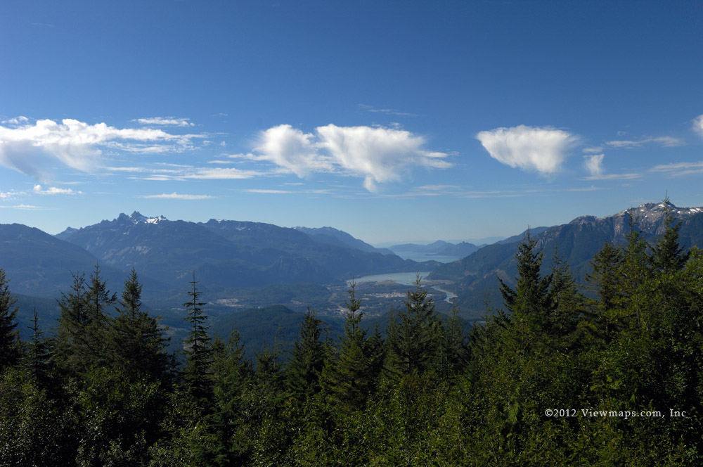
Finally I was able to get in to the back country again. The weather and my Ontario trip kept me sidelined since September! This morning Geoff and I left the house at 8am and set out for the Squamish FSR. Our first adventure of the day began early with our driving the newly completed Port Mann Bridge. It was a lovely drive with 4 lanes open each way. No more backups and delays, it really is a welcome project. The rest of the drive to Squamish went quickly and as we rounded the last turn before Squamish we had a spectacular view of Mt Garibaldi and The Chief. We just had to pull over and take a few photos before continuing along the highway into town.

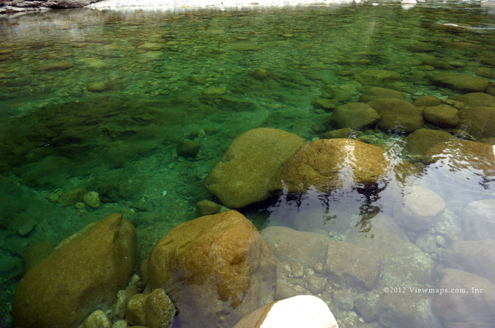
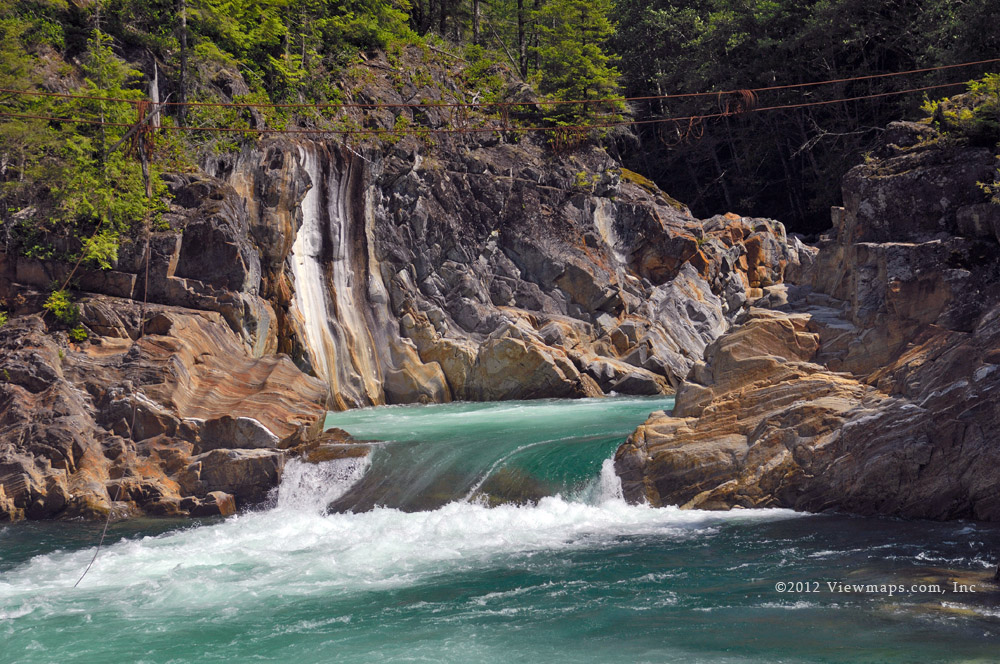
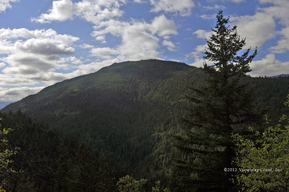
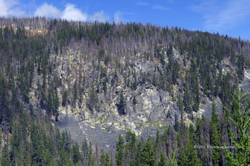
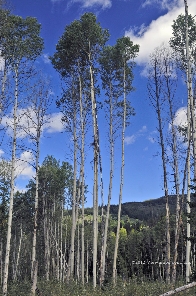
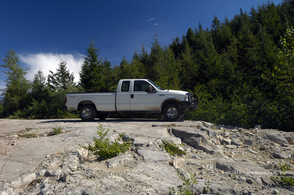
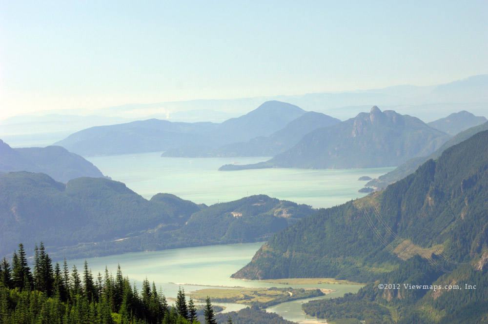
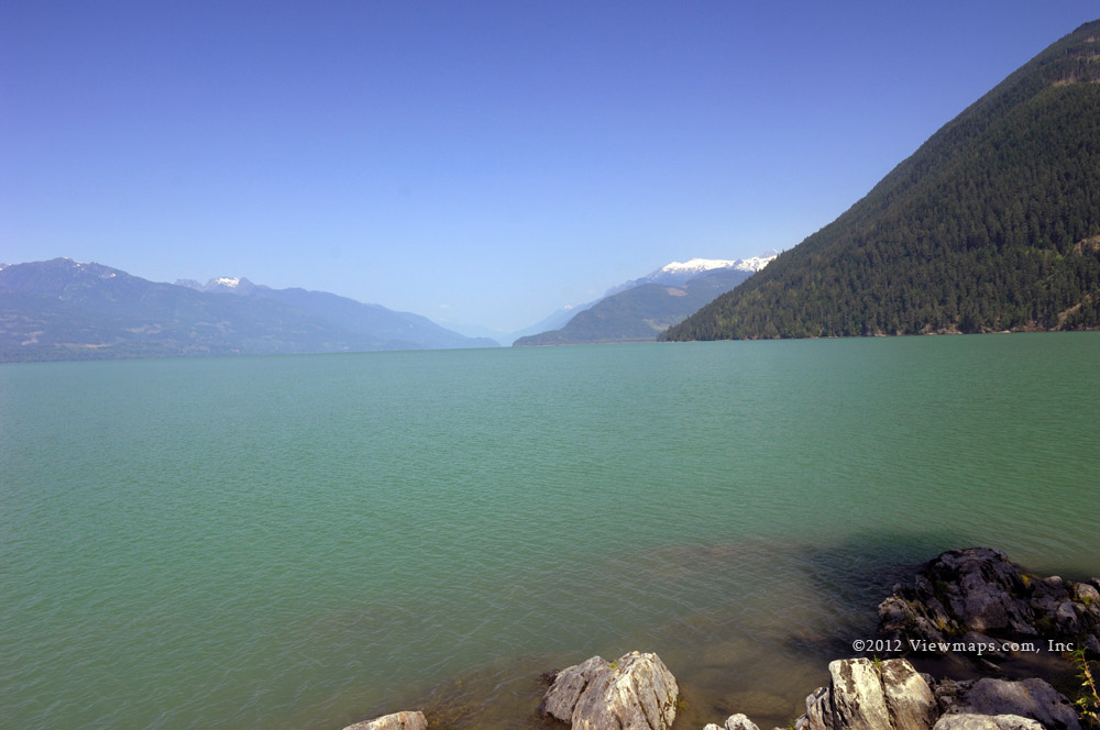
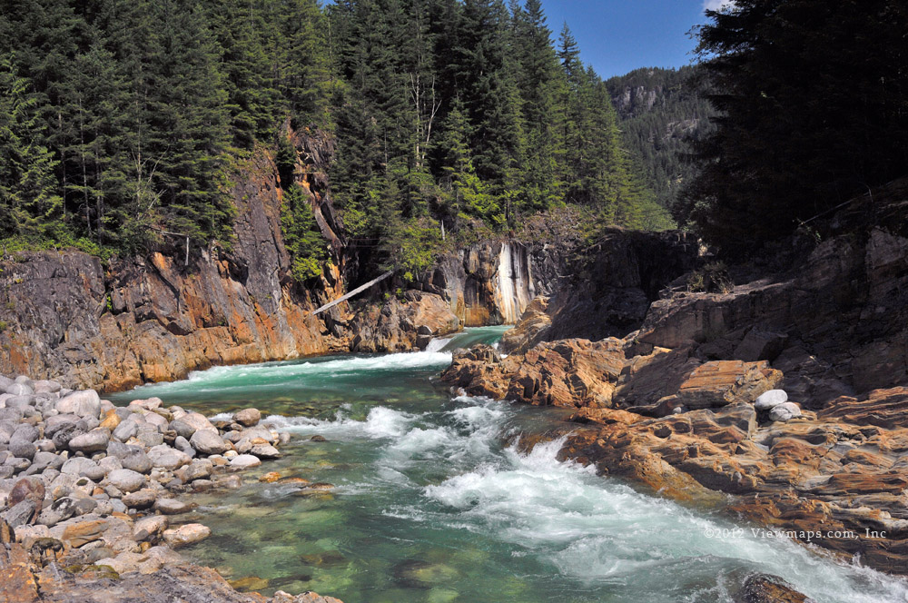
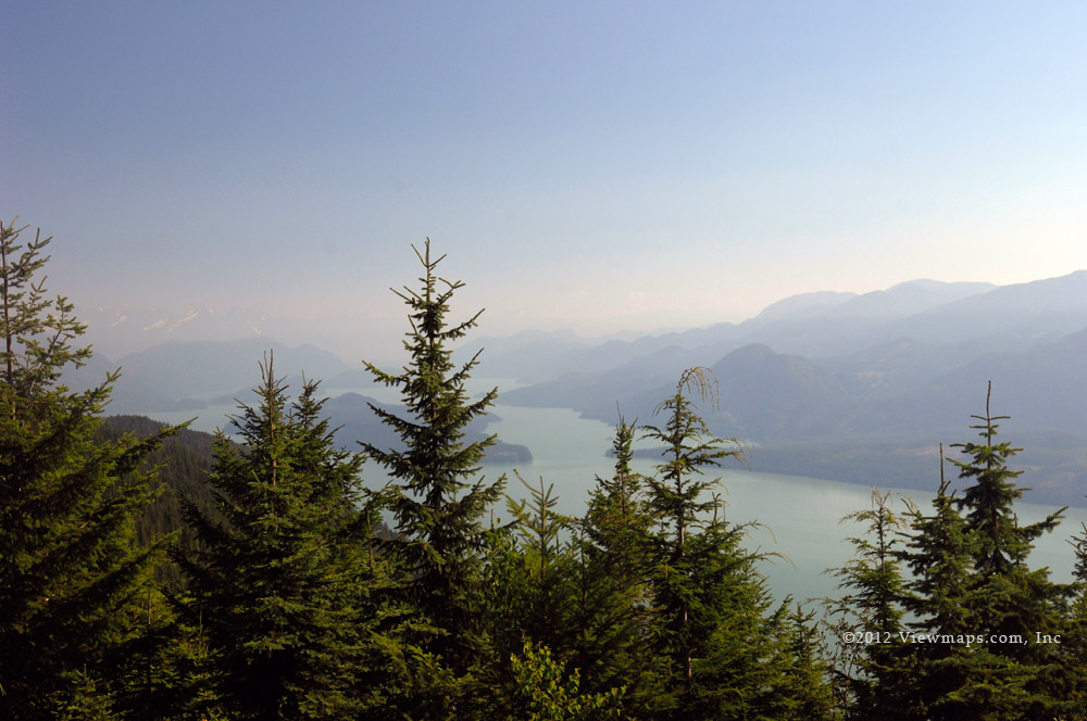
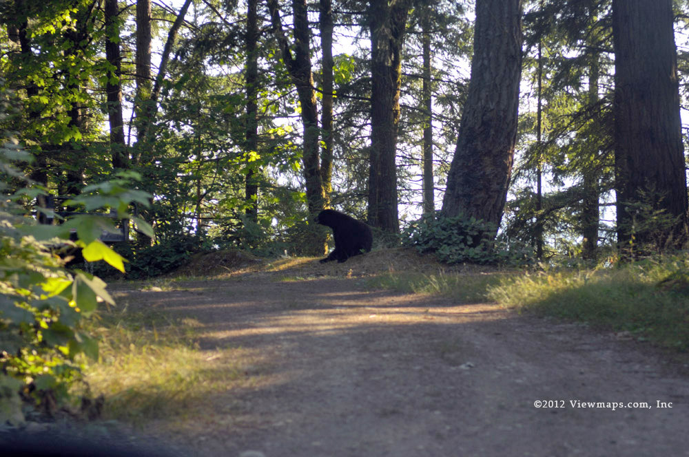
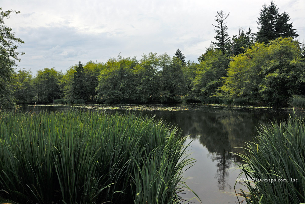
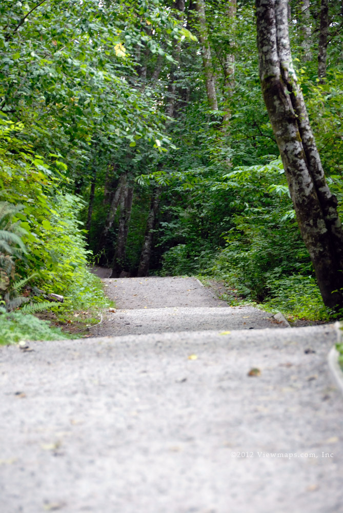
As we approached the start of the FSR we still weren’t sure what to expect snow wise but soon we could see that the road was clear without even a trace of snow to be seen. So that bode well and we made our way along the road looking for some places to stop and gather photos. The drive was actually quite good as the road was in fairly good condition. We stopped at a wide spot along the river at around the 30 mile marker and there I was able to take some lovely photos of Mt Wood. Meanwhile Geoff was busy sighting in his rifles.

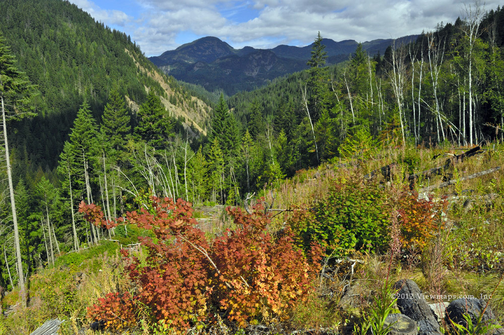
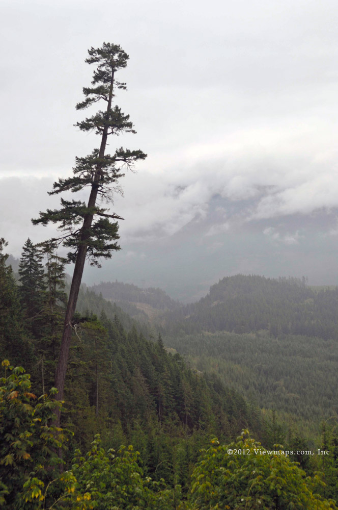
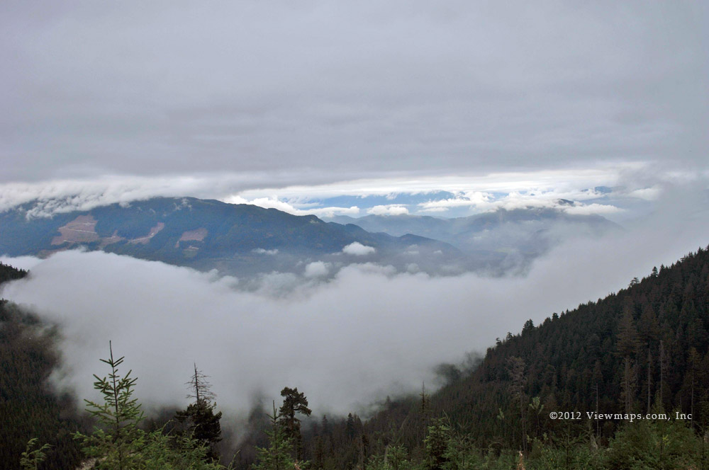
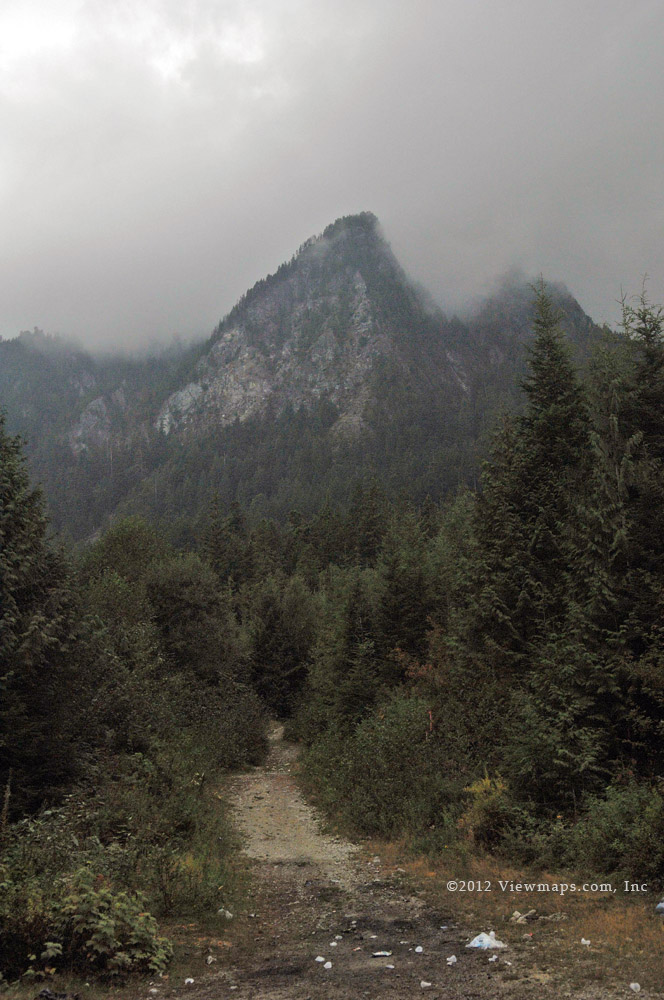
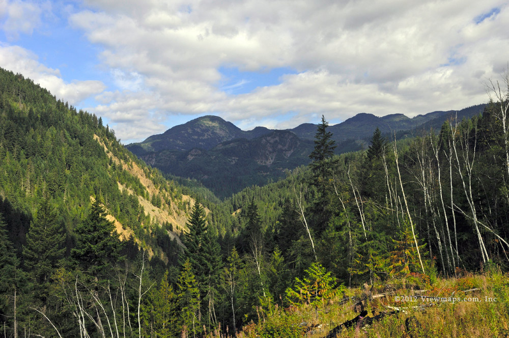
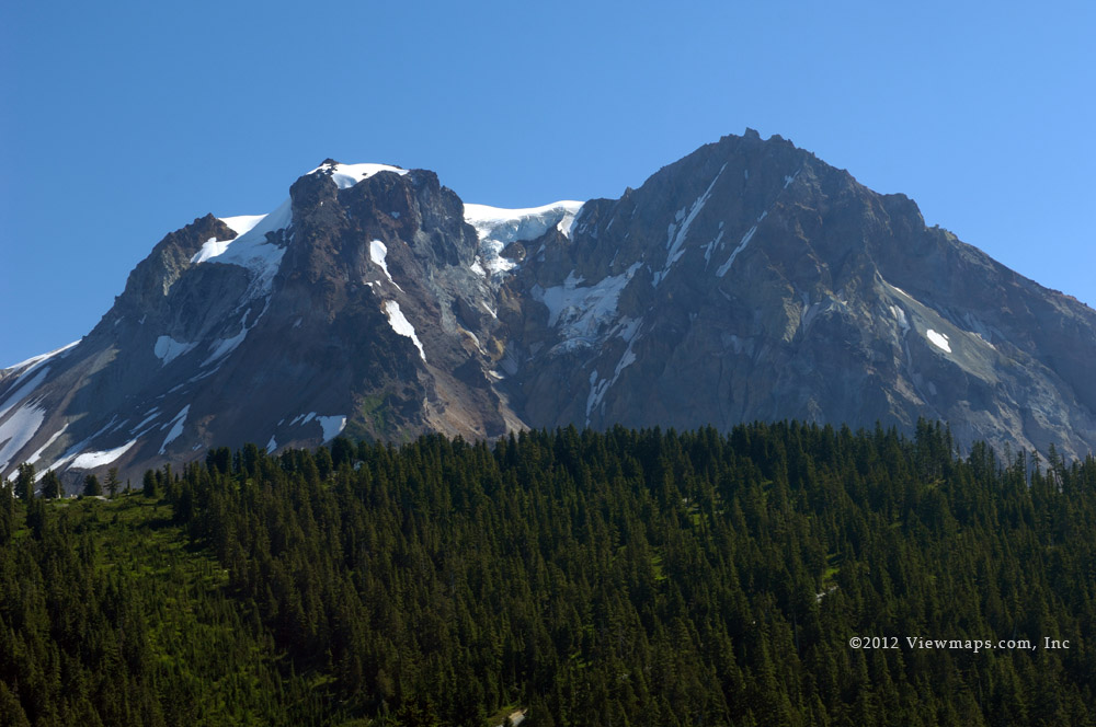
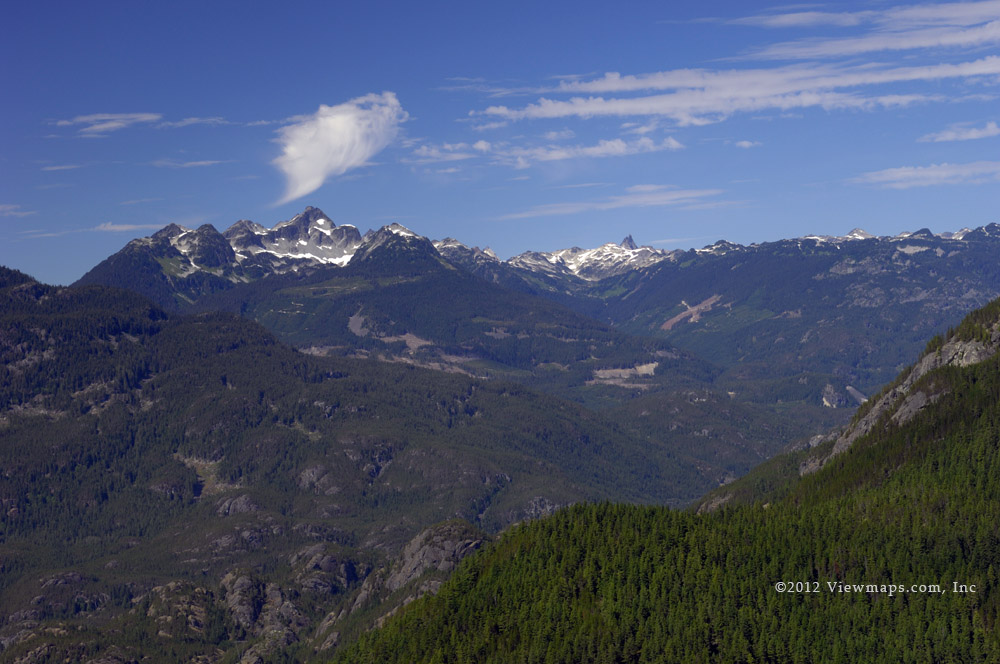
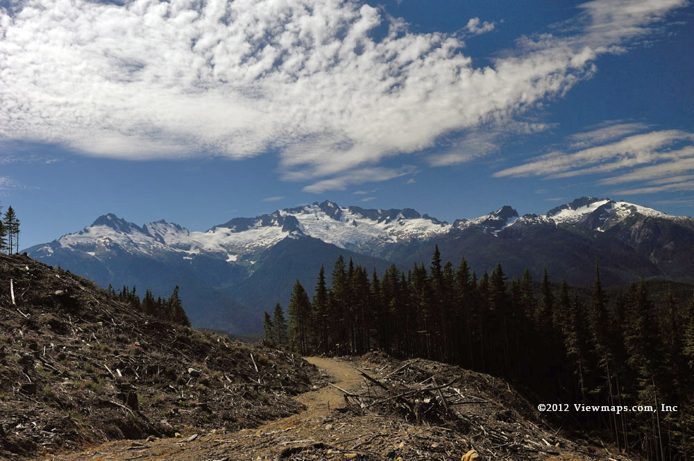
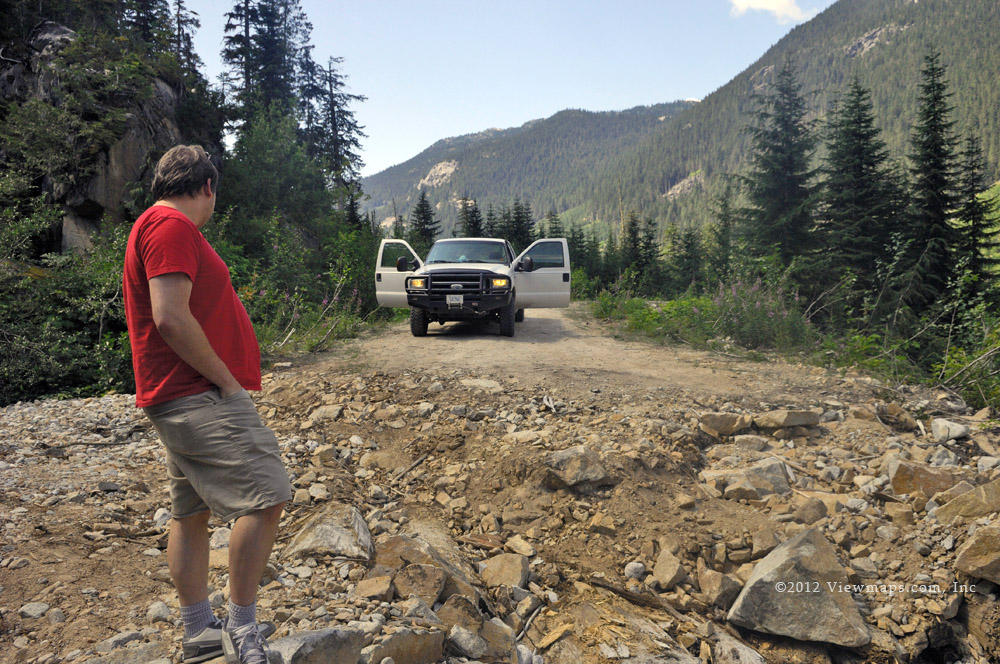
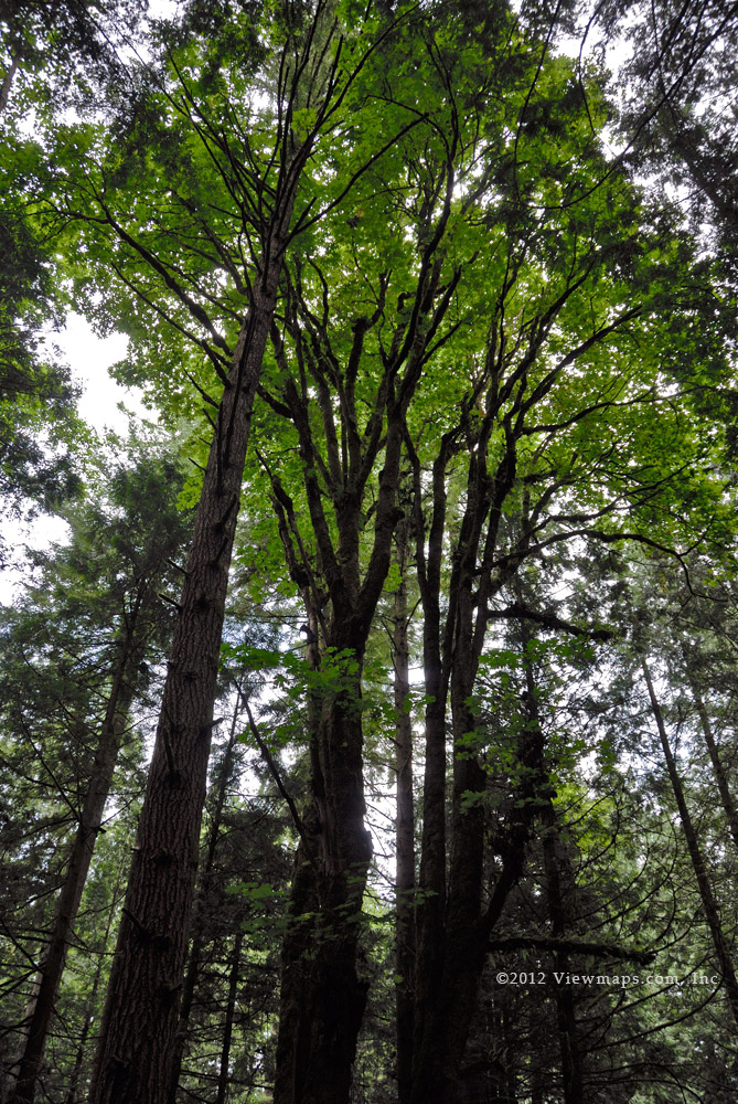
Done with the river view we continued up the mainline and came to the B700 branch. We hadn’t explored this road in our recollection so up it we went. The initial section continued snow free but as we reached 500m we encountered some lovely powder snow. It was unmarked as we were the first since the last snowfall to drive the road. Soon we reached a level spot with an amazing view of Pyroclastic Peak – the peak was just emerging from a cover of cloud. We drove a bit further up the road but soon the snow depth was deep enough that we no longer had good traction and we would need to put on chains to continue. The effort to chain up was not something we wanted to expend today so we turned around and started back down the road.

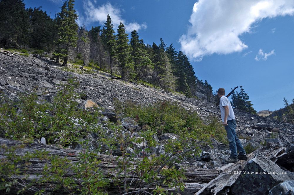
Unfortunately, the road going down was a different animal than the one going up and as we approached a cross ditch the truck lost traction and we slid into the ditch at a speed a bit faster than planned. This bounced Geoff and I into the ceiling of the truck and as I was wearing my cap with a button on the top it caused some ripping of flesh on my scalp! Once we picked our way past the ditch and stopped, we surveyed the damage and determined that my head took the worst of it. We decided to not bandage the gouge as the little hair I have left didn’t need to be ripped out by taking off a band-aid later!

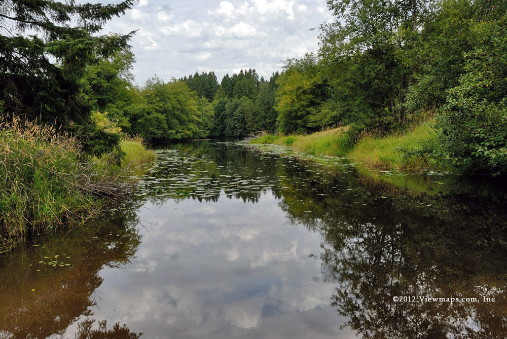
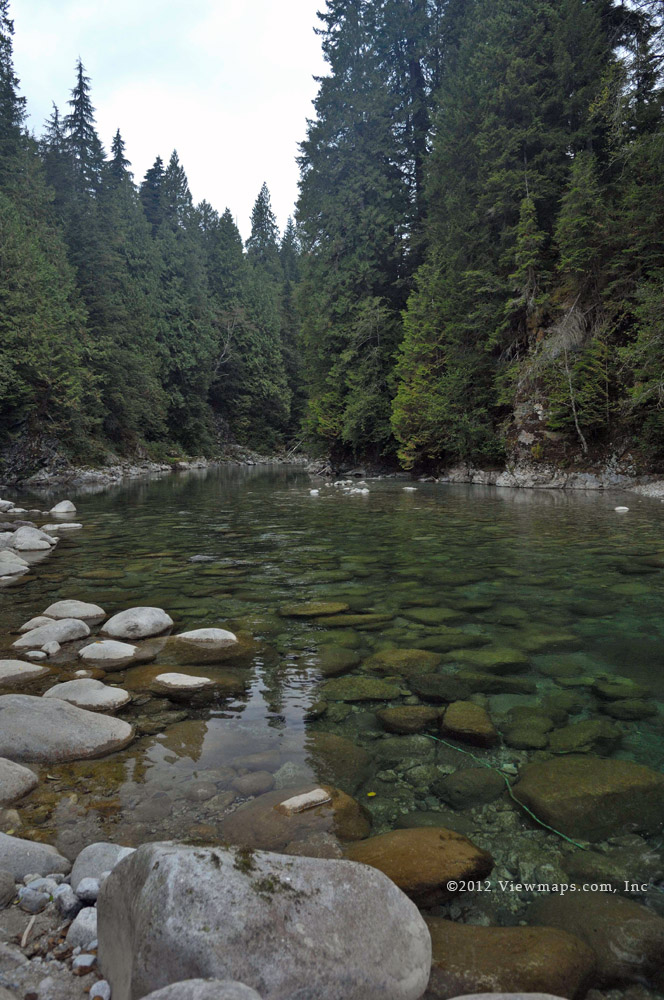
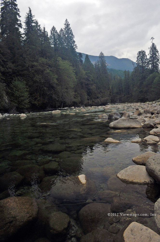
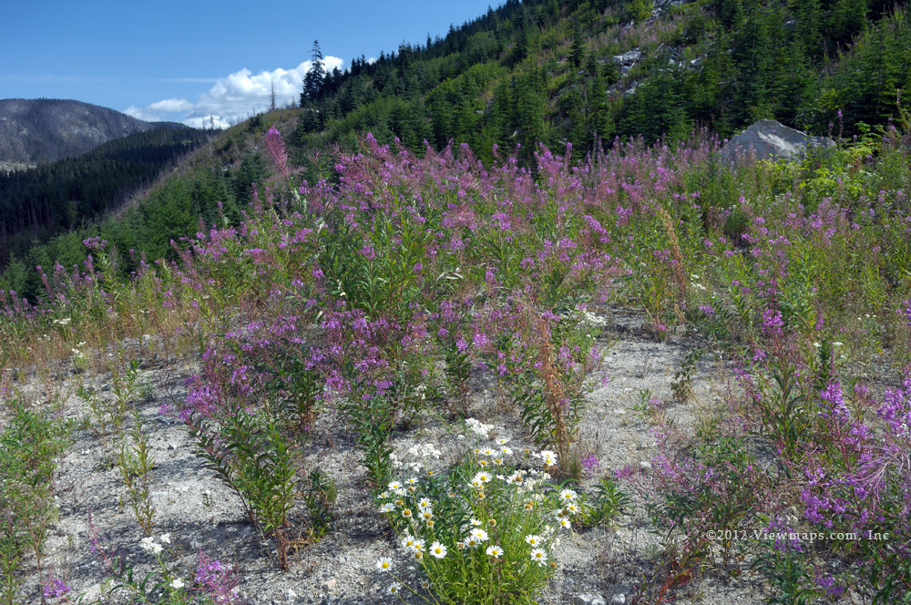
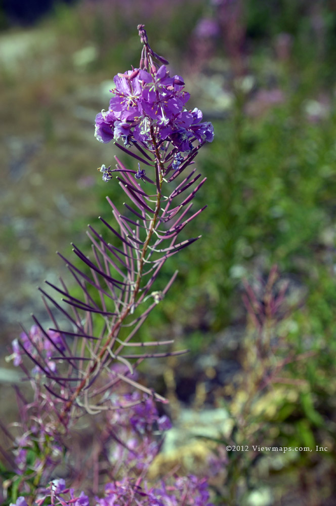
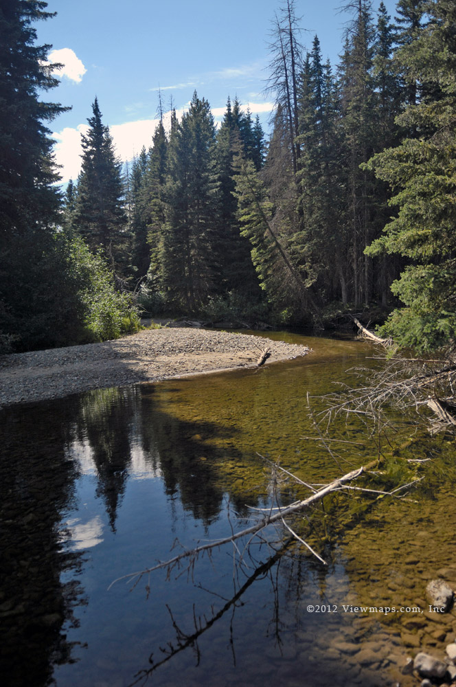
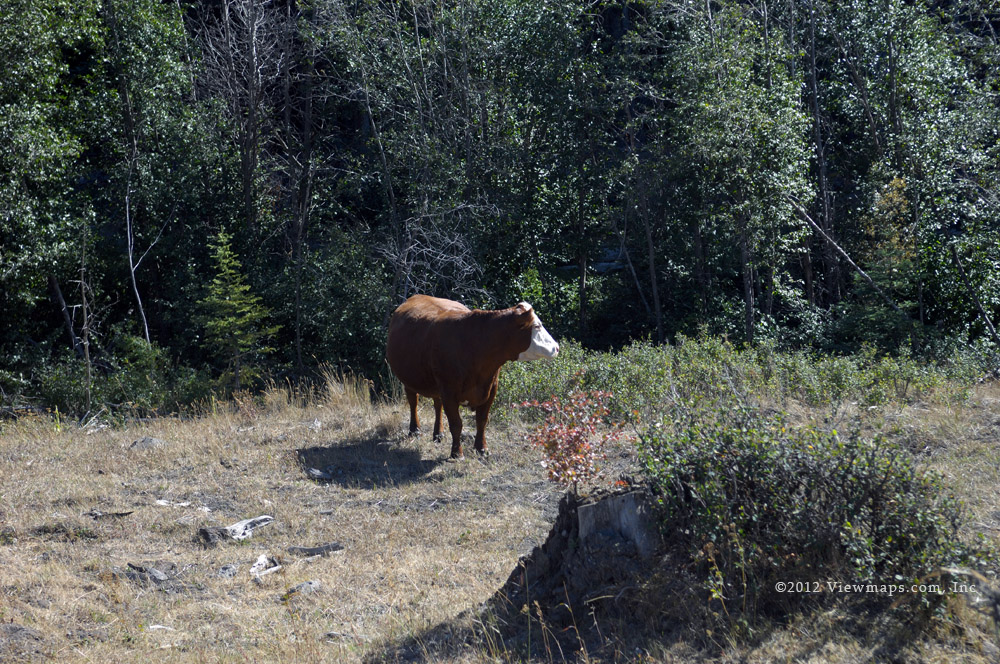
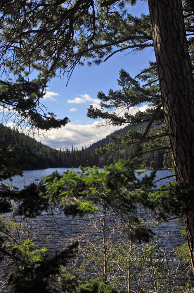
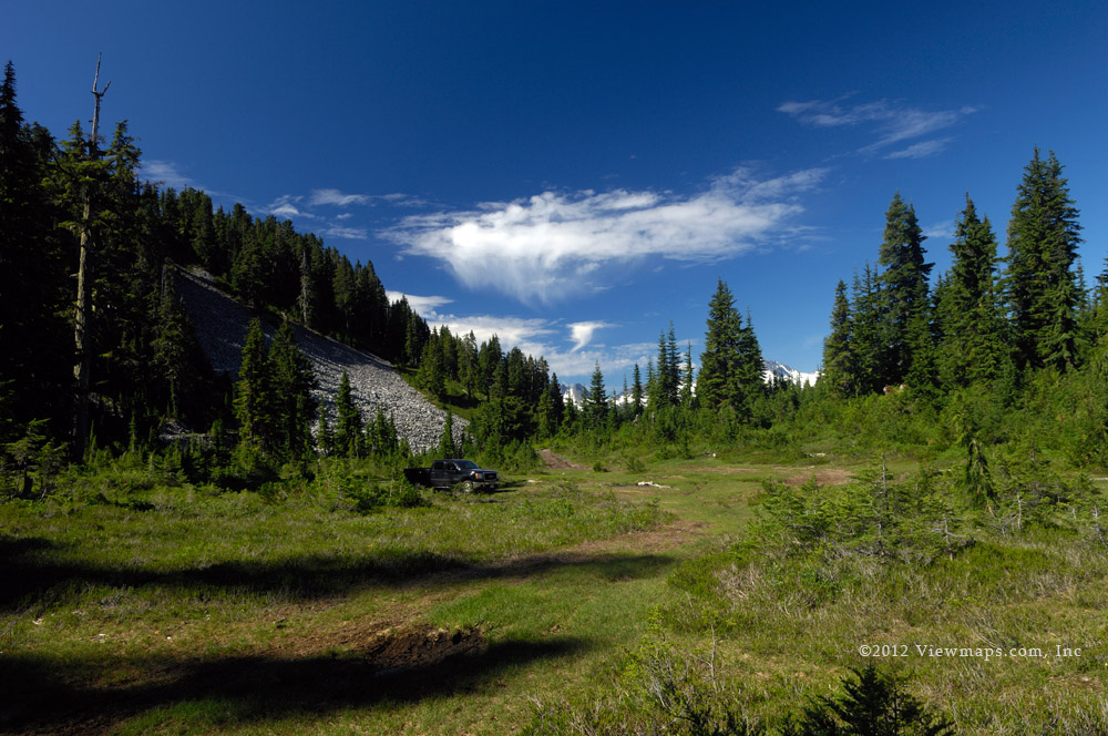
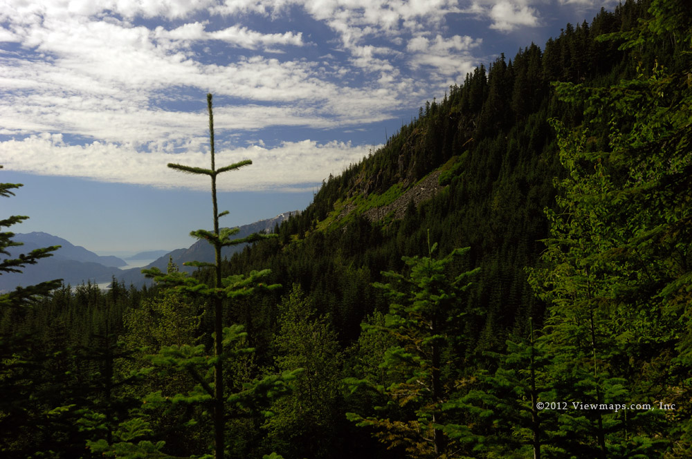
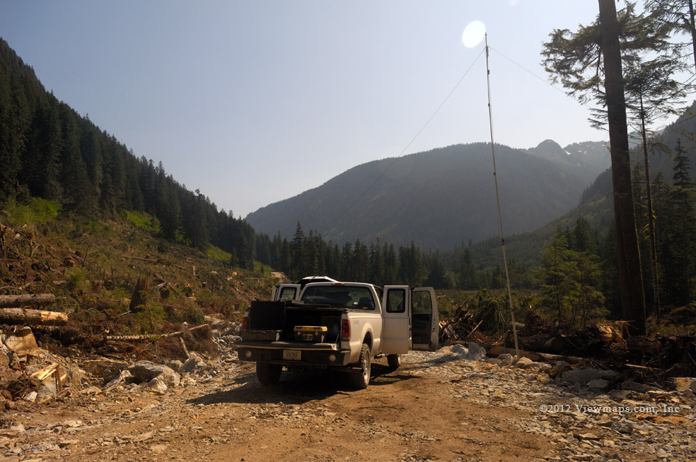
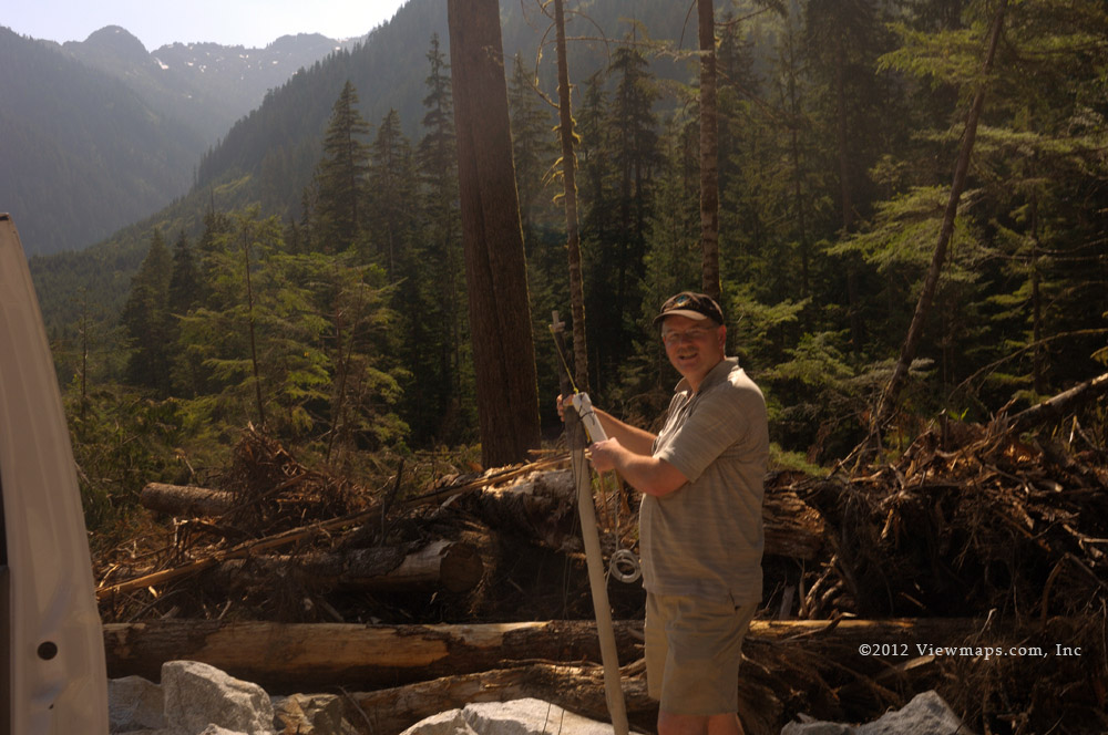
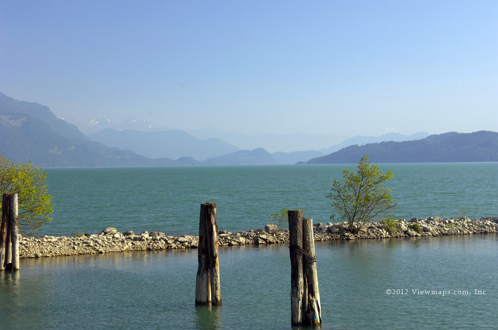
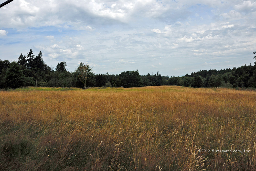
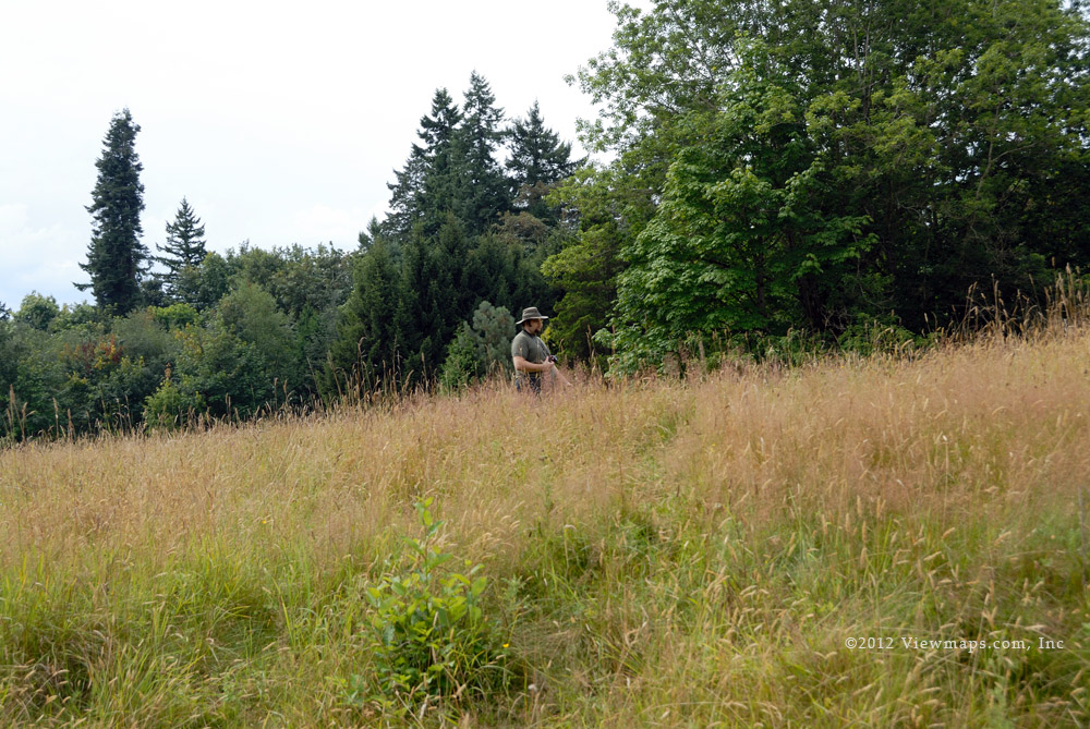
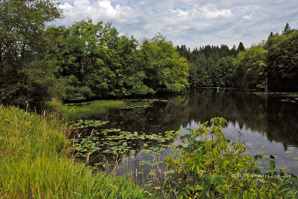
We continued down the B700 to the mainline and then continued along to the B800 fork which we then took to explore. As we reached the snow level we encountered a few others who were out hunting. This branch had a number of side forks which we also explored, one ended in a washout, a couple more stopped us by deep snow. Eventually we saw what we could and we returned to the mainline. As it was approaching lunch time we decided to head up to the Elaho fork and slide up the Squamish on the E100 branch to look for a spot where we could park alongside the river. A couple of Km’s up we found a point where we could drive to the edge of the river and enjoy a camping spot. Here we parked and cooked our lunch, Geoff started a small campfire but it didn’t get hot enough to do much good.

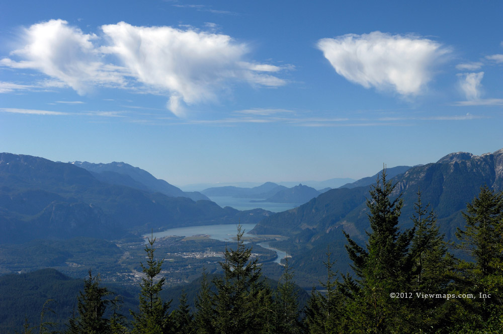
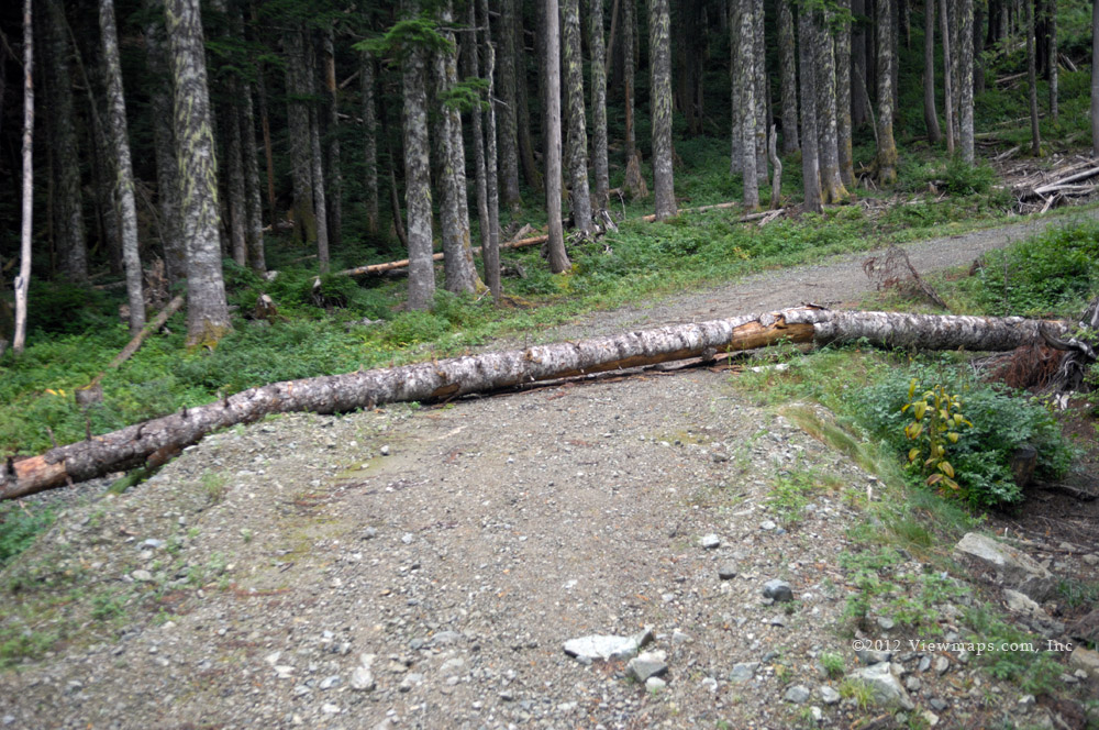
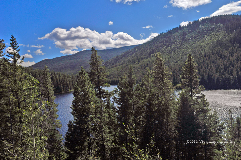
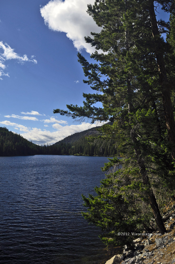
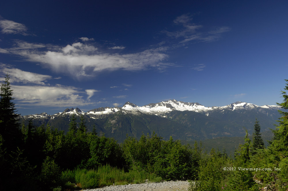
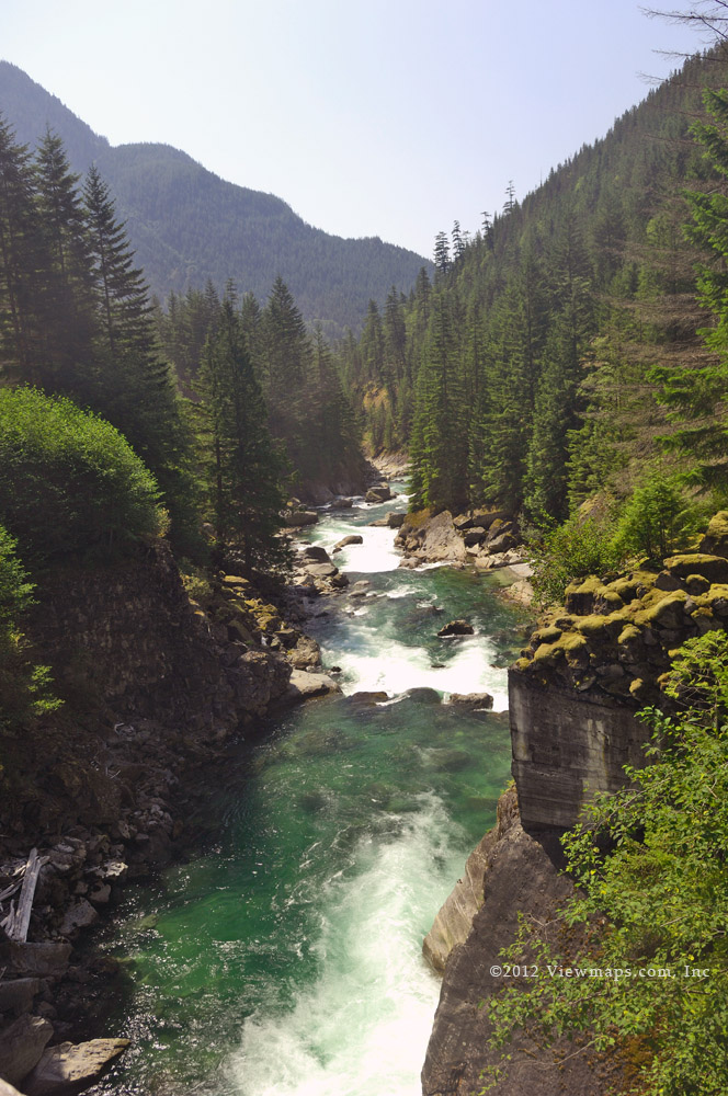
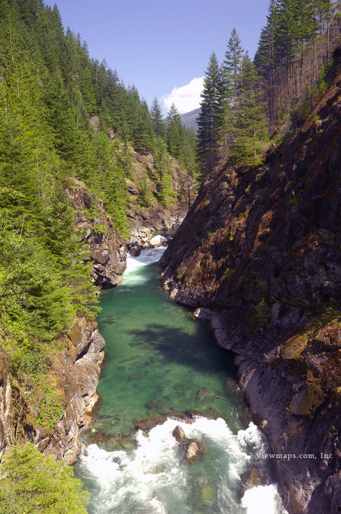
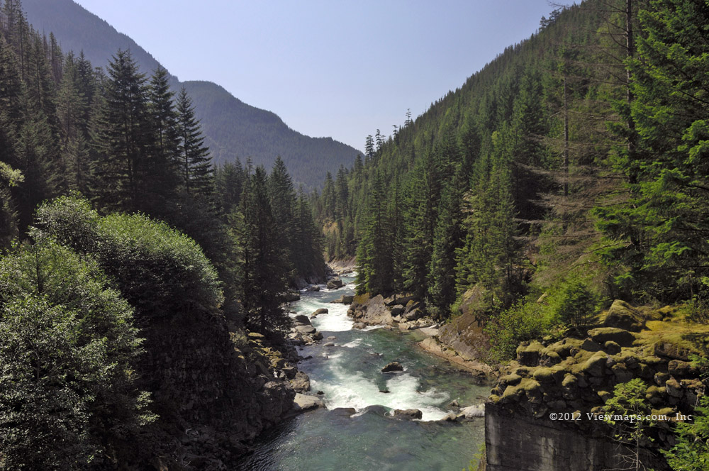
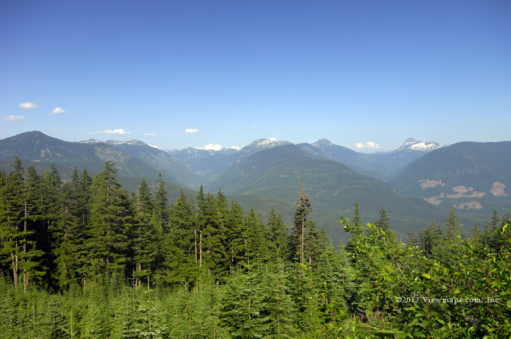
Done with lunch we decided to return to the Squamish mainline and continue along to see what had become of the washout we encountered the last time we were here. As we made our way along we almost missed the spot as the road was well repaired and we could only tell we were at the right spot by the look of the stream which had eroded the road last winter. We continued along trying the S200 branch which eventually stopped us with snow and then continuing along the mainline as far as we could snow permitting. Up here the mainline seemed to fork into two main roads and we drove both. The western fork crossed the Squamish River and offered a nice view of Ring Mountain. At least it did once Geoff removed a tree that was blocking the view.

By now it was approaching 3pm and the light levels were rapidly dropping so we decided to start the drive back to the pavement. We made excellent time as we trekked along the road encountering only a couple of vehicles, a couple more were parked and we did see one camper setup for the week-end. So the place was quite empty – just the way we like it. We reached pavement at 4:11pm just as the sun set. We then made our way along to the house of a local Ham – John – who we have chatted with a number of times the last couple of years and ended up spending an hour with him looking at some of his radio equipment and just chatting about things of interest. The rest of the drive home went quite quickly once we collected a coffee in Squamish. It was a good day of driving and exploring after 2 months of absence.

Chehalis Valley

For some time I have wanted to explore the slopes above the community of DeRoche. There is a logging road there and I thought today would be a good one to try it out. So Ethan and I left the house at 8:30 and soon found ourselves satisfied with a warm coffee and a breakfast sandwich. Then after a slow fill of the truck – our pump has been upgraded and now takes longer to fill the tank- we were off to DeRoche to find the start of the road. As we made our way through the residential area we passed the turn to the FSR and so had to back-track until we spotted it. Happy to find the entrance, our excitement was very quickly splattered across the gravel as we were stopped by a locked gate. So annoying. But our fall back was to head up the Chehalis and explore some spots along there. So back to the highway and off we went.

The Chehalis area always offers me pleasant views to enjoy and today was no exception. Though the light levels were quite low due to the heavy overcast we were still able to find some things to enjoy. The area at the start of Elbow Lake was full of campers and people so we just passed right by and though I was tempted to stop at the far end of the lake I decided to head up the Pretty Creek FSR. They had logged it last year and I was hopeful we would find a new section to explore. The road was rougher than I had expected but we persevered and soon did travel slightly better road but we didn’t make it to the area most recently logged due to a slide blocking the road, an ATV could have crossed but not our wide beast. So we returned to the fork which provides a road to the shoulder of Sasin Peak.  We continued along the over-grown road almost deciding to call it quits but the over-growth thinned just in time and we continued up the gravel to the viewpoint on the should of the peak. It offered us some nice views looking down on the clouds though we were only around 925m in elevation. After a few photos we continued up the road but found it blocked by a large tree. The tree was cracked at two points, one each side of the road. So we felt we could pull it and we set off to hook it up to the winch. After a few moments and lurches the one side had broken free from the rest of the tree and we were able to drag it up the road and then roll it off to the side.

On driving on we came to another view spot but just past it the road was blocked by several trees across a cross-ditch. This time we decided to not bother and we returned to the view point and set up to enjoy some lunch. I do enjoy having a hot lunch up on the slopes, especially on these cooler days. Done with eating we zipped down the rough road and soon we were back to the main line and heading up to the fork with the Statlu. But once again we arrived at the start of the Statlu only to find it blocked with a steel gate. A tad annoying but not uncommon, one day I will arrange for a key. We returned along the Chehalis mainline and took a turn which led to the river below. This area Geoff and I found a while back and it gave us access to a mini-gorge along the Chehalis River. I wanted to return to the place to gather a few more photos. 

We made good time along the side road and soon found the old upside-down camper that had been abandoned and filled with bullet holes. It was much worse for wear since I was last here. Ethan and I then walked the short distance down to the river where we enjoyed the clear fresh water of the Chehalis. It is a lovely spot and I was able to capture a number of river photos. The water level was down from last time and I found it quieter and more peaceful than last time. It was here that I spotted our first wildlife of the day – a very tiny frog that was leaping out of my path. I watched it for a while as it made leaps a good 30x its own length! I’m not sure I would like to jump 100 feet (my equivalent) at a time but this little guy thought nothing of it. We returned to the truck, only to be greeted by the stench of some pot smoke. It seems that an ATV traveler we had passed earlier had come and gone while we were at the river.

We climbed back up to the mainline and then took a road which climbed the slope above us this was a freshly logged area and the road was quite decent. We saw some neat sky effects peeking through the still standing trees. As we reached the end of the road we found greater numbers of trees stacked alongside the road and eventually we came by a parked harvester. It had been busy clearing the area now they need to collect the trees and haul them out. After looking over the fresh area we returned to the mainline and it being later in the day we decided to head on out. So I still missed exploring the north end of Elbow Lake. I guess I will just need to come back one more time. The day was still dull over cast and so it was quite a surprise as we got nearer to home to find the clouds parted and the sun blazing. I guess we should have stayed near home!

Wells Peak Reprised

This year, September has proven to be a warm and dry month and with the likelihood of good week-ends Geoff thought we could try Wells a second time this year rather than wait for next summer to affect our revenge. So we were watching the weather reports as the month progressed and come Saturday the 15th we felt great at having a chance for a second go at the summit. Like last time we left the house at 6:30AM but this time the sun had not yet risen and we enjoyed glimpses of a colourful sunrise. After our traditional stop for coffee we were on the road and making good time for the start of the FSR. We took a brief second stop for some food items in Bridal Falls and then it was onto the logging roads. The drive up the rough road seemed to go faster this trip as the road had been travelled and we didn’t need to clear any branches.

Soon we were at the parking area and ready to head out. After getting organized we were on the trail at precisely 9AM. Having done the first section before, we made good time up the old road and into the forest. The day was still much cooler than last time and so I was able to keep up a better pace as we ascended the steep slope to the ridge. The ground seemed drier and so our footing was a bit more sure which helped us to keep up the pace. Before long we had reached the point where we first encountered snow last time but today the ground was dry and we could actually follow the trail. Thinking back to our previous attempt and referencing the GPS track we noticed how we had wandered off the trail. Today it went quite quickly as we could follow the established route which was easier than the one we had forged. 

As we reached the ridge Geoff wanted to detour to the rock outcrop where we had eaten our lunch last time. Today it looked so different with the snow gone. There were trees all around us and the area looked so much fuller than when the snow was burying everything. After a brief rest and some photos we returned to the trail and hiked up the ridge to where the trail finally started to cross the open slope. During this section of the hike the trail was hard to find and we only found it sporadically. The slope was still very steep and uneven and we slipping quite a bit on the heather, so having learned from the Mt Hansen hike we put on our crampons and enjoyed better traction for the rest of the hike. In reviewing our path later we learned that we had ascended too high on the slope, which lead us into the gravel slide area. This was a challenge to get across but we eventually managed. 

We finally made it across the slope to the far ridge where we saw a couple of cairns indicating the resumption of the trail. Here we were able to spot worn sections in places and so we started up the slope to the shoulder and a very narrow ridge that connects to the main ridge between the major peaks of Wells. This section was steep and we felt it a challenge but then we reached a 100 foot long section where we had to scramble and crawl up the slope. Our spikes made it easier but we had to be very careful as there wasn’t much keeping us from a few hundred foot fall. I was glad to get passed this section and onto the main ridge.

The main ridge between the south and central peaks was very broad and flat with lots of spots one could easily pitch a tent. We made our way to the central peak – it being the highest of them all. After a short hike we were finally at the true summit and shedding our packs and gear. It sure felt good to get that load off. The sun was warm but not overly hot and there was a warm breeze which cooled us off as we rested. After a few minutes we got our stoves out and cooked our lunch. It was great having a hot meal even in the warm sunshine. After waiting we gathered photos from the area around the summit and then I called home with my radio. I always enjoy chatting with home from the back-country as so few have the tools to do so. Done with Carolyn, I was flipping the dial back to our hiking frequency when I heard a CQ on the standard calling frequency. It was a high school student who was also on a mountain peak a bit south-east of Lillooet – 145Kms due north of us. I was surprised to hear her and so I stopped and answered her call. We ended up chatting for 20 minutes before I finally felt we had to get going. She was out for the week-end with her class mates camping on the peak. Several of them also had their license. She was using the same Kenwood handheld as me but she had a 4 element yagi for her antenna.

Once I was done with the radio we started down from the peak and decided to walk over to the southern peak as it was an easy walk along the ridge. While on this sub-peak we were buzzed by a tour helicopter. It was only 120 feet from me at it closest – the tourists inside were waving at me as they flew by – a bit distracted form the views. Done with the peaks and tourists we returned to the small side ridge we had climbed up to get here. This time we had to descend the bare steep section. Geoff made good time going down this area but I took a bit longer as I was having trouble finding adequate grips to help lower myself. But soon I was finished with the exposed section and onto flatter trail. We continued along the shoulder following the path we used coming up but this time we headed out for the broader slope and descended a bit faster that way though the loose gravel made for some challenging steps. 

We eventually returned back to the side ridge and reached the cairns we saw on our way up. We added a few rocks to the markers to make them a bit more visible to those coming behind us. Resting for a bit we then set off across the open slope for the resumption of the trail on the far side. We still could not spot any trail markers along the slope and before long we realized we had stayed too high and gone too far! So we dropped down slope and doubled back towards the centre of the slope. It didn’t take too long before we were on our old path where we could actually see the trail. We made good time dropping down the trail – our spikes giving us the extra traction we needed for the faster pace. 

Though it was hotter than on the way up the tree cover kept us from over-heating which allowed us to make good time on our descent. We were at the truck before long, exhausted and hot but feeling great that we had mastered the summit. We took our time getting packed up and but eventually we were on our way back down the road. The drive down went without problems and as we reached the highway we felt both relieved and a bit disappointed that we were done so soon. The drive home went quickly and then we were unloading the truck. 

I found the hike to be tougher on my legs than the others I had done this year. This is likely due to the extensive amount of rough slope we had to cross in the middle of the trail. The heather field was very uneven and though one had decent traction the unevenness made for a difficult crossing. Not sure what to plan for next year – Mt Hansen for sure but beyond that we will need to think up a few options.

Cheam Peak, Great for Radio Contacts

Last month my friend Ralph got bitten by the bug to operate his small portable radio on a summit of a local peak. He had been reading about the SOTA (Summits on the Air) organization and felt like giving it a try. So we picked the next date I was available to do a backcountry trip and we planned to operate for a couple of hours from the summit of Mt Cheam. Mt. Cheam was our first choice as it was already a registered peak with the group and the access and trail were not difficult though the hike was still 4.5km each way.

Ralph hadn’t done any mountain peaks so he really didn’t know what to expect or what was needed. The first thing I had him do to prepare was for him to hike some of the steep roads in White Rock. I figured if he couldn’t do them then there was no way he would do a summit. He tried a couple of the steeper roads in White Rock and felt it was fairly easy. So that confirmed, we met a couple days before the hike to review his supplies and backpack. My son Geoff gave him some tips and helped him to finalize the items he would be packing up. So we were ready and good to go for Saturday, the weather looked good if not too hot, so we felt sure we would be on the slopes come the week-end.

To beat the heat of the day we set out from my house at 6:30AM and made for the nearest Starbucks to load up on our requisite caffeine. Then it was on to the open road. I had estimated that we would be starting the hike about 2.5 hours from when we left the house so when we arrived at the start of the logging road after just a bit more than an hour Ralph thought we would be quite early. He really didn’t know logging roads! The mainline was quick but soon we were onto the Chipmunk Creek FSR and it was very rough and had numerous patches of bad potholes. Needless to say, the speed of the drive dropped considerably and it took almost an hour to get to the parking area and that was with passing a couple of SUV’s.

Having arrived, the lot had only a few cars in it and we picked the spot closest to the trail head. We got our gear in order and items locked up that we were leaving and by the time we wereready to start it was 2.5 hours from our home departure. The day was still cool and we made good time along the first segment which follows the old logging road. Then we dropped down into the bowl – Spoon Lake was full of debris and still had ice in it. Continuing along we started the intial ascent which was fortunately still in the shadow of Lady Peak and so we avoided the heat during the steep part of the hike. We made really good time upto the top of the open knoll where we took a breather before continuing on to the col between Cheam and Lady Peak. By now a few groups of young people zipped past us on their journey to the summit. Though slow we made steady progress and reached the summit after 2 hour 20 minutes of hiking almost bang on to my 2.5 hours estimate.

At the top we joined the ever growing crowds of hikers and after a brief visit to the summit we backed down along the ridge to a level wide spot where we could safely set up Ralph’s radio and antenna. We wanted to be a bit distant from the sea of human bodies. The site was only a short distance from the summit but still had a great view of te Fraser Valley. Here we secured Ralph’s fishing pole with some rocks and he stretched out his thin wires to create a dipole. It was a very simple arrangement and soon he had his KX-1 assembled and he was sending out code with all of one watt of power. Itt was enough as he very quickly made contact with another chap doing the same thing as us down in California! Ralph continued to work his radio and by the end of two hours had secured 6 stations.

We had our lunch in the middle of the operating session, Ralph a sandwich, I heated water for a warm meal. During the session we had numerous people come buy to learn what we were doing. They all seemed quite interested and surprised at how far we were reaching. As two PM arrived we felt reasted but apprehensive of the long trek back down. We kept it slow and steady so as to not damage our sore joints. In the end we took two hours to get back – not much less than the time to go up. There was a chap who passed us on the way down we had been counting the people hiking the mountain this day He had counted 191 persons on te hill! It really is quite the highway. It was good to see the truck and we soon got our gear stowed and ourselves packed and ready to depart after a great adventure on the slope.We saw that trucks had filled up the lot and later ones parked along the side for quite a distance! I sure was glad we didn’t have to lengthen our hike due to a full parking lot.

The final drive out went fairly quickly even though it was very rough and we got bounced around quite a bit. When we reached pavement we reflected on the hike and radio event and felt we had achieved a successful event now we need to plan for another one.

A Stroll through Lighthouse Park

Nick doesn’t get to enjoy the backcountry as much as he would like due to his working on the week-ends. So when a long week-end comes along we try to take advantage of it and get out somewhere to enjoy the sights. Today we returned to Lighthouse Park. I hadn’t been there since our last visit together back in April, 2011! so it was well worth the effort to return. Today we decided to start our hike on the eastern trails and work our way around to the western views. So we set off and after the customary stop at Starbucks and later a Safeway for lunch supplies we made our way to the parking lot of the park. When we arrived it was quite full but there were a number of spots readily available for us. We chose one across from where the western trails connect to the parking lot.

Once parked and settled into the site we got our hiking gear loaded and we set off for the Arbutus Trail that runs along the eastern portion of the park. Before actually starting on the Arbutus trail we took a detour to the summit. Now this summit doesn’t compare to that of any minor mountain but it is the high point in the park and has some views of the water but most of the view is blocked by the beautiful and huge trees surrounding the rocky summit. Once we had our fill of the rarefied heights we slumbered down the Summit Trail to where it joins up with the Arbutus and there we continued our way down to the shoreline.

In time we reached a small spur trail that led out to a rocky exposure on the eastern side of the park. We were the only ones on the rocks and we took a few minutes to enjoy the freshness of the sea air and warm sunshine in the mild breeze. It was a delicious spot with all the elements readily available to enjoy and no one to bother us. I gathered a few photos but we wanted to see more and so we returned to the trail and made for Eagle Point. When we arrived at the point there were only two other couples enjoying the scenery and we were able to find a nice spot to relax and eat our lunch. Done with the prepared sandwich, I started to roam the rocks looking for some interesting photos to gather. By now several other groups had found the point and were busy taking in the views. After a few photos, I checked with Nick and he had collected the photos that he wanted and so we grudgingly left the rocks and continued along the Arbutus Trail and then the Valley Trail all the way to the main facilities. 

Continuing passed the buildings and the growing swarms of people we walked directly to the East Beach. The tide was out and we were able to crawl across the rocks to some that were normally out of reach. This opened some new angles for me and I was able to gather some photos from the new perspective. By now the crowds of people were getting large. I was quite surprised to see the numbers out here. After some time on the furthest rocks we returned to the beach, I set off for the main path back but Nick wanted to try scaling the rock face for an alternate return trail. He managed to get off the rocks but the undergrowth was thick with brambles and he decided it would be best to back track and follow the normal route back. This did wear him out a bit and so we took a bit slower of a walk as we made our way to the west beach.

The west beach had a few groups on it but it is much less travelled than the eastern one and so we had much of the rocks to ourselves. We picked a spot close to the western edge and there I enjoyed the sights, sounds and smells of the waves crashing over the rocks. The scene of the lighthouse is truly classic from the location and I could spend hours here enjoying it. It is a great spot for winter sunsets as well. But it was getting on in the day and so after getting well rested we reluctantly got up and started back up the trail. We had spent several hours enjoying the sights and we were getting a little tired so we decided to forego the rest of the western shoreline and take the Seven Sisters Trail back to the car. It was a pleasant walk through the trees and all too soon we arrived at the car. The crowds it seemed were increasing and cars were backed up looking for places to park. It sure is a popular park yet the eastern zone still virtually empty. We had a good time and the drive home went quite quickly. I look forward to my next visit.

Anderson River and the Uztilius

With the local roads being well travelled it was time to open up some new areas for our exploration. The big negative is the time it takes to get to the start of the roads and then back home. But we decided to give this region a go as we had briefly seen the start of the Anderson mainline last year. So we left the house an hour early and set off for Boston Bar where the Anderson mainline begins at the highway. The drive up the transa-Canada seemed to progress quite quickly and once in Boston Bar we refilled the tank and started up the Anderson River FSR.

The initial road segment we did last year but back then we got in only a few kilometers before being stopped by snow. Today it was warm and the snow long gone. So we made good time as we drove south along the river. It was not the most exciting of drives at this point as the river was hidden from view. We continued south staying on the mainline for the most part. Eventually we got a bit bored with the less than amazing views so we took the next branch which forked right down towards the river. It was a couple Km long and not too rough to travel. When we reached the end we had a bit of a view of the valley but the river was still unseen though we could hear it. As we returned to the truck we noticed that the tonneau cover had slipped and needed to be repositioned badly. The one fastener had popped off and was no longer holding the cover in place. It was the one that I had repaired before and it needed careful work to get it functioning again. Once secure we returned to the mainline for further driving.

We continued south and eventually came by a major fork. This time we chose the left side not fully realizing where it would take us. A short ways along we passed a large group of campers who were out for the long week-end. Continuing east we soon were making our way through a narrow valley following the Uztilius River. This valley gained elevation and soon was passing through some scenic areas. Here we managed to get out of the truck and actually find things of interest to shoot. Towards the end of the valley we chose a side branch that climbed the slope where we hoped we would find some nice views. It was worth the effort as we did manage to get some good shots from higher up the slope covered in wild flowers.

We returned to the Uztilius mainline and edged up a maintained but chewed up section that climbed the slope out of the valley. The road was now travelling along a higher plateau area with branches heading off in all directions. It was fortunate that the main route was marked with good signs. So we continued along with little difficulty. But here we learned that the area is so loaded with roads to explore that it could only be done by camping out in the area. Finally we reached a branch where we had to make a choice, either to continue along the FSR and end up at Merritt or take the right branch and head to the Coquihalla. We chose the right branch and followed the Dewdney FSR to the Maka which connects to the Murray Lake Road.

As the Maka FSR crosses the Maka Creek we pulled over into an empty wide spot to eat our lunch. Before settling in for food we walked out to the creek. The creek rounds a bend here and formed a wide pool. As we approached the creek we startled some Salmon which were resting in the water. They were on their way to spawn and in need of some rest. They were quite interesting to watch and both Geoff and I enjoyed watching them for a while. As we looked over the creek in more detail we discovered a few salmon carcasses, it seems that some didn’t quite finish the journey. After gathering some photos we returned to the truck and started cooking our lunch. Then Geoff did a bit of target practice while I explored some sheltered camp spots under clumps of pine trees. Done with the site we started off down the road to the Murray Lake Road where we decided to take the longer route back to the Coquihalla.

Driving north we soon passed the first of the open range land we would travel through. Here Geoff spotted a set of ruts leading across the open space and he decided to follow them. We made it a few hundred meters before being stopped by a narrow opening. Though we didn’t get far, it did open up some nice scenery for me. We then continued along the road to a higher alpine valley where we observed numbers of cattle grazing in the rangeland. Eventually we came by Gillis lake. It was a lovely spot with some huge pines along the northern shore. We chose to drop down onto the main road through the recreation area and get some close views of the big trees. Having driven through the camping area we returned to the Murray Lake Road and continued on out of the region. The road ended in a village of Kingsvale and here Geoff decided to turn left on the Coldwater Road rather than right. 

Driving north on the Coldwater soon brought us to a rise with some nice views of the valley. By now we were only 25km out of Merritt and so we decided to just head to Merritt and pick up a coffee. The road was good quality and we made good time to Merritt where we decided to drive through the small downtown area. Geoff found it a quaint spot that seemed quite pleasant. Done with sightseeing we made for the only Starbucks in town and ordered our drinks – it was very busy and it took a fair amount of time to get our drinks and leave. The final drive down the Coquihalla went quickly and soon we were passing old familiar landmarks as we homed in on the town of Hope.

Though a long drive to and from the area, we did see some nice countryside and came to the conclusion that this region has a lot of road to explore and that we will need to get out there and do it but not until we can spend the night.

Return to Brohm Ridge

It was only a few weeks ago that we drove up to the ridge with the hope of seeing the sights. Unfortunately on that trip the clouds were blowing through and we didn’t see any views of the valley below. We also didn’t get to the end of the road due to snow blocking our way. So this being a week without a hike planned we decided to give the ridge a second attempt. Our day began a bit earlier than our regular departure but not as early as the outrageous time we go hiking. We grabbed a few items in Cloverdale and then made for the highway and our destination – Squamish.

After arriving in Squamish we filled up the truck and I called John a local Ham radio friend. He answered back that he was heading up a ridge just a bit past where we were going so we agreed to listen for any calls from each other. Fueled up, we quickly reached the start of the FSR and made our way along the Cheekye Creek FSR. It really is a miserably rough road and the heavy traffic it gets just makes it worse. As we gained some serious elevation we started to enjoy the views of the valley and Howe Sound that we missed last trip. The view along the Sound is truly remarkable and I really enjoyed the look of the three major islands stacked up in a neat row. 

Geoff stopped at the small wooden platform I discovered with Ethan last trip. He immediately saw it as a mountain bike jump and pointed out the landing ramp which we didn’t notice in the over-growth last time. We continued up to ever better views and soon came by an old concrete structure that caught our eye and so we had to stop and check it out to see if we could figure out what it might have been in its better days. After some time and looking it over from all angles we still couldn’t decide what it was and so we continued on our drive up the road.

We quickly reached the point of the upper gate and the snow level that stopped us last trip. Well this time the snow was gone but the gate was locked! Now this was very annoying and we were not at all impressed. After a few minutes of anger and gathering a few photos we backed up the short drop in the road to where two other pickups were parked and we then drove a side road to a boggy area where there was one more pickup. They were all empty and we wondered where the occupants were off exploring. The alpine bog was quite interesting but we were soon back on our way to the main road with plans to continue our drive.

Driving back down the initial section of the road exposed even nicer views of the valley and Sound below and we stopped a number of times to gather up more photos. Rather than head back down we elected to take the cross-over route to the Brohm FSR and there we explored the area Ethan and I started out on last time. We could see better views and the bugs were a bit less intense. We drove up two side spurs to get close looks at two small lookouts that had been built. I would say that at one time they likely had a good view of the valley far below but today the view is quite limited and consequently the structures are falling into disrepair. The road to the second lookout was quite long and narrow and we had trouble trying to turn around. After a vigorous attempt at the start we gave up and backed out half the distance before we could find a wide enough spot to turn around. We then continued up the remaining short distance and once at the far end of the road we stopped to eat lunch. It was a decent spot with a fair view and the bugs weren’t too bad – at least not at first. 

Once done lunch we back tracked down the Brohm FSR past the point we entered it earlier and on down. This road was much smoother than the Cheekye on our way up. We found a few spots to stop and gather photos but all too soon we found ourselves back down to the bottom and on our way out to the highway. We decided to continue on up the highway to the next FSR – the Swift Creek FSR.

As we drove north along the Sea-to-Sky highway we zipped right past our intended exit point. So we had to find a place to turn around and try again. The start of the road is in a viewpoint and where the road continues there are a couple of signs indicating that a private chalet was up the road. After thinking it over , I determined that this was the actual FSR and we would give it a go. We could always turn around if the FSR no longer was usable. Fortunately the road continues right through the middle of the chalet and we were soon on less traveled road heading up and into the hills. The road went for a ways and then veered off the trail marked on the map for a fresher logged area. We decided to drive through the freshly denuded area and see what we could. We tried a steep spur but it was so steep and had a cross ditch placed just right to give us a challenge. We spun out on two attempts to cross the ditch while sliding towards the edge and so we gave up on it. We soon saw that the spur went only a short distance further so we didn’t miss much. We likely could have made it if we had switched to 4x4 low like we did a bit later on the other fork. Eventually we came by a few nice northern views and the end of the road. Here we stopped to gather photos and Geoff set up his target sheet for some shooting practice.

Done with the location we returned back down and once on the highway we continued north to the next road – Culliton creek. Unfortunately this was gated just in from the start and as it was getting on in time we decided to call the day and start heading home. Our drive went very smoothly but not so for those heading north along the highway. There were three areas where the cars were backed up, the final one lasted many kilometers in length and likely would take an hour + to get through! We sure were glad our direction was light with traffic and no slow-downs anywhere. We did stop in West Vancouver to pick up some drinks for our final segment home.

So despite the ridge being gated off we still got some great views from the lower portion of the ridge and we felt we had a decent trip into the area.

Mt Hansen

Geoff and I have wanted to try hiking a peak where there was no marked trail. So we were trying to determine the best location for this new adventure when I came upon an on-line posting of a hike of Mt Hansen and it seemed to fit the bill quite nicely. The distance was not too long nor the elevation gain too great and the terrain not too steep. I wasn’t sure we would find a good fit but we eventually did and so we planned for the trek later in the season to reduce the chance of heavy snow patches getting in the way.p/> Our day started with Geoff’s arrival at my place at 6:30AM, we quickly finished loading up and were soon on the way to of course the closest Starbucks on our route. Once loaded down with coffee we made another unplanned stop to buy a hat for Geoff who had forgotten his at home. The day was expected to be a hot one and a hat was essential. We then set off for the start of the forestry roads and our initial ascent to the ridge line. According to the maps the roads lead right up to the ridge and would give us an easier start. Our starting point was the Sowerby FSR which branches from the main Silver-Skagit road just before the start of the Silver Lake campsite. The road was rough in places but also very smooth and easy for long stretches. 

As we gained elevation we eventually came to the expected fork and there we saw a washout that was almost blocking the road. Someone had done clearing of the boulders which was fortunate for us. Once past the rocks we made good time to the ridge line but here the road continued on and we decided to follow it to the end. It continued along the ridge but 60+ meters below it. Once at the end we had to decide whether we would park here and climb to the ridge or back-track to where the road crossed it. We decided the gain in distance was worth more than the short climb back up. So we parked the truck and set up the cross-band radio. The location was proving to be difficult for us to reach the Sumas Mountain repeater but after erecting our larger antenna we had a reasonable connection. 

So with the radio in place we started up the bank to the ridge. This short climb went easily and we soon found ourselves on the ridge. Geoff tied a ribbon to a tree for a return reference and we were off to the peaks. The ridge was forested but the trees were widely spaced and our travel was quite easy for most of it. We slowly gained elevation and as we did the trees thinned. At some point I brushed against some trees and knocked off my lens hood. I didn’t notice it for a while and by then we couldn’t even be sure we were looking in the right location for it. So I had to make do with no lens hood for my photos taking.

By now the day was heating up and I was slowing down but we continued south along the ridge and soon came to a rise before the major sub-peak of the mountain. Here we took a longer rest and tried to determine how to proceed. Continuing along the ridge looked steep and so we felt it was time to skirt the peak for the next ridge which ran between the two main summits. This decision we learned after our way back was not optimal as it caused us to drift down quite some ways to get passed some rock walls and loose gravel patches. As we continued forward I was rapidly losing stamina and had to rest frequently in the heat. Eventually we made it around the slope to the point just below the lowest point of the second ridge. After a fierce struggle to get up this last climb I was able to rest and start preparing some lunch. I had also used up most of my water, so we also had to melt some snow to replenish our supplies. The path we had taken to get here had seen us traverse a variety of ground types – rock talus, loose sand, snow packs and heather fields. It was fun but the steepness made it slippery and slow going. For the final bit up the snow I put on my crampons and did better.

Unfortunately by the time we had reached the second ridge, finished lunch and prepared some water we felt it was getting too late to continue up to the main summit. This was a disappointment but we still had great views and a lovely hike so far. Being rested, we decided to head up the ridge to the sub-peak rather than retrace our steps. We still had our crampons on and as we made our way up the gravel and heather we found our steps much easier! We were making much better time! The views from the additional elevation were getting ever better and we were having a great time looking down on the path we had taken in. Soon we chose a point to skip around the sub-peak and start down the main ridge we had ascended on. This time the distance was quite short and we had few obstacles. It was a much easier path than the one we had taken on the way up.

Once across the slope and onto the first ridge we started down it along the path we had previously though too steep. It wasn’t that bad. After gathering numerous photos we eventually arrived at the point we had left the ridge earlier that day. Now we were able to continue north along the path we took coming in. Geoff was watching his Gps closely to try and follow the route as closely as he could. He did really well as I spotted many features I had seen on the way in. It was fun trekking and we made good time over the heather with our spikes still on. After what still seemed a fair amount of time Geoff spotted the tree he had flagged and we found our spot to head down slope to the truck. It all went very smoothly and soon we were pulling off our gear and resting at the truck. It was a long hike – much longer than we had expected, mainly due to the heat slowing me down. But we had learned some new techniques, saw some great scenery and generally enjoyed the day.

Done with the hike and our gear stowed we called out on the radio to notify Carolyn of our safe return to the truck and departure from the site. Another Ham reported that the highway was closed at one point due to a major accident and we would need to find an alternate route. This was helpful and we were able to plan a detour before being caught up in the slow traffic.

In hindsight we felt it was a great adventure even without achieving the summit. We expanded our skills in a few areas and now have some new techniques to apply to our future adventures. The biggest handicap of the day was the excessive heat and it may just mean we need to plan hikes on cooler days.

Silver River

Today’s adventure was to get fairly distant and do some HF radio work back to club members at home and to see some new valleys that we haven’t tried so far. So after review of our map book we decided to head up the East Harrison and onto Shovel Creek FSR where not too far up is a further branch heading up a valley to Camchin Peak. It looked like a nice area to explore and the location looked good for a radio contact back home. So Ethan came by at the standard 8:30AM time and we left for the hills.

The drive went well; traffic seemed a bit light and was moving well. We were soon making our way through Harrison Hot Springs and onto the FSR. As we started up the FSR, we began behind a slow car that was also on its way up. Though the road was mostly clear, we did come by a large number of campers at the various campsites. The initial road is well maintained and now everyone can get up to campsite just before the Cogburn River (Bear Creek) logging yard. We drove this section quickly stopping only at the point just before Cogburn to gather a few lake photos. The Haze was out and so the photos were not as sharp as they could be.

We then made our way further north stopping next at the bridge which crosses over Silver River. This gorge view always impresses me and I keep hoping that one day I will actually be able to capture the view well enough to portray its beauty. After few shots we continued north along Silver River to the washed out crossing where Geoff was digging sand last trip. I gathered a few more photos in the bright sunlight – this section of rapids through the gorge is another amazing spot to enjoy the look of the river. I think I will need to do some video footage of this location. Done with the spot we continued on to Shovel Creek and started up that road. 

Shovel creek was smoother than the upper part of the East Harrison and the bridge work was very nice but at the spot we wanted to turn south to follow up Spade Creek, we found the road completely blocked off. I doubt we could have got in there with an ATV! It was very annoying. The road was overgrown but we could have driven it for at least some distance. Frustrated with this discovery, Ethan decided he would like to do the loop run up to Nahatlatch and down through Boston Bar. So we continued along Shovel creek for a couple more kilometers and there we were faced with a washout that we didn’t feel we could cross. Another major frustration. It was too early to set up for the radio test but we were hungry and so we cooked our lunch and rested for a bit.

Done with lunch we returned to the East Harrison and continued north along it. The road was in much better shape than the last time we were here and so we felt optimistic for what was ahead. Eventually we came to a fork and chose the nicer side the other being blocked by a log. It was only later that we realized that the blocked fork was the one we were on last time and this new side didn’t exist. We continued up the newly logged area and eventually reached the end of it there we set up our HF antenna and got ready for the chat with the boys at home. 

The radio chat worked well. We had a number of club members joining in and everyone but one had strong signals to me. We then tried 80m and though I could hear them, they failed to hear me on 80m. Returning to 40, I picked up a mobile chap in Calgary and talked to him for a few minutes before returning to club members. Done with the radio we packed it and started on our way back.

We made good time down the FSR and at the about the 43km we took a branch heading west up the flank of Mt. Breakenridge. This area was also new to me and looked quite extensive on the maps. The first bit of road was fairly normal but as we got higher the cross ditches became increasingly brutal. They were quite fresh and so were quite steep and deep. Ethan and I were both getting very agitated by the road. As the road continued to climb to a ridge line, I began to hope that we would get there and possibly get some good view of Harrison Lake from a whole new vantage point.

The road did reach the ridge and we did have some lovely views of the lake but we were inundated with haze and the scene was partly lost to the haze. There are many more branches along this section of road and I will need to return. The road also provides the initial road access to hikes up to the peak of Mt Breakenridge. That is a hike across glacier and may be one I try one day, though it is best done over two days.

Done with the view we started back down and over all those horrid cross ditches, we were sure glad to finally get back to the East Harrison. We next stopped at the Silver Creek log sort yard where I gathered a few lake level photos. It was a nice spot in the late sun. I noticed that the yard was down a great deal in cut logs. They have been really hauling them out of there. We left the log yard and continued on out soon we passed the now crowded campsite along the shore of Harrison. Just a bit past the campsite we came by a side road where I noticed a black bear. Ethan had driven past so we stopped and backed up to get a view of the bear. I got a few shots while he just stood there and watched us. After a few shots I yelled out hello, the bear just instantly got up turned around and headed down the embankment and out of sight, likely towards the campers.

From there we just drove the final stretch with no further stops and soon we back on pavement and heading home. Though we missed our intended location we did find a number of others to enjoy.

Campbell Valley Regional Park

Campbell valley Park is only a few kilometers from my home but I don’t go there very often and there are still a number of spots I have never seen. The one area, in the north-east section, is not that easily accessible as there is no parking near it except alongside a busy road with no shoulder. This area holds some historical significance to me as almost 50 years ago my father had leased this area to raise highland cattle. I spent a few weeks in the summer there enjoying the rural life. I have not been back since even though I zip past heading along 16th Ave. So since Nick had the day off we decided to see what this area had to offer.

There is one wide area alongside the road just long enough for two vehicles. When we arrived there was already another car there so we had just enough space to pull in and get off the busy road. We set off up the access road and over the locked gate. A bit further a trail led off across the field and the road ahead stated it was private so we opted to head across the field to see the old pond that I remembered. The day was bright but mostly overcast which kept us cooler but It left me concerned about light levels. The walk across the open field was pleasant as it offered some classic rolling views to the south. 

Soon we reached the pond, it was now much larger than I remembered it and had a wooden dock and a number of locked canoes. There was also a nasty sign saying permits were required to canoe! And to avoid going in the water as the algae was thought to contain a carcinogen! such a nice place to visit. It was still a pleasant scene and I gathered a number of reflection photos off of McLean Pond. We made our way north and around the west side of the pond and into a forested area north of the pond where we joined a horse trail. Here we gathered a number of forest photos and continued north to the edge of the park and then back tracked and continued south along the east side of the pond and eventually through a tree farm and back to the truck. While walking through the trees Nick filled up his memory card and so his photo taking ended which made him anxious to get to a store to buy a new one.

Once back to the truck we set off for the mall near my home were we picked up a new 8GB card for his camera for all of $17.00. As it was lunch time we stopped for a quick burger at 5 guys and then returned to the north entrance of the park so we could walk the river loop. Just as we arrived it started to shower and the light levels dropped considerably. We waited in the truck for a few minutes for the rain to slow and then set off along the trail. It was a pleasant walk and I got a number of trail photos and various swamp shots – the river is now totally overgrown with grasses so any water shots were limited. As we reached the far bridge and the half way mark it started to shower again. We were fortunate that we were under trees for most of the return and so avoided getting too wet but the dim light hampered photo taking. The rain this time continued to get heavier and so we picked up our pace a bit and got back to the truck and safely out of the rain.  It was a nice visit to the park and I quite enjoyed seeing the new area to the north. I will need to return to it before too much time passes.

Subscribe to 2012